National Weather Service United States Department of Commerce
Click a location below for detailed forecast.

Last Map Update: Tue, Jul 21, 2026 at 1:00:18 pm CDT

A Heat Advisory is in effect until 7 PM this evening for Inland Kenedey, Willacy, and Cameron Counties. Heat Index values up to 112 degrees are expected this afternoon.
There remains a Moderate (Level 2 of 4) with some pockets of Major (Level 3 of 4) Risk of heat-related illness across Deep South Texas and the Rio Grande Valley today. Be sure to drink plenty of water if spending time outdoors.
We continue to monitor Tropical Storm Bertha, moving slowly to the north-northwest through the northeastern Gulf, with maximum sustained winds of 60 mph. At this time, no direct impacts are expected for Deep South Texas, but increased threats of rip currents, dangerous surf, and minor coastal flooding are possible later this week.
Hot and breezy at local beaches today with a LOW RISK of rip currents in the surf zone.
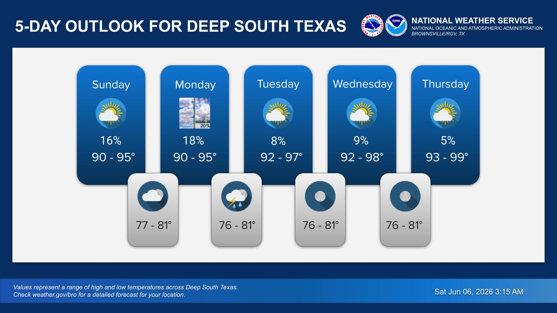
Hot and mainly rain-free conditions will continue through the weekend. However, there is a low chance of showers and thunderstorms late week. Temperatures are forecast to climb each day bringing an increased risk of heat-related illness through the week. Be sure to practice heat safety - learn more at weather.gov/heat
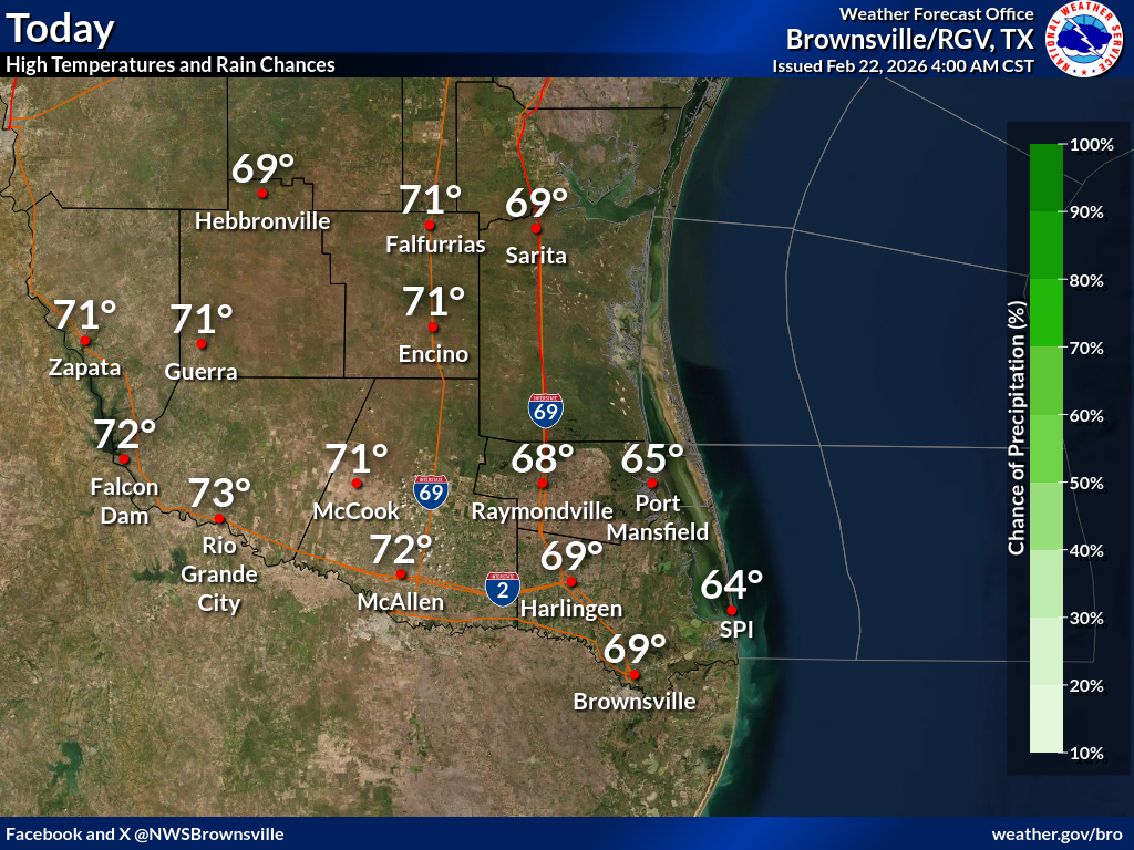
Here are the forecast high temperatures and rain chances for Deep South Texas today.
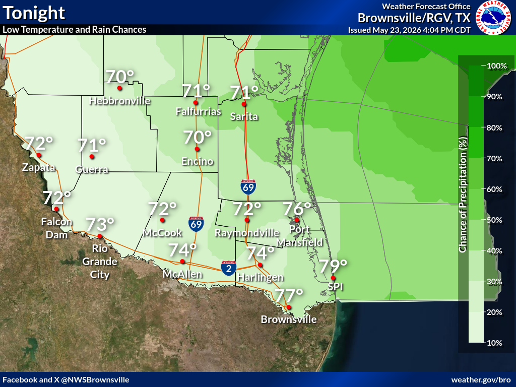
Here are the forecast low temperatures and rain chances for Deep South Texas tonight.

 
Current Observations ( )
Location Sky/Weather Temp Dewpt RH Wind Baro Remarks
Brownsville
N/A
N/A
N/A
N/A
N/A
N/A
N/A
Harlingen
N/A
N/A
N/A
N/A
N/A
N/A
N/A
McAllen
N/A
N/A
N/A
N/A
N/A
N/A
N/A
Bayview
N/A
N/A
N/A
N/A
N/A
N/A
N/A
Weslaco
N/A
N/A
N/A
N/A
N/A
N/A
N/A
Edinburg
N/A
N/A
N/A
N/A
N/A
N/A
N/A
Zapata
N/A
N/A
N/A
N/A
N/A
N/A
N/A
Hebbronville
N/A
N/A
N/A
N/A
N/A
N/A
N/A
Falfurrias
N/A
N/A
N/A
N/A
N/A
N/A
N/A
Laredo
N/A
N/A
N/A
N/A
N/A
N/A
N/A
Kingsville
N/A
N/A
N/A
N/A
N/A
N/A
N/A
Alice
N/A
N/A
N/A
N/A
N/A
N/A
N/A
Notes:
  • In the Location column, click on links for a list of recent observations at sites of interest. A new window will open.
  • In the Wind column, the letter indicates direction the wind blows from (N=North, E=East, S=South, W=West, NE=Northeast, etc). VRB is "variable" and G is "gust". Wind speeds are in MPH.
  • In the Baro (pressure) column, values are in inches.
  • In the Remarks column, HX is the Heat Index and WCI is Wind Chill Index (if shown). These are "Feels Like" temperatures. VSB is Visibility. "N/A" will be displayed if values are not available.
 
Text Product Selector (Selected product opens in current window)


Beach Page Tropical Marine Weather Fire Weather Hazards Outlook Rivers-Flooding
Beach Tropical Marine Weather Fire Weather Hazards Outlook Rivers-Flooding
Observations Forecaster Discussion Satellite Preparedness NOAA Weather Radio Spanish Weather Radio
Observations Forecasters Discussion Satellite Preparedness Weather Radio Spanish Weather Radio
RGV Outreach Web Newsletter RGV Drought Rip Current Safety Flood Safety Skywarn
Outreach Newsletter Drought Rip Current Safety Flood Safety Skywarn
RGV Event Summaries Seasonal Outlooks RGV Storm Data Reports (short form) Research User Guides Skywarn
Event Summaries Seasonal Outlooks Storm Data Research User Guides Severe Weather Drill