
Wildfires and poor air quality continue for the Pacific Northwest, Rockies and extended into the Plains. Severe thunderstorms possible for the northern Plains and upper Midwest on Monday along a frontal boundary. Another boundary will focus showers and thunderstorms for the eastern seaboard with localized heavy rainfall possible. For Alaska, a strong Bering Sea storm will bring winds and rainfall. Read More >
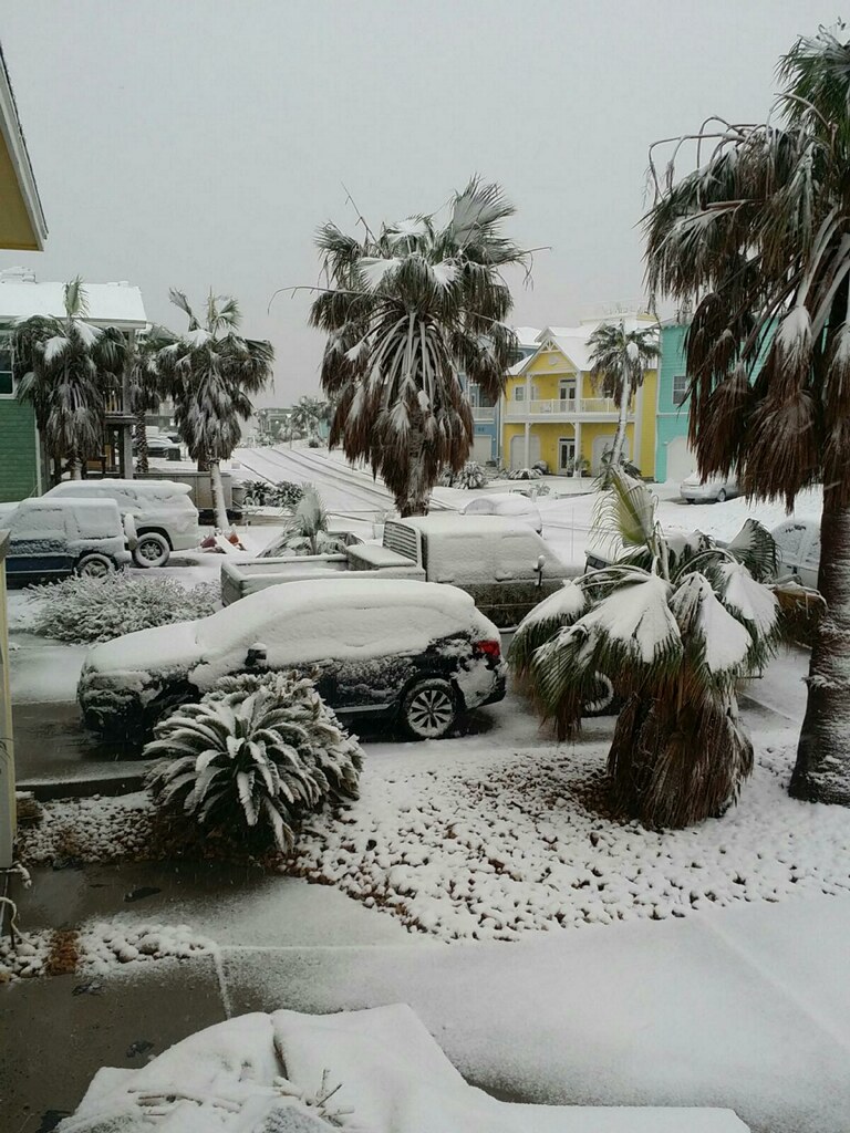
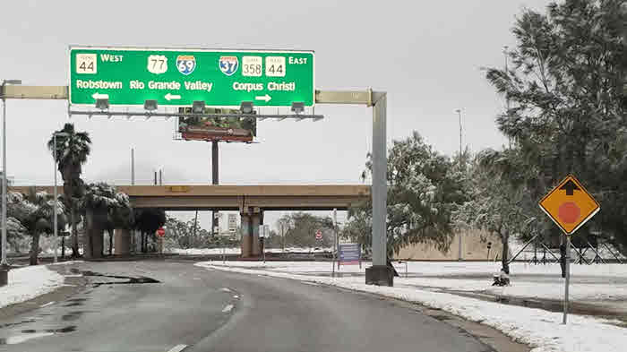
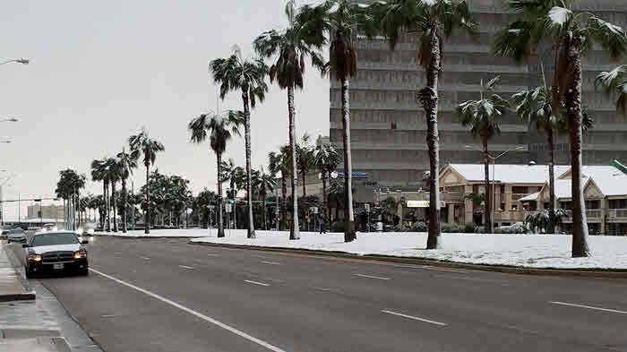
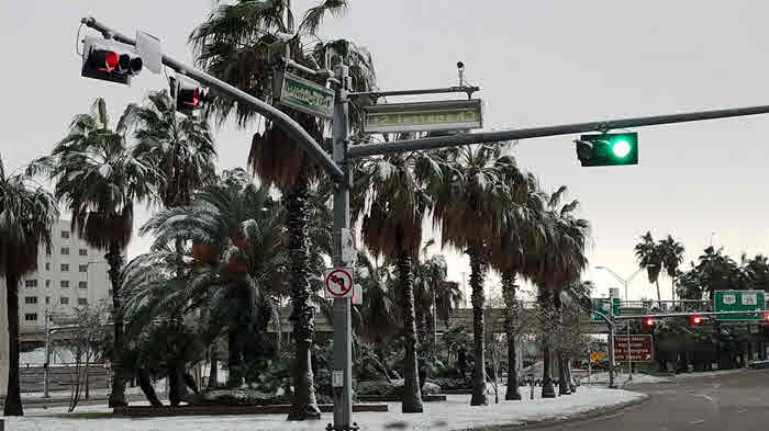
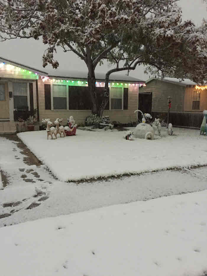
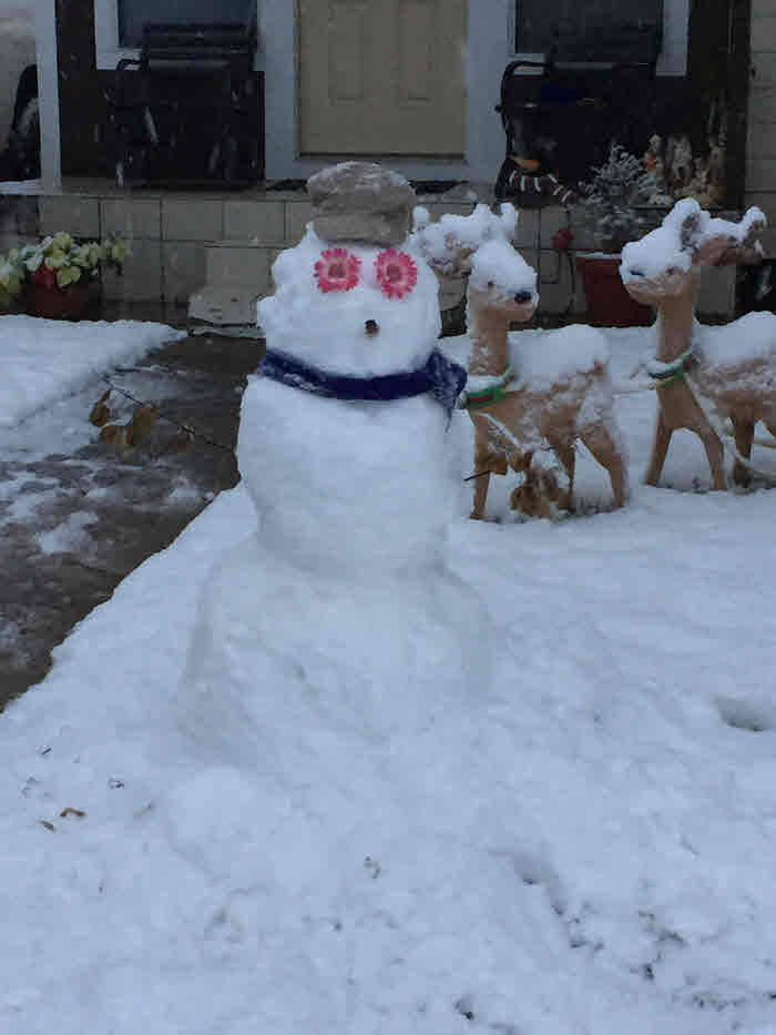
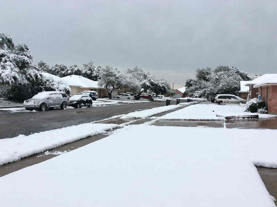
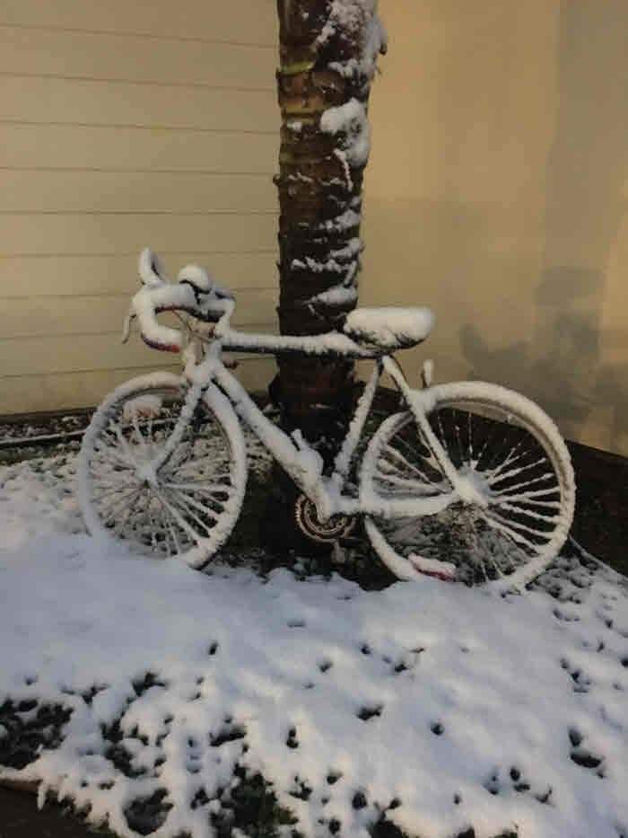
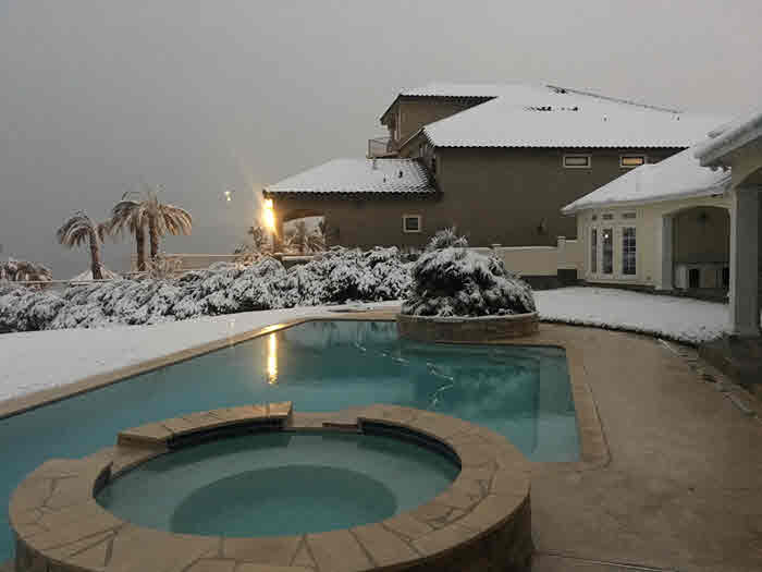
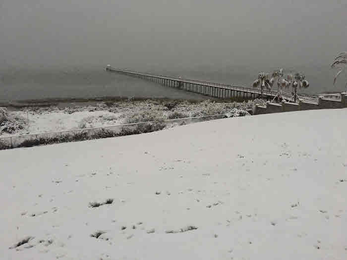
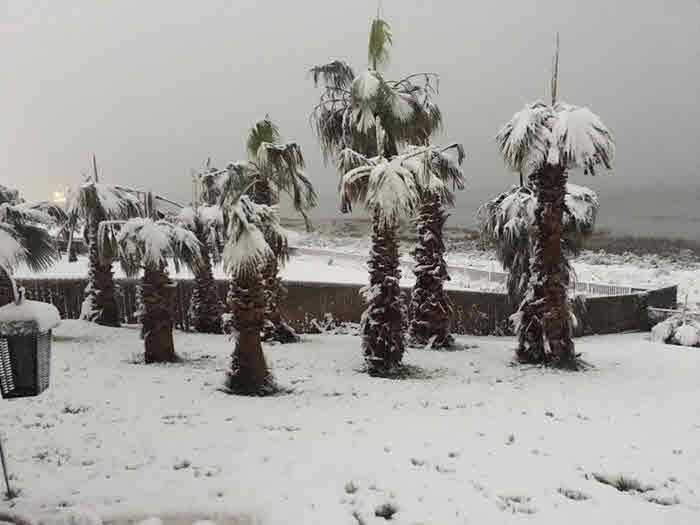
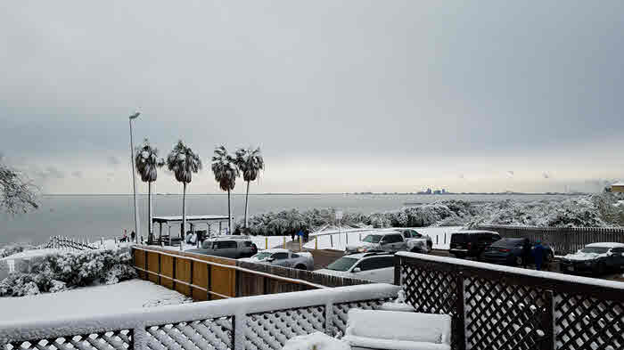
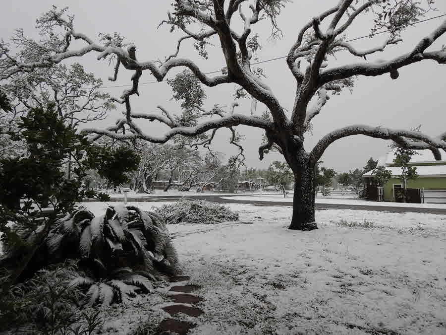
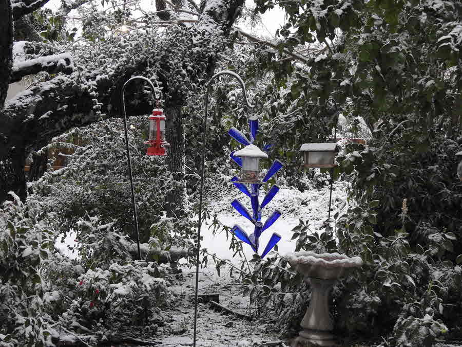
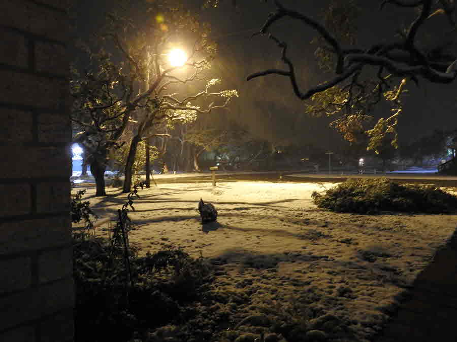
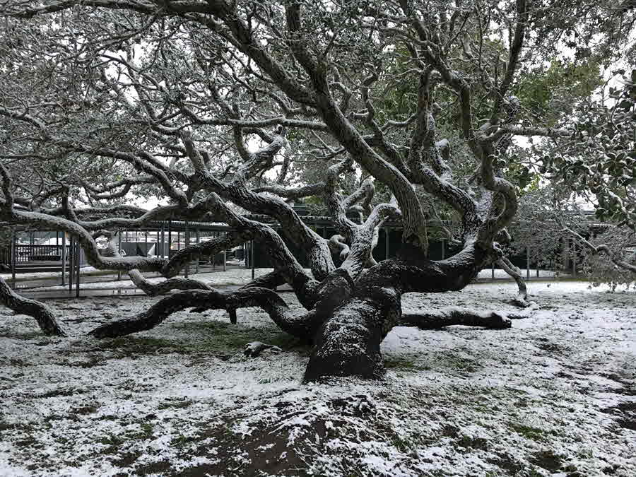
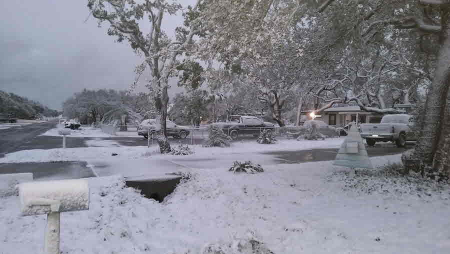
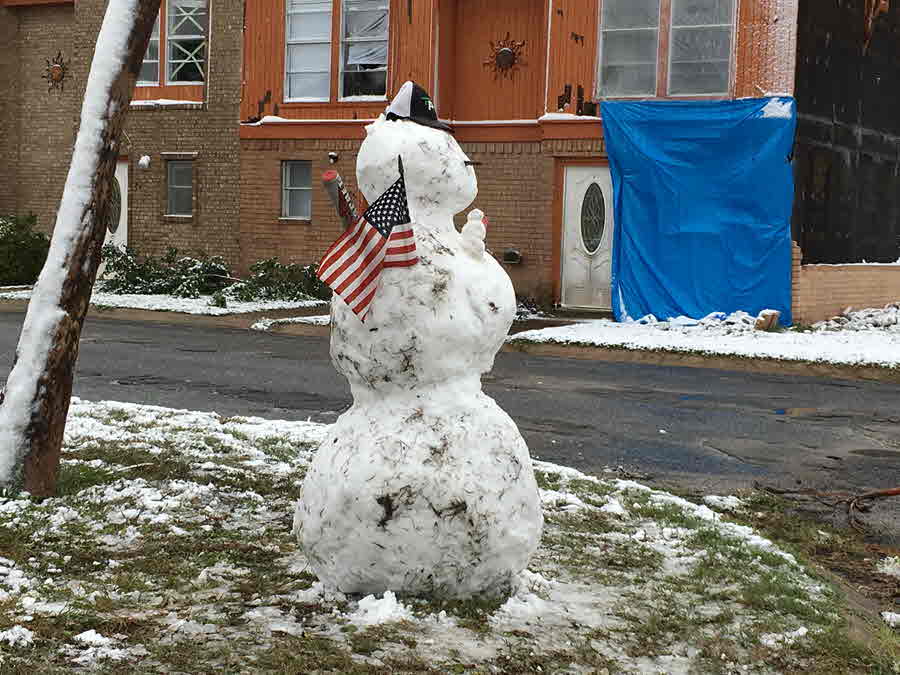
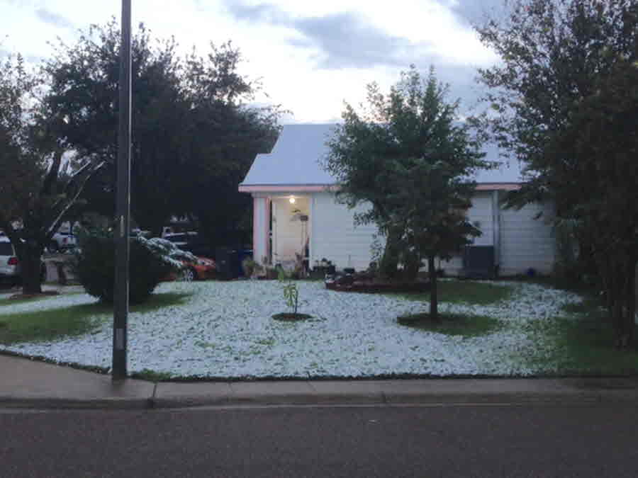
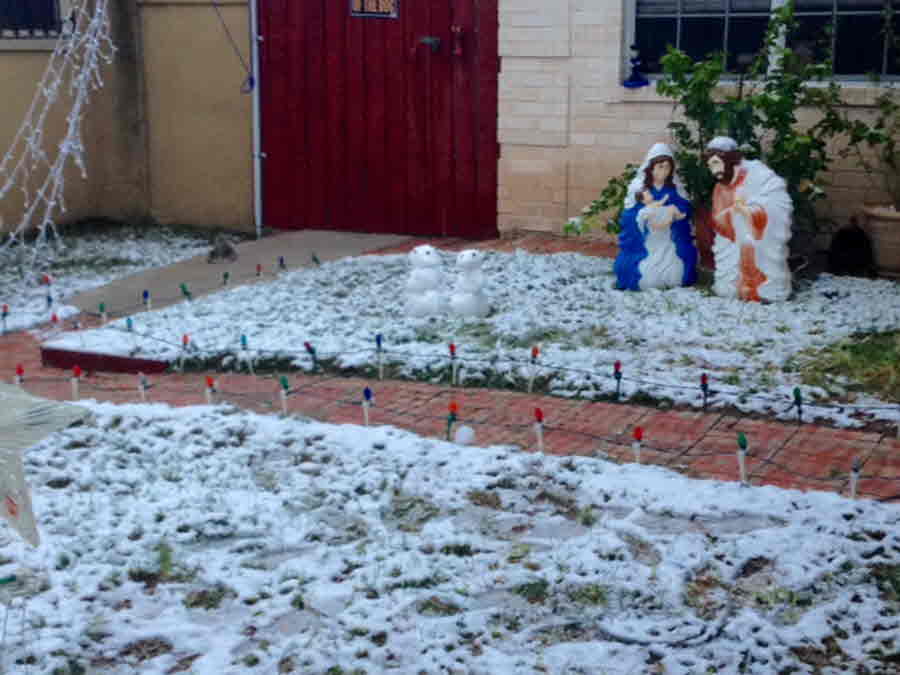
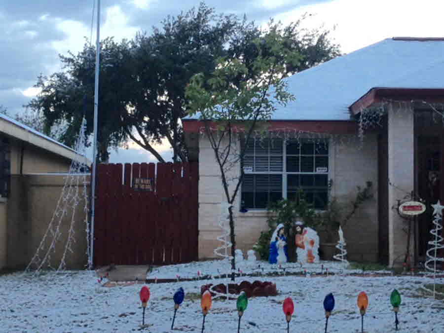
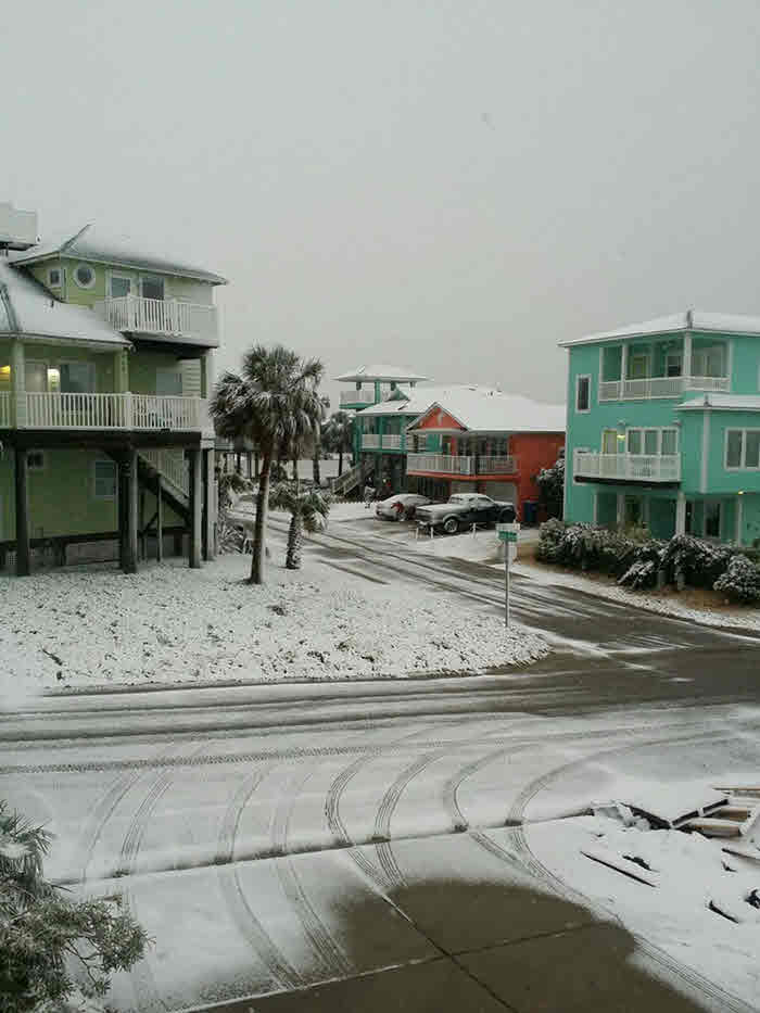
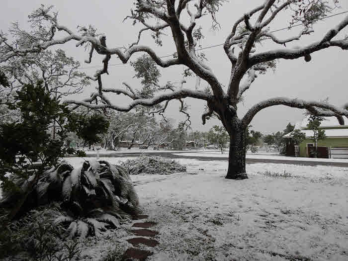
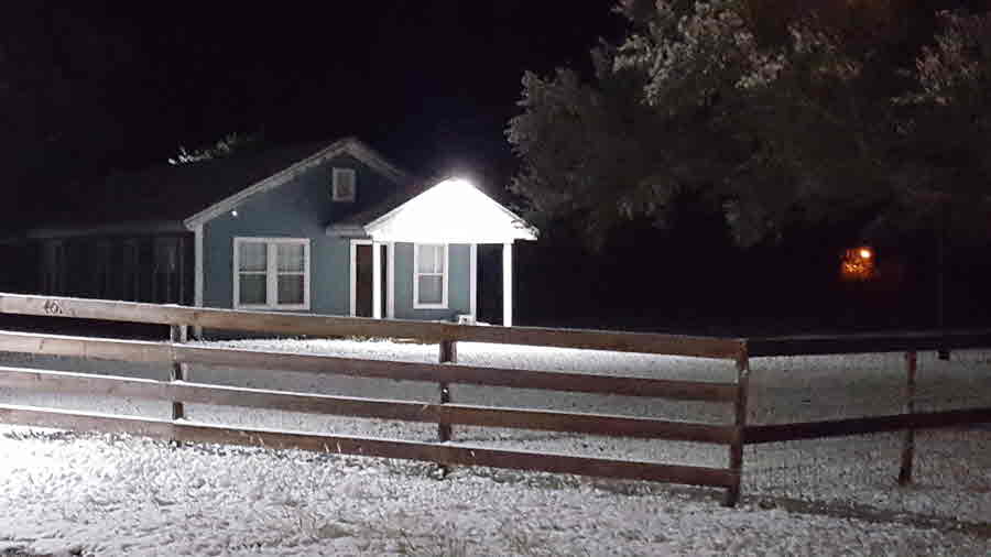
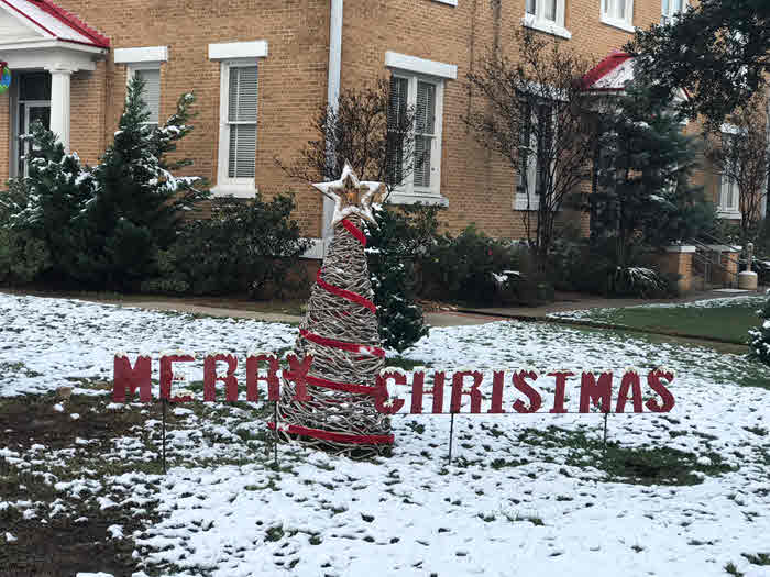
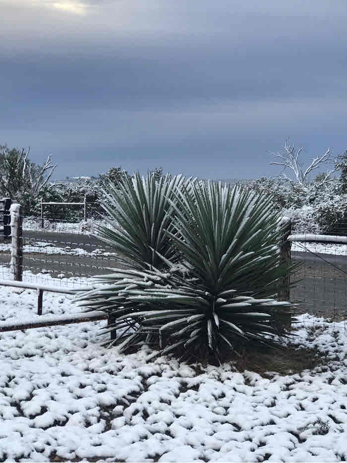
Winter weather is rare in South Texas, but occurs from time to time. A wintry mix of rain and snow occurred over South Texas from the morning of December 7th to the early morning of December 8th 2017. This was the first wintry precipitation event in South Texas since the icing event on January 23rd-24th 2014, and the first measurable snow event since the Christmas Snowstorm of 2004. Below is a summary of this snow event.
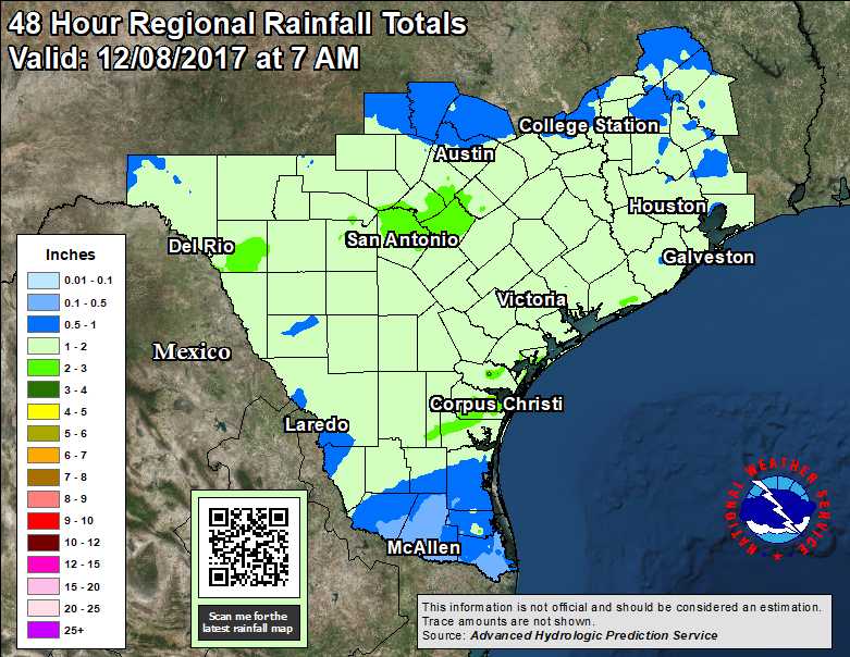
A strong cold front, located over South Central Texas early on the morning of December 5th moved slowly southward into South Texas during the afternoon. The boundary stalled over the area during the late afternoon, before pushing southward by early evening. Scattered showers and a few thunderstorms developed over eastern portions of South Texas ahead and along the boundary. Heavy rainfall and minor flooding was observed in the city of Corpus Christi, with a rainfall observer reporting 4.19 inches of rainfall. Most other areas saw much lower amounts as the boundary moved through (see rainfall amounts with the front here.
Behind the frontal boundary, colder air gradually seeped farther south into the area, and the frontal boundary intensified. As a result, temperatures continued to fall over the region. A coastal trough developed on Wednesday December 6th. This, along with an upper level trough, provided additional lift, and brought periods of rain to essentially all of South Texas.
 |
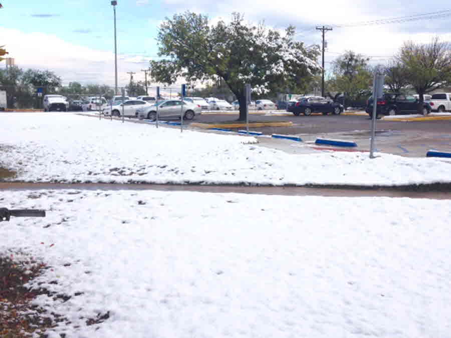
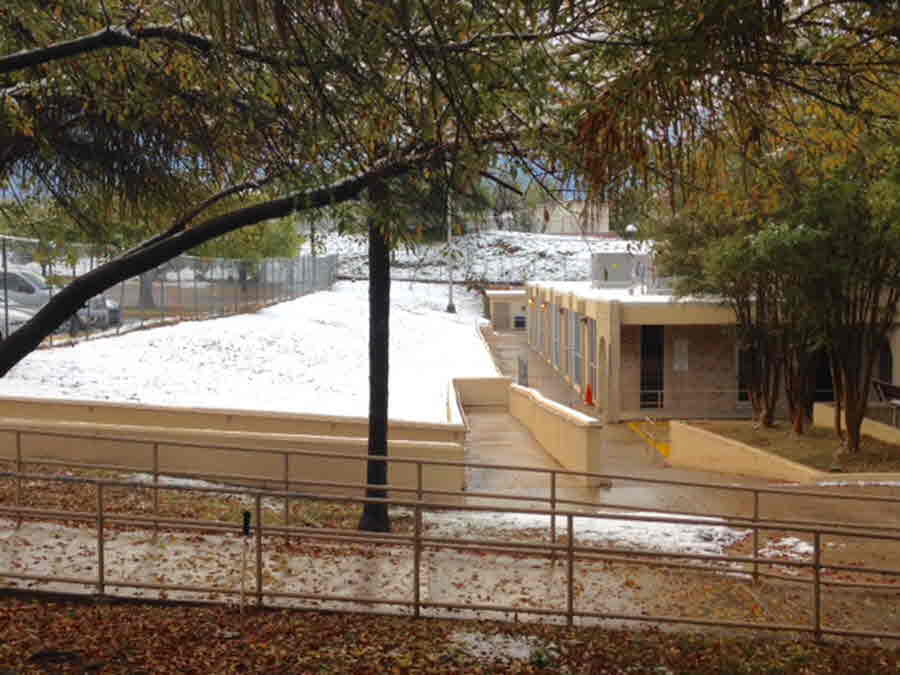
After the clouds cleared, snow cover remaining into the early afternoon was visible on satellite imagery.
|
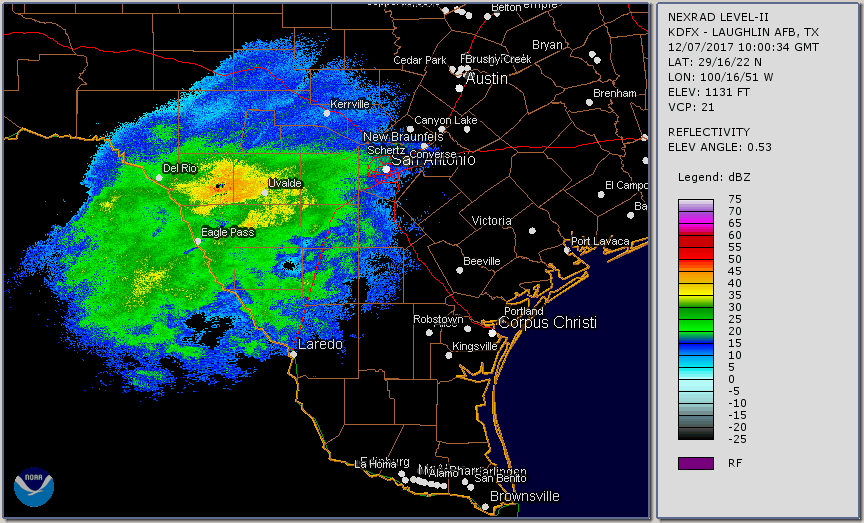
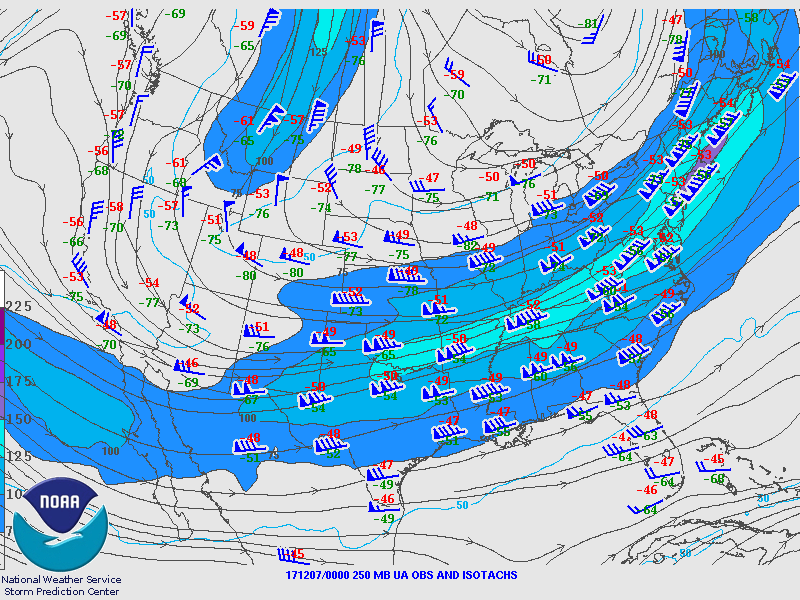
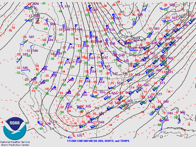
By the early morning of December 7th, the cold air was becoming entrenched over South Texas. Temperatures had fallen into the upper 30s and lower 40s over much of the area, as seen by the morning surface map. On top of that, the atmosphere continued to cool substantially, as indicated by comparing the Corpus Christi sounding at 6 AM December 5th with the soundings at 6 AM December 7th from Corpus Christi and Del Rio TX. Note that the Del Rio sounding showed much cooler air in the lower levels of the atmosphere, as well as being nearly saturated in the mid levels of the atmosphere, with temperatures around and above the 500mb level colder than -10 degrees Celsius. With a strong upper level jet streak adding more large-scale lift (and even more cooling of the atmosphere), rain began to turn to snow over the Western Brush Country and Rio Grande Plains. Some of the heavier bands of snow moved over portions of Webb and La Salle Counties during the late morning, and visibility at Cotulla was reduced to less than 1 mile at times due to the snow. As a result, portions of La Salle County Cotulla received as much as 1.5 inches of snow during the morning of December 7th before the snow turned back to rain during the afternoon. The city of Laredo also reported light snow at the airport for a few hours on the afternoon of the 7th. By late afternoon, essentially all of South Texas reported rain instead of snow. However, the heaviest snow was yet to come!
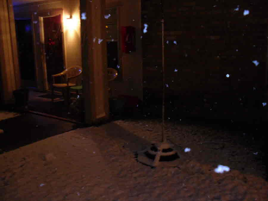
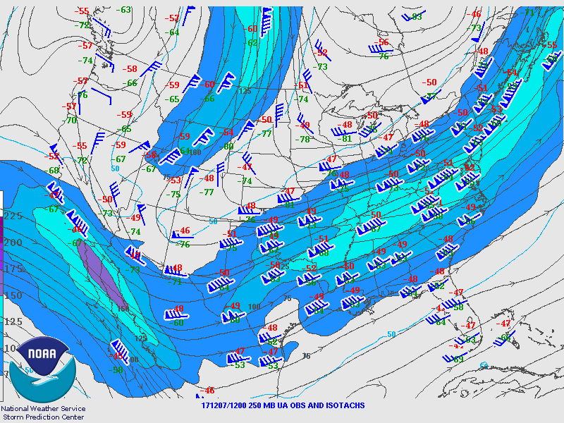
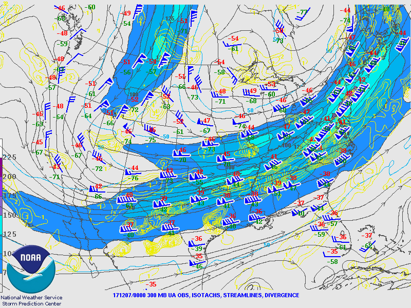
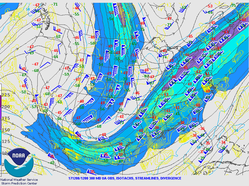
Another strong upper level jet streak approached South Texas in the late evening, causing more large scale lift and cooling. The previous upper jet from the morning of the 7th and the approaching upper jet that evening also enhanced the large scale lift by creating an area of diffluence (sometimes called divergence),and enhanced lifting, cooling and frontogenesis over South Texas. As a result, the airmass over South Texas become saturated from the surface to nearly 300mb, with temperatures above freezing only in the lowest 1000 feet of the atmospheric column (see the 12/8/2017 Midnight sounding at Corpus Christi). With the airmass being so saturated between -12 and -20 degrees Celsius, the large scale lift allowed for the production of large, wet snowflakes, especially over the southern and coastal areas of South Texas. By midnight, nearly all areas reporting precipitation were observing either all snow or a mixture of rain and snow (except near the immediate coast).
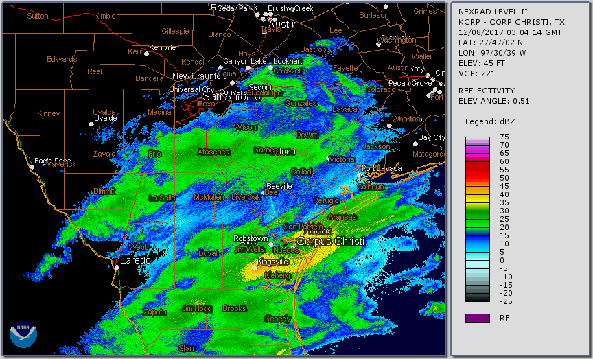 |
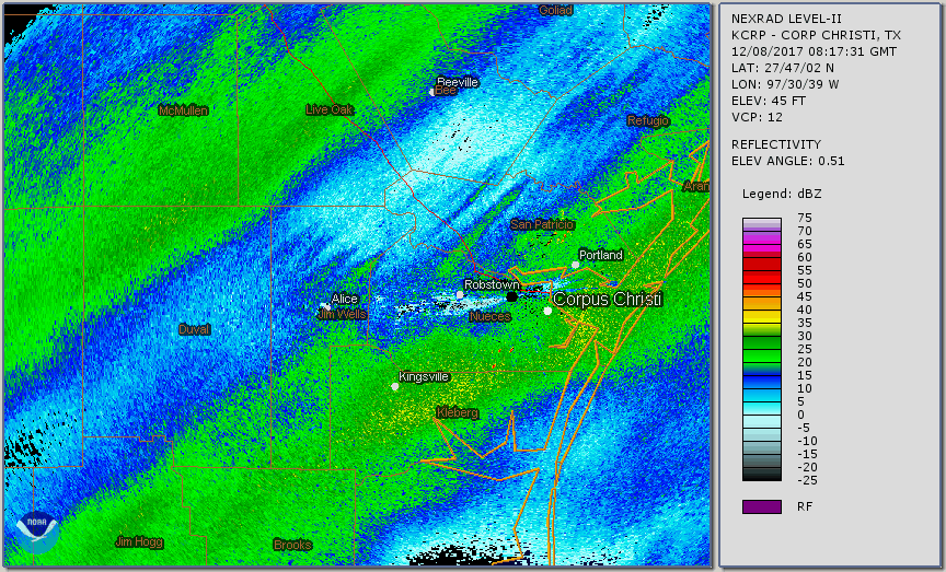
Corpus Christi Radar Loop
|
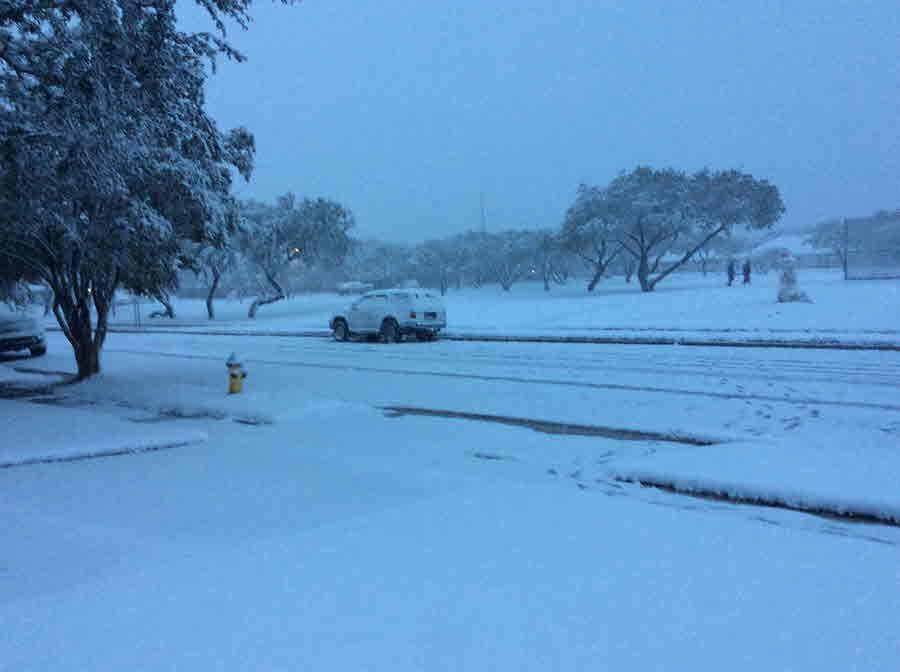
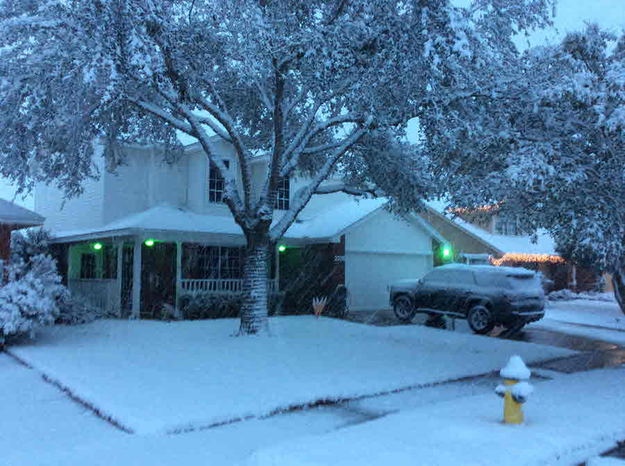
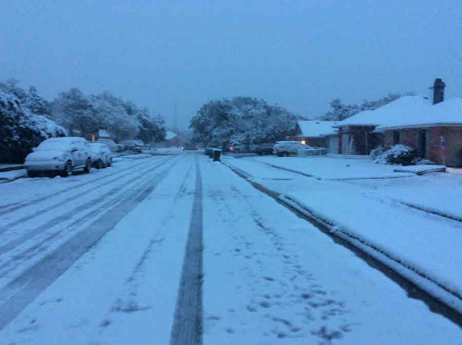
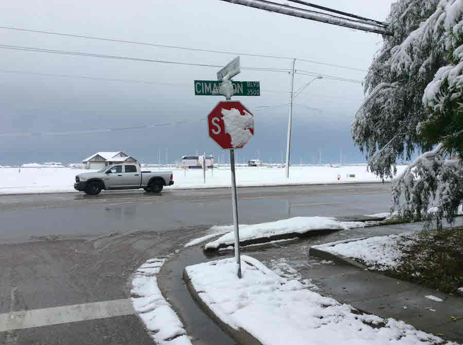
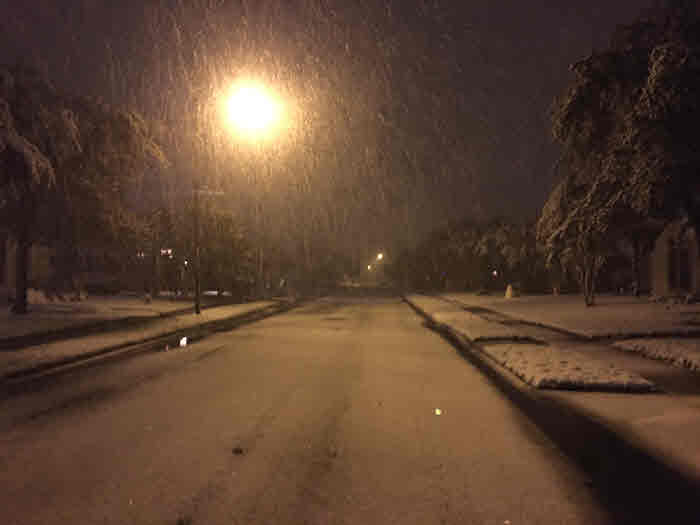
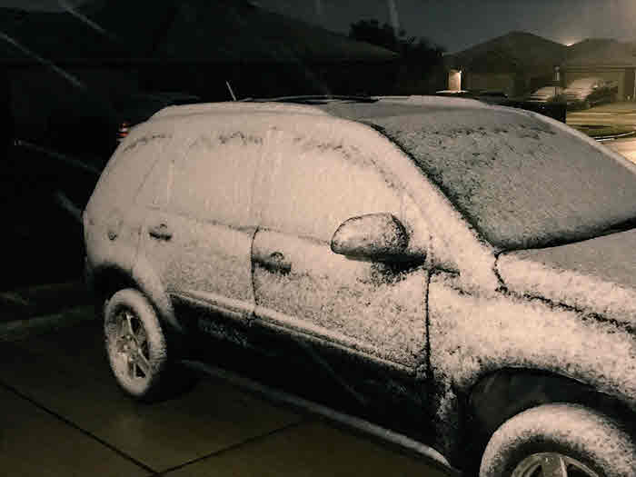
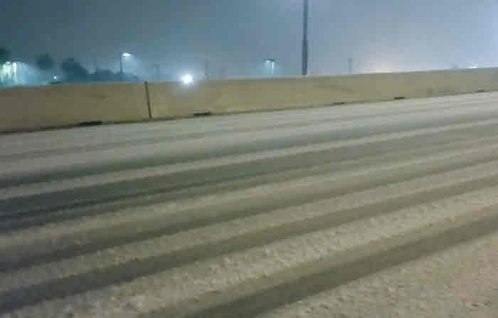
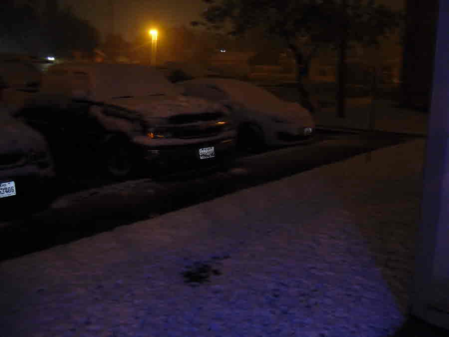
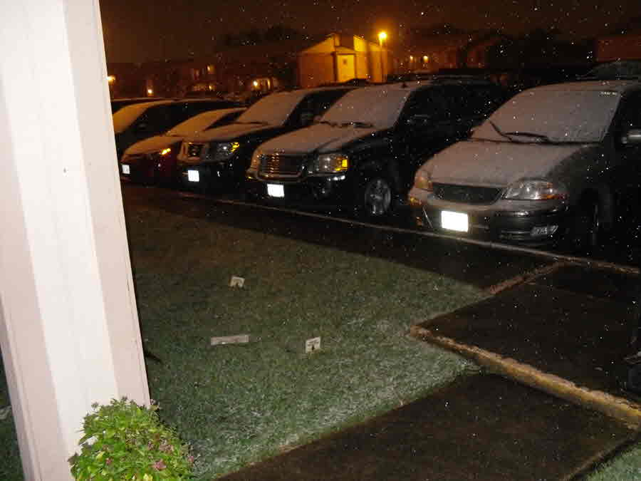
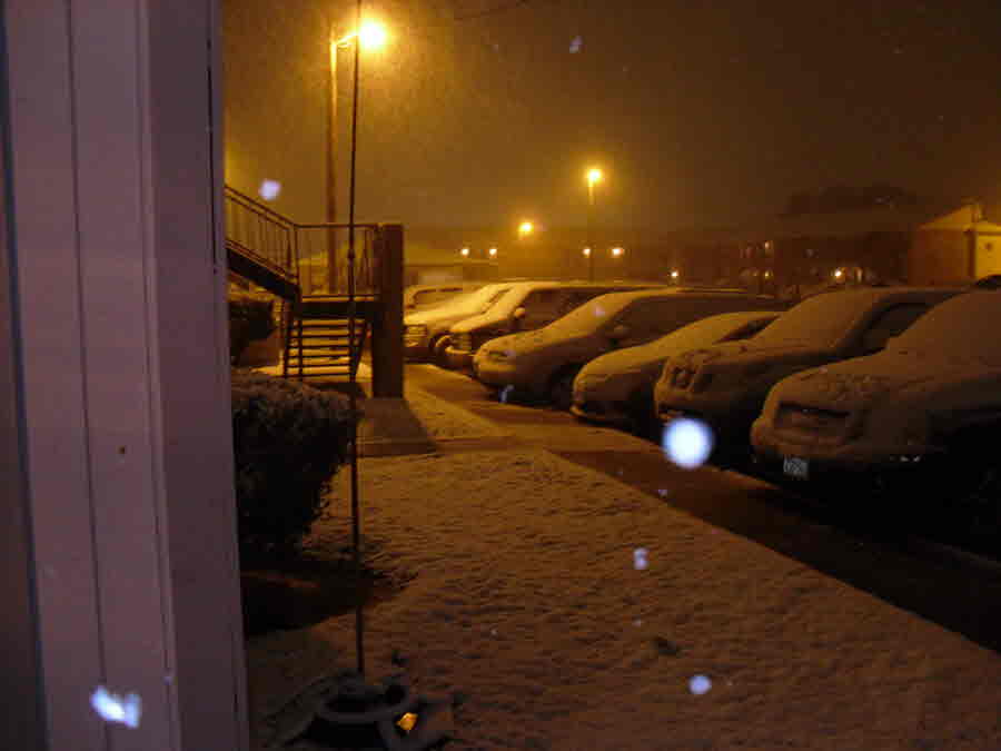
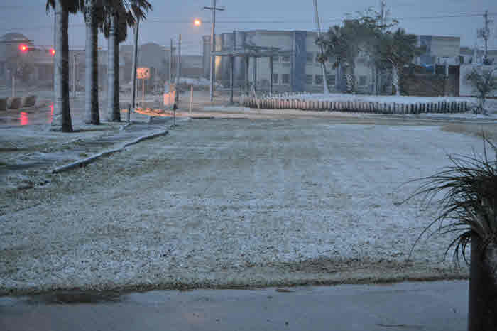
Two slow moving bands of precipitation set up over South Texas. One band extended from Victoria County to Webb County and another one ran along the Middle Texas Coastal counties swooping back to Zapata County. Although precipitation was predominantly rain most of the day on December 7th, by 10 pm surface temperatures cooled to just above freezing as the rain/snow transition line pushed southward with rain switching to snow first from Victoria to Cotulla. Within the next hour, the transition line pushed further southward into the Coastal Bend. By 11:30 pm, the band along the coast began to transition to wintry mix. After midnight as temperatures continued to drop to near freezing, all precipitation had switched over to snow and began to accumulate on grassy surfaces, cars, and creating slushy roadways. Snow continued during the overnight hours over much of South Texas, slowly diminishing from northwest to southeast toward morning as the impacts of the upper jet and drier air moving into the region ended the snow (as seen from the Del Rio sounding Friday morning December 8th. The two bands of snow slowly shifted eastward through the early morning. By 5 am, the band along the coast dissipated and the westernmost band of snow moved into the Coastal Bend for a second and final round snow. By 9 AM the snow band had moved offshore, and clouds gradually decreased during the remainder of the day.
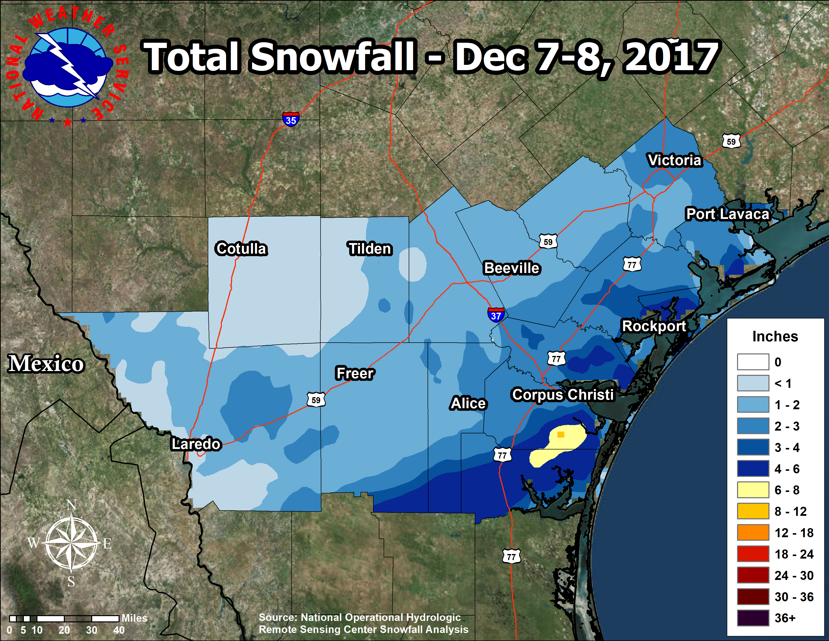 |
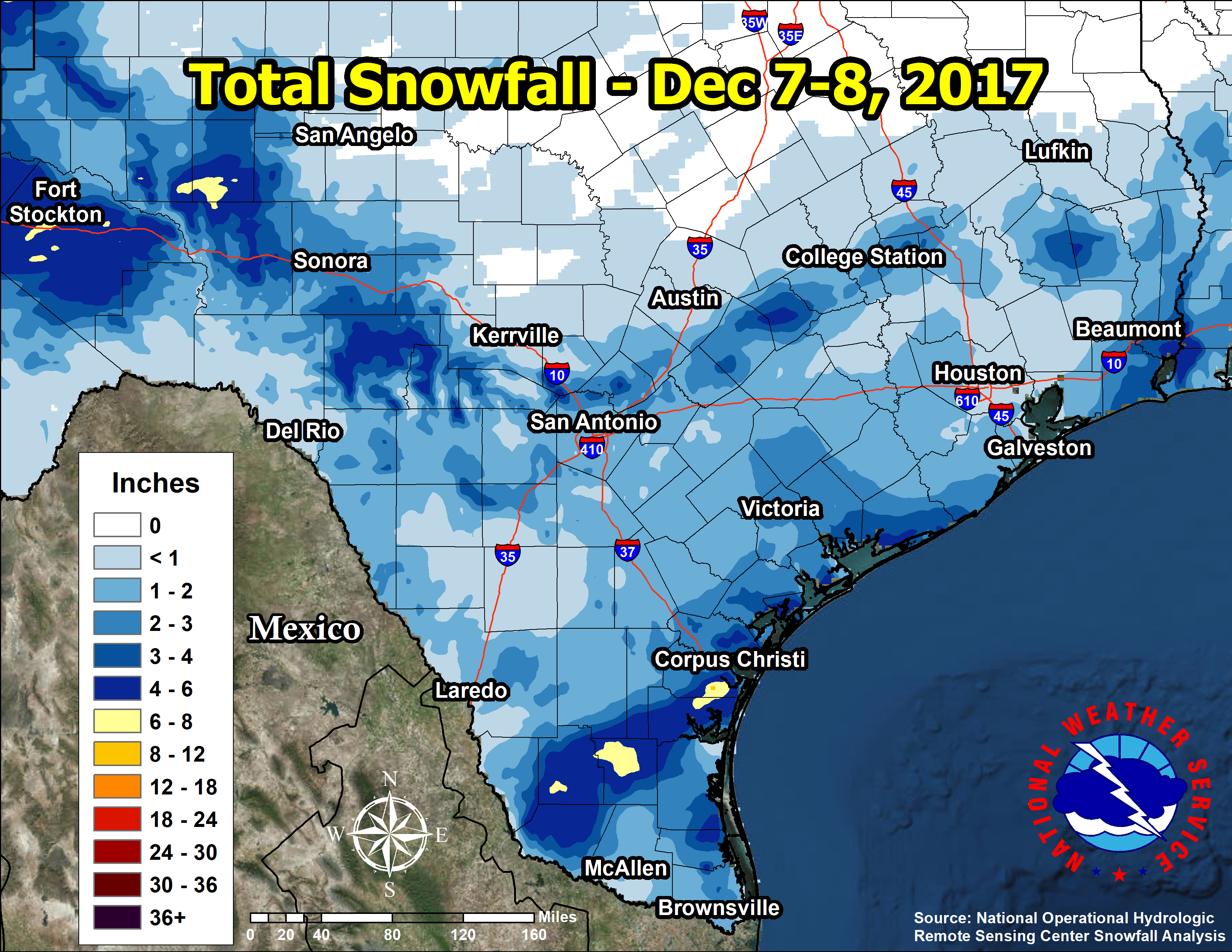
Snowfall Totals - Dec 7-8, 2017 |
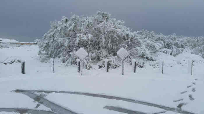
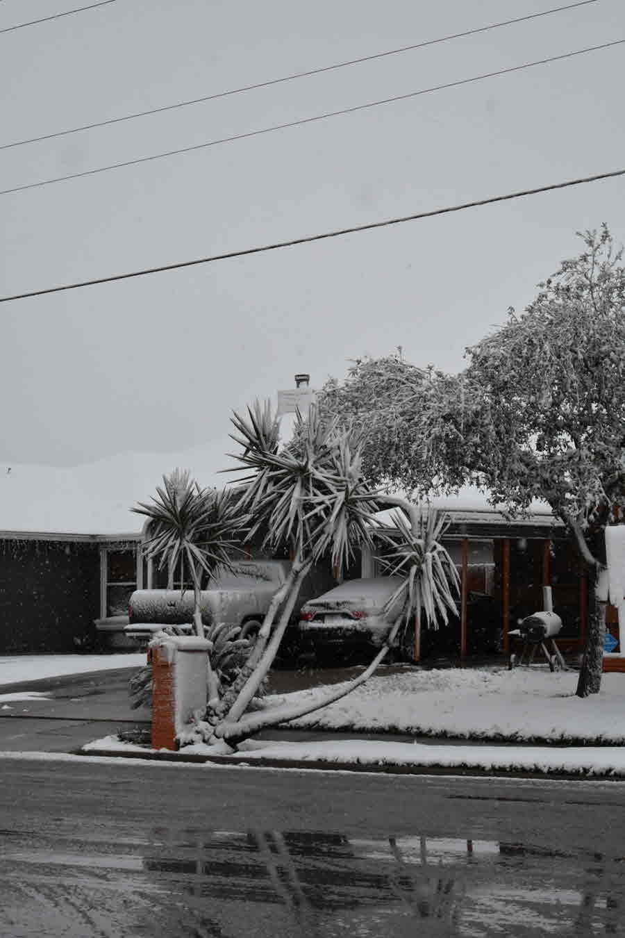
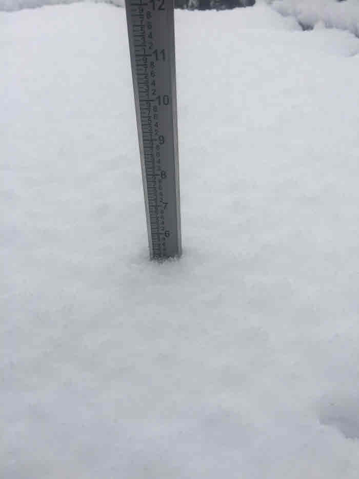
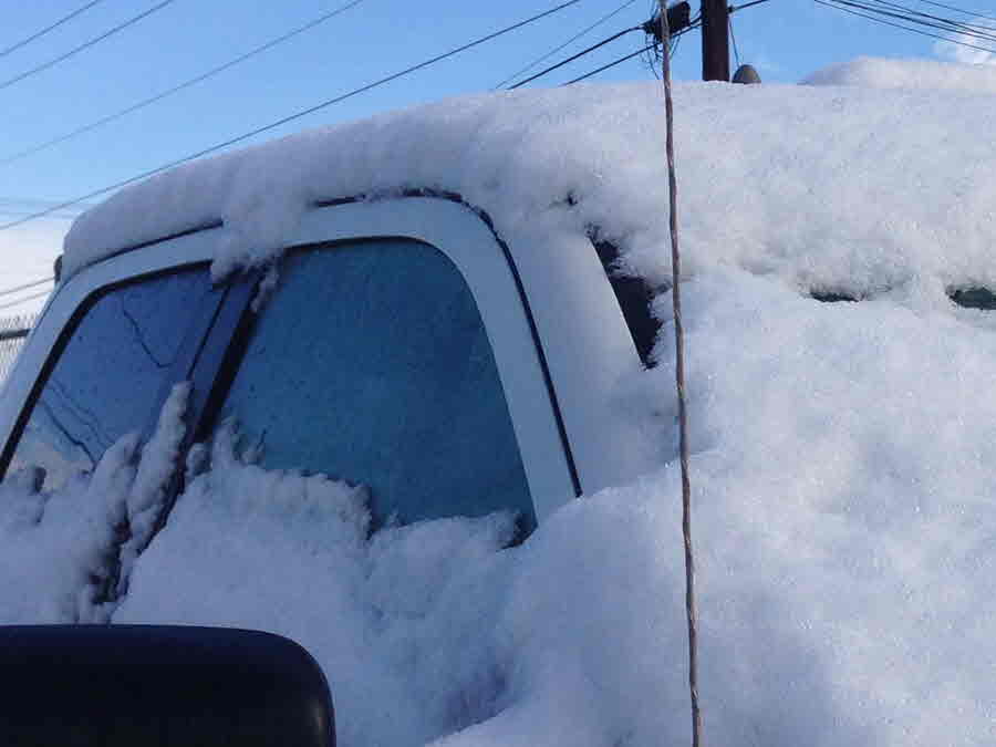
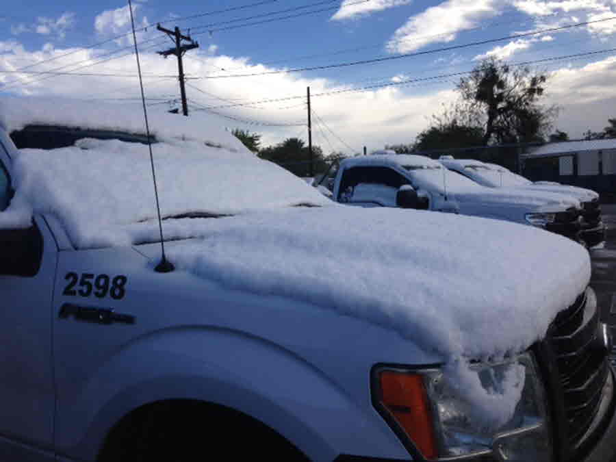
In addition to snow, areas around the Southern Coastal Bend experienced a rare phenomenon, THUNDERSNOW! The atmosphere had become convectively unstable, and occasional lightning was reported at Corpus Christi Airport. Thundersnow first began around 1230am and continued off and on through around 6am producing heavier bands of snow, resulting in moderate snowfall and reduced visibilities of nearly 1/2 mile! This heavier snow band moved over the South Side of Corpus Christi (including NAS Corpus Christi), and produced more than 3 inches of snow in some parts of the city.
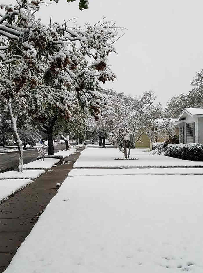
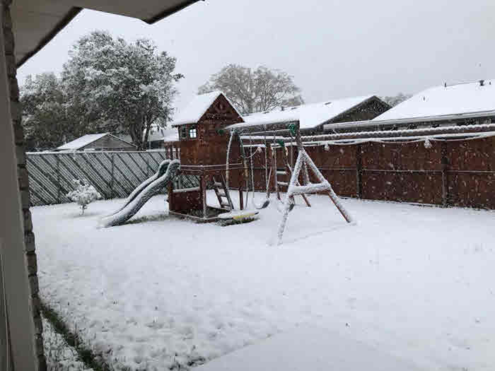
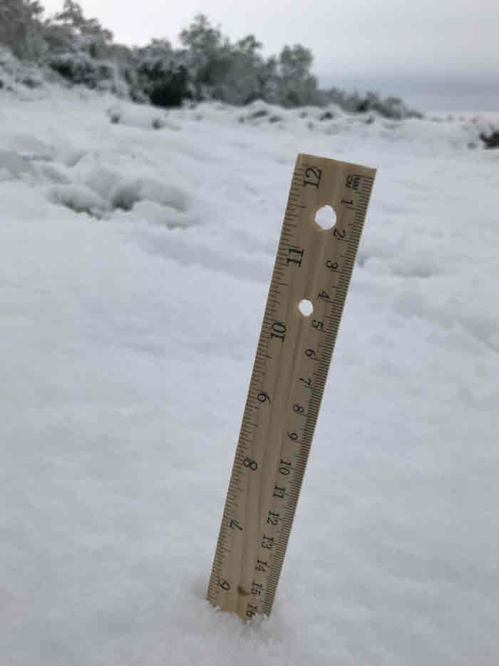
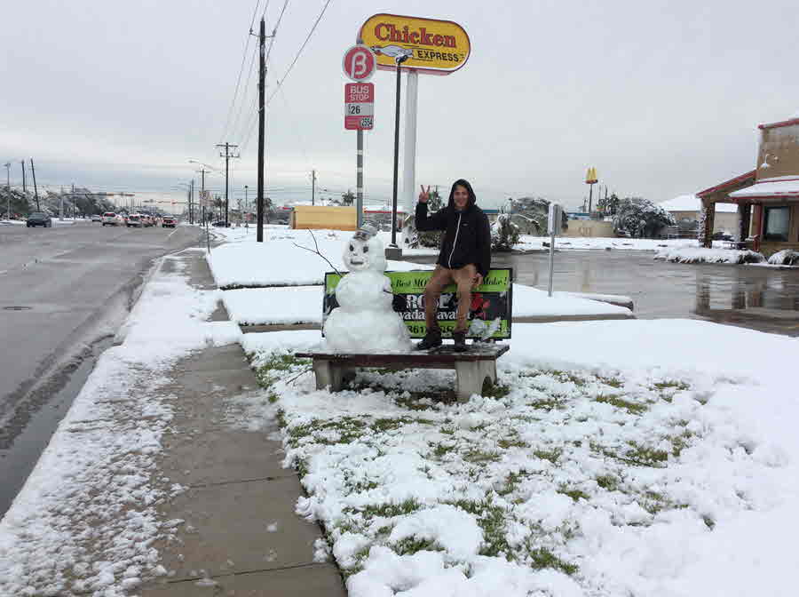
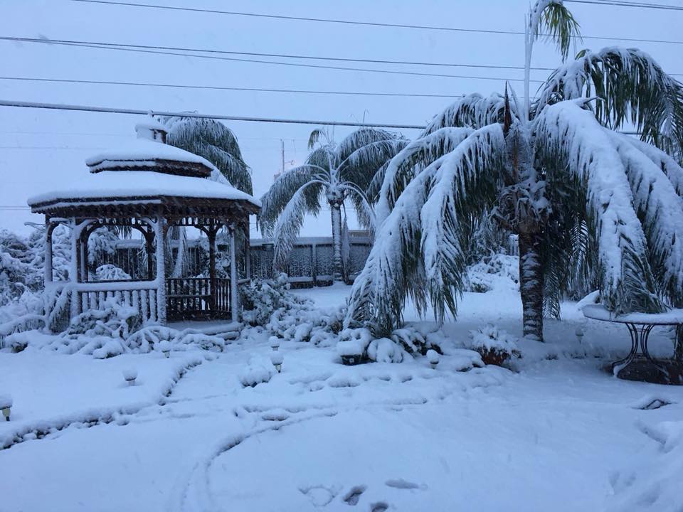
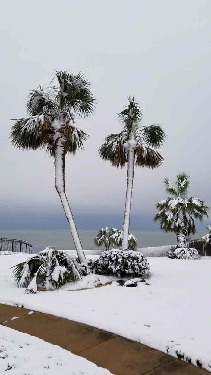
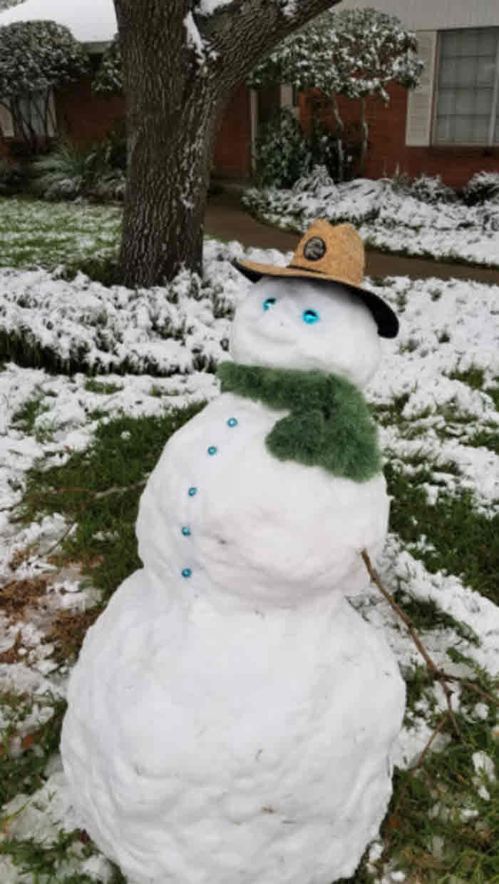
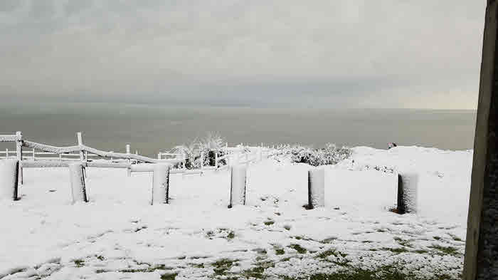
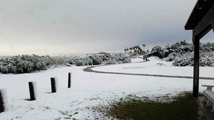
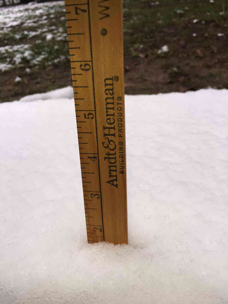
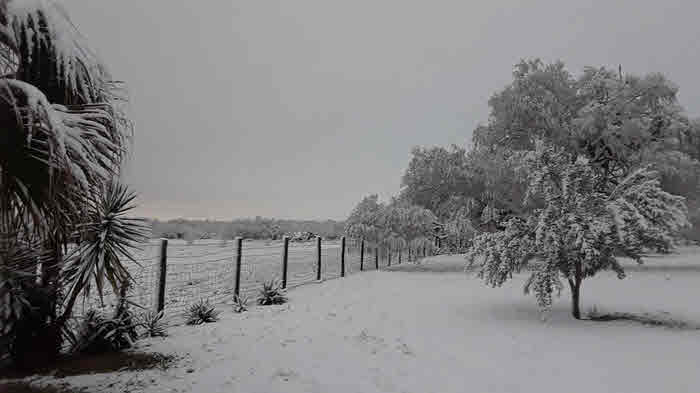
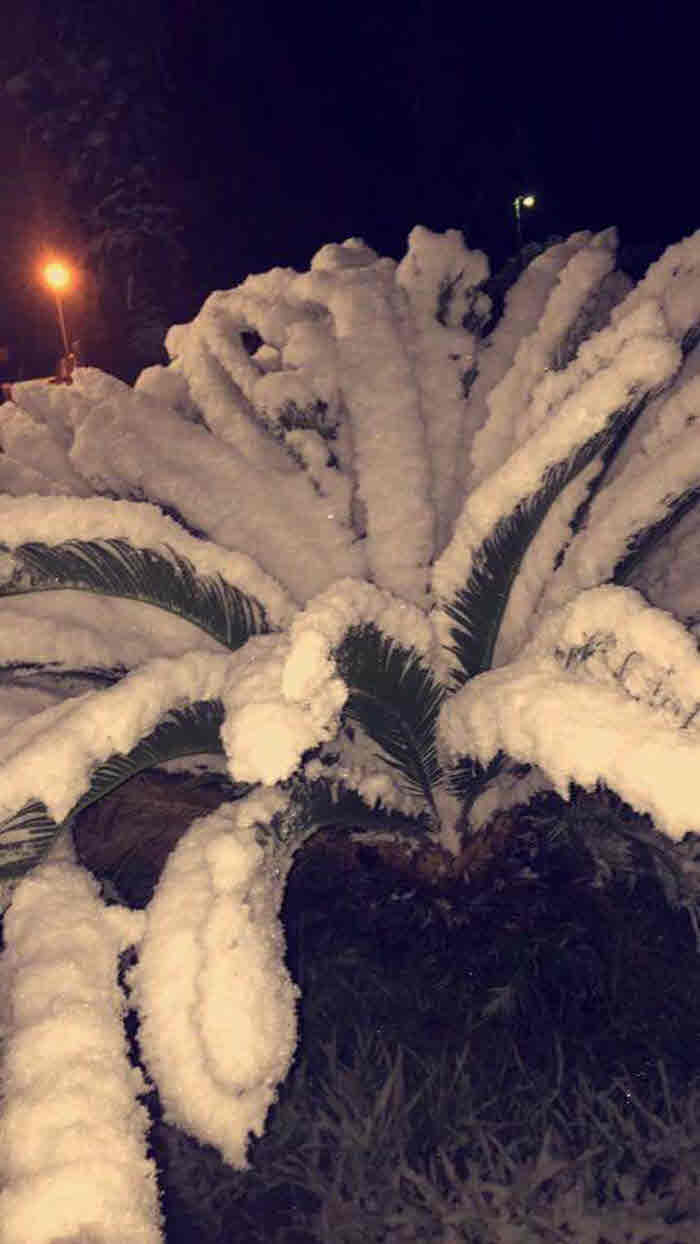
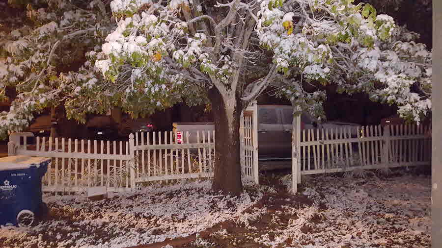
Most of the Southern Coastal Bend saw at least 1 inch of snow, with the highest amounts occurring in the heavier convective bands of snow over portions of Kleberg, Nueces, and San Patricio counties. Because of these convective bands, some areas received more than 3 inches of snow, with as much as around 7 inches reported on the south side of Corpus Christi due to the convective nature of the snow.
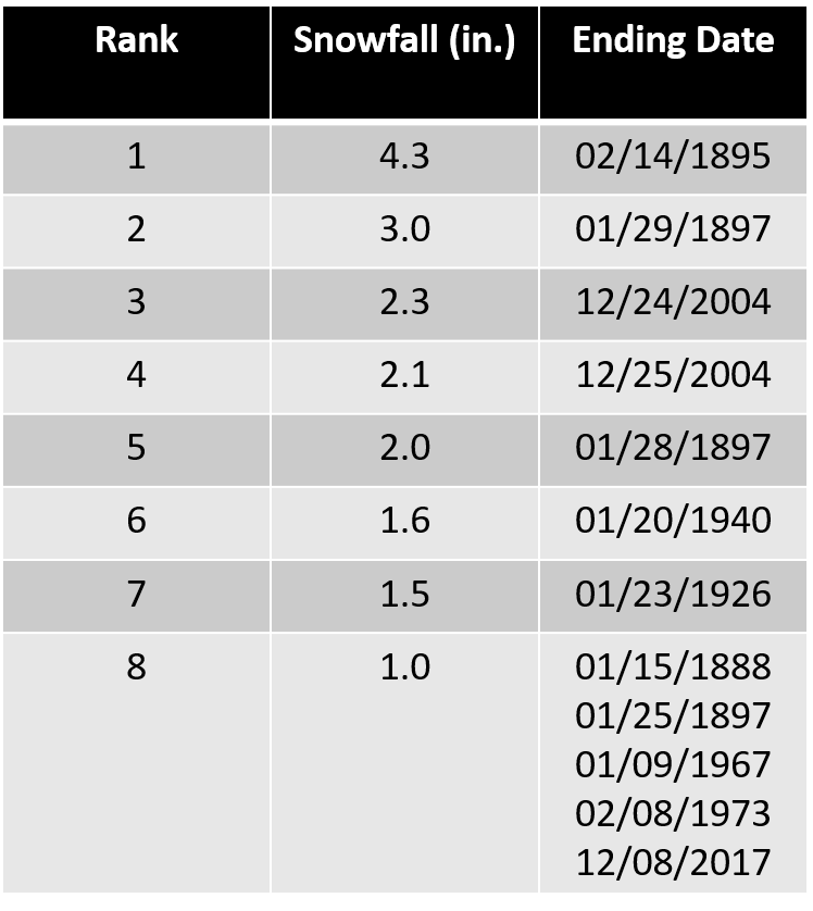
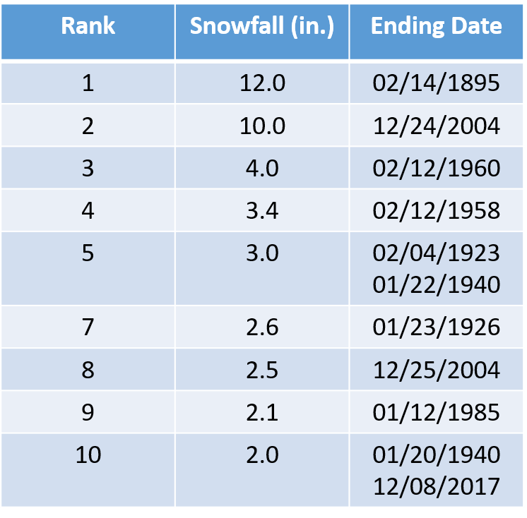
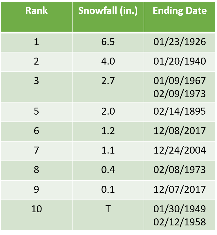
Officially, Corpus Christi received 1.0 inches of snow, tying for the 8th highest daily snowfall accumulation since records were recorded. Victoria Regional Airport received 2.0 inches of snow, tying the 9th highest daily snowfall total. Finally, Laredo's official daily snowfall total of 1.2 inches ranks as the 6th highest daily snowfall total in their history.
| Top 10 Daily Snowfall Rankings by City (Click each image to enlarge.) | ||
|---|---|---|
| Corpus Christi | Victoria | Laredo |
 |
 |
 |
| Del Rio TX Radar Loop: 401 AM CST Through 300 PM CST December 7, 2017 |
|---|
 |
| KCRP Radar Loop: 904 PM CST December 7 - 901 AM CST December 8, 2017 |
|---|
|
|
| KCRP Radar Zoom Heavy Snow Band: 223 AM - 400 AM CST December 8, 2017 |
|---|
 |
| Satellite IR Loop: 600 PM CST December 7 - 900 AM CST December 8, 2017 |
|---|
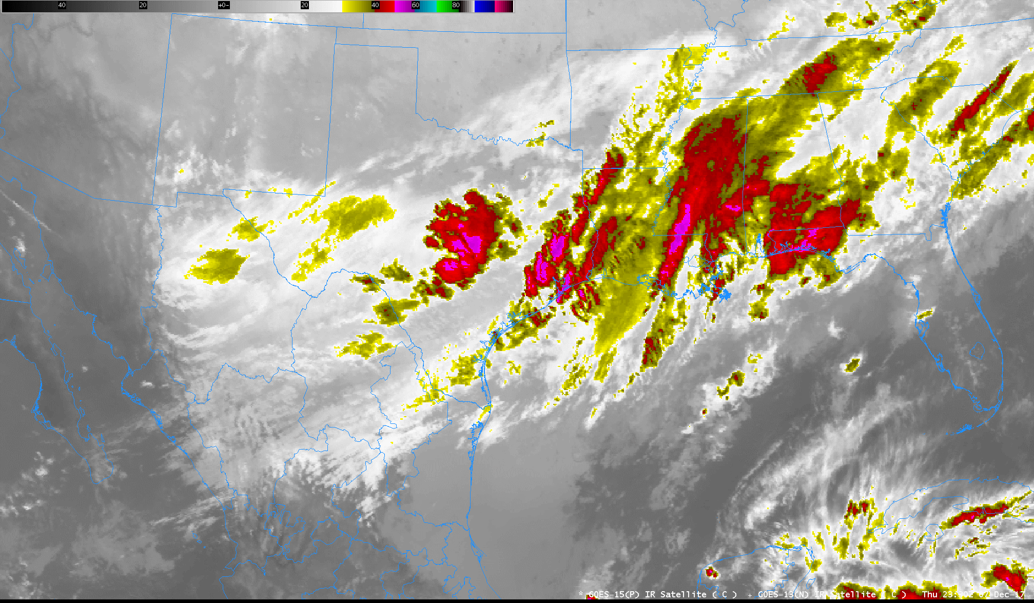 |
NWUS54 KCRP 090126
LSRCRP

PRELIMINARY LOCAL STORM REPORT...SUMMARY
NATIONAL WEATHER SERVICE CORPUS CHRISTI TX
725 PM CST FRI DEC 08 2017

..TIME...   ...EVENT...      ...CITY LOCATION...     ...LAT.LON...
..DATE...   ....MAG....      ..COUNTY LOCATION..ST.. ...SOURCE....
            ..REMARKS..

0300 AM     SNOW             CORPUS CHRISTI          27.71N  97.29W
12/08/2017  E1.0 INCH        NUECES             TX   BROADCAST MEDIA

            BROADCAST MEDIA REPORTS ESTIMATED 1 INCH ACCUMULATION.
            ALSO UTILITY COMPANY REPORTS 13,000 CUSTOMERS WITHOUT
            POWER.

0310 AM     SNOW             1 SE BEEVILLE           28.40N  97.74W
12/08/2017  U0.0 INCH        BEE                TX   DEPT OF HIGHWAYS

            HWY 181 CLOSED SOUTHEAST OF BEEVILLE. SLUSHY ROAD
            CONDITIONS.

0526 AM     HEAVY SNOW       3 S CORPUS CHRISTI      27.66N  97.29W
12/08/2017  M2.5 INCH        NUECES             TX   NWS EMPLOYEE

0530 AM     SNOW             VICTORIA DETAR HOSPITAL 28.85N  97.02W
12/08/2017  M2.0 INCH        VICTORIA           TX   CO-OP OBSERVER

0700 AM     HEAVY SNOW       2 ESE CORPUS CHRISTI    27.69N  97.26W
12/08/2017  M5.0 INCH        NUECES             TX   NWS EMPLOYEE

            5" OF SNOW MEASURED BY NWS EMPLOYEE.

0700 AM     HEAVY SNOW       PORTLAND                27.88N  97.33W
12/08/2017  M3.0 INCH        SAN PATRICIO       TX   NWS EMPLOYEE

0700 AM     HEAVY SNOW       7 SSE KINGSVILLE        27.42N  97.82W
12/08/2017  M4.5 INCH        KLEBERG            TX   COCORAHS

0700 AM     HEAVY SNOW       1 SSE INEZ              28.87N  96.78W
12/08/2017  M2.0 INCH        VICTORIA           TX   COCORAHS

0700 AM     HEAVY SNOW       4 NW GOLIAD             28.71N  97.44W
12/08/2017  M1.8 INCH        GOLIAD             TX   COCORAHS

0715 AM     HEAVY SNOW       3 S CORPUS CHRISTI      27.66N  97.29W
12/08/2017  M5.0 INCH        NUECES             TX   NWS EMPLOYEE

0800 AM     HEAVY SNOW       PORTLAND                27.88N  97.33W
12/08/2017  M3.1 INCH        SAN PATRICIO       TX   NWS EMPLOYEE

0853 AM     HEAVY SNOW       INGLESIDE               27.87N  97.20W
12/08/2017  M4.0 INCH        SAN PATRICIO       TX   SOCIAL MEDIA

            PICTURE SUBMITTED ON SOCIAL MEDIA OF SNOW IN INGLESIDE.

0857 AM     HEAVY SNOW       VICTORIA                28.82N  96.98W
12/08/2017  M2.5 INCH        VICTORIA           TX   SOCIAL MEDIA

            PICTURE SUBMITTED ON SOCIAL MEDIA FROM VICTORIA, TX.

0900 AM     SNOW             NURSERY                 28.92N  97.10W
12/08/2017  M1.5 INCH        VICTORIA           TX   COCORAHS

            1.5 INCHES OF SNOW ON THE GROUND

0926 AM     HEAVY SNOW       Airline/Cimmaron                 28.08N  97.24W
12/08/2017  M1.8 INCH        REFUGIO            TX   PUBLIC

            PICTURES SUBMITTED OF SNOW IN Airline/Cimmaron

0943 AM     HEAVY SNOW       2 E KINGS CROSSING GOLF 27.65N  97.36W
12/08/2017  M7.0 INCH        NUECES             TX   NWS EMPLOYEE

            7.0" OF SNOW REPORTED BY NWS EMPLOYEE.

0948 AM     HEAVY SNOW       LAKE CORPUS CHRISTI     28.13N  97.88W
12/08/2017  M3.5 INCH        SAN PATRICIO       TX   EMERGENCY MNGR

            EMERGENCY MANAGER REPORTS 3.5" OF SNOW.

0958 AM     HEAVY SNOW       VICTORIA                28.82N  96.98W
12/08/2017  M1.5 INCH        VICTORIA           TX   EMERGENCY MNGR

1000 AM     SNOW             GEORGE WEST             28.33N  98.12W
12/08/2017  M1.0 INCH        LIVE OAK           TX   EMERGENCY MNGR

1000 AM     HEAVY SNOW       SINTON                  28.03N  97.51W
12/08/2017  M3.5 INCH        SAN PATRICIO       TX   EMERGENCY MNGR

1001 AM     HEAVY SNOW       ROCKPORT                28.04N  97.05W
12/08/2017  M3.0 INCH        ARANSAS            TX   EMERGENCY MNGR

1009 AM     HEAVY SNOW       SAN DIEGO               27.76N  98.24W
12/08/2017  M2.0 INCH        DUVAL              TX   EMERGENCY MNGR

1027 AM     HEAVY SNOW       3 N LAREDO              27.57N  99.49W
12/08/2017  M1.2 INCH        WEBB               TX   COCORAHS

1034 AM     HEAVY SNOW       7 SW PREMONT            27.29N  98.20W
12/08/2017  M4.0 INCH        JIM WELLS          TX   TRAINED SPOTTER

1039 AM     HEAVY SNOW       2 SW CORPUS CHRISTI COU 27.68N  97.41W
12/08/2017  M6.2 INCH        NUECES             TX   SOCIAL MEDIA

1047 AM     SNOW             TILDEN                  28.45N  98.54W
12/08/2017  M1.0 INCH        MCMULLEN           TX   LOCAL OFFICIAL

1057 AM     SNOW             BEEVILLE                28.41N  97.75W
12/08/2017  M0.8 INCH        BEE                TX   EMERGENCY MNGR
| Regional Total Snowfall Amounts December 7th through December 8th, 2017 |
|---|
 |
| 48 Hour Regional Precipitation Amounts Ending 7 AM December 8th, 2017 |
|---|
 |
| Daily South Texas and Regional Rainfall Ending 7 AM December 7th, 2017 | |
|---|---|
 |
 |
COCORAHS PRECIPITATION SUMMARY
NATIONAL WEATHER SERVICE CORPUS CHRISTI TX
1001 AM CST THU DEC 07 2017

COCORAHS PRECIPITATION REPORTS
THESE REPORTS ARE CONSIDERED SUPPLEMENTAL AND UNOFFICIAL
VALUES ARE FOR THE PREVIOUS 24 HOURS ENDING AROUND 7 AM LOCAL TIME

.B CRP 1207 C DH07/PP/SF/SD/SW
:
:COCORAHS PRECIPITATION REPORTS IN SOUTH TEXAS
:
:                                               SNOW   SNOW  WATER
:                                        PCPN   FALL  DEPTH  EQUIV
:
TXRF05  : AUSTWELL 0.2 ESE         *   : 0.35 /  MM /   MM /   MM
TXRF02  : AUSTWELL 0.3 ESE         *   : 0.33 /  MM /   MM /   MM
TXBEE18 : BEEVILLE 9.0 S           *   : 0.62 /  MM /   MM /   MM
TXGD16  : BEEVILLE 12.6 NNE        *   : 0.62 /  MM /   MM /   MM
TXLO05  : CHOKE CANYON DAM NORTH SI*   : 0.70 /  MM /   MM /   MM
TXNU52  : CORPUS CHRISTI 4.8 SSE   *   : 0.35 /  MM /   MM /   MM
TXNU38  : CORPUS CHRISTI 4.8 W     *   : 0.38 /  MM /   MM /   MM
TXNU07  : CORPUS CHRISTI 9.0 SSE   *   : 0.49 /  MM /   MM /   MM
TXNU15  : CORPUS CHRISTI 9.1 NW    *   : 0.35 /  MM /   MM /   MM
TXLS05  : COTULLA 1.6 NE           *   : 0.85 /  MM /   MM /   MM
TXLS03  : DILLEY 17.9 ESE          *   : 0.58 /  MM /   MM /   MM
TXWB09  : EL CENIZO 8.8 E          *   : 0.07 /  MM /   MM /   MM
TXLO09  : GEORGE WEST 2.7 NNW      *   : 0.85 /  MM /   MM /   MM
TXLO11  : GEORGE WEST 2.9 E        *   : 0.76 /  MM /   MM /   MM
TXLO12  : GEORGE WEST 8.0 NE       *   : 0.61 /  MM /   MM /   MM
TXLO16  : GEORGE WEST 11.3 S       *   : 0.60 / 0.0 /   MM /   MM
TXGD06  : GOLIAD 0.4 NW            *   : 0.83 /  MM /   MM /   MM
TXGD03  : GOLIAD 2.4 SE            *   : 0.66 /  MM /   MM /   MM
TXGD08  : GOLIAD 4.1 NW            *   : 0.81 /  MM /   MM /   MM
TXGD27  : GOLIAD 6.5 WNW           *   : 0.93 /  MM /   MM /   MM
TXGD25  : GOLIAD 14.3 NNE          *   : 0.77 /  MM /   MM /   MM
TXGD04  : GOLIAD 14.5 WNW          *   : 0.89 /  MM /   MM /   MM
TXDV01  : HEBBRONVILLE 13.6 E      *   : 0.39 /  MM /   MM /   MM
TXVC37  : INEZ 1.1 SSE             *   : 0.55 /  MM /   MM /   MM
TXKL02  : KINGSVILLE 6.5 SSE       *   : 0.55 /  MM /   MM /   MM
TXWB12  : LAREDO 1.8 N             *   : 0.01 /  MM /   MM /   MM
TXWB47  : LAREDO 2.5 N             *   : 0.49 /  MM /   MM /   MM
TXWB46  : LAREDO 4.5 NNW           *   : 0.54 /  MM /   MM /   MM
TXJW05  : ORANGE GROVE 4.3 SW      *   : 0.35 /  MM /   MM /   MM
TXNU12  : ORANGE GROVE 4.5 SE      *   : 0.38 /  MM /   MM /   MM
TXJW03  : ORANGE GROVE 8.1 WNW     *   : 0.48 /  MM /   MM /   MM
TXJW08  : PALITO BLANCO 1.0 ESE    *   : 0.70 /  MM /   MM /   MM
TXSP18  : PORTLAND 1.3 NW          *   : 0.35 /  MM /   MM /   MM
TXRF08  : REFUGIO 1.0 NNW          *   : 0.31 /  MM /   MM /   MM
TXAR03  : ROCKPORT 2.1 NNW         *   : 0.43 /  MM /   MM /   MM
TXAR06  : ROCKPORT 3.0 NNW         *   : 0.44 /  MM /   MM /   MM
TXCLH15 : SEADRIFT 4.9 ENE         *   : 0.35 /  MM /   MM /   MM
TXCLH01 : SEADRIFT 5.1 E           *   : 0.22 /  MM /   MM /   MM
TXLO13  : THREE RIVERS 8.6 NNE     *   : 0.62 /  MM /   MM /   MM
TXMCM04 : TILDEN 16.0 NNW          *   : 0.80 /  MM /   MM /   MM
TXVC39  : VICTORIA 0.4 SE          *   : 0.76 /  MM /   MM /   MM
TXVC30  : VICTORIA 1.1 S           *   : 0.75 /  MM /   MM /   MM
TXVC10  : VICTORIA 1.6 W           *   : 0.63 /  MM /   MM /   MM
TXVC17  : VICTORIA 2.1 NNW         *   : 0.83 /  MM /   MM /   MM
TXVC41  : VICTORIA 2.2 NW          *   : 0.78 /  MM /   MM /   MM
TXVC26  : VICTORIA 3.8 NW          *   : 0.90 /  MM /   MM /   MM
TXVC29  : VICTORIA 9.5 SW          *   : 0.72 /  MM /   MM /   MM
TXVC25  : VICTORIA 9.5 WSW         *   : 0.86 /  MM /   MM /   MM
TXVC20  : VICTORIA 9.7 ESE         *   : 0.63 /  MM /   MM /   MM
TXVC03  : VICTORIA 11.9 SE         *   : 0.58 /  MM /   MM /   MM
TXVC21  : VICTORIA 14.0 SW         *   : 0.84 /  MM /   MM /   MM
TXGD22  : VICTORIA 15.0 WSW        *   : 0.90 /  MM /   MM /   MM
TXGD15  : WESER 1.9 NW             *   : 0.82 /  MM /   MM /   MM
TXRF03  : WOODSBORO 3.6 S          *   : 0.27 /  MM /   MM /   MM
:
.END

$$
| Daily South Texas and Regional Rainfall Ending 7 AM December 8th, 2017 | |
|---|---|
 |
 |
COCORAHS PRECIPITATION SUMMARY
NATIONAL WEATHER SERVICE CORPUS CHRISTI TX
1001 AM CST FRI DEC 08 2017

COCORAHS PRECIPITATION REPORTS
THESE REPORTS ARE CONSIDERED SUPPLEMENTAL AND UNOFFICIAL
VALUES ARE FOR THE PREVIOUS 24 HOURS ENDING AROUND 7 AM LOCAL TIME

.B CRP 1208 C DH07/PP/SF/SD/SW
:
:COCORAHS PRECIPITATION REPORTS IN SOUTH TEXAS
:
:                                               SNOW   SNOW  WATER
:                                        PCPN   FALL  DEPTH  EQUIV
:
TXLS06  : ARTESIA WELLS 14.0 SE    *   : 1.68 /  MM /   MM /   MM
TXRF05  : AUSTWELL 0.2 ESE         *   : 0.73 /  MM /   MM /   MM
TXRF02  : AUSTWELL 0.3 ESE         *   : 0.90 /  MM /   MM /   MM
TXBEE18 : BEEVILLE 9.0 S           *   : 0.77 /  MM /   MM /   MM
TXLO05  : CHOKE CANYON DAM NORTH SI*   : 0.70 /  MM /   MM /   MM
TXNU52  : CORPUS CHRISTI 4.8 SSE   *   : 1.36 /  MM /   MM /   MM
TXNU38  : CORPUS CHRISTI 4.8 W     *   : 0.91 /  MM /   MM /   MM
TXNU61  : CORPUS CHRISTI 6.9 SE    *   : 1.68 /  MM /   MM /   MM
TXNU07  : CORPUS CHRISTI 9.0 SSE   *   : 1.01 /  MM /   MM /   MM
TXNU15  : CORPUS CHRISTI 9.1 NW    *   : 1.19 /  MM /   MM /   MM
TXLS03  : DILLEY 17.9 ESE          *   : 0.63 /  MM /   MM /   MM
TXNU10  : FLOUR BLUFF 1.6 SW       *   : 1.39 /  MM /   MM /   MM
TXLO11  : GEORGE WEST 2.9 E        *   : 0.78 / 1.5 /   MM /   MM
TXLO12  : GEORGE WEST 8.0 NE       *   : 0.79 / 1.5 /   MM /   MM
TXLO16  : GEORGE WEST 11.3 S       *   : 0.96 /  MM /   MM /   MM
TXGD06  : GOLIAD 0.4 NW            *   : 0.60 /  MM /   MM /   MM
TXGD08  : GOLIAD 4.1 NW            *   : 0.71 / 1.8 /   MM /   MM
TXGD25  : GOLIAD 14.3 NNE          *   : 0.51 / 1.4 /   MM /   MM
TXVC37  : INEZ 1.1 SSE             *   : 0.56 / 2.0 /  2.0 /   MM
TXKL02  : KINGSVILLE 6.5 SSE       *   : 1.48 / 4.5 /   MM /   MM
TXWB47  : LAREDO 2.5 N             *   : 1.00 / 1.2 /  1.2 /   MM
TXJW05  : ORANGE GROVE 4.3 SW      *   : 1.20 /  MM /   MM /   MM
TXSP18  : PORTLAND 1.3 NW          *   :   MM / 3.0 /  3.0 /   MM
TXAR03  : ROCKPORT 2.1 NNW         *   : 0.75 /  MM /   MM /   MM
TXAR06  : ROCKPORT 3.0 NNW         *   : 0.86 /  MM /    T /   MM
TXCLH01 : SEADRIFT 5.1 E           *   : 0.65 /  MM /   MM /   MM
TXLO13  : THREE RIVERS 8.6 NNE     *   : 0.79 /  MM /   MM /   MM
TXMCM04 : TILDEN 16.0 NNW          *   : 0.76 /  MM /   MM /   MM
TXVC30  : VICTORIA 1.1 S           *   : 0.56 / 2.0 /   MM /   MM
TXVC17  : VICTORIA 2.1 NNW         *   : 0.62 / 2.5 /   MM /   MM
TXVC26  : VICTORIA 3.8 NW          *   : 0.67 / 3.1 /  3.1 / 0.15
TXVC25  : VICTORIA 9.5 WSW         *   : 0.75 / 2.0 /   MM /   MM
TXVC20  : VICTORIA 9.7 ESE         *   : 0.43 / 1.0 /  1.0 /   MM
TXVC03  : VICTORIA 11.9 SE         *   : 0.42 / 0.2 /   MM /   MM
TXVC22  : VICTORIA 12.1 W          *   : 0.20 / 2.0 /   MM /   MM
TXGD15  : WESER 1.9 NW             *   : 0.54 /  MM /   MM /   MM
:
.END

$$
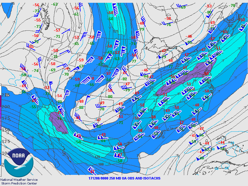
| 250 MB - 00Z 12/07 | 250 MB - 12Z 12/07 |
|---|---|
 |
 |
| 300 MB - 00Z 12/07 | 300 MB - 12Z 12/07 |
|---|---|
 |
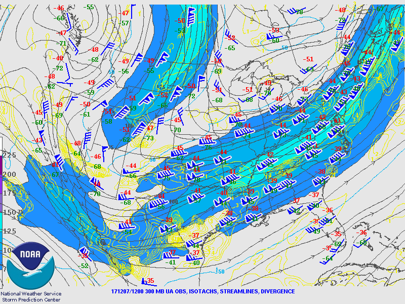 |
| 500 MB - 00Z 12/07 | 500 MB - 12Z 12/07 |
|---|---|
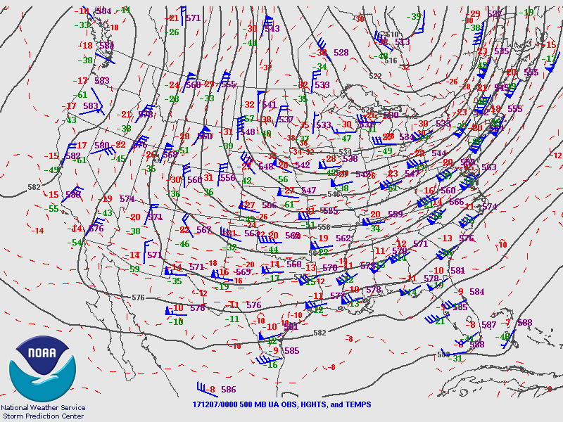 |
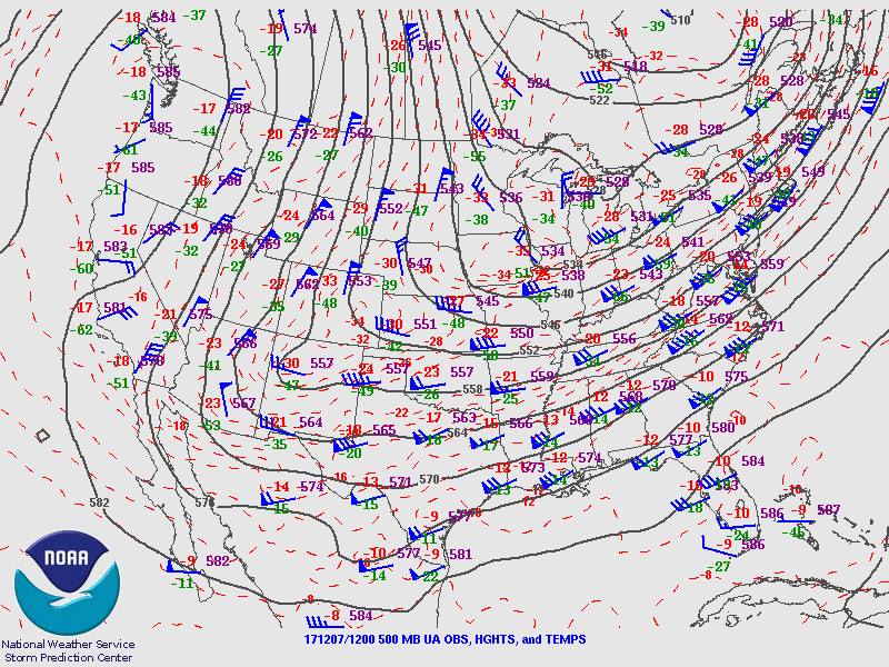 |
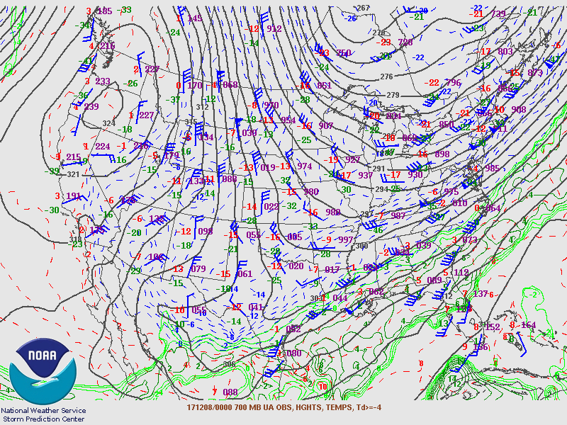
| 700 MB - 00Z 12/07 | 700 MB - 12Z 12/07 |
|---|---|
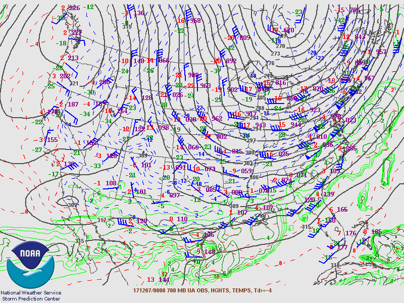 |
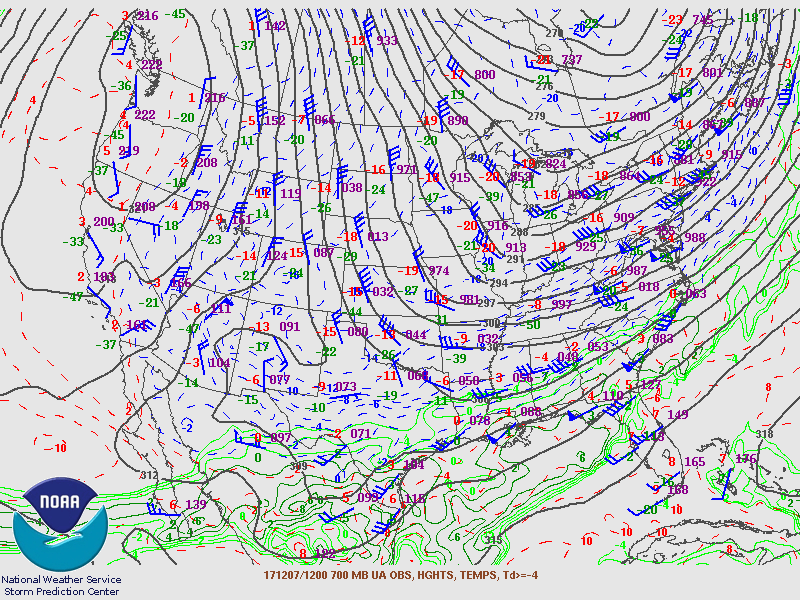 |
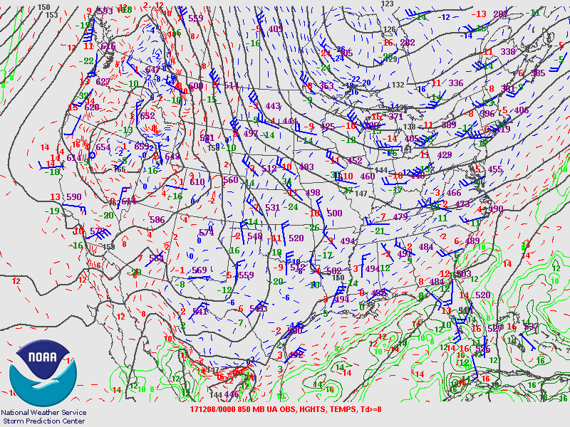
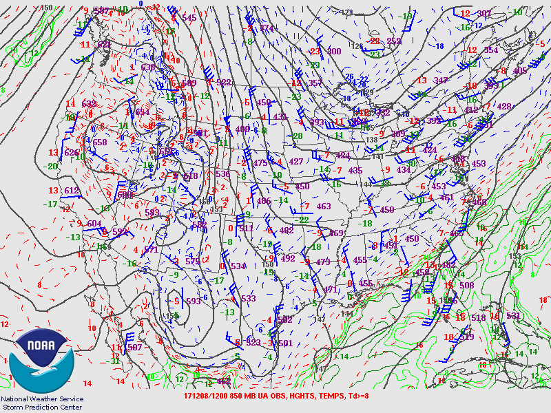
| 850 MB - 00Z 12/07 | 850 MB - 12Z 12/07 |
|---|---|
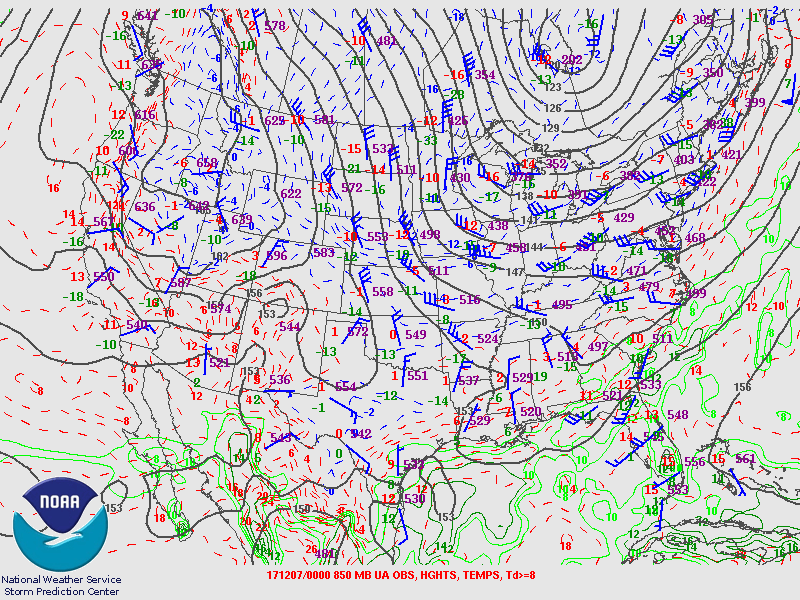 |
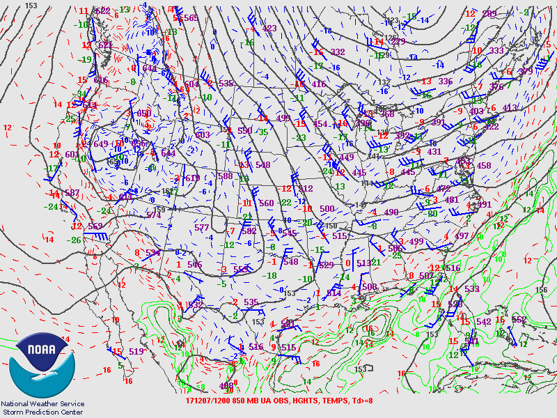 |
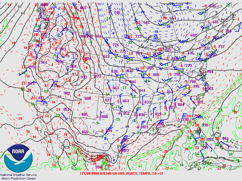
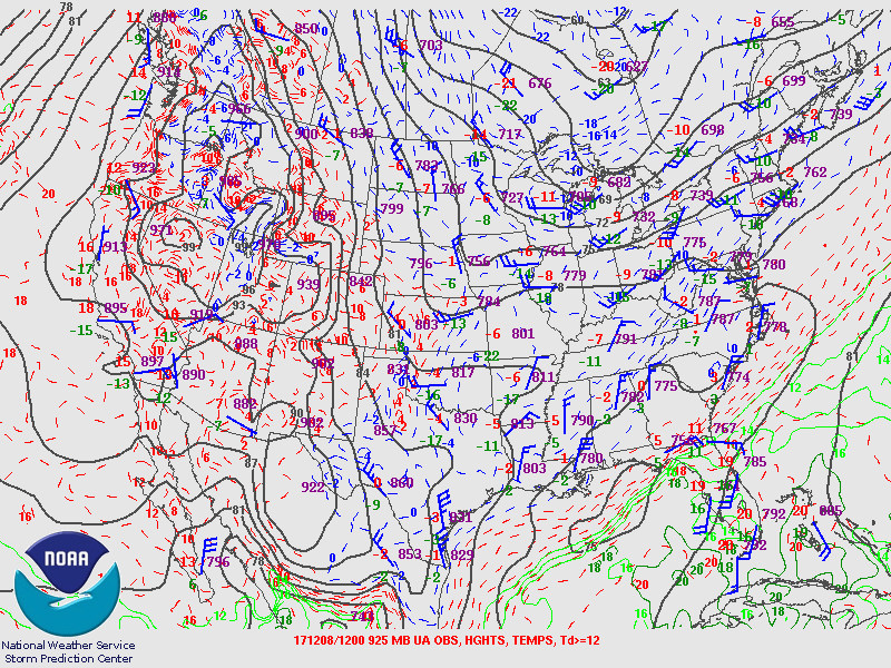
| 925 MB - 00Z 12/07 | 925 MB - 12Z 12/07 |
|---|---|
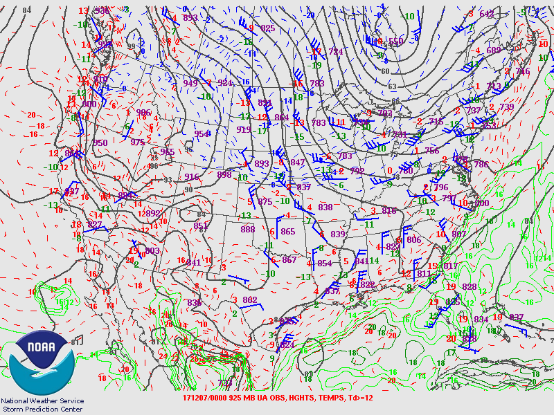 |
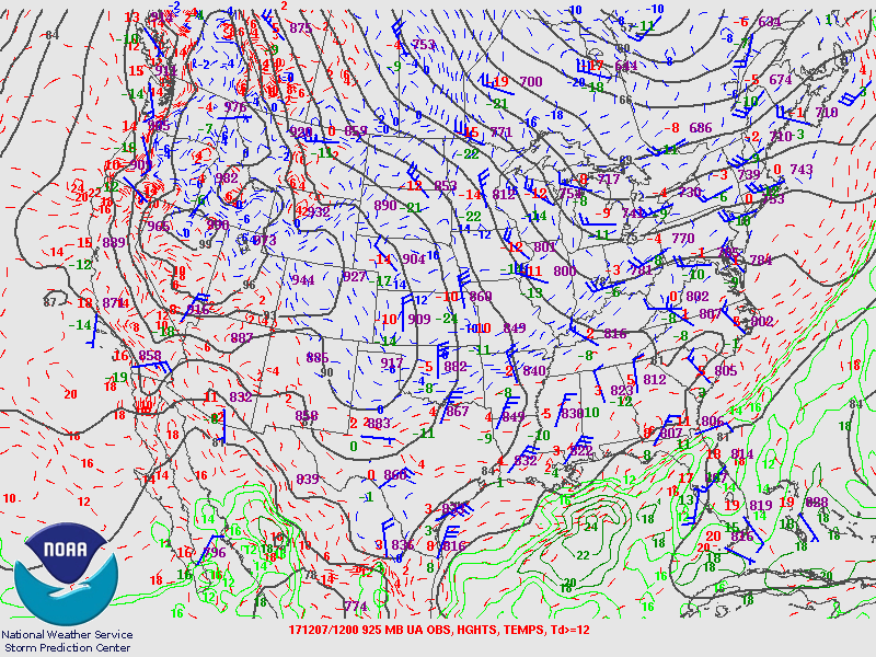 |
| 250 MB - 00Z 12/08 | 250 MB - 12Z 12/08 |
|---|---|
 |
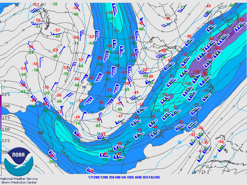 |
| 300 MB - 00Z 12/08 | 300 MB - 12Z 12/08 |
|---|---|
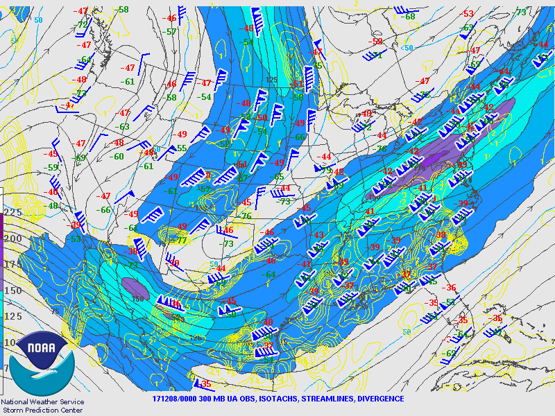 |
 |
| 500 MB - 00Z 12/08 | 500 MB - 12Z 12/08 |
|---|---|
 |
 |
| 700 MB - 00Z 12/08 | 700 MB - 12Z 12/08 |
|---|---|
 |
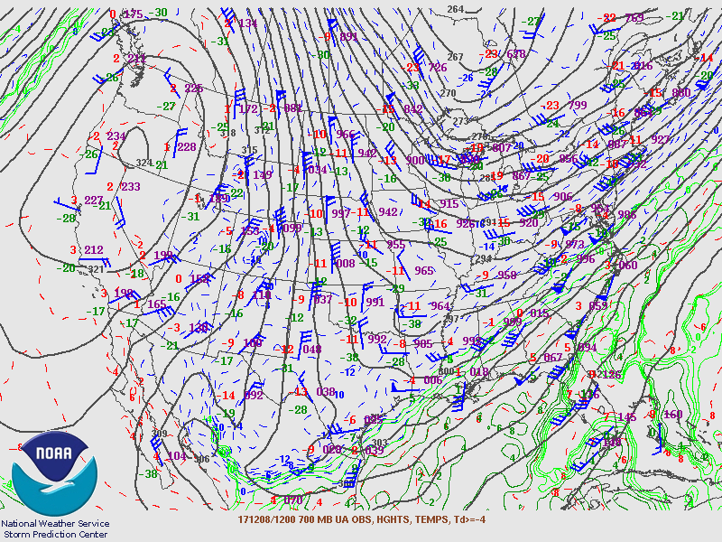 |
| 850 MB - 00Z 12/08 | 850 MB - 12Z 12/08 |
|---|---|
 |
 |
| 925 MB - 00Z 12/08 | 925 MB - 12Z 12/08 |
|---|---|
 |
 |
| Corpus Christi Sounding - 00Z 12/07 | Del Rio TX Sounding - 00Z 12/07 |
|---|---|
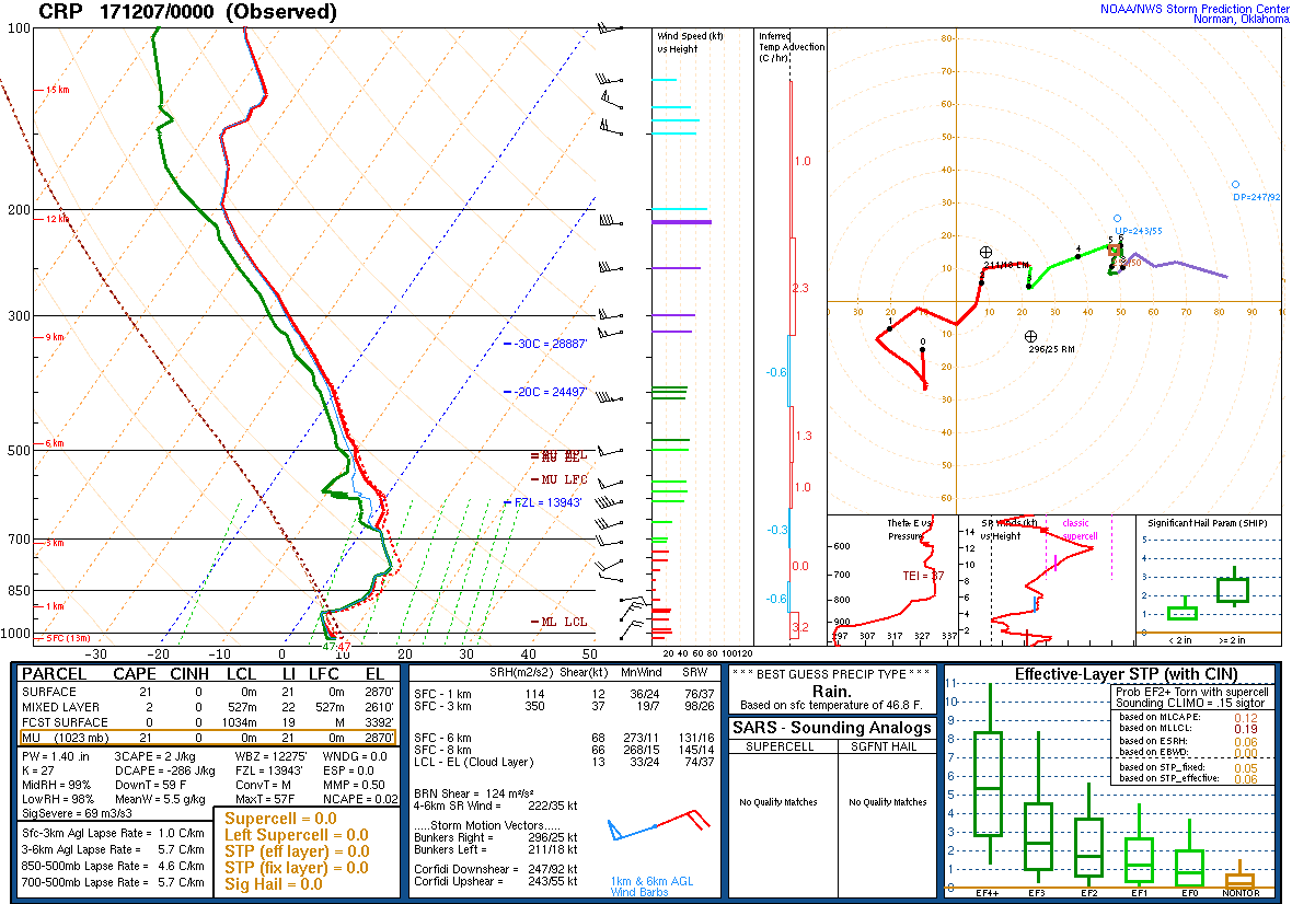 |
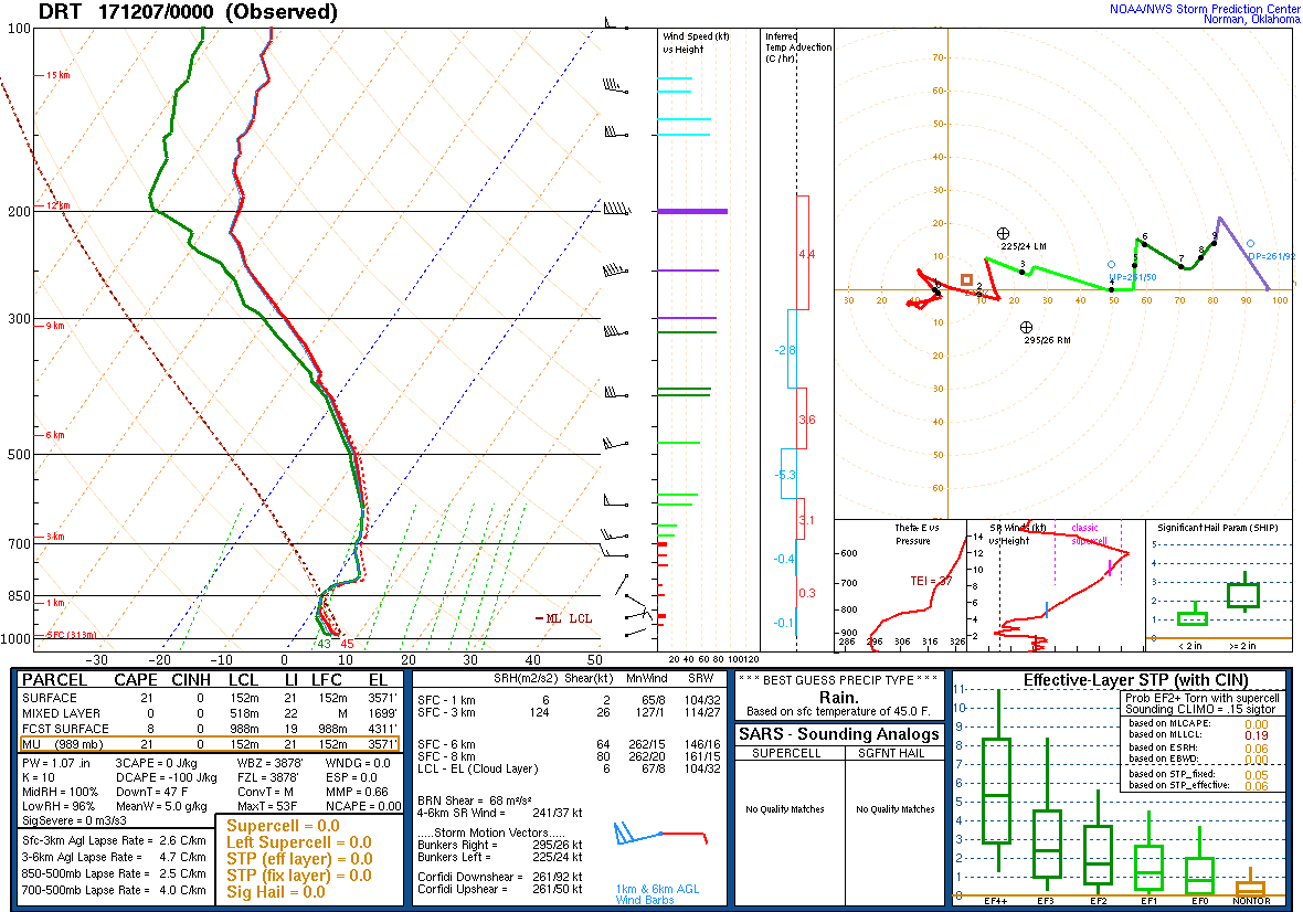 |
| Corpus Christi Sounding - 12Z 12/07 | Del Rio TX Sounding - 12Z 12/07 |
|---|---|
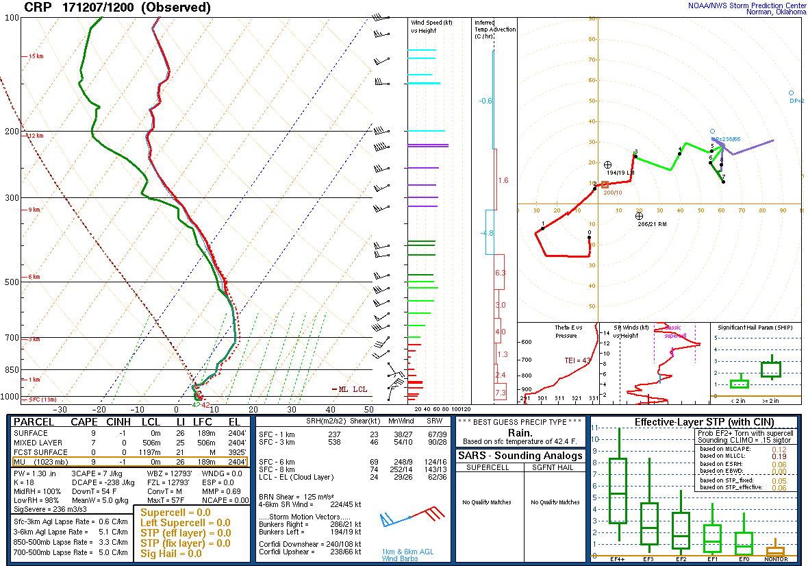 |
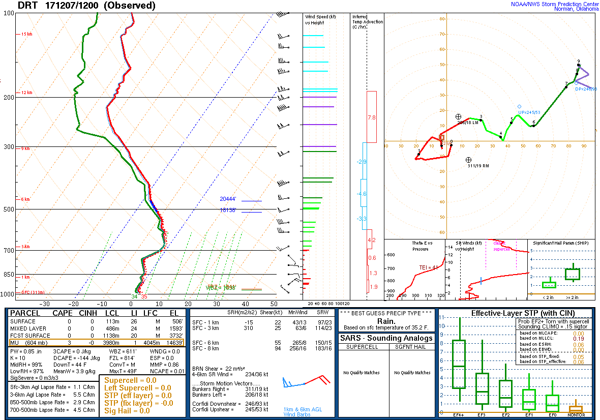 |
| Corpus Christi Sounding - 00Z 12/08 | Del Rio TX Sounding - 00Z 12/08 |
|---|---|
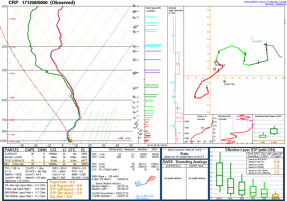 |
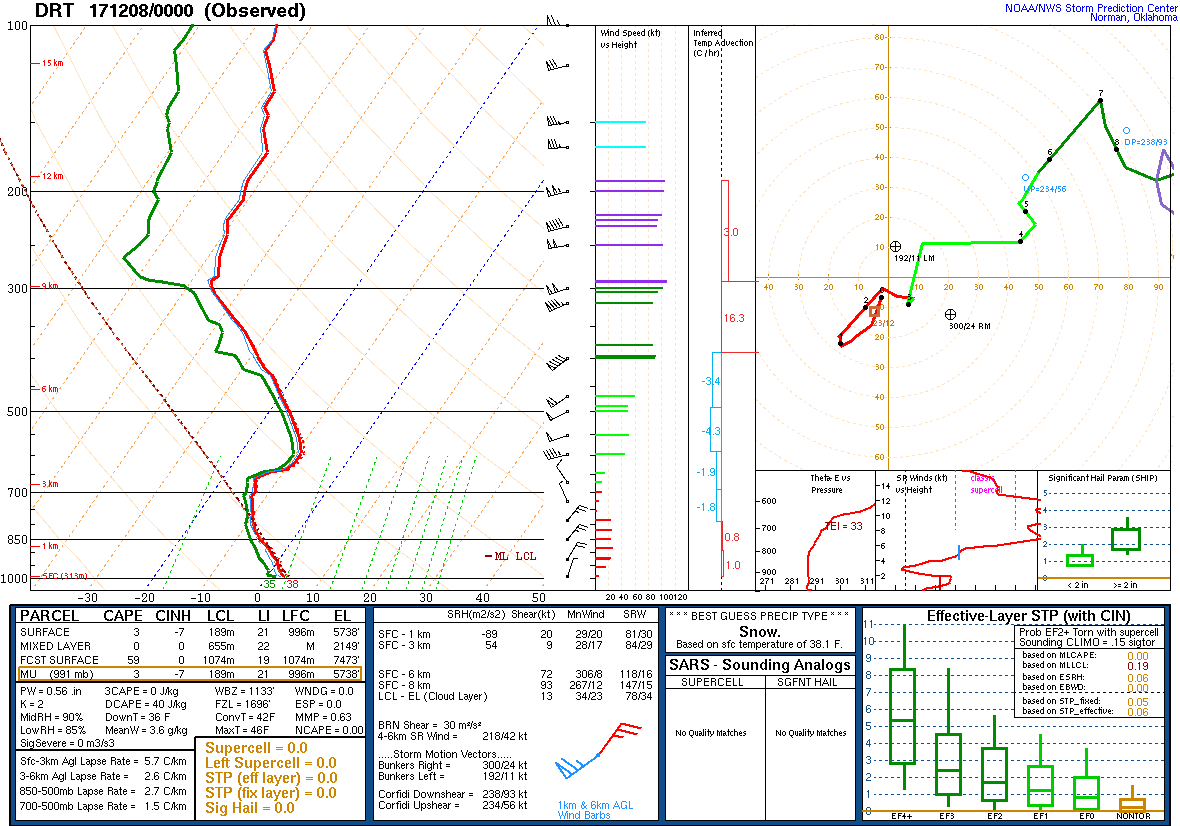 |
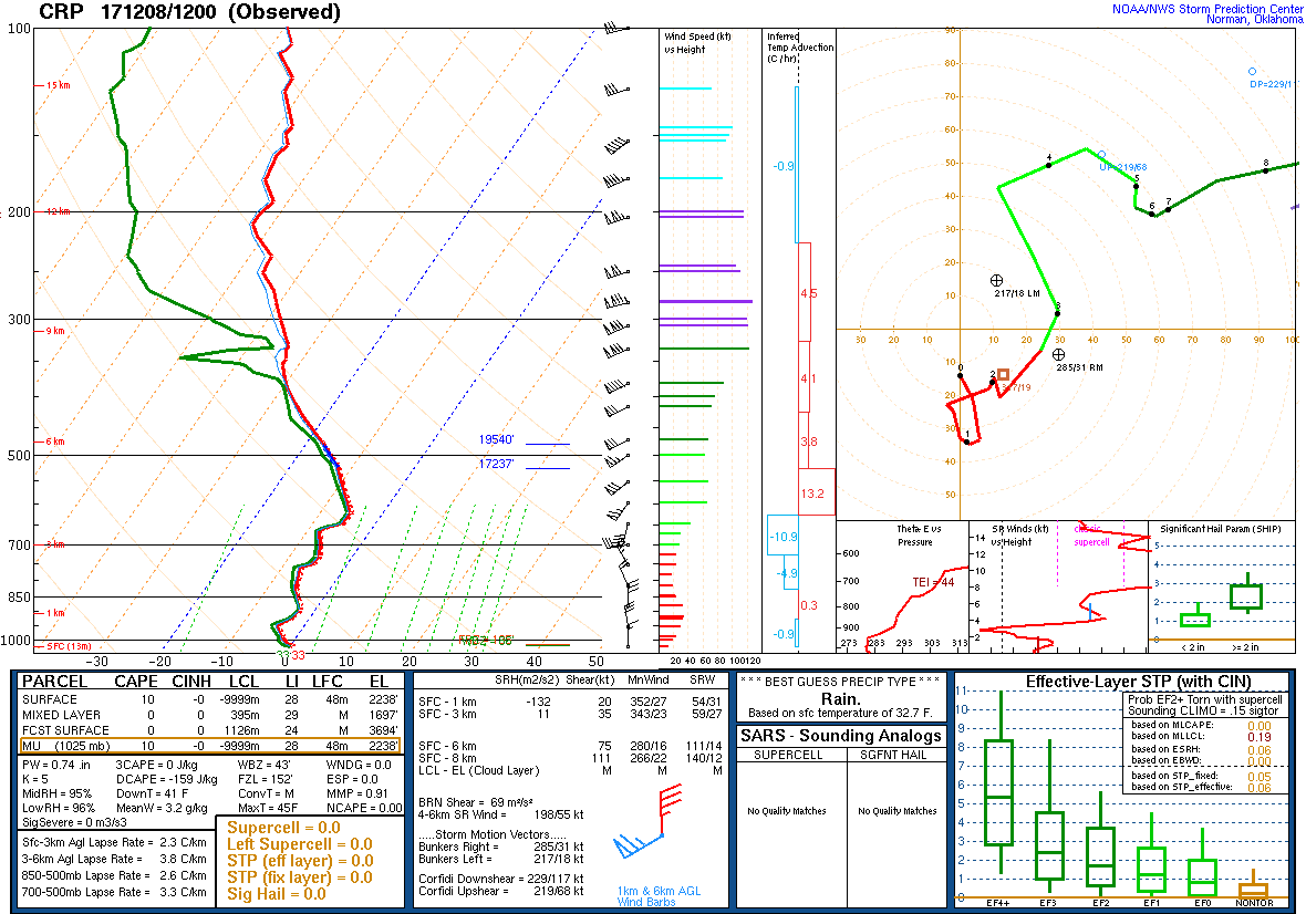
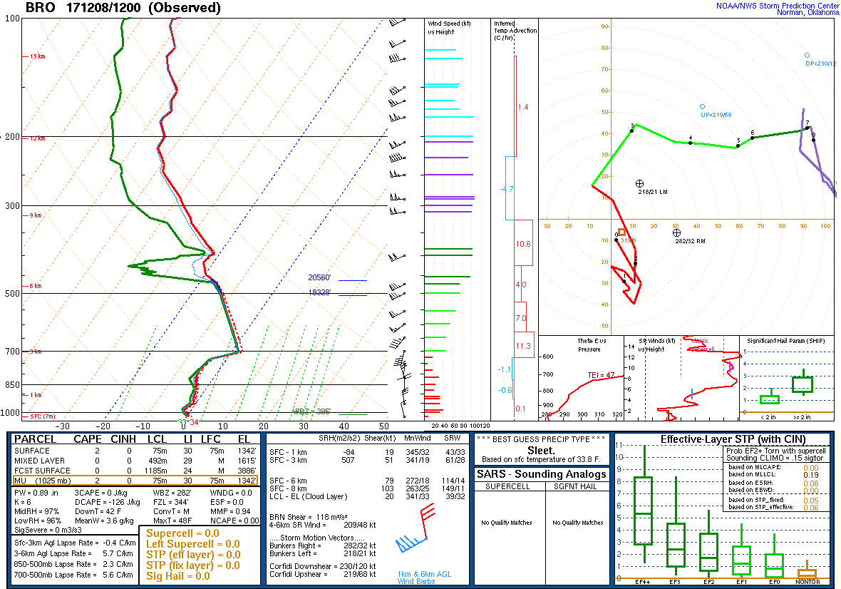
| Corpus Christi Sounding - 06Z 12/08 | Brownsville Sounding - 06Z 12/08 |
|---|---|
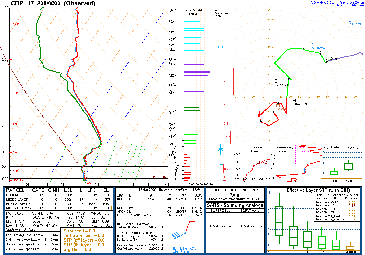 |
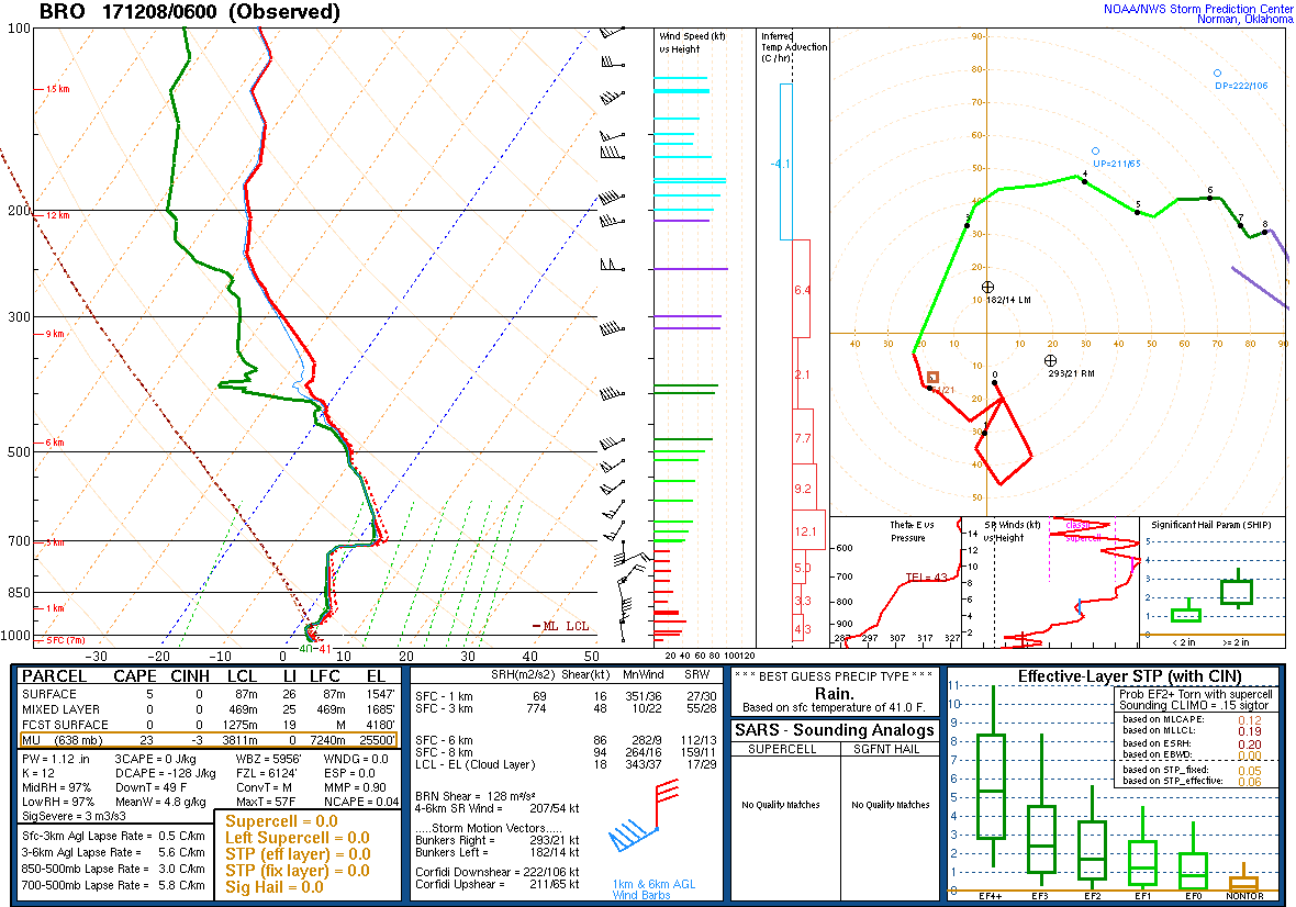 |
| Corpus Christi Sounding - 12Z 12/08 | Brownsville Sounding - 12Z 12/08 |
|---|---|
 |
 |

