National Weather Service United States Department of Commerce

Thunderstorms in the North Central U.S.; Dangerous Heat in Texas

There is a severe weather and isolated flooding threat from the Central to Northern Plains tonight into early Thursday. The severe weather threat will progress eastward to the Upper Mississippi Valley/Great Lakes into the Lower Ohio Valley Thursday. Major to extreme heat will continue to impact much of southern Texas into next week, where widespread record-breaking temperatures are possible. Read More >

Click a location below for detailed forecast.

Last Map Update: Thu, May 15, 2025 at 1:12:24 am CDT

A HOT week coming up with some record high temperatures in the forecast! This will be a prolonged early-season heatwave that continues into at least early next week. Heat index values will likely extend into the triple digits daily across most of South Texas.
Greatest risk of heat-related impacts will be over the Brush Country during the afternoon and evening hours today and Thursday. Heat index values up to 114 are expected. Please practice heat safety! Look before you lock!
A Small Craft Advisory remains in effect for all of the local waters until 7 pm Thursday. Sustained winds are expected to range between 20 to 25 mph with gusts over 30 mph. Seas will be 5-7 feet.
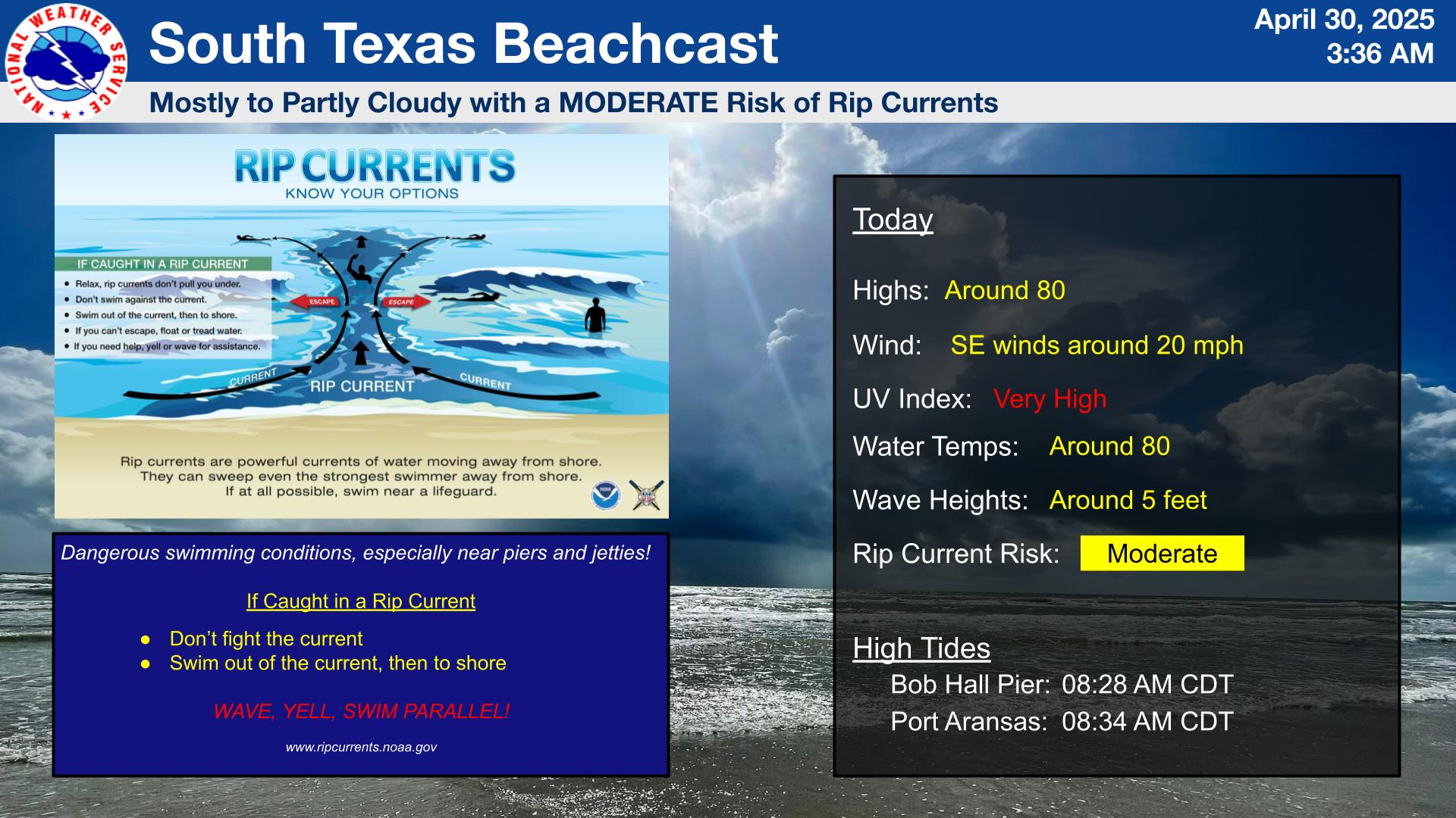
Breezy and mostly sunny skies are expected today with temperatures in the lower 80s and a low risk of rip currents. While the rip current risk is low, please use caution if entering the water as a low risk doesn't mean no risk. South to southeasterly winds around 20 mph.
Hot and rain-free conditions are expected into early next week. Highs will peak near 105-110° each afternoon with a low chance for Excessive heat conditions (Heat index over 114°). Please remain hydrated and limit outdoor exposure.

 
Hourly Weather Roundup ( )
Location Sky/Weather Temp Dewpt RH Wind Baro Remarks
Alice
N/A
N/A
N/A
N/A
N/A
N/A
N/A
Beeville
N/A
N/A
N/A
N/A
N/A
N/A
N/A
Corpus Christi
N/A
N/A
N/A
N/A
N/A
N/A
N/A
Corpus Christi NAS
N/A
N/A
N/A
N/A
N/A
N/A
N/A
Cotulla
N/A
N/A
N/A
N/A
N/A
N/A
N/A
Kingsville NAS
N/A
N/A
N/A
N/A
N/A
N/A
N/A
Laredo
N/A
N/A
N/A
N/A
N/A
N/A
N/A
Port Lavaca
N/A
N/A
N/A
N/A
N/A
N/A
N/A
Rockport
N/A
N/A
N/A
N/A
N/A
N/A
N/A
Victoria
N/A
N/A
N/A
N/A
N/A
N/A
N/A
Note: "N/A" or "MISG" will be displayed if values are not available. In the LOCATION column, click on links for a list of recent observations at sites of interest. In the WIND column, VRB is "variable" and G is "gust". Wind speeds are in MPH. In the BARO (pressure) column, values are in inches. In the REMARKS column, HX is "heat index", WCI is "wind chill index", and VSB is "visibility" (if shown).
 
Text Product Selector
Video Briefing Weather Outlook Fcst Discussion Tropical Marine Tides
Rivers and Lakes Daily Rainfall Drought Fire Observations Satellite

Hourly Wx Graph Graphical Fcst Aviation Climate Past Events Hurricane Guide