National Weather Service United States Department of Commerce

Severe Weather and Heavy Rainfall for Southern Plains; Strong Pacific Storm Moves Ashore

Heavy rainfall and flooding concerns continue for portions of Texas into the lower Mississippi Valley. Severe thunderstorms are expected to redevelop across areas of western Texas later Saturday. Meanwhile, strong Pacific storm will move ashore this weekend. Increasing winds for many areas of the West and Southwest, heavy precipitation with snow for the higher terrain. Read More >

Click a location below for detailed forecast.

Last Map Update: Sat, May. 4, 2024 at 5:05:27 am CDT

National Weather Service Austin/San Antonio, TXNational Weather Service Austin/San Antonio, TXNational Weather Service Houston/Galveston, TX
National Weather Service Austin/San Antonio, TXZoom
Out

National Weather Service Brownsville/Rio Grande Valley, TXNational Weather Service Brownsville/Rio Grande Valley, TX

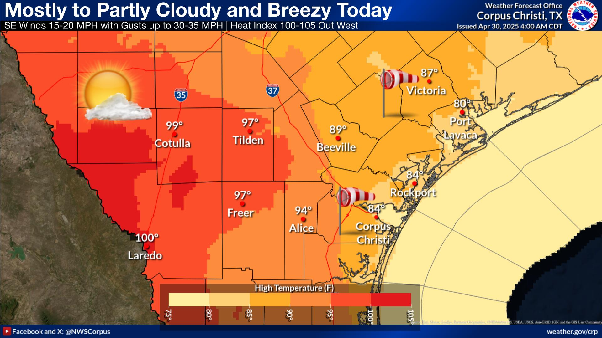
Expect warm temperatures today with highs west into the 90s; 80s east. Clouds and haze will remain in the area.
Temperatures once again will remain in the lower to mid 70s tonight under mostly cloudy skies.
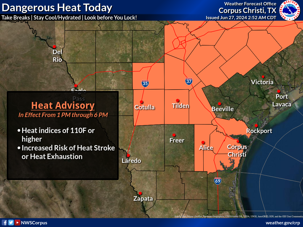
Hot and humid conditions are forecast for next week. This will result in an increasing risk of heat illnesses since bodies are not yet acclimated to the heat. The most significant heat will be on Wednesday and Thursday when there will be a major risk of heat impacts.
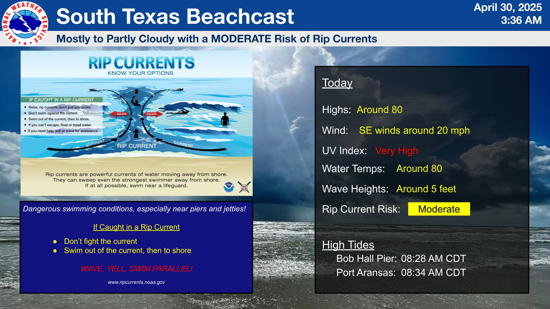
Partly to mostly cloudy skies continue this weekend with a moderate southeasterly breeze. There is a MODERATE risk of rip currents. Use caution if you venture into the water.
Isolated thunderstorms are possible west through this weekend with a gradual warming trend expected through next week. Hot and humid conditions are expected by the middle of next week with a medium chance of a heat index over 110.

 
Hourly Weather Roundup ( )
Location Sky/Weather Temp Dewpt RH Wind Baro Remarks
Alice
N/A
N/A
N/A
N/A
N/A
N/A
N/A
Beeville
N/A
N/A
N/A
N/A
N/A
N/A
N/A
Corpus Christi
N/A
N/A
N/A
N/A
N/A
N/A
N/A
Corpus Christi NAS
N/A
N/A
N/A
N/A
N/A
N/A
N/A
Cotulla
N/A
N/A
N/A
N/A
N/A
N/A
N/A
Kingsville NAS
N/A
N/A
N/A
N/A
N/A
N/A
N/A
Laredo
N/A
N/A
N/A
N/A
N/A
N/A
N/A
Port Lavaca
N/A
N/A
N/A
N/A
N/A
N/A
N/A
Rockport
N/A
N/A
N/A
N/A
N/A
N/A
N/A
Victoria
N/A
N/A
N/A
N/A
N/A
N/A
N/A
Note: "N/A" or "MISG" will be displayed if values are not available. In the LOCATION column, click on links for a list of recent observations at sites of interest. In the WIND column, VRB is "variable" and G is "gust". Wind speeds are in MPH. In the BARO (pressure) column, values are in inches. In the REMARKS column, HX is "heat index", WCI is "wind chill index", and VSB is "visibility" (if shown).
 
Text Product Selector
Video Briefing Weather Outlook Fcst Discussion Tropical Marine Tides
Rivers and Lakes Daily Rainfall Drought Fire Observations Satellite

Hourly Wx Graph Graphical Fcst Aviation Climate Past Events Hurricane Guide