Dangerous and extreme heat will remain across portions of the central U.S. this week, persisting across the mid to lower Mississippi Valley, Gulf Coast, southern Plains and portions of Texas. A heat wave over the Southwest U.S. will peak this weekend. Heavy to excessive rainfall may produce flash flooding from the Delmarva Peninsula north into the Hudson Valley today and tonight. Read More >
Overview
A line of severe thunderstorms moved rapidly east through southwest into central Kansas during the late evening hours of 26 May 2019 into the early overnight hours of 27 May 2019. Several short-lived tornadoes resulted from this line of storms with all tornadoes resulting in either EF1 or EF0 damage.
Tornadoes:
|
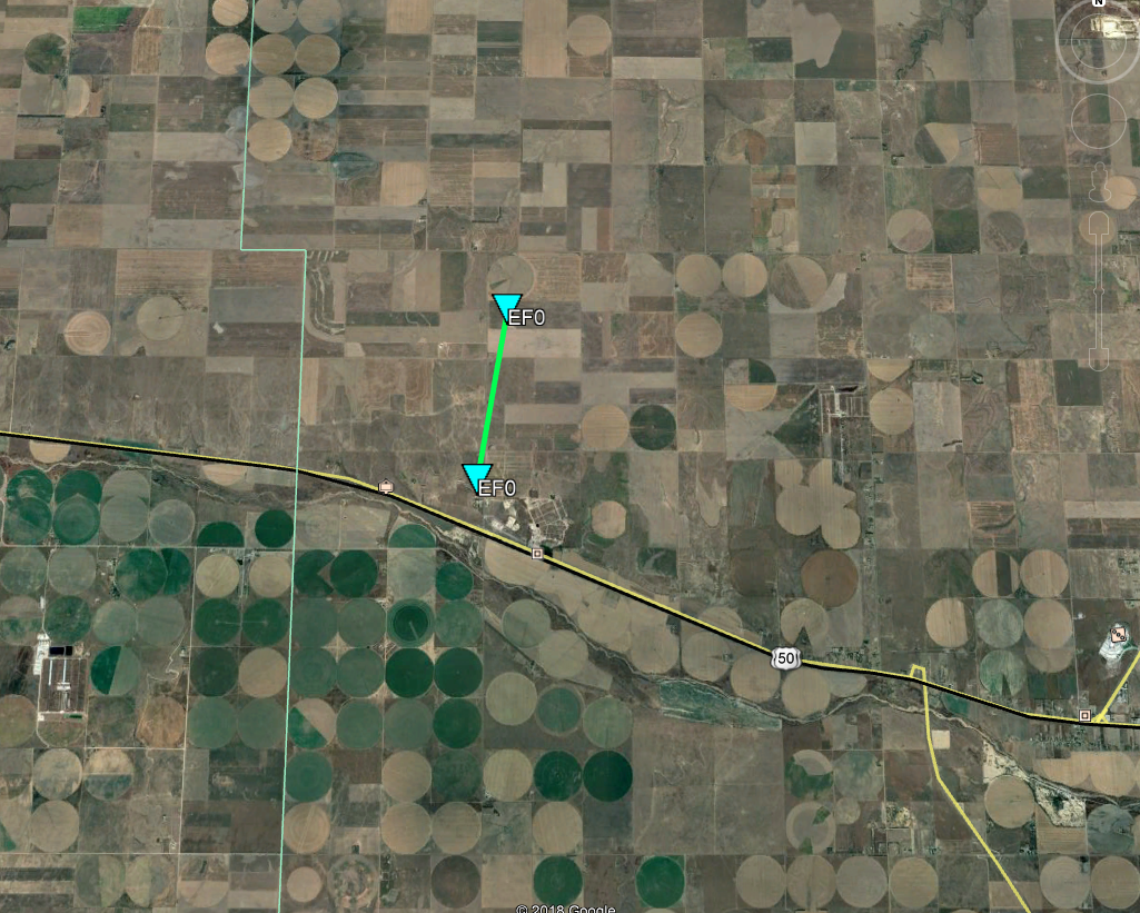
Tornado - Cimarron
|
||||||||||||||||
|
Tornado - Howell
|
||||||||||||||||
|
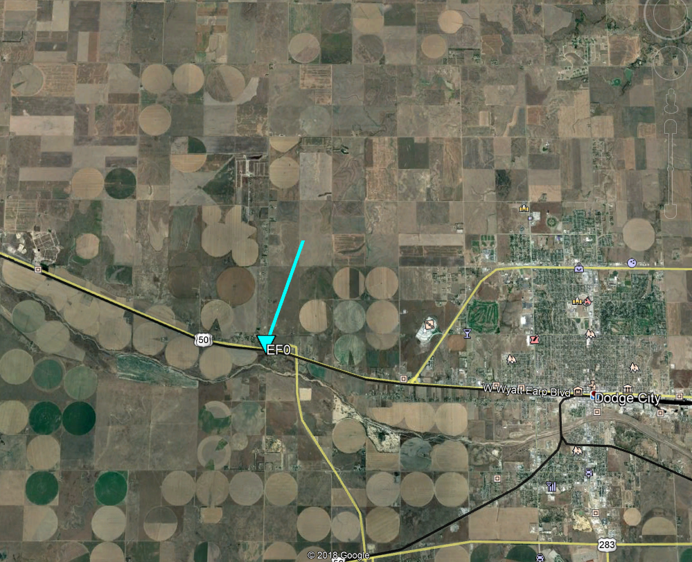
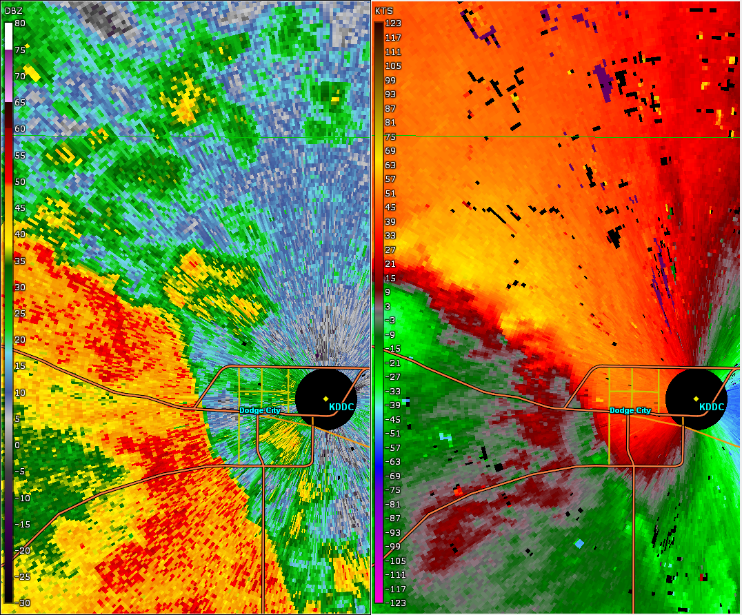
Tornado - West of Dodge City
|
||||||||||||||||
|
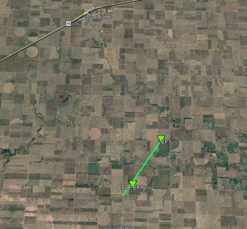
Tornado - South of Spearville
|
||||||||||||||||
|
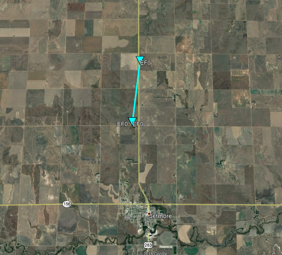
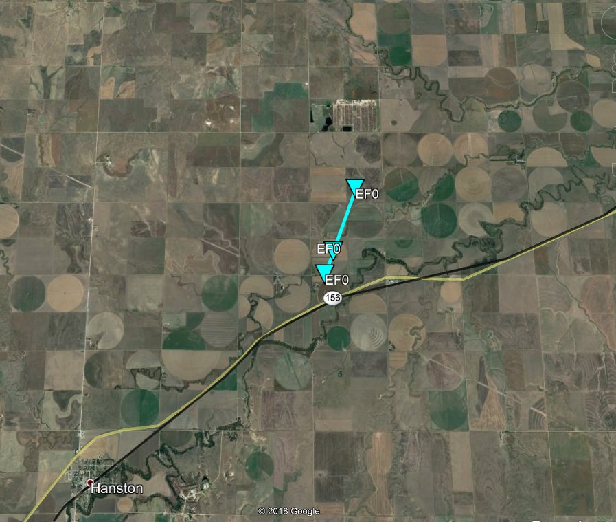
Tornado - Jetmore
|
||||||||||||||||
|
Tornado - West-Northwest of Gray
|
||||||||||||||||
|
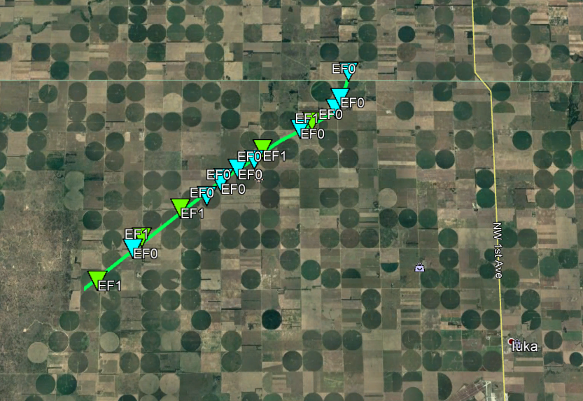
Tornado - Byers
|
||||||||||||||||
The Enhanced Fujita (EF) Scale classifies tornadoes into the following categories:
| EF0 Weak 65-85 mph |
EF1 Moderate 86-110 mph |
EF2 Significant 111-135 mph |
EF3 Severe 136-165 mph |
EF4 Extreme 166-200 mph |
EF5 Catastrophic 200+ mph |
 |
|||||
Radar
Tornado - Cimarron
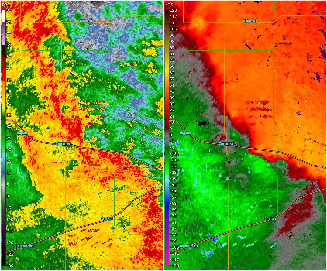 |
| KDDC WSR-88D data for Cimarron tornado. |
Tornado - Howell
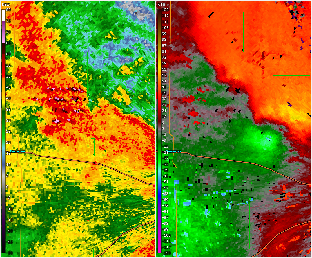 |
| KDDC WSR-88D data for Howell tornado. |
Tornado - West of Dodge City
 |
| KDDC WSR-88D data for west of Dodge City tornado. |
Tornado - South of Spearville
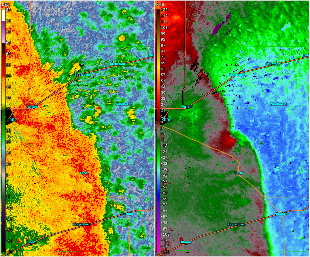 |
| KDDC WSR-88D data for south of Spearvill tornado. |
Tornado - Jetmore
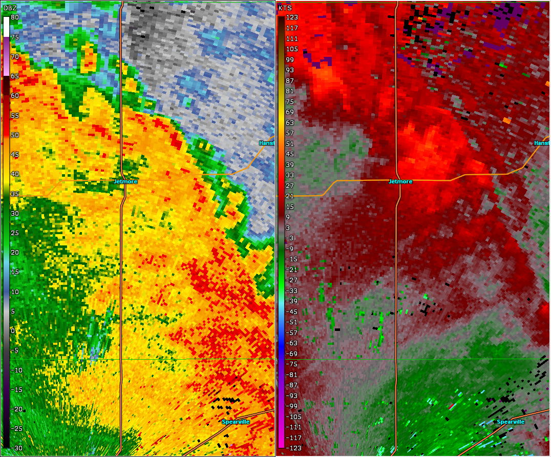 |
| KDDC WSR-88D data for Jetmore tornado. |
Tornado - West-Northwest of Gray
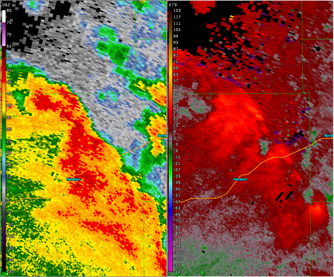 |
| KDDC WSR-88D data for Gray tornado. |
Tornado - Byers
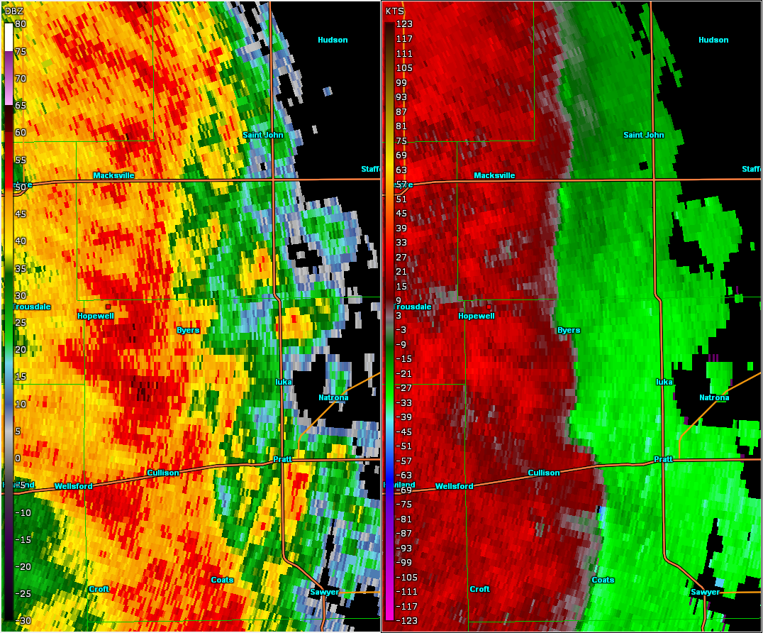 |
| KDDC WSR-88D data for Pratt-Stafford county tornado. |
 |
Media use of NWS Web News Stories is encouraged! Please acknowledge the NWS as the source of any news information accessed from this site. |
|