Widespread life-threatening flash and urban flooding will continue to pose a significant threat to life and property in south-central Texas. Catastrophic fiver flooding, with rapid rises on small streams, arroyos, and typically dry washes, is expected. Monsoonal showers persist across the Great Basin and Southwest with greatest flash flooding in southern Arizona. Read More >
Overview
A squall line developed in a strongly sheared environment in western Kansas Christmas Day. Damaging winds and several weak tornadoes occurred as the squall line moved rapidly eastward. Each tornado moved at least 60 mph and lasted only a few minutes.Tornadoes:
|
|
||||||||||
|
||||||||||
|
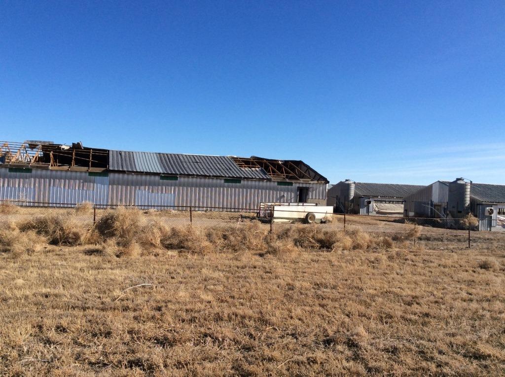
Tornado - Kismet
Track Map 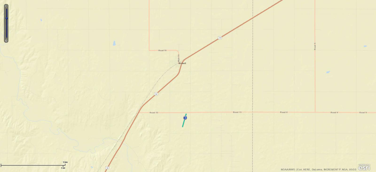 
Downloadable KMZ File |
||||||||||||||||
|
||||||||||||||||
|
Tornado - Ensign
Track Map 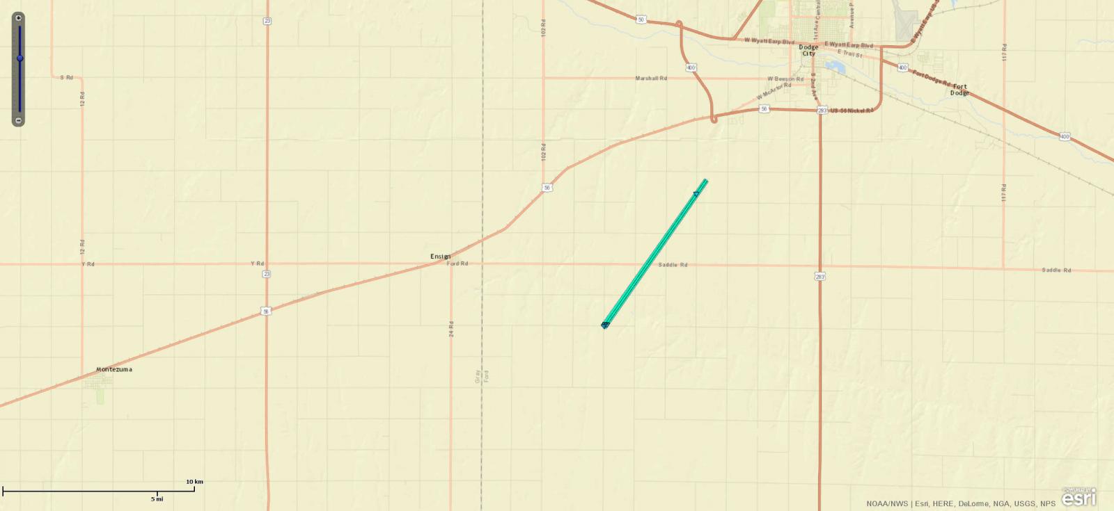
Downloadable KMZ File |
||||||||||||||||
|
|
||||||||||||||||
|
Tornado - Bucklin
Track Map 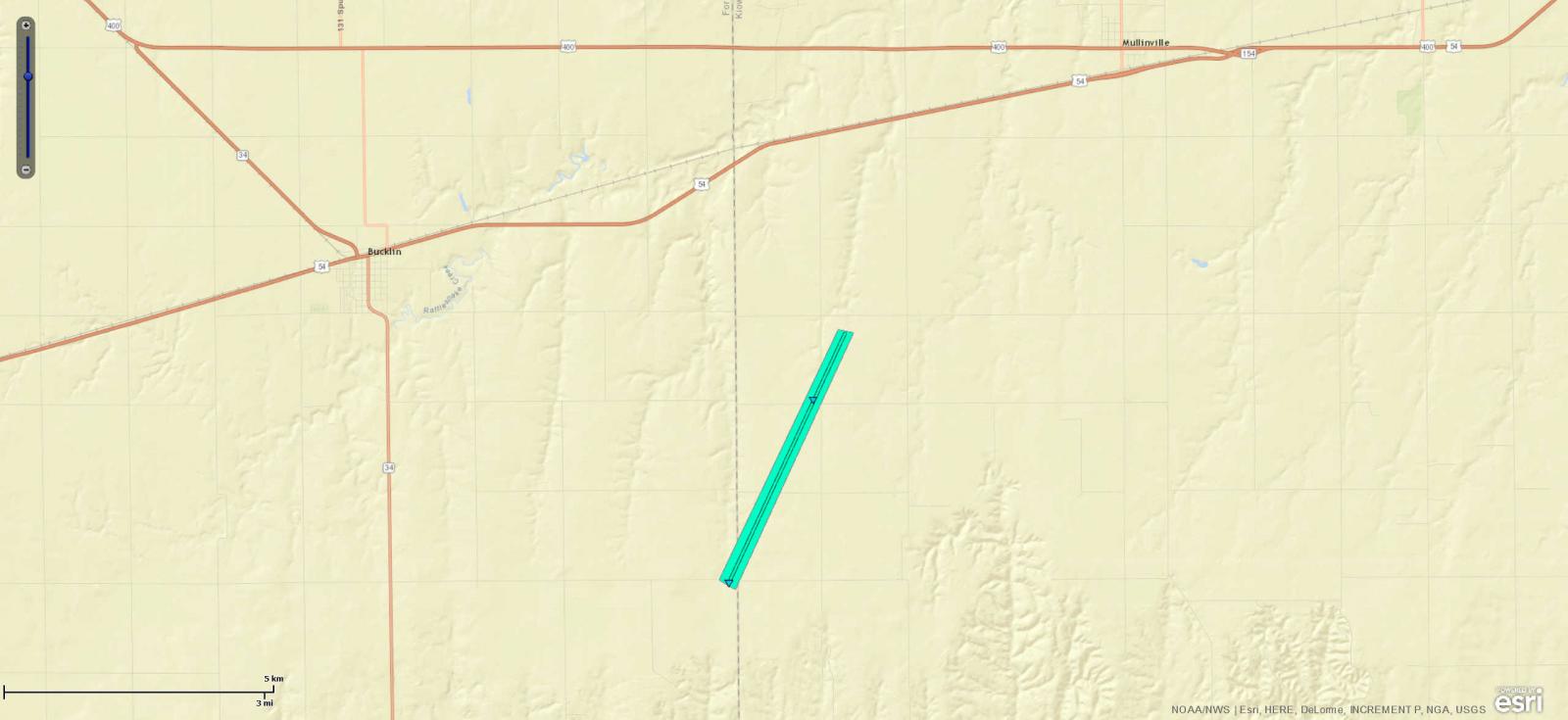
Downloadable KMZ File |
||||||||||||||||
|
||||||||||||||||
|
Tornado - Greensburg
Track Map 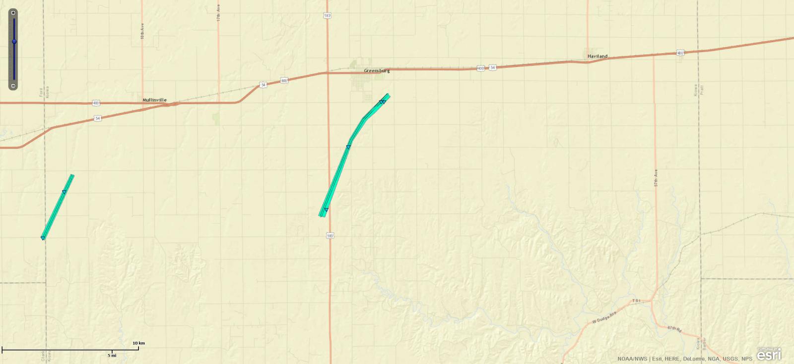
Downloadable KMZ File |
||||||||||||||||
|
Tornado - Wilmore
Track Map 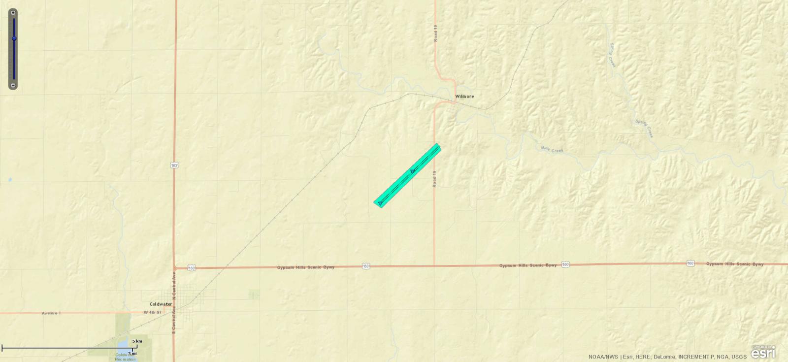
Downloadable KMZ File |
||||||||||||||||
|
Tornado - Rush Center
Track Map 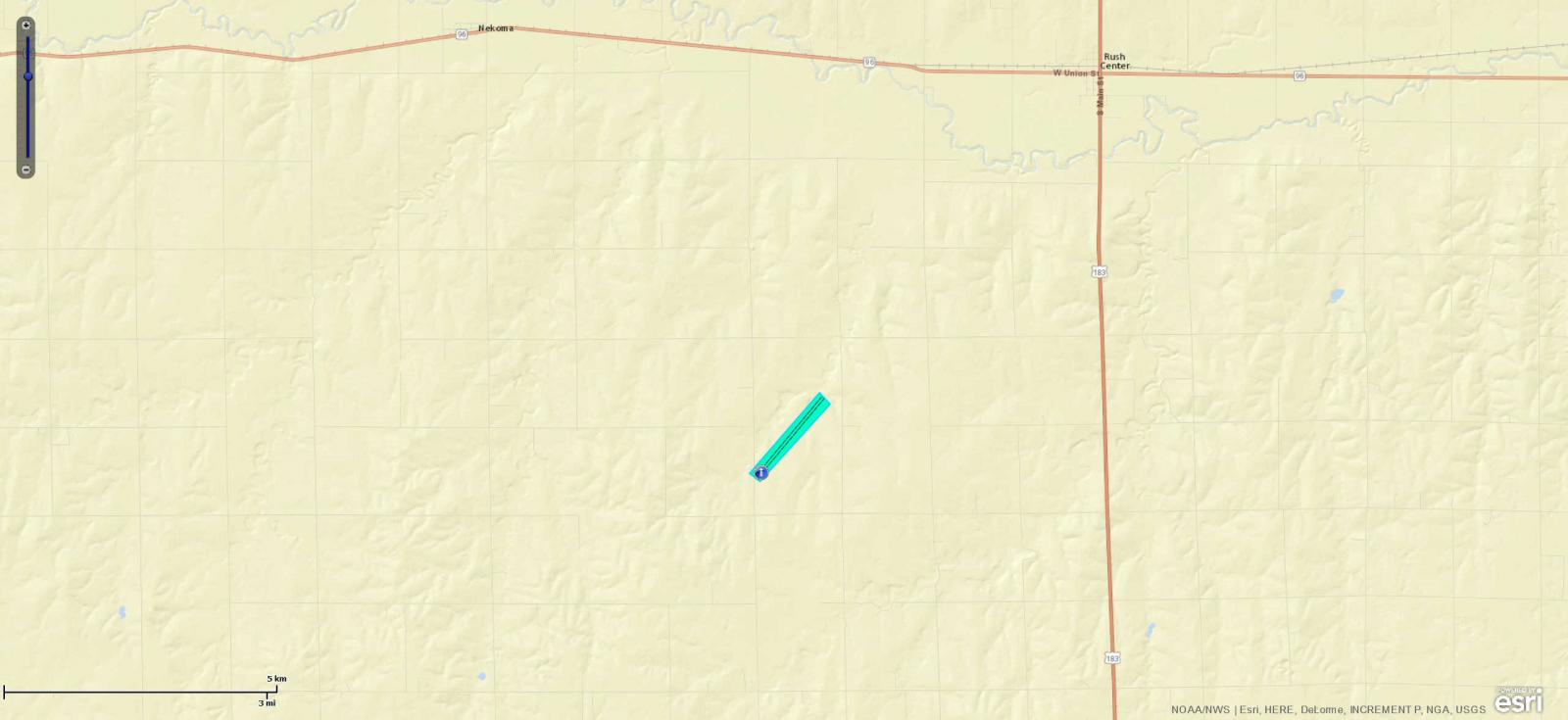
Downloadable KMZ File |
||||||||||||||||
The Enhanced Fujita (EF) Scale classifies tornadoes into the following categories:
| EF0 Weak 65-85 mph |
EF1 Moderate 86-110 mph |
EF2 Significant 111-135 mph |
EF3 Severe 136-165 mph |
EF4 Extreme 166-200 mph |
EF5 Catastrophic 200+ mph |
 |
|||||
Photos & Video:
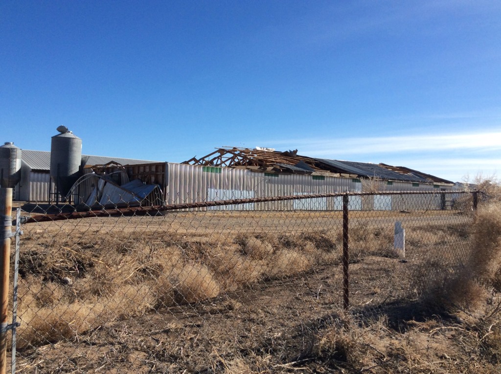
Tornado Damage Pictures
 |
 |
 |
|
| Hog Farm South of Kismet |
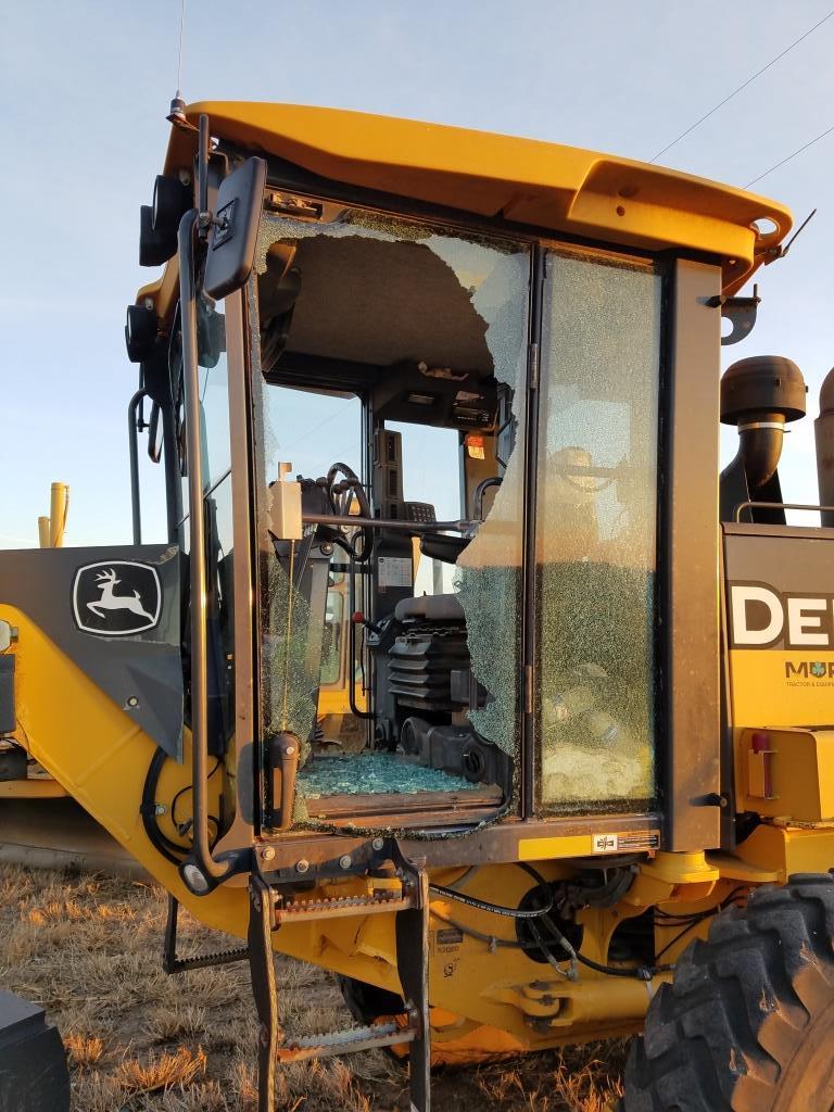
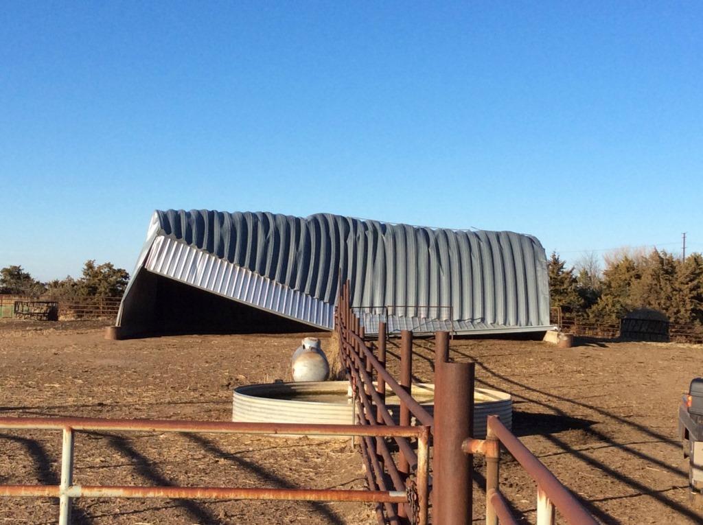
Road Grader Southeast of Ensign | Cattle Shed Southeast of Bucklin |
 |
Media use of NWS Web News Stories is encouraged! Please acknowledge the NWS as the source of any news information accessed from this site. |
|