A heat wave over the Southwest will intensify this week, peaking and expanding into the Intermountain West and northern High Plains this weekend. Critical to extremely critical fire weather conditions are forecast from the Northwest and the northern Great Basin this weekend. Particularly Dangerous Situation Red Flag Warnings have been issued. Read More >
Overview
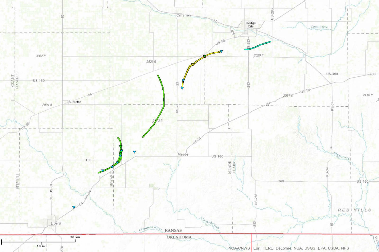
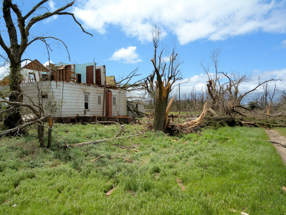
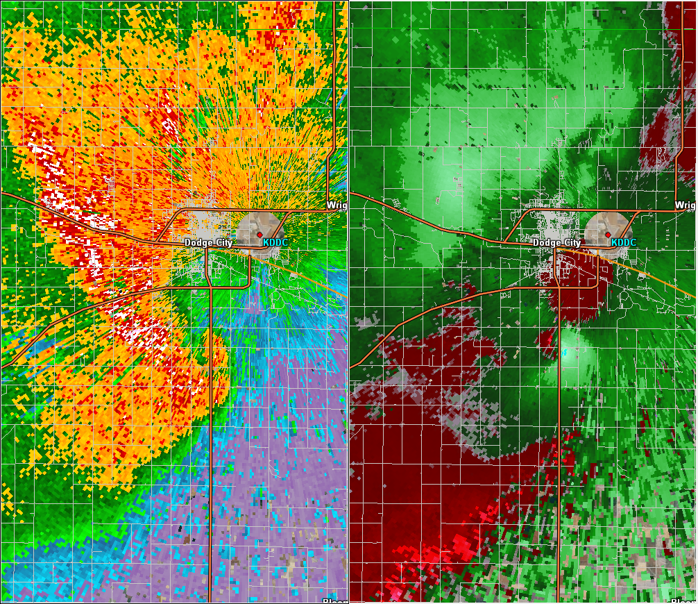
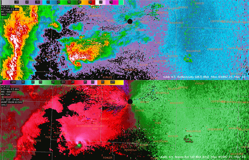
During the evening on Sunday May 24, 2015, a tornado producing supercell produced numerous tornadoes from near Kismet in Seward county to just south of Dodge City. Several were visually very large but as it turned out damage was not extensive. The strongest tornado based on damage was one that started about 7 miles southwest of Ensign and ended up dissipating just ENE northeast of Ensign. Unfortunately a home received major damage from the tornado. Along the path there was low end EF2 damage and then EF1 damage was done to the home and surroundings. A car that had been parked in the driveway was carried across the road (there were no visible skid marks) and then slammed into a field just north of the house. Fortunately the occupants of the home had sought shelter and were not injured.
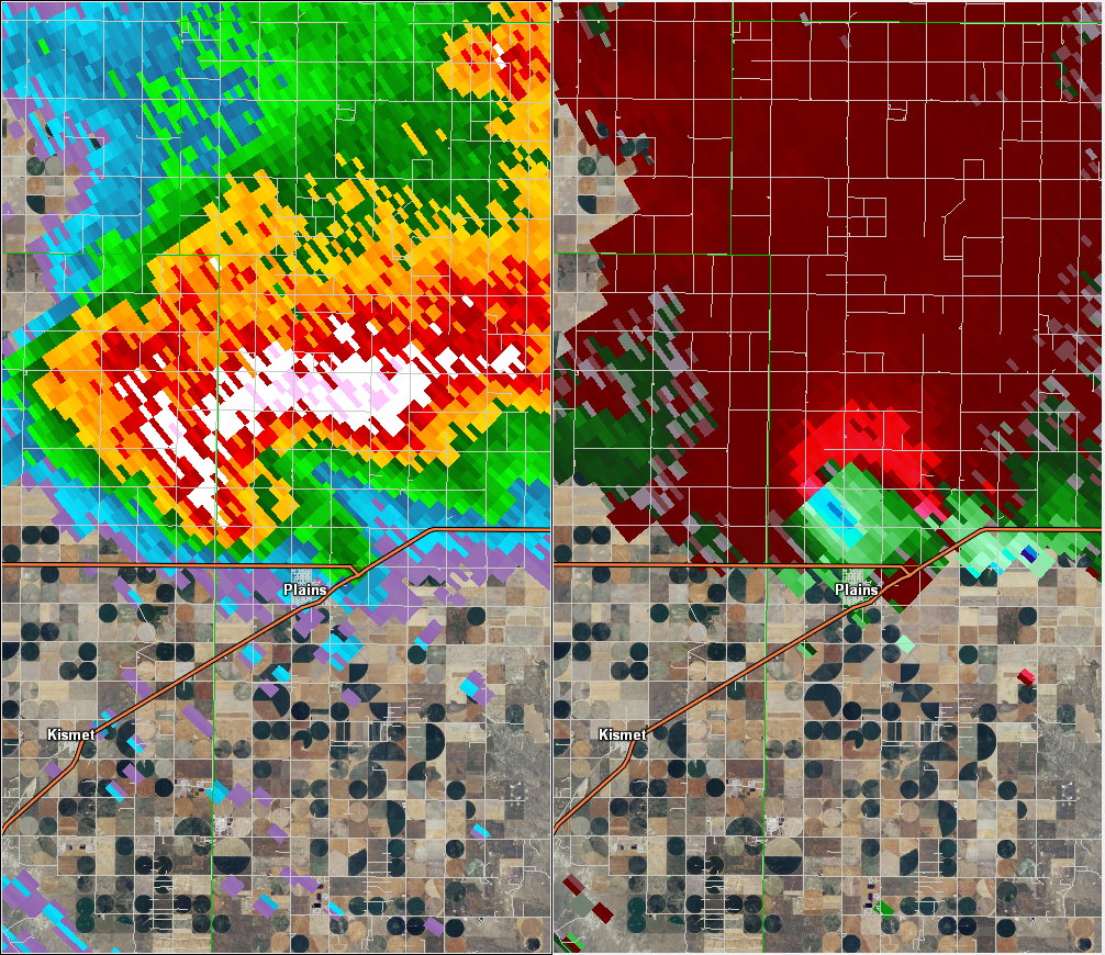
Another tornado that appeared to be up to a mile wide based on visual reports, damaged a couple of outbuildings and and overturned about a dozen pivot irrigation sprinklers. This tornado formed just northeast of Kismet and ended up passing just northwest of Plains before dissipating north of Plains.
Tornadoes:
|
|
||||||||||
|
||||||||||
|
Tornado - LOCATION
|
||||||||||||||||
|
||||||||||||||||
The Enhanced Fujita (EF) Scale classifies tornadoes into the following categories:
| EF0 Weak 65-85 mph |
EF1 Moderate 86-110 mph |
EF2 Significant 111-135 mph |
EF3 Severe 136-165 mph |
EF4 Extreme 166-200 mph |
EF5 Catastrophic 200+ mph |
 |
|||||
Photos & Video:
Header
 |
 |
|
|
| Caption (source) |
Caption (source) |
Caption (source) |
Caption (source) |
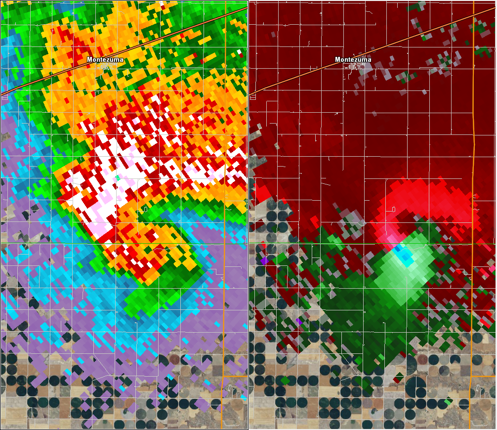
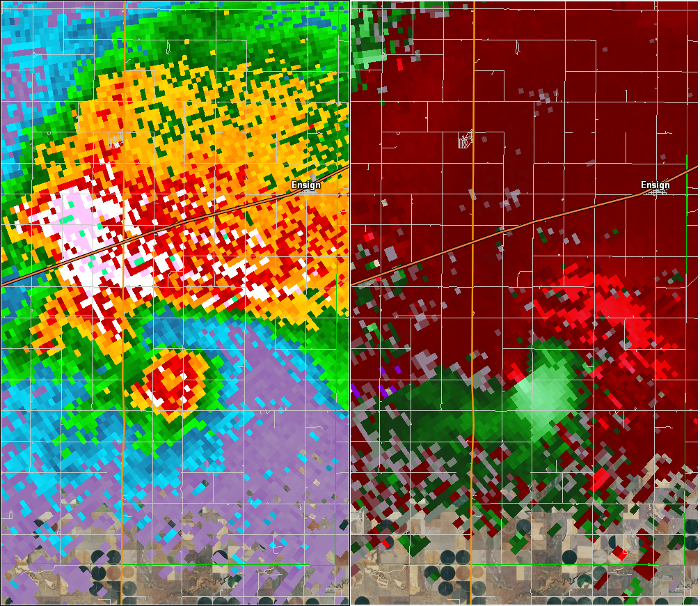
Radar:
Images are from DDC radar at 7 pm Sunday.
 |
 |
|
 |
| Caption | Caption | Caption | Caption |
 |
 |
| Caption | Caption |
 |
Media use of NWS Web News Stories is encouraged! Please acknowledge the NWS as the source of any news information accessed from this site. |
|