Severe storms, including large hail, wind, and perhaps a couple of tornadoes, are possible in the central Plains. Dry, windy conditions and lightning from dry thunderstorms may produce hazardous fire conditions in the Southwest and southern High Plains. Late-season snow is expected in the Northwest and the Great Basin. Heat is spreading across the eastern U.S.. Read More >
Overview
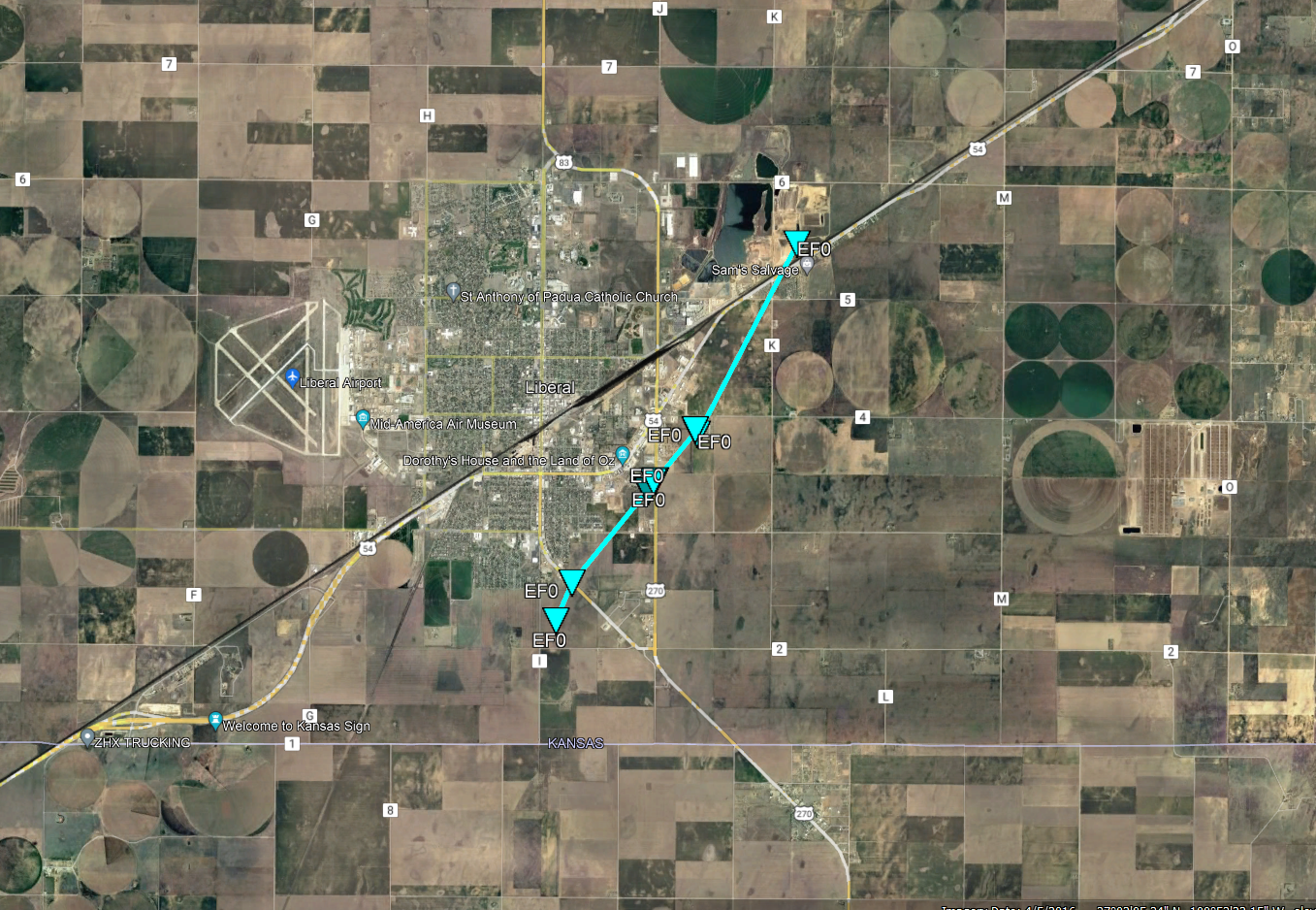
A line of fast moving thunderstorms produced widespread wind damage during the late afternoon to early evening hours of February 26, 2023. This included a short-lived tornado near Liberal before 5 pm CST.
Tornadoes:
|
Tornado - Liberal, KS Haskell-Gray Counties
|
||||||||||||||||
The Enhanced Fujita (EF) Scale classifies tornadoes into the following categories:
| EF0 Weak 65-85 mph |
EF1 Moderate 86-110 mph |
EF2 Significant 111-135 mph |
EF3 Severe 136-165 mph |
EF4 Extreme 166-200 mph |
EF5 Catastrophic 200+ mph |
 |
|||||
 |
Media use of NWS Web News Stories is encouraged! Please acknowledge the NWS as the source of any news information accessed from this site. |
|