| Overview | Radar | SPC Products | Additional Resources |
A powerful upper-level low pressure system dropped southward into the Great Lakes on Sunday July 27, sparking a good deal of severe thunderstorms in the warm, moist, and unstable air in advance of the system. A severe thunderstorm watch was issued for a large portion of Michigan at 1:40 pm, including all of southeast Michigan. The first severe thunderstorm warning for the DTX CWA was issued at 2:15 pm. Between then and 7:45 pm, severe weather affected nearly all of southeast Michigan, with 33 combined tornado, severe thunderstorm, and special marine warnings issued. The initial storm that affected portions of Midland and Bay counties from around 2:15 to 3:15 pm was a prolific hailer, with hail up to 3" diameter (greater than baseball size) recorded near Midland. Later, another particularly strong storm moved across Oakland County between around 4:30 and 5:15 pm, dropping hail up to 1.75" diameter (golf ball size) near the HIghland/White Lake area, with wind damage reported over central and eastern portions of the county. The storms produced heavy rainfall as well, with a swath of 1-2" recorded over southern Oakland County. Wyandotte, in southern Wayne County, picked up 2.67" in 4 hours.
Back to top
|
|
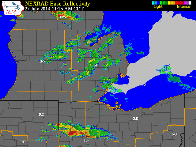
| Radar loop courtesy of Iowa Environmental Mesonet (IEM). Larger red boxes are tornadao watches, storm-based tornado warnings shown with smaller red boxes, yellow boxes are severe thunderstorm warnings, and green boxes are special marine warnings. Orange lines indicate county warning area (CWA) boundaries |
|
|
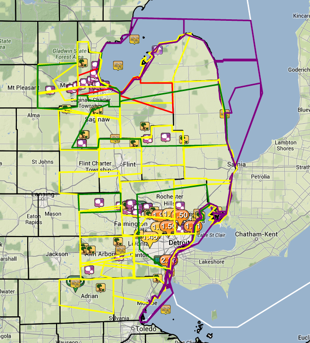
| Image courtesy of Iowa Environmental Mesonet (IEM). Yellow boxes are severe thunderstorm warnings, red box is a tornado warning, and purple boxes are special marine warnings. Local Storm Reports (LSR) are also shown plotted on the map. |
|
|
Text listing of the summary LSRs
Back to top
SPC Products (More details can be found by clicking on the images)
 |
 |
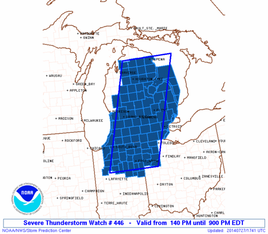 |
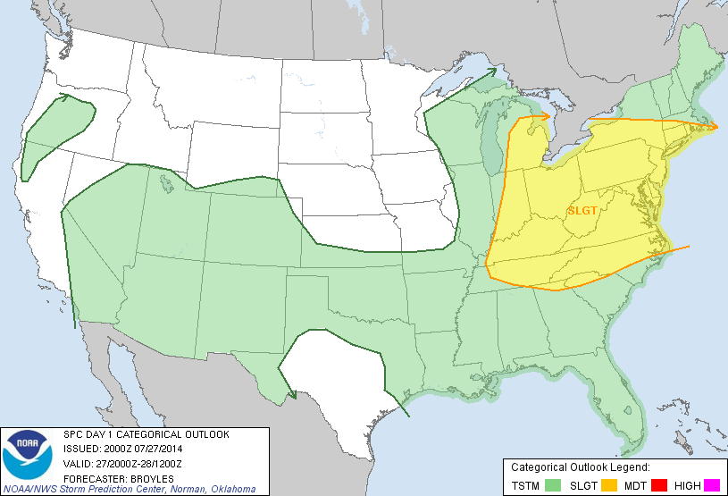
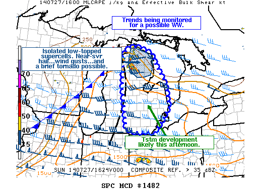
| SPC Day 1 Outlook issued at 20Z | Mesoscale Discussion | Severe Thunderstorm Watch 446 |
Storm Summaries from local NWS Offices