Central Illinois
Weather Forecast Office
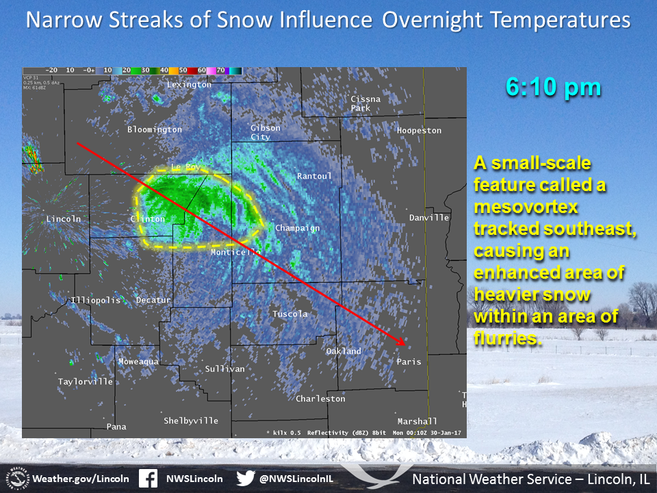
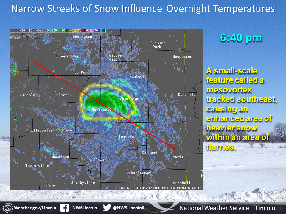
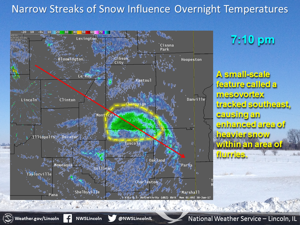
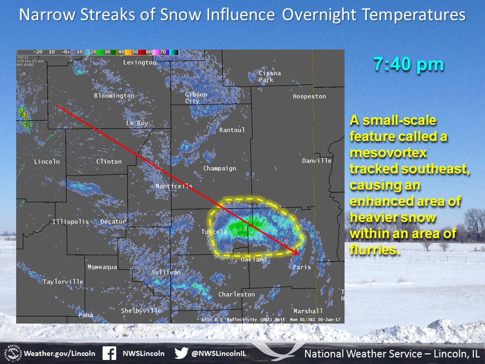
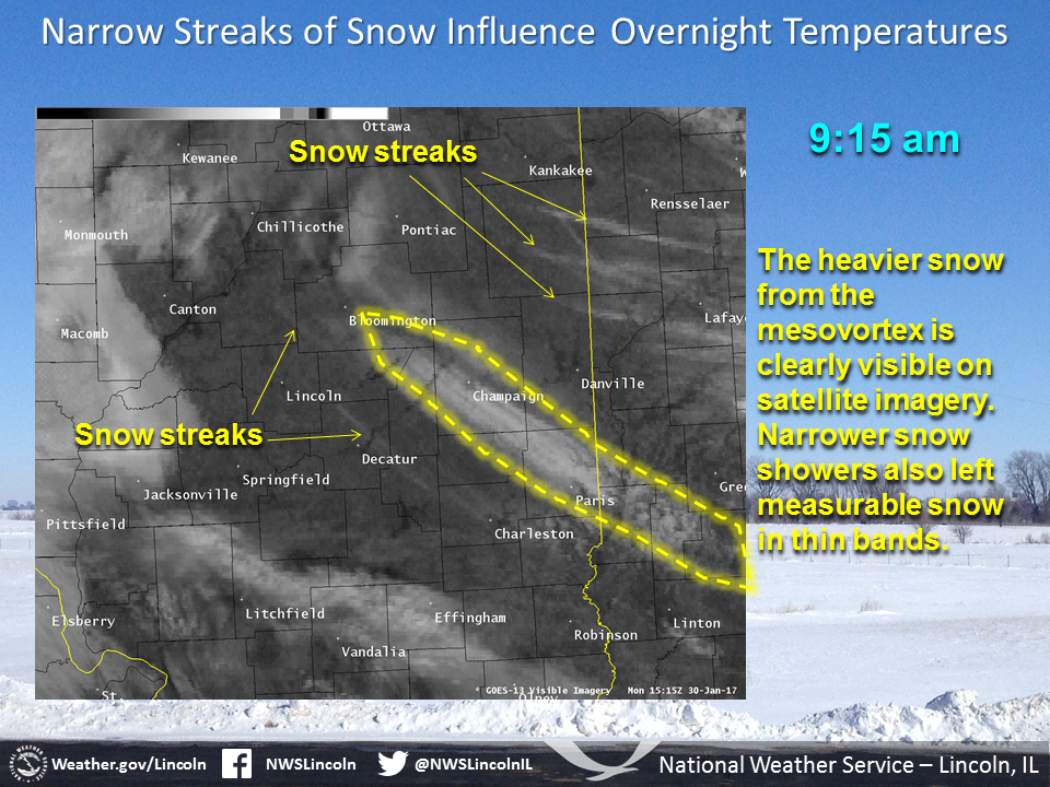
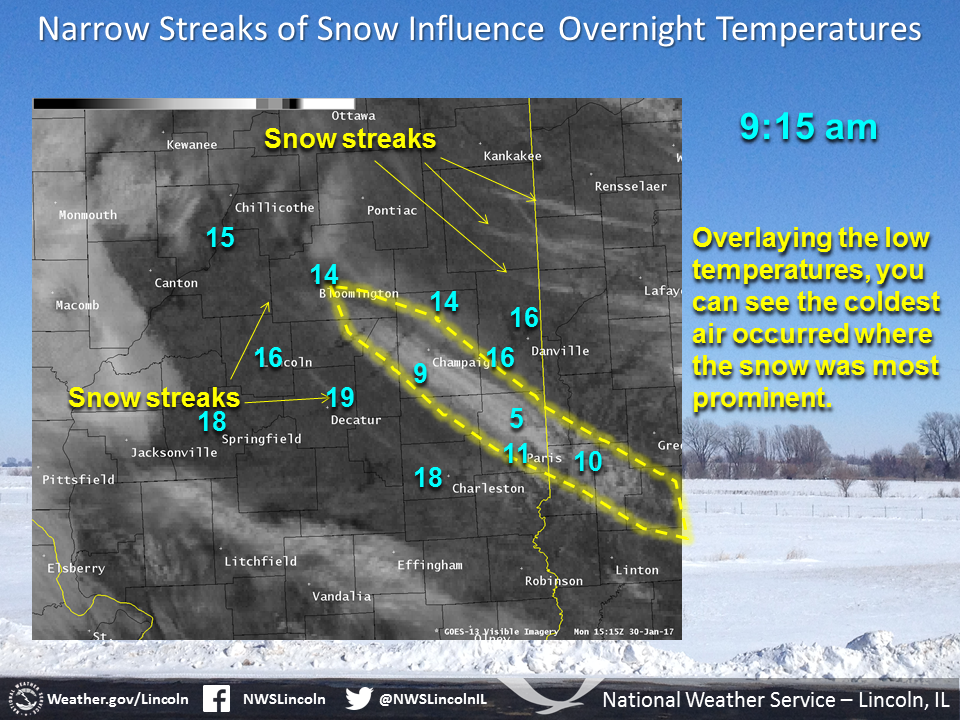
A small-scale feature called a mesovortex tracked across east central Illinois the evening of Sunday, January 29. In summertime, these features can help trigger thunderstorm development, and in both winter and summer, they can enhance precipitation rates. Surface reports indicated that 1 to 1.5 inches of snow fell underneath this feature, resulting in icy roads and several accidents.
In the images below, the red line indicates the approximate track of the mesovortex. (Click the images to enlarge, and use the arrow buttons in the lower left corner to advance the images.) This track can be seen in the satellite image toward the end of the image list. As skies cleared behind this feature, temperatures fell quickly. Low temperatures fell into the single digits where the snow was deepest, while nearby areas which received only flurries remained in the mid to upper teens.
US Dept of Commerce
National Oceanic and Atmospheric Administration
National Weather Service
Central Illinois
1362 State Route 10
Lincoln, IL 62656
217-732-7321 (forecast recording) or 217-732-3089
Comments? Questions? Please Contact Us.

