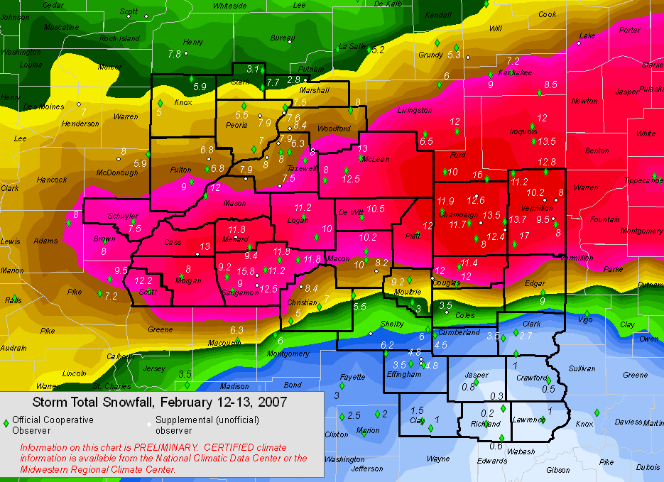
Snowfall totals from across the region. Click image to enlarge.
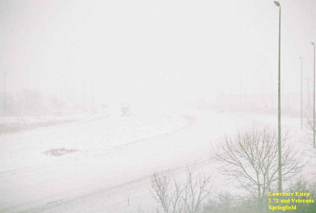
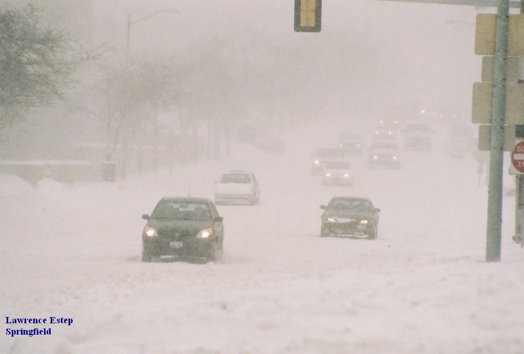
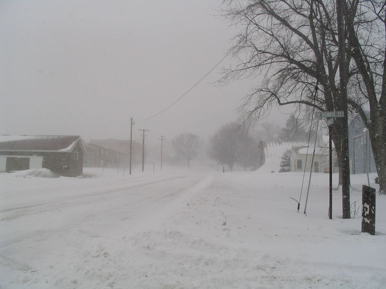
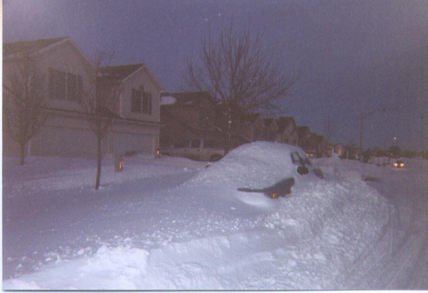
One of the most significant snowstorms in nearly a decade struck central Illinois on February 13, producing blizzard conditions in many locations. Snow began falling during the late evening hours of February 12 and did not come to an end until 24 hours later. The extended period of snow produced impressive accumulations across parts of central Illinois, particularly along the I-72 corridor where between 10 and 15 inches was common. Further north and south, snow totals gradually tapered downward. The precipitation began as rain across southeast Illinois, then changed to a brief period of freezing rain, sleet, and snow during the afternoon. As a result, snow accumulations south of I-70 were minimal, generally only an inch or two.
Event overview:
An area of low pressure developed across Texas on February 13, then began slowly tracking northeastward into the Ohio Valley. At the same time, Canadian high pressure built southward into the Northern Plains, pushing increasingly colder air into the Midwest. Precipitation broke out across Missouri early in the day, then began spreading northward into the colder air across central Illinois by evening. Surface temperatures were initially above freezing, but as precipitation began to fall, evaporative cooling caused the temperature to drop below freezing along and north of a Springfield to Paris line. A brief period of freezing rain and sleet occurred as the precipitation started, but quickly transitioned to all snow as temperatures continued to drop later in the evening. Snow fell across much of central Illinois throughout the night, with significant accumulations taking place by dawn. Meanwhile, a mix of sleet and freezing rain occurred along a Shelbyville to Mattoon line, where minor ice accumulations were reported before the precipitation changed over to snow during the morning of February 13. Further south, temperatures were warm enough to support rain across southeast Illinois until the colder air gradually worked southward toward midday.
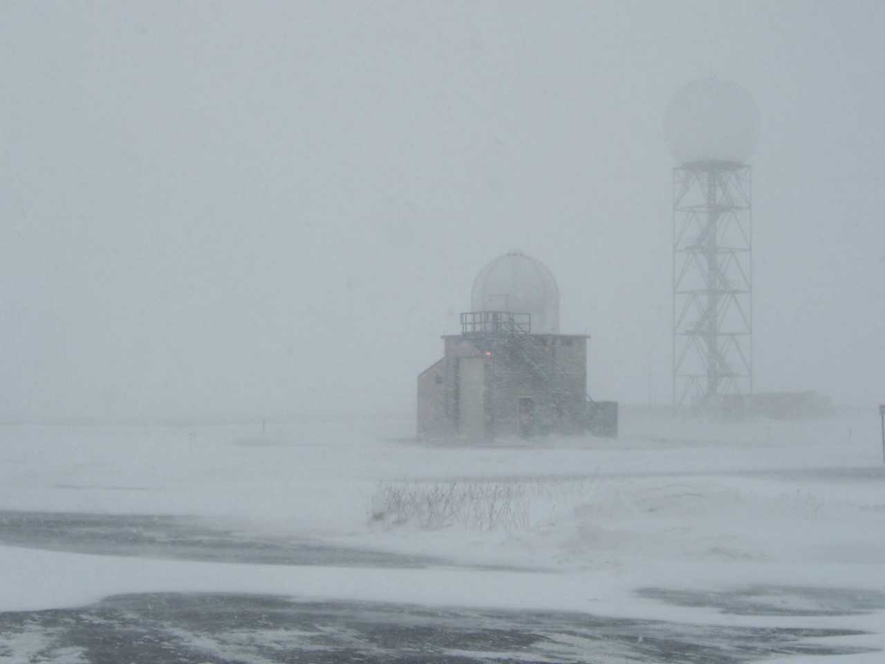
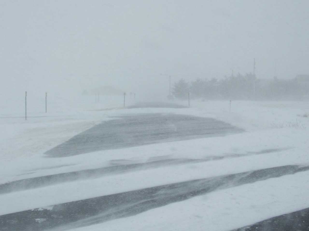
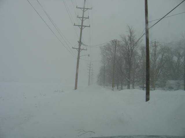
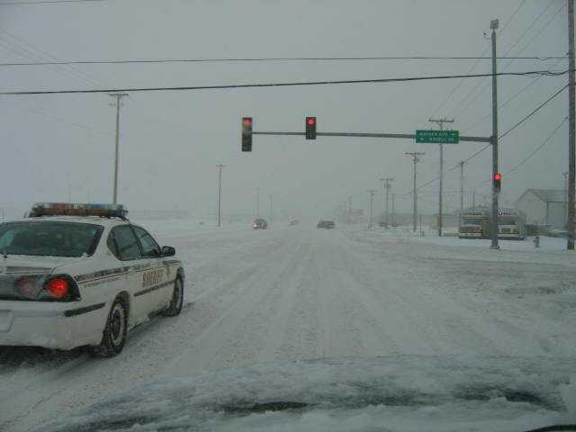
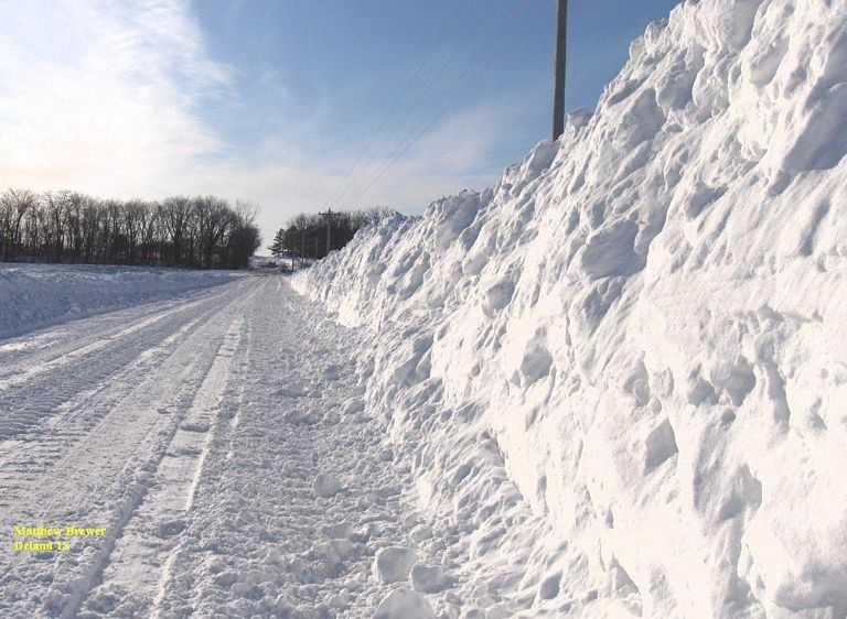
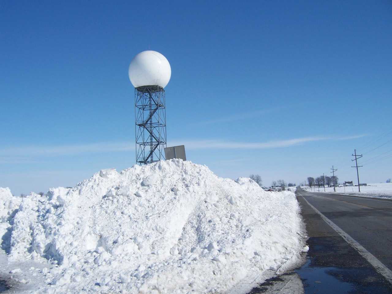
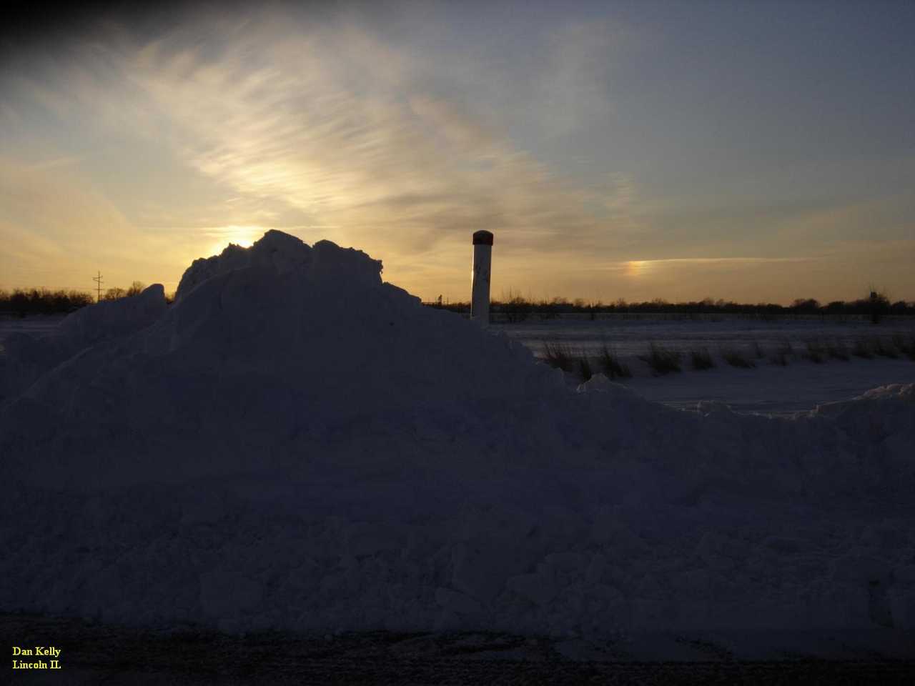
The snow became heavy at times along and north of a Litchfield to Mattoon line during the day, as the low tracked into Kentucky. As an upper level disturbance approached from the west, synoptic lift increased across the area, resulting in the formation of several enhanced bands of snowfall. When the snow finally tapered off and came to an end during the evening, a wide swath of accumulations ranging from 8 to 14 inches was evident stretching from near Quincy eastward along the I-72 corridor through Springfield and Champaign-Urbana. In addition to the heavy snowfall, strong northerly winds gusting from 35 to 45 mph created blizzard conditions. Visibilities were reduced to less than a quarter of a mile at times in falling and/or blowing snow. Many locations reported snow drifts ranging from 3 to 6 feet, prompting the closure of several area roadways. Further north, the snow was not quite as heavy in the Galesburg area, where 4 to 8 inches was common. The same was true across southeast Illinois, with Effingham picking up around 5 inches and areas further south seeing even less snow.
Event Highlights:
 |
The definition of a "blizzard", as written in NWS Directive 10-513, is: Sustained wind or frequent gusts greater than or equal to 35 mph accompanied by falling and/or blowing snow, frequently reducing visibility to less than 1/4 mile for three hours or more.
Blizzard warnings were issued around 4 am February 13, running through midnight. This was generally in an area from the Illinois River eastward to the Indiana border. This was only the 2nd time the Lincoln NWS has issued a blizzard warning during its 12-year existence. Blizzard warnings also extended across much of northern and central Indiana, into northwest Ohio.
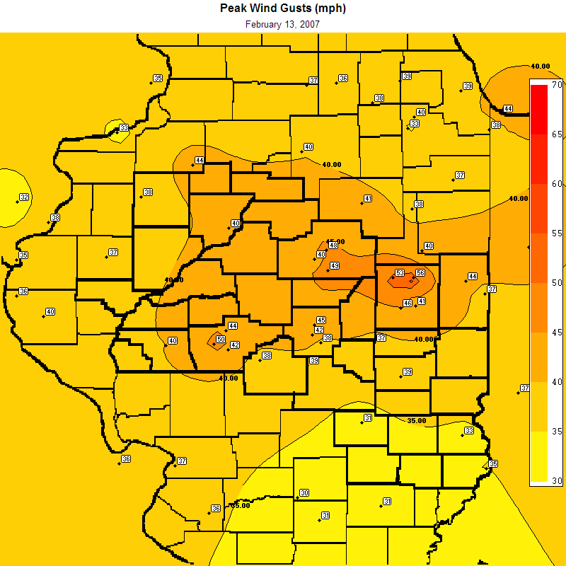
Winds across much of central Illinois were sustained at 25 to 35 mph throughout the day, with frequent gusts even higher, especially from late morning through the afternoon. The map above (click to enlarge) shows the highest wind gusts reported on February 13. Gusts over 50 mph were reported in northern Champaign County, and also near Springfield. A large area of wind gusts over 40 mph extended from about Kewanee to Jacksonville, eastward into northern and central Indiana. This resulted in significant blowing and drifting snow, with near zero visibility and snow drifts of 3 to 5 feet. Snowplows were unable to keep up with this drifting. Many counties had roads closed from late morning into the overnight hours, as snow drifted back onto the roads as fast as the plows cleared them.
Actual snowfall amounts ranged from 8 to 14 inches along the I-72 corridor, with locally higher amounts. The highest reported value of 17 inches was measured near Sidell, which is in southwest Vermilion County. The town of Paxton, northeast of Rantoul near the Ford/Champaign County line, reported 16 inches. An unofficial total of 15.8 inches was reported on the southwest side of Springfield. Totals of 13 inches were reported in Normal and Havana. (See full listing below.)
In Springfield, the official snowfall was 11.2 inches. This marked the 4th snowest 24-hour period on record for the city, and was the most to fall since 13.7 inches was measured in the New Year's snowstorm of 1999. The all-time record of 15 inches was set Feb. 28, 1900.
Further south, temperatures were warm enough for periods of freezing rain and sleet, before the snow began. Around a quarter inch of ice was reported in Charleston/Mattoon and Effingham, followed by 2-4 inches of sleet. In southeast Illinois, areas around Lawrenceville remained warm enough for rain, before finally mixing with sleet and snow by mid afternoon.
The following snowfall totals were reported. Please note that these are preliminary.
SNOWFALL
INCHES LOCATION COUNTY
----- ------------------ -----------
17.0 SIDELL VERMILION
15.8 4 SW SPRINGFIELD
13.7
13.0 4 NE NORMAL MCLEAN
13.0 PHILIDELPHIA CASS
13.0 HAVANA MASON
12.8 HOOPESTON VERMILION
12.5 5 W BLOOMINGTON MCLEAN
12.2 WINCHESTER SCOTT
12.0 MONTICELLO PIATT
12.0 ARCOLA DOUGLAS
12.0 ARTHUR
11.9 MAHOMET CHAMPAIGN
11.8 RIVERTON
11.8 PETERSBURG MENARD
11.7
11.4 TUSCOLA DOUGLAS
11.2 SPRINGFIELD-OFFICIAL
11.2 LINCOLN NWS-OFFICIAL LOGAN
11.2 RANKIN VERMILION
10.5 CLINTON DEWITT
10.2 DECATUR MACON
10.0 RANTOUL
10.0 MOUNT PULASKI LOGAN
10.0 MONTICELLO PIATT
9.5
9.4 ATHENS MENARD
9.2 LOVINGTON MOULTRIE
9.2 ROANOKE WOODFORD
9.0 CHESTNUT
9.0 LEWISTOWN FULTON
9.0 PARIS EDGAR
9.0 LOAMI SANGAMON
8.6 HOMER
8.5 1 N MACKINAW TAZEWELL
8.5 PRINCEVILLE PEORIA
8.4 GERMANTOWN HILLS WOODFORD
8.4 ST DAVID FULTON
8.0 JACKSONVILLE MORGAN
8.0
8.0
8.0 5 SW PEORIA
8.0 PHILO CHAMPAIGN
8.0 STANFORD MCLEAN
8.0 MINONK WOODFORD
8.0 GROVELAND TAZEWELL
7.9 MANITO MASON
7.7 CAMP GROVE MARSHALL
7.6
7.5 MORTON TAZEWELL
7.5 DELAVAN TAZEWELL
7.5 RUSHVILLE SCHUYLER
7.5 CHILLICOTHE PEORIA
7.1
7.0 3WSW PEORIA-OFFICIAL
7.0 TAYLORVILLE CHRISTIAN
6.8 CANTON FULTON
6.2 BEECHER CITY EFFINGHAM
6.0 WINDSOR SHELBY
5.9 ALTONA KNOX
5.9 PRAIRIE CITY MCDONOUGH
5.5 PRINCEVILLE PEORIA
5.5 MOWEAQUA SHELBY
5.4 WASHINGTON TAZEWELL
5.0
5.0 MORRISONVILLE CHRISTIAN
4.5 NEOGA CUMBERLAND
4.3 TOULON STARK
4.3
3.8 MATTOON (0.25 ICE) COLES
3.5 EFFINGHAM (0.25 ICE) EFFINGHAM
3.0 CASEY CLARK
2.8 HENRY
2.2 MARTINSVILLE CLARK
2.0 STE MARIE JASPER
1.0 LAWRENCEVILLE LAWRENCE
1.0 FLORA CLAY
1.0 MOONSHINE CLARK
0.8 NEWTON JASPER
0.5 ROBINSON CRAWFORD
0.3 CLAREMONT RICHLAND
0.2 OLNEY RICHLAND
0.1 HUTSONVILLE CRAWFORD
|
|
|
|
|
|
|
|
|
|
 |
 |
 |