Overview
|
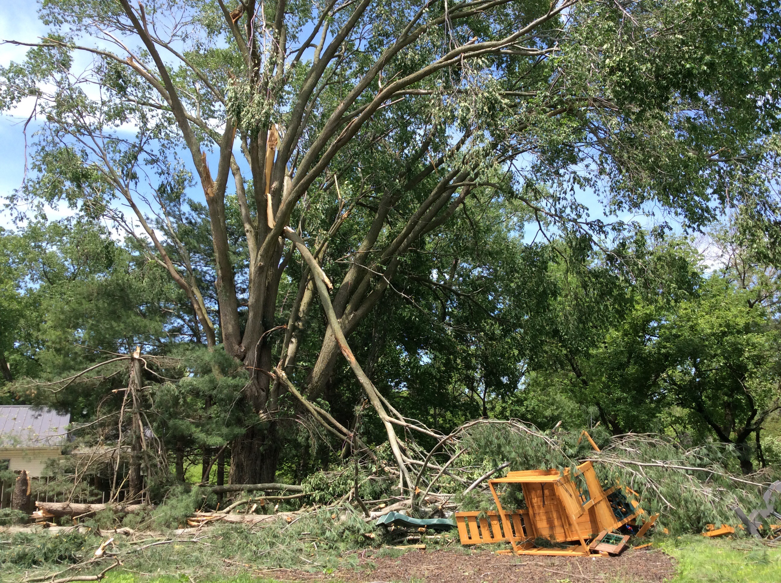
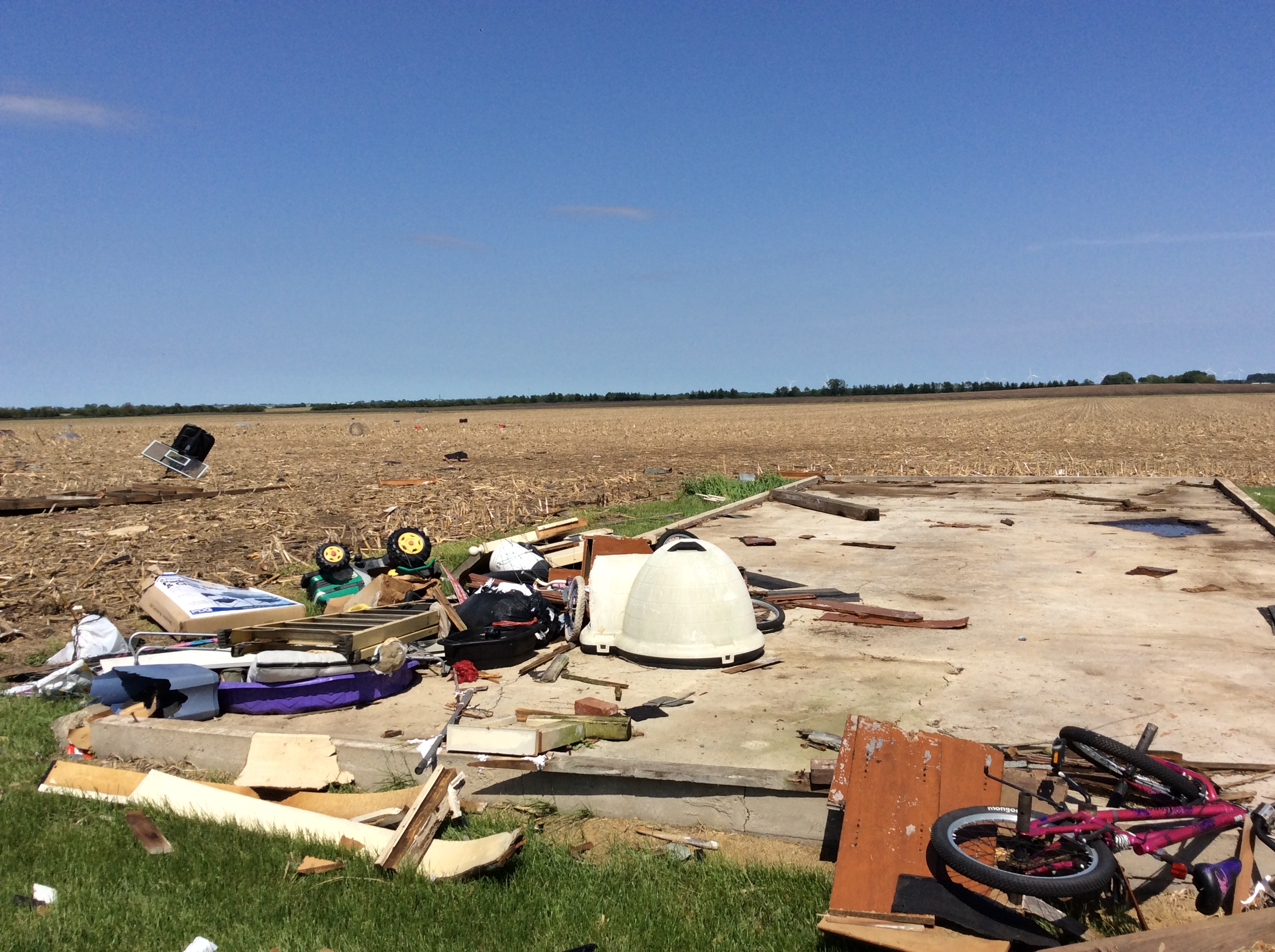
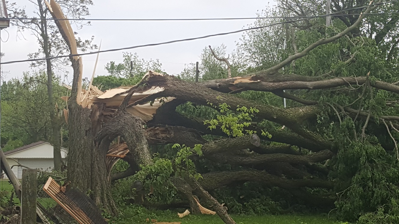
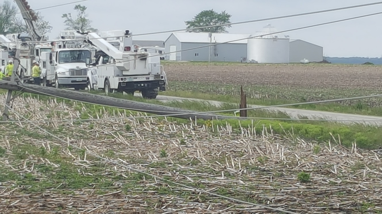
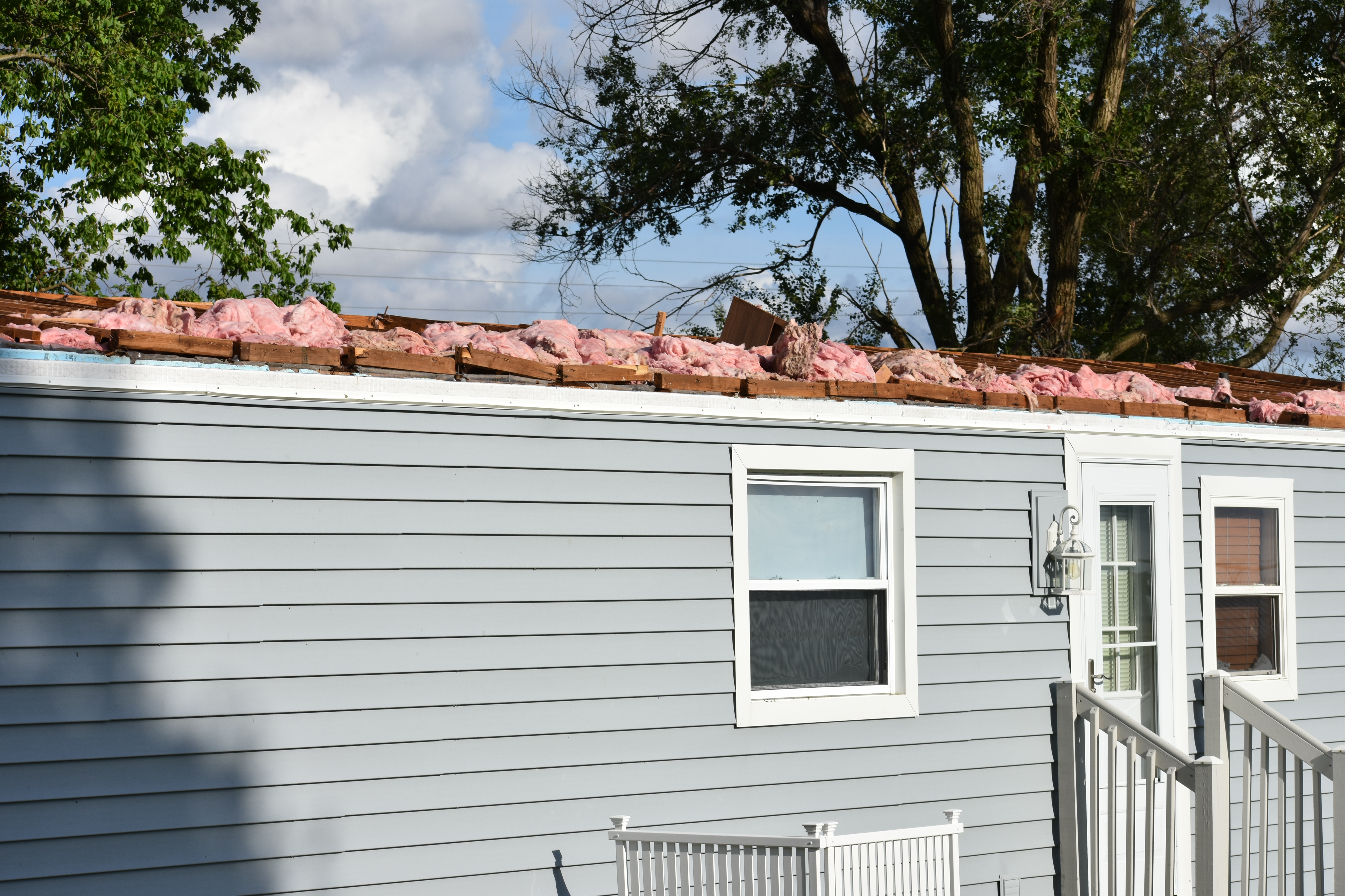
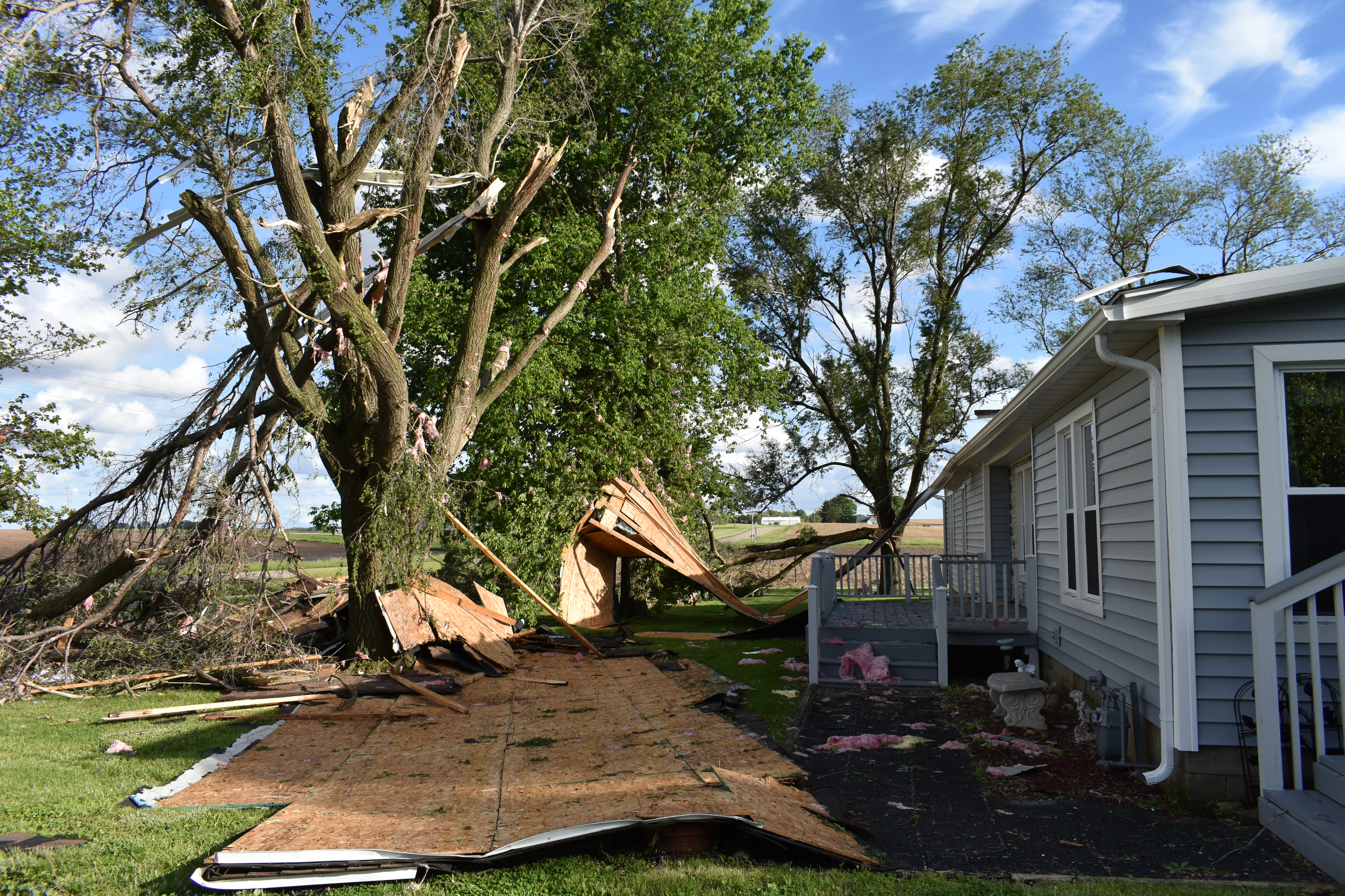
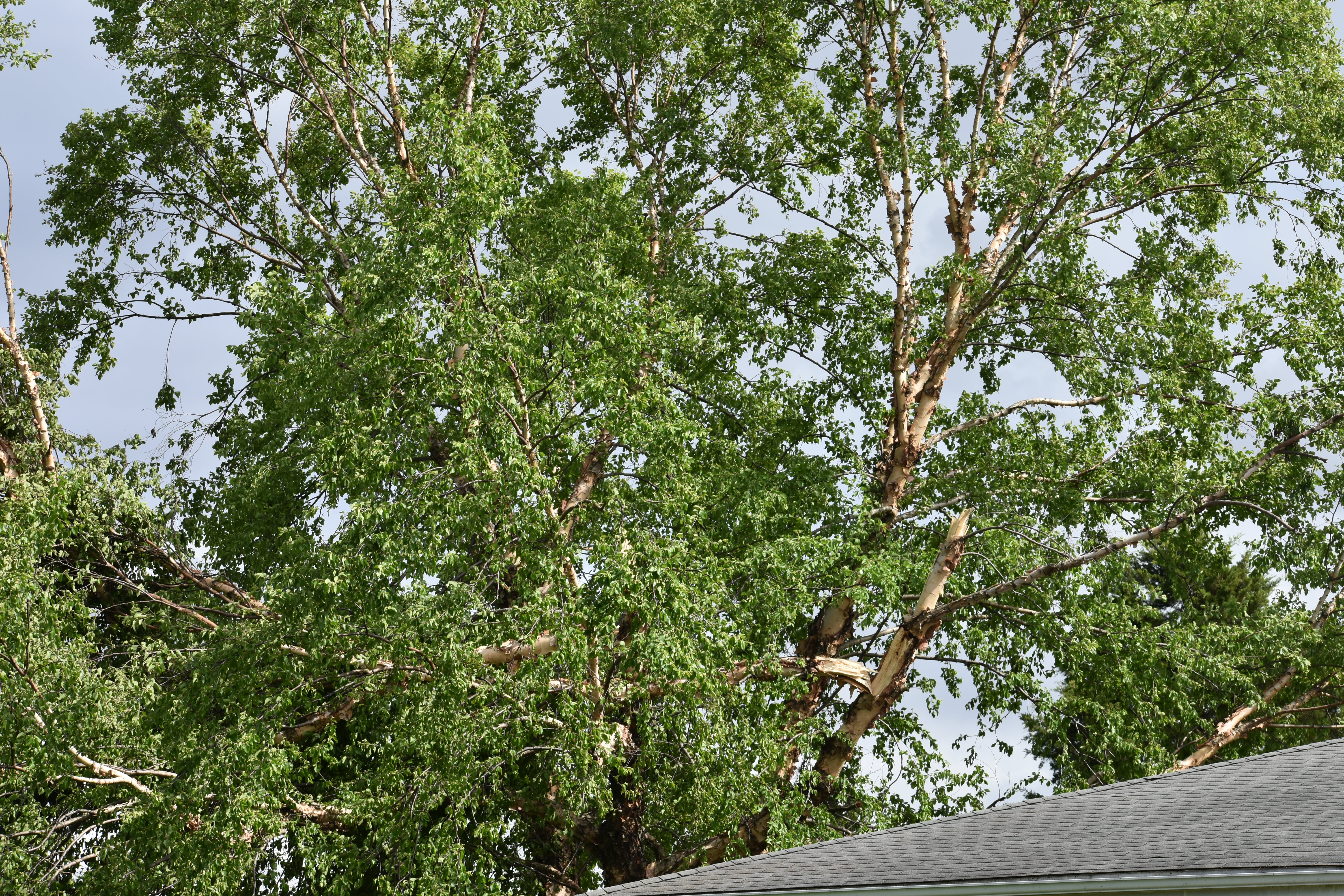
An active period of severe weather impacted central and southeast Illinois for more than a week. Several periods of strong to severe thunderstorms occurred, producing 19 tornadoes (10 EF-0 and 9 EF-1) from May 22nd to May 29th. |
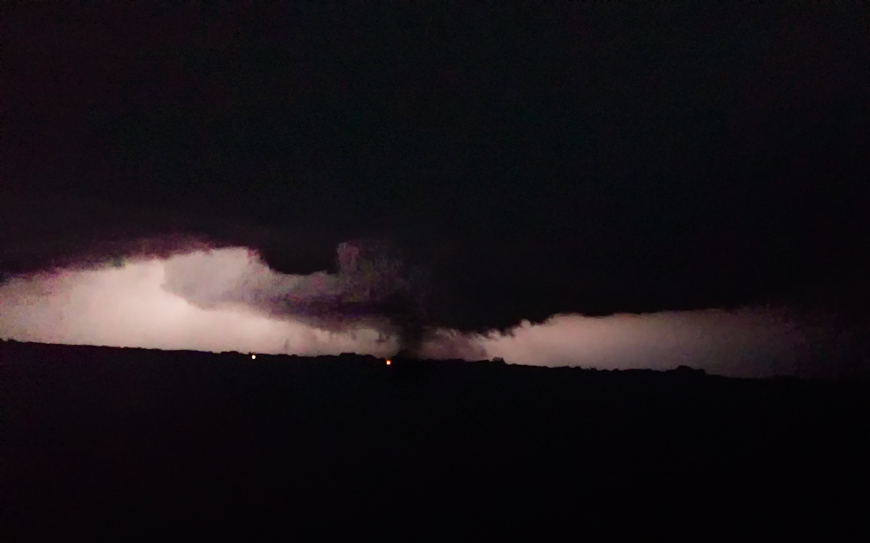
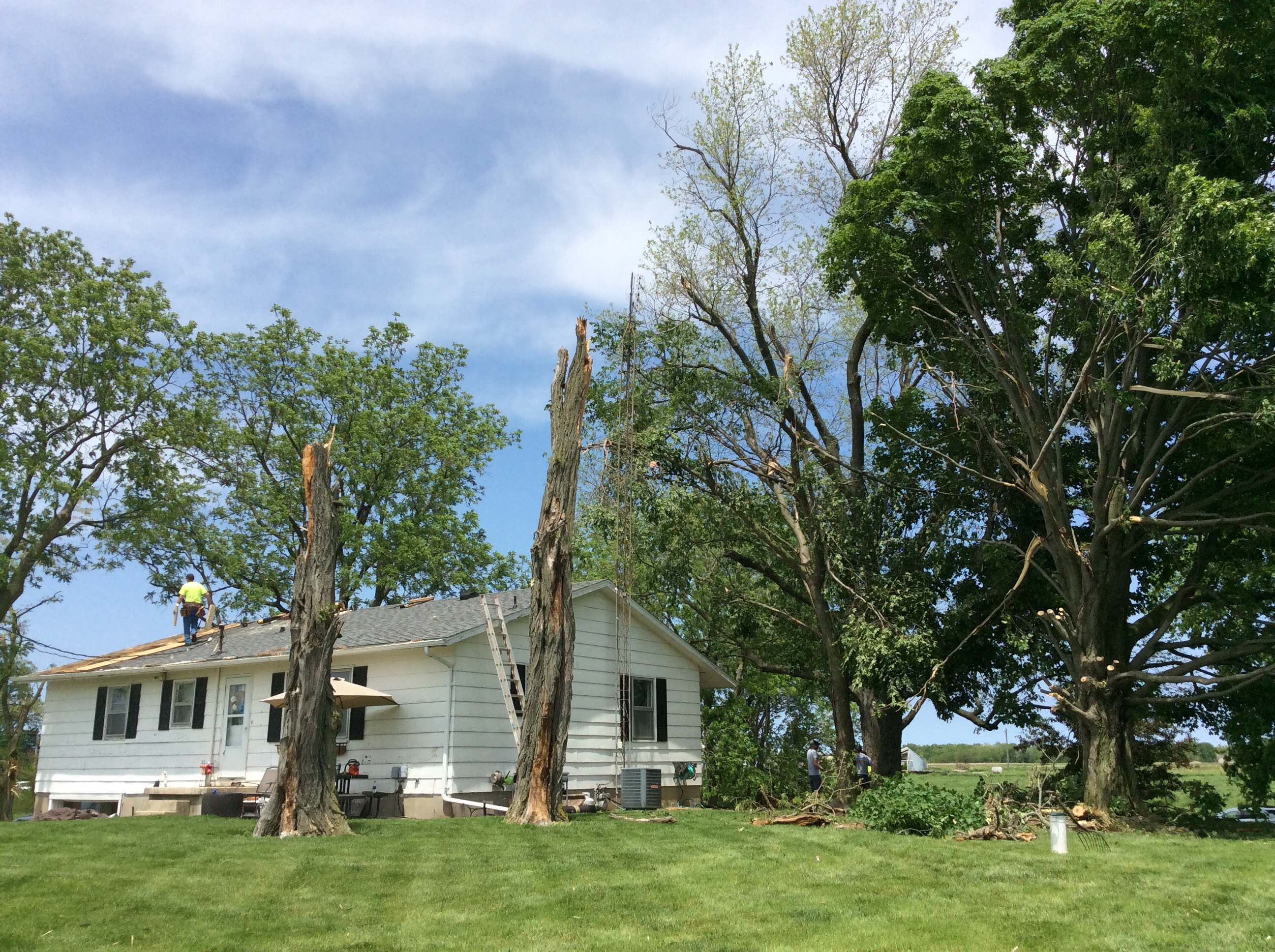
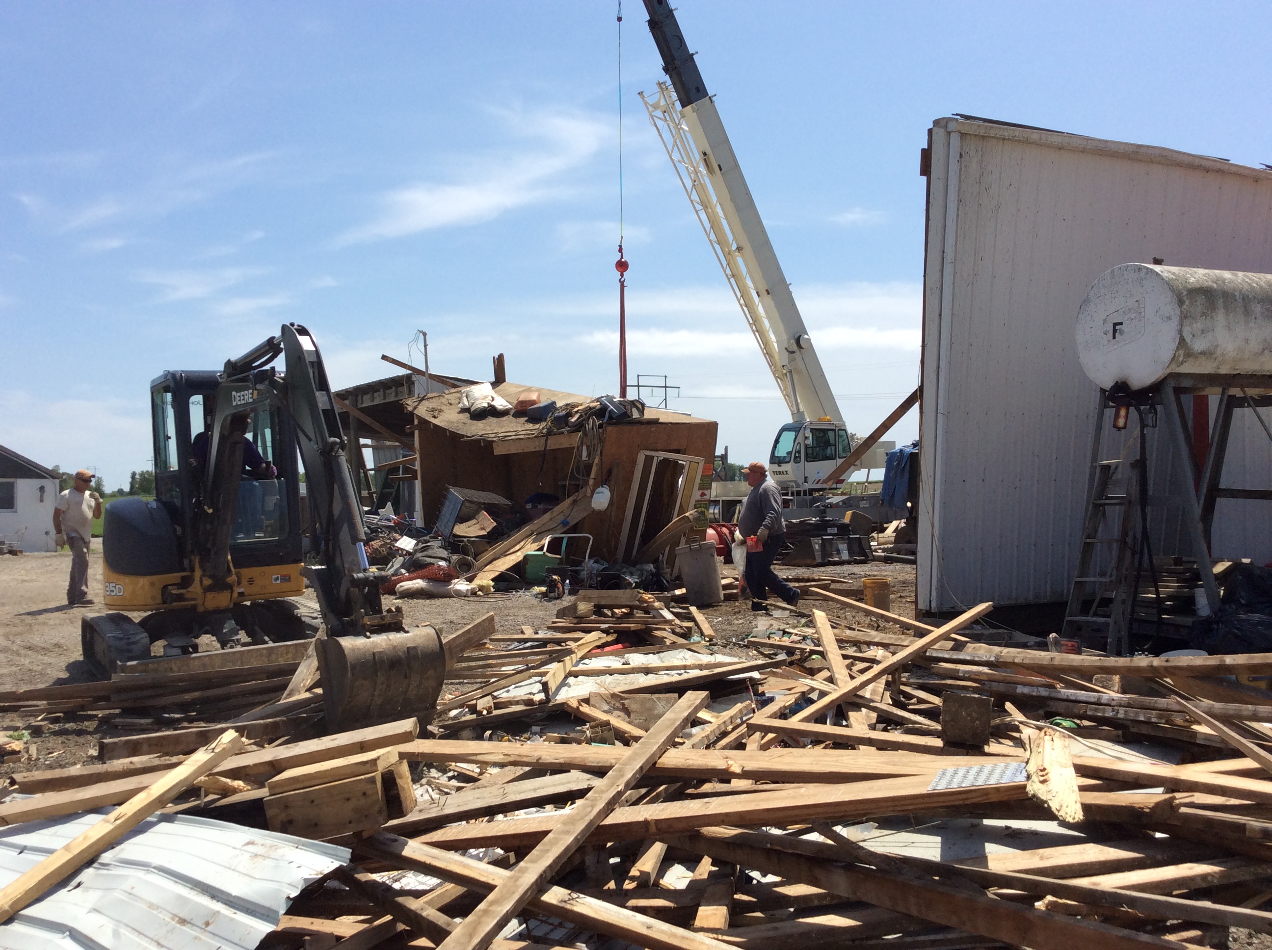 Tornado Damage near the Menard / Logan County Line 5/23/19 |
Tornadoes
|
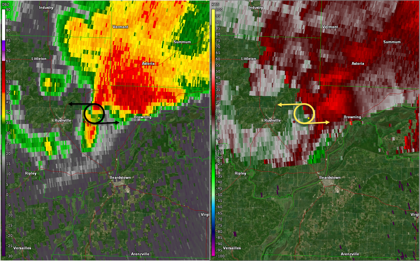
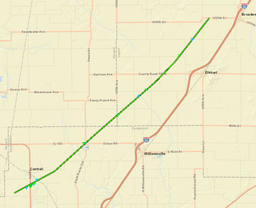
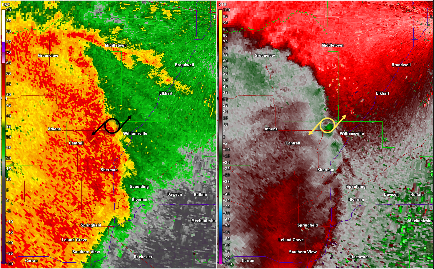
May 23 -- Cantrall to Broadwell
|
||||||||||||||||
|
||||||||||||||||
|
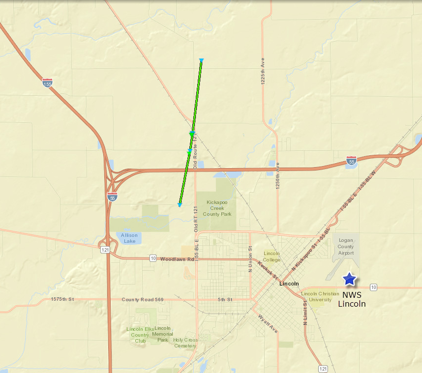
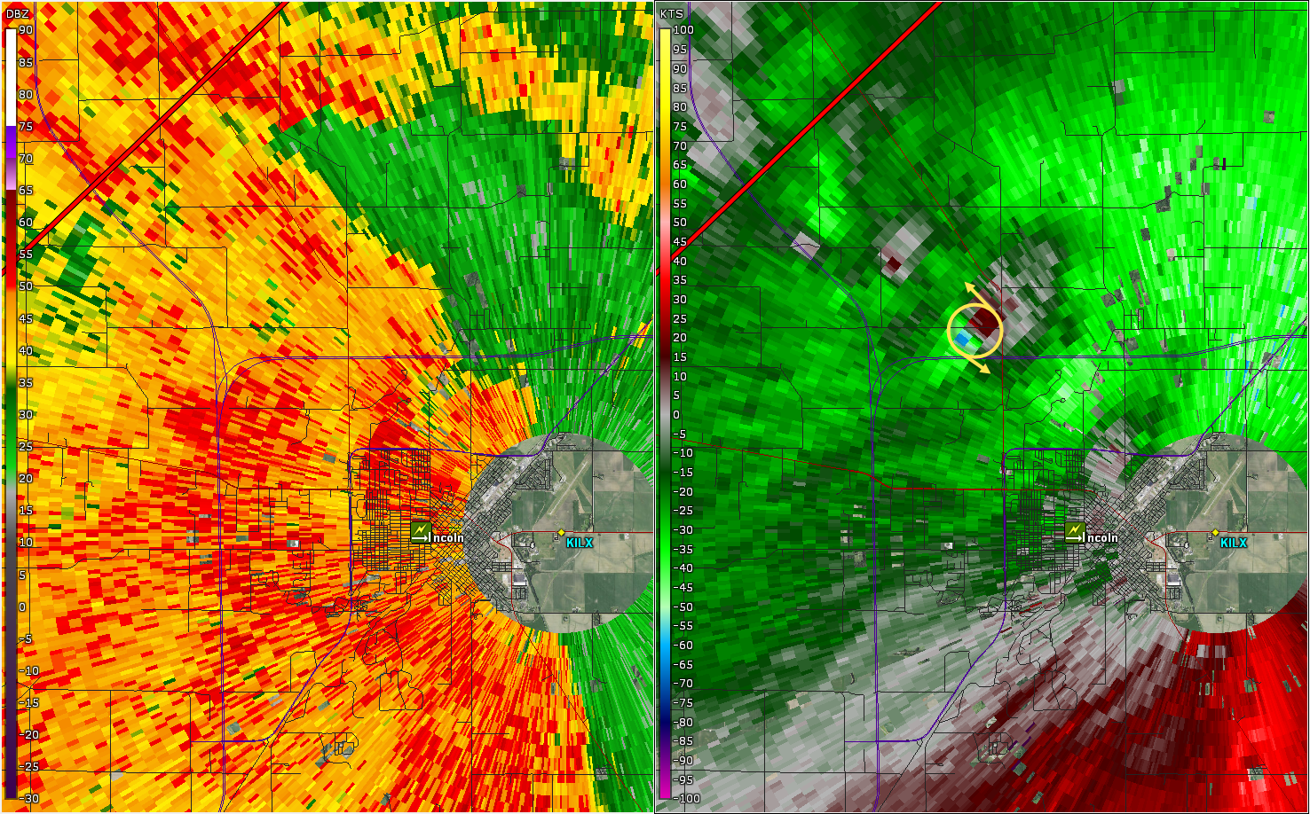
May 23 -- Lincoln
|
||||||||||||||||
|
||||||||||||||||
|
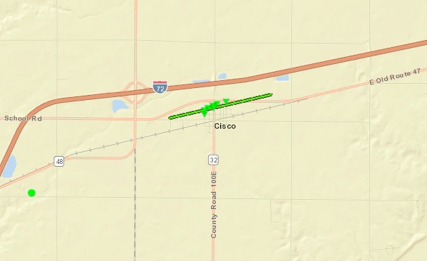
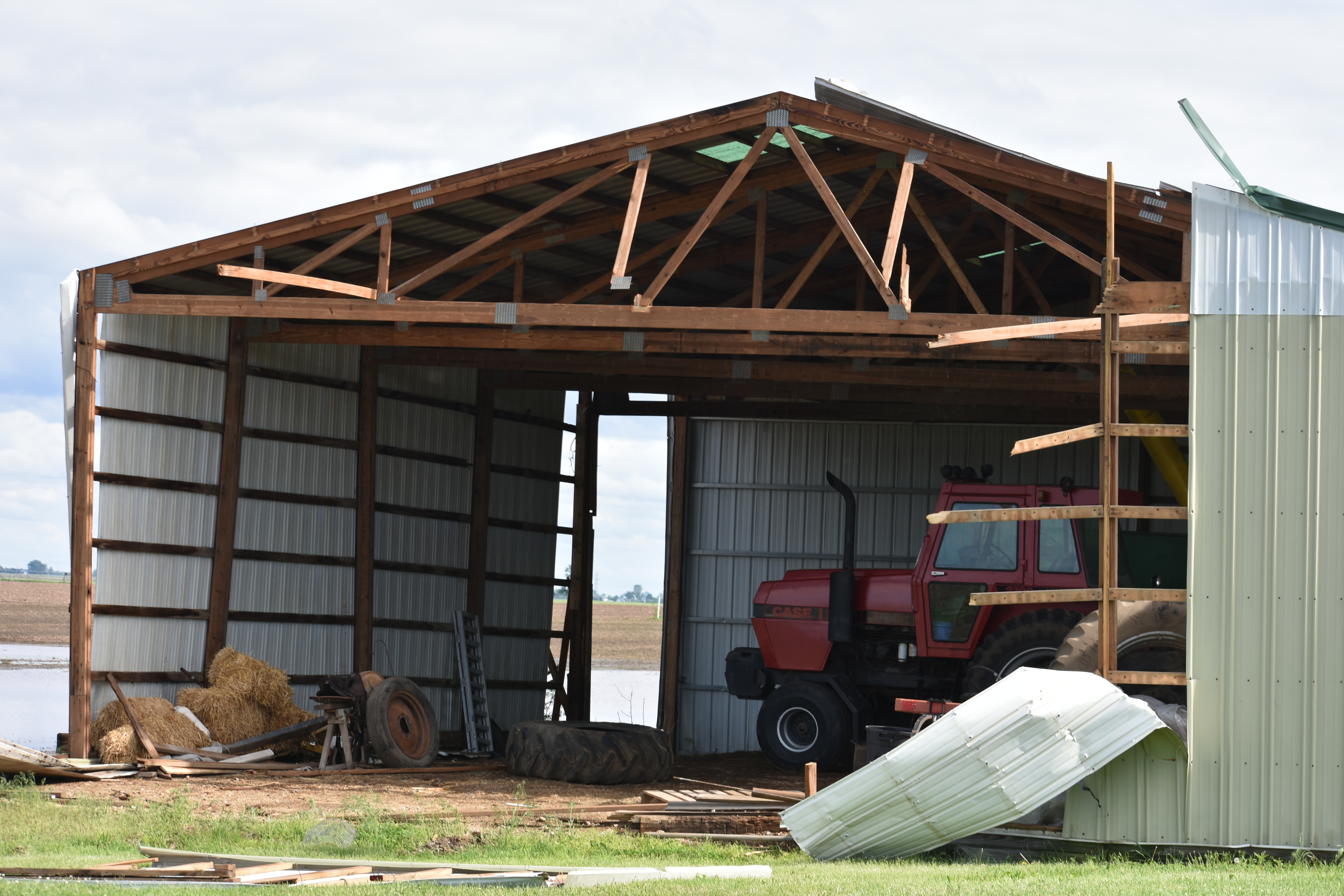
May 23 -- Cisco
|
||||||||||||||||
|
|
||||||||||||||||
|
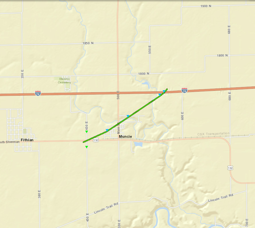
May 23 -- Muncie
|
||||||||||||||||
|
||||||||||||||||
|
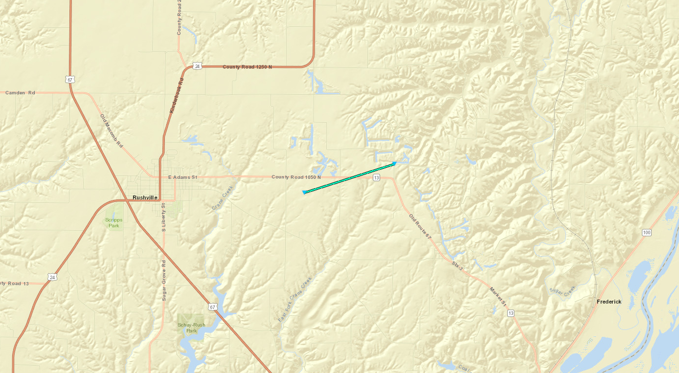
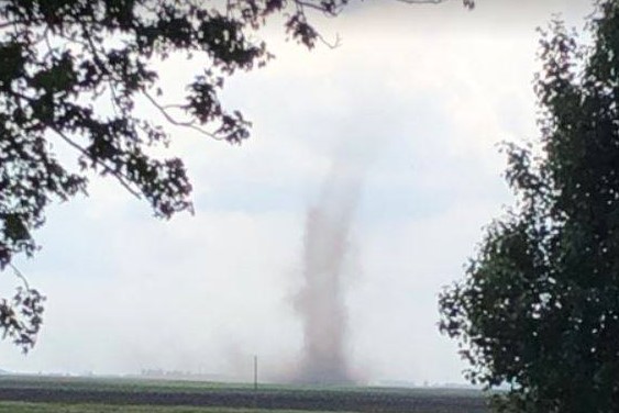
May 23 -- 3 mi. WSW of Xenia
Track Map 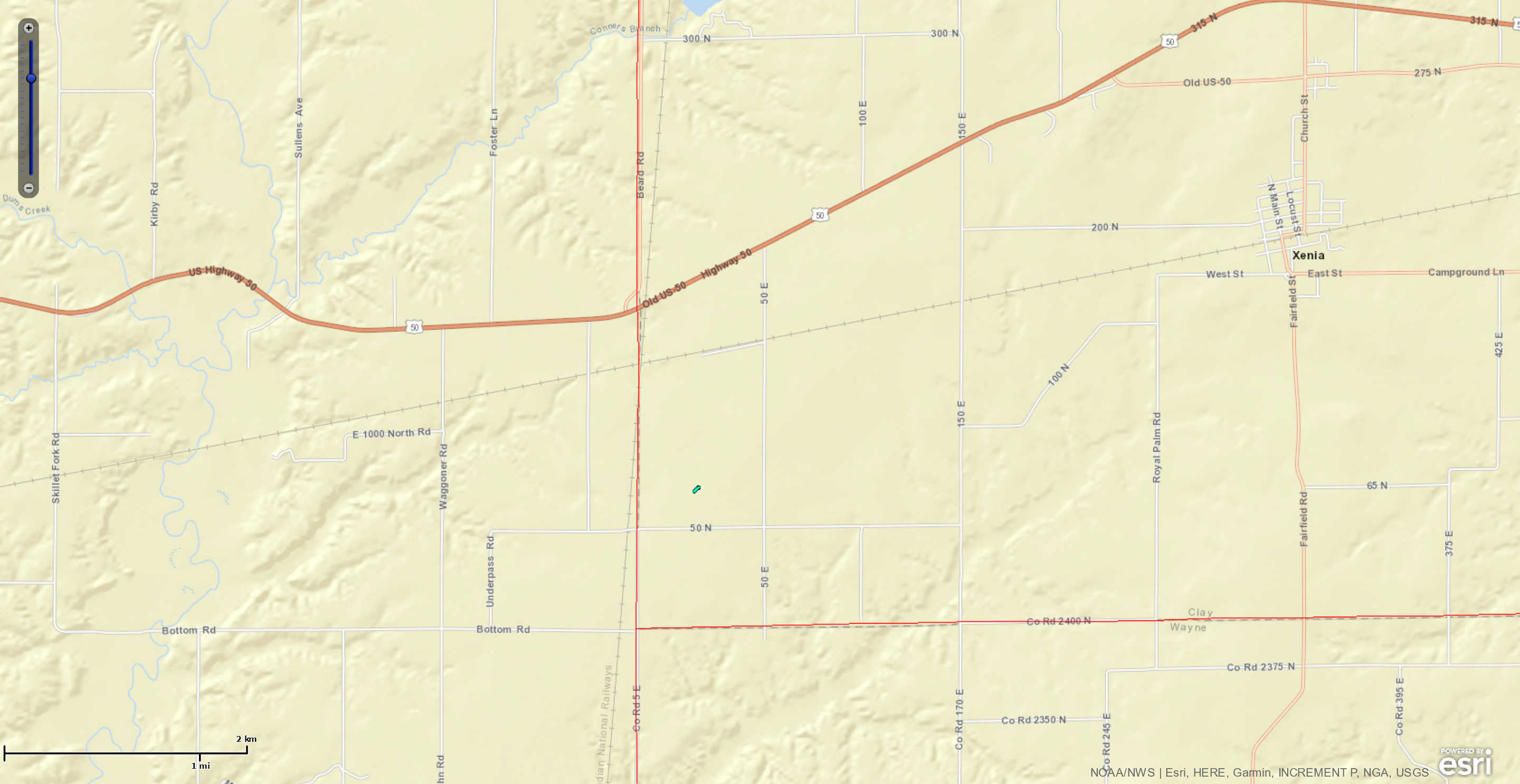 
|
||||||||||||||||
|
||||||||||||||||
|
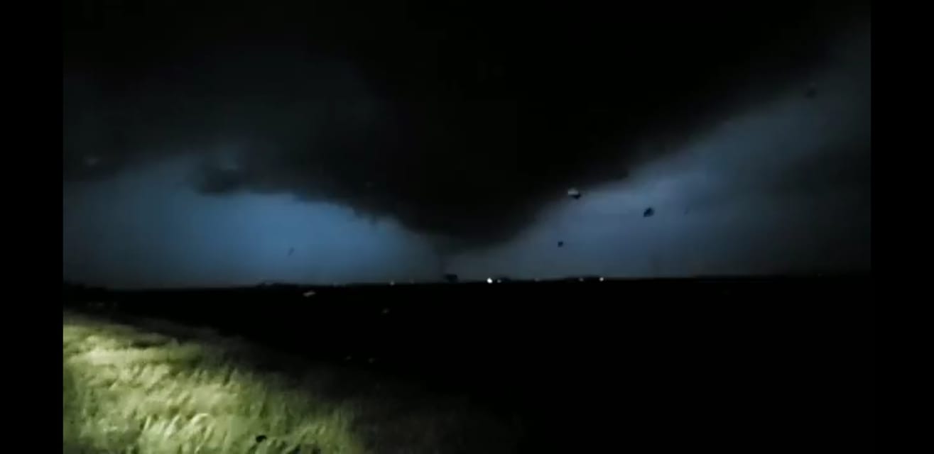
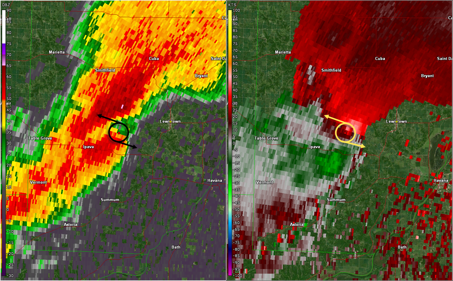
May 24 -- 4.5 mi. West of Lewistown
Track Map 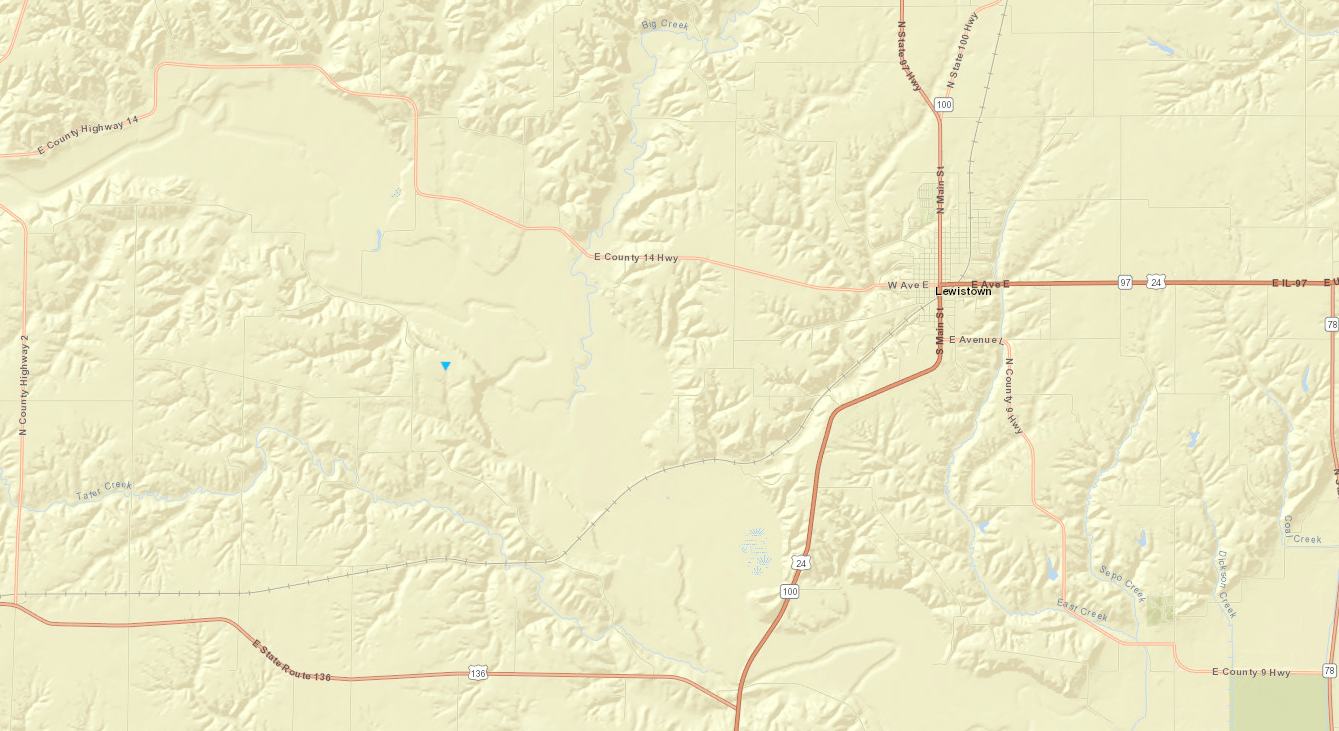
|
||||||||||||||||
|
||||||||||||||||
|
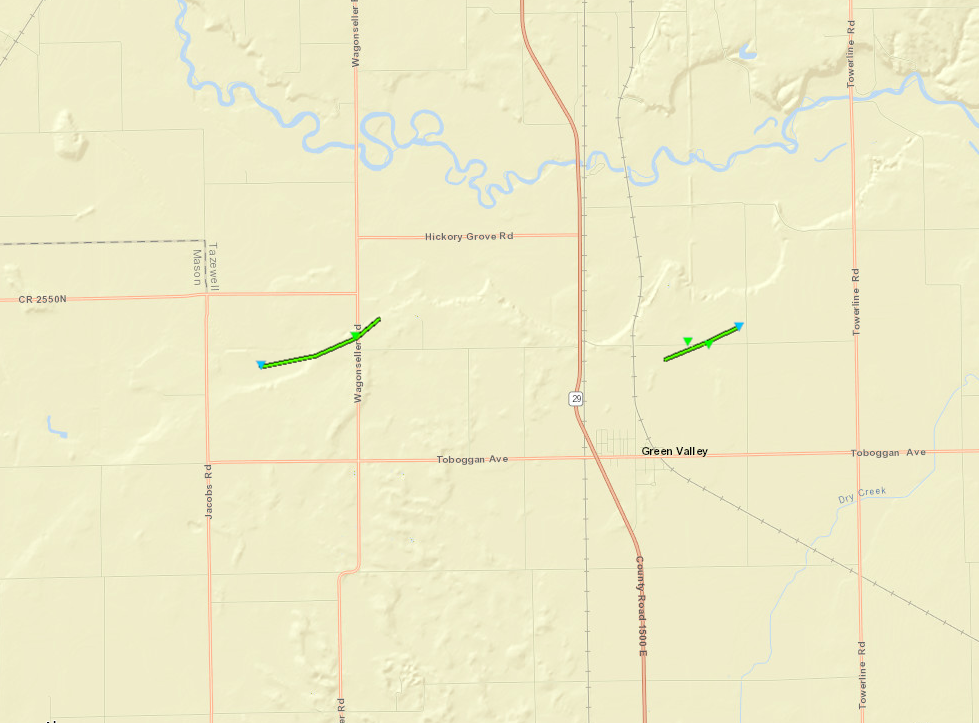
May 25 -- Green Valley (2 Tornadoes)
|
||||||||||||||||
|
||||||||||||||||
|
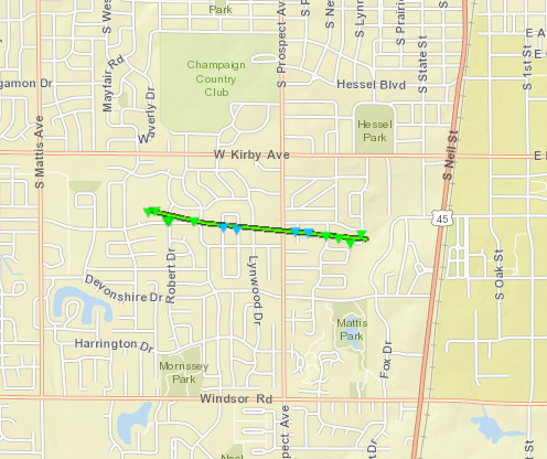
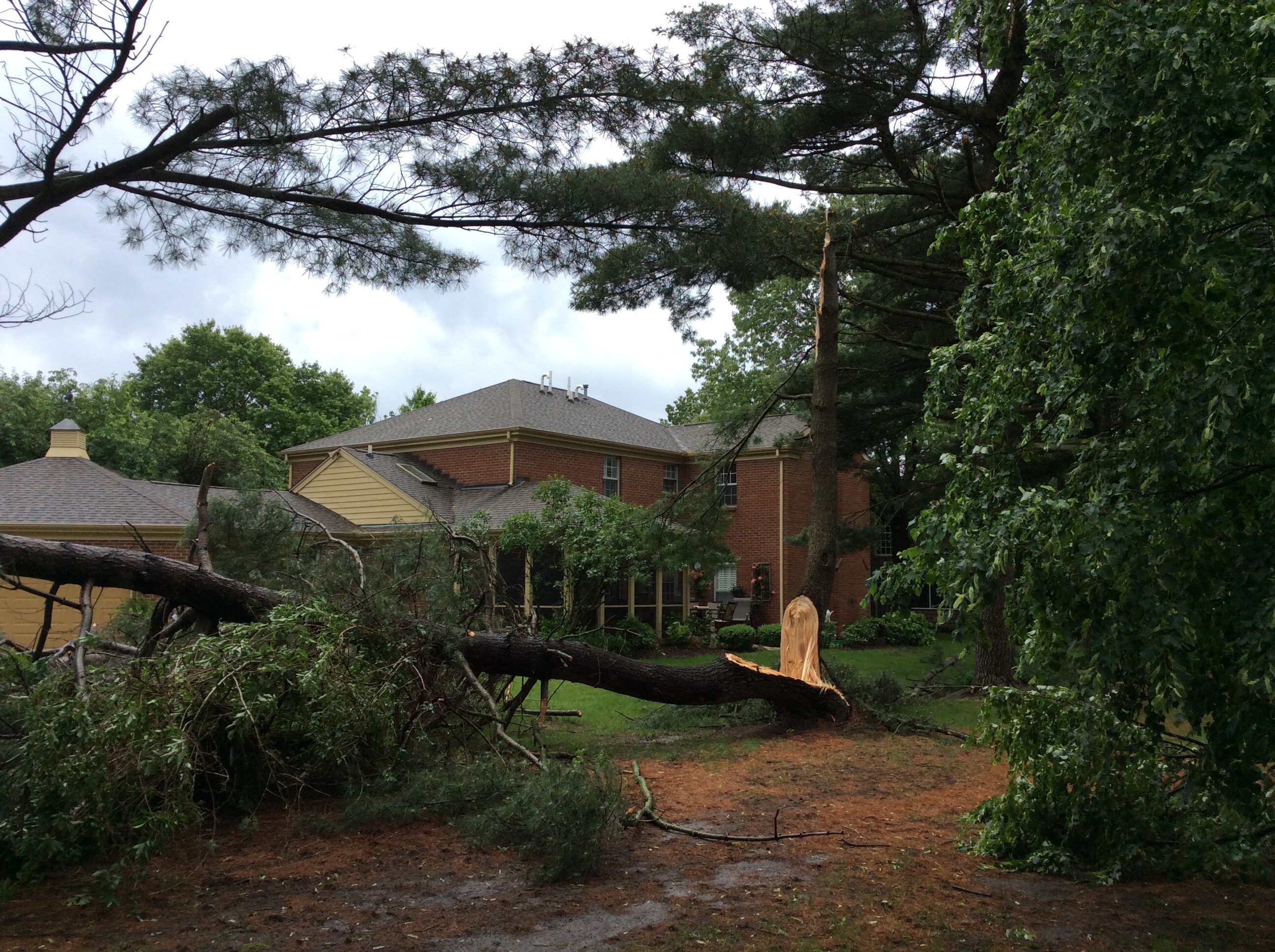
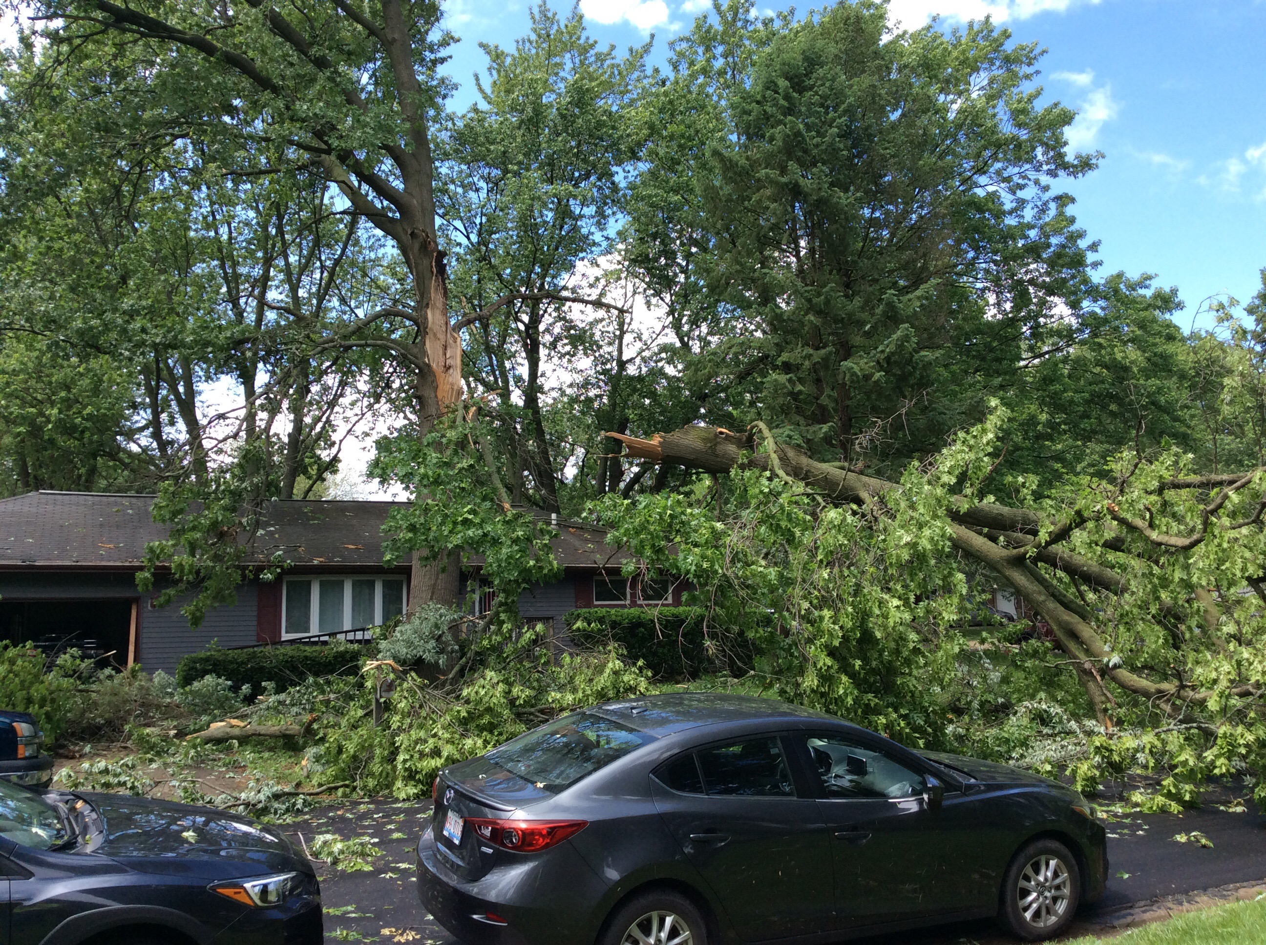
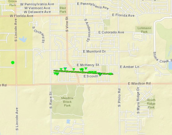
May 26 -- Champaign
|
||||||||||||||||
|
||||||||||||||||
|
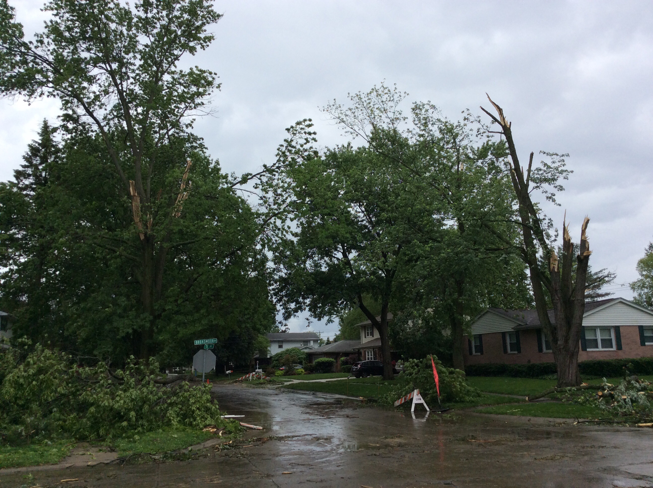
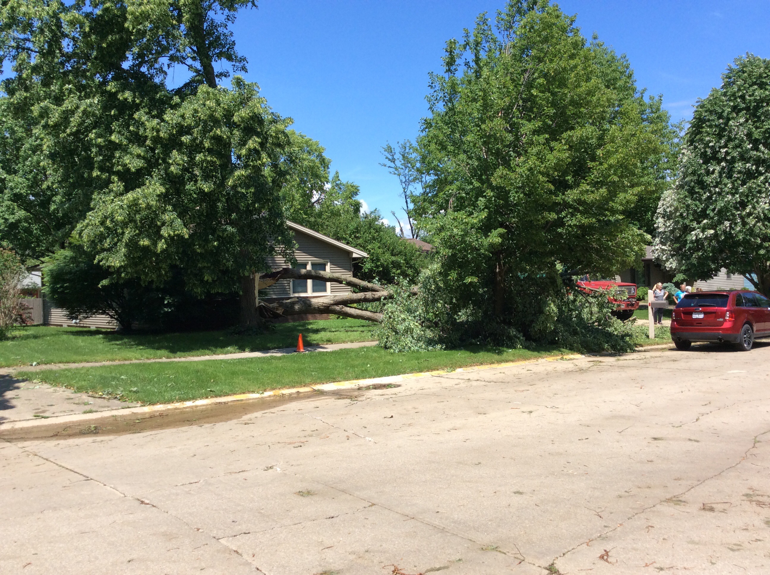
May 26 -- Urbana
|
||||||||||||||||
|
||||||||||||||||
|
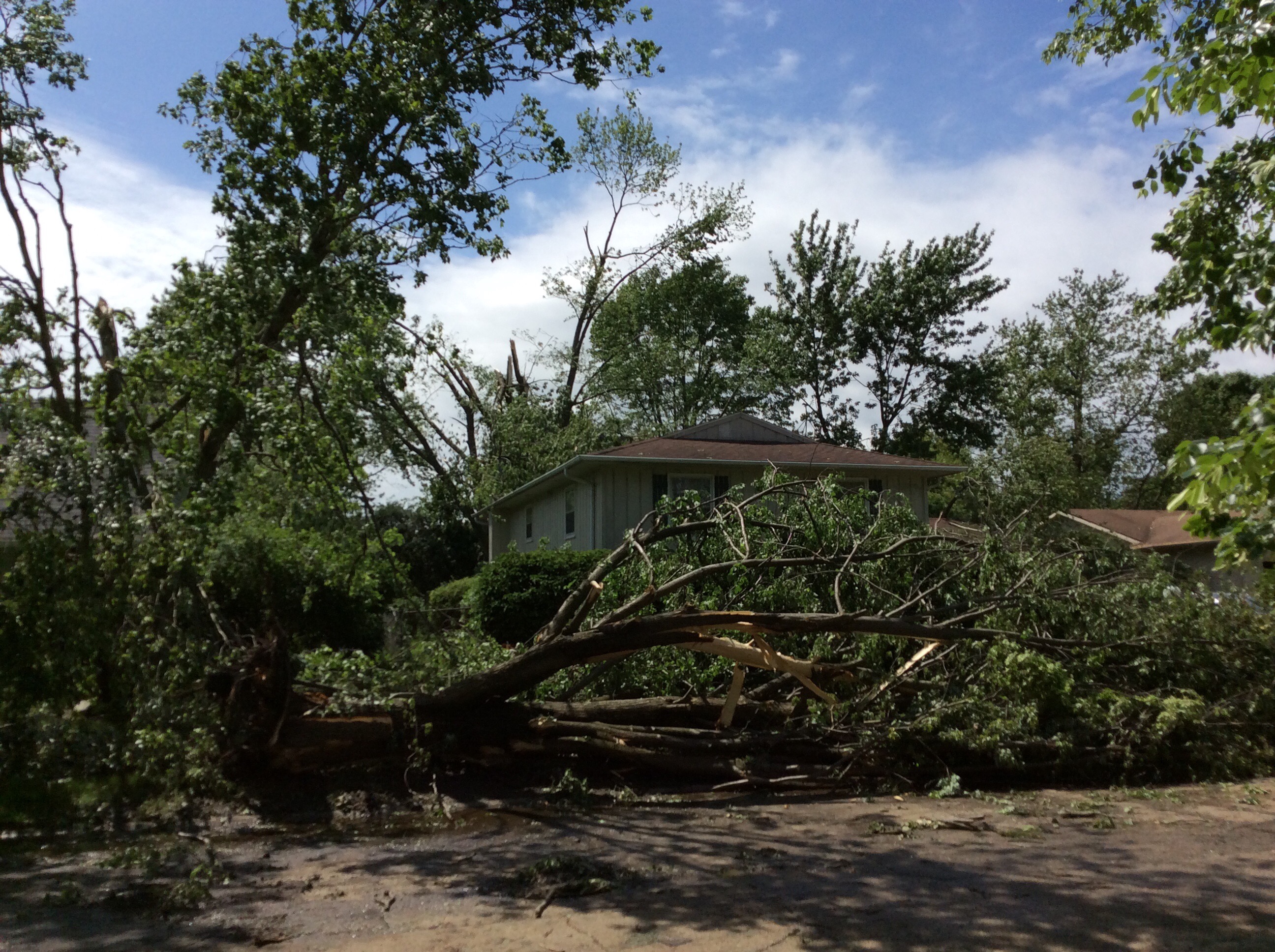
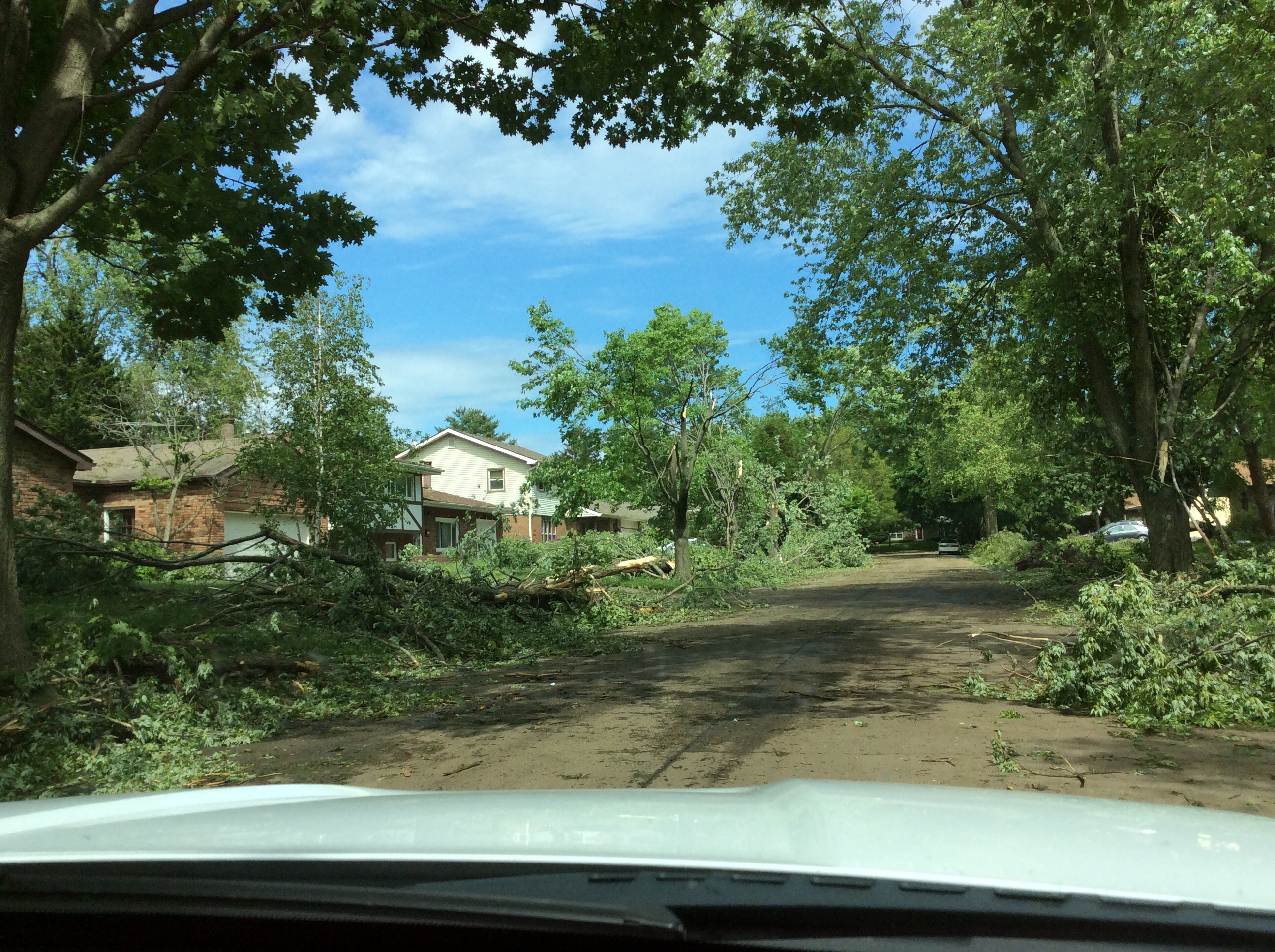
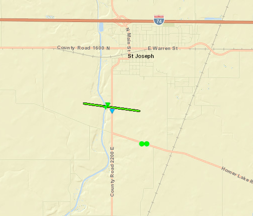
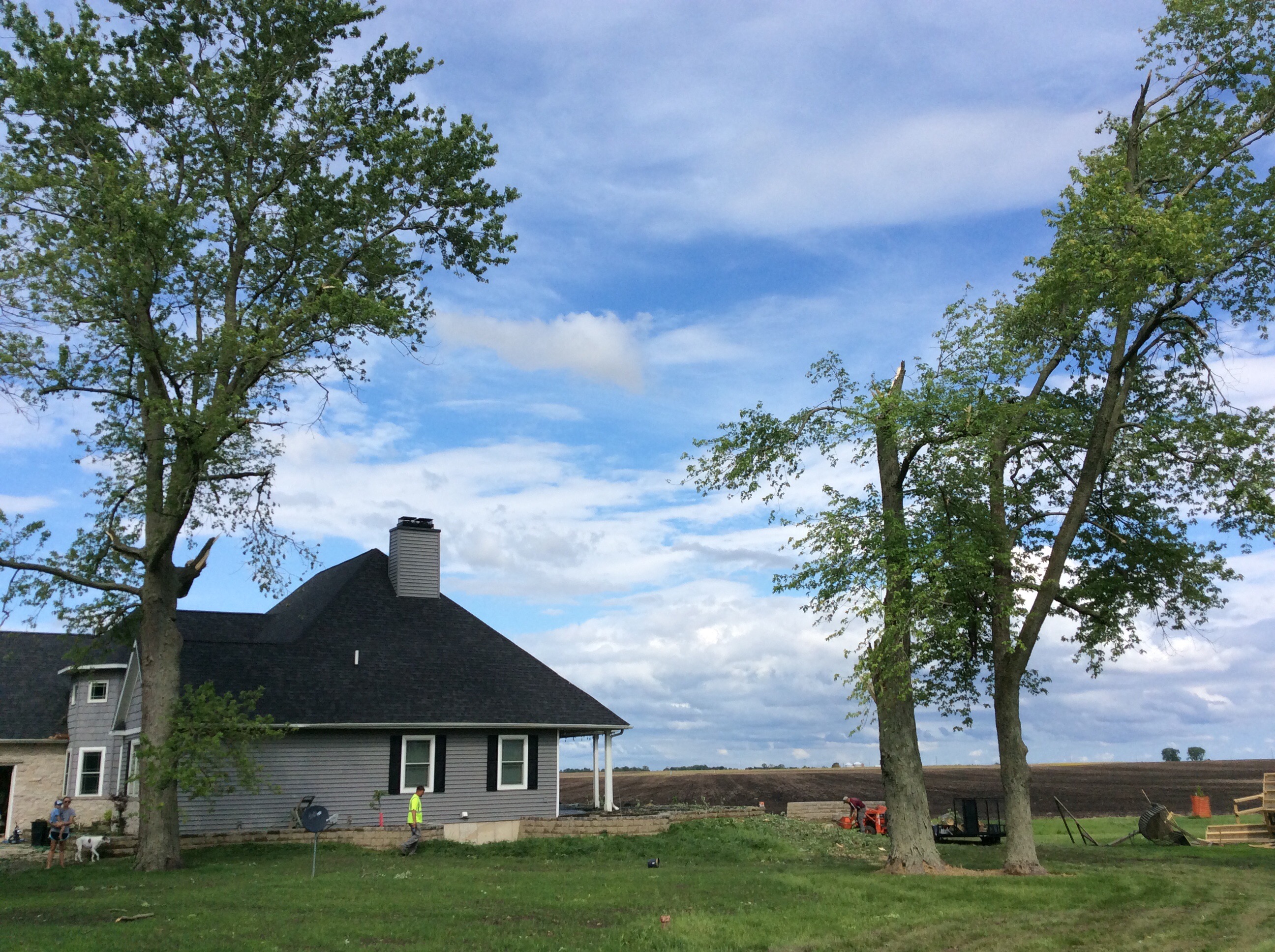
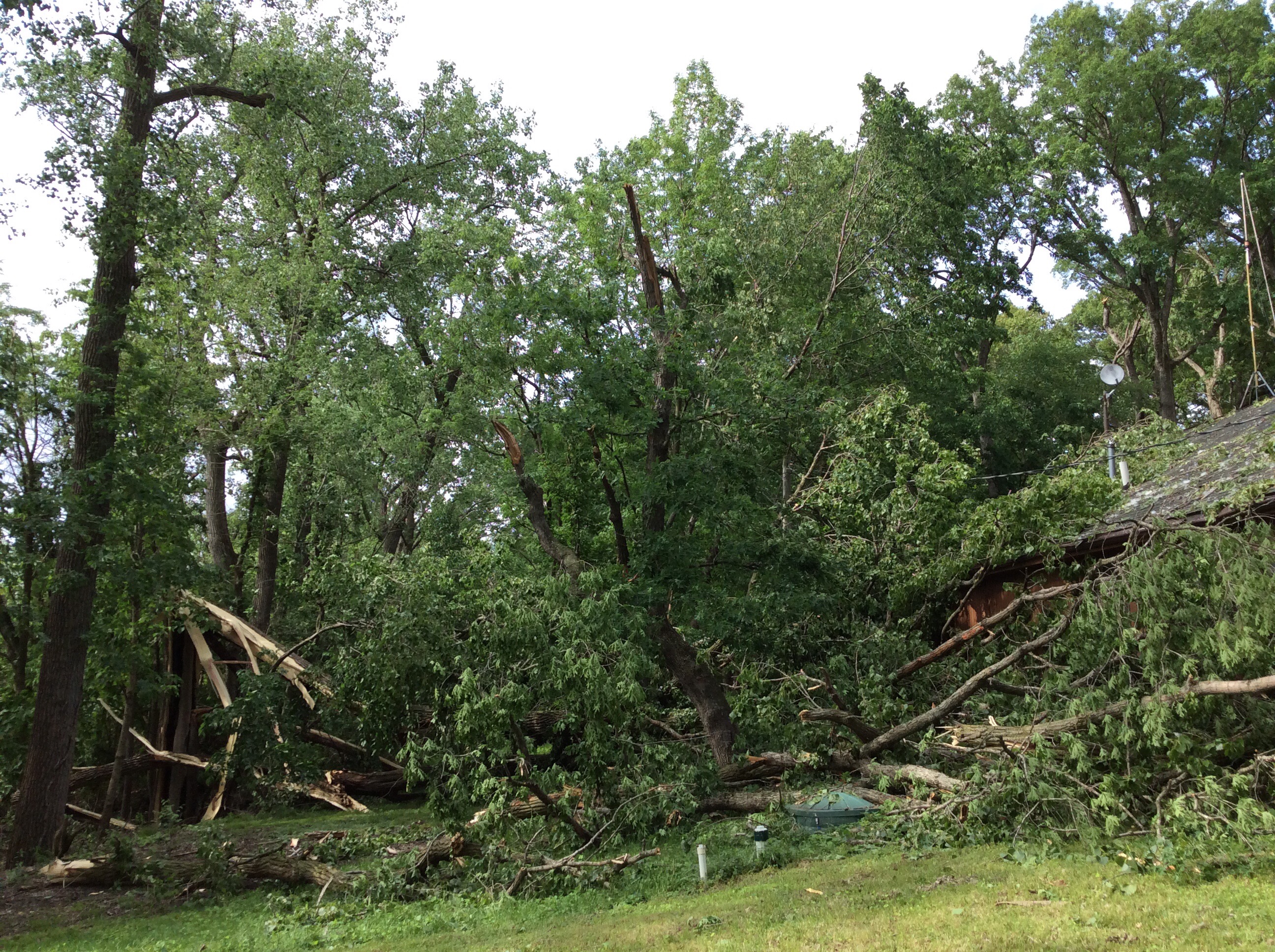
May 26 -- St. Joseph
|
||||||||||||||||
|
||||||||||||||||
|
May 27 -- 1 mi. South of Dahinda
Track Map 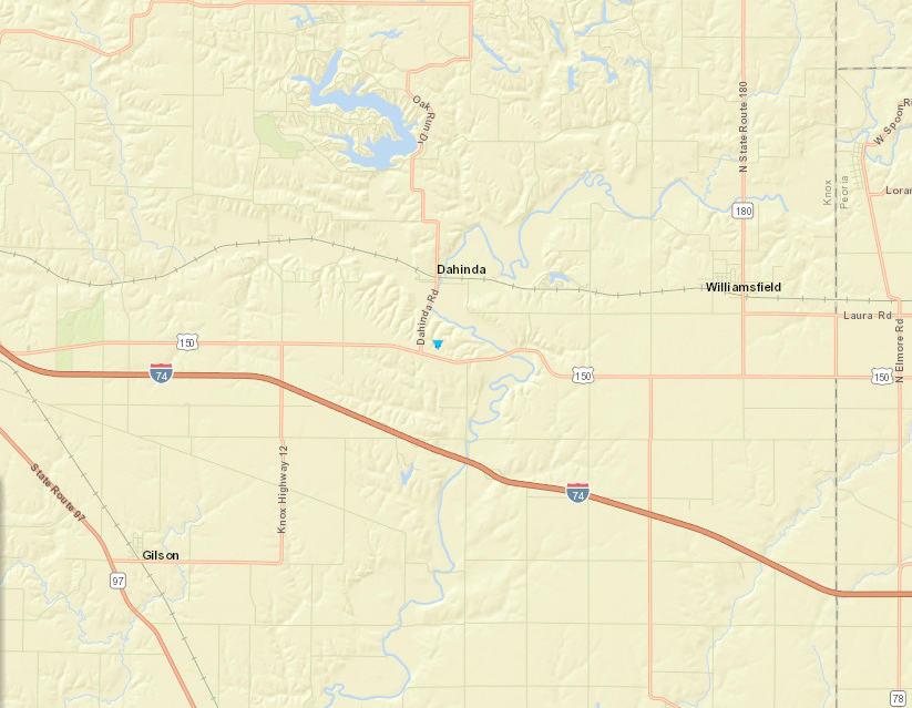
|
||||||||||||||||
|
May 27 -- 3 mi. NW of Benson
Track Map 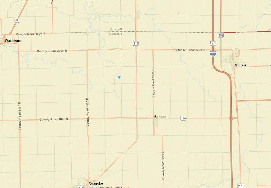
|
||||||||||||||||
|
May 28 -- 5 mi. south of Henning
Track Map 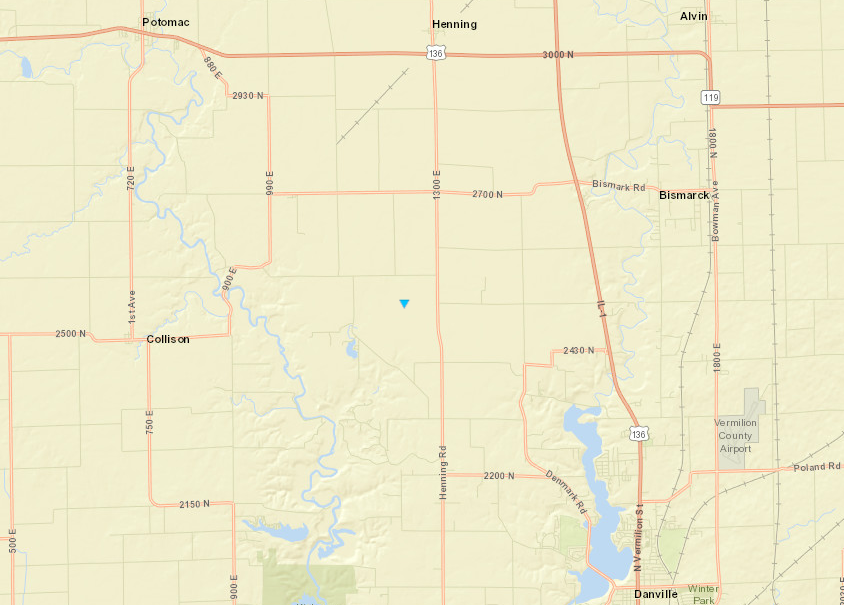
|
||||||||||||||||
|
||||||||||||||||
|
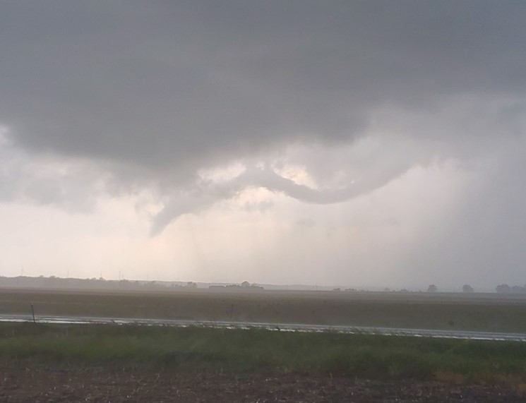
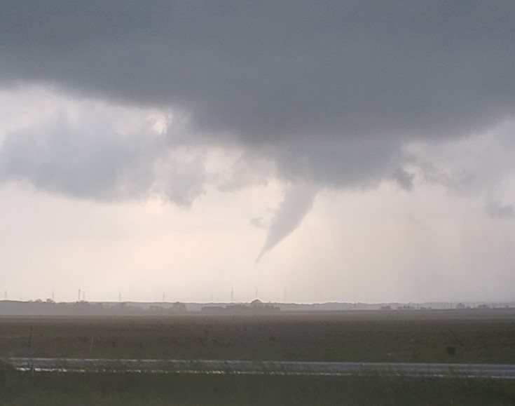
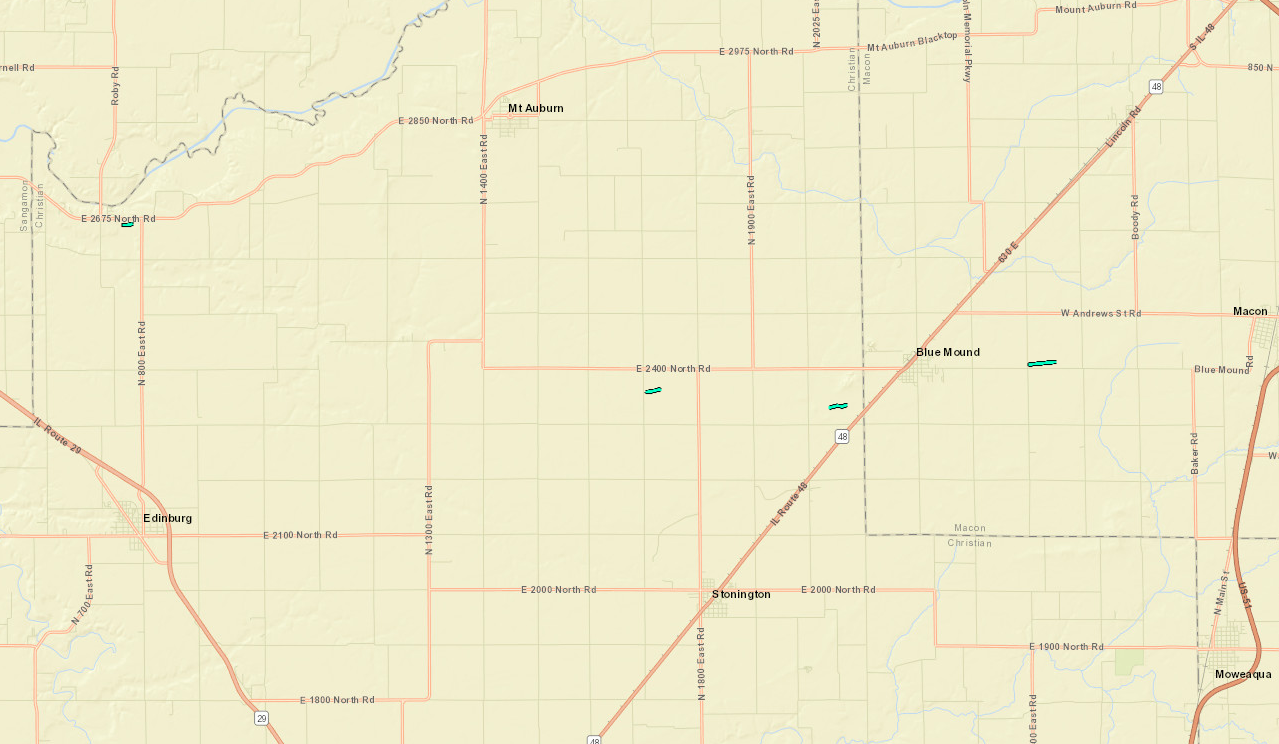
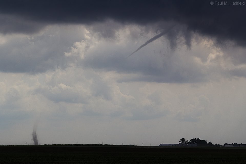
May 29 -- (4) Tornadoes from north of Edinburg, to north of Stonington, to east of Blue Mound, IL
|
||||||||||||||||
|
||||||||||||||||
The Enhanced Fujita (EF) Scale classifies tornadoes into the following categories:
| EF0 Weak 65-85 mph |
EF1 Moderate 86-110 mph |
EF2 Significant 111-135 mph |
EF3 Severe 136-165 mph |
EF4 Extreme 166-200 mph |
EF5 Catastrophic 200+ mph |
 |
|||||
 |
Media use of NWS Web News Stories is encouraged! Please acknowledge the NWS as the source of any news information accessed from this site. |
|