
A significant heat wave is underway for the Intermountain West, Northern Plains, and Upper Great Lakes, peaking in intensity through midweek and lingering across parts of the Northern Plains and Midwest until this weekend. In southwest Texas, excessive rainfall may bring a risk for potentially life-threatening flash and arroyo flooding through Thursday. Read More >
Central Illinois
Weather Forecast Office
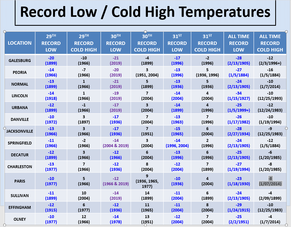
* Illinois State Record Low -36 at Congerville, 1/5/1999
New Record Lows Set in Central Illinois...
Record Lows set on Jan 30th...
Peoria... -20 in 2019 (old record -12 in 1966)
Lincoln... -19 in 2019 (old record (-12 in 1936)
Springfield... -14 Tied Record Low in 2004 & 2019
Urbana... -17 in 2019 (old record -13 in 1936)
Normal... -21 in 2019 (old record -15 in 1966)
Galesburg... -21 in 2019 (old record -13 in 1966)
Sullivan... -14 in 2019 (old record -13 in 2004)
Paris... -12 Tied Record Low in 1966 & 2019
Altona low temperature of -32 on Jan 30, 2019
Bloomington IL airport had a wind chill of -53 at 6 am on Jan 30, 2019
US Dept of Commerce
National Oceanic and Atmospheric Administration
National Weather Service
Central Illinois
1362 State Route 10
Lincoln, IL 62656
217-732-7321 (forecast recording) or 217-732-3089
Comments? Questions? Please Contact Us.

