|
History of Federal Weather Services in Central Illinois
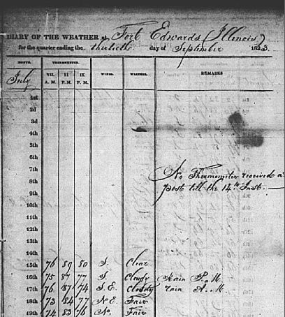
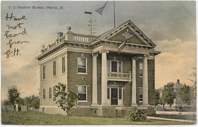
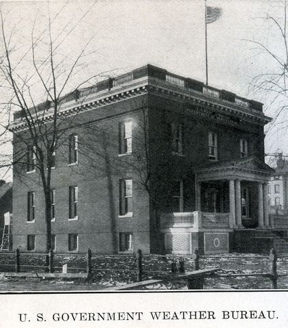
July 1, 1879: The Army Signal Service began weather observations in Springfield, with equipment measuring temperature and precipitation on top of the Springer Building at 6th and Monroe Sts. downtown. Sgt. T.B. Jennings was the first official in charge. October 1, 1890: The U.S. Weather Bureau was established by an act of Congress, and assigned to the Department of Agriculture. Observations and forecast responsibility from the Army Signal Service was transferred to the Weather Bureau. May 1894: The Weather Bureau opened its first district forecast center in Chicago. Besides central Illinois, the forecast area of the Chicago office ranged from the Great Lakes to the Rocky Mountains. 1898: The Weather Bureau established a network of weather stations that measured data in the atmosphere, using tethered kites to carry instruments aloft. One of these kite stations was located in Springfield. September 7, 1904: Ground was broken on the Bradley Polytechnic Institute (now Bradley University) campus, for a Weather Bureau station, to open in 1905. The cornerstone that was laid on this day included a box that contained correspondence regarding the Peoria office, Bradley publications, and 6 Peoria newspapers from the previous day. The contents of this box were retrieved when the building was torn down in 1957.
January 19, 1906: A telegraph was installed at the Peoria Weather Bureau office, for transmitting weather observations. At the same time, Weather Bureau headquarters announced that Peoria would become home to one of the first upper-air stations to use weather balloons. However, no evidence exists that indicates this station was installed in Peoria before the 1950's.
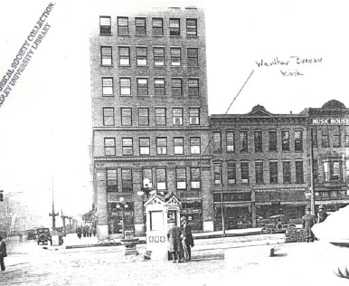
September 1918: The Peoria Weather Bureau office hires its first female weather observer, Miss Gladys Catlin. October 1926: The first telephone reports from the Peoria Weather Bureau office were made to air mail fields in Chicago and Springfield. November 1, 1928: The Springfield Weather Bureau office moved to the Abe Lincoln Hotel, at 5th and Capitol. The site of the old office is demolished in 1929, in preparation for the construction of the new federal courthouse.
1931: The Peoria Weather Bureau office begins 24-hour operations. 1935: The Peoria Weather Bureau begins direct radio broadcasts, through the cooperation of radio station WMBD.
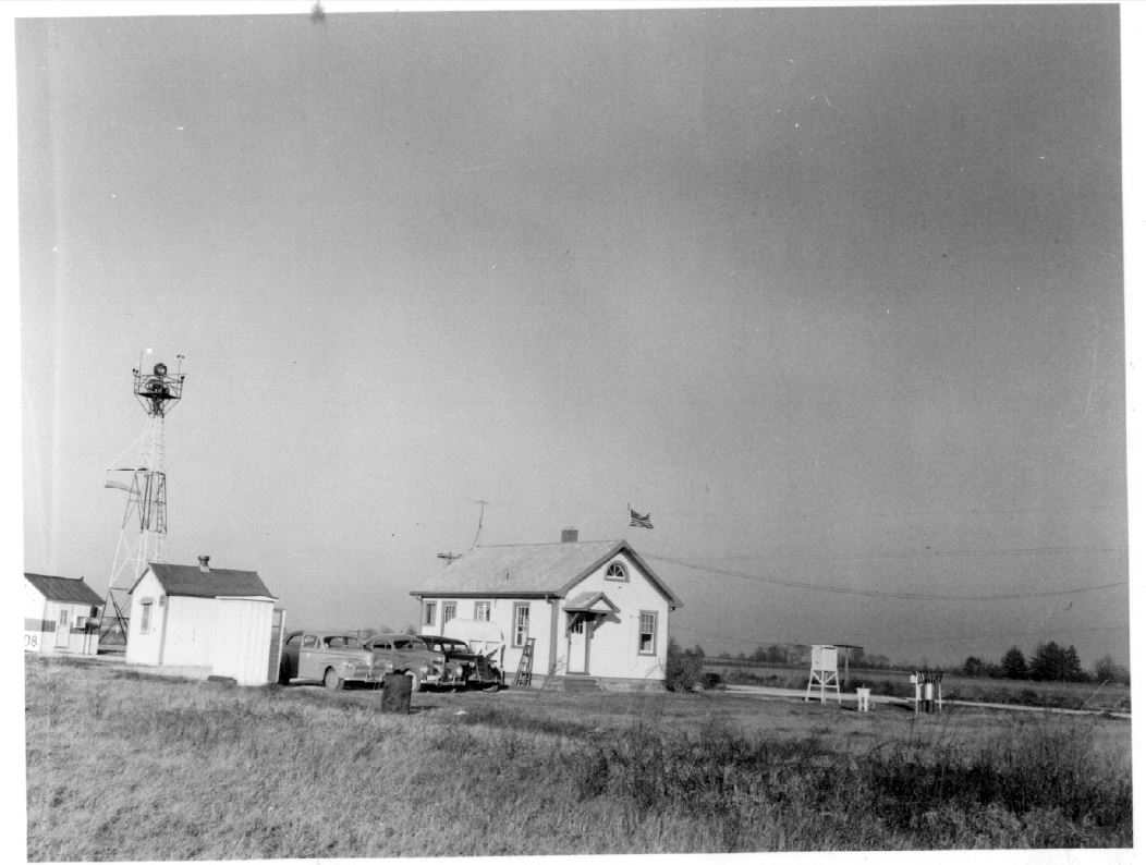
November 15, 1935: Another Weather Bureau Airport Station (WBAS) is opened in central Illinois. This one is located in Springfield, at the Southwest Airport (near the current intersection of Chatham Rd. and Westchester Blvd). Hourly weather observations of temperature, wind, pressure, and sky condition are taken. 1936: Weather forecasts for central Illinois continue to originate from the Chicago district office. This office also issued forecasts for all of Illinois, Indiana, Iowa, Michigan, Wisconsin, Minnesota, North and South Dakota, Missouri, Kansas and Nebraska, although the latter 3 states were assigned to a new district office in Kansas City during this year. November 4, 1937: Precipitation measurements began at the Southwest Airport in Springfield, and the site is designated as a "first-order" station. June 30, 1940: With the expansion of the aviation industry, the operation of the U.S. Weather Bureau is transferred from the Department of Agriculture to the Department of Commerce. May 4, 1943: The Weather Bureau operations of the City Office (Bradley campus) in Peoria are merged with the Airport Office.
August 15, 1944: The Weather Bureau closes its City Office in Peoria. September 1944: Radiosonde (upper-air) observations begin at Chanute Field in Rantoul. These observations are taken 4 times a day. February 1, 1947: Operation of the WBAS at Effingham was transferred back to the CAA.
April 1, 1951: Operations of the CAA (former WBAS) station in Effingham were moved to the Vandalia airport. December 1952: A facsimile recorder is installed at the Peoria Weather Bureau office. 1953: The Peoria Weather Bureau office's hours of operation are reduced to 8 am to 6 pm daily. April 30, 1954: The Weather Bureau closes its City Office in Springfield. The airport station carried on the work of the city office, with 6 people to do the work previously requiring 10 people. The climatological duties of the Springfield office are alleviated in 1955, when the state climatologist position is transferred to work from the University of Illinois. November 13, 1954: Teletype operations are established at the Peoria Weather Bureau office, for transmitting hourly weather conditions, local summaries, and severe weather warnings. June 1955: Portions of central and western Illinois come under radar coverage for the first time, with the installation of the WSR-1 radar at Lambert Field in St. Louis, MO.
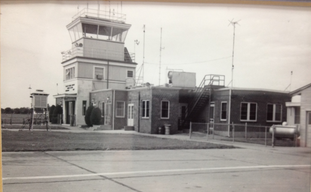
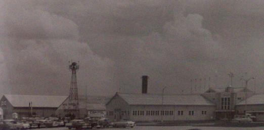
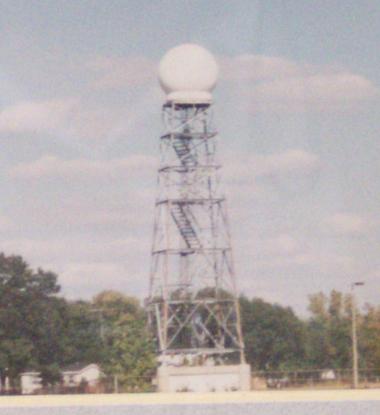
October 1, 1959: The Peoria Weather Bureau office moves to the new Administration Building, 2300 feet west-northwest of the old office. July 1960: Radar coverage in central and western Illinois is improved with the new WSR-57 radar in St. Louis. July 13, 1965: The Weather Bureau becomes part of the new Environmental Science Services Administration (ESSA) within the Department of Commerce. December 14, 1966: The Weather Bureau office in Springfield discontinues its pilot balloon (pibal) observation program. 1967: The ESSA begins to internally refer to the Weather Bureau as the "National Weather Service", but externally the organization is still largely called the Weather Bureau. The district forecast offices were reorganized and divided into State Forecast Offices, with the Illinois SFO located in Chicago. October 1, 1970: The ESSA is renamed the National Oceanic and Atmospheric Administration (NOAA), and the Weather Bureau is renamed the National Weather Service (NWS). Field offices are redesignated as "Weather Service Forecast Offices" (WSFO, such as Chicago) and "Weather Service Offices" (WSO, such as Peoria and Springfield). November 1, 1974: Radar coverage over much of central Illinois is improved with the activation of a new radar, the WSR-74S, in Marseilles, in eastern La Salle County. 1976: The Peoria NWS office discontinues its routine weather broadcasts on WMBD radio.
August 30, 1977: A new radar was commissioned at Moline, the WSR-74C. This radar, along with the Marseilles radar (and later the Springfield radar), was used for warning issuance by the Peoria NWS, which never had its own radar unit. Remote radar displays, and telephone conversations between the offices, were the methods used by the Peoria staff to accomplish this task. October 24, 1979: The Peoria NWS office moves to the Business Aviation Building (Byerly Building), 800 feet east-northeast of the old office location.
March 5, 1980: The Springfield NWS office is relocated to the new Services Building on the north side of the airport grounds. August 1, 1980: Construction begins on the WSR-74C radar at Capital Airport in Springfield.
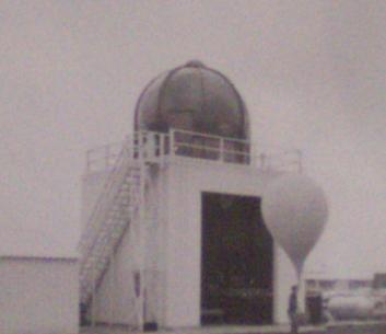
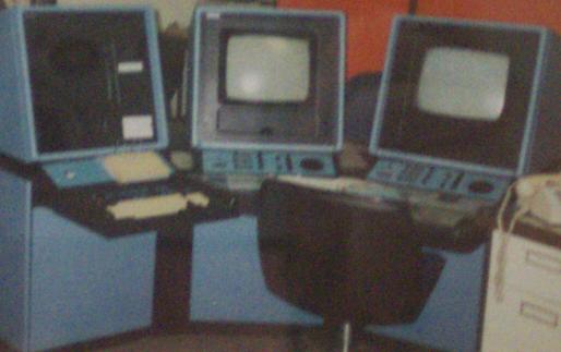
April 1990: The upper-air (weather balloon) tracking system in Peoria was upgraded to use a PC, replacing magnetic tapes and a mini-computer.
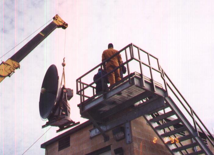
February 14, 1995: The last upper-air observation is taken at Peoria. The equipment is then relocated to the new NWS office in Davenport, IA. March 1, 1995: Warning responsibility for 6 counties in west central Illinois is transferred from the Peoria NWS to the Davenport NWS office.
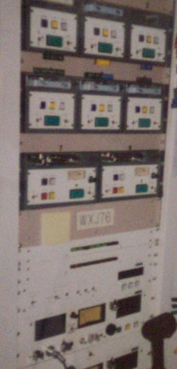
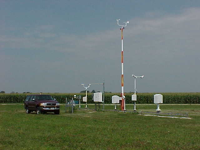
September 27, 1995: The NWS office in Lincoln begins full-time operations, with transfer of the remaining 10 counties covered by the Peoria NWS office, and of the 18 counties covered by the Springfield office. Additionally, 2 counties are transferred to Lincoln from the St. Louis NWS, and 5 counties are transferred from the Evansville, IN, NWS. Programming of the Peoria, Springfield and Champaign NOAA Weather Radio stations also is transferred to Lincoln, along with the AFOS computer network. The Lincoln NWS office is initially responsible for severe weather warnings and local short-term forecasts for 35 counties. October 1, 1995: The NWS offices in Peoria and Springfield are officially closed. The ASOS observing system is commissioned for operations at the Peoria Airport. Contract observers oversee the operation of the ASOS for accuracy. Contract observers take manual observations of hourly weather conditions at Springfield. December 1, 1995: The ASOS observing system is commissioned in Springfield. The contract and control tower personnel oversee operation of ASOS for accuracy.
July 1, 1996: The Lincoln NWS assumes aviation route forecast responsibilities for the air routes from Chicago to Springfield to St. Louis, and from Terre Haute to St. Louis. July 30, 1996: The WSR-74C radar in Springfield is decommissioned. October 17, 1997: The Lincoln NWS Internet home page makes its debut.
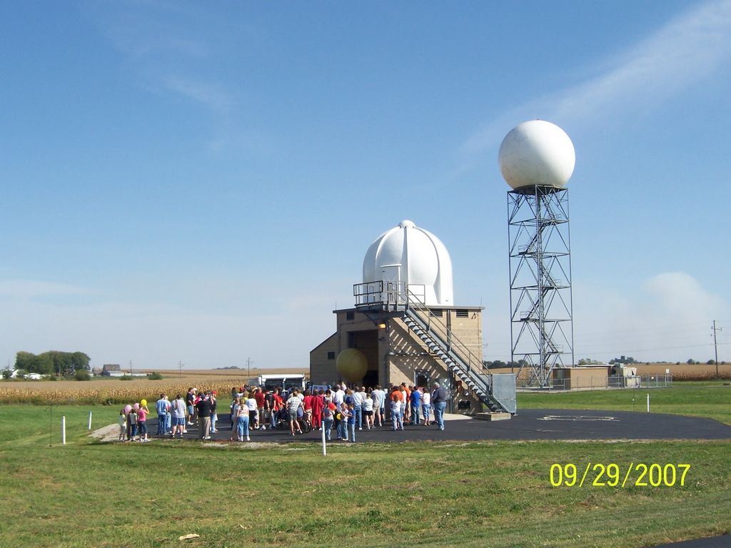
September 12, 1998: The Lincoln NWS conducts an open house of its facilities. Approximately 1,000 people take advantage of a beautiful day to tour the office.
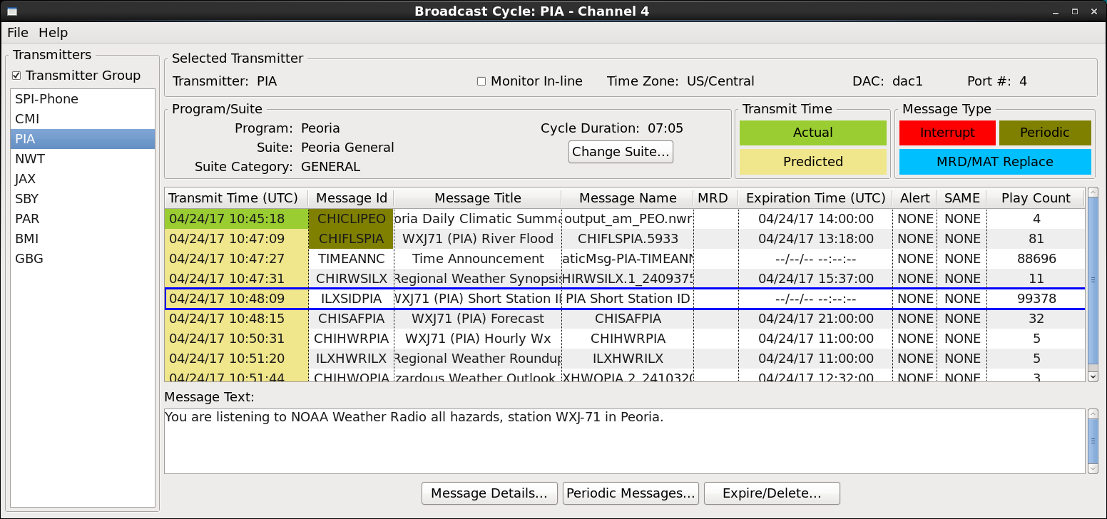
January 1, 1999: A major winter storm paralyzed central Illinois. Several Lincoln NWS staff members were forced to spend 1-2 consecutive days at work, when replacement shifts were unable to reach the office. July 6, 1999: The Lincoln NWS assumes public forecast responsibility for its 35 counties in central Illinois. These forecasts were previously issued by the Chicago NWS office. April 2000: NOAA Weather Radio coverage in central Illinois is expanded with the installation of new station WXM-90 near Jacksonville. October 1, 2000: The AFOS computer system is officially decommissioned by the NWS, having been replaced by AWIPS. October 20, 2000: A long-awaited NOAA Weather Radio transmitter is installed in southeast Illinois. Station KXI-48 in Newton began transmitting in a 40 mile radius on this date, programmed from the Lincoln NWS office. February 2001: New NOAA Weather Radio stations debut: KXI-46 in western Shelby County, near Tower Hill, and KXI-47 just south of Paris. October 2001: NOAA Weather Radio expansion in central Illinois includes new transmitters at Bloomington (KZZ-65, activated on the 10th) and at Galesburg (KZZ-66, activated on the 25th). February 15, 2005: The Lincoln NWS begins a new aviation forecast for the Bloomington airport.
September 29, 2007: The Lincoln NWS issues its last Transcribed Weather Broadcast (TWEB) for the aviation route from Chicago to St. Louis, when TWEB forecasts in the U.S. are discontinued.
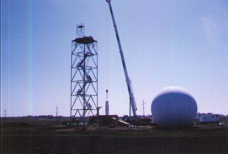
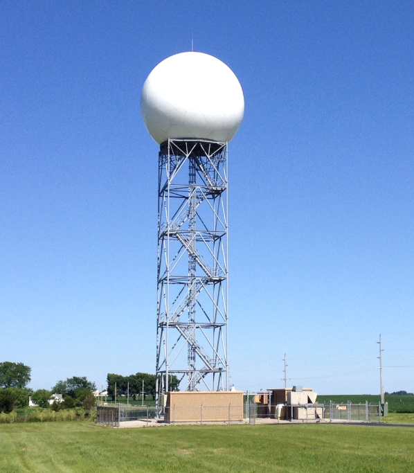
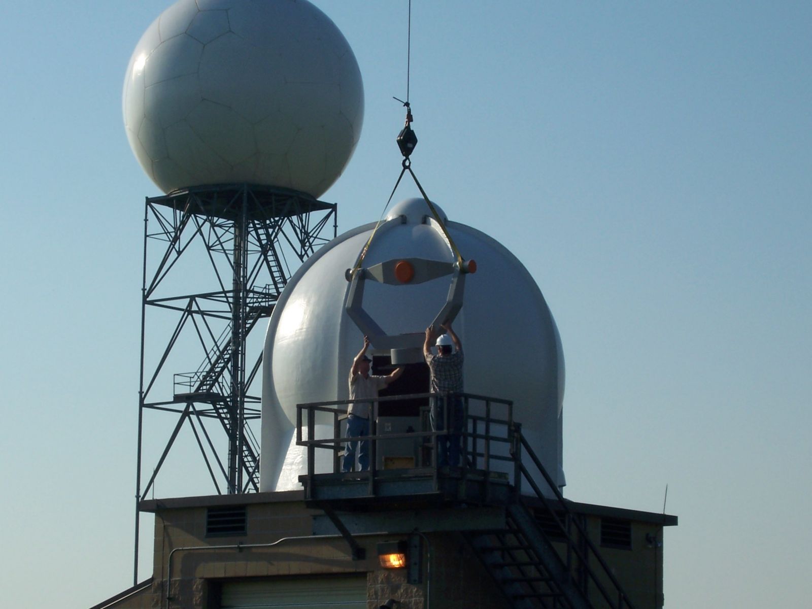
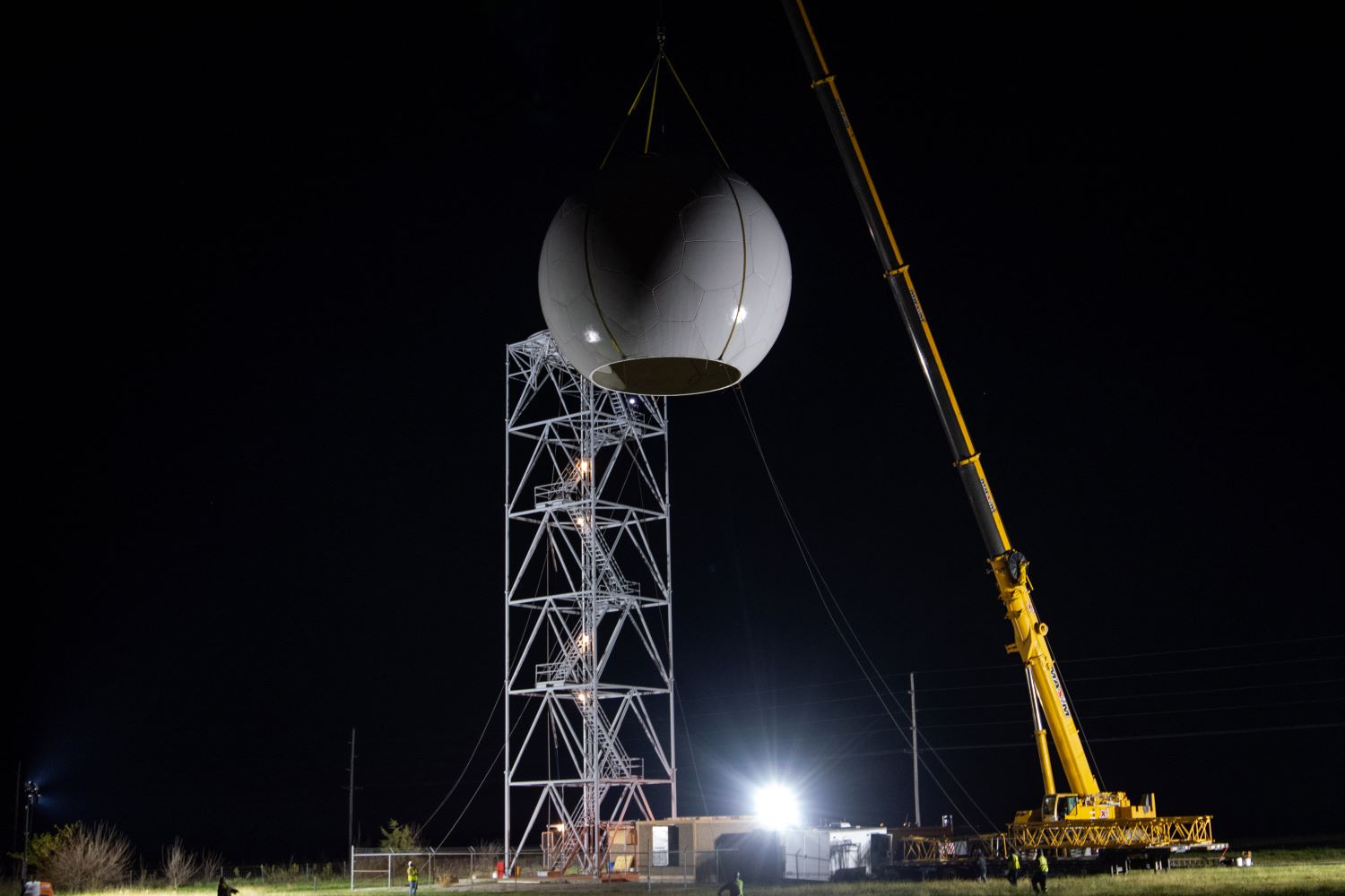
June 1, 2011: The Lincoln NWS joins social media, debuting a page on Facebook. 2012: The Lincoln NWS debuts its Twitter social media account. October 2012: The Lincoln WSR-88D radar is upgraded with dual polarization technology, the most significant upgrade to the radar since it was installed in 1995. |
|||||||||||||||||||||||||||||||||||||||||||||||||||||||||||
|
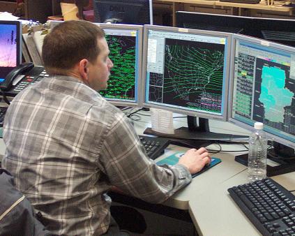
April 14, 2015: The second generation of the AWIPS software (AWIPS-2) is installed.
|
|||||||||||||||||||||||||||||||||||||||||||||||||||||||||||