Central Illinois
Weather Forecast Office
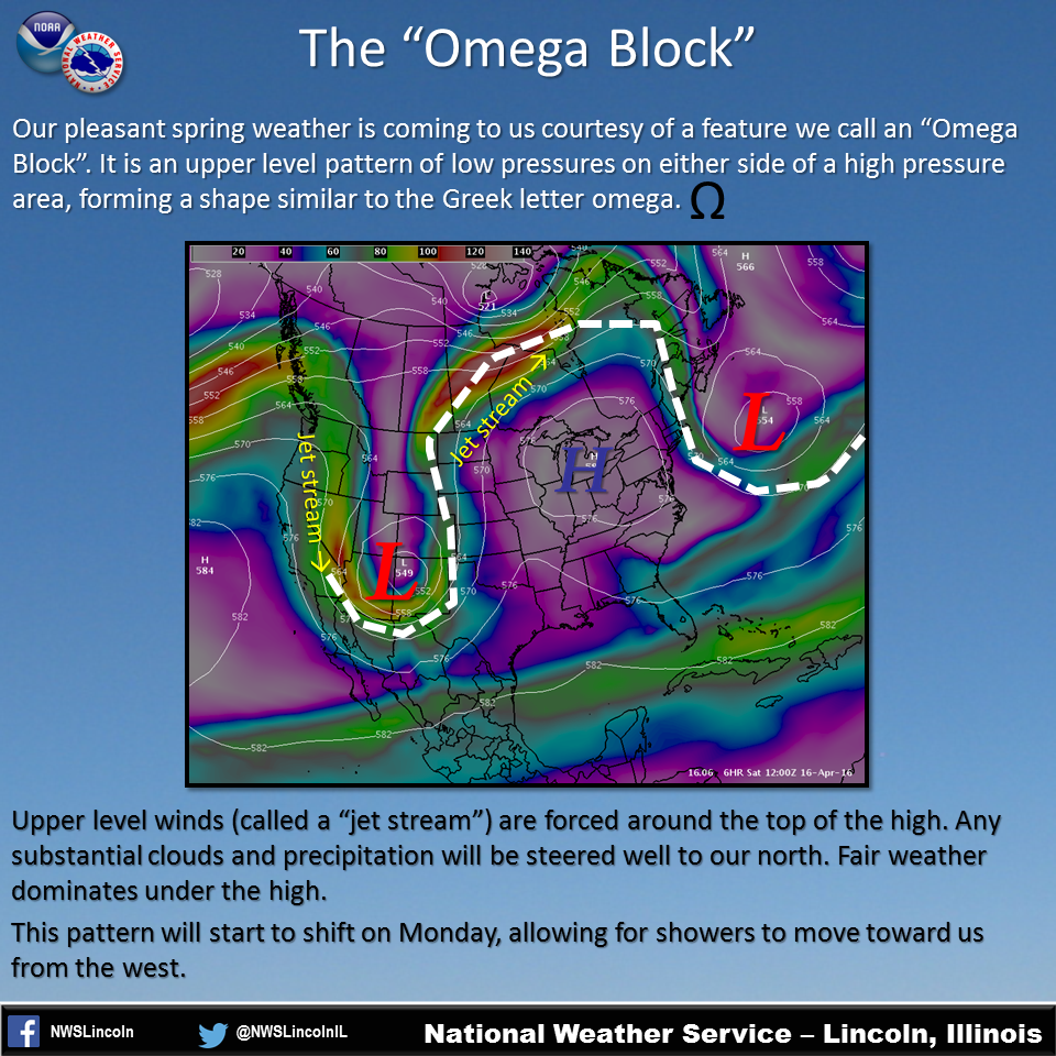
Quiet conditions will prevail over central Illinois through the weekend, with fair skies and temperatures reaching well into the 70s. This is coming to us courtesy of an upper level weather pattern called an "Omega Block", so named because it resembles the shape of the Greek letter omega.
In this particular pattern, we are underneath an area of high pressure aloft. On either side of it are areas of low pressure. Because the high is not able to move at the moment, the jet stream over the southwest U.S. is being forced northward along the edges of the high into Canada. Any substantial clouds and precipitation are being steered along its path, staying well north of us. This pattern will continue through Monday, before some movement finally takes place and the threat of rain will spread toward us from the west.

US Dept of Commerce
National Oceanic and Atmospheric Administration
National Weather Service
Central Illinois
1362 State Route 10
Lincoln, IL 62656
217-732-7321 (forecast recording) or 217-732-3089
Comments? Questions? Please Contact Us.


 Follow us on X
 Follow us on Facebook
 Follow us on YouTube
 ILX RSS Feed