Central Illinois
Weather Forecast Office
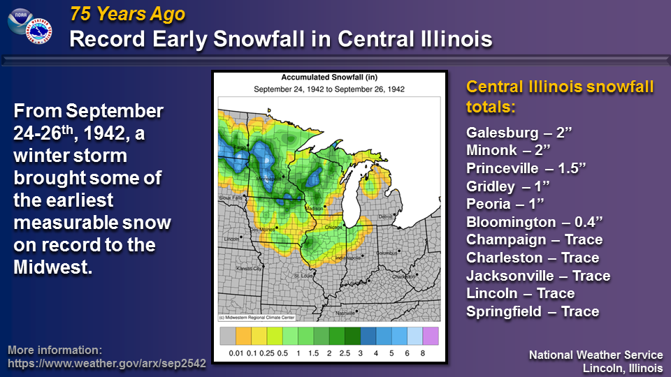
75 years ago, much of the Midwest was impacted by unseasonably chilly air. From September 24-26th, 1942, an early season winter storm moved from the Northern Plains into the Great Lakes, producing some of the earliest snowfall on record for the region. This snow occurred as far south as central Illinois and far northern Missouri. Snowfall totals of 2 inches were reported at Galesburg and Minonk, with an inch at Peoria and trace amounts as far south as Springfield and Charleston. Most of these amounts in central Illinois fell on the 25th.
The National Weather Service office in La Crosse, WI, has an overview of this event at https://www.weather.gov/arx/sep2542 .

US Dept of Commerce
National Oceanic and Atmospheric Administration
National Weather Service
Central Illinois
1362 State Route 10
Lincoln, IL 62656
217-732-7321 (forecast recording) or 217-732-3089
Comments? Questions? Please Contact Us.


 Follow us on X
 Follow us on Facebook
 Follow us on YouTube
 ILX RSS Feed