
Record setting heat is expected over the next several days from the Intermountain West through the northern Plains. Furthermore, fire weather concerns increase with dry and breezy conditions. Meanwhile, heavy rainfall and severe thunderstorm threats for the Ohio/Tennessee Valleys, central Appalachians and Southeast today. The threat shifts to central Gulf Coast and across central Texas this week. Read More >
Meteorological autumn began on September 1, but it still feels like summer out there. Temperatures in the 90s are expected across much of central and southeast Illinois into the holiday weekend. Humidity levels are high enough to produce heat index values in the mid to upper 90s, but the brutally humid conditions from earlier this summer (when the dew point was near 80 degrees) is not expected.
Many people, especially those sweating in un-air-conditioned schools, may be wondering if this is unusual.
Looking back at the climate statistics since 1980, there have generally been about 3 days per September with highs of at least 90 degrees. This does not happen every year, but is somewhat regular. For example, at Peoria, 20 of the last 35 Septembers have had 90-degree days. Warmer years more recently included 2005 and 2007 (9 days each September with highs 90+), and 2013 (6 days). Springfield observed 26 such Septembers since 1980, including 13 days in 2005 and 11 in 2007 with highs of at least 90.
September 2011 started off especially hot, due to drought conditions that were ongoing. Highs reached 100 degrees, including 3 straight days in Springfield (its first such occurrence since 1995). However, with the drought, the humidity was lower than the current heat wave.

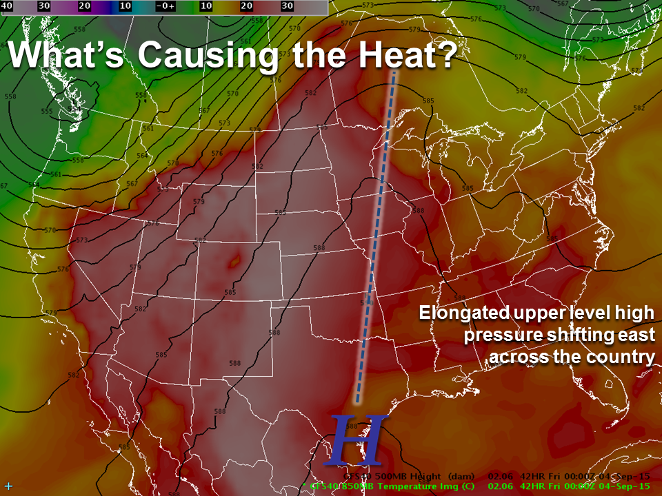
So what is causing this heat wave?
An area of high pressure aloft will be shifting eastward as the week progresses. The image below shows what this high pressure is expected to look like by late week. As it moves east, the warm air mass (shown in the orange and red shades) will move along with it. In such a pattern, dry conditions frequently accompany the area of high pressure. If any storms happen to form beneath it, they can be slow moving due to lighter winds aloft, causing isolated but locally heavy rain.
Relief is expected to move in next week. Cooler conditions will start shifting eastward across the northern parts of the country, as the elongated high pressure flattens out.

