Central Illinois
Weather Forecast Office
236
FLUS43 KILX 221856
HWOILX
Hazardous Weather Outlook
National Weather Service Lincoln IL
156 PM CDT Wed Jul 22 2026
ILZ027>031-036>038-040>057-061>063-066>068-071>073-231900-
Knox-Stark-Peoria-Marshall-Woodford-Fulton-Tazewell-McLean-Schuyler-
Mason-Logan-De Witt-Piatt-Champaign-Vermilion-Cass-Menard-Scott-
Morgan-Sangamon-Christian-Macon-Moultrie-Douglas-Coles-Edgar-Shelby-
Cumberland-Clark-Effingham-Jasper-Crawford-Clay-Richland-Lawrence-
156 PM CDT Wed Jul 22 2026
This Hazardous Weather Outlook is for central Illinois, east
central Illinois, southeast Illinois and west central Illinois.
.DAY ONE...This afternoon and tonight.
No hazardous weather is expected at this time.
.DAYS TWO THROUGH SEVEN...Thursday through Tuesday.
Heat and humidity will return early next week as heat index values
climb back to around 105 degrees by Sunday and Monday.
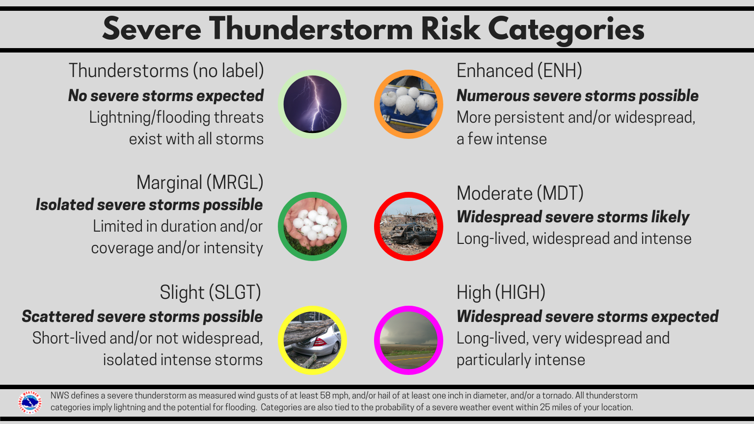
There is a slight chance (20%) for thunderstorms late Sunday and
Monday. If storms do develop, they could be severe, though timing and
location details still need to be resolved.
.SPOTTER INFORMATION STATEMENT...
Spotter activation is not anticipated through tonight.
$$
Deubelbeiss
|
|
US Dept of Commerce
National Oceanic and Atmospheric Administration
National Weather Service
Central Illinois
1362 State Route 10
Lincoln, IL 62656
217-732-7321 (forecast recording) or 217-732-3089
Comments? Questions? Please Contact Us.