February 27, 2023
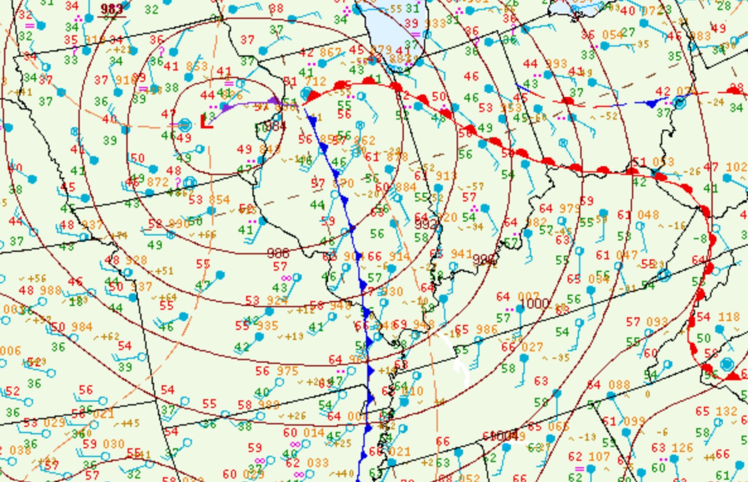
Low pressure rapidly deepened as it tracked from western Kansas during the evening of February 26th to southern Lake Michigan by midday February 27th. The airmass ahead of this system was initially quite stable across central Illinois thanks to easterly low-level flow and rain to the north of a developing warm front. However as the low tracked into Iowa, the warm front surged northward and instability increased markedly along and east of the I-55 corridor by morning. The 15z/9am February 27 surface map below shows a 984mb low pressure over eastern Iowa...with a warm front arcing eastward along I-80. Meanwhile the trailing cold front is already pushing eastward toward I-55. Note the strong southerly winds and temperatures in the lower to middle 60s across east-central and southeast Illinois.
SURFACE WEATHER MAP 9AM CST FEB 27
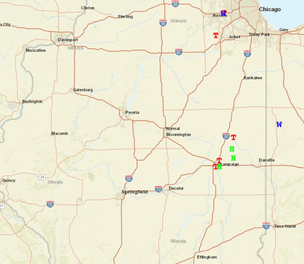
As a pocket of very cold air aloft spread over the warming boundary layer, steepening lapse rates led to vigorous updrafts and the development of scattered showers and thunderstorms ahead of the approaching cold front. While mesoanalysis showed only modest Convective Available Potential Energy (CAPE) values of 200-300J/kg, low-level wind shear was sufficient to create organized and sustained updraft structures. As a result, a few fast-moving mini-supercells developed across east-central Illinois...then rapidly tracked into northern and central Indiana toward midday. One of the cells produced two brief tornado touchdowns in Champaign County...the first between Bondville and Champaign and the second along I-57 just north of Urbana. Another brief tornado touchdown occurred further north in Ford County just east of Paxton. No damage was reported.
SEVERE WEATHER REPORTS FEBRUARY 27, 2023
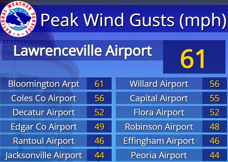
In addition to the morning tornadoes, the other big weather story was the strong winds across all of central and southeast Illinois. Winds routinely gusted 30-40mph throughout the day, with occasional gusts exceeding 50mph. The highest gust observed was a whopping 61mph at both Central Illinois Regional Airport in Bloomington and at the Lawrenceville Airport.
PEAK WIND GUSTS FEBRUARY 27, 2023