March 4-5, 2011
A wet early spring storm system affected central and southeast Illinois from the afternoon of March 4th through the morning of March 5th. Abundant moisture from the Gulf of America flowed northward and interacted with a slow moving frontal boundary and low pressure complex to produce a swath of heavy rain from southern Missouri, northeast across much of Illinois and into Indiana.
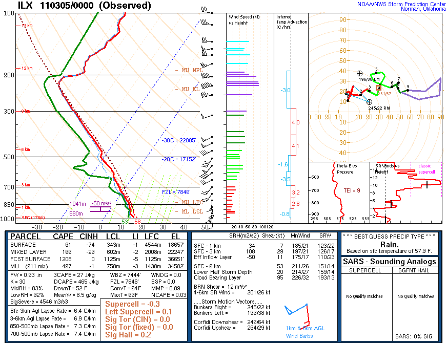
The weather balloon launched from the Lincoln NWS office at 5 PM on Friday showed a moist and slightly unstable atmosphere present. Precipitable water values near 1" were above seasonal levels, and even richer moisture flowed into the area from the southwest, thanks to a moderately strong low level jet stream. Thunderstorms that developed in the unstable airmass were efficient at producing heavy rainfall.
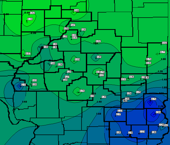
A cluster of severe thunderstorms tracked east from central Missouri during the late afternoon, then weakened as they moved into a less favorable environment east of the Mississippi River. This initial band of storms brought locally heavy rain from western Illinois northeastward through central Illinois. As the evening progressed, the main upper level dynamics moved overhead and combined with the surface frontal boundary and strong southwest flow to produce steady moderate to heavy rainfall with embedded thunderstorms across east central and southeast Illinois. Areas south of I-70 saw the most prolonged heavy rains, which added up to over 2 inches in many locations!
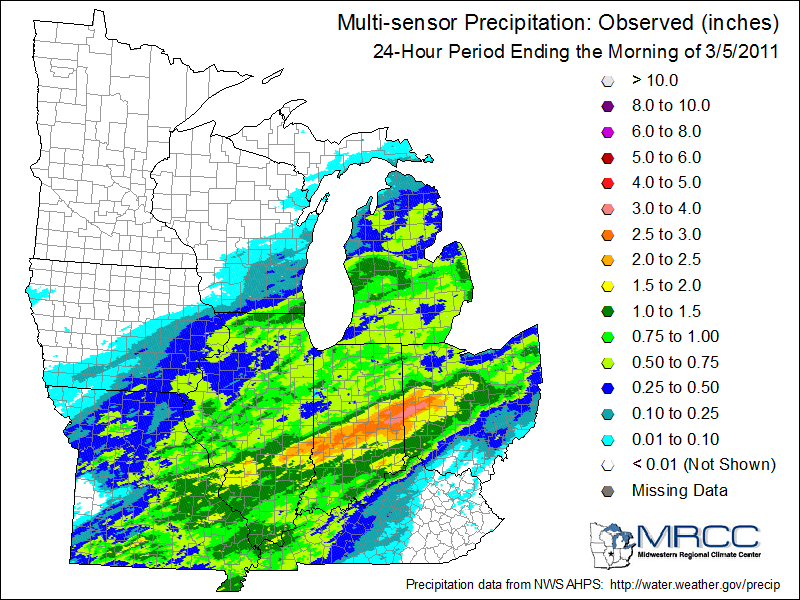
The images below show SWOP rainfall reports for the ILX CWA, and a multi-sensor rainfall map for a larger area of the Midwest courtesy of the NOAA MRCC. Note the band of heavy rain that affected southeast Illinois into Indiana. Luckily the unfrozen ground was able to absorb enough moisture that flash flooding was not an issue. However, runoff will lead to continued rises on area streams and rivers.