November 16, 2014
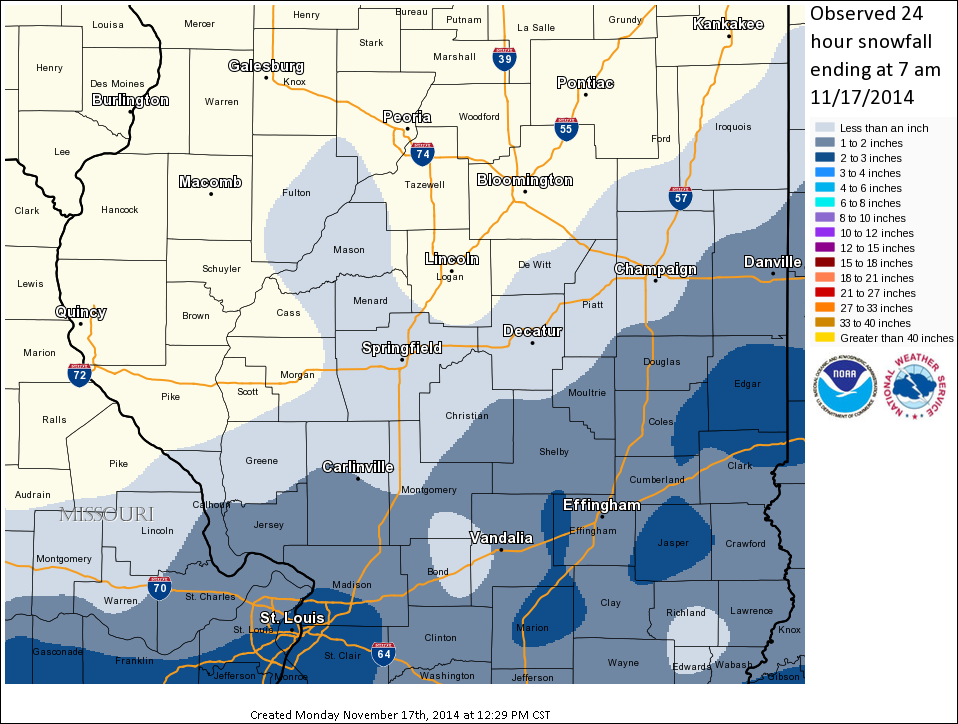
The first widespread accumulating snowfall of the season occurred across east-central and southeast Illinois on Sunday, November 16th. An upper-level disturbance that was previously expected to track northeastward and mainly impact the Ohio River Valley came further north and produced snow as far northwest as the I-55 corridor. The precipitation was enhanced by a strengthening upper-level jet stream over the Great Lakes that increased from 130mph Sunday morning to around 150mph by evening. The additional lift created by this feature allowed the area of snow to expand and intensify during the afternoon into the early evening. The snow gradually shifted further east into Indiana overnight, leaving behind an accumulation of 1 to 3 inches.
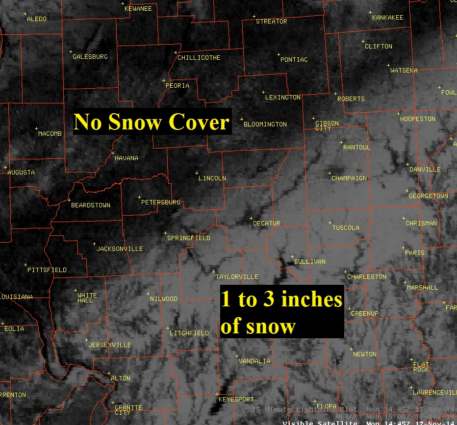
Below is visible satellite imagery from Monday, November 17th at 9:45 AM. The white area on the map along and east of a Gibson City to Springfield line is snow that remains on the ground this morning. You can differentiate this area from cloud cover, because you can clearly see area waterways such as the Sangamon and Kaskaskia Rivers. Further northwest, little or no snow is evident along and west of the I-55 corridor.
Here is a map of the snowfall.
|
City |
County |
Snowfall |
|
Ste. Marie 1NW |
Jasper |
3.5 |
|
Pana |
Christian |
3.0 |
|
Paris |
Edgar |
3.0 |
|
Effingham |
Effingham |
2.7 |
|
Neoga |
Cumberland |
2.7 |
|
Newton |
Jasper |
2.6 |
|
Charleston |
Coles |
2.6 |
|
Robinson 3W |
Crawford |
2.3 |
|
Flora |
Clay |
2.0 |
|
Watson |
Effingham |
2.0 |
|
Tuscola |
Douglas |
1.8 |
|
Taylorville |
Christian |
1.4 |
|
Homer 2N |
Champaign |
1.4 |
|
Ogden |
Champaign |
1.2 |
|
Lovington |
Moultrie |
1.2 |
|
Danville |
Vermilion |
1.2 |
|
Bismarck 3W |
Vermilion |
1.1 |
|
Sumner |
Lawrence |
1.0 |
|
Springfield (COOP) |
Sangamon |
0.3 |
|
Bloomington |
McLean |
T |
|
Peoria |
Peoria |
T |
|
Lincoln NWS |
Logan |
T |



 Follow us on X
 Follow us on Facebook
 Follow us on YouTube
 ILX RSS Feed