Week 2: What is Wind Shear?
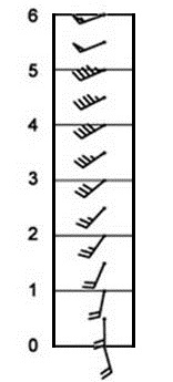
Wind shear describes how the wind changes speed and/or direction with height. There is almost always some degree of wind shear present within the atmosphere: however, it tends to be much greater across central Illinois during the winter and spring when strong storm systems frequently impact the region. For example, when a powerful jet stream shifts overhead, wind speeds from the surface to jet stream level can increase by over 100mph. The example below shows a diagram of winds from ground-level up to an altitude of 6km (about 3.7 mi). The direction the wind barb points tells us the direction from which the wind is blowing and the number of sticks or flags on the barb tell us the speed of the wind. A small stick equals 5kt, long stick 10kt, and a flag is 50kt. As you can see from the diagram, the wind at the surface is from the southeast at 20kt while the wind 6km aloft is from the west-southwest at 55kt. This represents a wind speed change of 35kt (40mph) and a wind direction change of about 45 degrees.
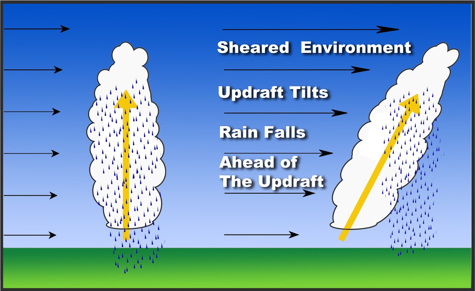
Wind shear is important to severe thunderstorm forecasting, because if it becomes strong enough, it can tilt a storm's updraft in such a manner that the updraft and downdraft remain separate from one another. If this occurs, the storm's energy source (it's warm/moist updraft) will not get choked off by the downdraft, and thus the storm will be able to maintain itself for a prolonged period of time. The image below shows two storms...one in a very weakly sheared environment on the left, and another in a strongly sheared environment on the right. The storm experiencing little or no wind shear will produce a vertical updraft, which will quickly get killed off by falling rain. On the other hand, the storm experiencing strong wind shear will develop a tilted updraft with the rain falling away from the updraft.
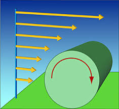
Wind shear can also enhance rotation within the thunderstorm updraft, which in turn can lead to the development of a tornado. The picture below shows light westerly winds at the surface with very strong westerly winds aloft. This creates a rolling motion within the atmosphere as shown by the red arrow, which if ingested into a storm's updraft can lead to the formation of a supercell thunderstorm and thus enhance the probability of a tornado.
For these reasons, strong wind shear is a chief indicator of long-lived and potentially severe thunderstorms. Meteorologists assess wind shear in a number of ways, but one of the primary tools is 0-6km bulk shear. This parameter describes the deep-layer wind shear from the surface up to 6km aloft. Supercell thunderstorms become more likely as values increase to greater than 35kt. As always, wind shear is just one of many tools available for severe weather forecasting and should not be used alone in order to determine the potential for strong to severe thunderstorms.

