Central Illinois
Weather Forecast Office
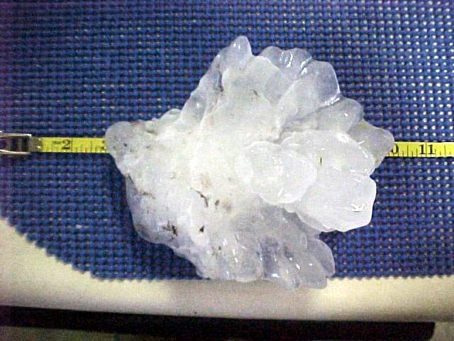 Hail Size Estimation Chart
| Hail Diameter | Description |
| 1/4" | Pea |
| 1/2" | Plain M&M |
| 3/4" | Penny |
| 7/8" | Nickel |
| 1" | Quarter |
| 1 1/4" | Half Dollar |
| 1 1/2" | Ping Pong Ball |
| 1 3/4" | Golfball |
| 2" | Hen Egg |
| 2 1/2" | Tennis Ball |
| 2 3/4" | Baseball |
| 3" | Teacup |
| 4" | Grapefruit |
| 4 1/2" | Softball |
*Red values denote severe criteria hail
US Dept of Commerce
National Oceanic and Atmospheric Administration
National Weather Service
Central Illinois
1362 State Route 10
Lincoln, IL 62656
217-732-7321 (forecast recording) or 217-732-3089
Comments? Questions? Please Contact Us.

