Isolated severe thunderstorms with strong wind gusts and hail will be possible Tuesday from parts of central Plains northeastward into the Midwest. Additional storms capable of damaging winds will be possible across the eastern Florida peninsula. Elevated to critical fire weather including gusty winds and low relative humidity is forecast again Tuesday over much of the northern Great Plains. Read More >
Northern Indiana
Weather Forecast Office
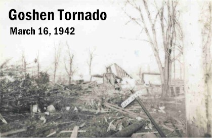
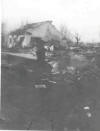
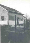
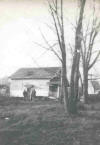
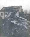
Between 9:30 p.m. and 9:45 p.m. March 16, 1942, a powerful tornado touched down southwest of Goshen, Indiana, and moved northeast, striking the south and southeast sides of town. The twister damaged or destroyed 87 homes and injured 53 people along its 200 yard wide, 10 mile long path. Near the end of the path the funnel narrowed and intensified, briefly reaching F4 strength as it completely demolished a home and killed the two occupants.
Another tornado touched down on the Yellow River southwest of Plymouth at 9:15pm, destroying a barn (F2 strength) and injuring two people with flying glass. It is interesting to note that the paths of the northeastward moving Plymouth and Goshen tornadoes, when plotted on a map, line up with each other almost perfectly.
These tornadoes were part of one of the Twentieth Century's most significant tornado outbreaks. Tornadoes were seen in Illinois, Indiana, Mississippi, Tennessee, Kentucky, and Alabama. Twenty-six of them were of F2 strength or greater, including six that produced F4 damage, and one that caused F5 destruction at Lacon, Illinois. A total of 152 people lost their lives and 1284 were injured.
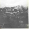
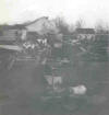
The photos below were donated to the NWS and were identified as being tornado damage in Goshen from sometime in the 1940's. The pictures are most likely of the aftermath of the March 16, 1942 twister. Many thanks to Jody Harrison for giving the photos to Elkhart County Emergency Management. Photos taken by Bonnie LeCount.
Hazards
Heat Related
Winter Related
Watch/Warning
Outlook
Storm Reports
Storm Prediction Center
Submit a Report
Event Ready
Climate
CoCoRaHS
FWA Daily
SBN Daily
FWA Monthly
SBN Monthly
Cliplot
Spring Frost Climatology
Fall Frost Climatology
Severe Climatology
Tornado Climatology
Local Information
Public Information Statement
Probabilistic Snowfall
Storm Data
Skywarn
COOP
Our Office
WSR-88D
Headline Criteria
NOAA Weather Radio
Weather History
Social Media Feeds
Weather Events Page
US Dept of Commerce
National Oceanic and Atmospheric Administration
National Weather Service
Northern Indiana
7506 E 850 N
Syracuse, IN 46567
574-834-1104
Comments? Questions? Please Contact Us.


