Northern Indiana
Weather Forecast Office
Adams County
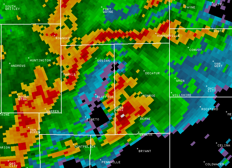
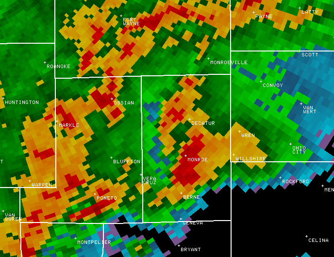
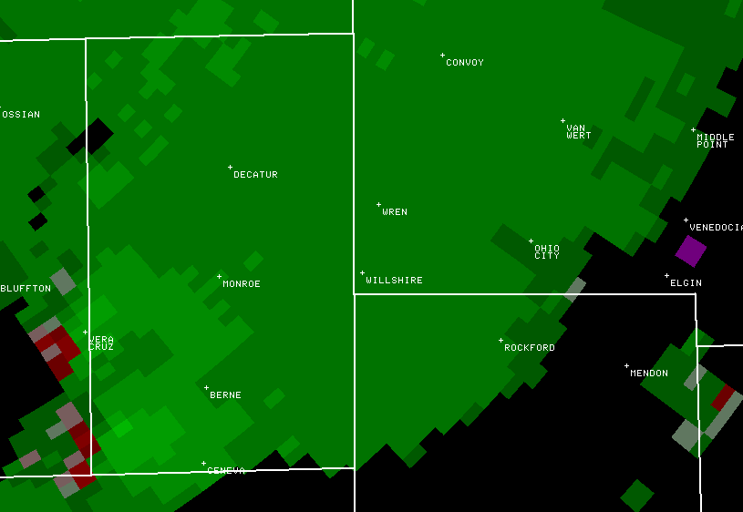
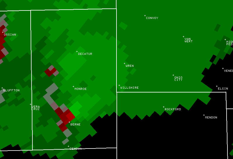
Reflectivity
The oranges and reds signify heavy rainfall and possible hail.
In the first three pictures the storm moves from southwest to eastcentral Adams County. The white rectangle between Vera Cruz and Berne in the first picture indicates a very tall, strong storm. Note how the tornado-producing storm is by itself, out ahead of the line of storms moving in from the west.
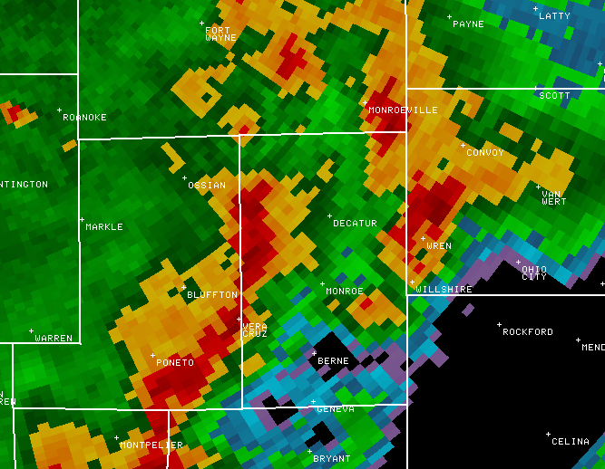
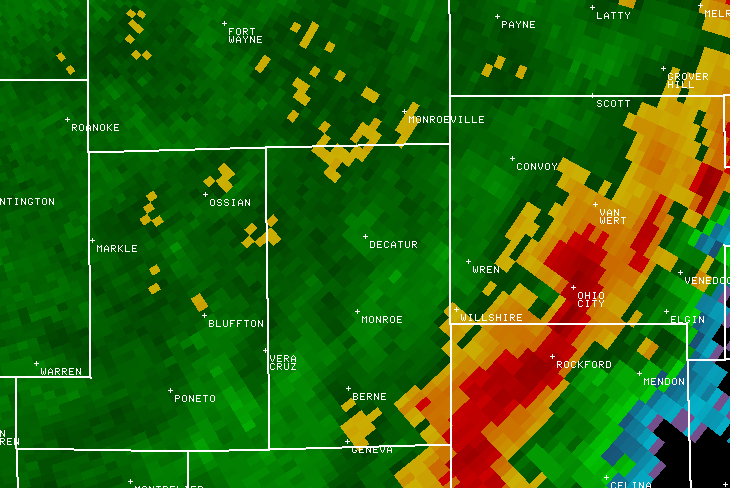
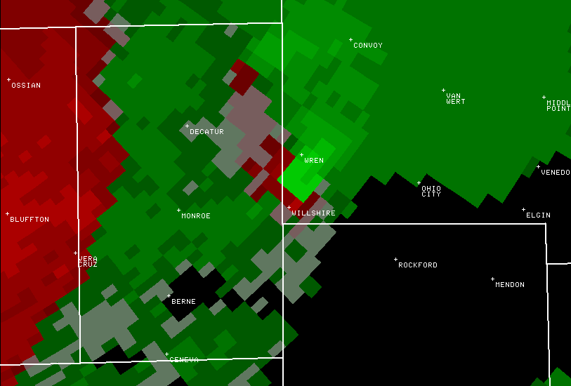
Velocity
The reds depict air moving away from the radar, the greens depict air moving toward the radar (in these pictures, the radar is to the upper left, out of the picture). Reds and greens right next to each other suggest circulation, since there are air currents flowing in opposite directions in close proximity to each other.
In the first picture shows weak, disorganized circulation about to enter southwest Adams County. A brief F0 tornado in Wells County had just lifted when this picture was taken. In the second picture the circulation is noticeably stronger. This picture was taken at the birth of what was to become an F3 tornado. In the last picture the circulation has become very strong and has crossed into Van Wert County. About a minute after this third shot was captured, what was to be the F4 tornado that struck Van Wert was born.
On to Van Wert County...
Hazards
Heat Related
Winter Related
Watch/Warning
Outlook
Storm Reports
Storm Prediction Center
Submit a Report
Event Ready
Climate
FWA Daily
SBN Daily
FWA Monthly
SBN Monthly
CoCoRaHS
Spring Frost Climatology
Fall Frost Climatology
Severe Climatology
Local Information
Skywarn
COOP
Our Office
WSR-88D
Headline Criteria
NOAA Weather Radio
Weather History
Probabilistic Snowfall
Public Information Statement
Social Media Feeds
Weather Events Page
US Dept of Commerce
National Oceanic and Atmospheric Administration
National Weather Service
Northern Indiana
7506 E 850 N
Syracuse, IN 46567
574-834-1104
Comments? Questions? Please Contact Us.

