Northern Indiana
Weather Forecast Office
Huntington and Wells County Tornado
July 4, 2003
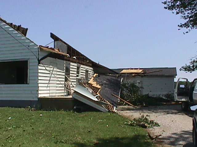
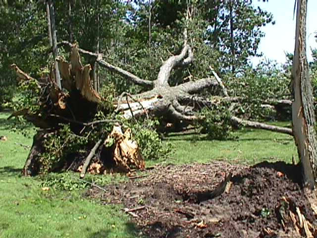
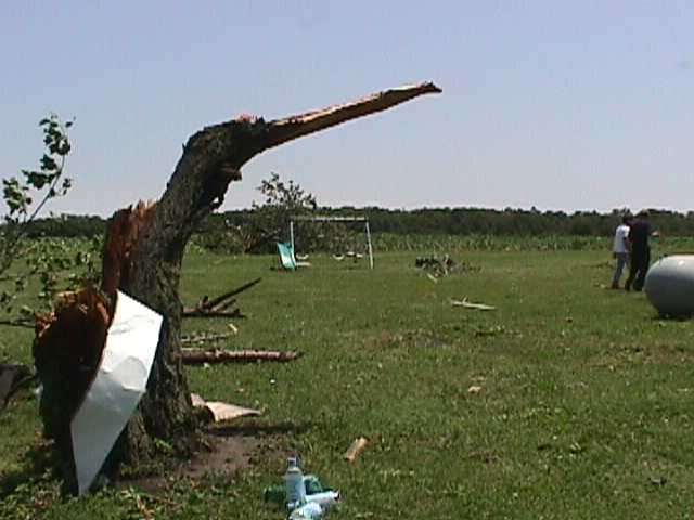
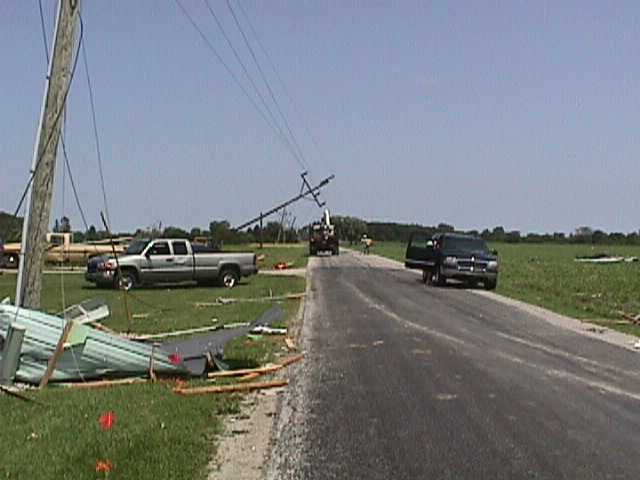
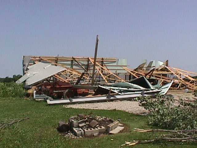
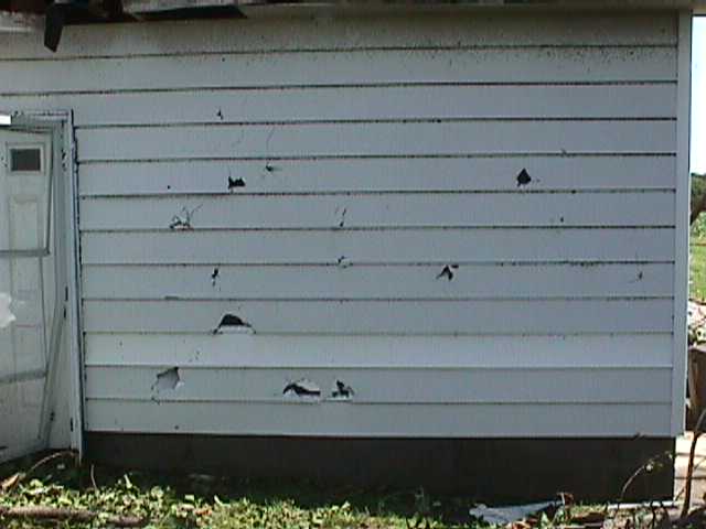
During the late afternoon of Friday July 4, 2003 a tornado affected areas of extreme eastern Huntington county and west central Wells county. On Saturday July 5 a damage assessment team from the National Weather Service Forecast office in Northern Indiana conducted a survey of possible tornado damage. The survey team confirmed that the damage was caused by a tornado, with a preliminary intensity rating of F1. An F1 tornado produces winds of 73 to 112 mph. An 8.5 mile long damage path was found, beginning in extreme eastern Huntington county about 2 miles southeast of Plum Tree. The path then extended southeast into Wells county, where the tornado lifted about 3 miles south of Liberty Center. Several residences and barns sustained extensive damage from the tornado, and numerous trees were uprooted or snapped. Two high voltage power towers were destroyed. No deaths or injuries have been reported with this storm.


Hazards
Heat Related
Winter Related
Watch/Warning
Outlook
Storm Reports
Storm Prediction Center
Submit a Report
Event Ready
Climate
FWA Daily
SBN Daily
FWA Monthly
SBN Monthly
CoCoRaHS
Spring Frost Climatology
Fall Frost Climatology
Severe Climatology
Local Information
Skywarn
COOP
Our Office
WSR-88D
Headline Criteria
NOAA Weather Radio
Weather History
Probabilistic Snowfall
Public Information Statement
Social Media Feeds
Weather Events Page
US Dept of Commerce
National Oceanic and Atmospheric Administration
National Weather Service
Northern Indiana
7506 E 850 N
Syracuse, IN 46567
574-834-1104
Comments? Questions? Please Contact Us.

