Northern Indiana
Weather Forecast Office
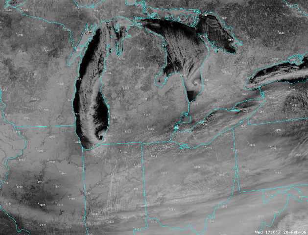
A very interesting visual satellite picture from the afternoon of February 20th, it shows two mesolows; one moving across southern Lake Michigan and another over southern Lake Huron. These smaller scale features can have an appearance of tropical systems such as Hurricanes or Tropical Storms but that is where the similarities end. They are created by a fairly rare temperature and wind pattern across the Great Lakes, but when they do form during the winter months they can produce a period of very heavy snow.
Hazards
Heat Related
Winter Related
Watch/Warning
Outlook
Storm Reports
Storm Prediction Center
Submit a Report
Event Ready
Climate
FWA Daily
SBN Daily
FWA Monthly
SBN Monthly
CoCoRaHS
Spring Frost Climatology
Fall Frost Climatology
Severe Climatology
Local Information
Skywarn
COOP
Our Office
WSR-88D
Headline Criteria
NOAA Weather Radio
Weather History
Probabilistic Snowfall
Public Information Statement
Social Media Feeds
Weather Events Page
US Dept of Commerce
National Oceanic and Atmospheric Administration
National Weather Service
Northern Indiana
7506 E 850 N
Syracuse, IN 46567
574-834-1104
Comments? Questions? Please Contact Us.

