Synopsis
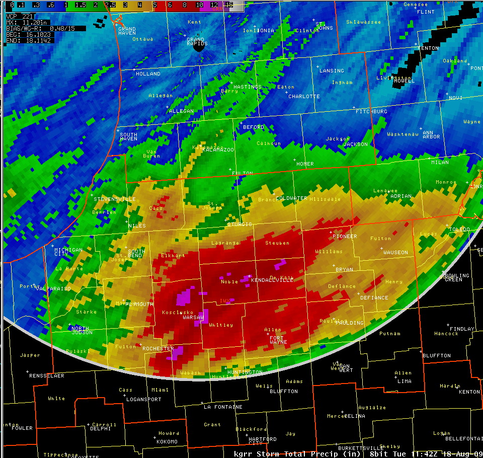
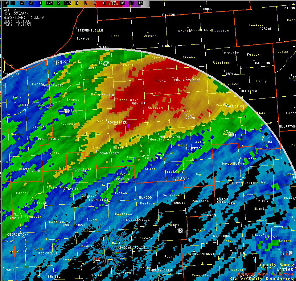
A stationary front was located from Kansas into the western Great Lakes. South of this front a weak, but persistent flow of deep moisture was flowing into northern Indiana. Several weak disturbances moved through the flow into the area, helping to enhance rainfall amounts and allow for the re-development of thunderstorms. These thunderstorms kept moving over the same areas with rainfall rates of 1 to locally as high as 3 inches per hour.
Radar Estimations of the Rainfall
 |
 |
 |
|
Radar Estimation for Northern Indiana (KIWX) |
Radar Estimation for Grand Rapids (KGRR) | Radar Estimation for Indianapolis (KIND) |
Three different perspectives are shown above of the WSR-88D rainfall estimation (Click pictures for larger views).
Rainfall reports from around the area
Our dedicated network of Cooperative Observers, CoCoRaHS, Spotters, Employees and Media Outlets gave us extensive reports, allowing us to get the warnings out for those affected and in danger of the rapidly rising water in some areas. Thanks to all that passed on reports!!!!
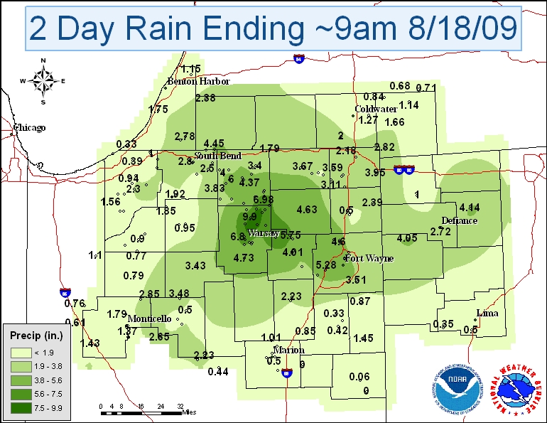
Above is a 2 day rainfall total map for the event. While the overall contours are averaged, you can still see where the heaviest rainfall occurred in northern Kosciusko county and southeastern Elkhart county. Click here for specific rainfall reports and locations used to create this map.
Damage and Flooding
Dry ground conditions allowed for rapid ponding and runoff of the initial rainfall, with numerous reports of high water as well as water ranging from six to twelve inches deep flowing over some roads. However, once the rainfall tapered off, the ground was quickly able to begin absorbing much of the much needed moisture with normally low areas continuing to see the ponding and some flowing water into the early morning hours of the 18th.
Fisher/Steinwedel/Logsdon

