Northern Indiana
Weather Forecast Office
Isolated severe thunderstorms raced east across portions of northeast Indiana and northwest Ohio, producing large hail and strong winds. Hail up to the size of golf balls was reported with severe thunderstorms in Wells county Indiana and Fulton county Ohio, while other large hail reports were received at various other locations. A strong upper level shortwave trough combined with a surface cold front supported the development of thunderstorms by late Wednesday afternoon. Pictures of some of the hail as well as radar images are located below.
 |
 |
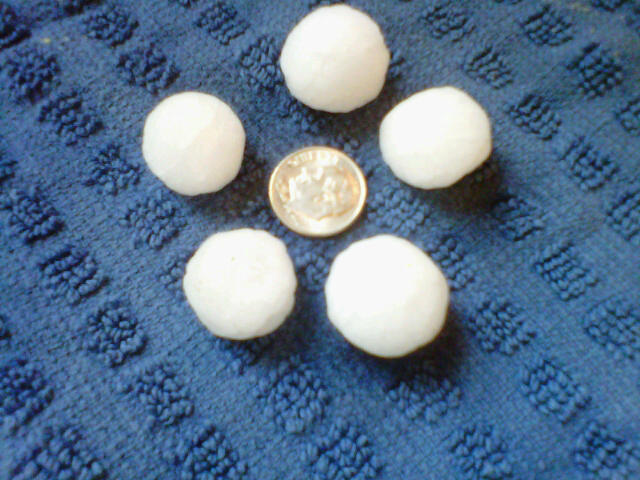 |
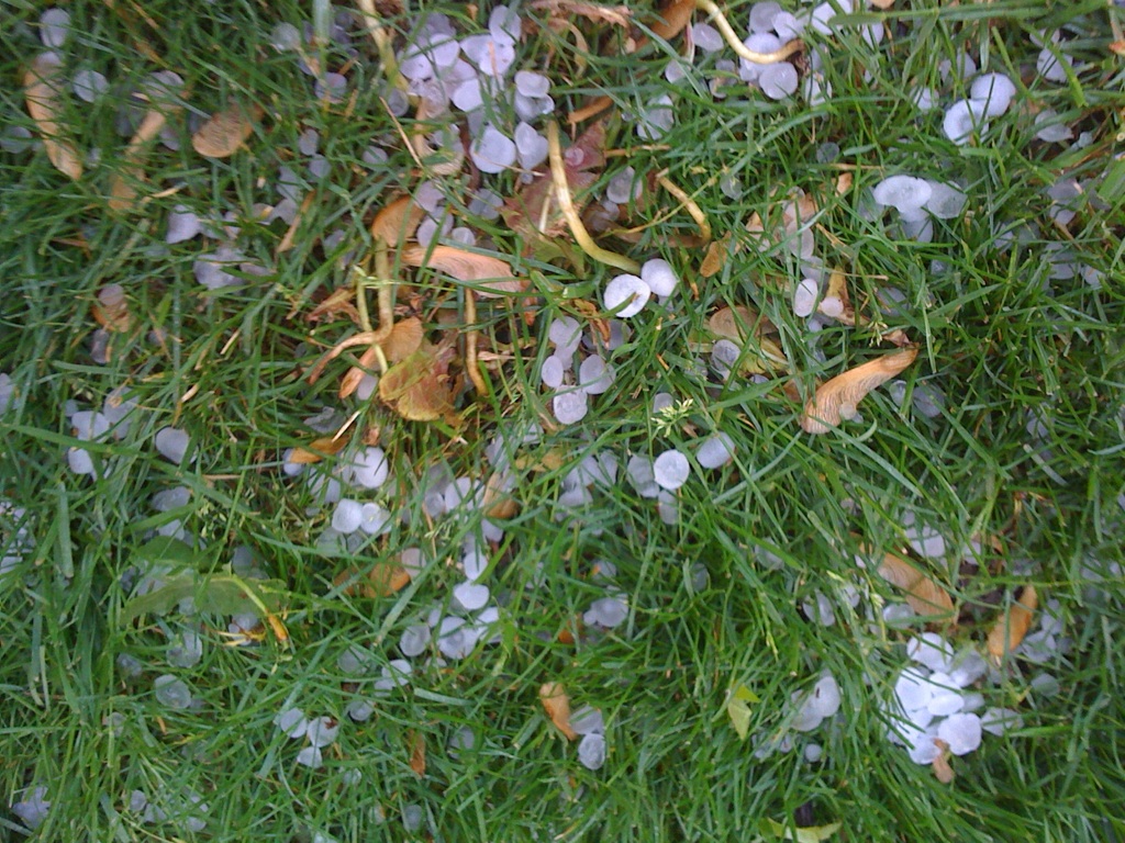
| Pea to penny size hail from Bluffton Courtesy WANE TV Fort Wayne. | Pea to penny size hail from Bluffton Courtesy WANE TV Fort Wayne. | Large hail from Warren Courtesy WANE TV Fort Wayne. |
 |
 |
 |
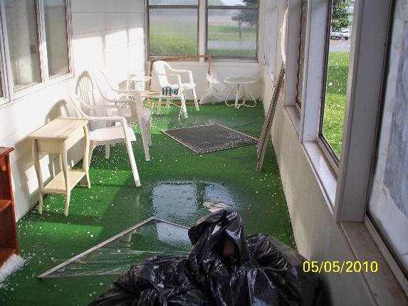 |
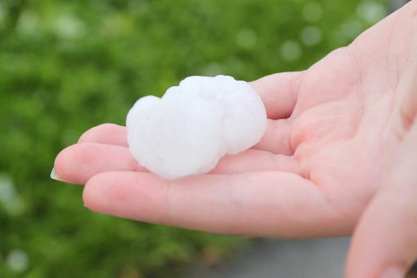
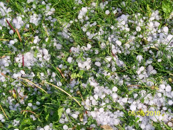
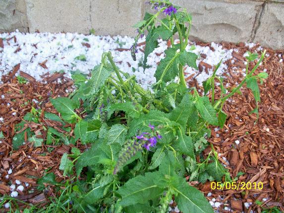
| Golf ball size hail from Bluffton Courtesy Indiana's News Center Fort Wayne. | Various size hail from Liberty Center Courtesy Indiana's News Center Fort Wayne. | Plant damage from hail in Liberty Center Courtesy Indiana's News Center Fort Wayne. | Porch windows blown out in Liberty Center Courtesy Indiana's News Center Fort Wayne. |
 |
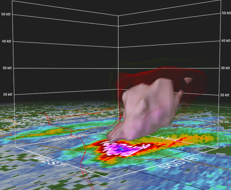 |
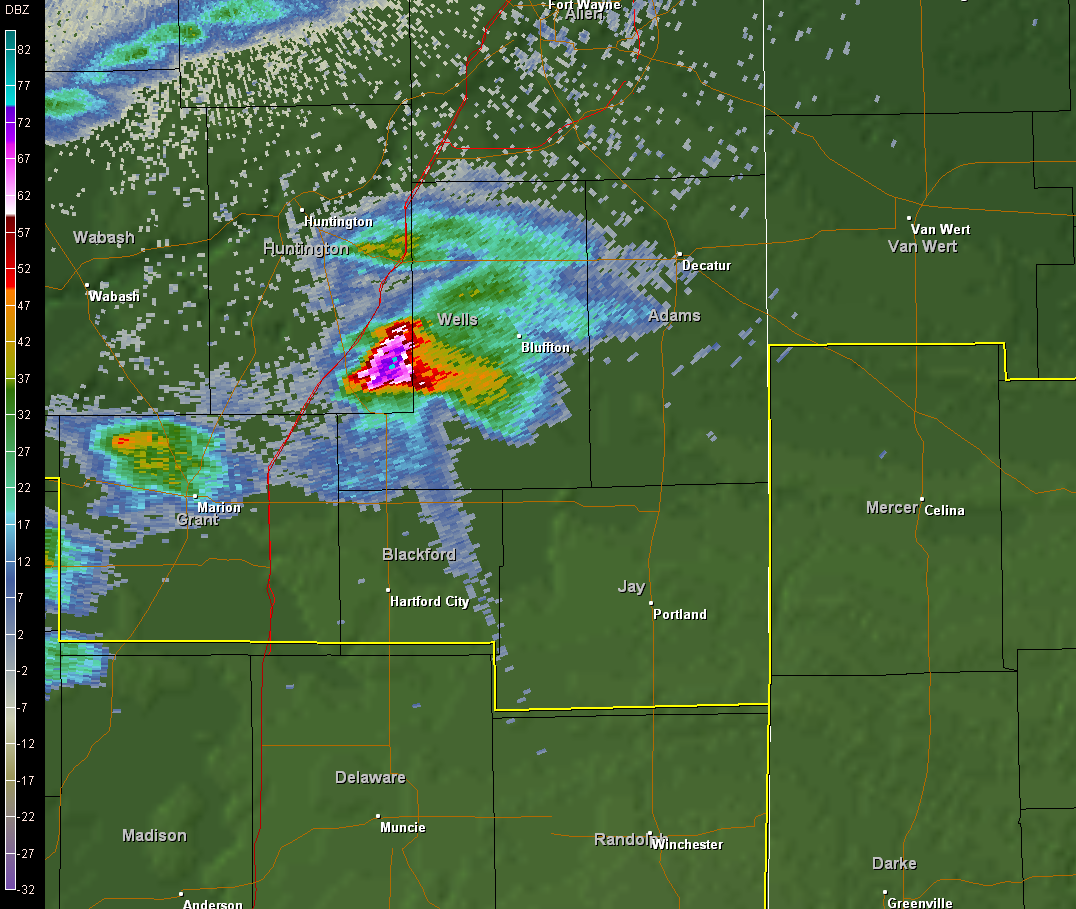
| Very large hail indicated on the KIWX Doppler Radar. Very large hail creates what is know as a "hail spike" in radar imagery. The spike is formed as the radar beam is deflected down to the ground and then back to the radar. The presence a spike is indicative of very large hail, in this case golf ball size hail. | A three dimensional view of the storm near Liberty Center shows how impressive core was on radar. The white/pink returns aloft was basically the location of the hail core aloft. |
Hazards
Heat Related
Winter Related
Watch/Warning
Outlook
Storm Reports
Storm Prediction Center
Submit a Report
Event Ready
Climate
FWA Daily
SBN Daily
FWA Monthly
SBN Monthly
CoCoRaHS
Spring Frost Climatology
Fall Frost Climatology
Severe Climatology
Local Information
Skywarn
COOP
Our Office
WSR-88D
Headline Criteria
NOAA Weather Radio
Weather History
Probabilistic Snowfall
Public Information Statement
Social Media Feeds
Weather Events Page
US Dept of Commerce
National Oceanic and Atmospheric Administration
National Weather Service
Northern Indiana
7506 E 850 N
Syracuse, IN 46567
574-834-1104
Comments? Questions? Please Contact Us.

