A strong upper level system developed over the south central Plains on the afternoon of Tuesday, April 19th. This helped to intensify a strong surface low pressure system over Missouri that moved northeast into central Indiana during the evening hours. A warm front extended east of the system center into Indiana which slowly moved north during the afternoon. However, the northward advance of the warm front was hindered by clouds and strong winds from earlier rain and thunderstorms and the front remained just south of the county warning area (CWA). This caused a large difference in temperatures on either side of the boundary (30s and 40s to the north, 60s to the south). More moisture was also present south of the warm front.
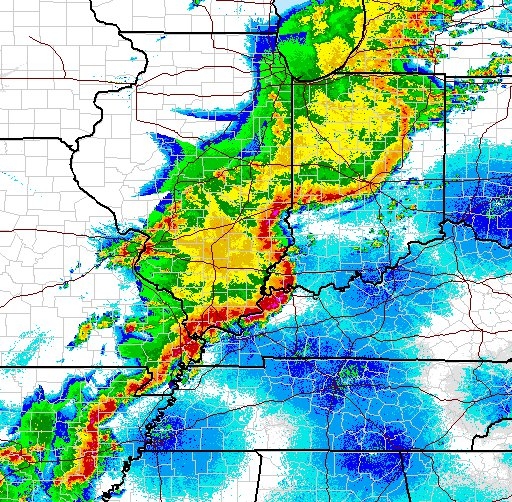
Storms, in the form of supercells, began to fire near the surface low in the afternoon in western Illinois and quicky merged a large line known as a LEWP (line echo wave pattern) with bowing segments. Below is a composite radar image as the storms progressed across the Midwest.
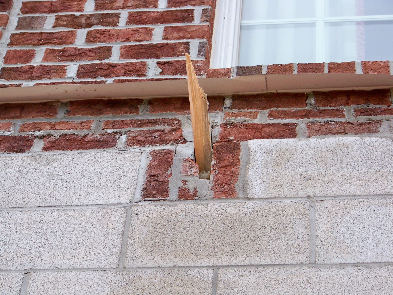
One of these bowing segments moved into the southwest portion of the CWA just before 10 PM EDT on the 19th and traveled across the entire southern portion of the CWA by the early hours of Wednesday, April 20th. Strong winds were mixing down to the surface, which is rare given that the surface warm front was well to the south and temperatures were in the 30s and 40s. Winds, in excess of 70 mph, were able to penetrate the very shallow cold layer at the surface (a temperature inversion) and caused significant wind damage as the storms rolled through the area. A temperature inversion typically acts like a lid separating two layers in the atmosphere. This counteracts downward transport of air from aloft, including higher momentum air from thunderstorm downdrafts. Typically, when an inversion is present, fast flow from thunderstorms will “reflect” off the inversion, with little influence to the surface winds. An inversion also significantly decreases the chances for a tornado, to near zero in many cases. However, on the 19th the inversion was much shallower than anticipated by forecasters (around 2100 ft as indicated on an aircraft sounding from Fort Wayne International Airport). As a matter of fact, while it was just 41 degrees F at the surface it was 67 degrees 2100 feet above the Fort Wayne Terminal. Hence, the very strong thunderstorm generated “jet cores” (in excess of 80 knots) were able to mechanically break through the inversion and produce damaging winds at the surface. Much of the damage was in the form of roofs that had blown off of sheds and barns destroyed. Damage surveys completed by IWX also found evidence of brief and isolated weak tornadoes.
Here is a radar reflectivity loop of the storms as they progressed across the IWX CWA.
Nearly all the tornadoes occurred very near or along the surface warm front, which lifted quickly north in response to a mesoscale area of low pressure associated with the thunderstorm complex moving through the area (see Warm Front Progression below). Cold NE low level flow (likely accentuated by the cold waters of the Great Lakes) was persistent through much of the day. Winds actually backed to the NE as strong surface pressure falls developed upstream over IL. The bowing thunderstorm complex that progressed through the area intersected the lifting warm front and supported a local high shear environment that was ingested by the line of thunderstorms. This stretched the ambient local shear allowing for brief “spin ups” within the line of storms, a much different tornado formation mechanism from a storm that contains a strong and deep rotating updraft or mesocyclone. This process is known as non-mesocyclone tornado formation. Each one of the tornadoes was very quick to develop and dissipate, lasting one radar volume scan or less (very typical of non-mesocyclone tornadoes). Non-mesocyclone tornadoes can be very hard to detect given the fact that they develop and occur very near the ground, below the radar beam in many cases. Hence, forecasters rely on mesoscale analysis and environmental conditions to anticipate the possibility of this type of tornado, which can be very challenging. Meteorologists will continue to study this event and similar events to help increase understanding of the environmental processes that lead to this type of tornado, all in an effort to increase detection and warning lead time in future events.
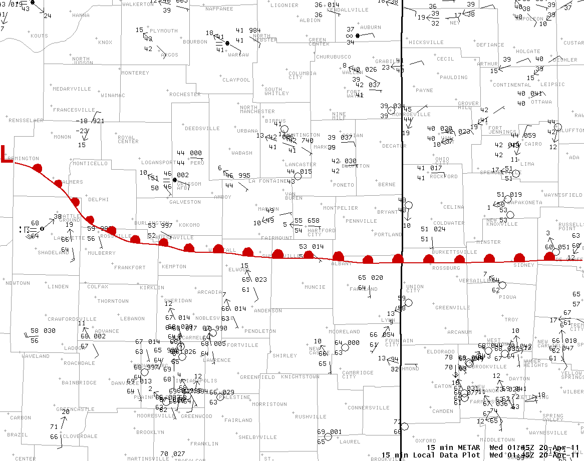
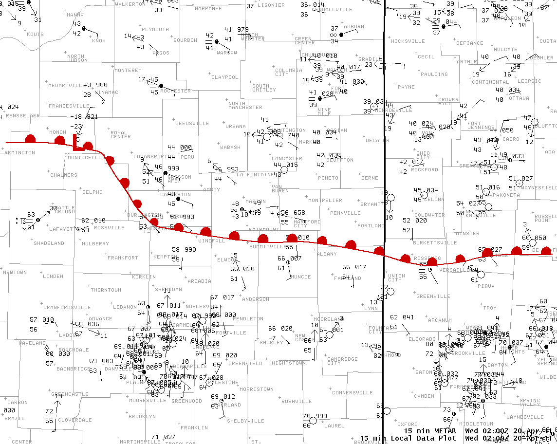
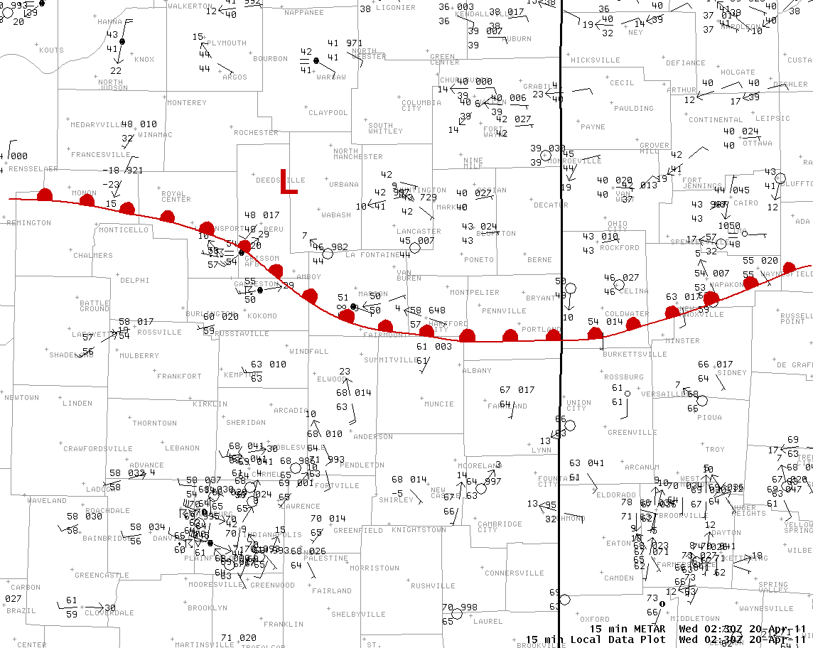
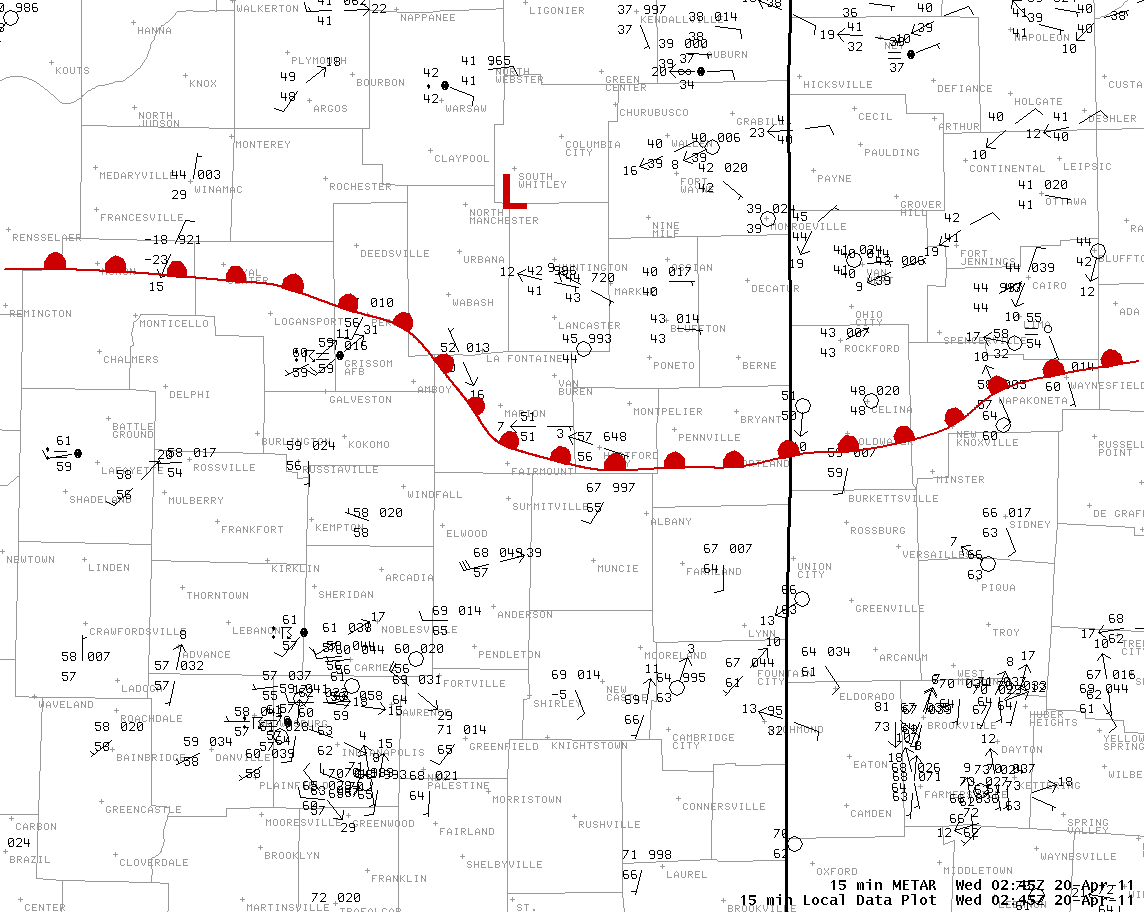
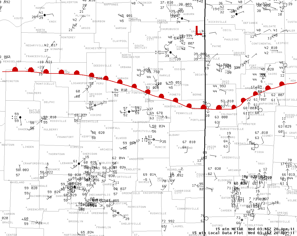
Warm frontal analysis. Low pressure symbol indicates approximate position of the thunderstorm complex generated mesoscale low pressure center.
Warm Front Progression
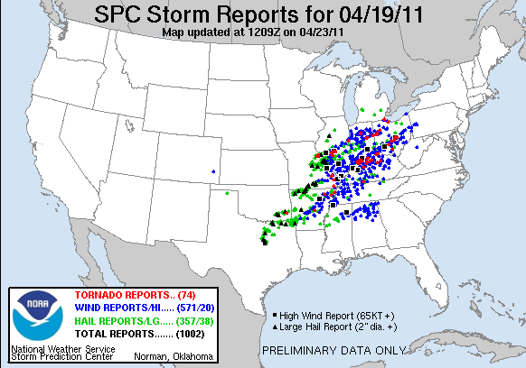
Below is an image of all the storm reports across the Midwest as the system moved east.
AN EF0 TORNADO OCCURRED JUST WEST OF THE CITY OF VAN WERT IN VAN
WERT COUNTY WITH ESTIMATED WINDS OF 80 TO 85 MPH. THIS BRIEF TORNADO
TOUCHED DOWN NEAR THE INTERSECTION OF LIBERTY ROAD AND TOWNSHIP
HIGHWAY 140 AND CONTINUED NORTHEAST FOR 1/2 MILE CROSSING THE
INTERSECTION OF SR 224 AND LINCOLN HIGHWAY BEFORE DISSIPATING.
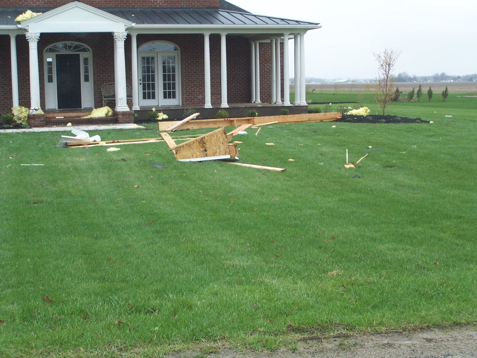
ONE HOME SUFFERED EXTENSIVE STRUCTURAL DAMAGE INCLUDING SIGNIFICANT
LOSS OF ROOFING MATERIAL AND COMPLETE DESTRUCTION OF ATTACHED PORCH
WITH DEBRIS INCLUDING 2X4 LUMBER SCATTERED TO THE NORTHEAST FOR 300
YARDS WITH SEVERAL EMBEDDED INTO THE GROUND. IN ADDITION SEVERAL
PINE TREES ON THE PROPERTY WERE SNAPPED.
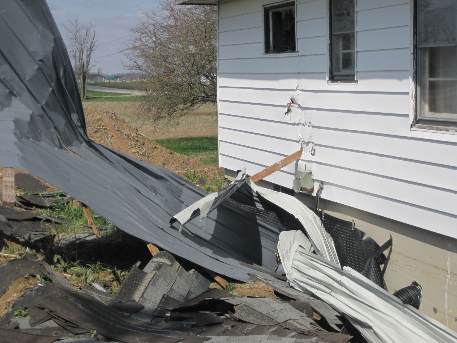
AN EF1 TORNADO OCCURRED IN VAN WERT COUNTY OHIO AND CONTINUED INTO
ALLEN COUNTY OHIO. THIS TORNADO HAD AN APPROXIMATE PATH LENGTH OF 4
MILES AND MAXIMUM WIDTH OF 100 YARDS AND WAS EMBEDDED WITHIN A
LARGER 1/2 MILE SWATH OF MICROBURST WIND DAMAGE. WINDS WERE
ESTIMATED TO BE IN THE 100 TO 105 MPH RANGE WITHIN THE TORNADO AND
UP TO 75 MPH IN THE MICROBURST. THIS TORNADO BEGAN SOUTH OF MONTICELLO NEAR
THE VAN WERT/AUGLAIZE COUNTY BORDER AND ENDED TO THE NW OF
SPENCERVILLE IN ALLEN COUNTY OHIO. DAMAGE WAS OBSERVED TO MULTIPLE
STRUCTURES INCLUDING SHEDS AND POLE BARNS THAT WERE DESTROYED AND
TWO HOUSES. DEBRIS WAS CARRIED UP TO A MILE AWAY.
...ALLEN COUNTY OHIO...
AN EF1 TORNADO OCCURRED IN ALLEN COUNTY OHIO WITH ESTIMATED WINDS OF
95 TO 100 MPH. THE BRIEF TORNADO HAD A PATH LENGTH OF ONE HALF MILE
AND WAS APPROXIMATELY 100 YARDS WIDE. THE TORNADO BEGAN IN A FIELD
JUST SOUTHWEST OF THE INTERSECTION OF HILLVILLE ROAD AND STATE ROAD
65...AND TRAVELED NORTHEAST TO THE RAILROAD TRACKS NORTH OF
HILLVILLE ROAD. SUBSTANTIAL DAMAGE TO A HOMESTEAD WAS OBSERVED
INCLUDING THE LOSS OF THE ROOF AND COMPLETE DESTRUCTION OF A BARN.
LARGE PINE TREES WERE SNAPPED AT THE BASES. DEBRIS WAS FOUND
SCATTERED IN THE FIELD UP TO A HALF MILE AWAY. A TRAILER AND
OTHER LARGE TREES WERE TOPPED AT A LOCATION ACROSS THE STREET. NEAR
THE RAILROAD...NUMEROUS TREES WERE TOPPED.
AN EF1 TORNADO OCCURRED IN JAY COUNTY WITH ESTIMATED WINDS OF 90 TO
95 MPH. THIS TORNADO SKIPPED ALONG A PATH OF ALMOST 7 MILES WITH A
MAXIMUM WIDTH OF 50 YARDS. THE TORNADO DAMAGE WAS EMBEDDED WITHIN AN
AREA OF STRAIGHT LINE WIND DAMAGE THAT WAS ABOUT 4 MILES WIDE.
THIS EF1 TORNADO BEGAN NORTH OF ANTIVILLE AND ENDED NORTH AND EAST
OF THE INTERSECTION OF 550 E AND 800 N...ABOUT 1.5 MILES SOUTH
SOUTHWEST OF JAY CITY. THE TORNADO WAS NOT ON THE GROUND
CONTINUOUSLY ALONG THIS PATH...BUT EF1 DAMAGE WAS OBSERVED AT
MULTIPLE LOCATIONS. THERE WERE 5 UTILITY POLES SNAPPED NEAR
ANTIVILLE WITH POWER FLASHES OBSERVED WHERE THE TORNADO BEGAN.
NUMEROUS TREES WERE ALSO SNAPPED NORTHEAST OF THIS LOCATION AS WELL
AS A HOME WITH A GARAGE THAT WAS COMPLETELY DESTROYED ALONG WITH A
SMALL BARN AND POLE BUILDING. PART OF THIS EF1 DAMAGE AND DEBRIS WAS
LIFTED AND DEPOSITED 1.5 MILES AWAY. ANOTHER HOUSE ALSO SUSTAINED
EF1 DAMAGE WHERE ANOTHER GARAGE WAS DESTROYED.
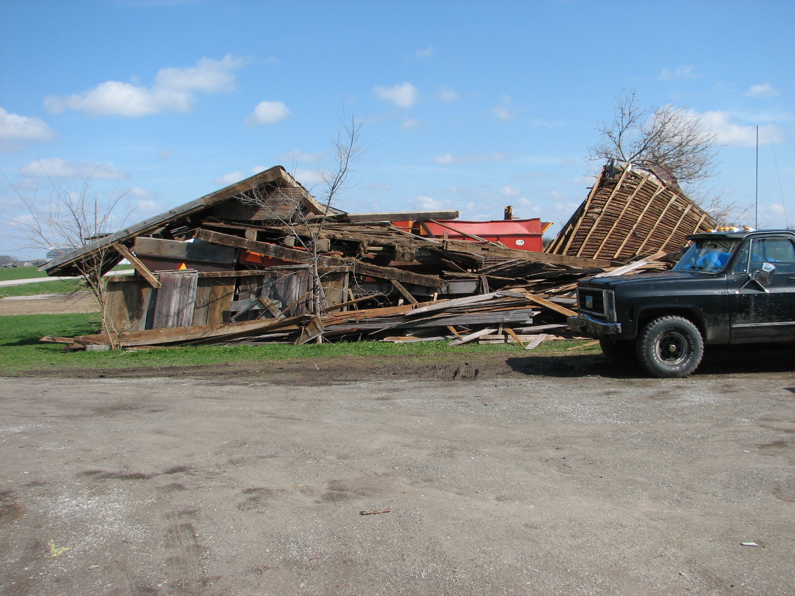
A SEVERE THUNDERSTORM PRODUCED A MICROBURST IN NORTHERN CASS COUNTY
WITH SPORADIC WIND DAMAGE. WITHIN THIS PATH OF STRAIGHTLINE WIND
DAMAGE WERE TWO LOCATIONS OF MORE SUBSTANTIAL DAMAGE WITH SIGNS OF
ROTATION. IT WAS DETERMINED THAT THIS DAMAGE WAS THE RESULT OF GUSTNADOES
ON THE LEADING EDGE OF THE GUST FRONT. WIND SPEEDS WERE DETERMINED TO BE
IN THE 65 TO 75 MPH RANGE. DAMAGE WAS OBSERVED BETWEEN ADAMSBORO AND
TWELVE MILE WHERE A BARN WAS DESTROYED. DEBRIS WAS BLOWN AND LIFTED ONE
EIGHT OF A MILE TO THE NORTH. DAMAGE ALSO OCCURRED
NORTHEAST OF THIS LOCATION ABOUT FIVE MILES. A TV ANTENNA NEXT TO A
HOUSE WAS COMPLETELY BENT TO THE GROUND AND A SMALL OUTBUILDING WAS
SHIFTED OFF ITS FOUNDATION AND THE ROOF WAS REMOVED AND CARRIED INTO
A FIELD.
DAMAGE FOUND IN GRANT COUNTY INDICATES TWO EF1 TORNADOES OCCURRED.
THE FIRST TORNADO WAS RATED AT HIGH END EF1 AND PRODUCED A DAMAGE
PATH LENGTH OF 2.5 MILES AND HAD A MAXIMUM WIDTH OF 150 YARDS. THIS
TORNADO BEGAN ABOUT 2 MILES WEST SOUTHWEST OF FAIRMOUNT. WINDS WITH
THIS TORNADO WERE ESTIMATED TO BE 105 TO 110 MPH. THE TORNADO
TOUCHED DOWN AT A HOUSE AT ON S 200 W. HOUSE SIDING WAS
STRIPPED...WINDOWS BROKEN AND A ROOF COMPLETELY REMOVED FROM THE
BACK SIDE OF THE HOME. DEBRIS WAS CARRIED TO THE NORTHEAST INTO A
FIELD. SEVERAL OTHER HOUSES TO THE NORTHEAST SUSTAINED SIMILAR
DAMAGE ALONG THE PATH OF THIS TORNADO.
THE SECOND TORNADO WAS RATED AS A LOW END EF1 WITH WIND SPEEDS
ESTIMATED TO BE 90 TO 95 MPH. THIS STORM ALSO HAD A LENGTH OF ABOUT
2.5 MILES AND A WIDTH OF 50 YARDS. THIS TORNADO OCCURRED ROUGHLY 3
MILES SOUTHWEST OF UPLAND AND ENDED JUST WEST NORTHWEST OF UPLAND. A
COUPLE HOMES SUSTAINED DAMAGE ALONG WITH HARDWOOD TREES BEING
SNAPPED.
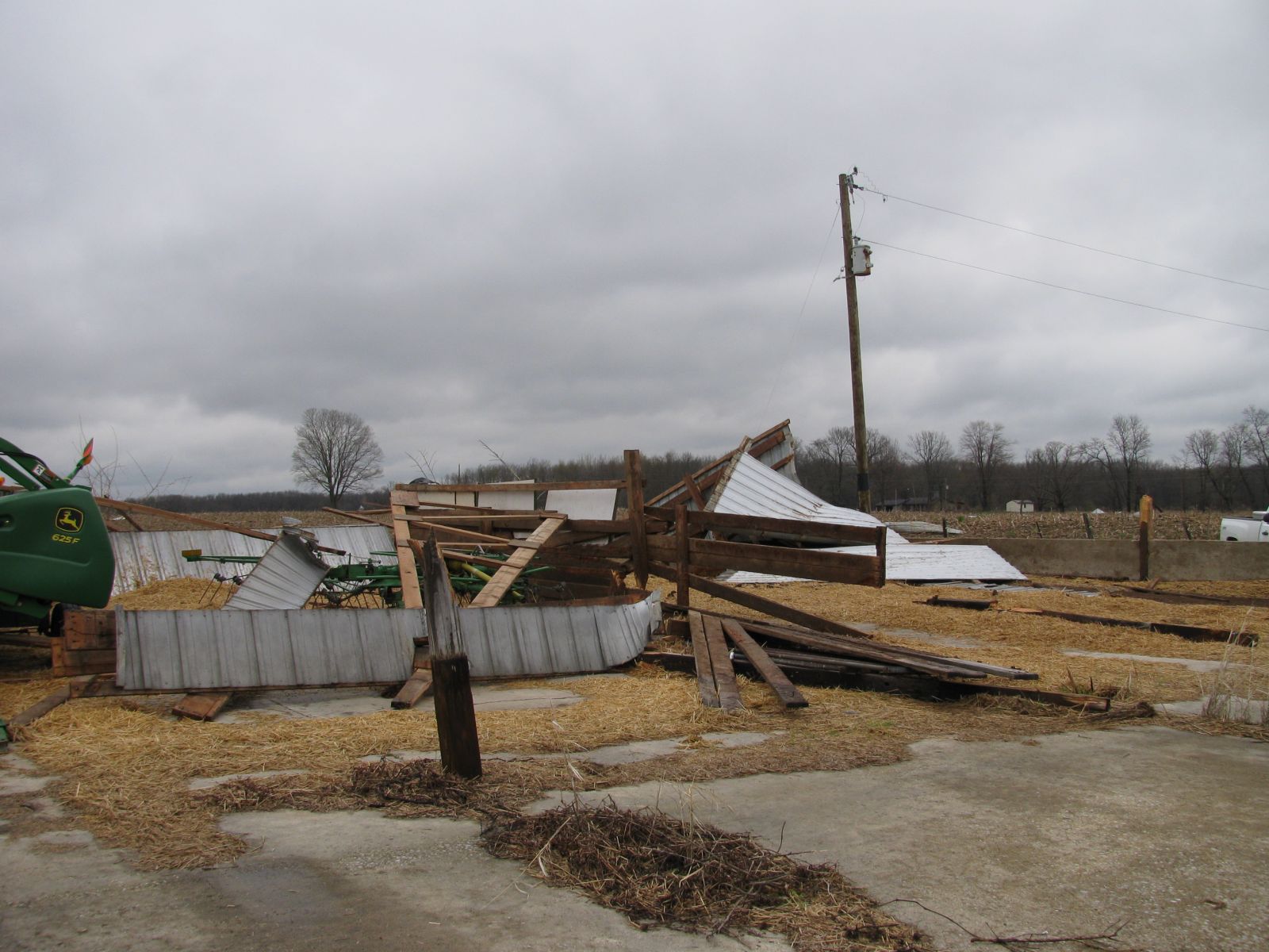
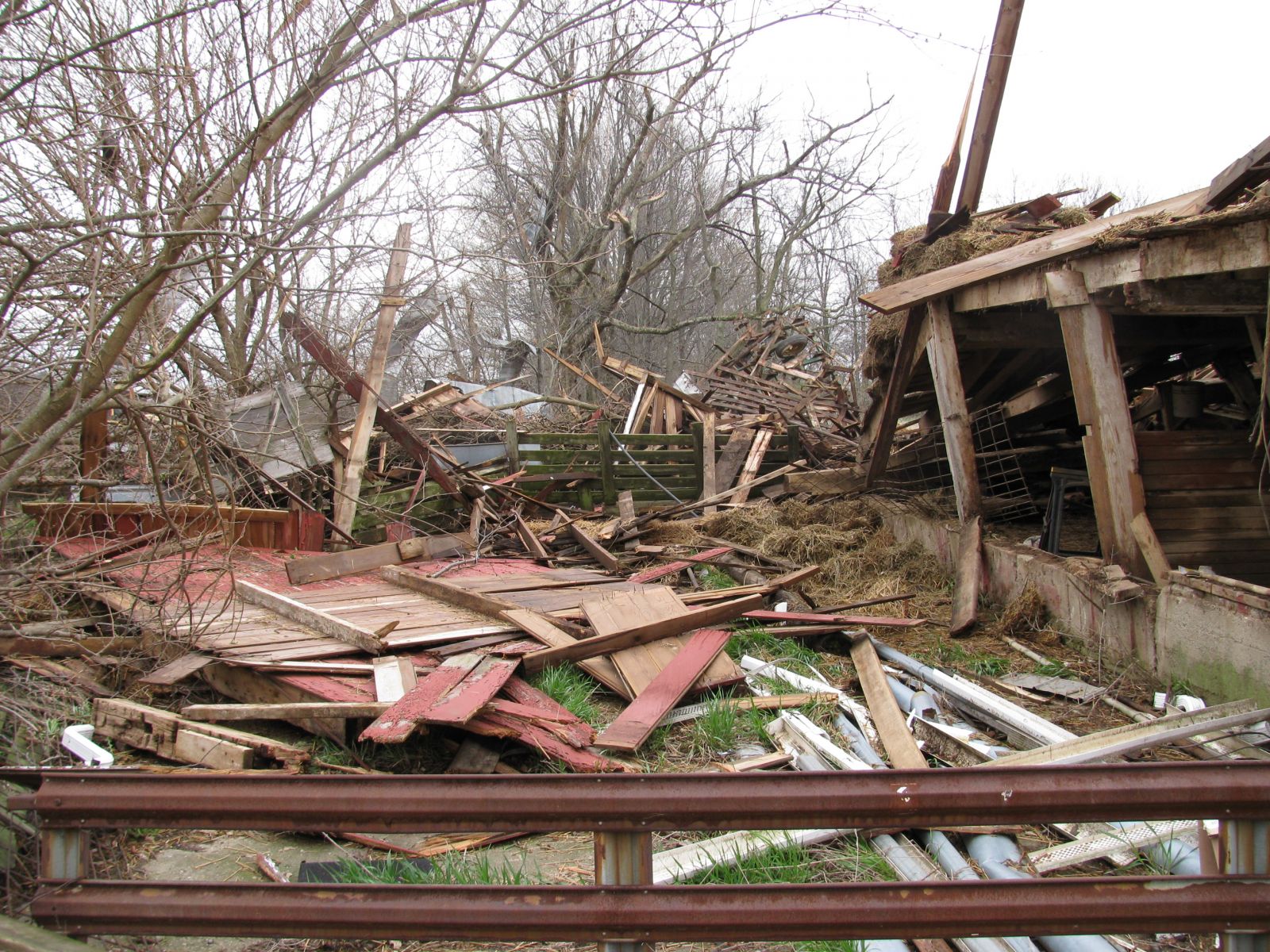
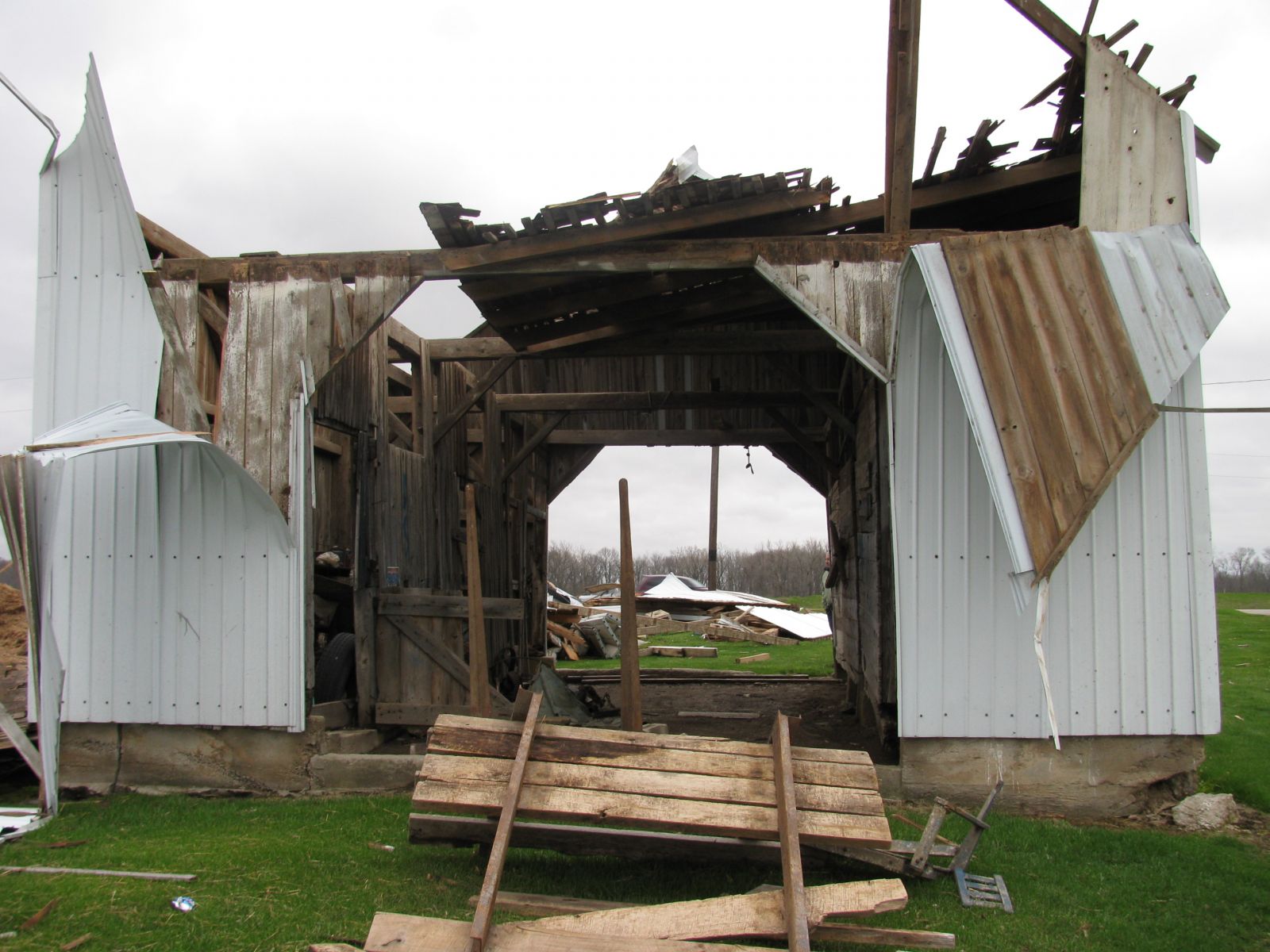
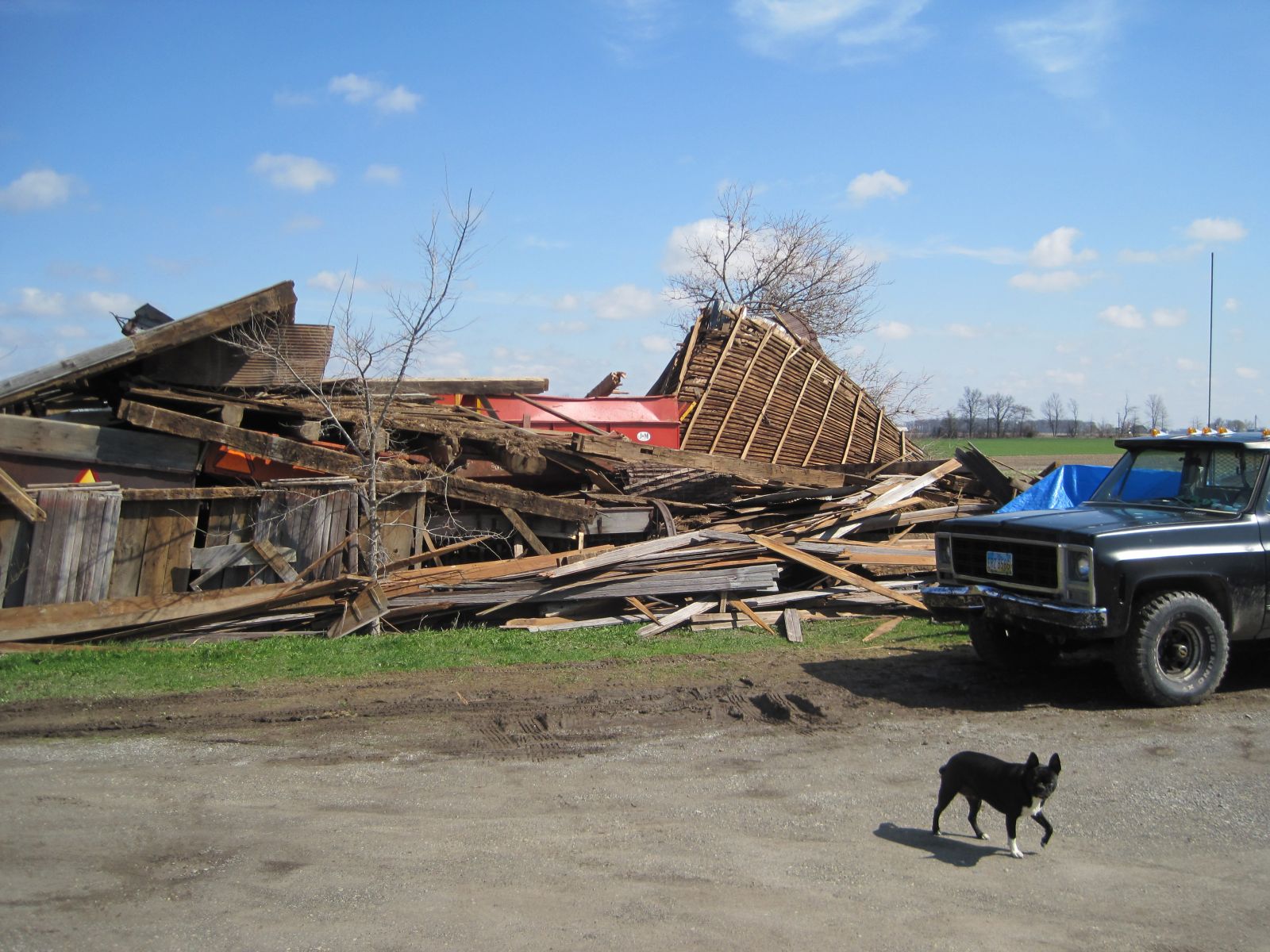
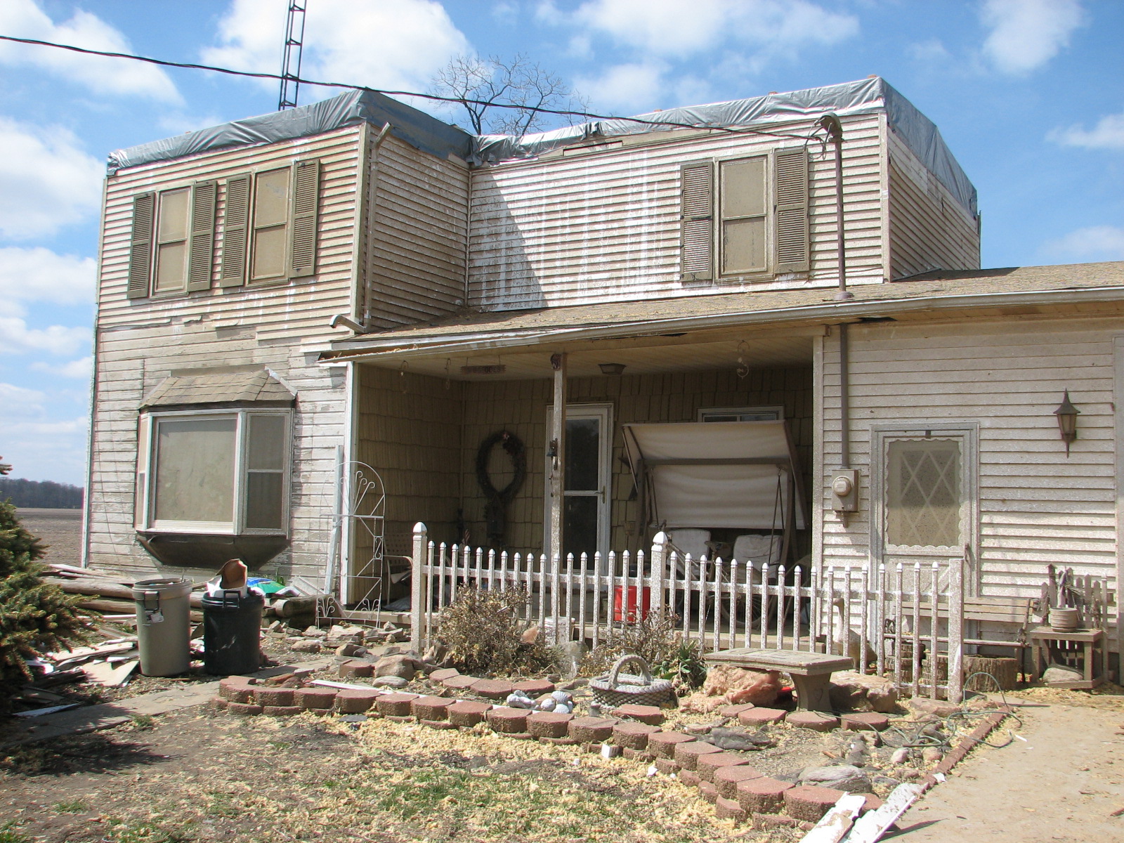
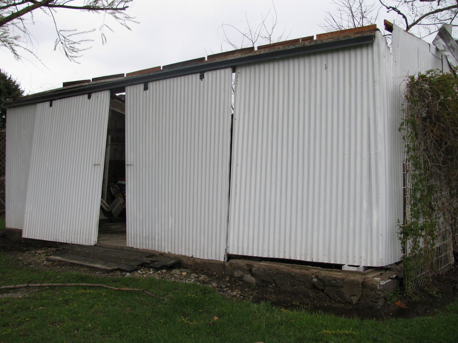
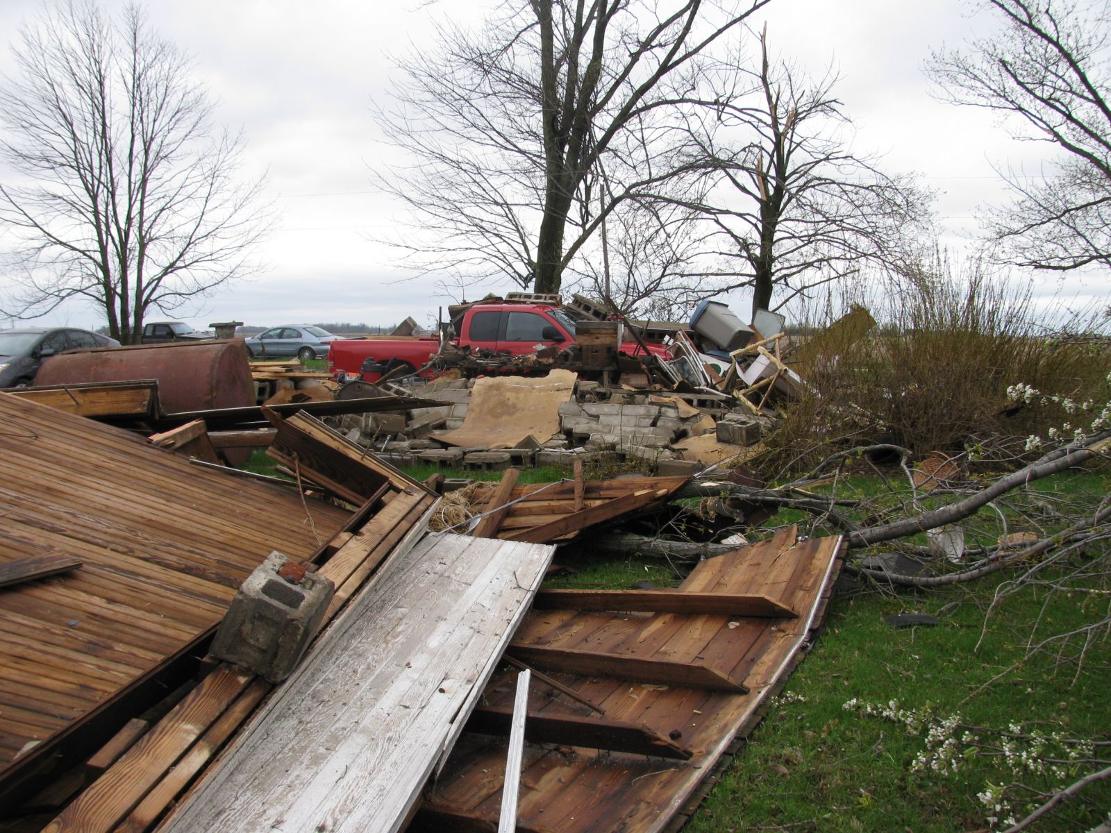
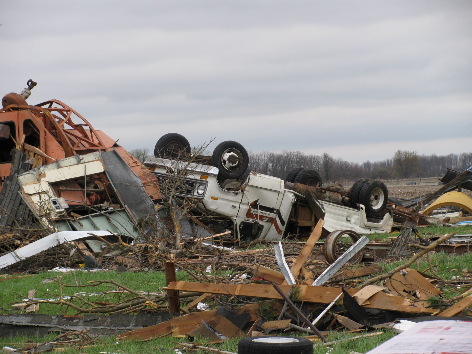
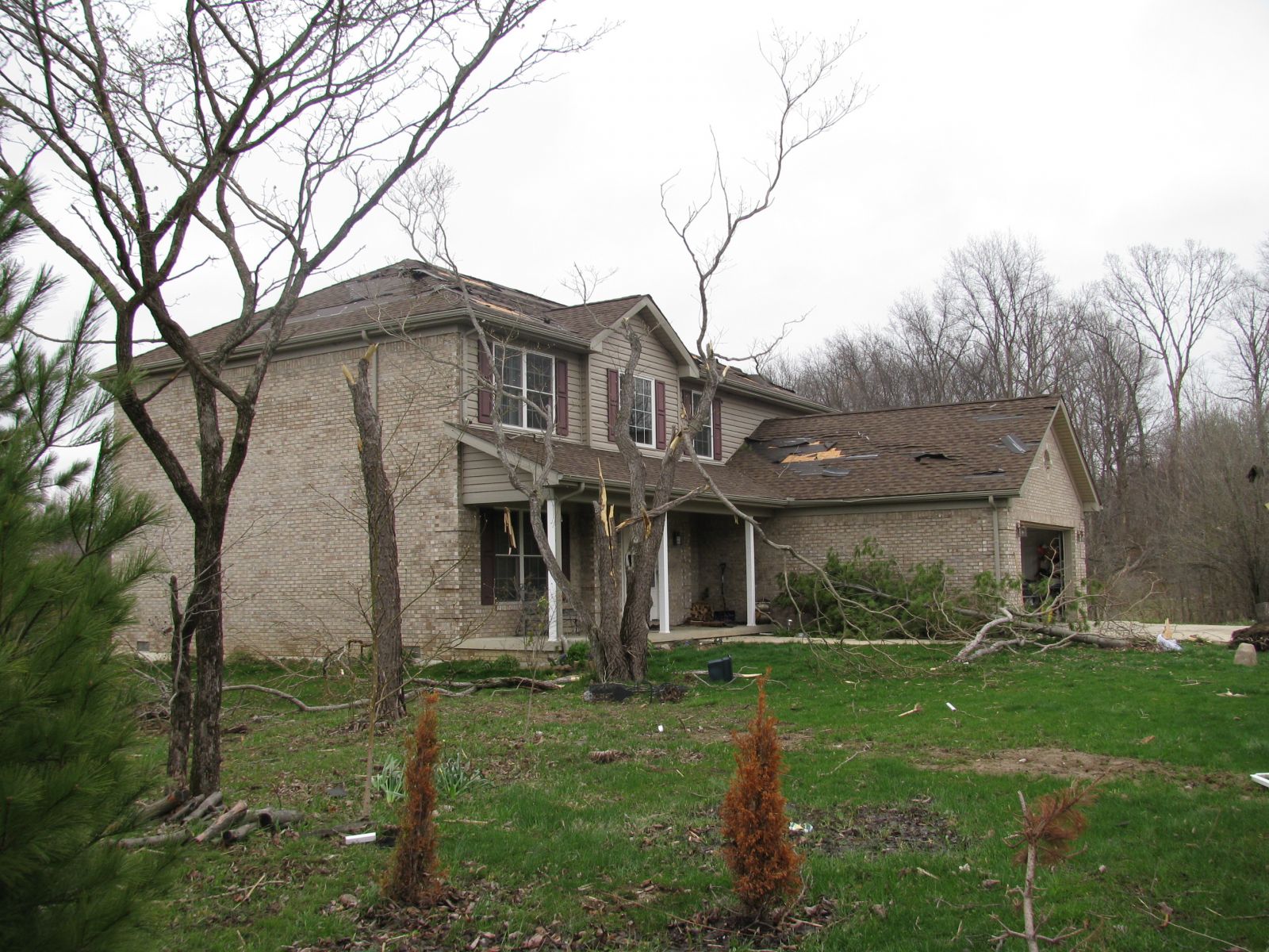
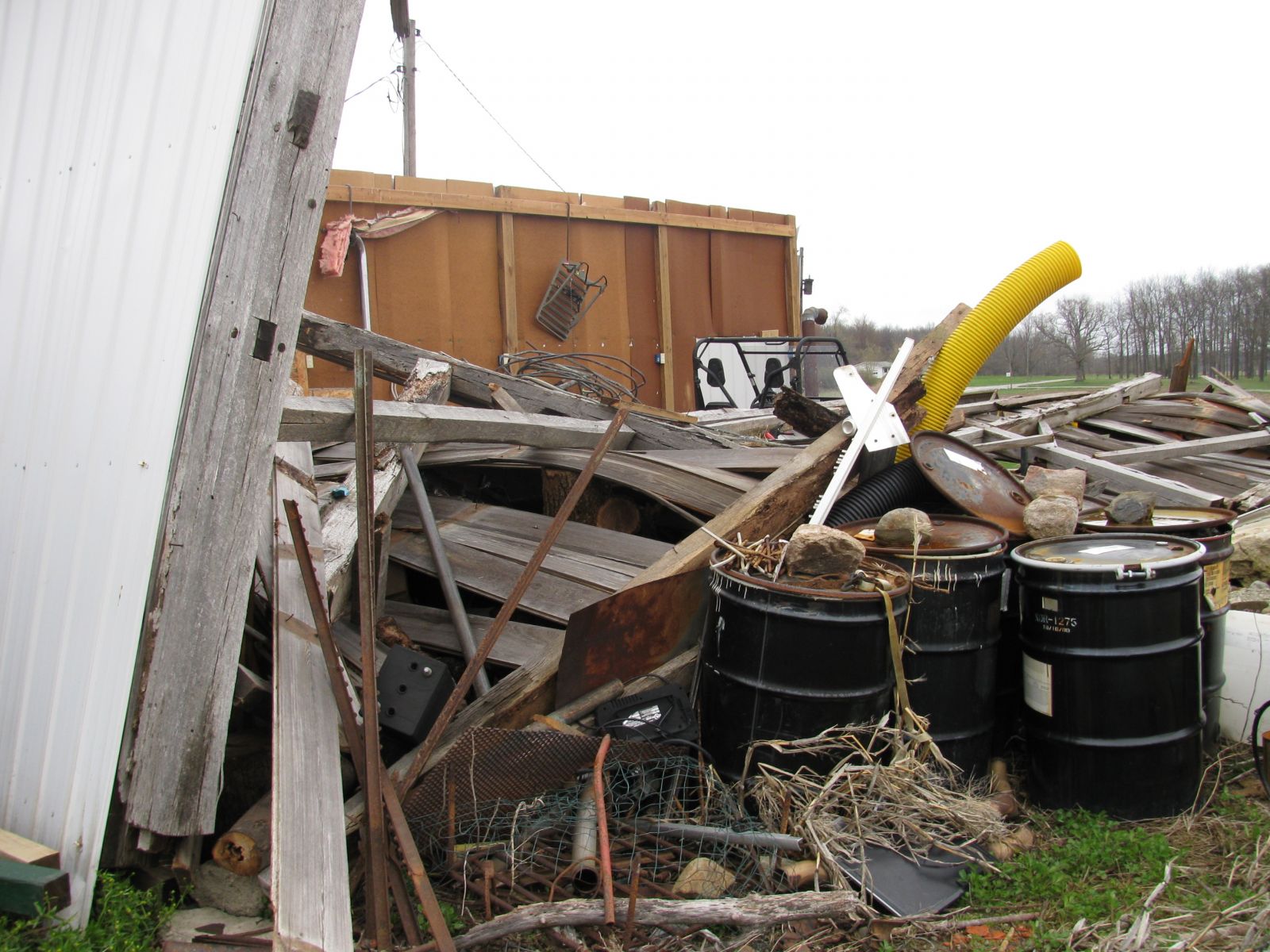
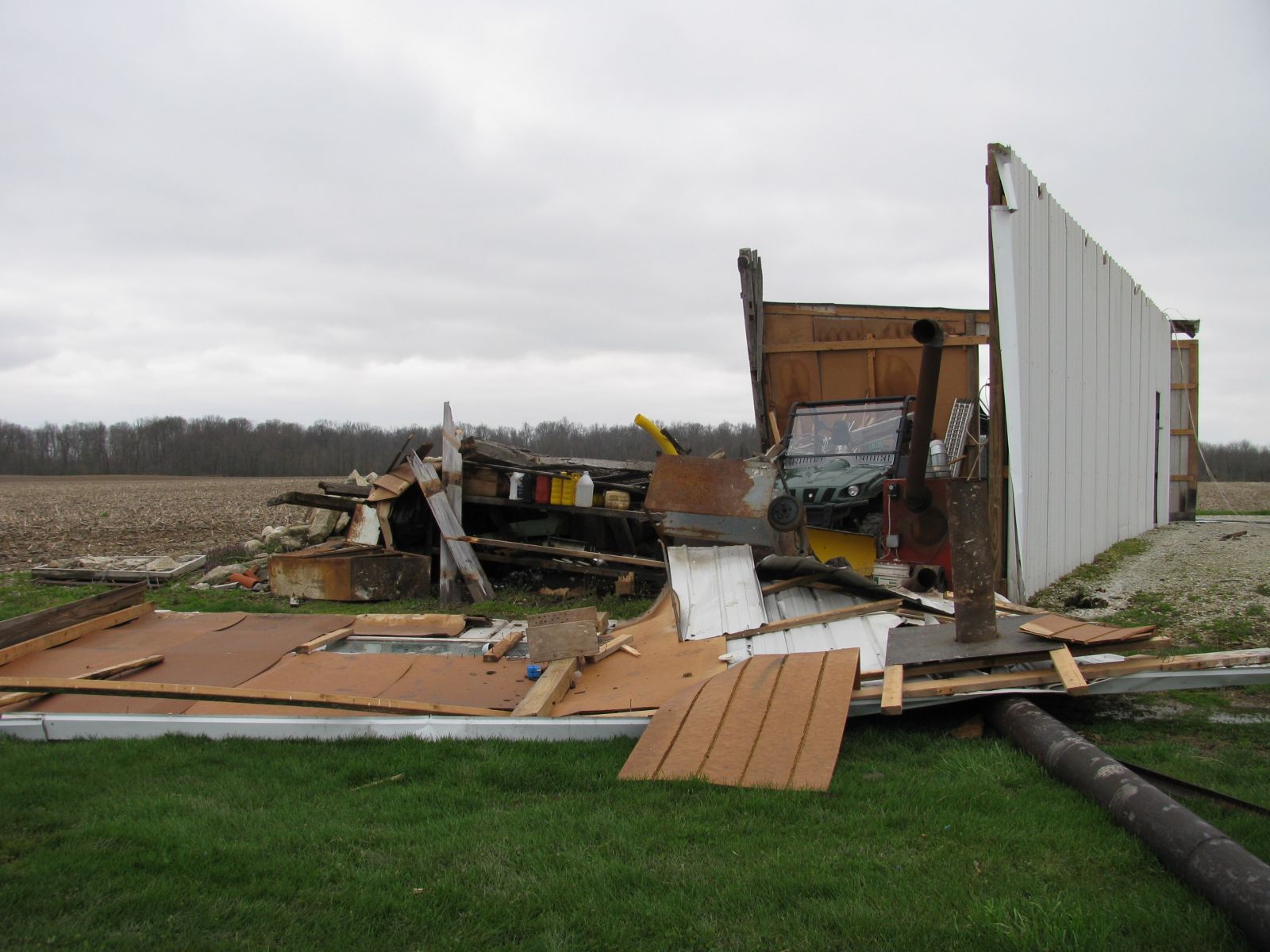
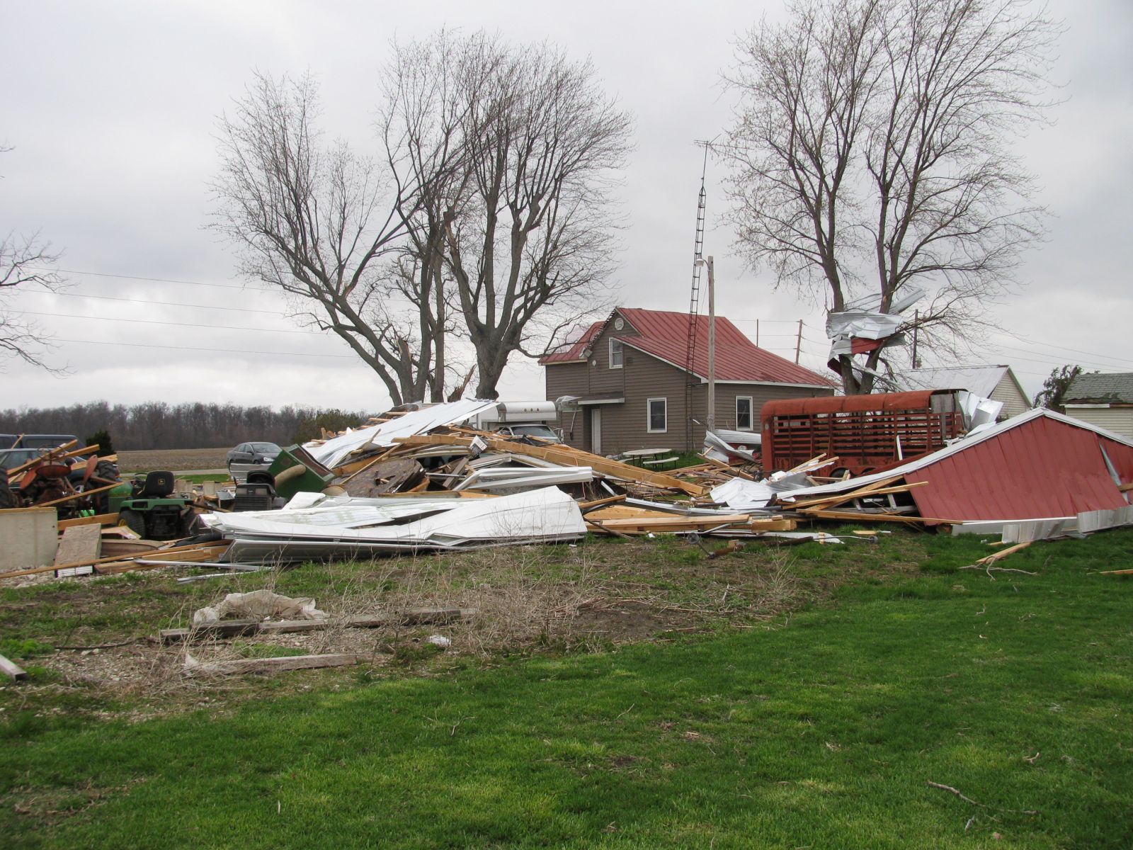
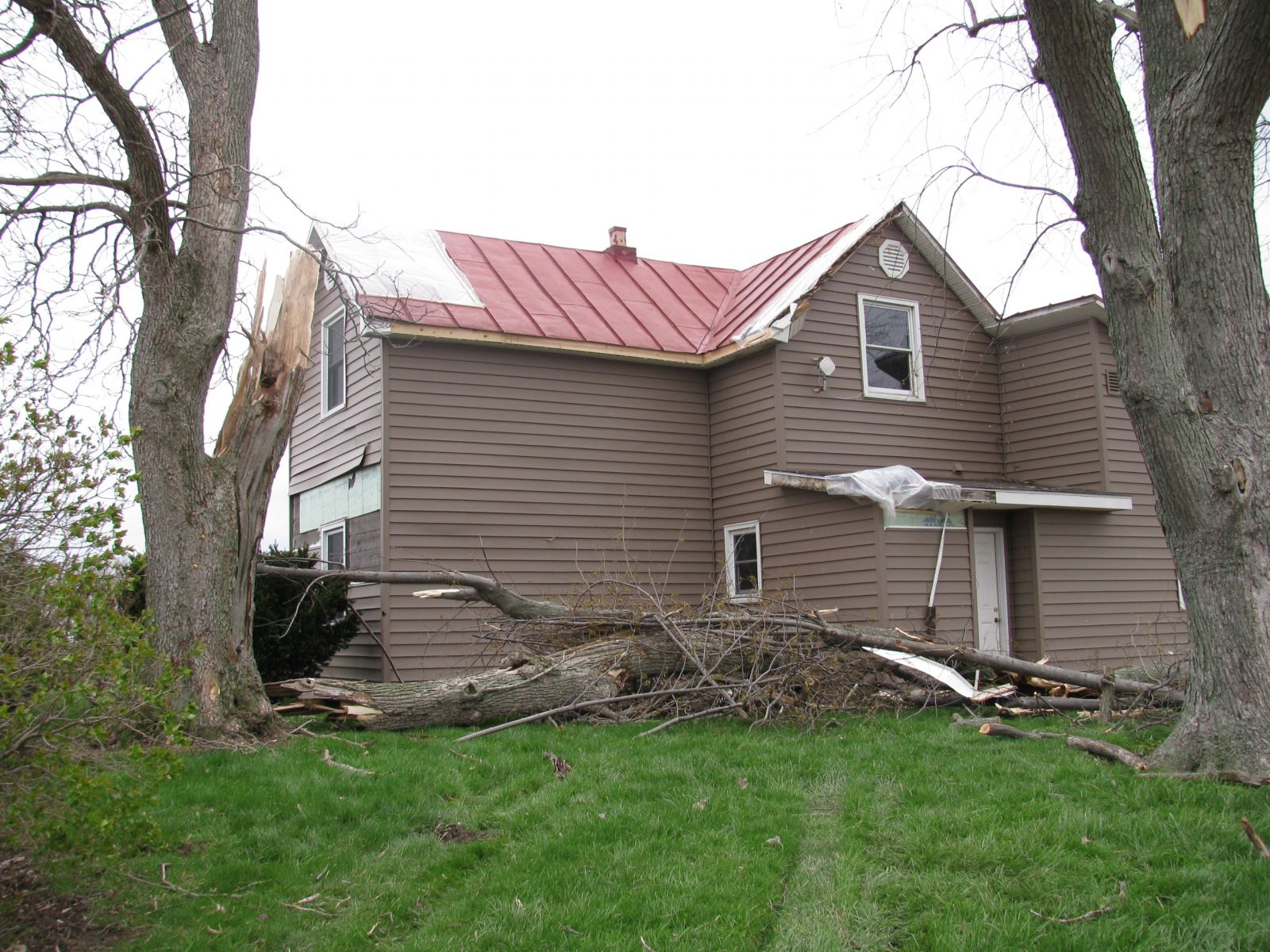
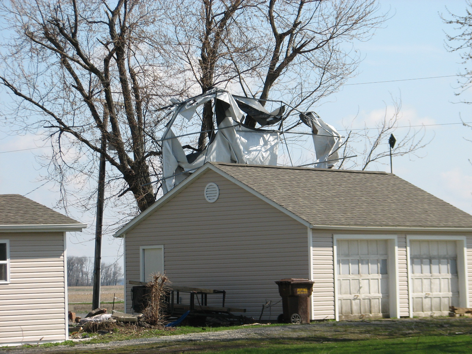
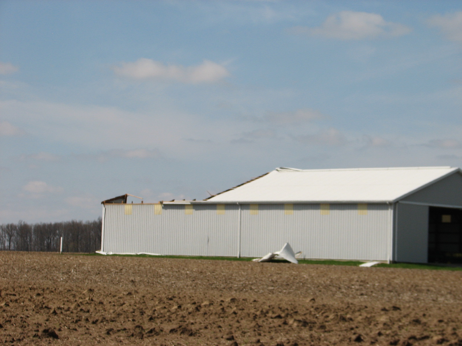
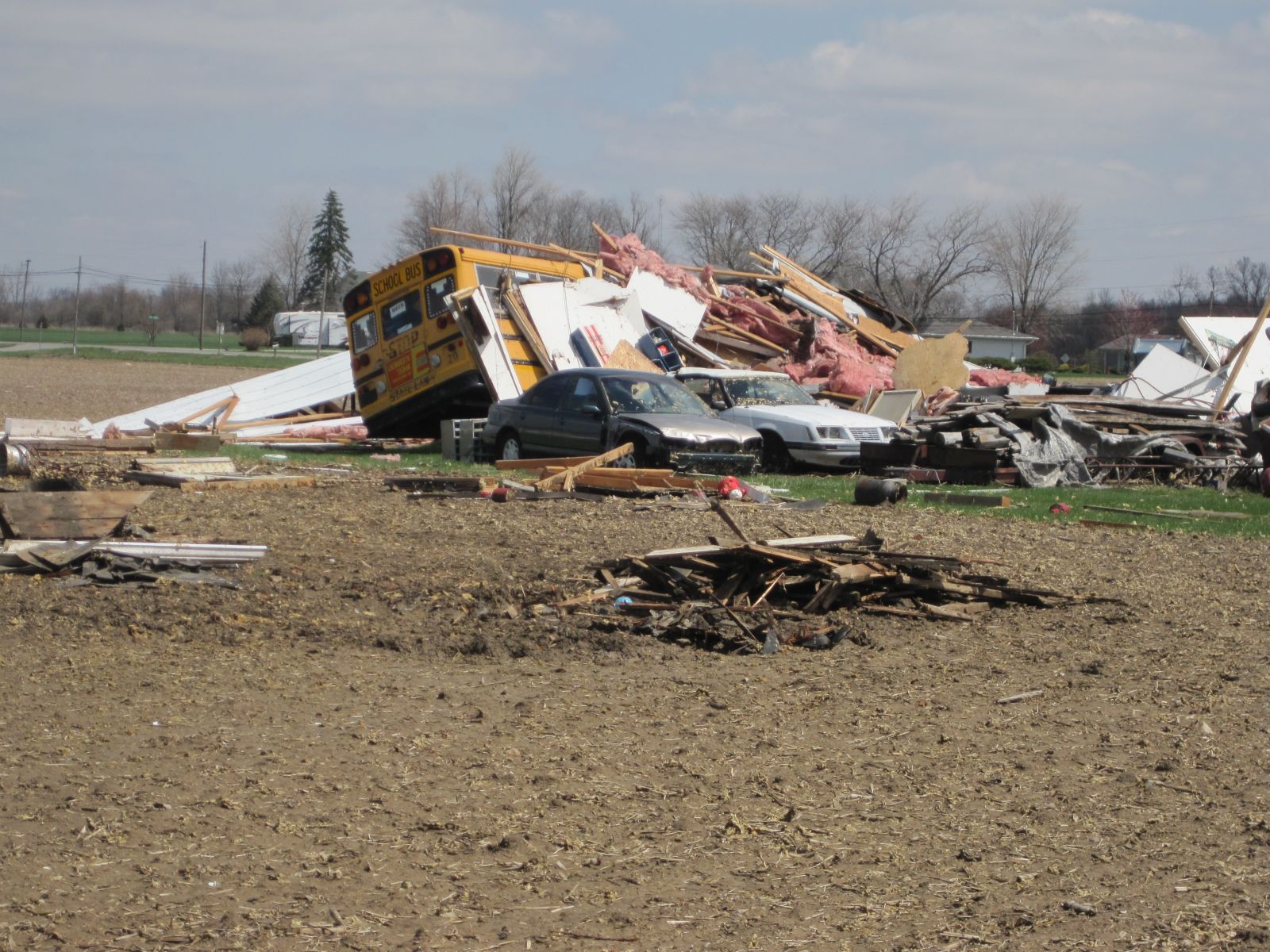
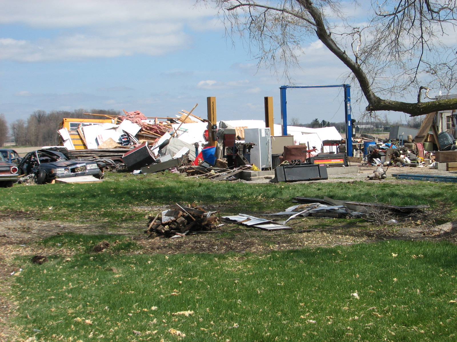
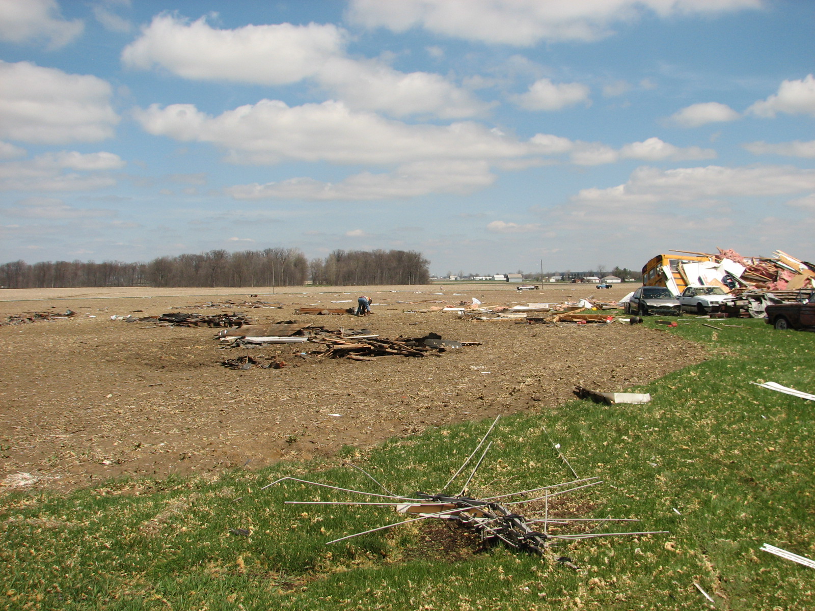
Storm Damage Photos:
Cass County Indiana
Grant County Indiana
Jay County Indiana
Van Wert County Ohio
Van Wert County to Allen County Ohio
Allen County Ohio
(Click on an image for more photos from each county.)


