Summary:
|
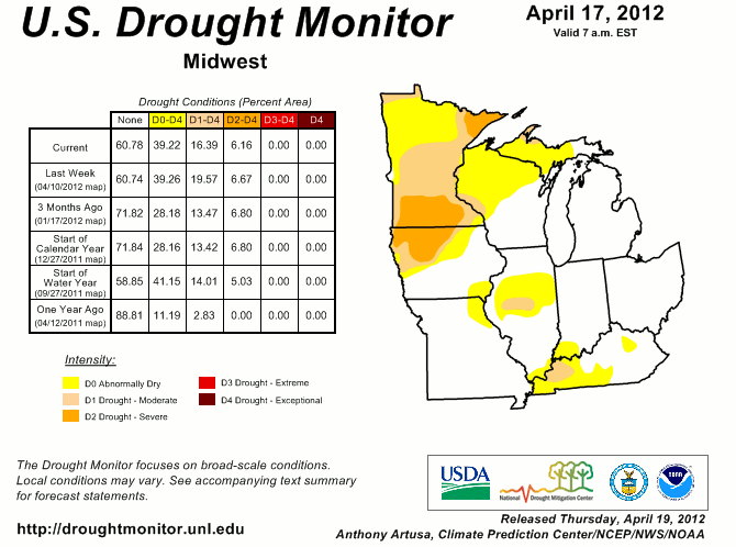
| Most locations across the area ended the winter season of 2011-2012 with near normal precipitation and below normal snowfall. This led to below normal snowmelt which usually adds a fair amount of moisture to the soil prior to the growing season. March was characterized by much above normal temperatures (record-breaking warmth, in fact) which led to above normal evapotranspiration and an early start to the growing season. This combined with lack of snowmelt in the winter led to abnormally dry conditions which developed across the region by the middle of April. Given much below normal rainfall in April and May, topsoil preconditioned for drought, and already low streamflow across area streams, rivers, and lakes, drought conditions developed across the local area and Midwest region by May. With high pressure remaining in control outside of some fast-moving low pressure systems, dry weather ruled the summer months. Record-breaking heat combined with the lack of substantial precipitation brought on devastating drought conditions to the region. By the middle of July, all of the local area was entrenched in at least D2 or severe drought conditions with a large portion of the area in D3 or extreme drought conditions (on a scale from D0 to D4 drought severity). These conditions lasted until the middle of August as the atmospheric pattern became more active and some improvement in drought conditions occurred.
As fall began, a series of low pressure systems and accompanying strong cold fronts moved across the eastern half of the US. The Great Lakes region and the Ohio Valley received beneficial rainfall from these frontal passages. This rainfall combined with below normal temperatures lead to notable improvements in drought conditions from September into October. By the end of October, only a small portions of northeast Indiana was left in D1 or moderate drought conditions with the rest of the local area in D0 or abnormally dry conditions. However, as the fall season wore on, the weater pattern began to revert back to a dry pattern. Rainfall events were far and few between in November and precipitation for the month was well below normal. Drought conditions began to reappear and many streams, rivers, and lakes were back to the low levels seen earlier in the year. Several systems toward the end of November and into December produced widespread rainfall across the area, but it was not enough to erase or ease long-tern deficits. The year ended with most of the area in D0-D1 drought conditions. |
Animation of U.S. Drought Monitors (April - December):
|
|
|
Month by Month Precipitation Totals:
|
||||||||||||||||||||||||||||||||||||||||||
|
||||||||||||||||||||||||||||||||||||||||||
|
||||||||||||||||||||||||||||||||||||||||||
Impacts: |
|
Courtney Obergfell
NWS Northern Indiana
Drought Focal Point