Overview
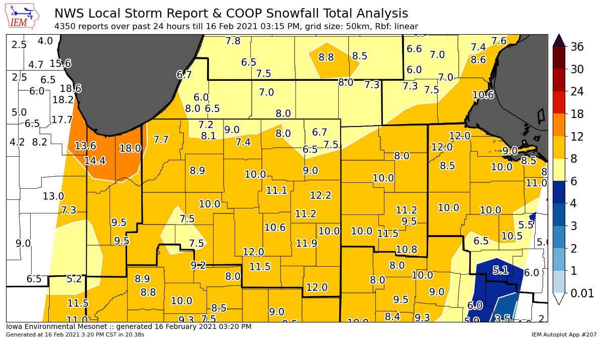
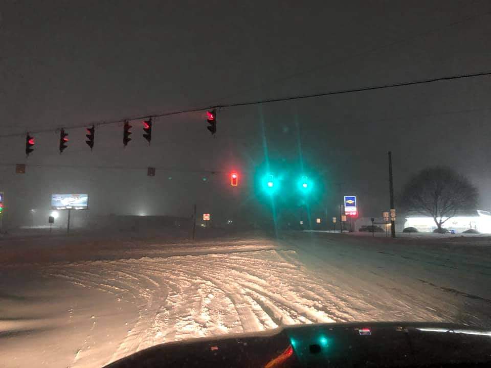
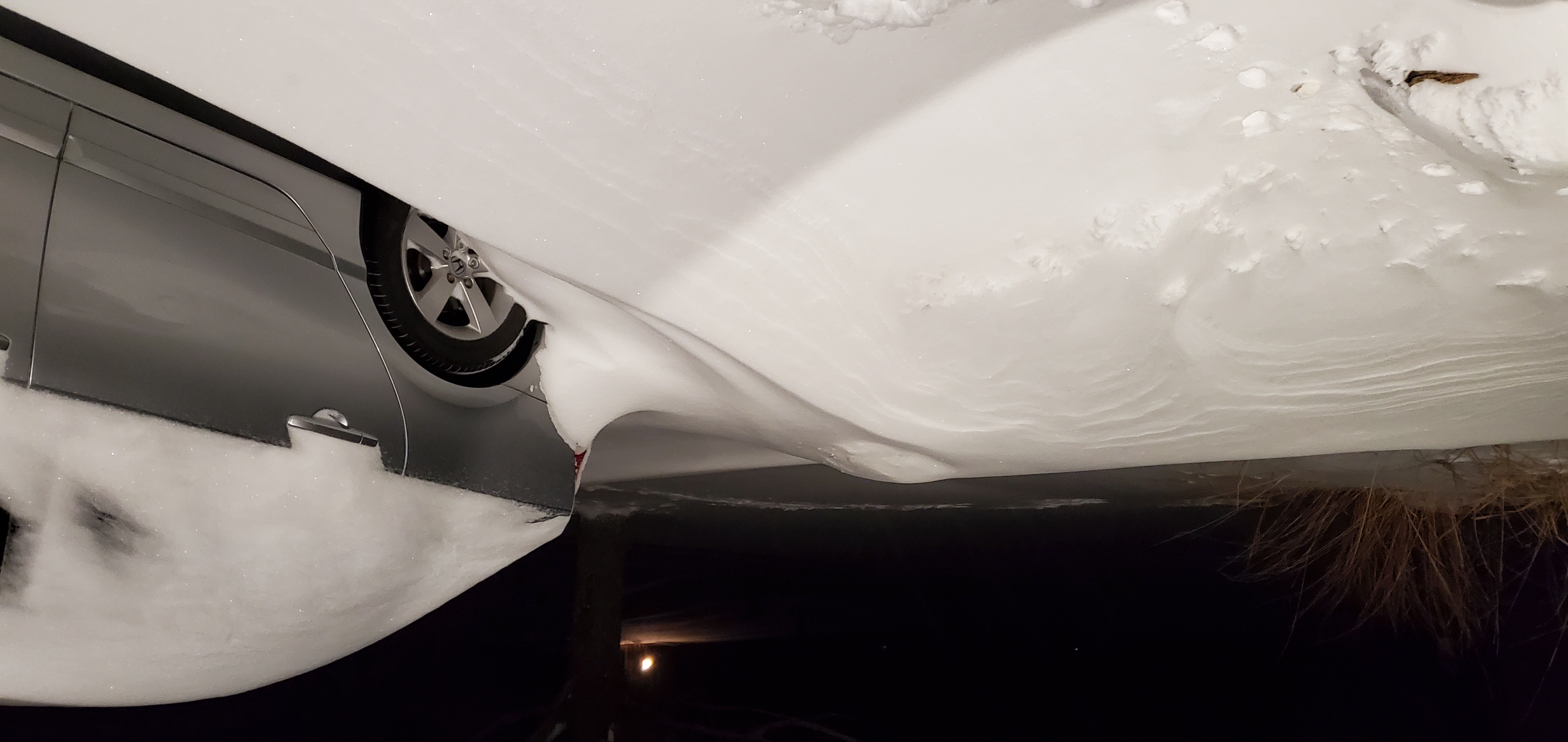
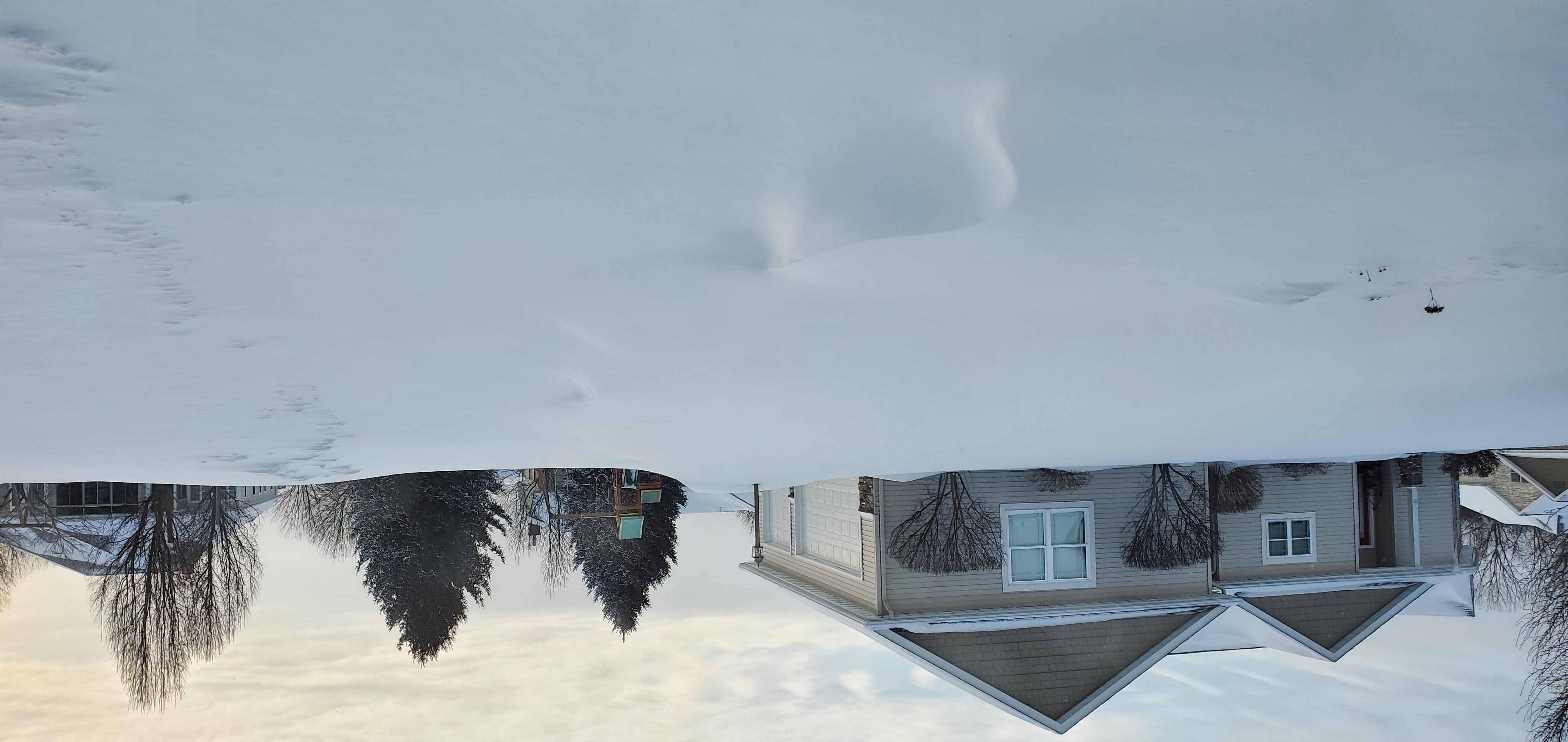
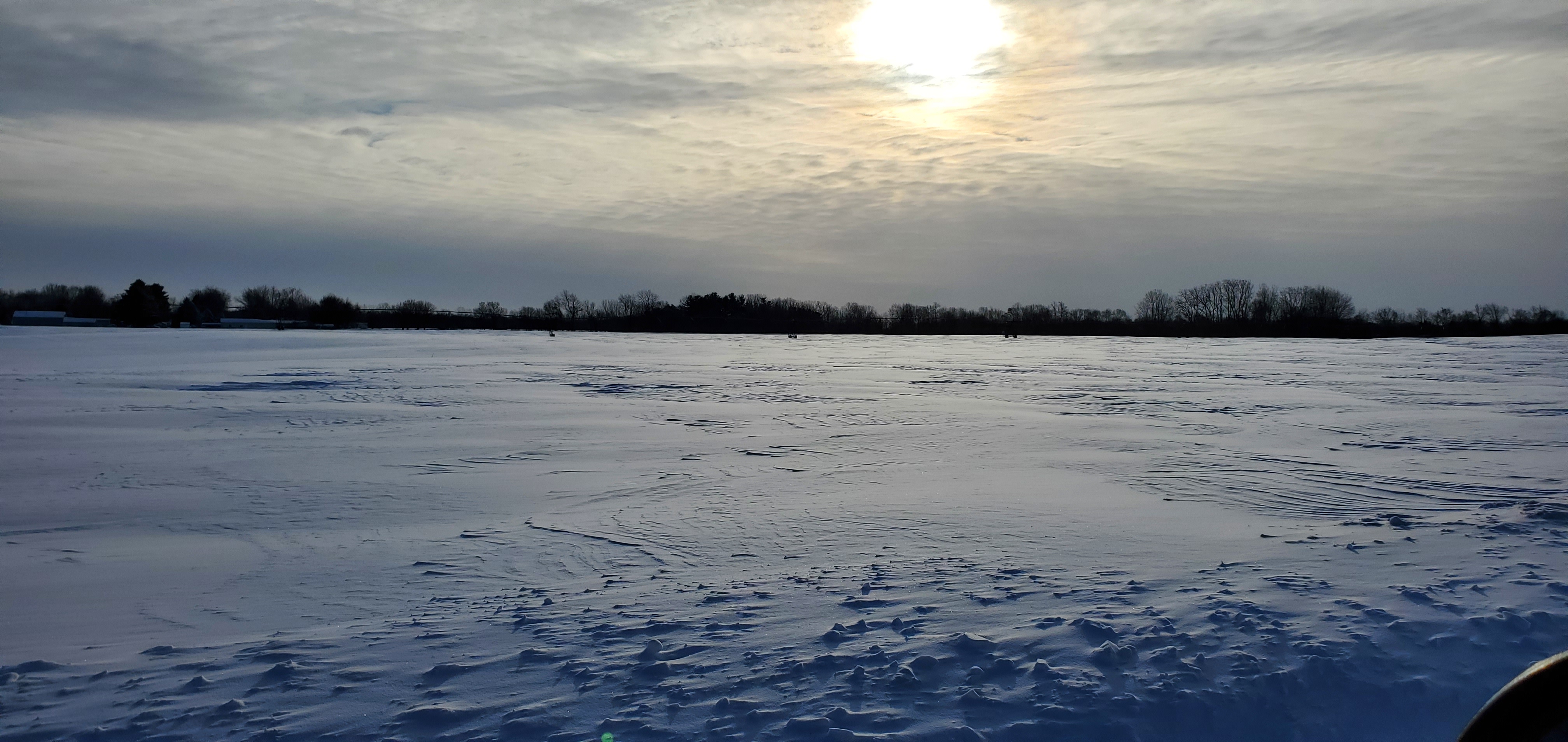
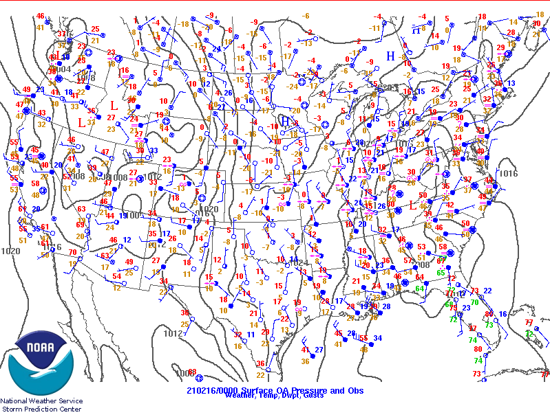
Two systems moved across the Great Lakes Region with the first system producing widespread 1 to 2 inch snowfall amounts. A second, much stronger system moved rapidly northeast into the region, bringing widespread moderate to heavy snowfall across the entire forecast area starting late afternoon on the 15th and lingering into the overnight hours of the 16th. 6 to 12 inches of snow fell across the area, with the bulk of the snowfall occurring within a 6 to 9 hour period. Winds of 10 to 20 mph with gusts to 30 mph caused widespread blowing and drifting with many county roads across the area looking like the one shown below. Snowfall rates of 1 to 2 inches per hour occurred at the peak of the event. A summary of reports, a snowfall map for the event and other details can be found below or by clicking the respective tab.
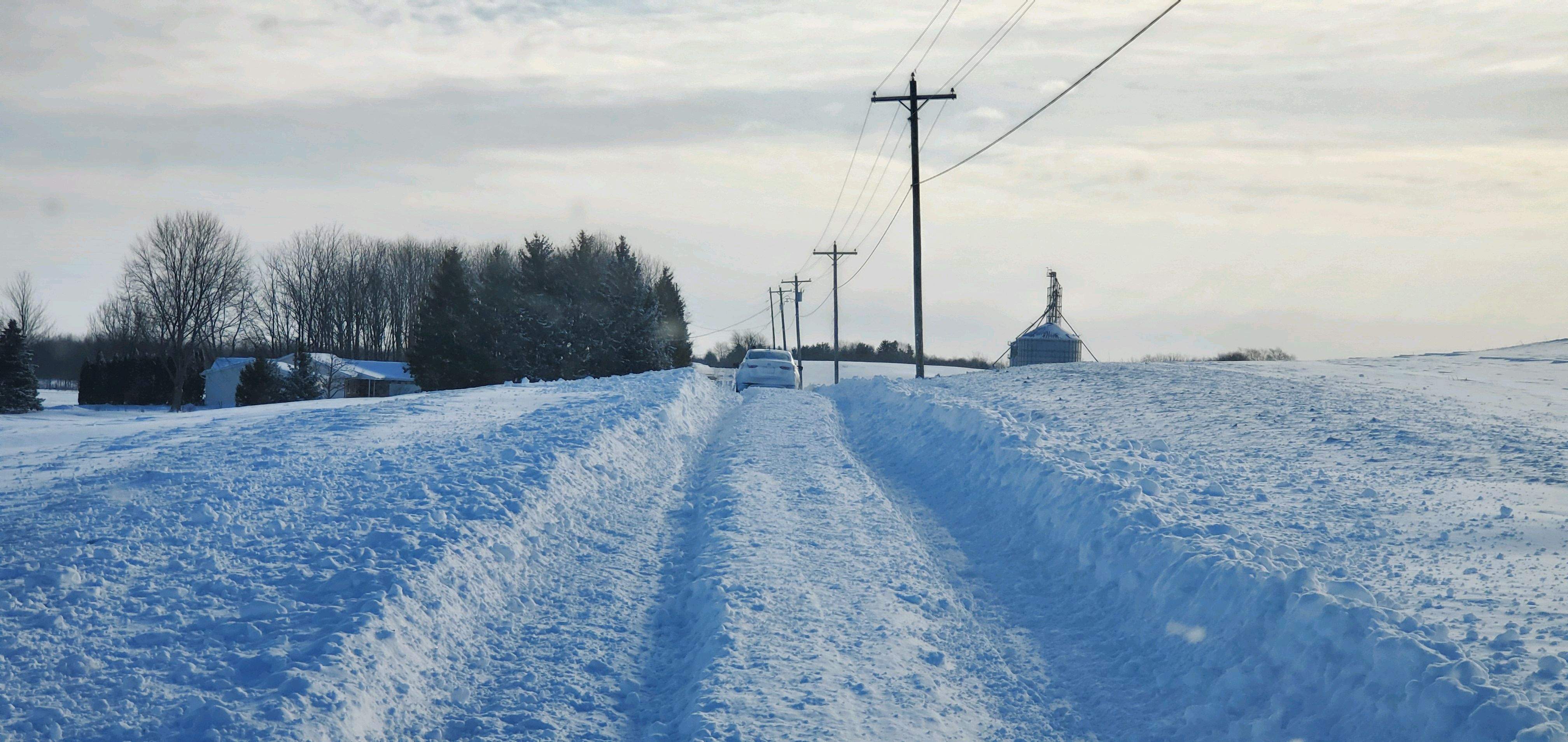 |
| East of Leesburg, IN Photo: Todd Holsten |
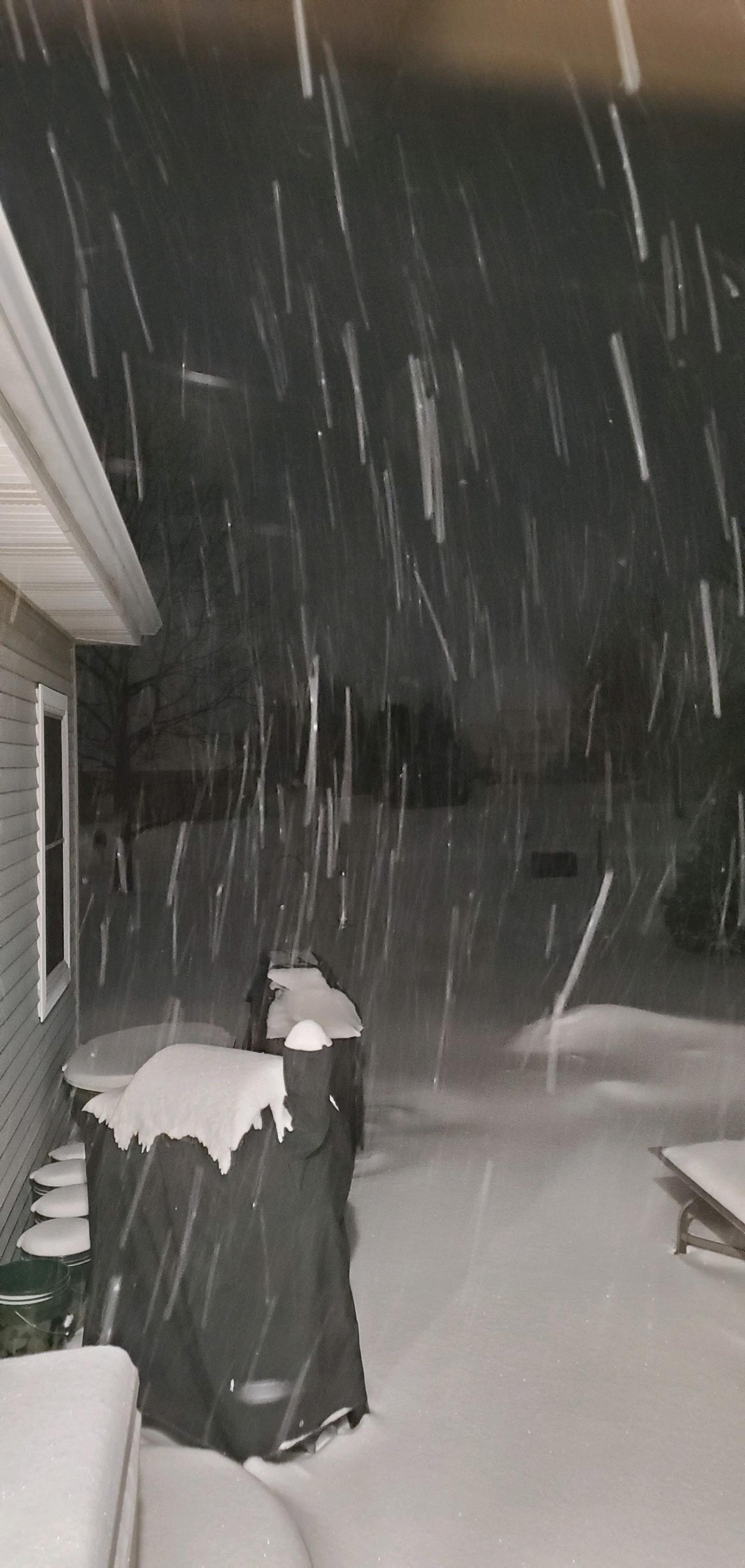
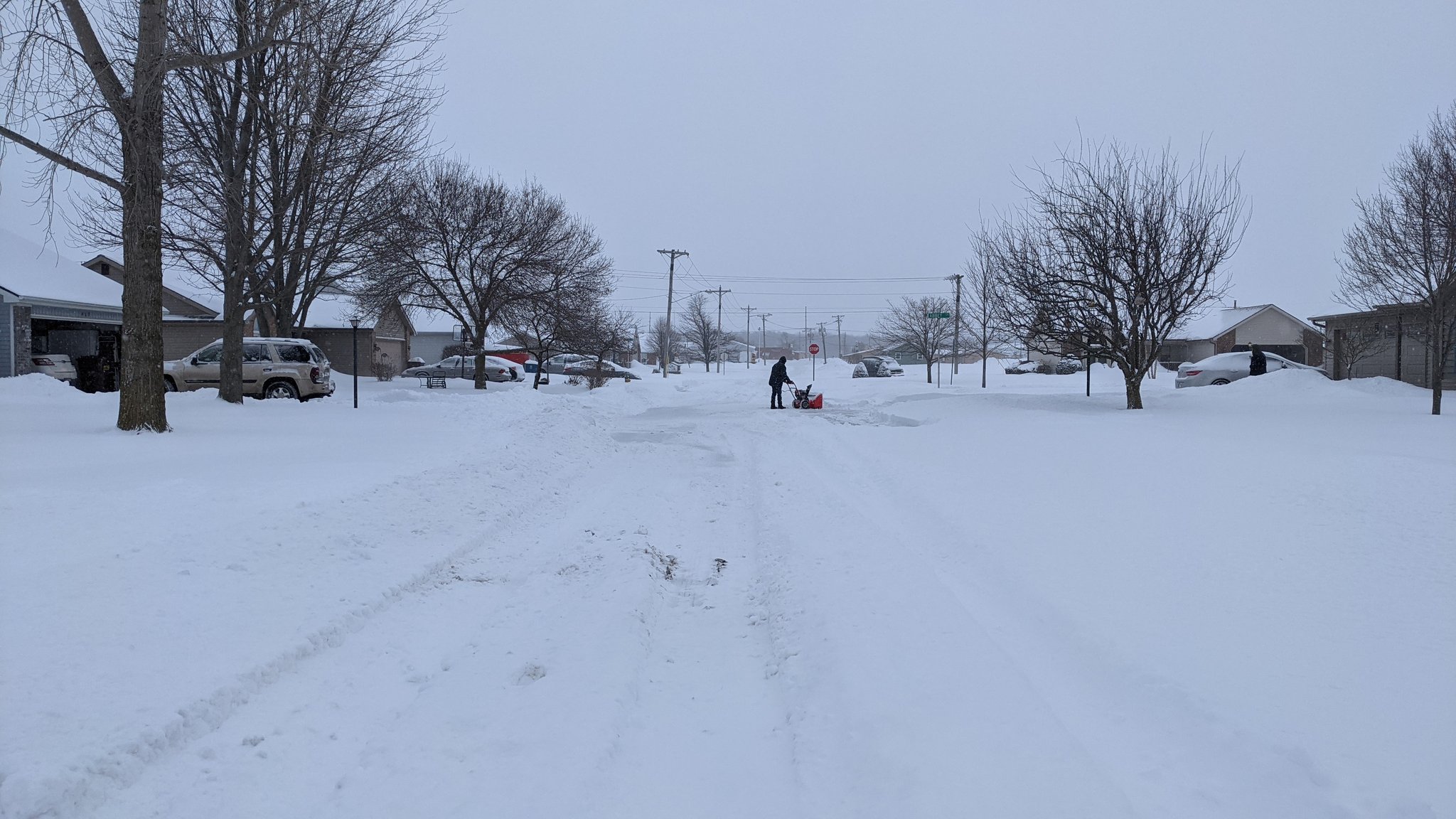
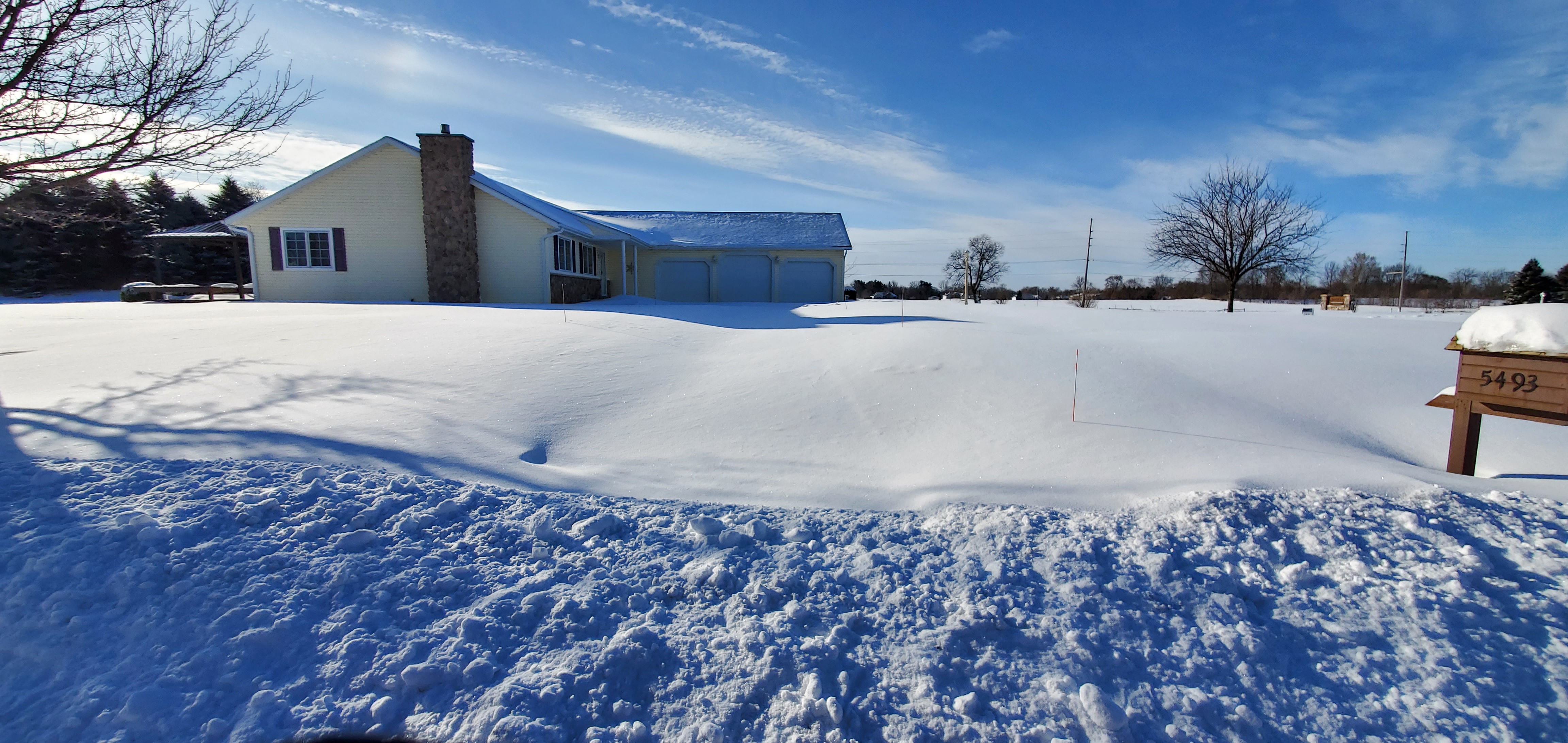
Photos & Video
Permission to display these photos have been granted to the National Weather Service by the original owners.
 |
 |
 |
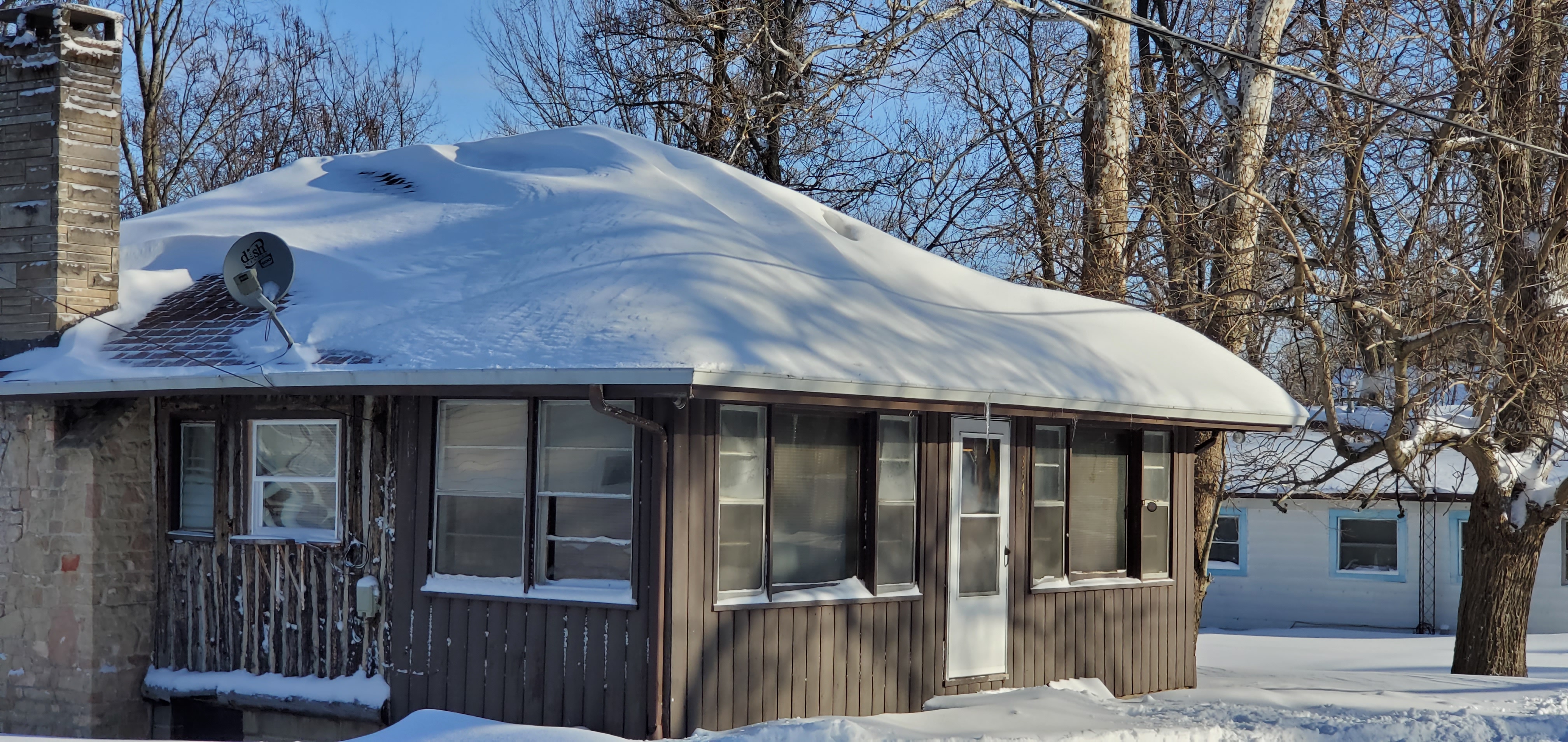 |
| North Webster, IN Photo: Todd Holsten |
Bluffton, IN Photo: Matthew Hartman |
Pierceton, IN (US-30/SR 15) Photo: Megan Dodson |
North Webster, IN Photo: Todd Holsten |
 |
 |
 |
 |
| North Webster, IN Photo: Todd Holsten |
North Webster, IN Photo: Todd Holsten |
North Webster, IN Photo: Todd Holsten |
North Webster, IN Photo: Todd Holsten |
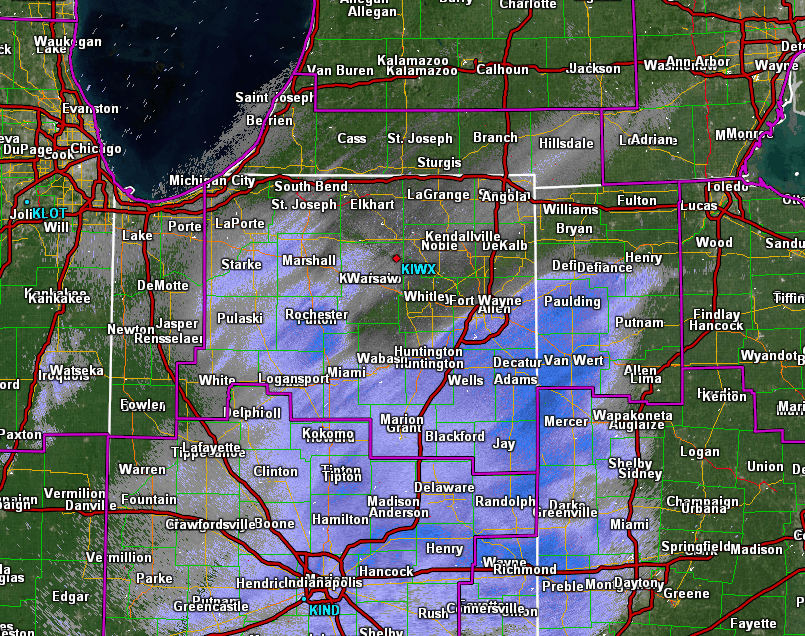
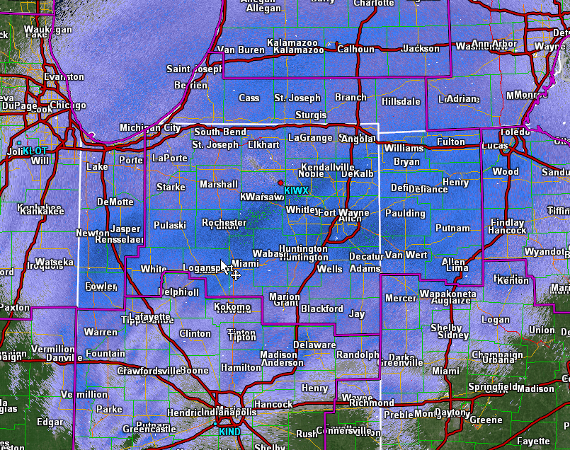
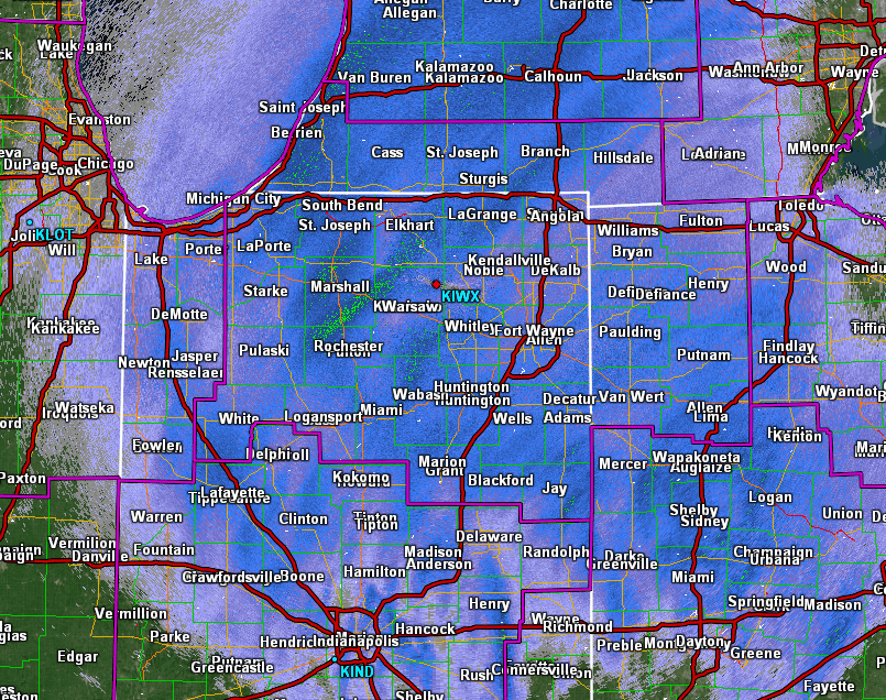
Radar
The images below show the evolution of the snowstorm, with the greatest impacts and heaviest snowfall coming between 7 pm and 12 am. The highest snowfall rates occurred in areas where darker blue (1"/hr) to green (2"/hr) are observed.
 |
 |
 |
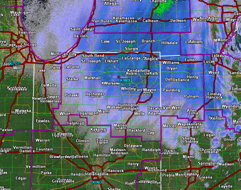 |
| 130 to 7 pm Feb 15 | 7 to 940 pm Feb 15 | 940 pm Feb 15 to 12 am Feb 16 | 12 to 2 am Feb 16 |
Storm Reports
Even the most seasoned snowfall measurers had challenges with this event from widespread blowing and drifting, resulting in some variations in totals.
Our thanks to the CoCoRaHS, Cooperative Observers and Public for your reports!
PUBLIC INFORMATION STATEMENT
NATIONAL WEATHER SERVICE NORTHERN INDIANA
412 PM EST TUE FEB 16 2021

...SNOWFALL REPORTS...

SNOWFALL TOTALS FOR THE FEBRUARY 15 TO 16, 2021 WINTER STORM.

LOCATION                     AMOUNT    TIME/DATE       LAT/LON

...INDIANA...

...ADAMS COUNTY...
1.3 N DECATUR                10.0 IN   0640 AM 02/16   40.85N/84.93W

...ALLEN COUNTY...
WOODBURN 3 N                 11.6 IN   0700 AM 02/16   41.16N/84.85W
2 ENE NINE MILE              11.2 IN   0700 AM 02/16   40.99N/85.18W
2 NE WALLEN                  10.0 IN   1200 PM 02/16   41.18N/85.13W
FORT WAYNE 9.1 SE            10.0 IN   0700 AM 02/16   40.99N/85.00W
HOAGLAND 1.5 SSW             9.2 IN    0700 AM 02/16   40.93N/85.00W
FORT WAYNE 2.6 NW            9.0 IN    0700 AM 02/16   41.10N/85.18W
1 N ROLLING HILLS            8.0 IN    0813 AM 02/16   41.04N/85.27W
FORT WAYNE 9.3 W             7.5 IN    0700 AM 02/16   41.05N/85.31W
FORT WAYNE 2.6 NE            5.5 IN    0700 AM 02/16   41.10N/85.11W
WOODBURN 2.8 WSW             5.1 IN    0700 AM 02/16   41.12N/84.91W

...BLACKFORD COUNTY...
(KA9VIS) HARTFORD CITY 0.7 N 9.0 IN    0700 AM 02/16   40.46N/85.37W
HARTFORD CITY 4 ESE          8.0 IN    0800 AM 02/16   40.44N/85.29W
(KC9DCR)HARTFORD CITY 0.3 SS 8.0 IN    0700 AM 02/16   40.45N/85.37W

...CASS COUNTY...
YOUNG AMERICA                9.2 IN    0800 AM 02/16   40.57N/86.33W
LOGANSPORT 0.6 E             7.5 IN    0800 AM 02/16   40.75N/86.35W
(WA9TTB)GALVESTON 1.0 ESE    7.5 IN    0700 AM 02/16   40.57N/86.17W

...ELKHART COUNTY...
1 S ELKHART                  9.0 IN    1241 PM 02/16   41.67N/85.97W
GOSHEN 2.8 NW                9.0 IN    0845 AM 02/16   41.60N/85.88W
GOSHEN 1.2 SW                7.4 IN    0700 AM 02/16   41.57N/85.85W
ELKHART 4.8 SW               6.5 IN    0800 AM 02/16   41.64N/86.04W
WAKARUSA 2.4 NNE             5.4 IN    0700 AM 02/16   41.57N/85.99W
GOSHEN 3.0 WSW               5.1 IN    0700 AM 02/16   41.56N/85.88W
2 WNW GOSHEN                 5.0 IN    0957 AM 02/16   41.59N/85.88W
GOSHEN 0.3 NE                4.5 IN    0700 AM 02/16   41.58N/85.83W

...FULTON COUNTY...
ROCHESTER                    10.0 IN   0700 AM 02/16   41.07N/86.21W
KEWANNA 4.9 SSW              7.5 IN    0700 AM 02/16   40.95N/86.45W

...GRANT COUNTY...
1 N MARION                   11.5 IN   1000 AM 02/16   40.56N/85.67W
(KB9CRA)GAS CITY 0.3 N       11.0 IN   0700 AM 02/16   40.49N/85.61W
MARION 1.8 NW                10.0 IN   0500 AM 02/16   40.57N/85.69W
MARION 6.5 N                 8.0 IN    0700 AM 02/16   40.64N/85.69W
2.2 N MARION                 7.0 IN    0700 AM 02/16   40.58N/85.66W
MARION 5.6 NE                5.0 IN    0800 AM 02/16   40.60N/85.59W
MARION 1.4 W                 4.5 IN    0430 AM 02/16   40.55N/85.69W
UPLAND 2.4 SSE               4.0 IN    0700 AM 02/16   40.43N/85.50W

...HUNTINGTON COUNTY...
HUNTINGTON 0.3 W             10.6 IN   0700 AM 02/16   40.88N/85.51W

...JAY COUNTY...
(KC9LQY) PORTLAND 5.4 SW     12.0 IN   0700 AM 02/16   40.39N/85.06W

...KOSCIUSKO COUNTY...
LEESBURG 6.7 ESE             10.0 IN   0700 AM 02/16   41.31N/85.72W
WARSAW 3.0 SE                7.0 IN    0800 AM 02/16   41.21N/85.80W
2 NNE WINONA LAKE            6.5 IN    0100 PM 02/16   41.24N/85.81W
LEESBURG 0.1 WNW             6.5 IN    0700 AM 02/16   41.33N/85.85W
NORTH WEBSTER 2.3 N          6.2 IN    0700 AM 02/16   41.36N/85.70W
WARSAW 1.4 N                 5.7 IN    0720 AM 02/16   41.26N/85.85W
WARSAW 3.7 E                 5.5 IN    0730 AM 02/16   41.23N/85.78W
SYRACUSE 3.0 ESE             3.6 IN    0800 AM 02/16   41.41N/85.70W

...LA PORTE COUNTY...
LA PORTE 1.6 SW              7.7 IN    0800 AM 02/16   41.59N/86.73W
1 NNE WATERFORD              7.3 IN    1100 AM 02/16   41.68N/86.84W
MILL CREEK 1.9 NNE           4.8 IN    0800 AM 02/16   41.61N/86.52W

...LAGRANGE COUNTY...
LAGRANGE                     8.0 IN    0630 AM 02/16   41.64N/85.42W

...MARSHALL COUNTY...
1.2 W PLYMOUTH               8.9 IN    0540 AM 02/16   41.34N/86.34W

...MIAMI COUNTY...
0.8 NW PERU                  6.3 IN    0950 AM 02/16   40.76N/86.07W
DENVER 1.3 NE                6.0 IN    0700 AM 02/16   40.88N/86.06W
DENVER 0.5 SSE               5.7 IN    0700 AM 02/16   40.86N/86.07W

...NOBLE COUNTY...
ALBION 3.7 S                 6.3 IN    0930 AM 02/16   41.34N/85.42W

...PULASKI COUNTY...
FRANCESVILLE                 5.6 IN    1000 AM 02/16   40.98N/86.89W

...ST. JOSEPH COUNTY...
SOUTH BEND 4.5 SE            8.1 IN    0800 AM 02/16   41.62N/86.22W
2 NNW OSCEOLA                7.5 IN    0735 AM 02/16   41.69N/86.10W
GRANGER 1.8 ENE              7.5 IN    0700 AM 02/16   41.75N/86.11W
2 E SOUTH BEND               7.3 IN    1045 AM 02/16   41.68N/86.23W
ROSELAND                     7.2 IN    0700 AM 02/16   41.71N/86.25W
1 NE GEORGETOWN              7.0 IN    1000 AM 02/16   41.74N/86.22W
2 W ROSELAND                 5.8 IN    1200 PM 02/16   41.71N/86.29W
WALKERTON 5.7 ENE            5.7 IN    0800 AM 02/16   41.50N/86.39W

...STARKE COUNTY...
1.0 NW KNOX                  4.0 IN    0800 AM 02/16   41.31N/86.63W

...STEUBEN COUNTY...
1 ENE HAMILTON LAKE          7.5 IN    0300 PM 02/16   41.55N/84.91W
1 E SALEM CENTER             6.8 IN    0710 AM 02/16   41.59N/85.11W
HUDSON 4.1 NNW               6.8 IN    0700 AM 02/16   41.59N/85.10W
ANGOLA 1.7 WNW               6.7 IN    0700 AM 02/16   41.65N/85.03W
HUDSON 4.6 N                 6.5 IN    0715 AM 02/16   41.60N/85.09W
ANGOLA 4.1 N                 6.5 IN    0545 AM 02/16   41.70N/84.99W

...WABASH COUNTY...
LA FONTAINE 1.1 NW           12.0 IN   0600 AM 02/16   40.68N/85.74W

...WELLS COUNTY...
1 N BLUFFTON                 11.5 IN   1000 AM 02/16   40.75N/85.17W

...WHITE COUNTY...
5.6 N BADGER GROVE           5.0 IN    0540 AM 02/16   40.67N/86.95W

...WHITLEY COUNTY...
COLUMBIA CITY 1.5 NNW        11.1 IN   0500 AM 02/16   41.18N/85.49W
COLUMBIA CITY 7.4 N          9.0 IN    0800 AM 02/16   41.26N/85.50W
TRI-LAKES 3.0 N              7.0 IN    0700 AM 02/16   41.26N/85.49W
COLUMBIA CITY                5.8 IN    0730 AM 02/16   41.16N/85.49W

...MICHIGAN...

...BERRIEN COUNTY...
BUCHANAN 1.3 WNW             8.0 IN    0600 AM 02/16   41.84N/86.39W
1 NNE SAINT JOSEPH           6.7 IN    0920 AM 02/16   42.11N/86.48W
1 ENE FAIR PLAIN             6.5 IN    1200 PM 02/16   42.09N/86.44W
3 ESE BERRIEN SPRINGS        6.0 IN    1013 AM 02/16   41.93N/86.30W
NILES 2.7 W                  6.0 IN    0800 AM 02/16   41.84N/86.30W
BUCHANAN 1.4 ESE             5.5 IN    0700 AM 02/16   41.82N/86.34W
STEVENSVILLE 1.7 SSE         5.4 IN    0800 AM 02/16   41.99N/86.51W
SHOREHAM 2.0 SE              4.6 IN    0800 AM 02/16   42.03N/86.49W

...CASS COUNTY...
NILES 3.5 E                  6.5 IN    0600 AM 02/16   41.84N/86.18W

...HILLSDALE COUNTY...
LITCHFIELD                   8.0 IN    0738 AM 02/16   42.05N/84.75W
JEROME                       7.3 IN    0247 PM 02/16   42.03N/84.47W
MONTGOMERY 1.9 SSE           5.5 IN    0800 AM 02/16   41.75N/84.79W
OSSEO 2.7 NE                 2.6 IN    0830 AM 02/16   41.90N/84.49W

...ST. JOSEPH COUNTY...
STURGIS                      8.0 IN    1230 PM 02/16   41.80N/85.42W
THREE RIVERS 2.4 NE          7.0 IN    0700 AM 02/16   41.97N/85.60W

...OHIO...

...ALLEN COUNTY...
DELPHOS 2.3 ESE              11.5 IN   0600 AM 02/16   40.83N/84.30W
LIMA 3.0 SSE                 10.8 IN   0600 AM 02/16   40.70N/84.10W
LIMA 2.7 NE                  8.5 IN    0700 AM 02/16   40.77N/84.08W

...DEFIANCE COUNTY...
DEFIANCE 0.5 E               10.0 IN   0700 AM 02/16   41.28N/84.35W

...FULTON COUNTY...
SWANTON 4.0 S                6.8 IN    0850 AM 02/16   41.53N/83.91W

...HENRY COUNTY...
NAPOLEON 4.5 NNW             8.0 IN    0700 AM 02/16   41.46N/84.15W
MCCLURE 3.4 SSE              7.0 IN    0700 AM 02/16   41.33N/83.91W

...PUTNAM COUNTY...
1 SW GLANDORF                11.2 IN   1029 AM 02/16   41.02N/84.10W
1 WNW COLUMBUS GROVE         9.5 IN    0930 AM 02/16   40.93N/84.07W

...VAN WERT COUNTY...
VAN WERT                     10.0 IN   0438 PM 02/16   40.86N/84.58W

OBSERVATIONS ARE COLLECTED FROM A VARIETY OF SOURCES WITH VARYING
EQUIPMENT AND EXPOSURES. WE THANK ALL VOLUNTEER WEATHER OBSERVERS
FOR THEIR DEDICATION. NOT ALL DATA LISTED ARE CONSIDERED OFFICIAL.
$$
Environment
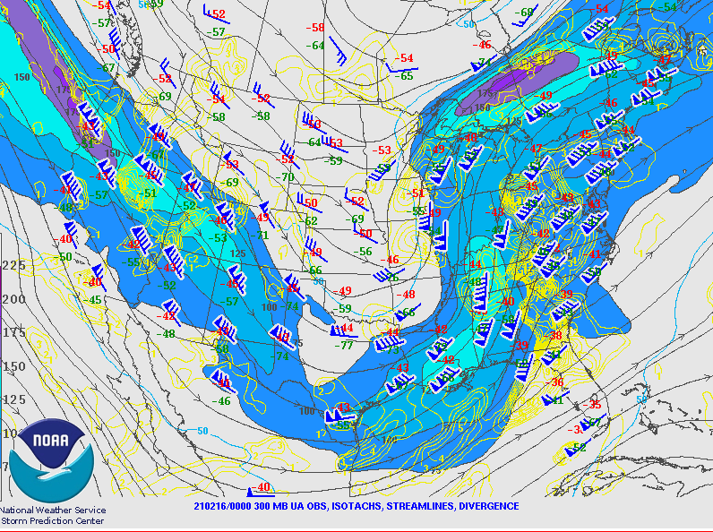
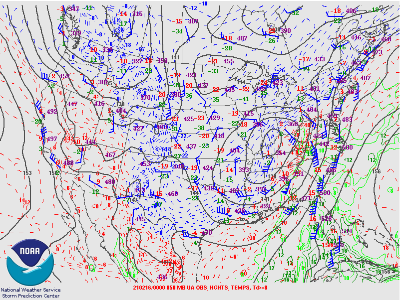
A neutral to slightly negatively tilted upper trough lifted into the area Monday night. Strong moisture transport and isentropic ascent aided in precipitation production. The combination of two upper jet streaks also supported strong vertical motion. The track of the surface low south of the area allowed for strong north winds gusting to 20 to 30 mph and blowing and drifting snow.
 |
 |
 |
| Figure 1: SPC 300 mb analysis for 2/16 7pm ET. Note the upper jet streak lifting north from the Lower MS Valley and the jet streak across the northern Great Lakes. Strong upward motion can exist between these features. | Figure 2: SPC 700 mb analysis for 2/16 7pm ET. A strong mid level circulation can be seen across the Ohio Valley with a strong mi level front over central Indiana. These strong elevated fronts can be generation zones for heavy snow. | Figure 3: SPC surface analysis for 2/16 7pm ET. The surface low track across eastern Kentucky was favorable for snow in our area. Note the strong packing of the isobars across Indiana which supported north wind gusts to 25 to 30 mph. |
The combination of moisture moving into the area, strong dynamics with the synoptic system, and elevated frontogenesis forcing allowed for widespread heavy snow across the area.
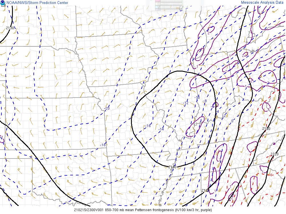
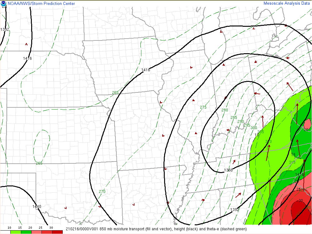 |
 |
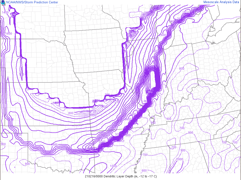 |
| Figure 4: RAP analysis of 850 mb heights (dark contours) and moisture transport (arrows) valid 2/16 8pm ET. Note the strong moisture transport at 850 mb from eastern TN to southern OH. Often times heavy precipitation can focus at northern extent of this moisture transport. | Figure 5: RAP analysis of 850-700 mb frontogenesis (purple contours) valid 2/16 7pm ET. Note the axis of mid level frontogenesis from east central Illinois into northwest Ohio. This area of elevated frontogenesis helped to create some bands of heavier snowfall. | Figure 6: RAP analysis of the dendritic layer depth valid at 2/16 7pm ET. Deeper dendritic layers (i.e. layers where the temperature is -12 to -18 deg c) can be supportive of higher snow to liquid ratios. Note how NE IN/NW OH have smaller depths. This resulted in lower snow:liquid ratios for these areas. |
Satellite imagery captured the strong system which moved across the area.
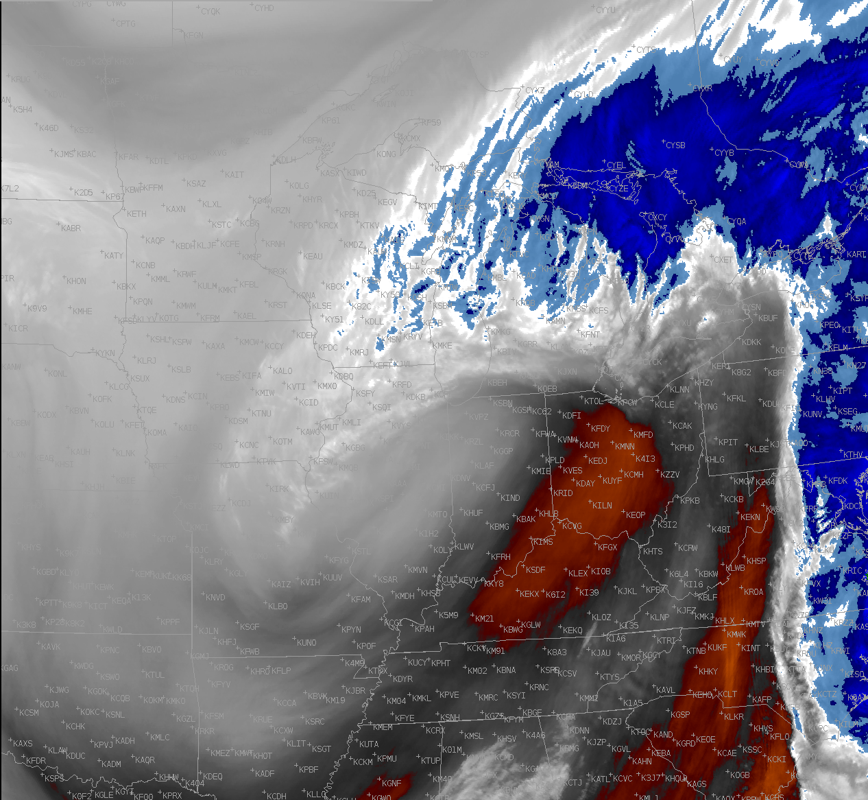 |
| Figure 7: GOES-16 Channel 9 mid level WV band ~ 1 AM 2/17 |
 |
Media use of NWS Web News Stories is encouraged! Please acknowledge the NWS as the source of any news information accessed from this site. |
|