Overview
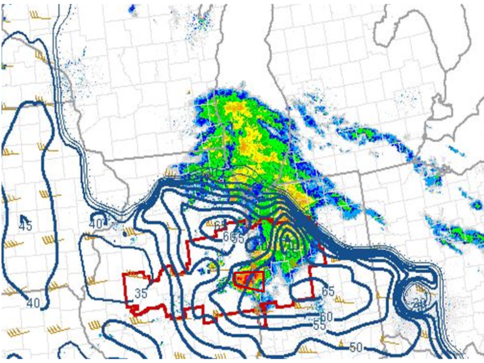
The approach of a mesoscale convective vortex (MCV) in the late afternoon/early evening of the 26th resulted in enhancing the effective shear (~50-60 knots) over the region. Initially, a large band of rain showers moved across the region early evening, however behind this band of showers, a line of storms developed over northwest Indiana and slowly organized southeast. By 10:00 pm EDT, a spearhead echo developed over southwestern Kosciusko county south of Mentone and rapidly surged southeast affecting the towns of Silver Lake, North Manchester, Bippus and Huntington. A narrow corridor of intense wind damage resulted along this path with winds estimated at 85-90 mph. Some street flooding was also noted in Huntington City and points north as well as in Roanoke
 |
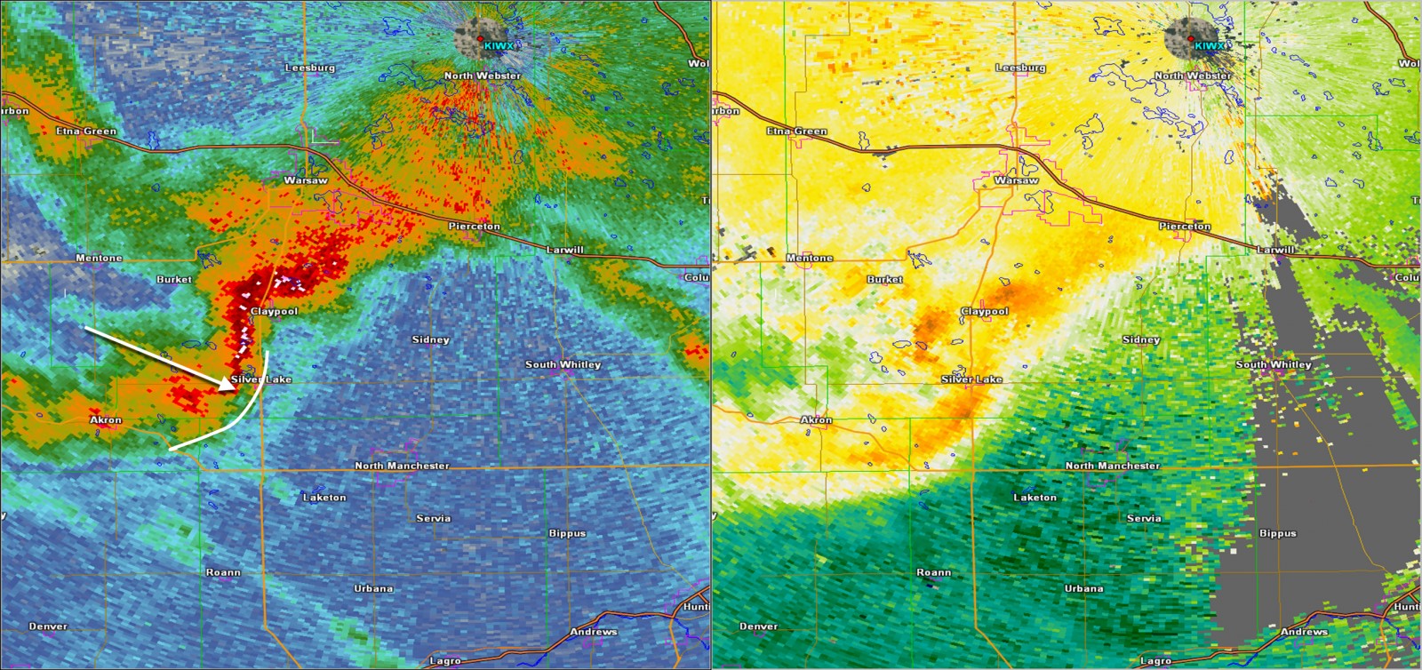 |
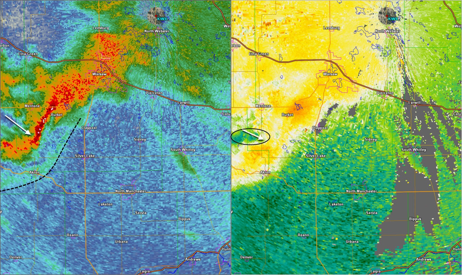
| 1001 pm EDT. White arrows in this image denotes approximate position of developing rear inflow jet. Dashed black line denotes position of leading outflow boundary just ahead of this line of storms. Black oval encapsulates the area of strong inbound winds taking shape at the rear of the line of storms. | 1010 pm EDT. White arrow denotes approximate position of rear inflow jet which just 9 minutes later had progressed to the leading edge of the line of storms. The white arc denotes a surge in the 0.5 degree reflectivity data occurring at this time with intense wind damage ongoing in the Silver Lake area. |
Wind:
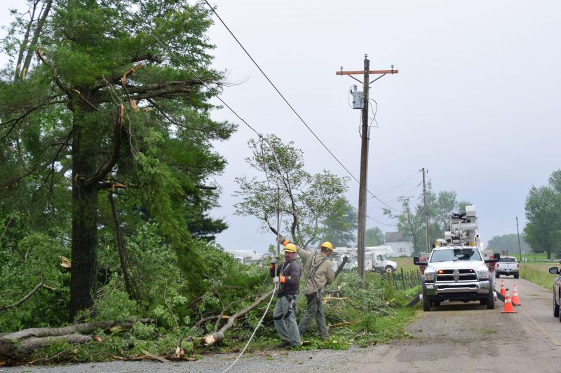
Strong winds and wind damage were observed as a result of a thunderstorm that moved southeast across southern Kosciusko county into Huntington county.
Preliminary Local Storm Reports
| 2017/05/27 0245 Z (10:45 PM) |
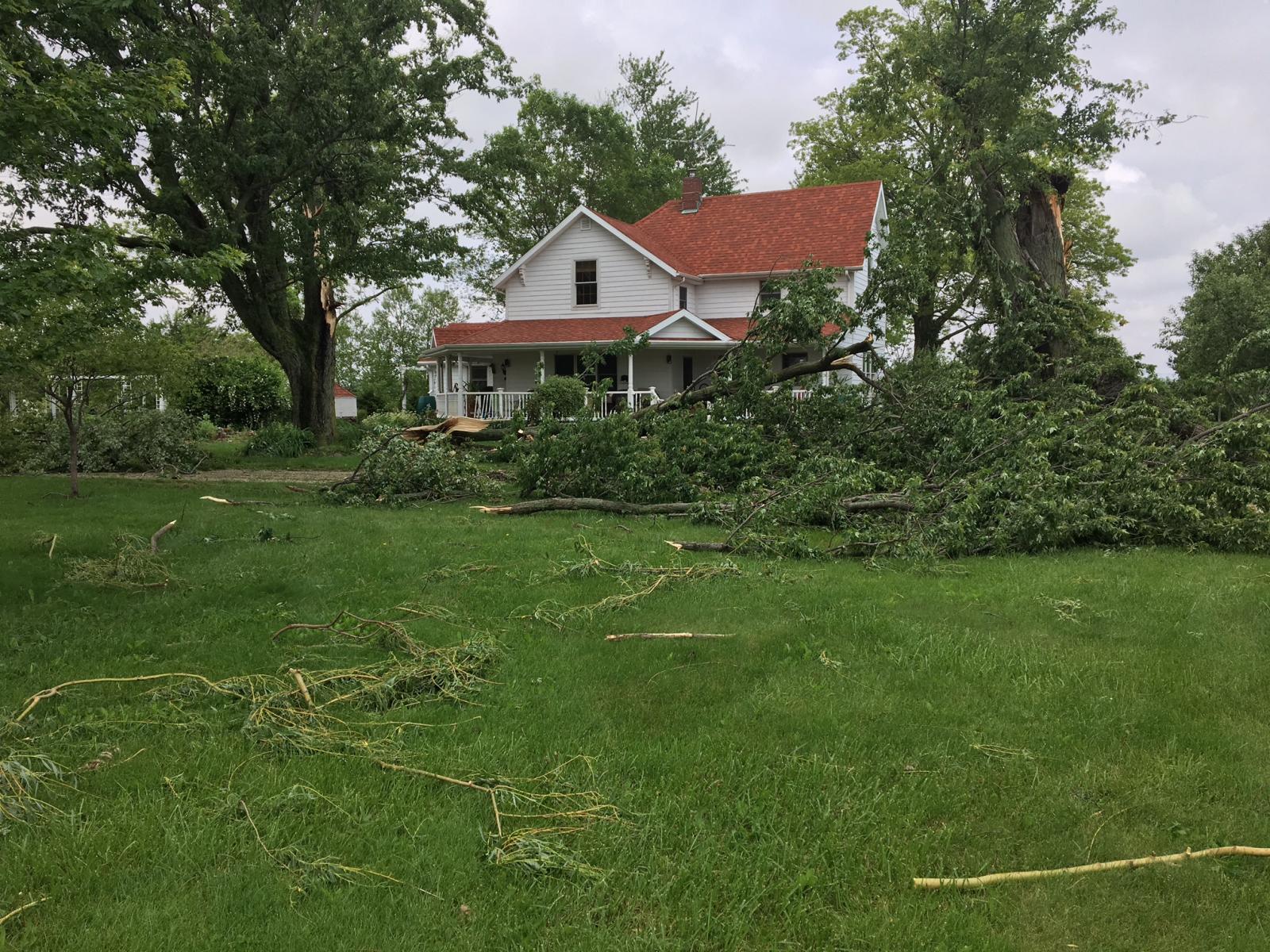
Multiple trees lost. Damaged siding to house as a result of tree debris. nearby barns are also damaged with lost roofs. |
BIPPUS | HUNTINGTON | IN | 40.95 | -85.62 |
| 2017/05/27 0230 Z (10:30 PM) | Large trees uprooted and small trees snapped off in the middle. |
4 WNW NORTH MANCHESTER | WABASH | IN | 41.03 | -85.85 |
| 2017/05/27 0215 Z (10:15 PM) | Multiple trees down | 1 NE NORTH MANCHESTER | WABASH | IN | 41.02 | -85.76 |
| 2017/05/27 0214 Z (10:14 PM) |
Widespread wind damage reported from Burket to Sidney and including Claypool and Silver Lake Areas. Numerous trees and power poles blown down. |
CLAYPOOL | KOSCIUSKO | IN | 41.13 | -85.88 |
| 2017/05/27 0210 Z (10:10 PM) | Multiple trees down | SILVER LAKE | KOSCIUSKO | IN | 41.07 | -85.89 |
Photos & Video:
 |
 |
 |
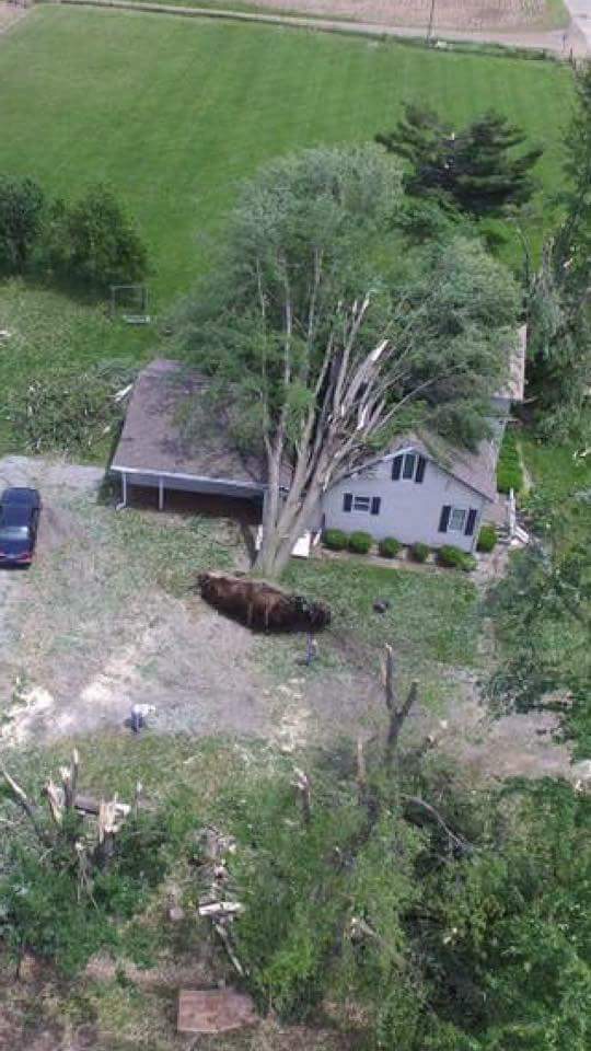 |
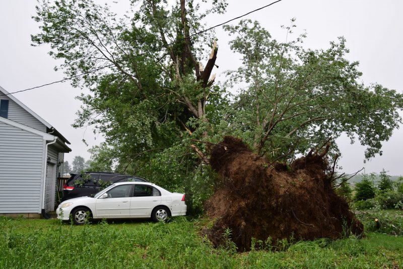
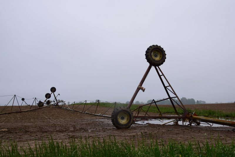
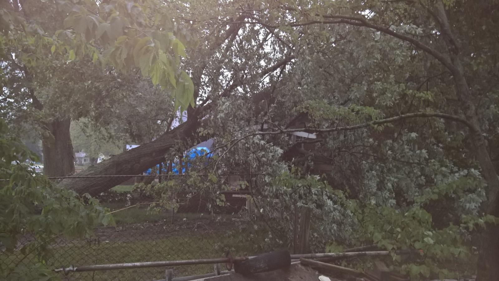
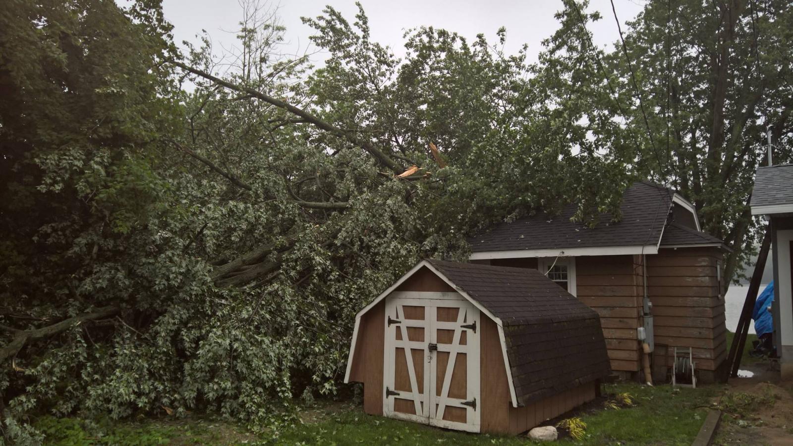
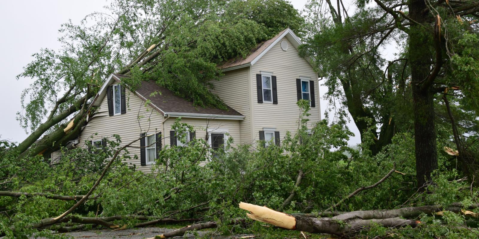
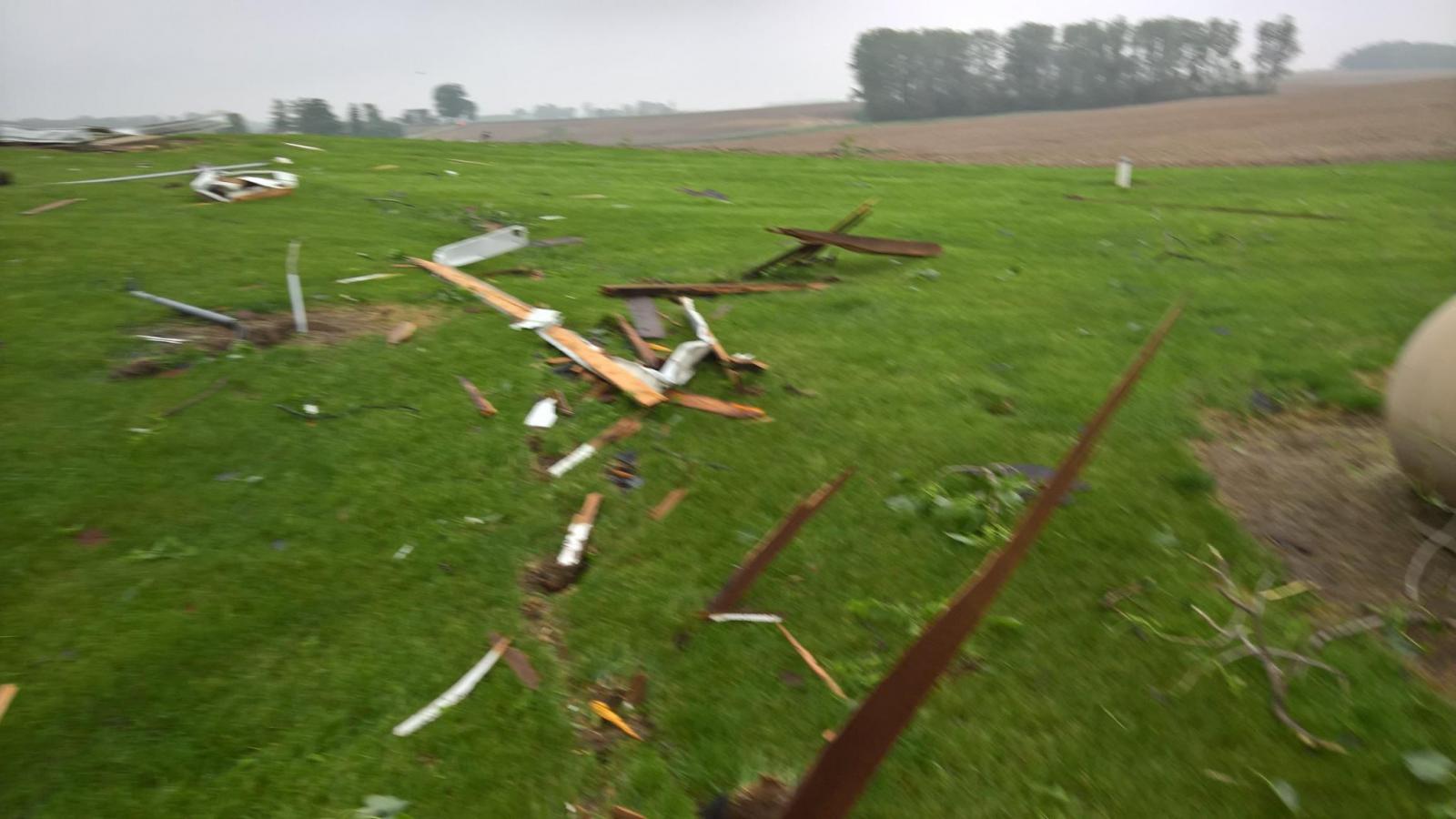
| Large trees came down as a result of the strong winds across the area. This damage was in Silver Lake (via Ink Free Press) | Center pivots overturned near Silver Lake (via Ink Free Press) | Large tree uprooted onto a house. Courtesy of Silver Lake Fire Dept. | An aerial photo of a large tree that fell on a house in Silver Lake via Rhonda Perry Mote |
 |
 |
 |
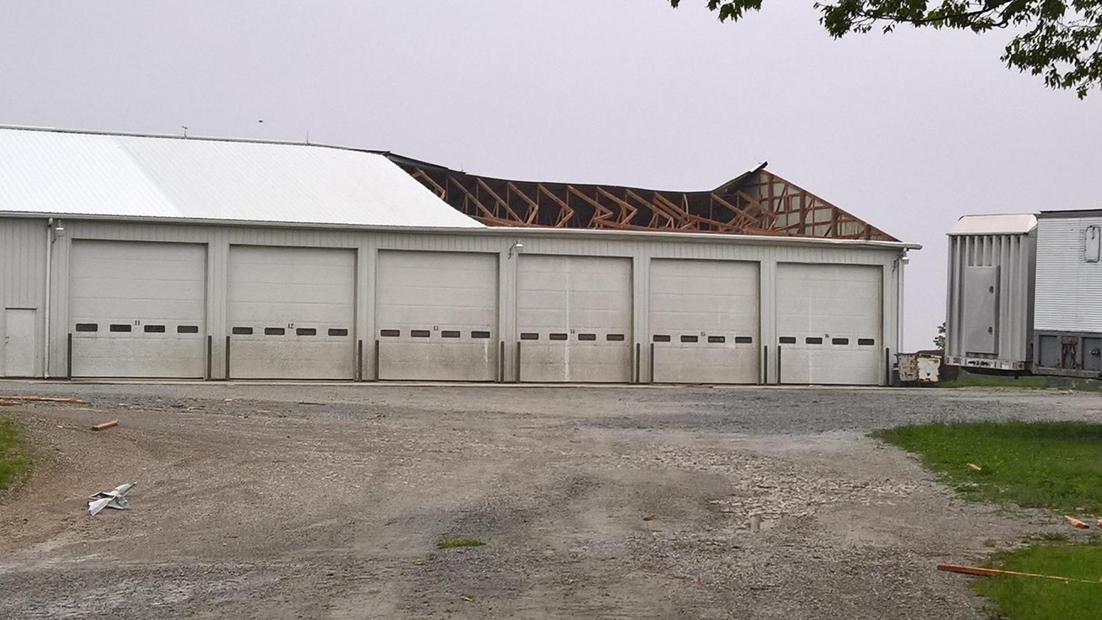 |
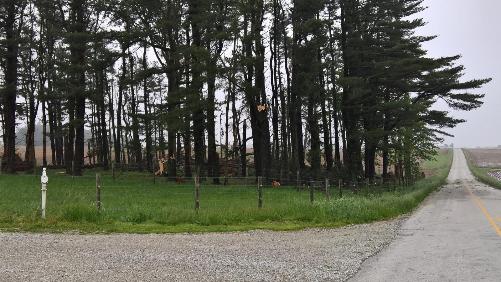
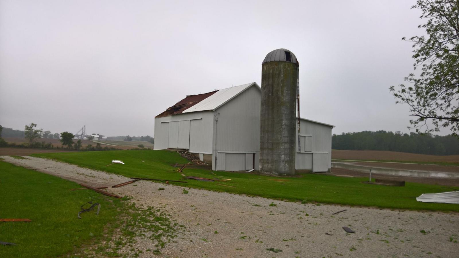
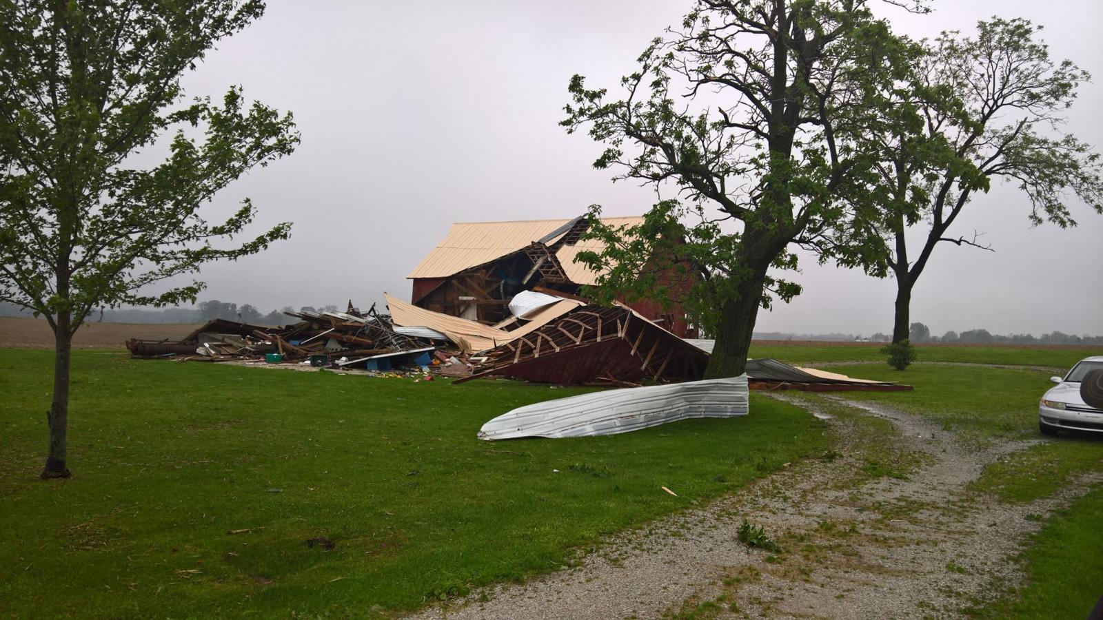
| Shredded pine tree. Courtesy of Silver Lake Fire Dept. | Numerous snapped pine trees. Courtesy of Silver Lake Fire Dept. | Barn with considerable roof damage. Courtesy of Silver Lake Fire Dept. | Large garage building with considerable roof damage. Courtesy of Silver Lake Fire Dept. |
 |
 |
 |
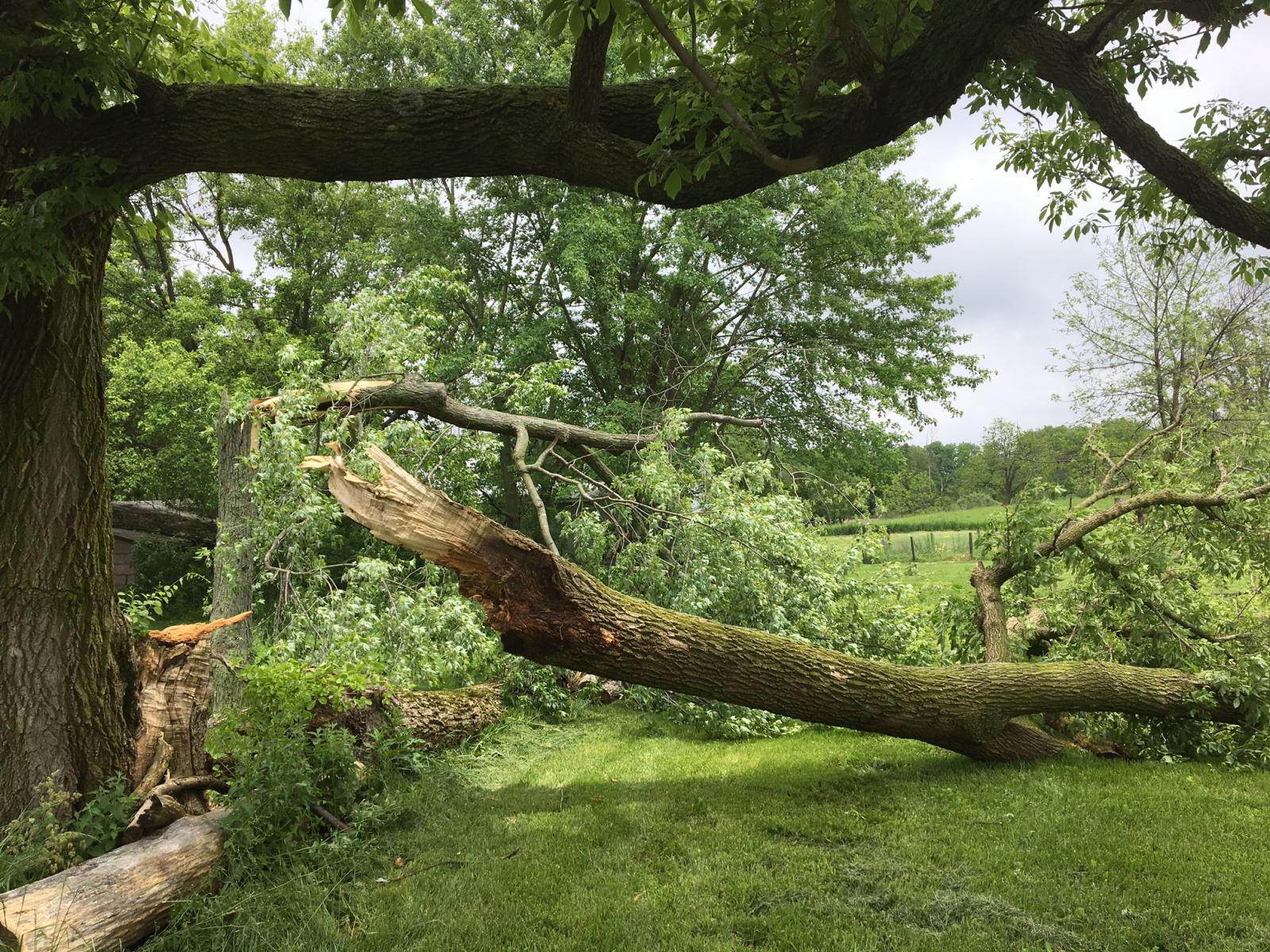 |
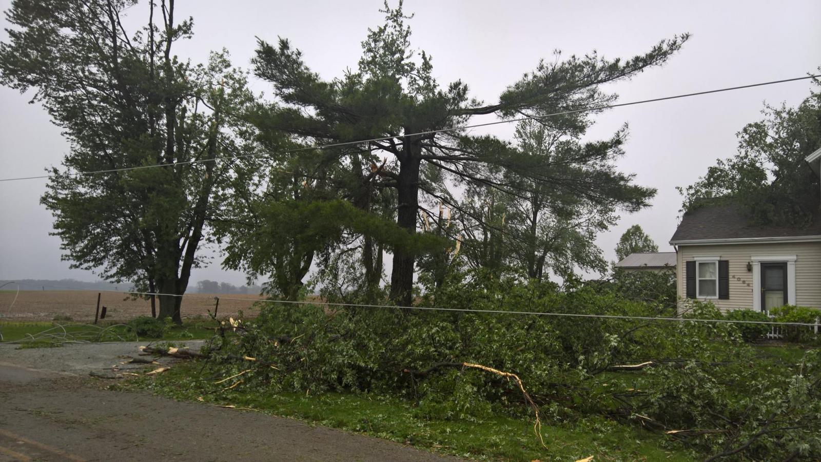
| Tree damage at 9608 N St Rd 5 in Bippus, IN | Tree damage in Silver Lake, IN via Silver Lake Fire Dept | Tree damage at North Manchester, IN via Jacob Longanecker | Tree damage at 8249 N St Rd 5 in Bippus, IN |
 |
 |
 |
 |
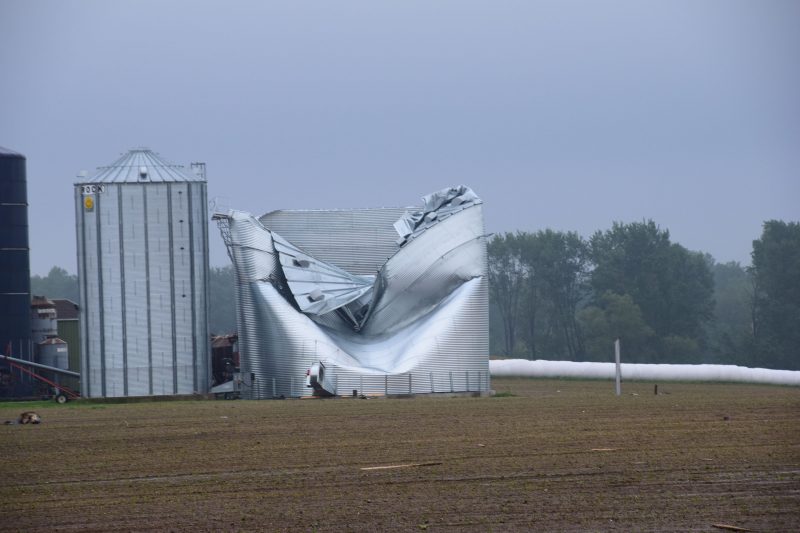
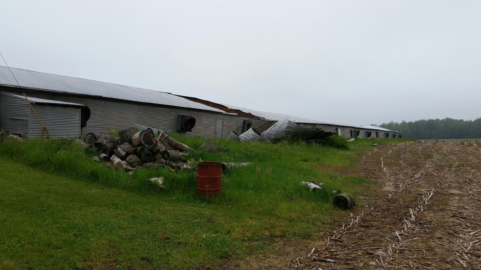
| Tree damage at 5734 W 800 N in Bippus, IN | Tree damage at 4064 W 950 S in Silver Lake, IN via Ink Free Press | Damage to a silo in Silver Lake via Ink Free Press | Tree and power pole damage in Silver Lake via Ink Free Press |
 |
 |
 |
 |
| Fig. 1. Debris thrown from the winds. Courtesy of Silver Lake Fire Dept. | Fig. 2. Additional Damage. Courtesy of Silver Lake Fire Dept. | Fig. 3. Additional Damage. Courtesy of Silver Lake Fire Dept. | Fig. 4. Additional Damage. Courtesy of Silver Lake Fire Dept. |
Radar:
Environment
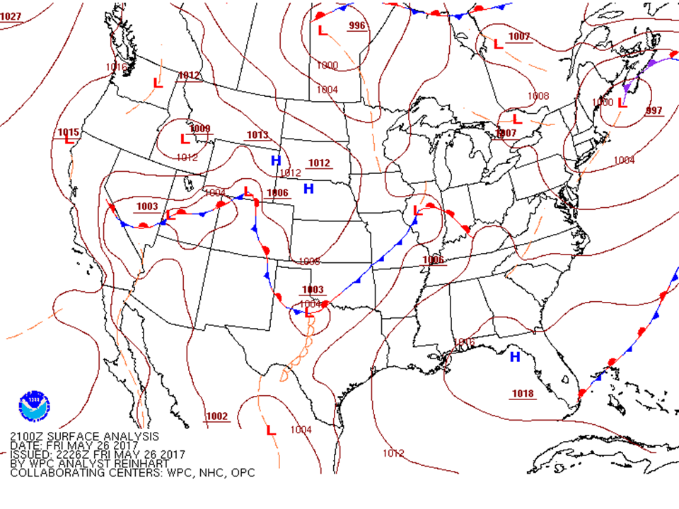
A mesoscale convective vortex (MCV) entered the Great Lakes region with plenty of shear and weak to moderate instability later in the day on May 26th, 2017.
 |
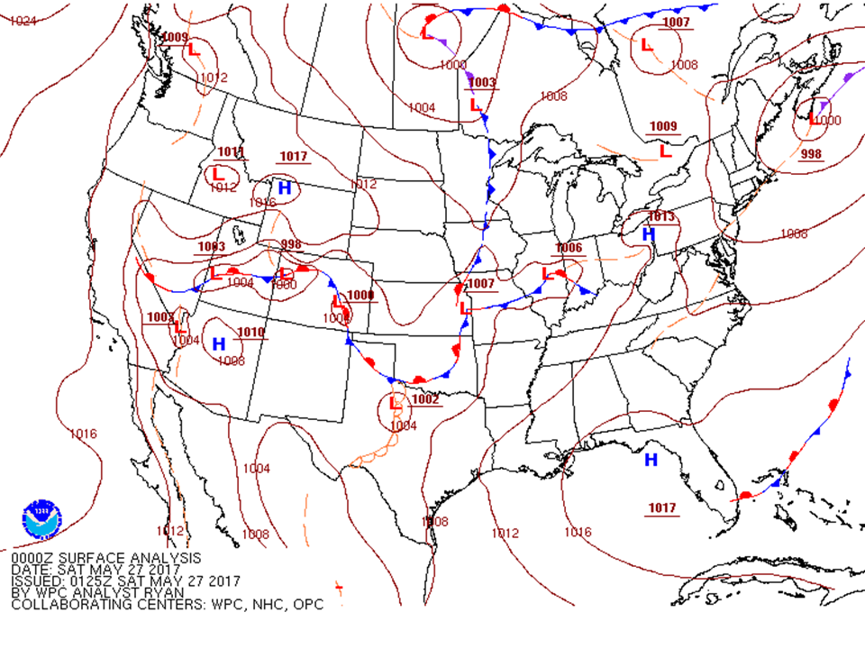 |
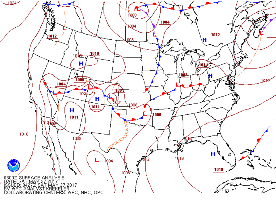 |
| Surface Analysis 5PM Friday | Surface Analysis 8PM Friday | Surface Analysis 11PM Friday |
Near-storm environment summary.
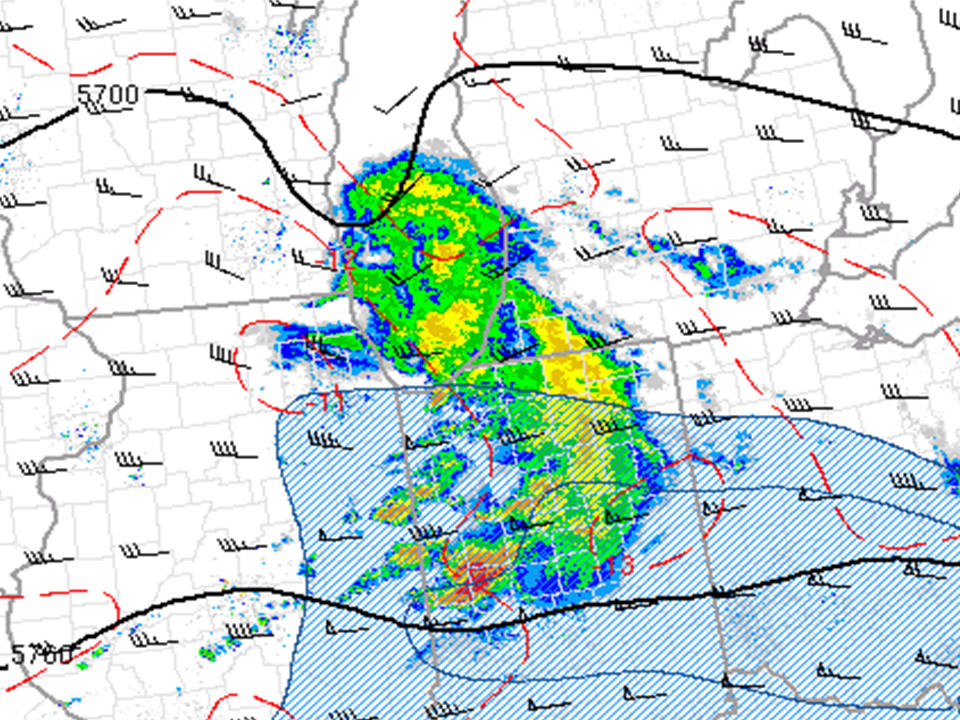
 |
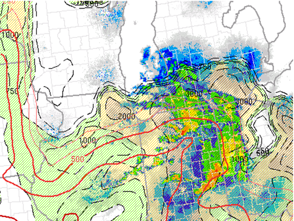 |
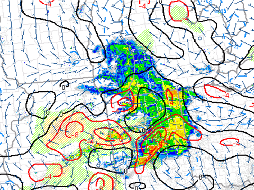 |
| At 7PM, strong shear was around the region as indicated by Effective Bulk Shear (kts). Tornado Watch 292 and Tornado warning within the watch box also shown | At 10PM, weak to marginal instability around the region as indicated by MUCAPE (J/kg) | At 9PM, areas of convergence (red contours) were around the region as indicated by surface divergence and vorticity This often shows surface boundaries that lead to the enhancement of storms |
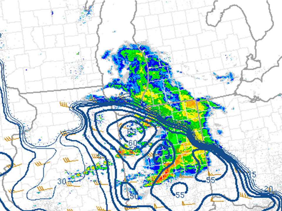 |
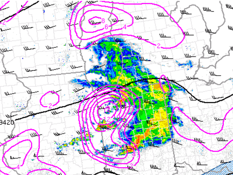 |
 |
| Effective Bulk Shear increased at 9PM within the near storm environment to 65 kts helping to sustain storm development | Plenty of large scale lift (pink contours) was around the region as indicated by the 300 mb analysis at 9PM. Wind speed (wind barbs) also shown. | Winds (wind barbs and color fill) were strong in the mid levels as indicated by the 500 mb analysis at 8PM. |
 |
Media use of NWS Web News Stories is encouraged! Please acknowledge the NWS as the source of any news information accessed from this site. |
|

