Atlantic Beach/Morehead City Tornado, November 26, 2013
EVENT OVERVIEW
At approximately 10:18 PM, on Tuesday November 26, 2013, a tornado quickly spun up just south of Bogue Banks in Carteret County and came ashore in the western part of Atlantic Beach, causing EF-2 damage to the Ocean Sands and Island Beach and Racquet Club Condominiums with extensive damage to several units. The tornado then tracked across Bogue Banks producing EF-1 damage along Hoop Pole Road snapping many hard and softwood trees and causing minor damage to several homes with the greatest damage due to falling trees.
The tornado then passed across Bogue Sound and came ashore in Morehead City at Carteret Community College and passed by Carteret General Hospital. Strong EF-1 damage occurred to several buildings on campus, blowing out windows and causing significant structural damage to one wall of the historical Camp Glenn Building there. Many trees on campus were also uprooted and snapped. The hospital only received minor damage but many trees, out buildings and vehicles at the facility also had strong EF-1 damage. The tornado continued north-northeast through the residential areas of Mandy Farms, Country Club East and Crab Point causing extensive EF-1 damage to trees and homes. Most damage to homes were limited to loss of roofing material and damage to siding, however many hard and softwood trees were snapped with many falling on homes causing extensive damage to the dwellings. The path length was estimated at 5.25 miles but is likely slightly longer as the tornado started as a waterspout over the Atlantic Ocean and continued into the Newport River before lifting. The width of the tornado remained fairly consistent at around 150 to 200 yards through the entire path. See the track graphics below.
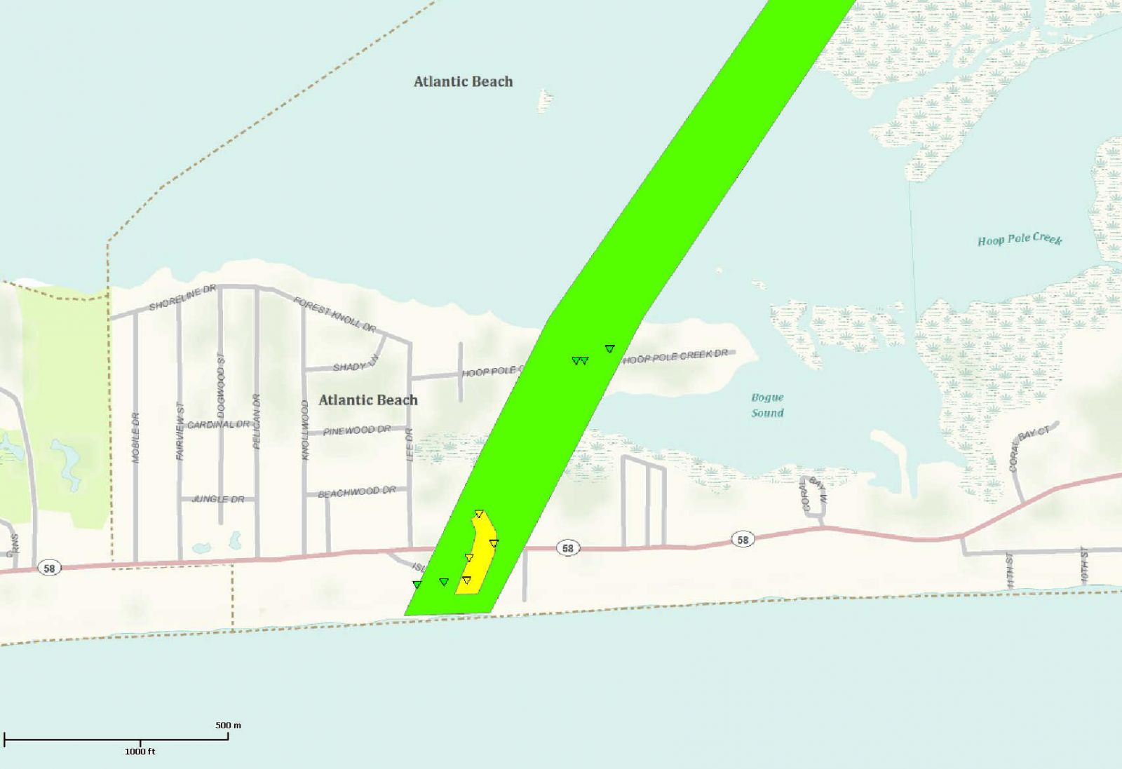
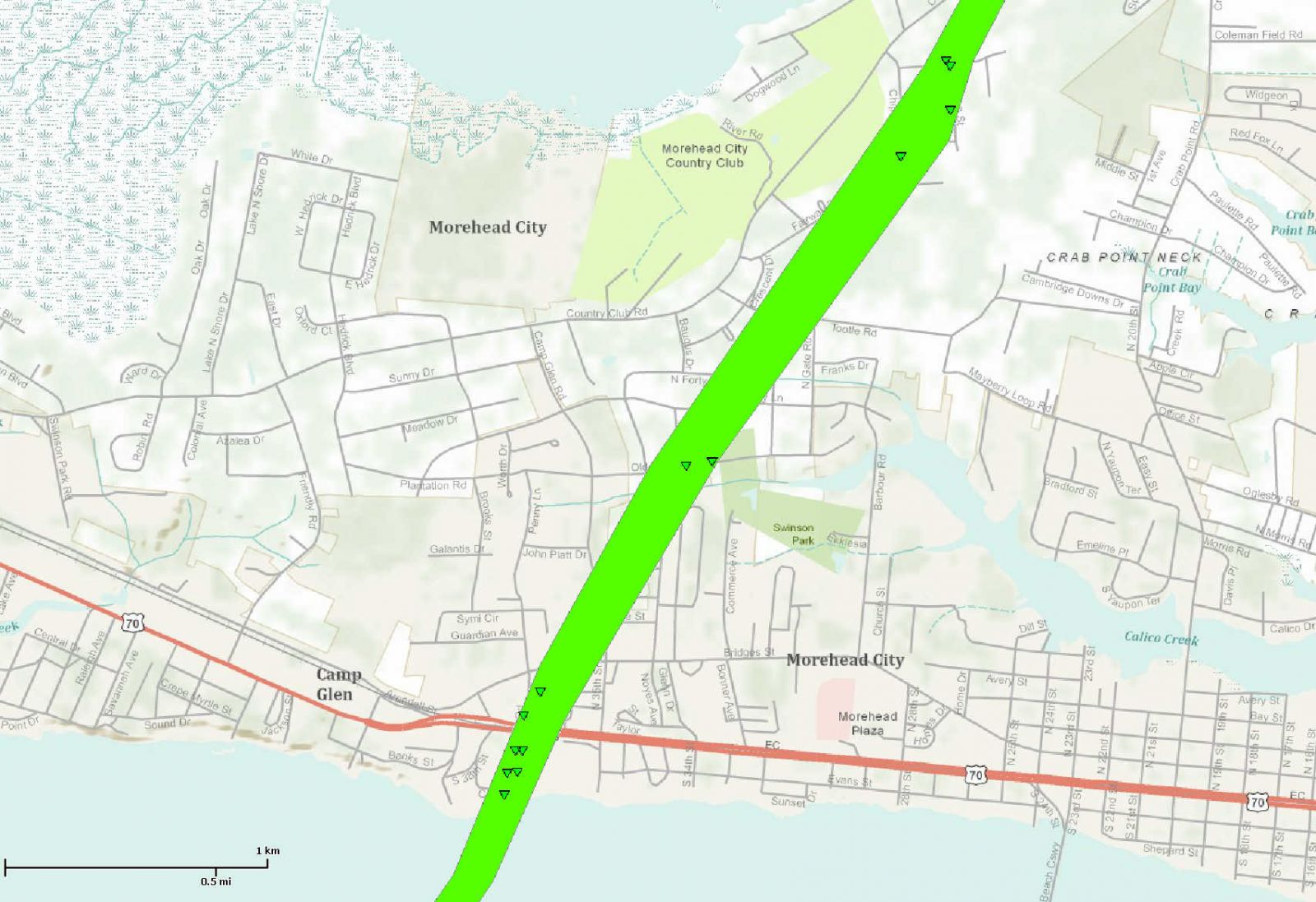
Damage Path across Atlantic Beach Damage Path across Morehead City
More in-depth information and pictures, click here for the Google-Earth *.kml file.
SYNOPTIC OVERVIEW
Surface Analysis during the early evening hours of November 26 showed a strong cold front moving into the western Piedmont of North Carolina with broad low pressure along the front. A warm front had moved north across eastern North Carolina during the late afternoon and early evening and was now approaching the border of Virginia. This led to a large temperature gradient across the state of North Carolina with temperatures at 10 PM November 26 around 40 degrees in the North Carolina mountains with 70 degrees reported at Wilmington. With the entire eastern portion of North Carolina in the warm sector, the 00Z Sounding from Newport, NC (Figure 1), showed impressive low-level shear with strongly-backed southeast winds near the surface. A 10 PM map of the 0 to 3 kilometer Storm Relative Helicity (Figure 2) also showed a maximum of low-level shear just off the eastern North Carolina coast. The directional shear is further illustrated in the winds from the 850 mb analysis with increasing southeast winds (Figure 3) and the 500 mb analysis (Figure 5) with increasing southwest flow.
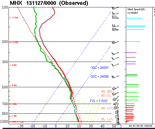
Figure 1. The 00Z (7 PM EST) Sounding from Newport, NC on November 26, 2013.
.gif)
Figure 2. 0-3 km Storm Relative Helicity at 9 PM EST November 26, 2013. Note the strong shear off the NC coast.
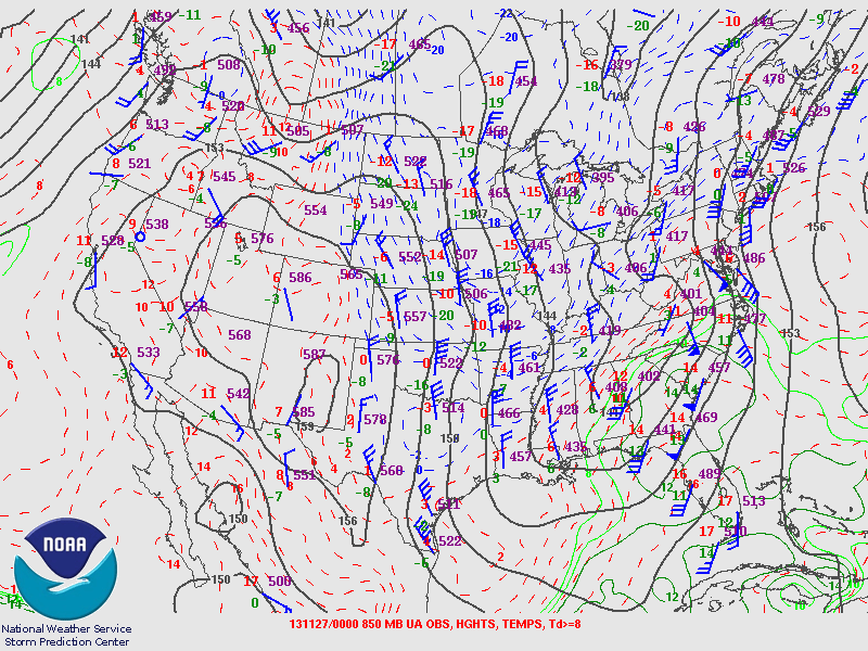
Figure 3. 850 MB Analysis at 7 PM EST, November 26, 2013. Note the Southeast winds at Newport, NC.
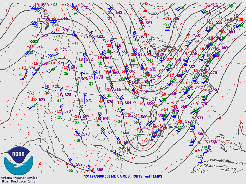
Figure 4. 500 MB Analysis, 7 PM EST, November 26, 2013. Note the 60 knot Southwest flow at Newport, NC.
RADAR IMAGERY
Convection started developing off the North Carolina coast during the late afternoon hours of November 26, 2013 and started progressing gradually toward the North and Northeast. Although instability was minimal, a 50 to 55 knot low-level jet helped increased surface dewpoints into the mid 60s as far inland as New Bern. The low-level shear was conducive to rotating updrafts despite marginal instability across the coastal areas. A few mesocyclones were observed by radar in a large cluster of storms that remained mostly offshore. The main rotating storm began to move north-northeast and exhibited strong rotation just off Bogue Banks at 10:12 pm EST, sufficient to trigger the Nexrad radar's Tornado Vortex Signature (TVS). (Figure 5).
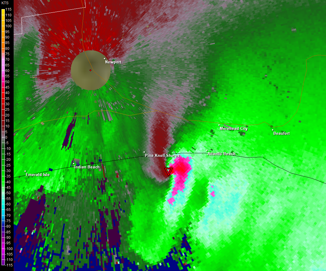
Figure 5. Strong Rotation off Bogue Banks at 10:12 PM EST, November 26, 2013. Red Triangle indicates a Tornado Vortex Signature (TVS).
.png) Figure 6. Although weaker, strong rotation continues in the low levels at 10:17 PM over Morehead City.
Figure 6. Although weaker, strong rotation continues in the low levels at 10:17 PM over Morehead City.
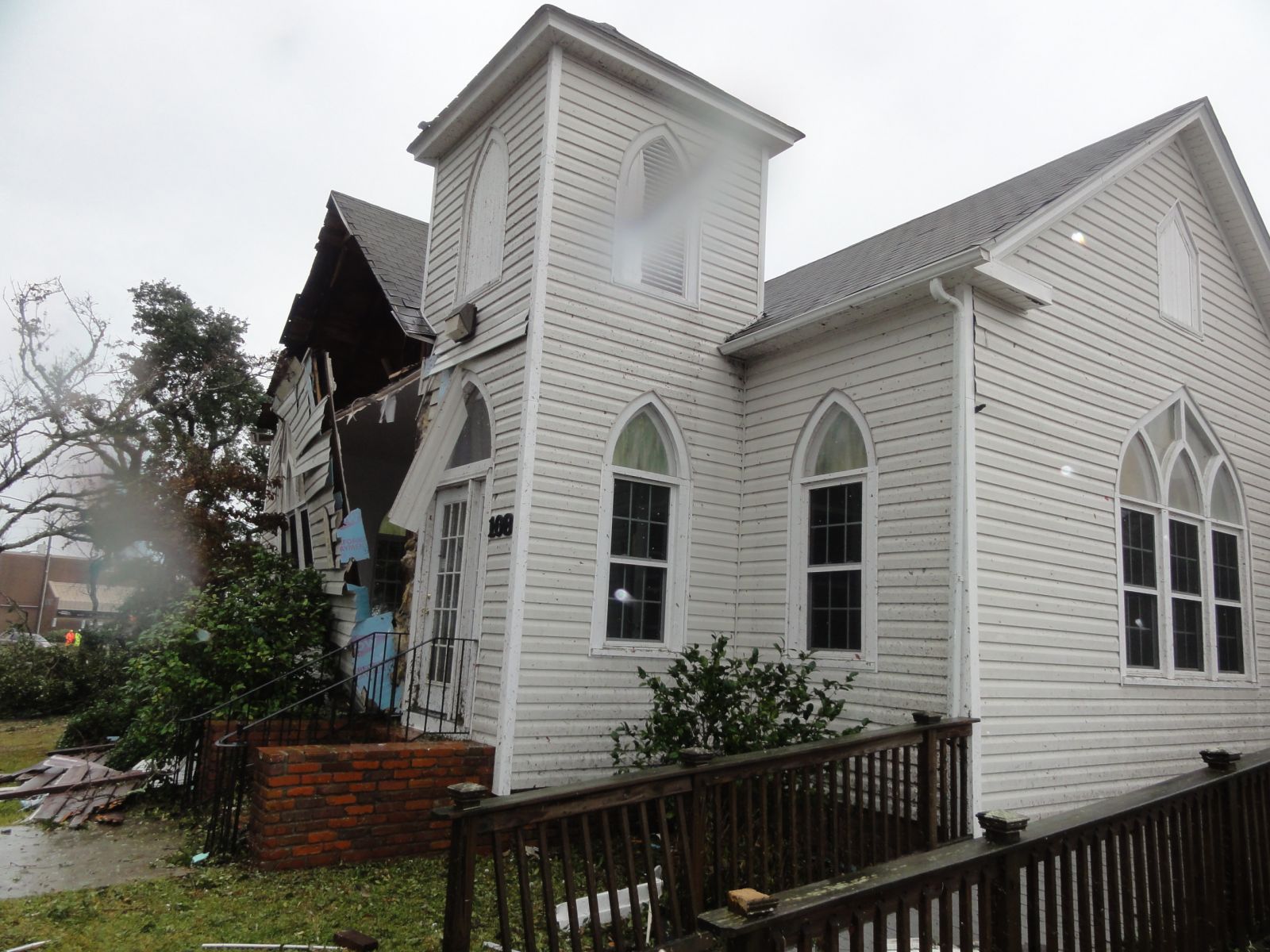
DAMAGE PHOTOS
.jpg)
.jpg)
EF-2 damage to the Ocean Sands Condominiums, Atlantic Beach Tree Damage in Mandy Farms, Morehead City
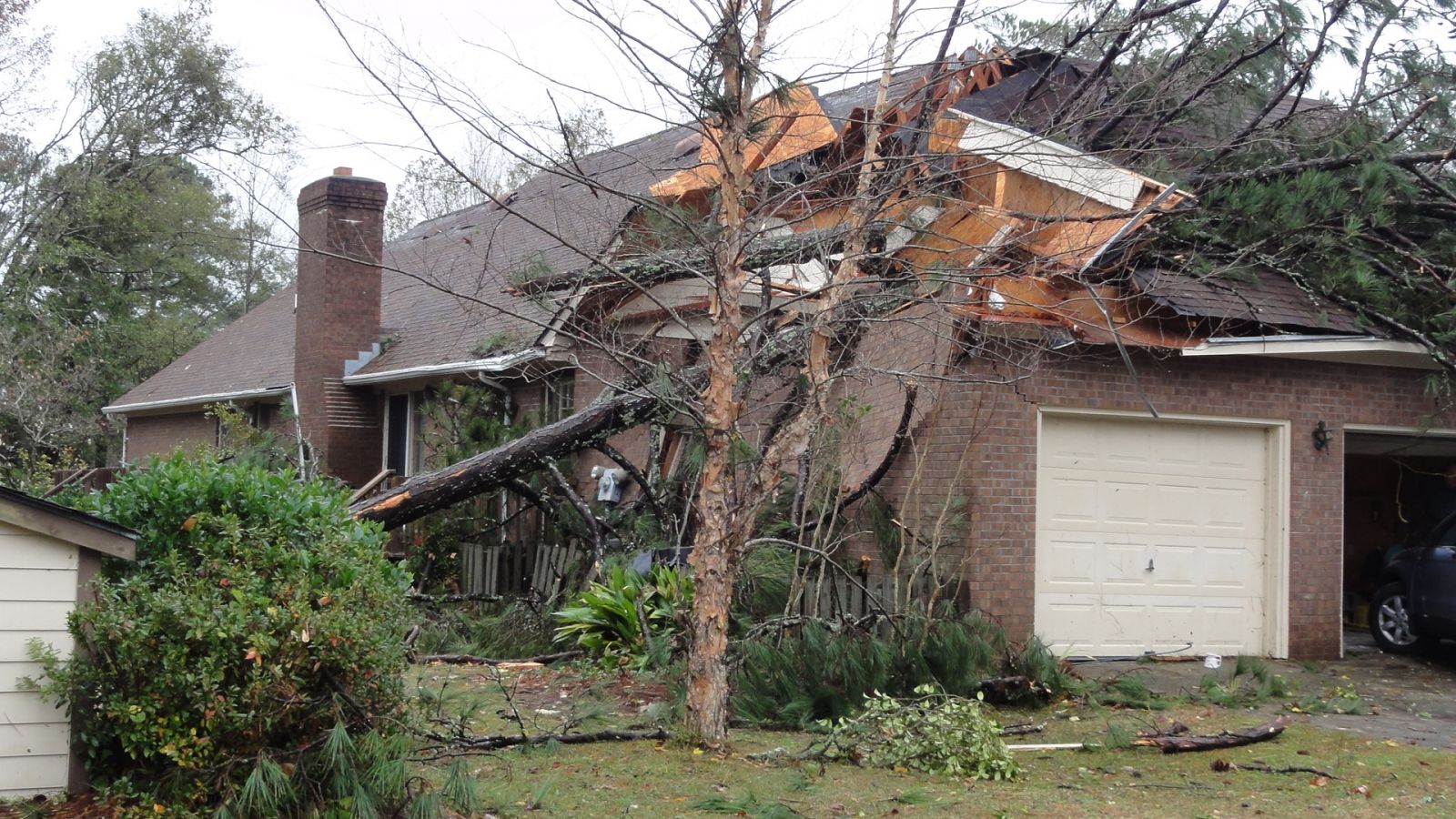
Damage at Carteret Community College, Morehead City Damage in Country Club East, Morehead City, NC
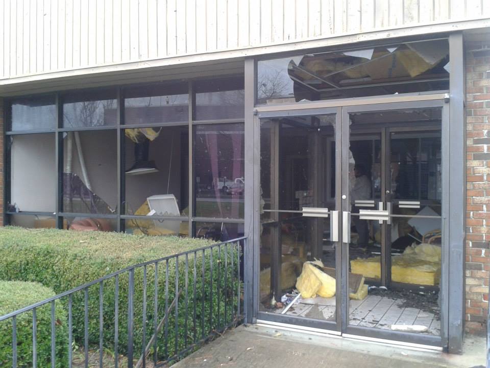
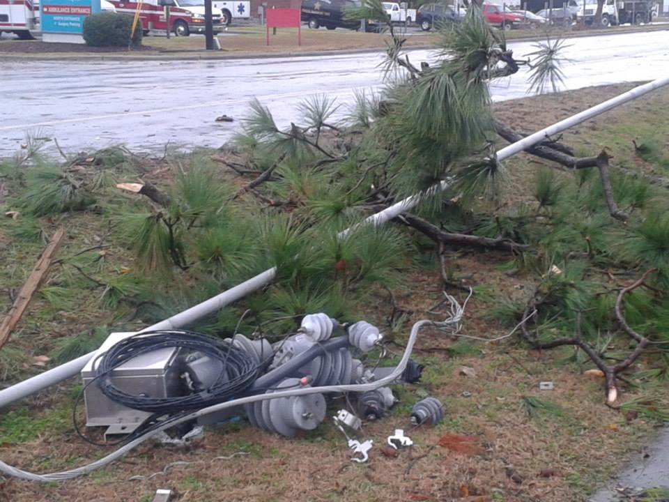
Damage to Coastal Eye Clinic in Morehead City (Courtesy Anna Harvey) Powerlines down on Bridges Street, Morehead City (Courtesy Anna Harvey)


 Map View
 Weather Hazard Briefing (when applicable)
 Forecaster Discussion
 Marine
 Text Products
.png) Skywarn
Skywarn Submit Storm Reports
 Coastal Flood
.png) Surf Forecast/Rip Currents
Surf Forecast/Rip Currents