Winter Weather Preparedness
It Only Takes One Snow Or Ice Storm To Make an Impact!
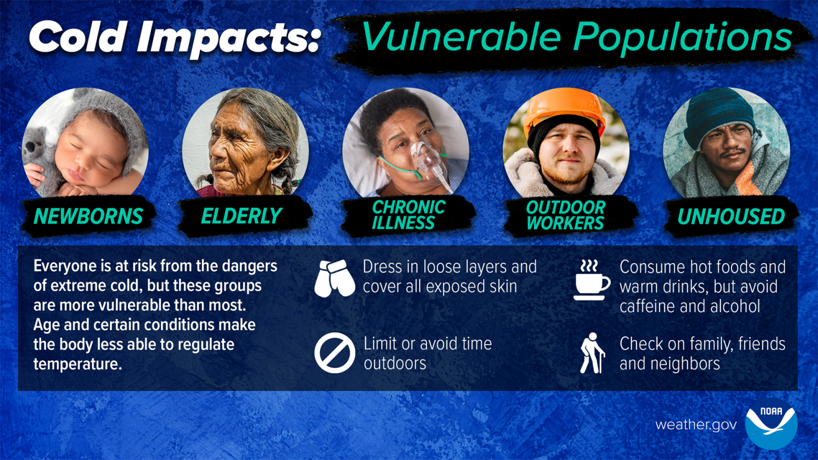
NC Winter Preparedness Week December 7th - 13th
Please join us in promoting winter weather safety during this year's "Winter Weather Preparedness Week". The National Weather Service asks emergency management, public safety officials, local media and Weather-Ready Nation Ambassadors to help join forces in improving the nation's readiness, responsiveness, and overall resilience against extreme weather during the winter weather season.
Each day this week, a different topic will be covered. Click on the tabs below for more winter weather preparedness information.
Sunday
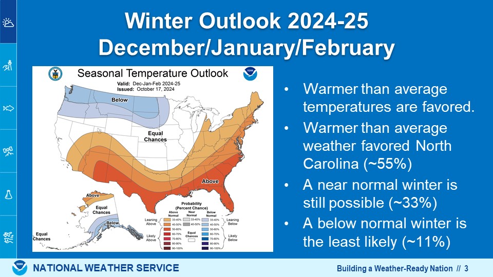
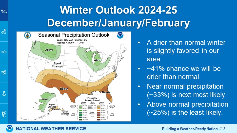
Winter Season Outlook and winter weather terminology
Winter Outlook 2025-26 (Video)
|
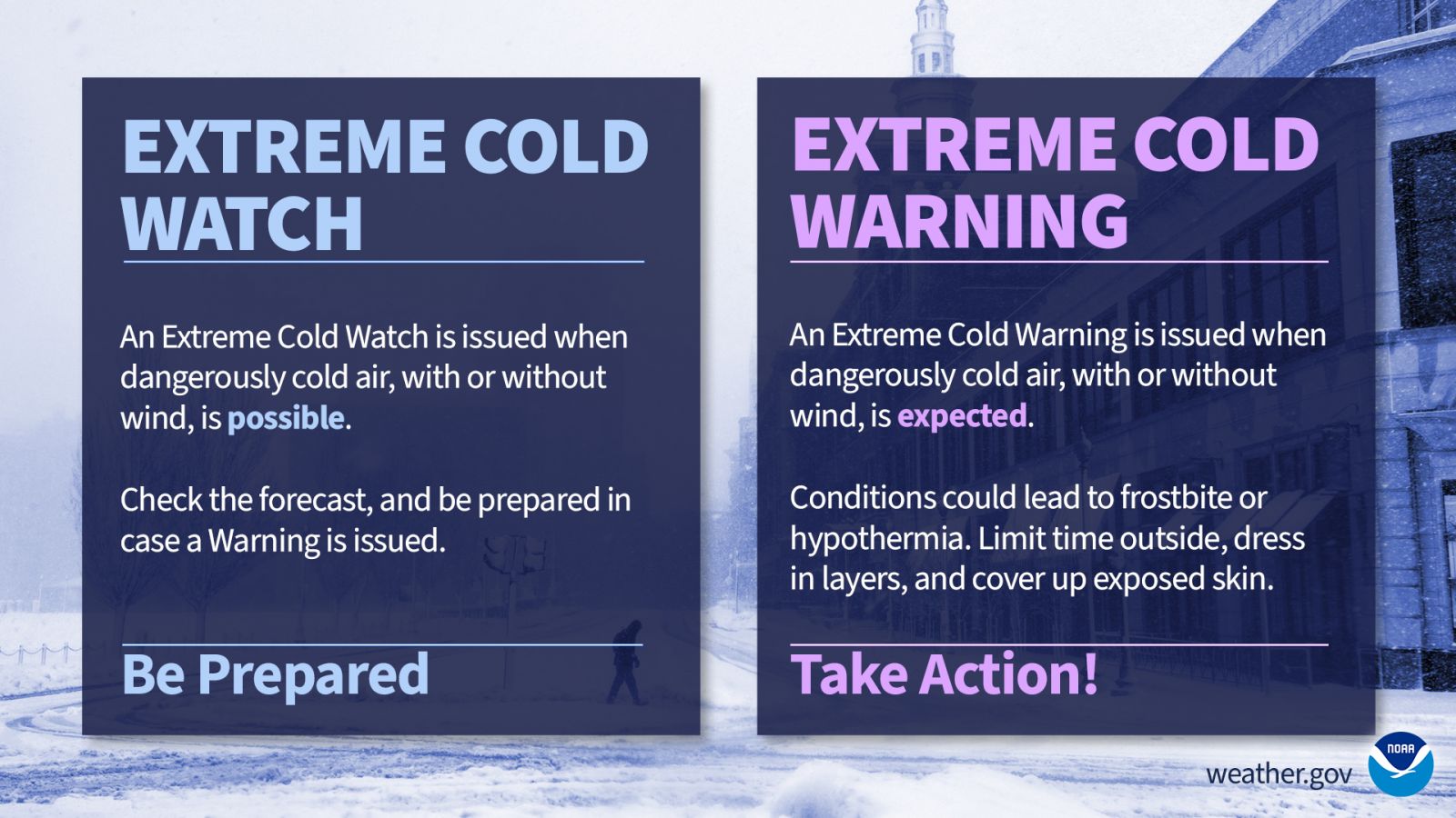
Watches are issued when a storm is in it's early stage of development, and may create conditions that may harm life and property. Hazardous winter weather is only a possibility, not a certainty. The following are the watch headlines issued for winter weather events:
|
|
Warnings are issued when the threat to life and property is imminent or has already begun from severe winter weather. The following are the warning headlines issued for winter weather events:
|
|
Advisories are issued for less serious weather conditions that will not cause immediate threat to life and property. Advisories will be issued when weather conditions will impact motorists, outdoor activities, or public events. These events could become life-threatening if proper precautions are not taken. The following are the advisory headlines issued for winter weather events:
|
Monday
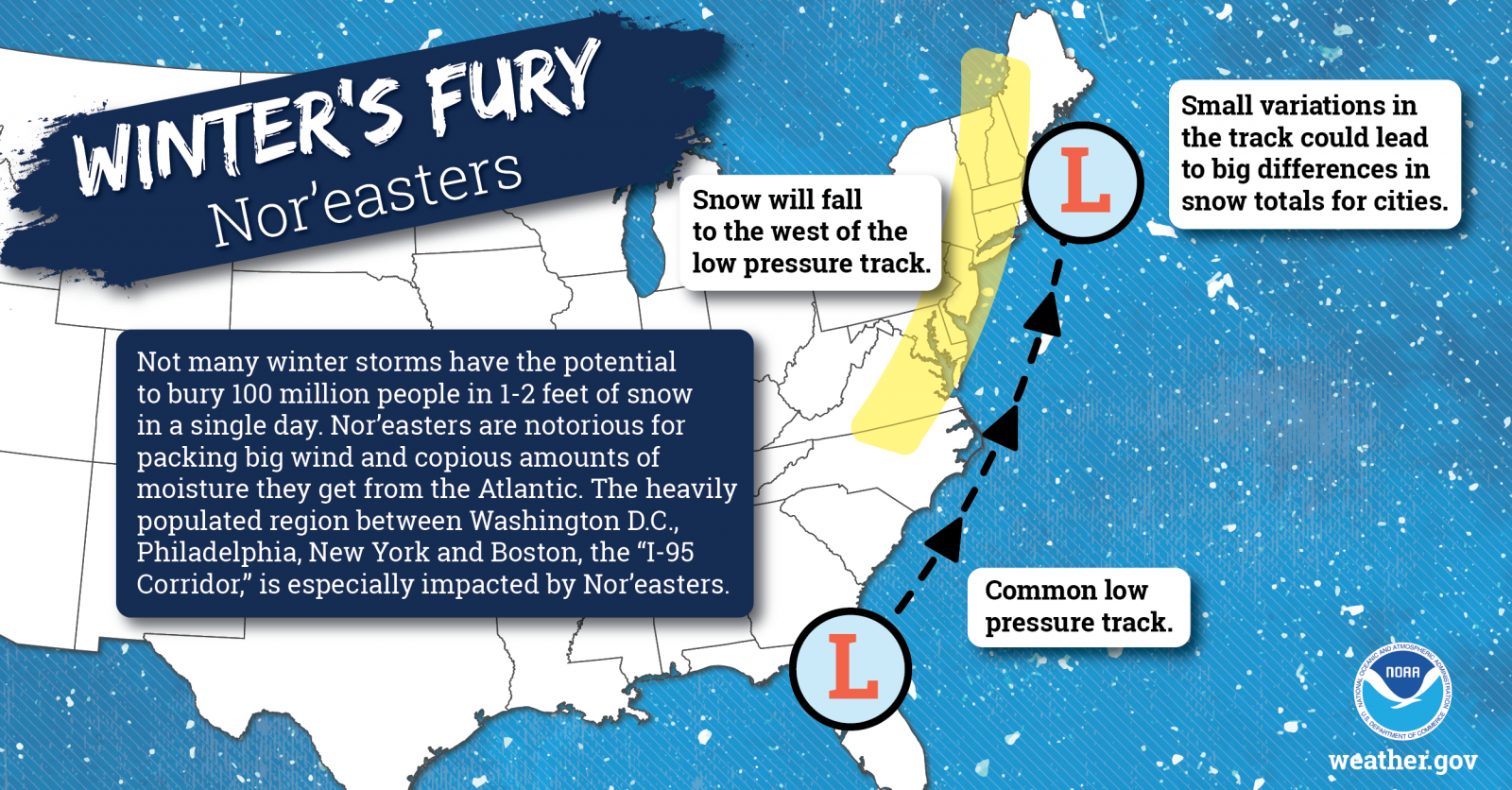
Winter weather patterns affecting North Carolina
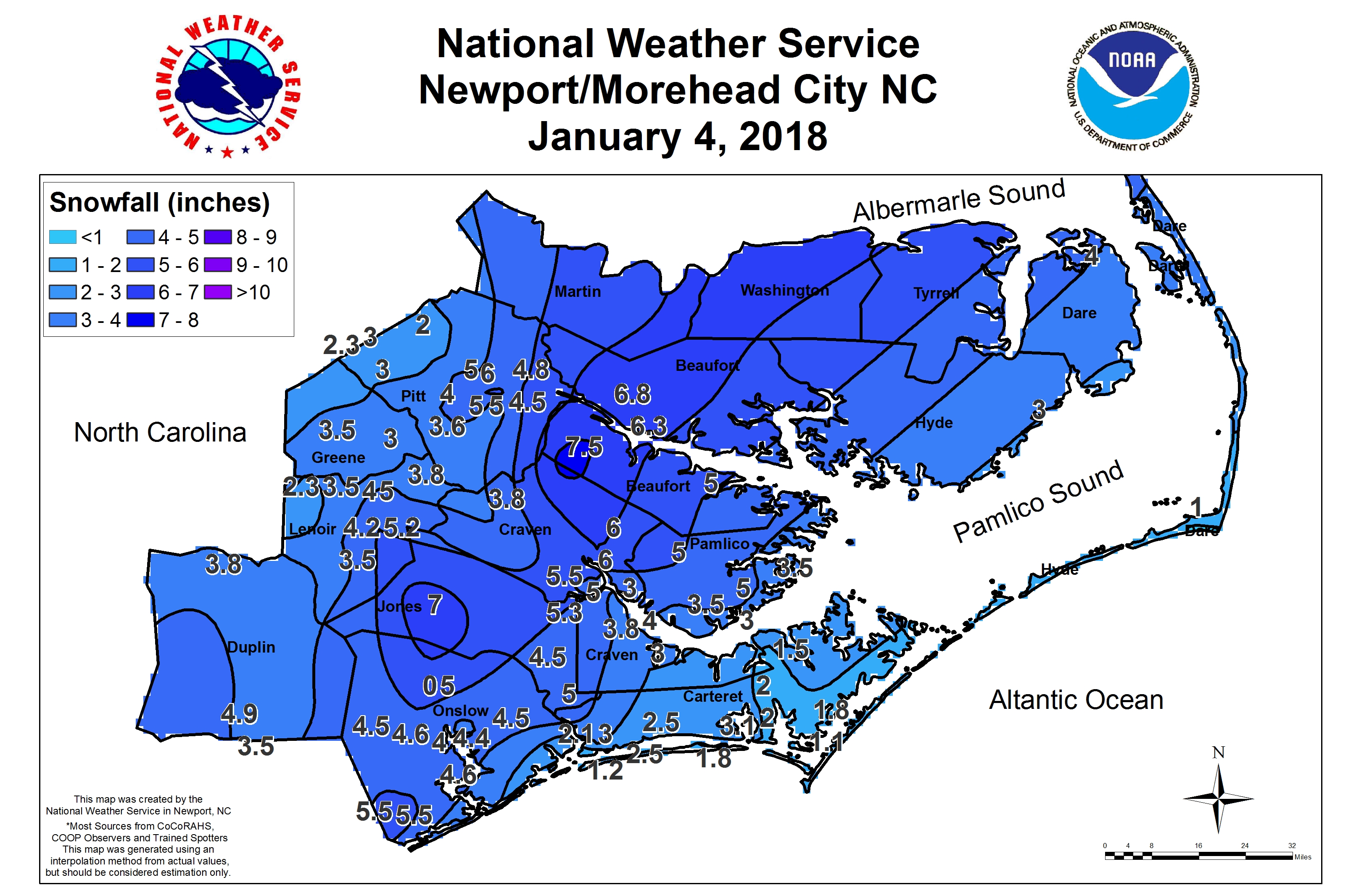
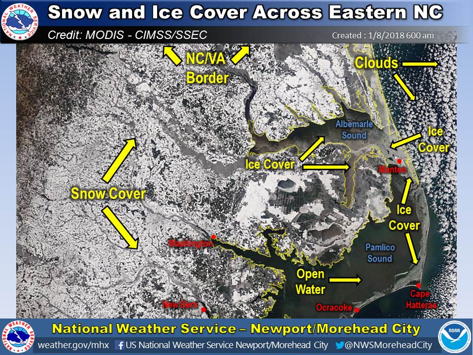
The most common and dangerous winter weather systems which can produce snow and ice are strong coastal low pressure systems known as nor'easters. This was the case on January 3rd - 4th, 2018 when more than 6" of snow fell inland across our area. In addition behind the system, often we can experience a period of very cold weather. This happened with the early January 2018 storm when many locations away from the coast had morning lows below zero, behind the system. In fact some areas had snow and ice covered roads for days! Who says Eastern North Carolina can't experience winter?
 |
 |
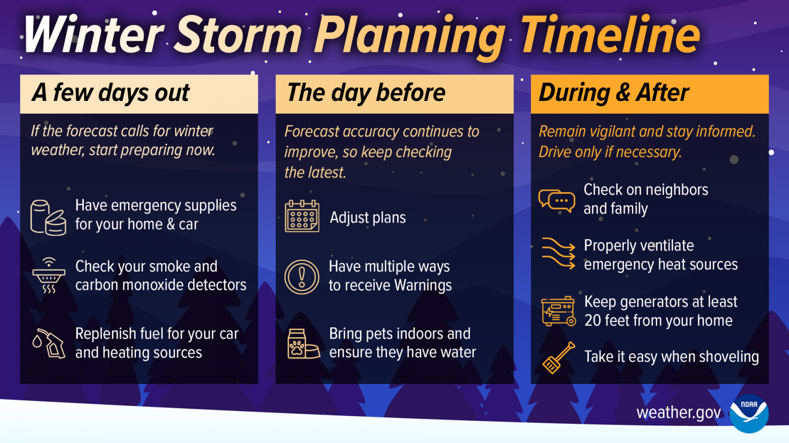
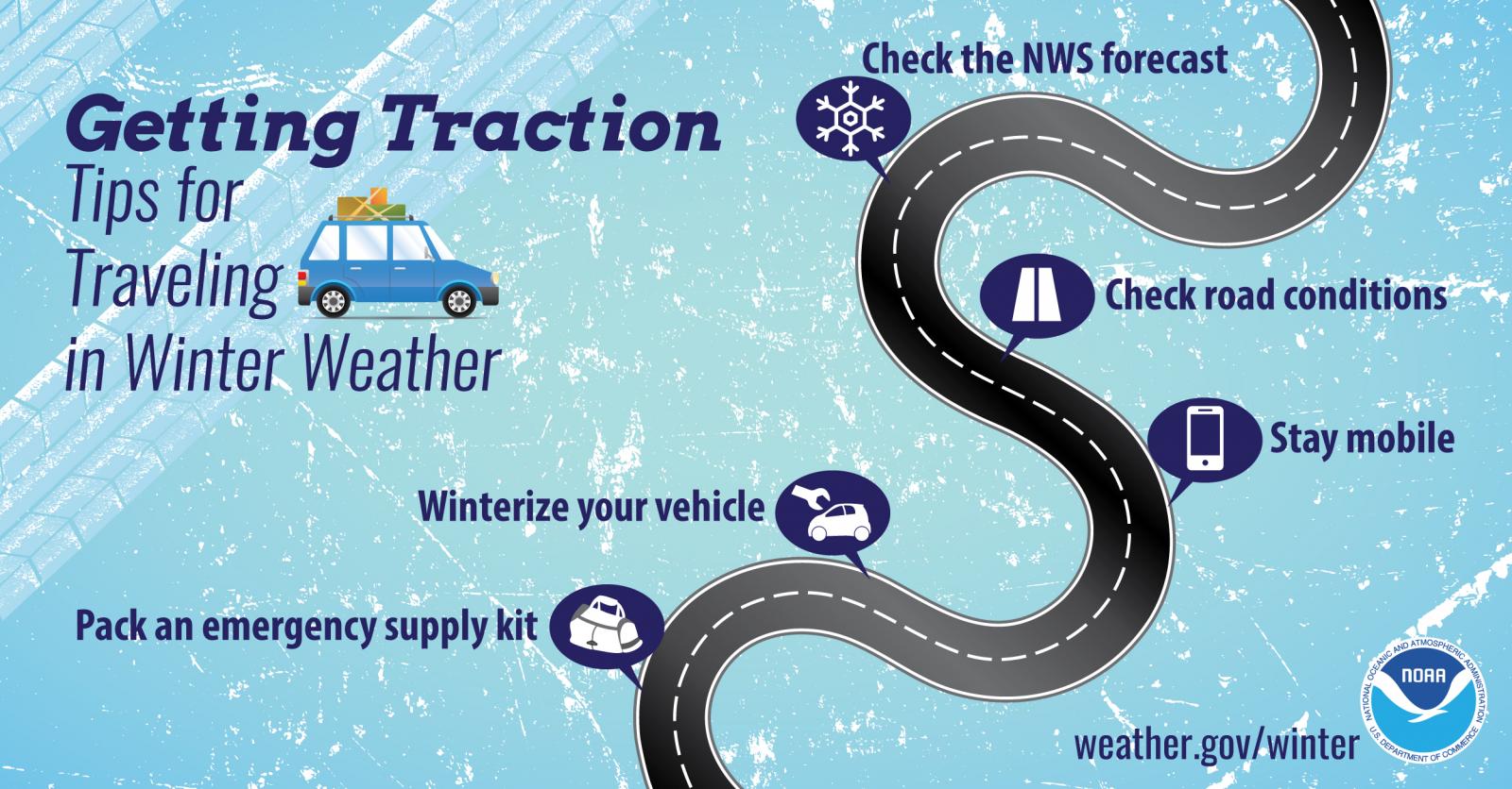
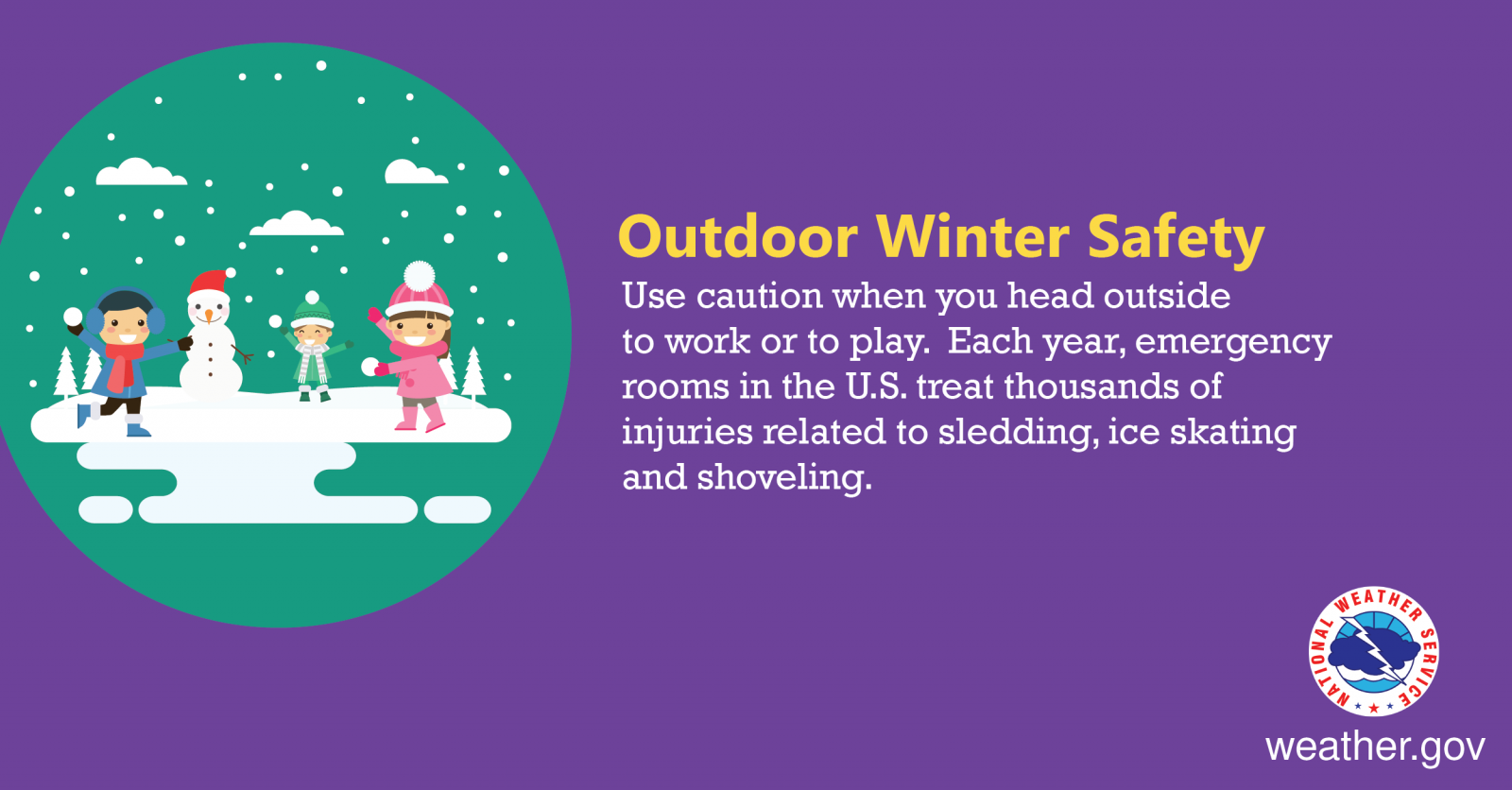
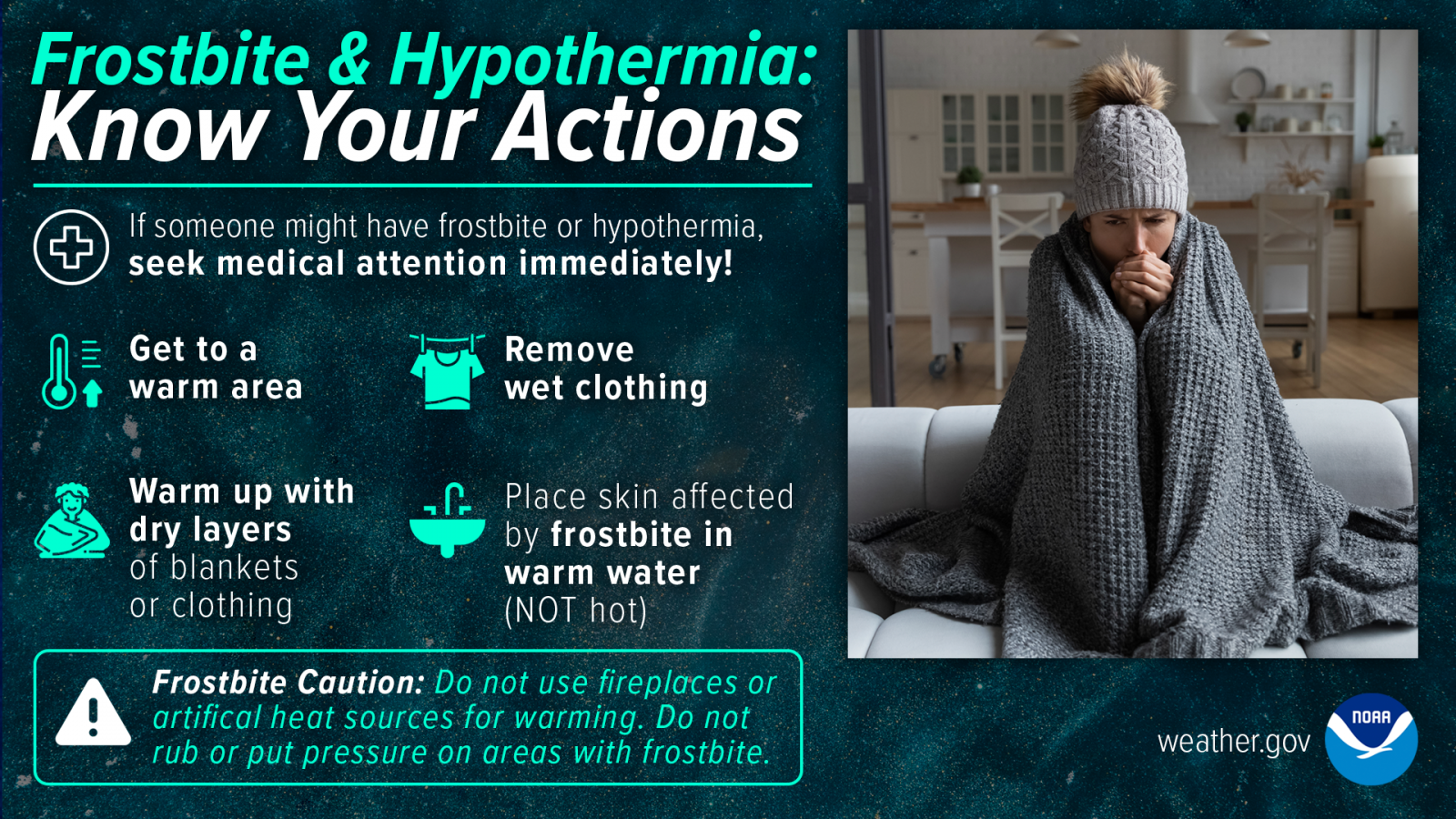
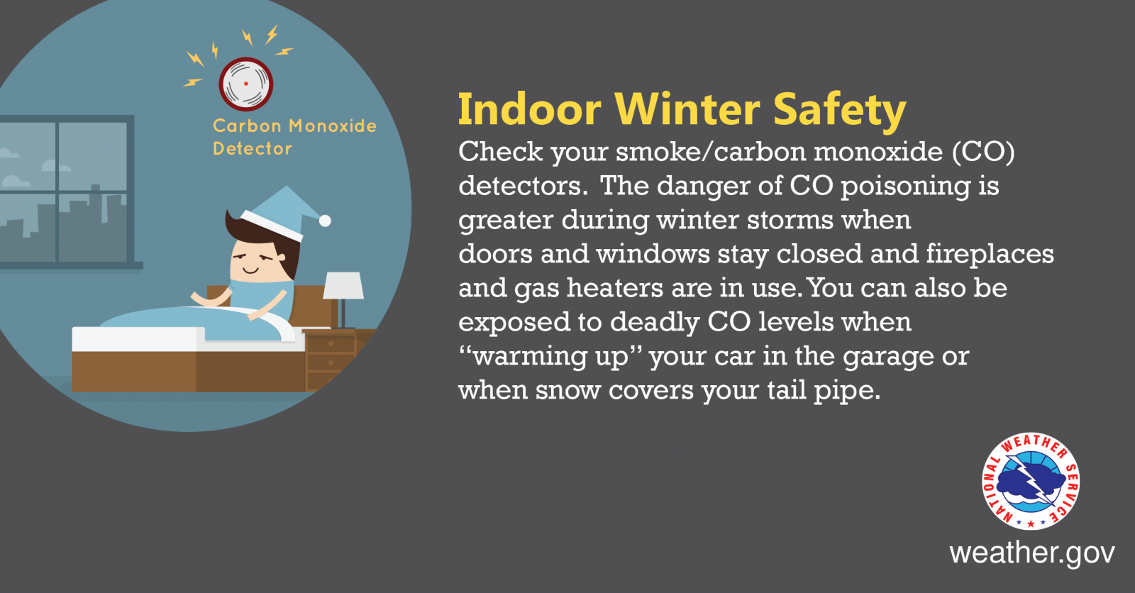
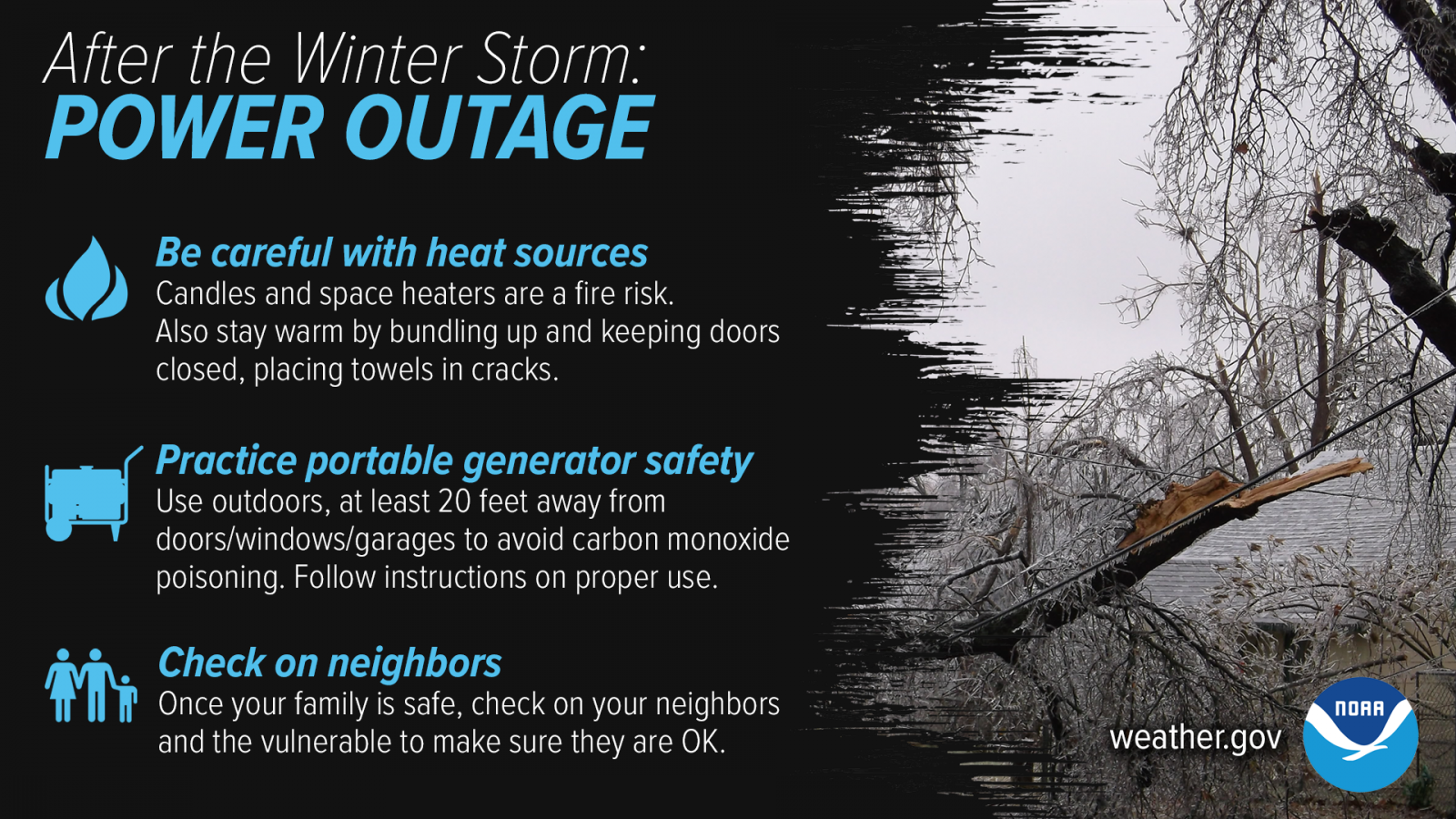
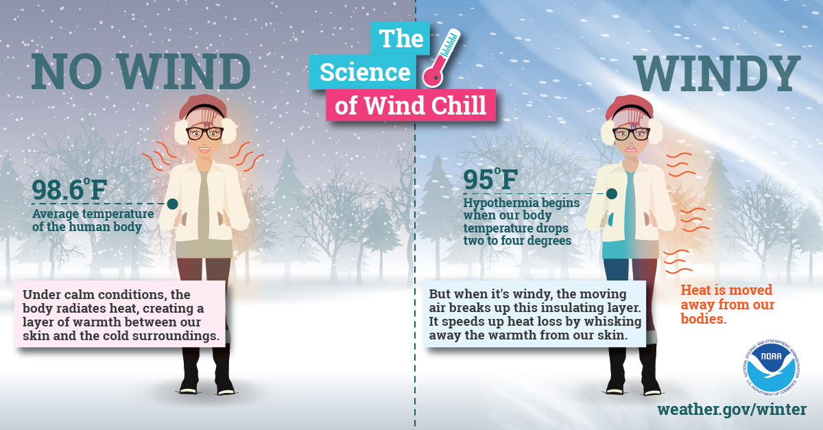
Winter storms can make driving and walking extremely dangerous. The aftermath of a major winter storm can have a devastating impact for days or even weeks. Winter storms can be deceptive killers because most deaths are indirectly related to the storm. People die in traffic accidents on icy roads, have heart attacks while shoveling snow, or succumb to fires or carbon monoxide while trying to heat their home improperly. With proper planning and preparation, you can limit or even mitigate the impacts from winter storms.
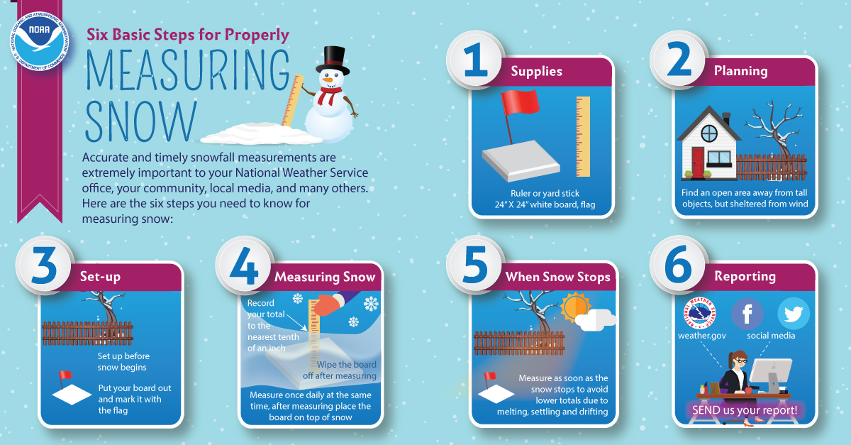
Winter infographics
 |
 |
 |
 |
 |
 |
 |
 |
Tuesday
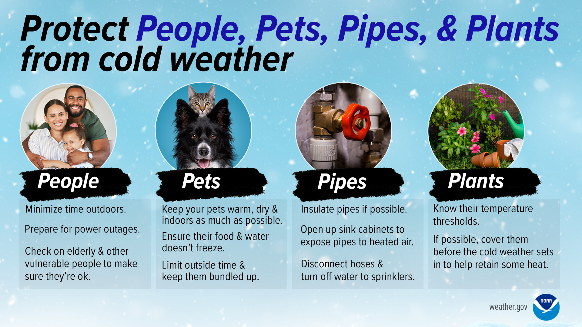
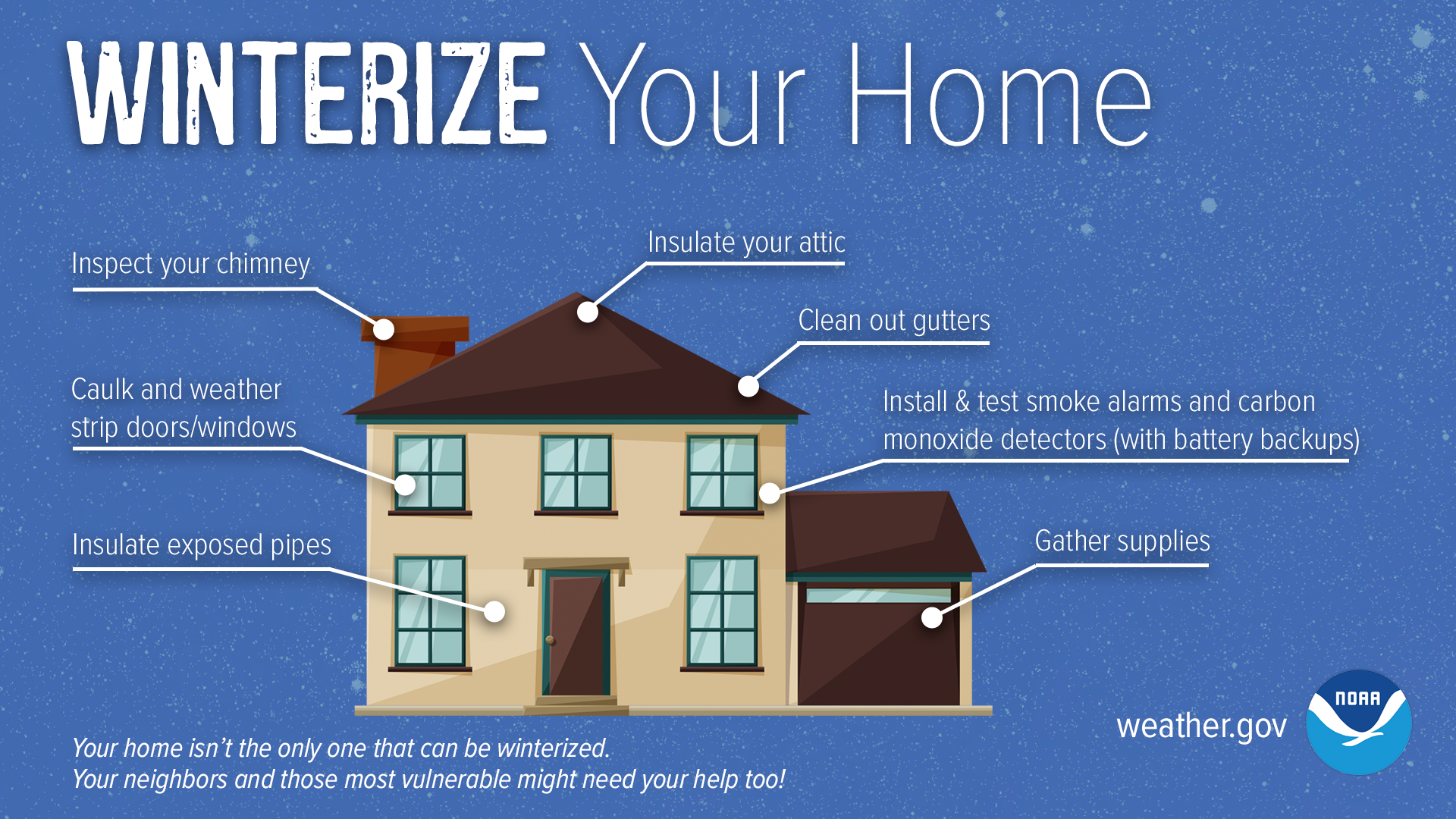
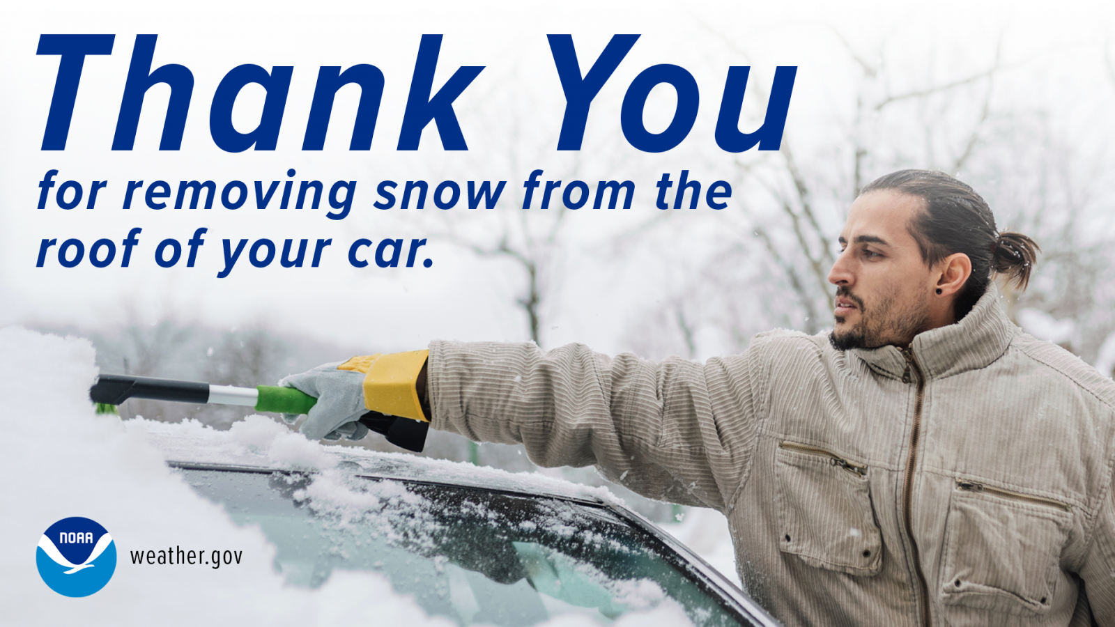
Preparing your home for winter
Stock an emergency supply of food and water prior to the onset of a winter storm. Include food items which require no cooking such as canned meats, peanut butter and other non-perishables. Also do not forget to have necessary medicines and baby items on hand. A three to five day supply of food and medicine is generally sufficient. A lot of these items may already be in your home from your hurricane kit.
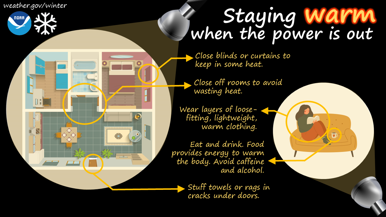
Severe winter storms can produce conditions which can isolate you in your home for several days. Prolonged loss of power and telephone services can severely limit your ability to heat your home and call for help. In severe winter storms, obtaining supplies, food and other necessities can be hampered or prevented by poor road conditions.
.png)
Winter infographics
|
|
 |
 |
 |
 |
 |
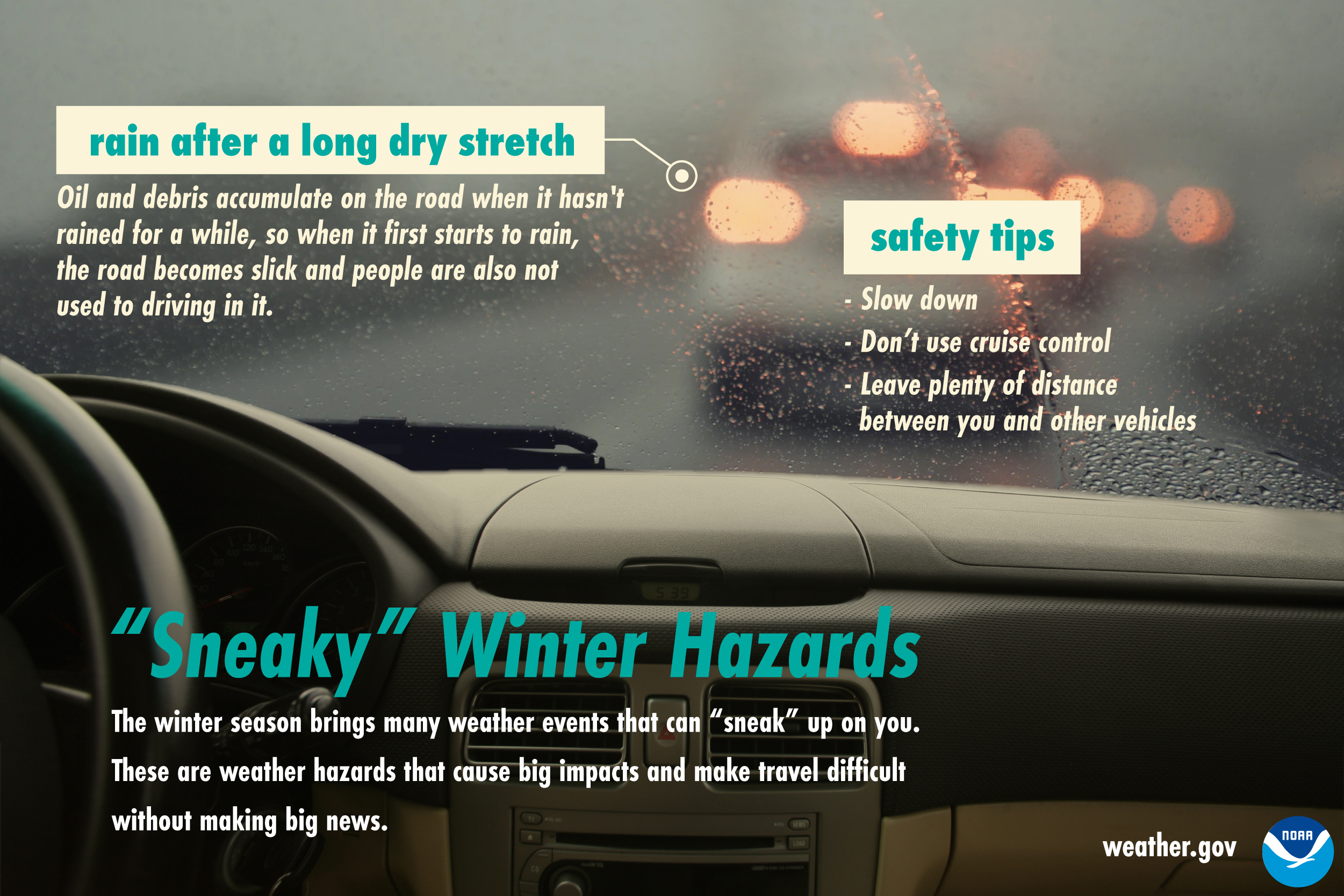
Wednesday
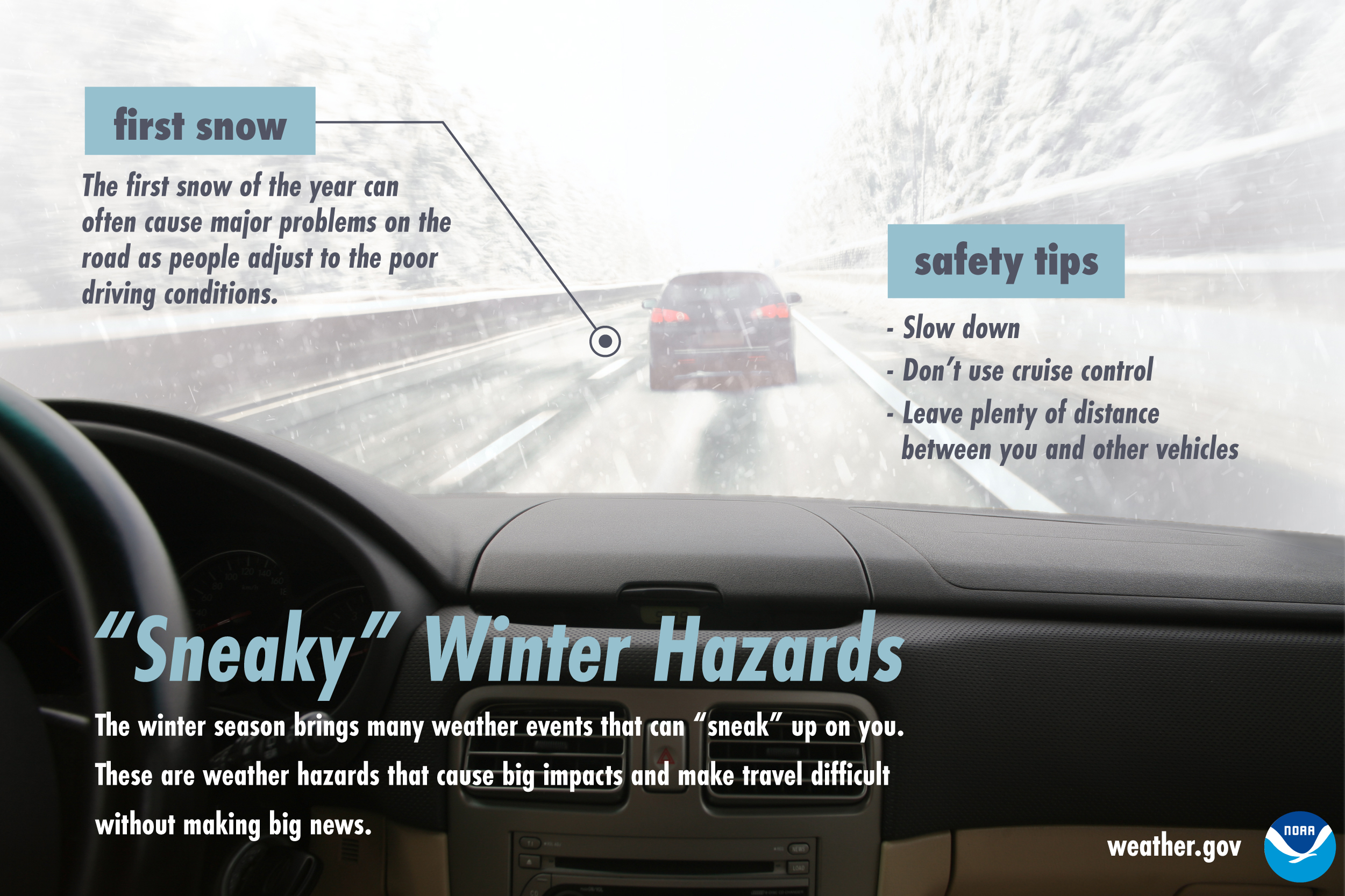
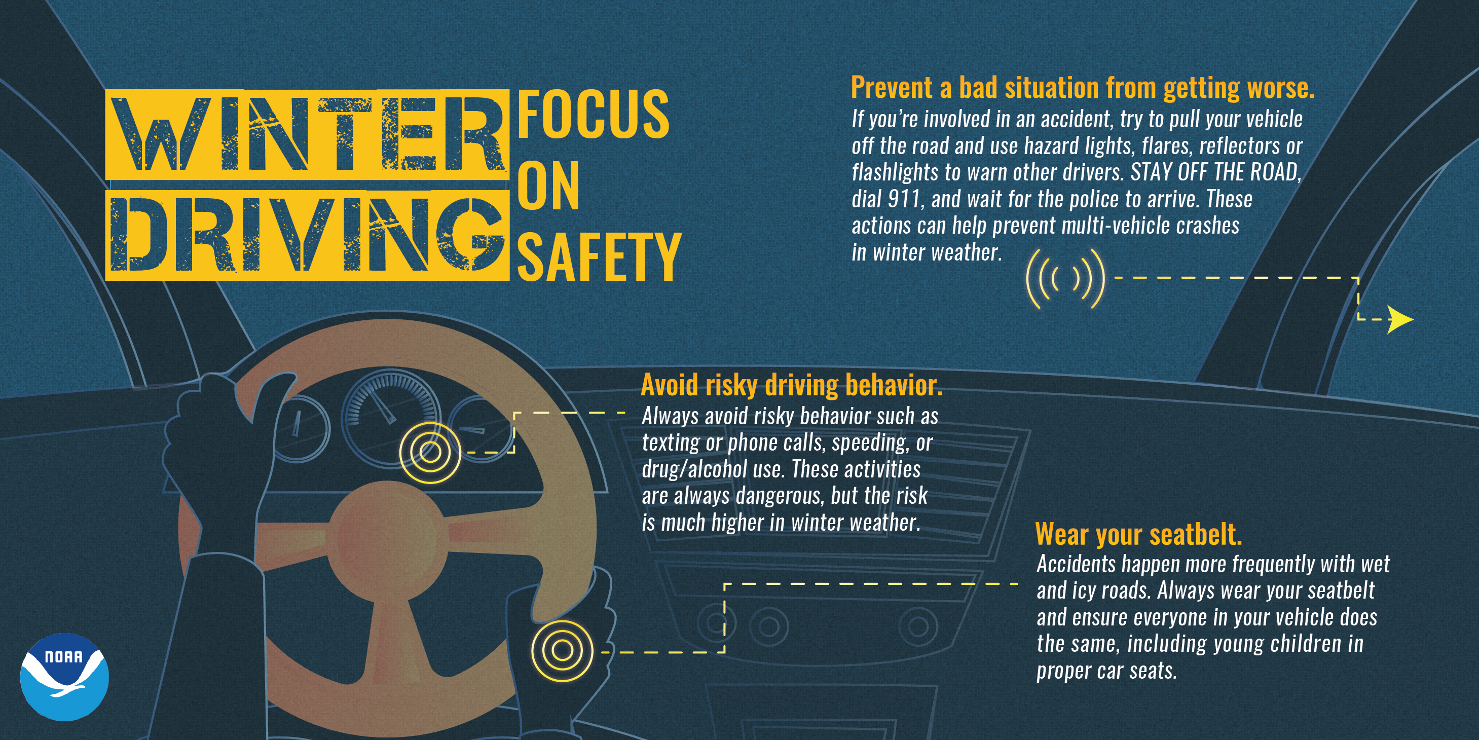
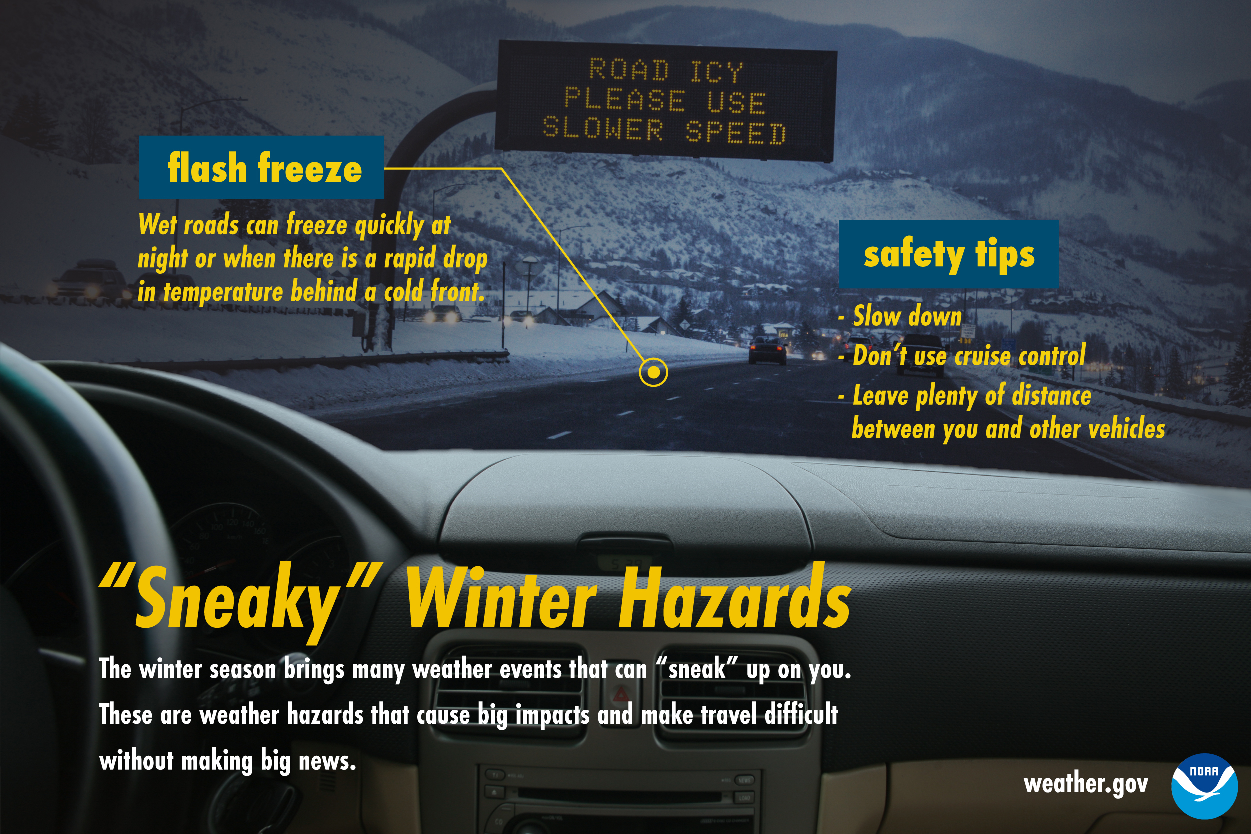
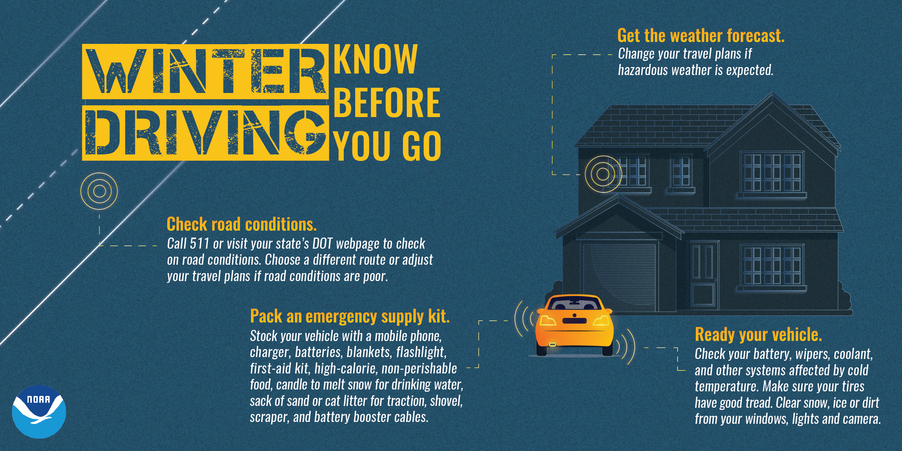
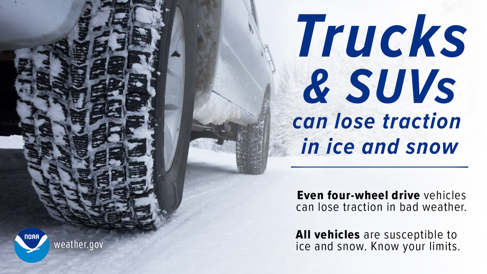
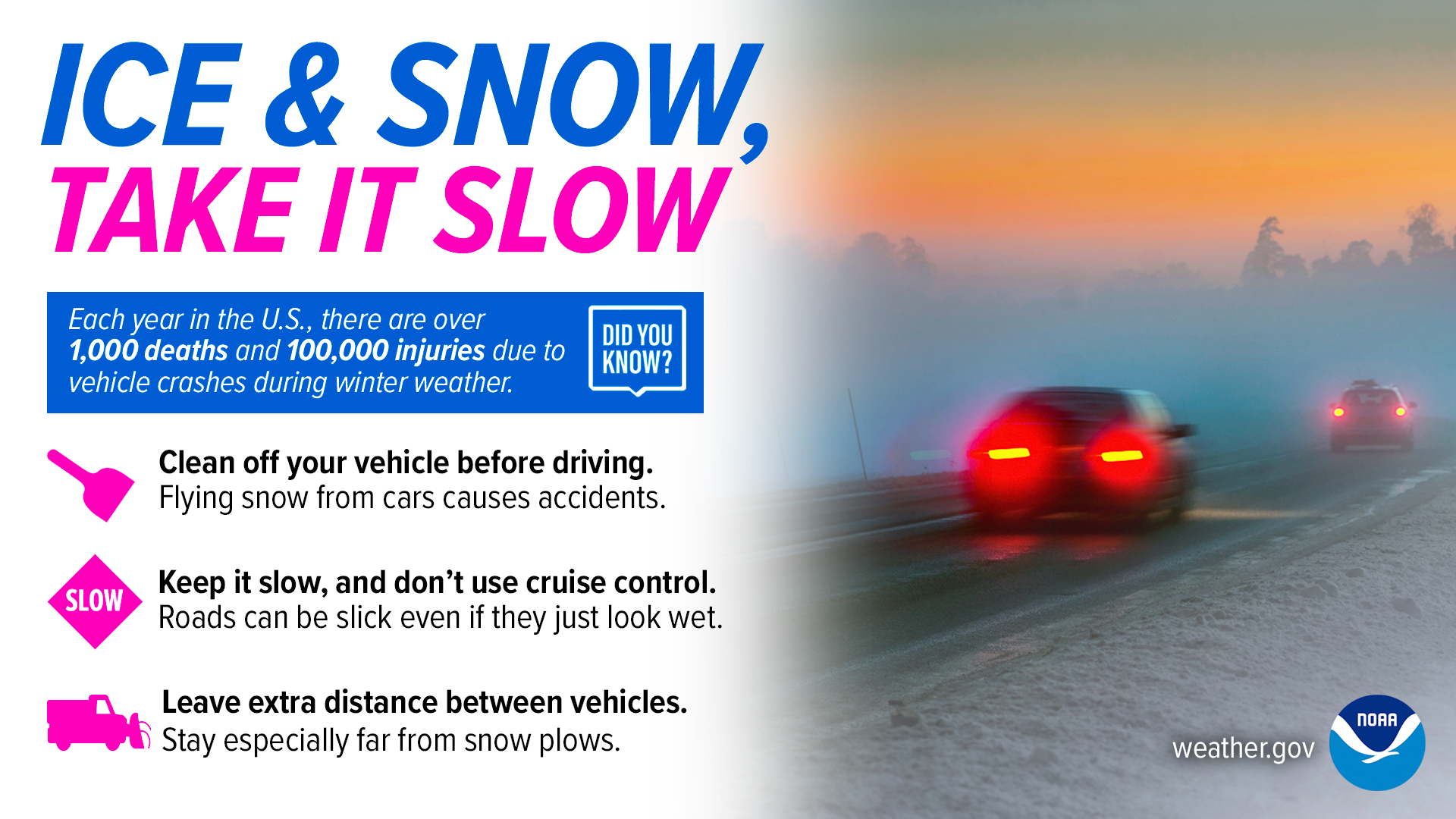
Driving in winter weather
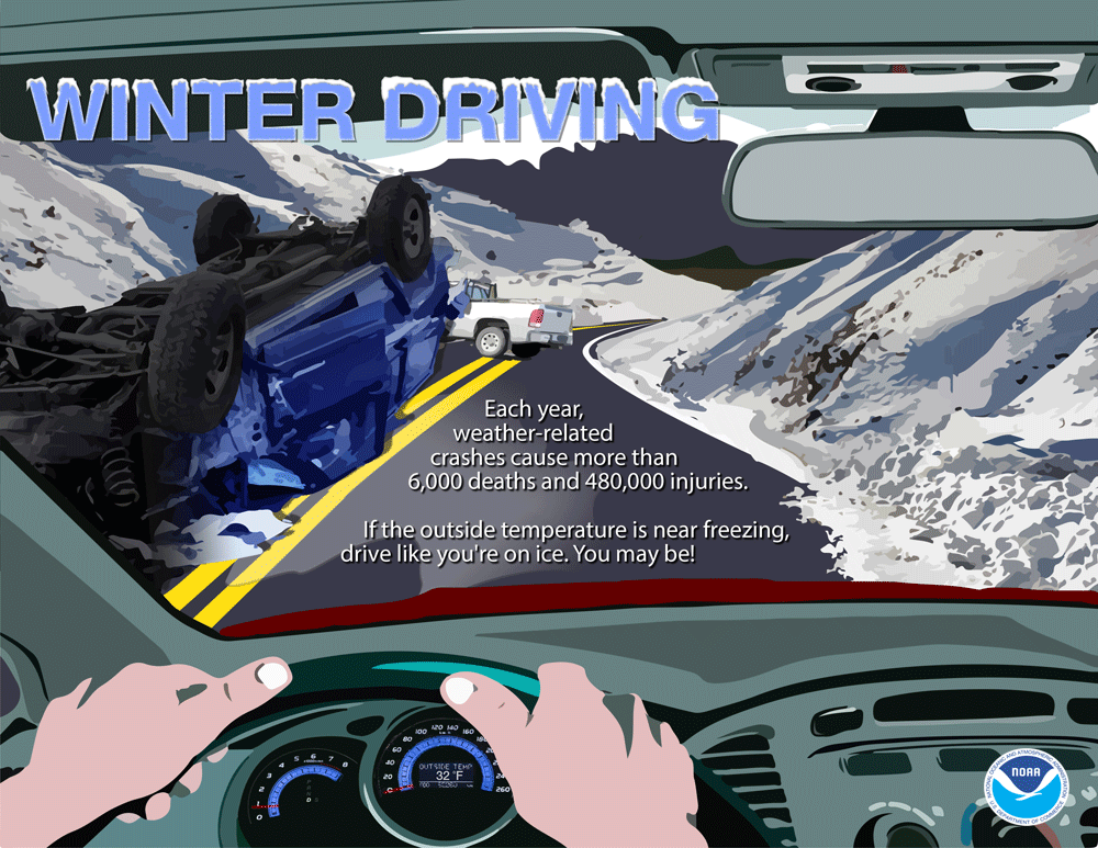
Seventy-five percent of all winter weather related deaths occur on the road, either in accidents or by people becoming stranded. When the weather is bad and driving conditions are poor, the best bet is to stay at home
Winter infographics
 |
 |
 |
 |
 |
 |
 |
 |
Thursday
Excessive Cold/Reducing the fire risk in your home
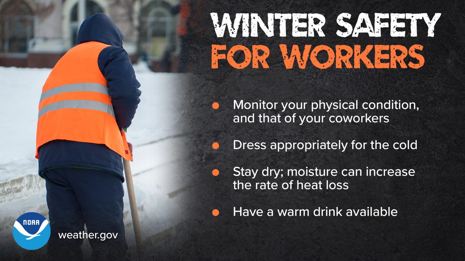
Cold weather is a fact of winter. With the cold temperatures comes an increase in the number of house fires. House fires resulting from heating material within the home ranks second for the most deaths and property loss. Chimney fires are the number one cause of home heating fires and typically the result of a poorly maintained chimney where creosote is allowed to build up. Space heaters are typically involved in 25 percent of home heating fires and account for 74 percent of the deaths. Be sure to test some detectors and replace any broken detectors and dead batteries.
Winter infographics
 |
 |
 |
 |
 |
 |
 |
 |
Friday
Winter climatology and becoming a winter weather observer
WE NEED YOUR HELP!
To accurately understand what is happening across our area in real time, we have over 500 weather spotters that have been trained to reports all types of weather to us, including rain and snowfall reports. Training is held year round and you can always find online training via our YouTube Channel. For more information on the program visit our local spotter page. We can't stress how much these real time, ground truth, reports, help us at the office.
If you're looking for something to do on a more consistent basis, have you ever heard of CoCoRaHS? Citizen scientists wishing to report snow and rainfall amounts are encouraged to join the community collaborative, rain, hail and snow network. Daily reports are sent via the internet and used by the National Weather Service and other agencies daily. For more information please visit: http://www.cocorahs.org.
Saturday
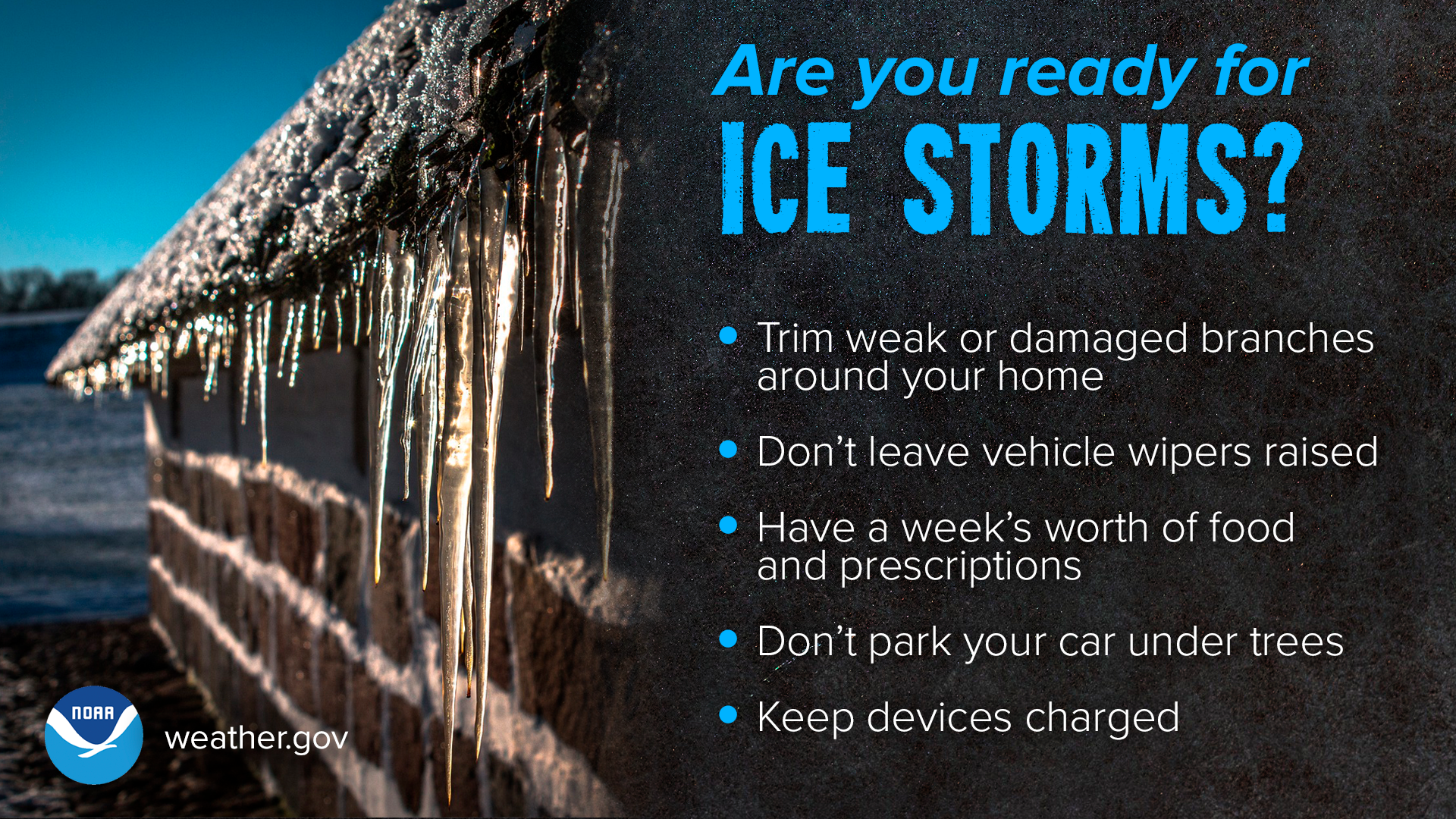
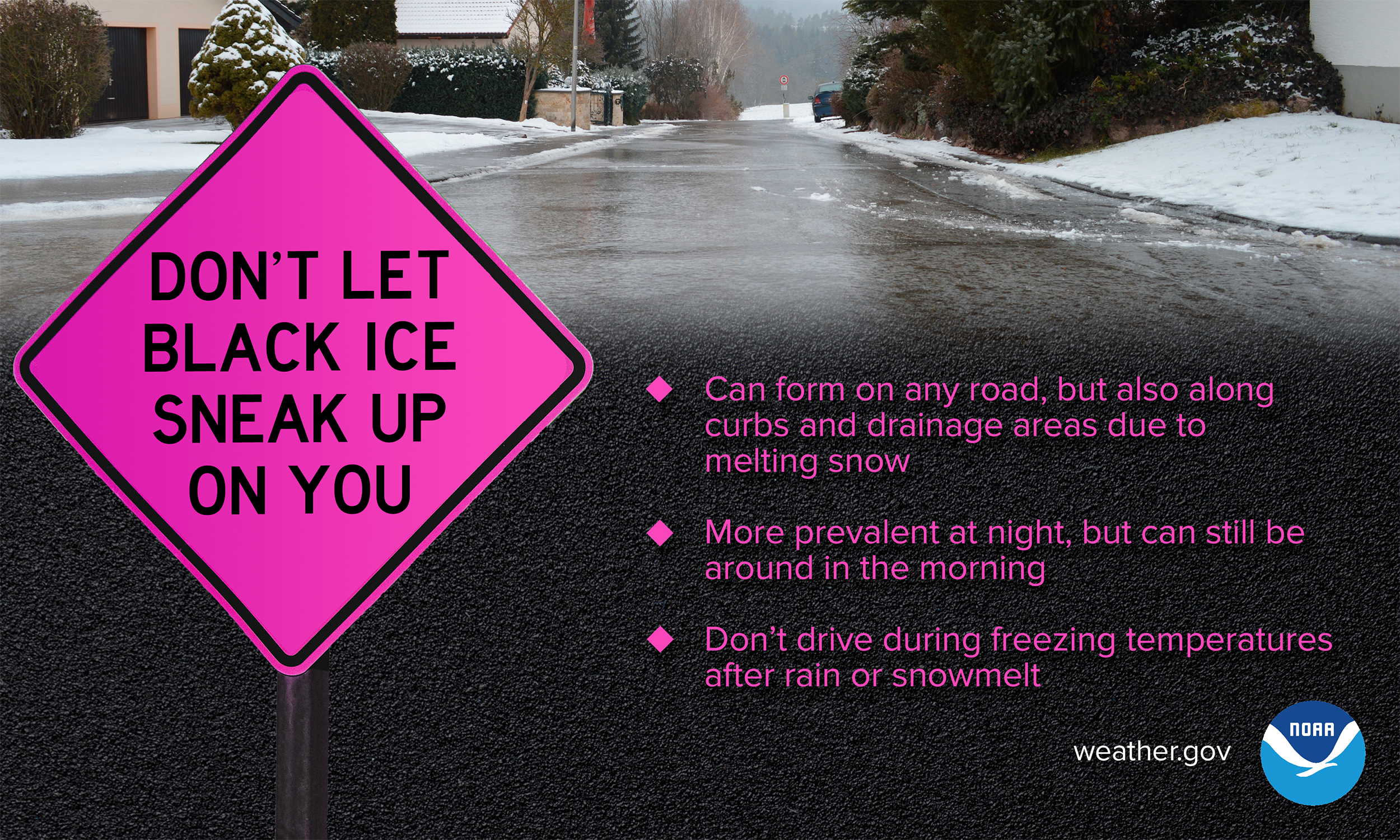
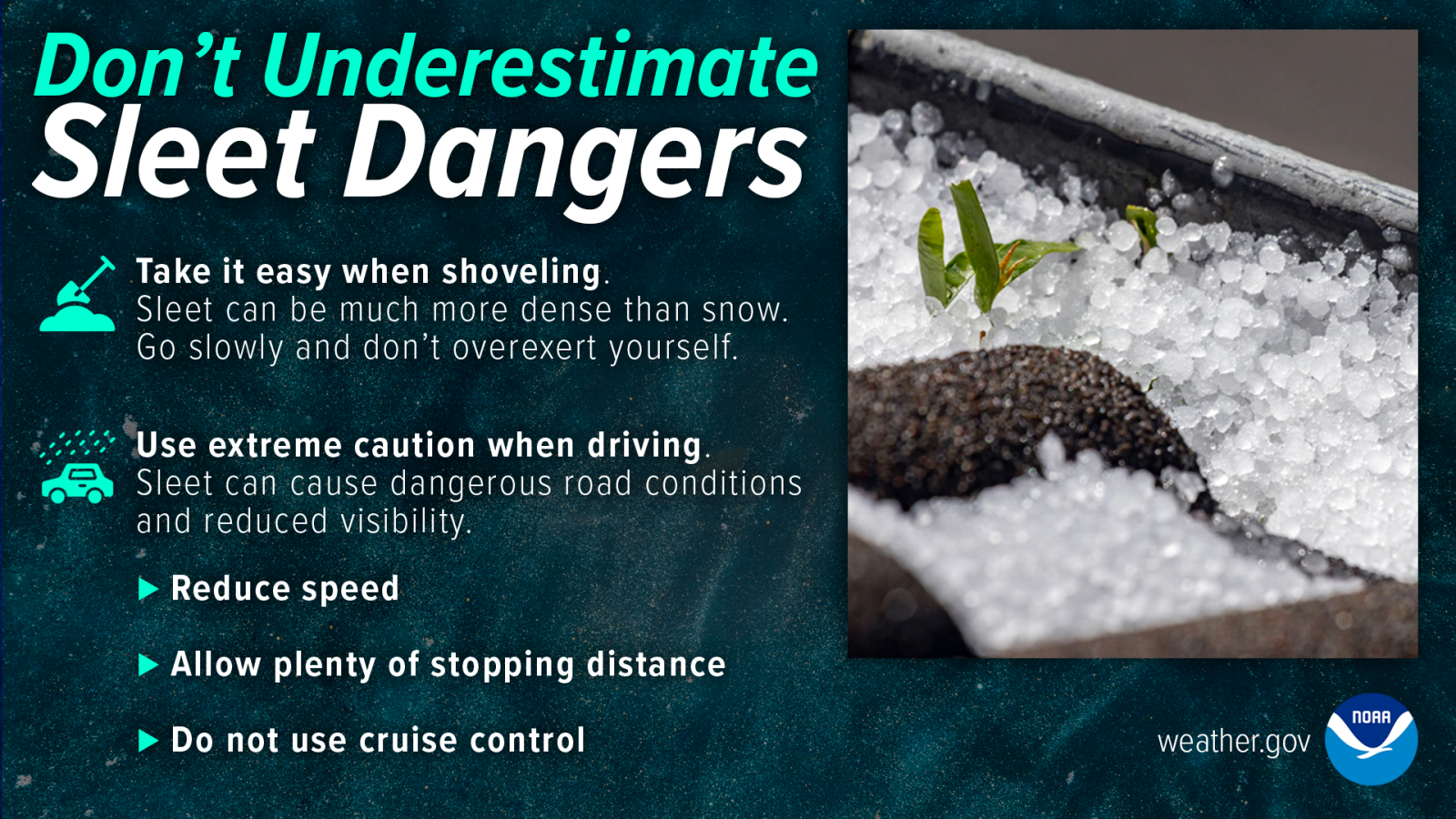
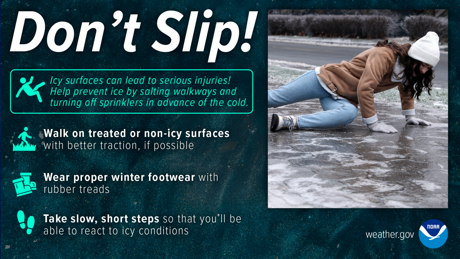
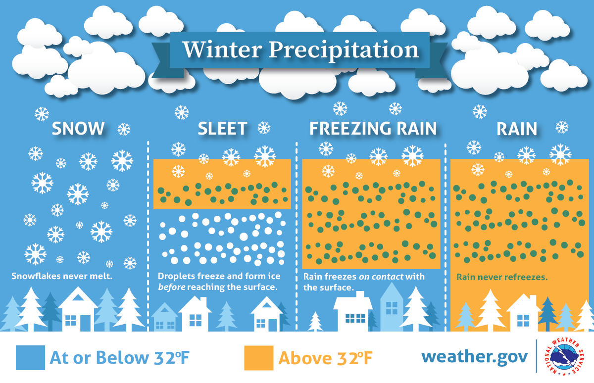
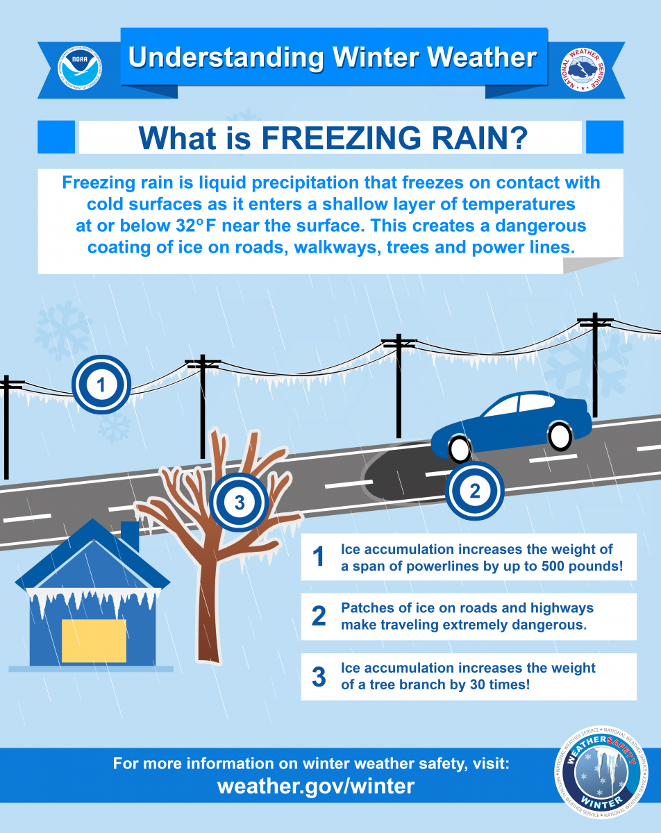
Dangers associated with freezing rain and sleet
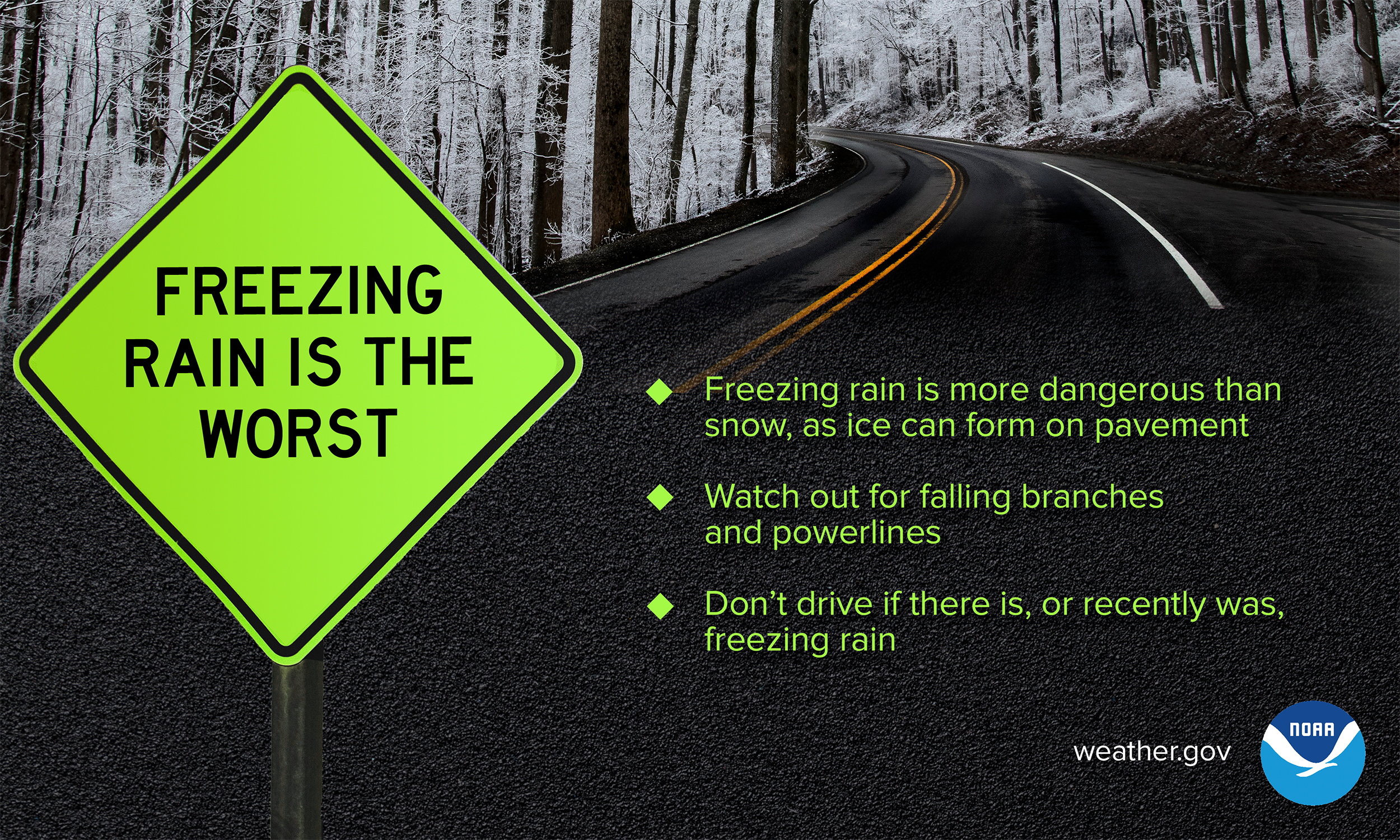
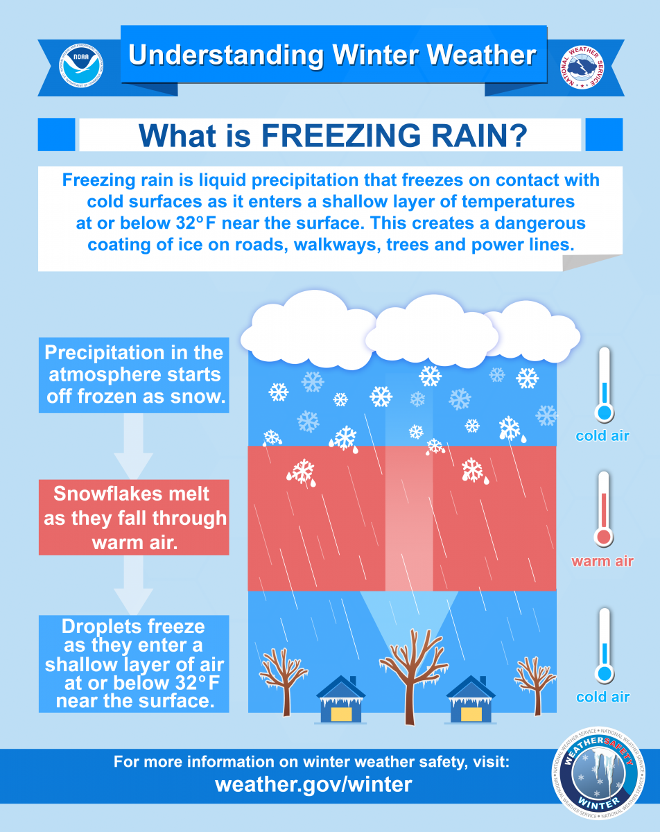
Ice falling in the form of freezing rain is particularly dangerous and poses a variety of problems. The ability of freezing rain to accumulate on nearly every surface, including trees, power lines, and bridges, makes it one of the most dangerous forms of winter weather. As little as a quarter of an inch of freezing rain can create widespread power outages. On February 17th of 2015, inland areas of Eastern North Carolina saw widespread freezing rain of up to a quarter of an inch of ice which created power outages.
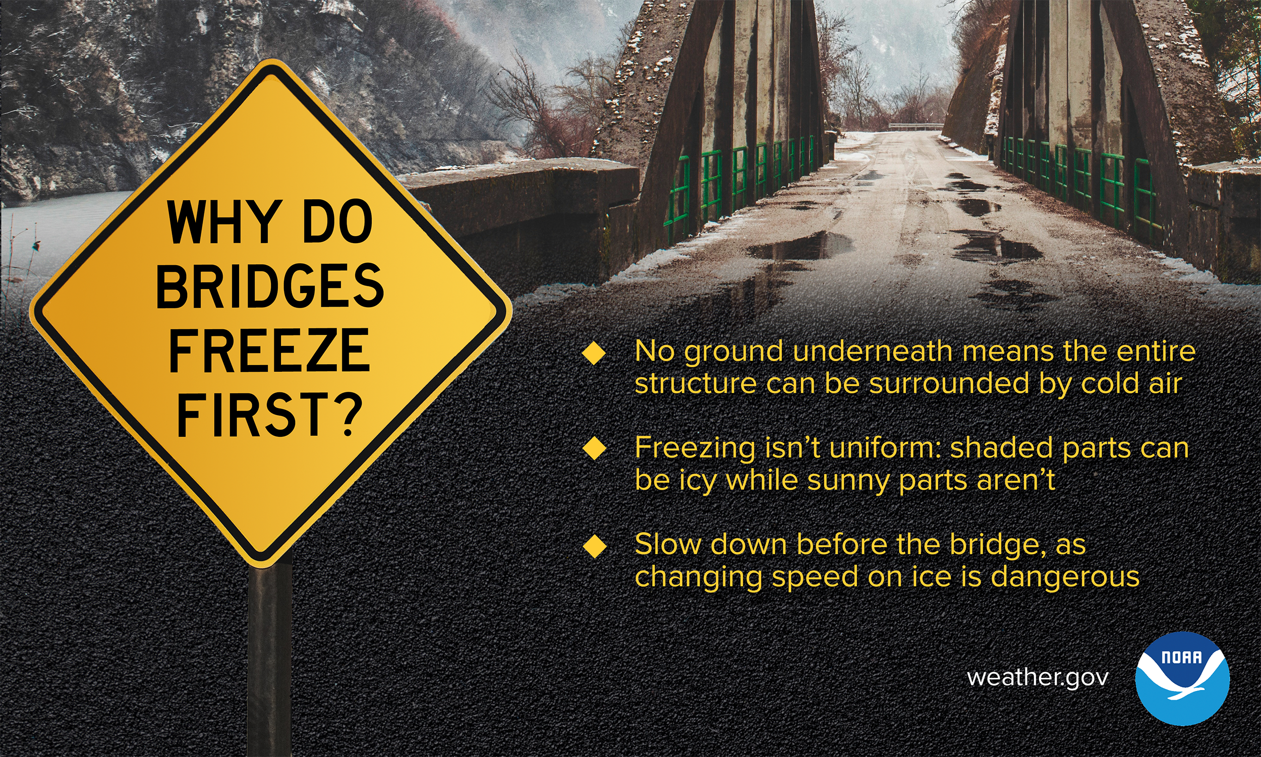
When driving, ice can be very difficult to recognize. The roadway may appear to be wet when in reality when appears to be water may actually be ice. If the temperature outside is below freezing, ice can form on the roads, especially on bridges and overpasses. When encountering ice, do not panic and do not stomp on your brakes. It is safer to slowly decelerate to a stop.
Winter infographics
 |
 |
 |
 |
 |
 |
Deaf & Hard of Hearing
Winter Storm Safety (ASL Video)
Winter storms can be just as hazardous as any other type of weather, and it's important to be prepared. Learn how to prepare NOW with this video in American Sign Language.
Check out this video in American Sign Language from the National Weather Service
to learn about what you need to know for winter storms: youtu.be/V-t-9R2o8No
Tornado Safety (ASL Video)
You may only have seconds to get to your safe place when the next tornado occurs!
Learn where to shelter and how to get warning information from the National Weather Service with this video in American Sign Language!
youtu.be/aEPC5F4Zios
See a Flash, Dash Inside (ASL Video)
If you are outdoors and see a flash of lightning or feel the rumble of thunder, dash inside immediately! Check out our Lightning Safety video in American Sign Language and captioned in English!
Flood Safety Video (ASL Video)
Did you know flooding is the leading cause of death due to storms? Learn more about Flood Safety with this video in American Sign Language and captioned in English! youtu.be/RUf3ErtEbG4
NOAA Weather Radio (ASL Video)
NOAA Weather Radios receive warnings, watches, forecasts, and other hazard information 24 hours a day. Why would Deaf people want a radio? They can be used as a way to alert you or wake you up at night! Some come with flashing lights, vibrating alarm attachments, and color displays with text readouts for use by those with hearing loss. youtu.be/A4izxOnKnug
General Safety and Preparedness Tips (ASL Video)
Having a plan is important in times of emergency, and this includes building an emergency preparedness kit before a disaster. Learn how with this video in American Sign Language.
youtu.be/XWEvqy0e9-0
Winter Preparedness (Español)
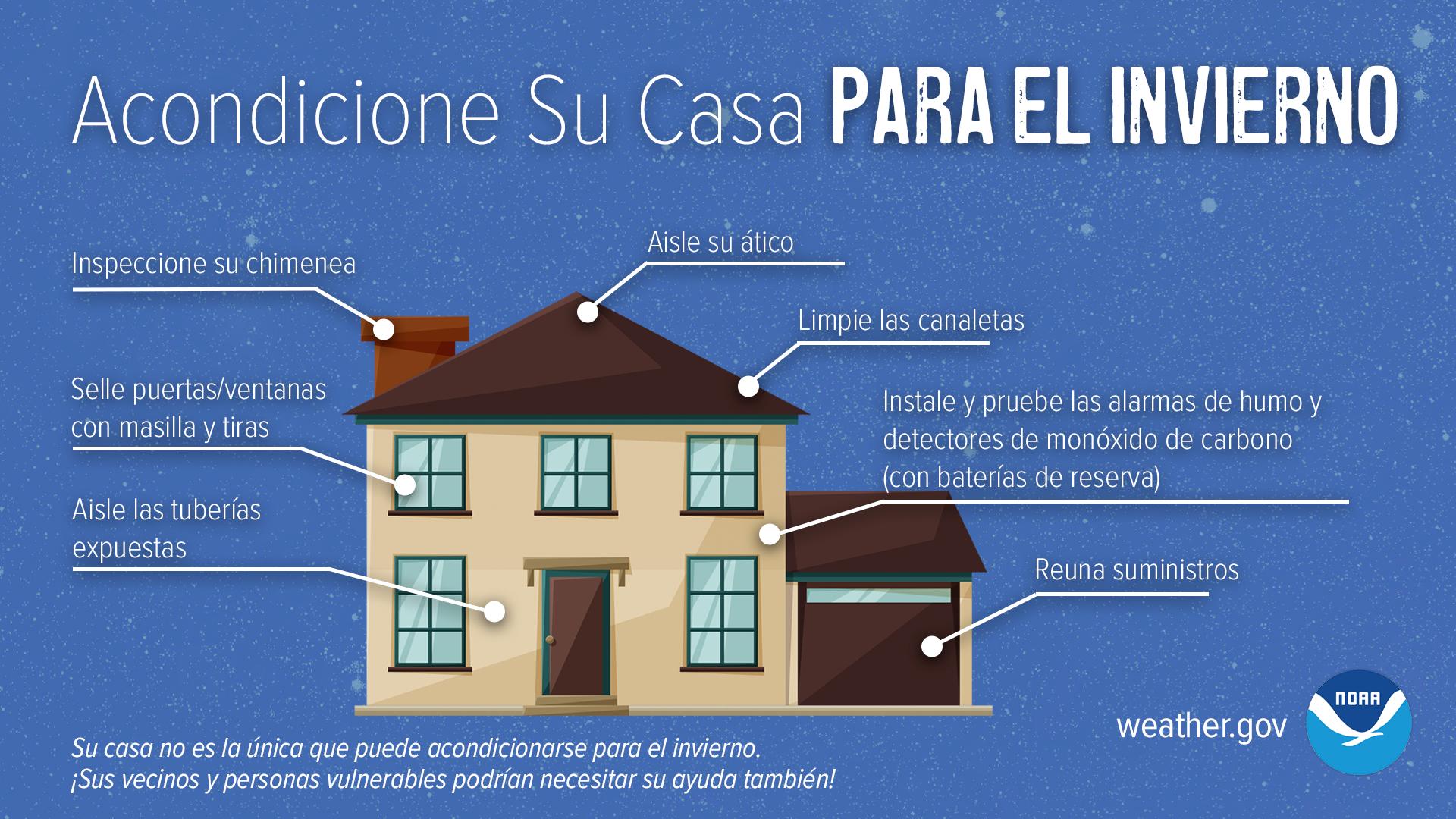
Acondicione Su Casa Para el Invierno (Winterize Your Home)
A medida que se acerca el invierno, hay pasos que puede seguir para preparar su hogar para el tiempo frío que se avecina. Obtenga más información ene que un puente esté helado, ¡REDUCE TU VELOCIDAD! Y hazlo antes de cruzar el puente - frenar sobre hielo es peligroso.
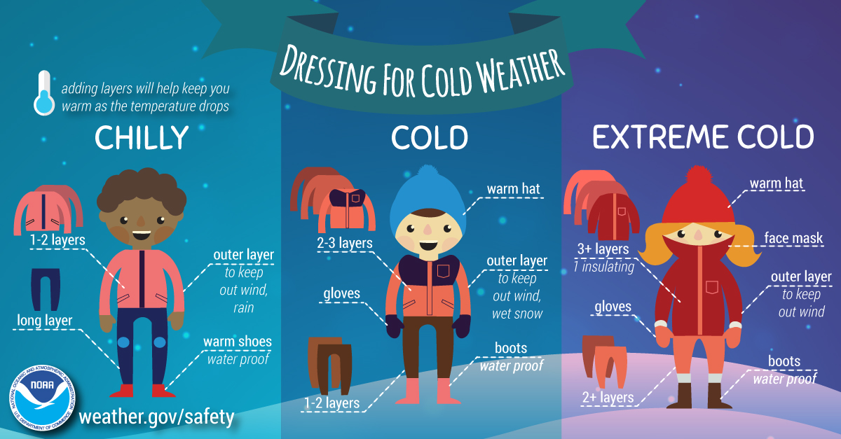
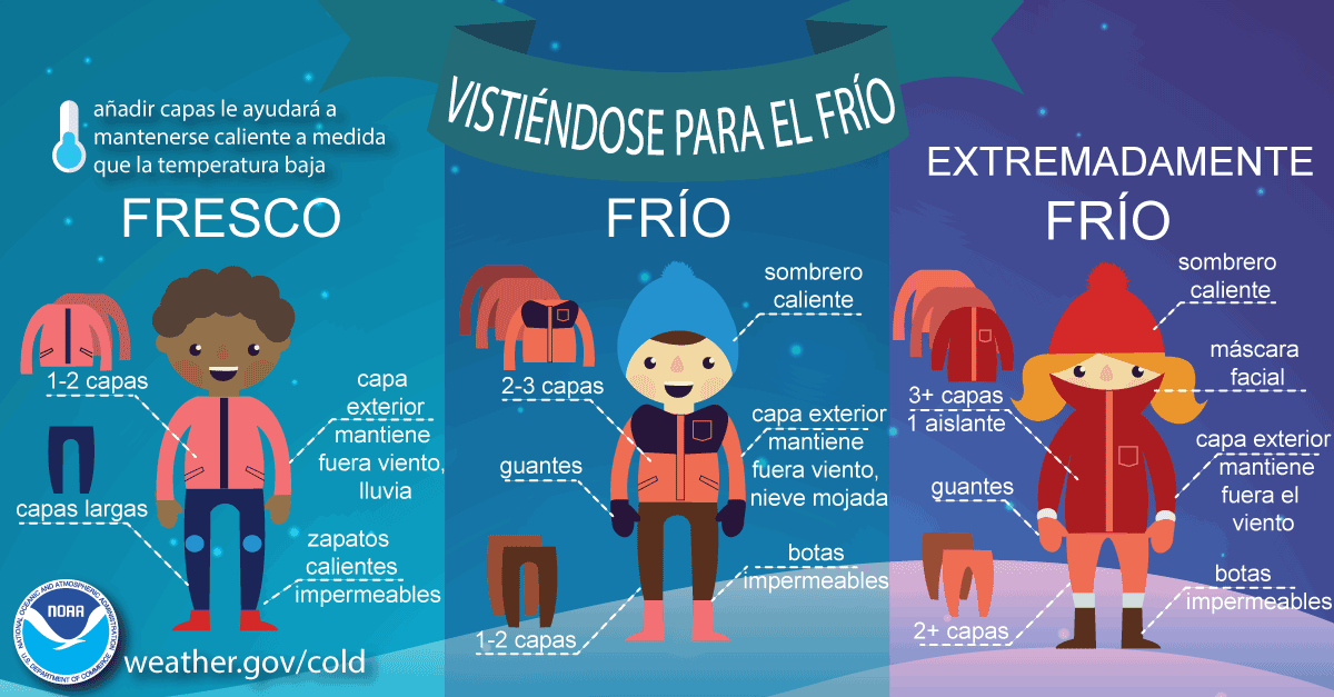
Vestirse para el Frío - Infografía (Dressing for the Cold - Infographic)
Abrigándose en capas y manteniéndose seco es una de las mejores cosas que puede hacer para mantenerse seguro este invierno. Protégete del frío este invierno.
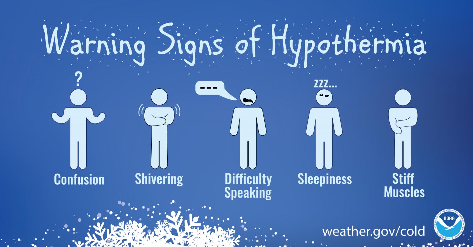
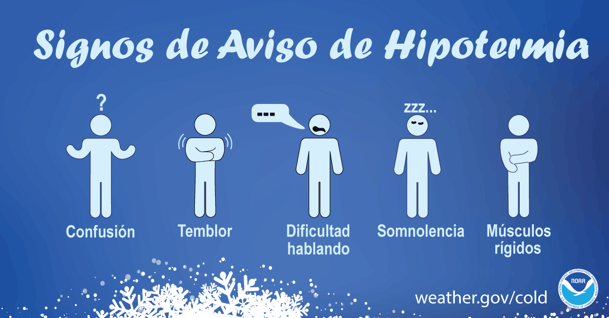
Infografía de Hipotermia (Hypothermia Infographic)
Si nota que alguien muestra signos de hipotermia, llévelo a un lugar cálido inmediatamente.
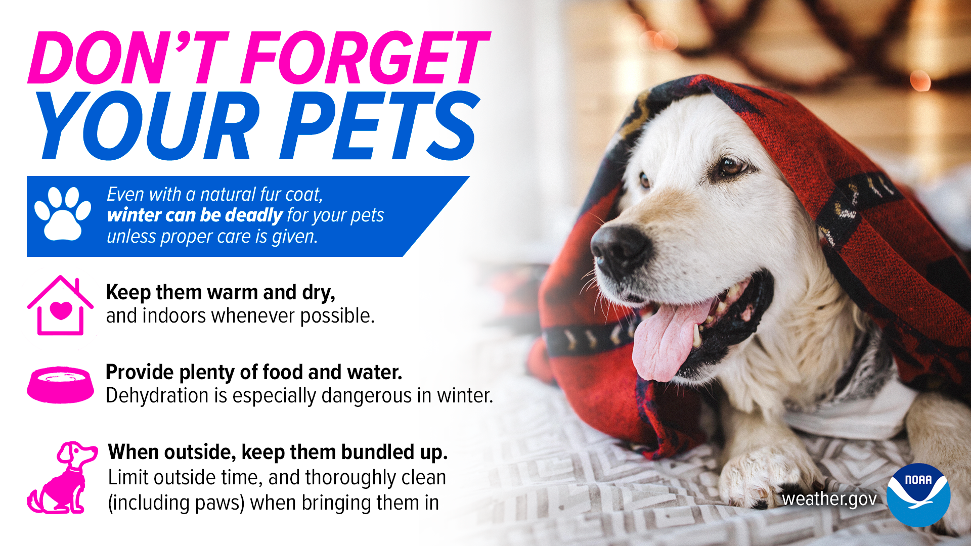
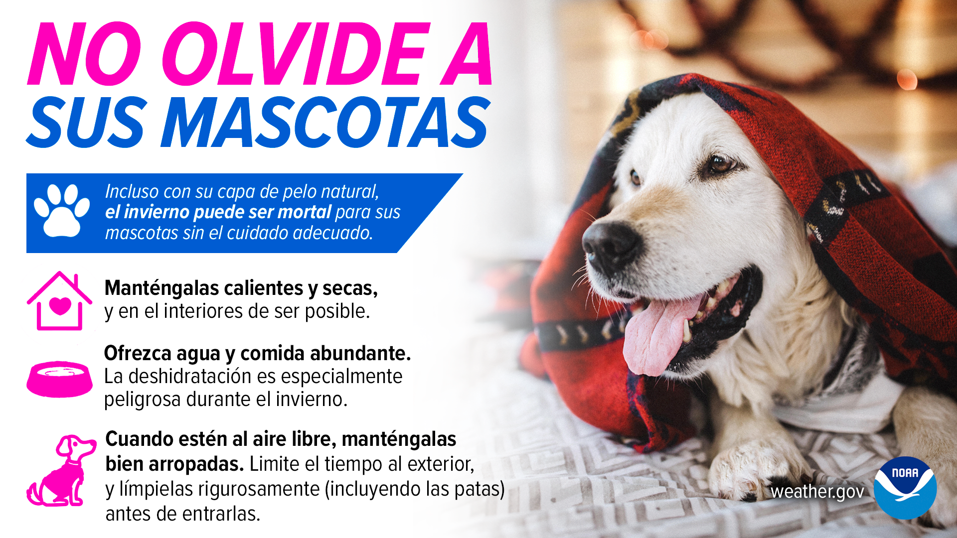
El Invierno y Las Mascotas (Winter and Pets)
¡No se olvide de sus mascotas este invierno! Asegúrese de que tengan un lugar cálido y seco para descansar, con abundante agua y comida.
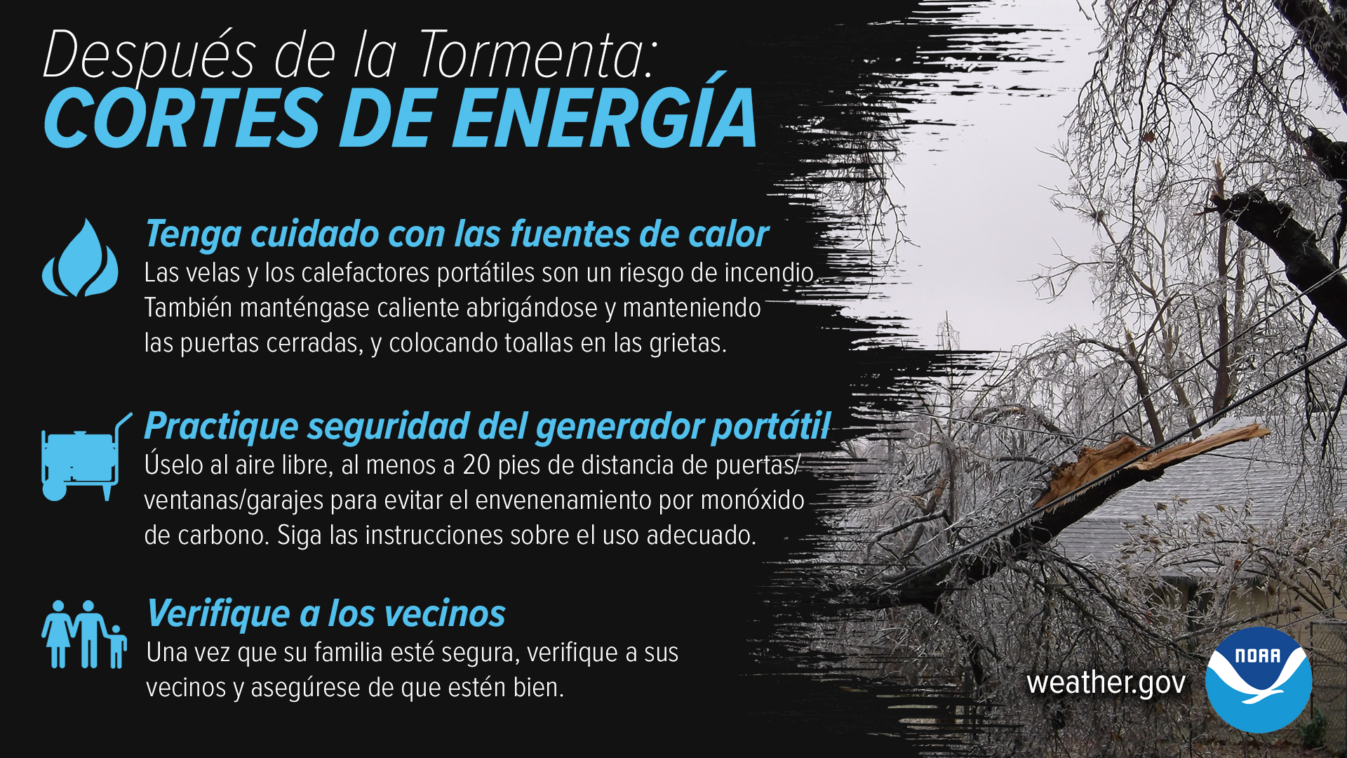
Los cortes de energía son comunes después de una gran tormenta de invierno. Si pierde energía, asegúrese de tener cuidado al usar fuentes alternativas de calor y practique la seguridad del generador portátil. Una vez que usted y su familia estén a salvo, consulte con otras personas en su vecindario para asegurarse de que estén bien.
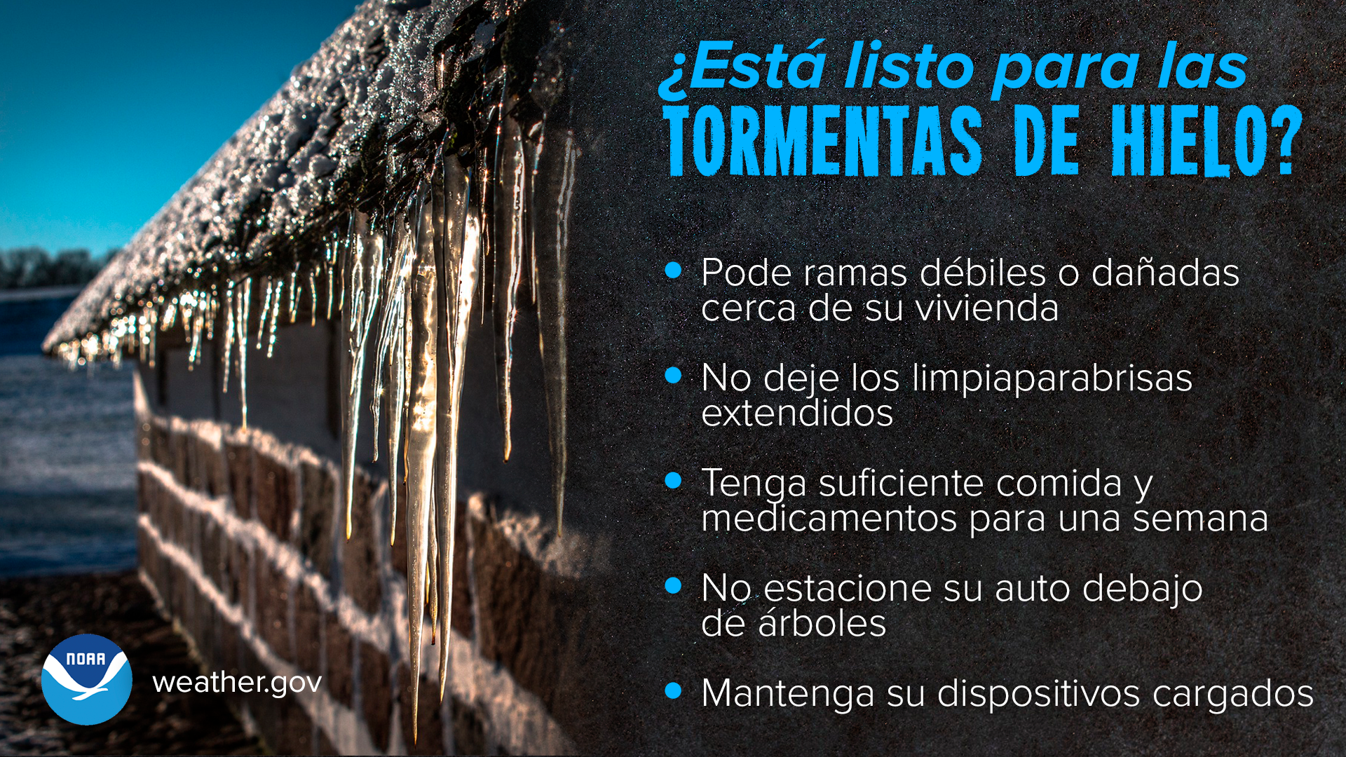
Tormentas de Hielo (Ice Storms)
¿Está lista su casa para una tormenta de hielo? Las tormentas de hielo pueden causar apagones eléctricos de varios días, impactando su casa además de áreas colindantes - por eso es importante tener suficiente comida y medicamentos para durar una semana. ¿Qué más necesitarías?
Las ramas de los árboles se rompen fácilmente durante tormentas de hielo, así que pode ramas débiles o dañadas cerca de su vivienda y evite aparcar debajo de un árbol. No deje los limpiaparabrisas extendidos al aparcar...a pesar de ser una práctica común, dejarlos extendidos aumenta el riesgo de que se dañen. Aprende más sobre seguridad durante tormentas de hielo:
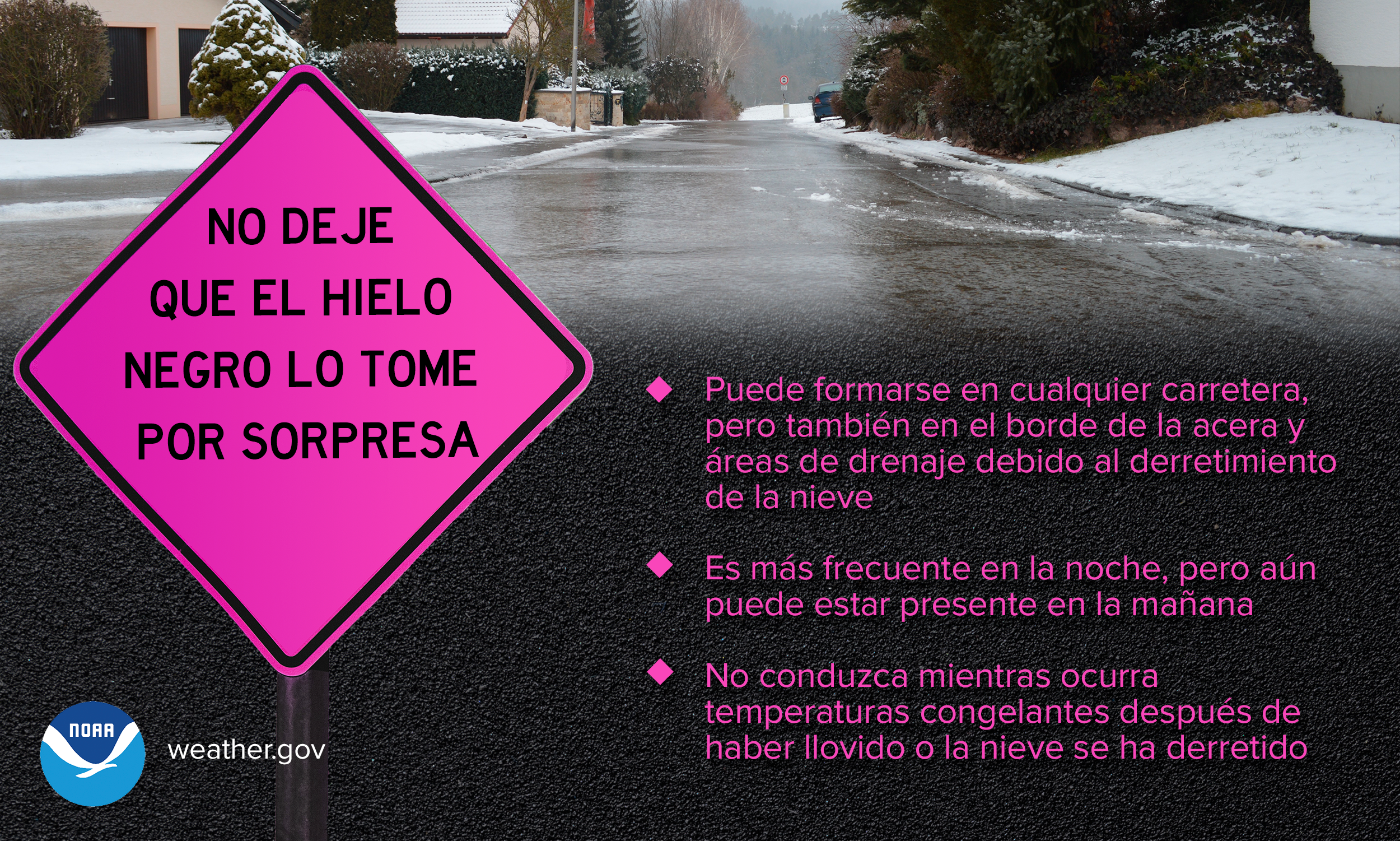
Hielo Negro o Fino en Pavimento (Black Ice)
Cuando se mezclan temperaturas heladas con lluvia reciente o nieve derretida, se puede crear una capa fina de hielo - y podría ser casi invisible. Estas capas finas de hielo (o hielo negro) suelen ser más comunes por las noches, y pueden permanecer hasta la mañana. Evita conducir de ser posible...no dejes que te sorprenda.
Lluvia Helada (Freezing Rain)
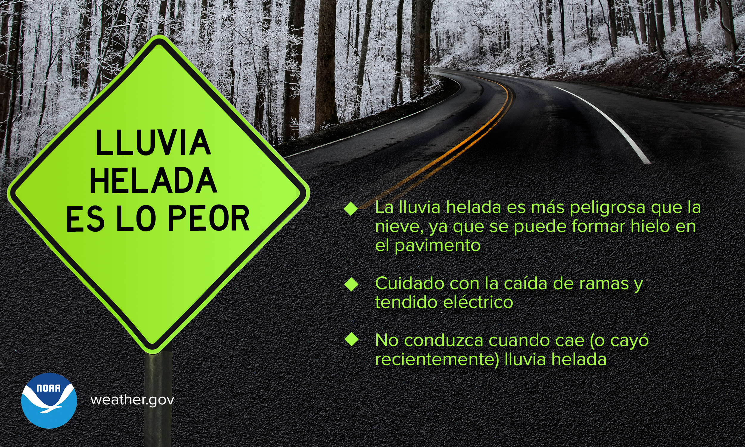
Comparado con una tormenta de nieve típica, la lluvia helada es mucho más peligrosa - especialmente en carreteras. Aunque las dos son peligrosas, es mucho más fácil perder el control de tu vehículo sobre pavimento helado, al igual que el riesgo de caída de ramas y tendido eléctrico. En definitiva: No conduzcas cuando cae (o cayó recientemente) lluvia helada.
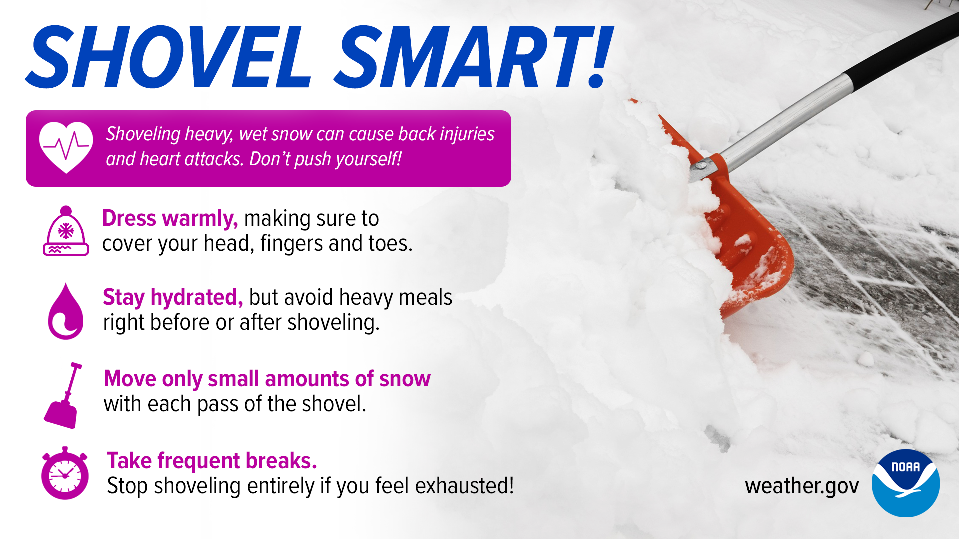
Palear de Forma Inteligente (Smart Shoveling)
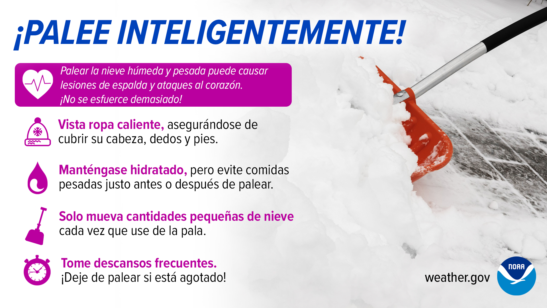
Las aceras y carreteras resbaladizas no son lo único a tener en cuenta durante las tormentas de nieve - palear la nieve también puede ser arriesgado para la salud. Recuerde mantenerse hidratado, tomar descansos frecuentes, y solamente mover cantidades pequeñas en cada pase.
Find us on social media:
You can also contact:
Erik Heden (Erik.Heden@noaa.gov) for additional information about Winter Weather Preparedness Week.
.jpg)
National Weather Service in Newport on the morning of February 13, 2010


 Youtube
 Map View
 Weather Hazard Briefing (when applicable)
 Forecaster Discussion
 Marine
 Text Products
.png) Skywarn
Skywarn Submit Storm Reports
 Coastal Flood
.png) Surf Forecast/Rip Currents
Surf Forecast/Rip Currents