Christmas Snowstorm December 23, 1989
Event Review
A storm system moving across the Florida peninsula and along the Southern Atlantic Coast produced high winds and record snows along the Carolina coast. On the evening of December 22, the developing offshore storm system began to produce snow in southeastern North Carolina. By early on the 23rd, the storm had intensified dramatically, producing 60 mph winds and waves as high as 34 feet in the near-shore waters. The tanker Benjamin Isherwood ran aground just off Corolla. Snow fell from the evening of the 22nd to about midday on the 24th.
Snowfall totals of 15 inches at Wilmington, NC and 13.3 inches at Cape Hatteras, NC were all-time records for those locations. The final snow depth at Cape Hatteras does not account for about five inches of snow that melted when the snow changed briefly to rain on the 23rd. Along the northern coast, snow amounts ranged from 10 inches at Manteo to one inch at the Virginia border. Gusty winds piled snow drifts four to eight feet high all along the coast. Many towns were paralyzed. The snow shattered many snow records for the coastal areas (Figure 1). Gale force winds whipped the heavy snow into drifts up to 8 feet high.
Elsewhere, two inches of snow fell at Savannah, GA; one of only three times that snowfall in the city required a ruler for measurement. Charleston, SC picked up 3.9 inches. The storm resulted in the first white Christmas on record from northeastern Florida to North Carolina. Snow fell in Tampa and Daytona Beach as Florida experienced its most widespread snowstorm in history and their first white Christmas in history as airports and interstates were shut down. Snow and sleet fell as far south as a Sarasota to Melbourne line. Many traffic accidents and several fatalities occurred on ice-covered roads in North Florida. Extensive crop damage including a loss of about 30% of the $1.4 billion citrus crop occured leaving tens of thousands of migrant farm workers unemployed. Winter vegetables, berries, nursery ornamentals and fish suffered heavy losses. Power blackouts hit hundreds of thousands of residents at various times during the holiday weekend.
It was the first White Christmas on record for coastal North Carolina. In the wake of the storm, Christmas morning low temperatures along the coast set all-time low records in many locations. Wilmington reached zero degrees F. Jacksonville reached minus 5 degrees. The cold produced widespread damage to subtropical ornamental plants and winter crops in the area. Large numbers of waterfowl and fish were killed in the sounds and estuaries. A Warsaw man was found dead in his home on the 27th.
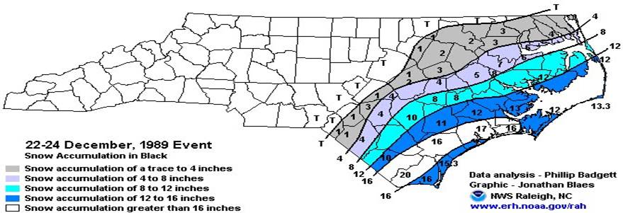
Figure 1. Snow totals for Eastern North Carolina for the December 23, 1989 snowstorm. (Courtesy NWS Raleigh, NC)
Synoptic Overview
Significantly below normal temperature anomalies over the Carolinas were observed on the morning of December 22 with morning temperatures in the teens and lower 20s and with the center of a strong Arctic high pressure system over the central Plains (Figure 2), temperatures as low as -36 degrees Fahrenheit was observed over northern Nebraska (Figure 3). This supported snow as the predominant precipitation type as this event unfolded. As a 500 mb trough dug into the Mississippi Valley on the morning of December 23, and started to gradually take on a more neutral tilt (Figure 4), a surface low pressure system developed off the Georgia coast (Figure 5). By the morning of December 24, the 500 mb trough had taken on a negative tilt and started to show signs of closing off over the Eastern Carolinas (Figure 6). As both the surface and 850 mb low pressure (Figure 7) intensified by 12Z on December 24, 1989, easterly winds resulted in moisture advection off the Atlantic Ocean. Low-level convergence and enhancement of low-level frontogenesis, resulted in increased precipitation production and a large area of heavy snow along the North Carolina coast.
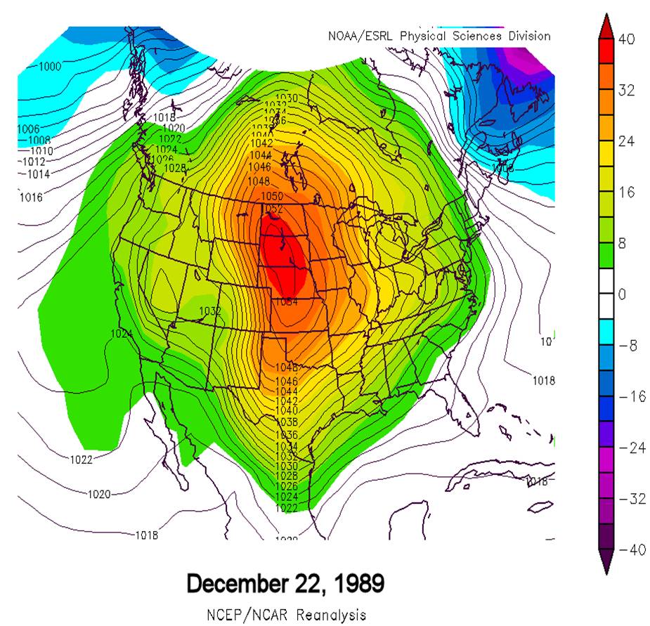
Figure 2. Strong Arctic high pressure over the Central United States (1054 mb) at 12Z December 22, 1989.
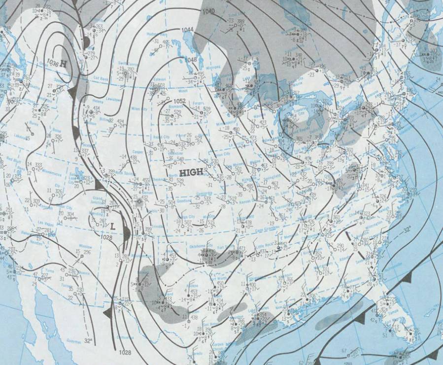
Figure 3. Another surface map from 12Z December 23, 1989 showing temperatures as low as -36F in Nebraska.
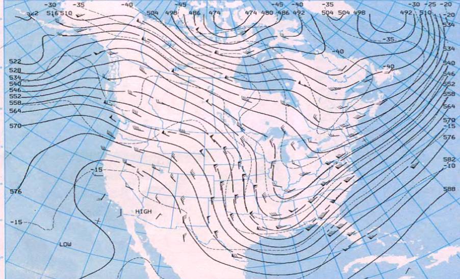
Figure 4. The 500 mb trough digs and gradually starts to take on a more neutral tile at 12Z December 23, 1989.
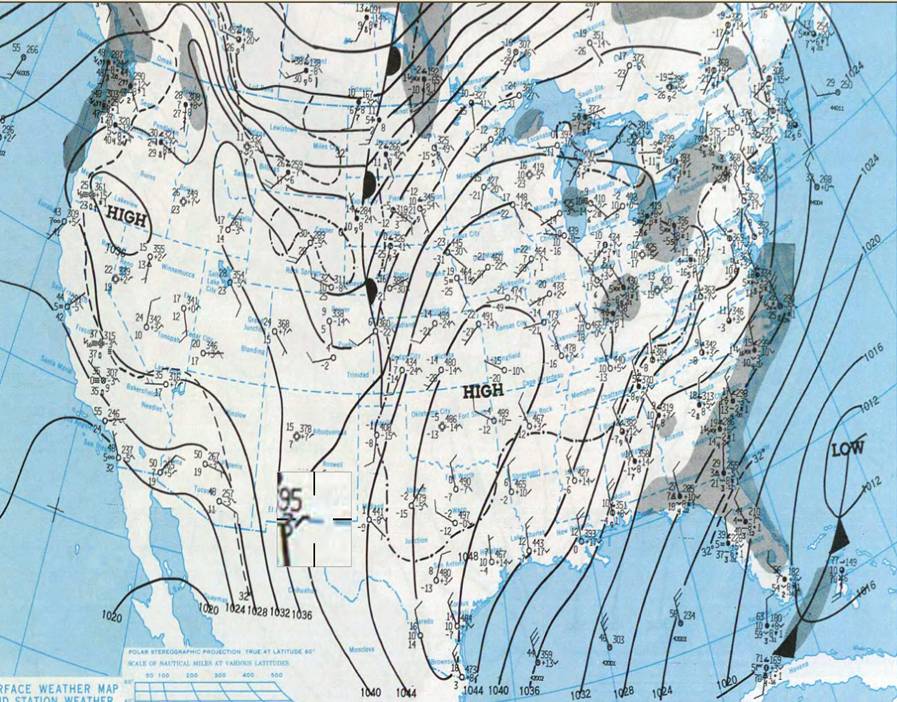
Figure 5. Low pressure develops off the Georgia coast as of 12Z December 23, 1989 as Arctic high pressure sinks south.
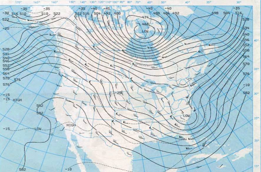
Figure 6. 500 mb Analysis at 12Z December 24, 1989 showing upper low showing signs off cutting off as it moves across the Eastern Carolinas.
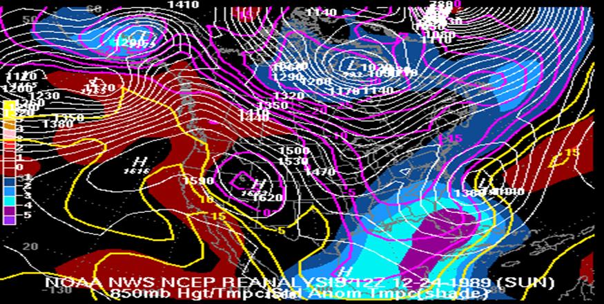
Figure 7. 850 mb low strengthening off the North Carolina coast at 12Z December 24, 1989 leading to bands of heavy snow along the North Carolina coast.
Sources
NCEP Reanalysis Page
Daily Weather Maps
WECT- TV Wilmington, NC
WRAL-TV Raleigh, NC
National Weather Service, Raleigh, NC
Photos
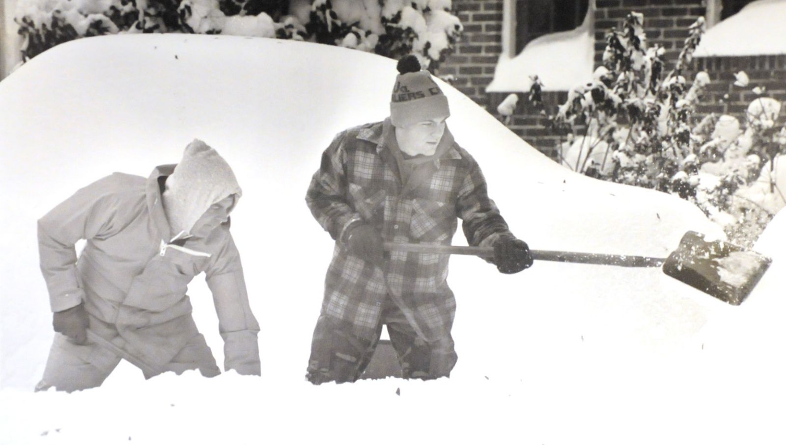
Digging out in Carteret County
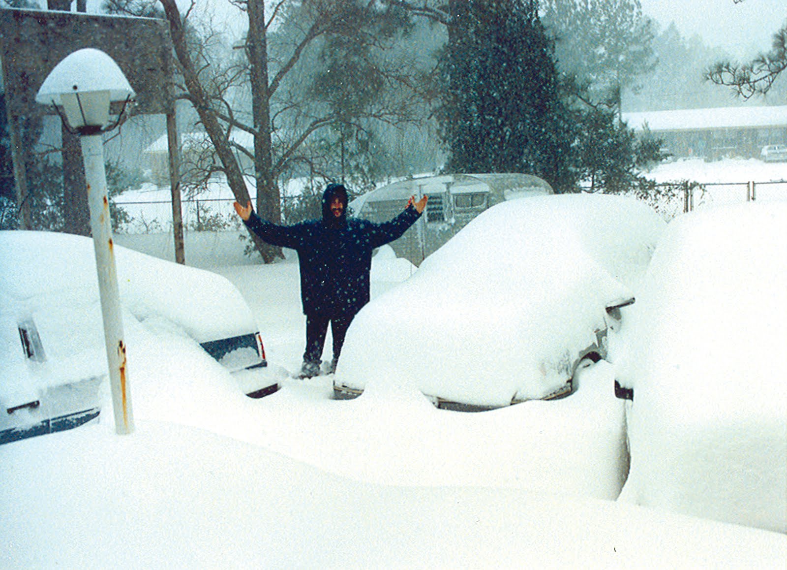
Deep Snow near Bogue, Carteret County
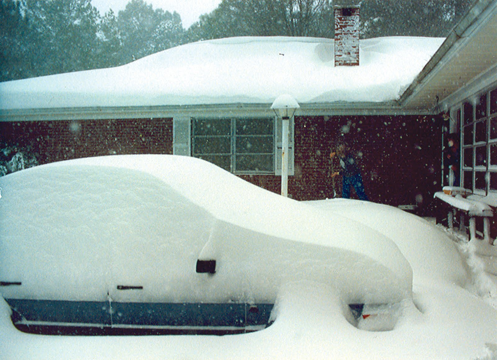
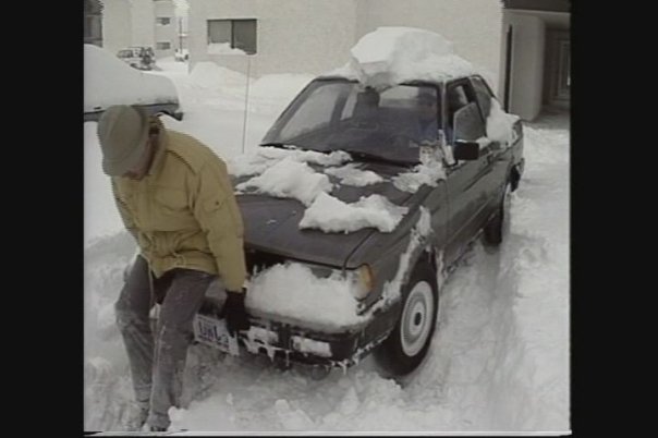
Snow buries a car in Carteret County
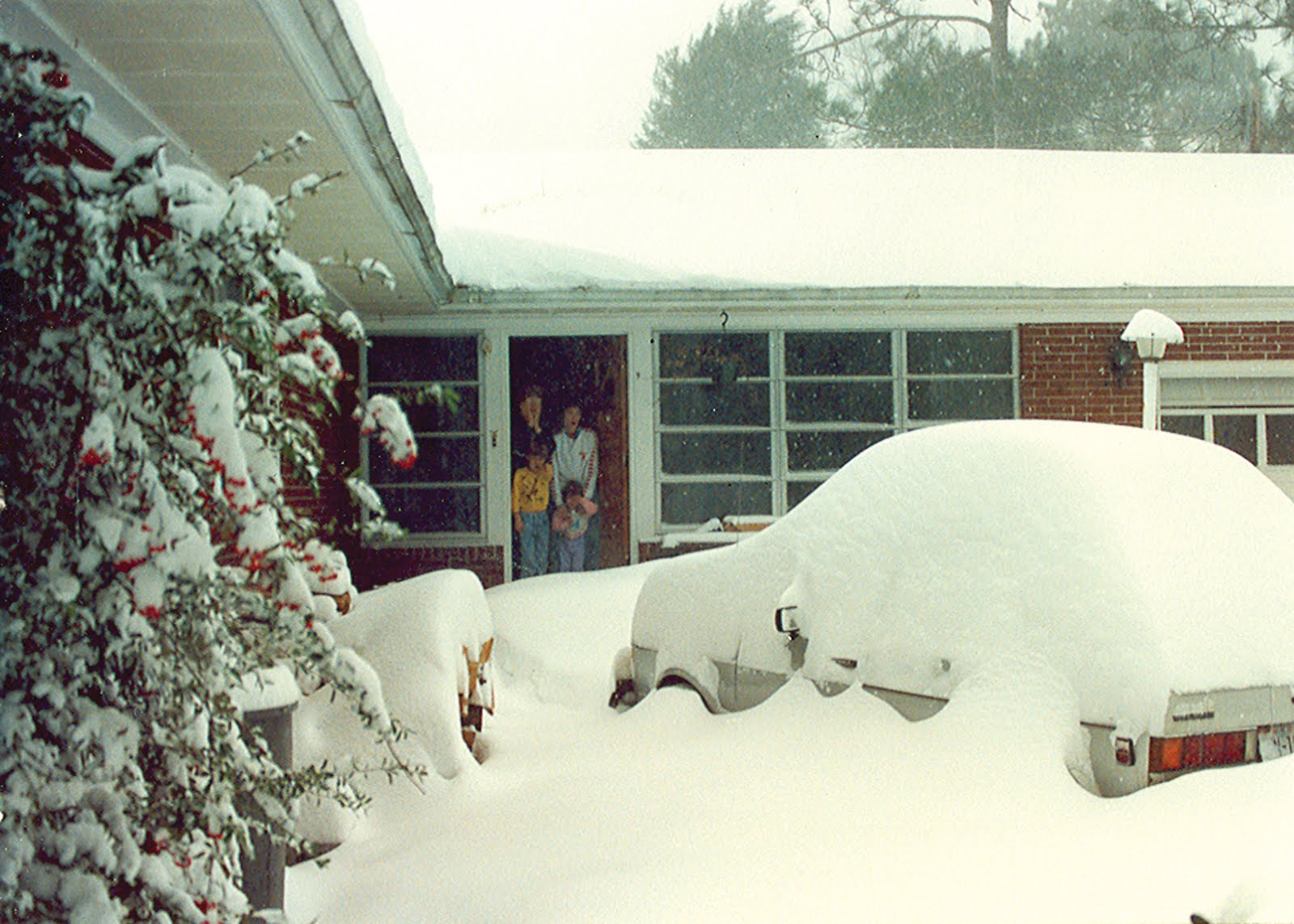
More deep Carteret County snow.
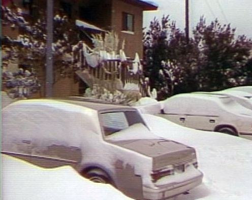
Snow drifts in Morehead City
Case Study Team:
Chris Collins


 Map View
 Weather Hazard Briefing (when applicable)
 Forecaster Discussion
 Marine
 Text Products
.png) Skywarn
Skywarn Submit Storm Reports
 Coastal Flood
.png) Surf Forecast/Rip Currents
Surf Forecast/Rip Currents