Hurricane Connie, August 12, 1955
Overview
Connie was first detected as a tropical storm over the tropical Atlantic on August 3, 1955. It moved west-northwest for several days, reaching hurricane strength several hundred miles northeast of the Leeward Islands on the August 5, 1955. After passing north of the Leewards on the 6th, Connie turned northwestward, a motion that continued until the August 10th. An erratic, generally north-northwestward motion then brought Connie to the North Carolina coast on August 12 (Figure 1) as a Category 3 hurricane. This was followed by a gradual northwestward turn through August 14, when Connie dissipated over the eastern Great Lakes.
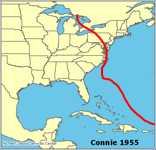
Figure 1. Track of Hurricane Connie, August 4-15, 1955 (Courtesy NOAA Coastal Services Center)
Impacts
Ahead of the storm, about 2000 people were evacuated from flood-prone areas in New Bern and up to 14,000 people were evacuated along the North Carolina beaches. As the storm reached landfall near Fort Macon (Figures 2 & 3), sustained winds of 75 mph with gusts to 100 mph were observed, while a storm surge of up to 8 ft occurred along the coast.
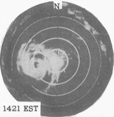
Figure 2. Hurricane Connie, west of Cape Hatteras from the Cape Hatteras Radar, August 12, 1955.
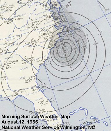
Figure 3. Surface Map from the morning of August 12, 1955 from NWS Wilmington, NC.
Rainfall amounts of over 10 inches were observed along and west of where Hurricane Connie made landfall (Figure 3). In Eastern North Carolina, the most significant flooding occurred along the Pamlico River in Washington where National Guardsmen evacuated nearly 1,000 people during the storm. Power was knocked out over much of Eastern North Carolina and rainfall flooding closed U.S. Highway 17 in the New Bern area. The hurricane caused nearly $40 million in damage in North Carolina, much from crop damage. There were 27 deaths in the state related on Connie, including traffic deaths, drownings, people in damaged buildings and electrocutions.
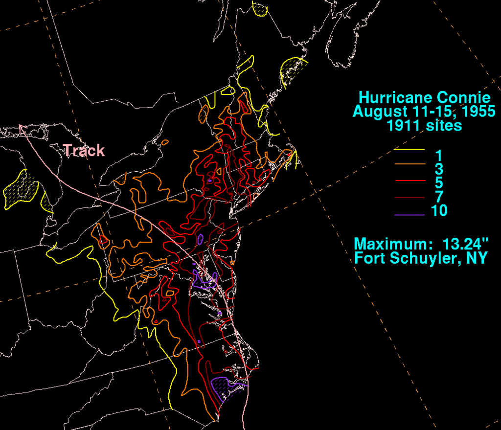
Figure 4. Rainfall amounts from Hurricane Connie, August, 1955. (Courtesy David Roth, Weather Prediction Center)
The floods from Hurricane Connie were important in setting the conditions for later significant flooding across the east coast of the United States (Figure 5). Just five days after Connie struck North Carolina, Hurricane Diane affected the same area, but instead of continuing to the northwest it turned to the northeast. Diane produced further rainfall in already wet areas from Connie.
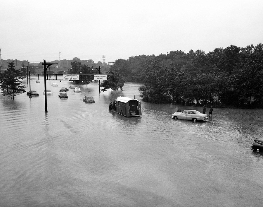
Flooding in New York from Hurricane Connie, August, 1955. (Photo courtesy Associated Press).
https://www.youtube.com/watch?v=-VgohWzxyN0
Newsreel from Hurricane Connie.
Sources
National Hurricane Center
Weather Prediction Center
Coastal Services Center


 Map View
 Weather Hazard Briefing (when applicable)
 Forecaster Discussion
 Marine
 Text Products
.png) Skywarn
Skywarn Submit Storm Reports
 Coastal Flood
.png) Surf Forecast/Rip Currents
Surf Forecast/Rip Currents