Melbourne, FL
Weather Forecast Office
Photograph and LDAR images (below) 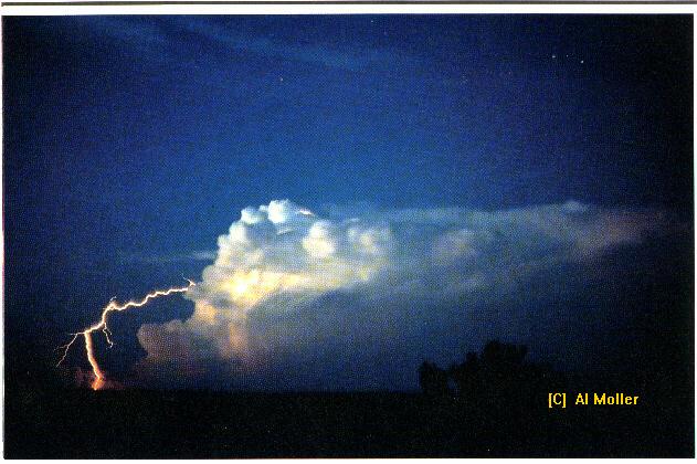
This is a classic example of a 'Bolt from the Blue". Note how the flash eminates from about 2/3rds the way up from the updraft, travels a relatively large distance horizontally away from the storm and then angles down towards the ground. If a person was nearby where this flash hit the ground, that person would be extremely startled as the storm (and the heavy rain) is many miles away from where the flash made contact with the ground.
The image below is what a bolt from the blue looks like on LDAR:
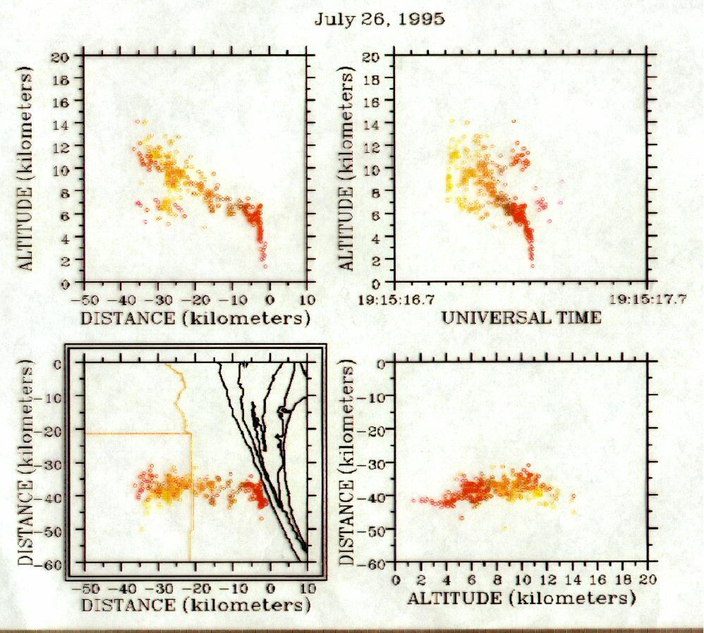
Note how this flash travelled to the east 40 KILOMETERS away from where the storm was located! (note distance on X axis in upper left box). This flash struck very close to the National Weather Service Office here in Melbourne. The storm itself was located in northeastern Osceola county (Florida).
Here is another Bolt from the Blue which occurred near the Kennedy Space Center. This flash is overlayed on radar data which was collected near the time of the flash. Note how the flash travels away from the radar reflectivity.
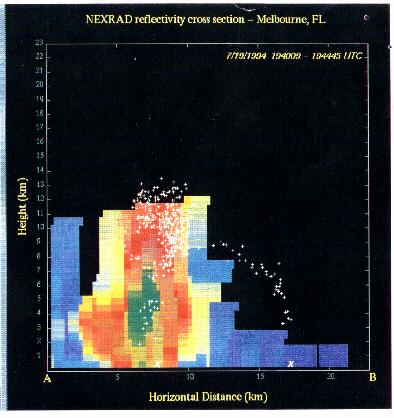
Bolts from the blue are obviously very dangerous to the general public as they can strike many miles away from the storm.
CURRENT HAZARDS
Hazardous Weather Outlook (Graphical)
Florida Hazards (CAP Text)
Outlooks
Storm Reports (Text)
Storm Reports (Graphical)
Cold Weather Support
FORECASTS
Area Forecast Discussion
Aviation Weather
Fire Weather
Graphical
Marine Weather
Probabilistic
Text Products
Tropical Weather
Winter Probabilistic
CURRENT WEATHER
Local Analysis
Observations
Precip Analysis
Satellite Images
Rivers/Lakes
RADAR IMAGERY
Melbourne Standard
Melbourne Enhanced
Regional - Southeast
Area Radars
US Dept of Commerce
National Oceanic and Atmospheric Administration
National Weather Service
Melbourne, FL
421 Croton Road
Melbourne, FL 32935
321-255-0212
Comments? Questions? Please Contact Us.

