Overview
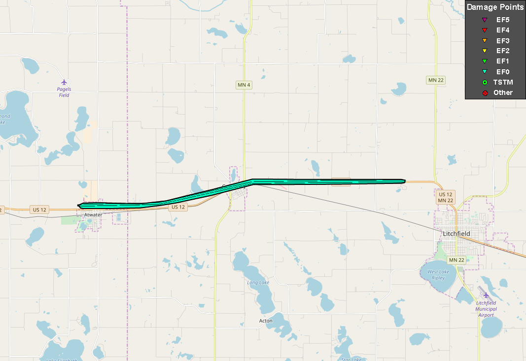
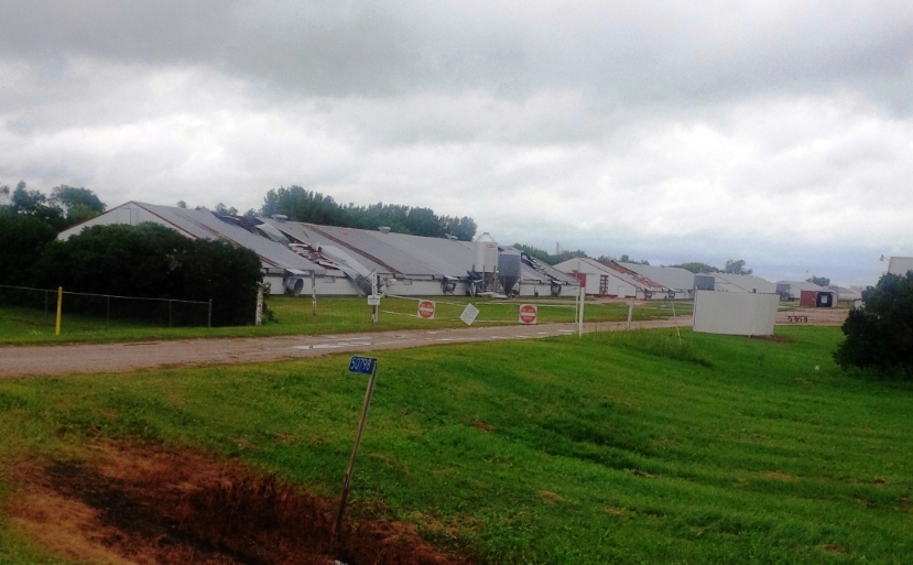
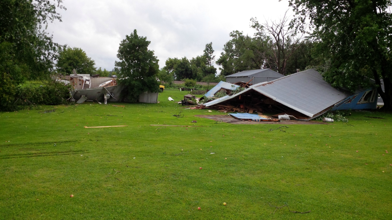
A line of severe thunderstorms developed over western Minnesota and continued east across central Minnesota during the evening hours. A surge of wind in a section of the line resulted in a tornado that developed just west of Atwater and continued eastward along Highway 12 to northwest of Litchfield.
Tornado:
|
Tornado #1 - Atwater/Grove City, MN
Track Map
|
||||||||||||||||||||||
The Enhanced Fujita (EF) Scale classifies tornadoes into the following categories:
| EF0 Weak 65-85 mph |
EF1 Moderate 86-110 mph |
EF2 Significant 111-135 mph |
EF3 Severe 136-165 mph |
EF4 Extreme 166-200 mph |
EF5 Catastrophic 200+ mph |
 |
|||||
Storm Reports
Public Information Statement
National Weather Service Twin Cities/Chanhassen MN
350 PM CDT Sat Aug 4 2018

...NWS DAMAGE SURVEY FOR 8/3/2018 TORNADO EVENT...

.OVERVIEW...A line of severe thunderstorms developed over western
Minnesota and continued east across central Minnesota during the
evening hours. A surge of wind in a section of the line resulted
in a tornado that developed just west of Atwater and continued
eastward along Highway 12 to northwest of Litchfield. Pockets of
tree damage, an overturned trailer, and some other minor
structural damage to sheds and pole barns resulted. Straight line
wind damage, mostly to trees, was found south of the tornado
track and Highway 12.

.ATWATER/GROVE CITY, MN TORNADO...

Rating:                 EF0
Estimated peak wind:    80 mph
Path length /Statute/:  11.2 miles
Path width /Maximum/:   300 yards
Fatalities:             0
Injuries:               0

Start date:             8/3/2018
Start time:             634 PM CDT
Start location:         1 WNW Atwater, MN
Start Lat/Lon:          45.1407 / -94.7912

End date:               8/3/2018
End time:               645 PM CDT
End location:           3 NW Litchfield, MN
End lat/lon:            45.1527 / -94.5634

EF Scale: The Enhanced Fujita Scale classifies tornadoes into the
following categories.

EF0...Weak......65 to 85 mph
EF1...Weak......86 to 110 mph
EF2...Strong....111 to 135 mph
EF3...Strong....136 to 165 mph
EF4...Violent...166 To 200 mph
EF5...Violent...>200 mph

NOTE:
The information in this statement is PRELIMINARY and subject to
change pending final review of the event and publication in NWS
Storm Data.
 |
Media use of NWS Web News Stories is encouraged! Please acknowledge the NWS as the source of any news information accessed from this site. |
|