Overview
|
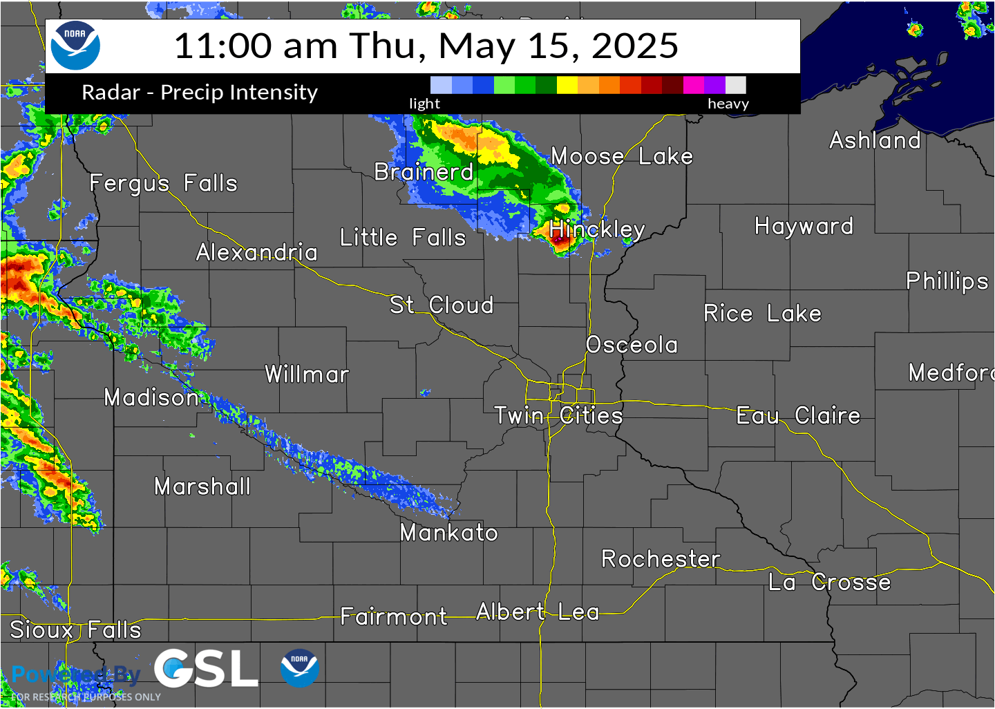
A very strong low pressure system resulted in two rounds of storms on Thursday, May 15th, 2025 across the Upper Midwest. The first round of storms developed west of Minnesota Wednesday evening and produced wind damage along the South Dakota and Minnesota border before weakening as they moved into Minnesota early Thursday morning. The storms eventually lifted north and dissipated as they approached the Minnesota and Wisconsin border. |
|
Tornadoes
Select a tornado from the table to zoom into the track and view more information. The default table view is limited to 8 tracks, but can be scrolled by a mouse wheel or dynamically expanded. Additionally, the table can fill the entire window by clicking the small circular expanding arrow icon at the very top right of the table and returned to its original size by clicking the button again. The side information panel that opens over the map can be closed using the "X" on the upper right corner of the pop-up. Zoom into the map and click damage points to see detailed information and pictures from the surveys.
|
NOTE: times shown below are local to your device's time zone. |

The Enhanced Fujita (EF) Scale classifies tornadoes into the following categories:
| EF0 Weak 65-85 mph |
EF1 Moderate 86-110 mph |
EF2 Significant 111-135 mph |
EF3 Severe 136-165 mph |
EF4 Extreme 166-200 mph |
EF5 Catastrophic 200+ mph |
 |
|||||
| Tornadoes that fail to impact any ratable structures on the EF-Scale are rated EF-Unknown (EF-U) | |||||
Wind & Hail
There was widespread damaging wind gusts and very large hail observed with these storms as well.
Wind
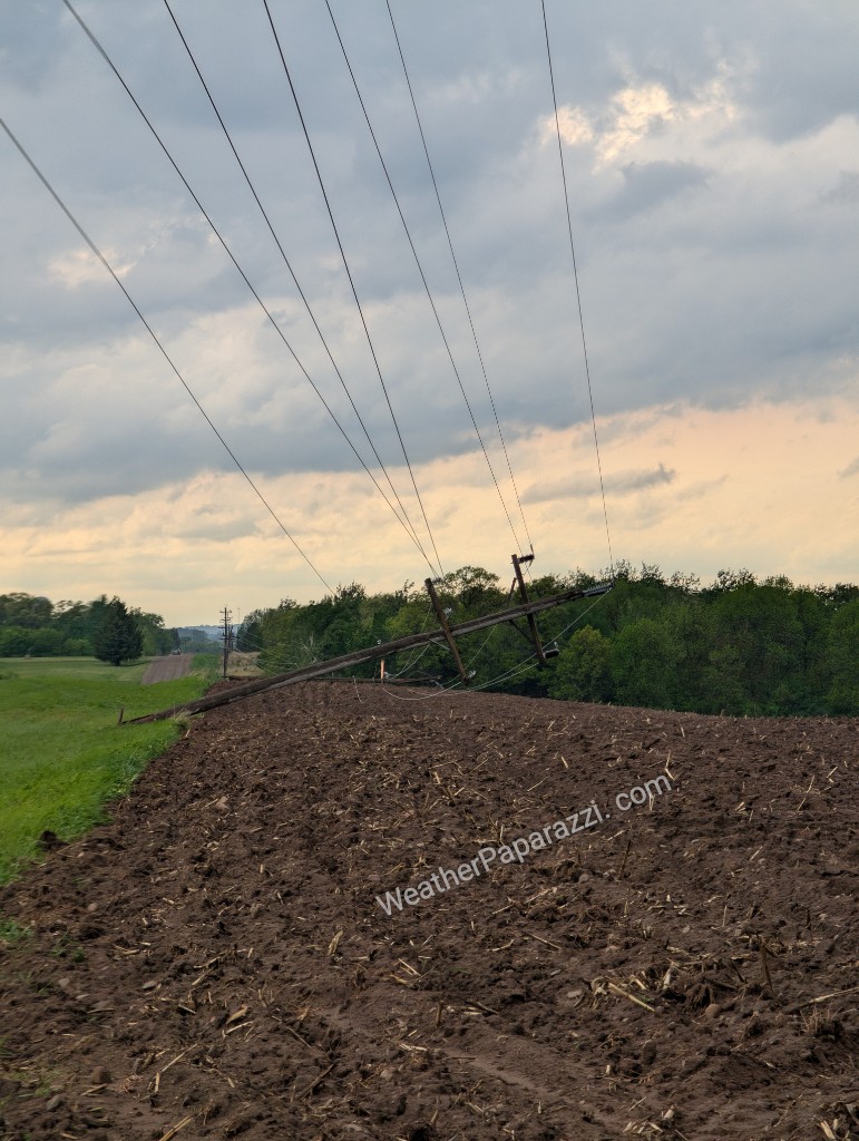
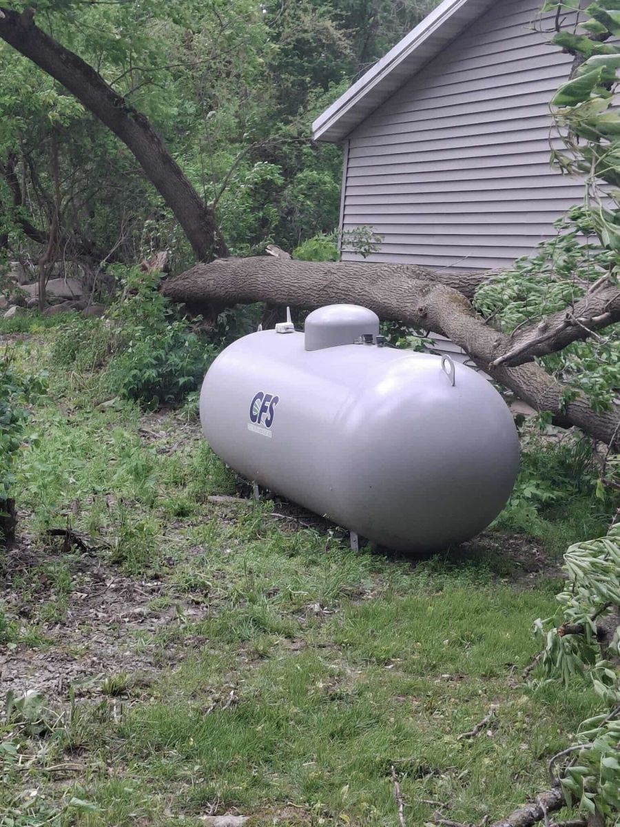
The most concentrated thunderstorm wind damage occurred in western WI, numerous power lines and trees knocked down and even some structural damage. Multiple areas of significant straight line wind damage were surveyed in Dunn, Barron, Chippewa and Rusk Counties (specifically near Colfax, Rice Lake, Holcombe and Ladysmith) with estimated wind speeds near 100 mph with the line of storms that moved through Rusk County based off of structural and tree damage. A pontoon was even partially lifted onto another nearby pontoon near the Dairyland Flowage northeast of Ladysmith.
 |
 |
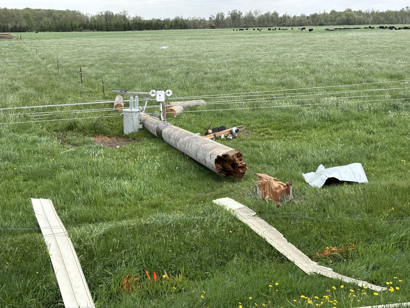 |
| Multiple power lines were knocked down just southeast of Pierz, MN. Image courtesy of Doug Kiesling. | A large, healthy tree fell down near Owatonna, MN due to strong thunderstorm winds. | Several power lines were snapped or knocked down along County Highway P southeast of Ladysmith in Rusk County, WI. |
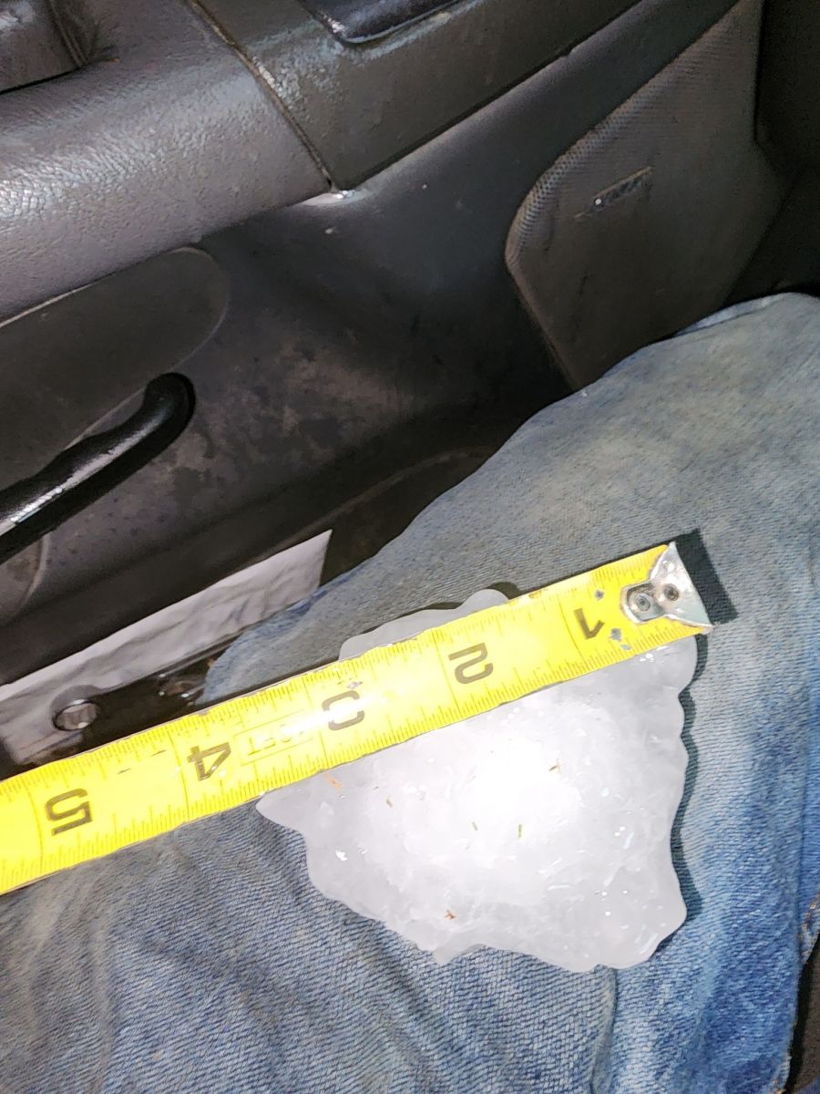
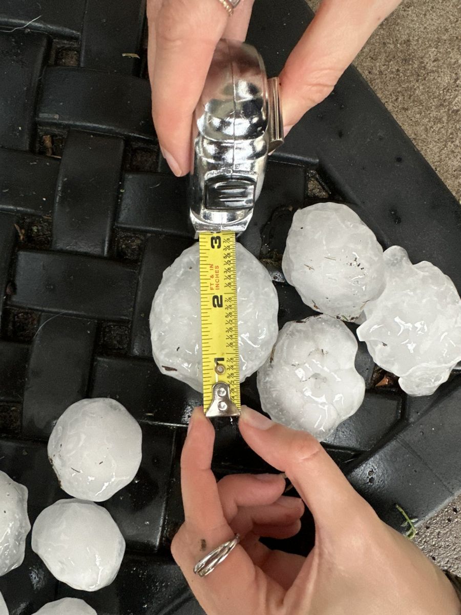
Hail
Very large hail fell near Eau Claire and Altoona in Wisconsin, with the largest report being up to 4 inches in diameter from Altoona, WI.
 |
 |
 |
| A 3 inch hail report via Darren Maier from the east side of Eau Claire, WI. | A 3.5 inch hail report from Altoona, WI courtesy of Russell Giere. | A 3 inch hail report via Adam Young from Eau Claire, WI. |
Storm Reports
...HIGHEST WIND REPORTS FROM MAY 15-16 2025...

Location                     Speed     Time/Date       Provider
Sauk Centre AP               58 MPH    0255 PM 05/15   AWOS
St. James AP                 56 MPH    0715 AM 05/16   AWOS
Mankato AP                   55 MPH    0632 PM 05/15   AWOS
Alexandria MN ASOS           54 MPH    1053 PM 05/15   ASOS
Crystal AP                   54 MPH    0554 PM 05/15   ASOS
Owatonna AP                  54 MPH    0415 PM 05/15   AWOS
Eau Claire AP                52 MPH    0405 PM 05/15   ASOS
Eden Prairie AP              52 MPH    0531 PM 05/15   ASOS
Minneapolis-St. Paul AP      52 MPH    0536 PM 05/15   ASOS
Olivia AP                    52 MPH    0335 AM 05/16   AWOS
Redwood Falls AP             52 MPH    0534 PM 05/15   ASOS
Buffalo AP                   51 MPH    0435 AM 05/16   AWOS
St. Paul Dwtn AP             51 MPH    0239 PM 05/15   ASOS
Waseca AP                    49 MPH    0315 PM 05/15   AWOS
Granite Falls AP             49 MPH    0315 AM 05/16   AWOS
Morris AP                    49 MPH    1015 PM 05/15   AWOS
Madison AP                   48 MPH    1135 PM 05/15   AWOS
New Richmond AP              48 MPH    0330 PM 05/15   AWOS
Willmar AP                   47 MPH    0215 AM 05/16   AWOS
Fairmont AP                  47 MPH    0615 PM 05/15   AWOS
Menomonie AP                 47 MPH    0355 PM 05/15   AWOS
Stanton AP                   47 MPH    0435 PM 05/15   AWOS
Canby AP                     46 MPH    0315 AM 05/16   AWOS
Glenwood AP                  46 MPH    0615 PM 05/15   AWOS
Tony AP                      46 MPH    0515 PM 05/15   AWOS
Camp Ripley                  45 MPH    0255 AM 05/16   AWOS
New Ulm AP                   45 MPH    0615 PM 05/15   AWOS
Appleton AP                  44 MPH    0133 AM 05/16   AWOS
Benson AP                    44 MPH    0115 AM 05/16   AWOS
Faribault AP                 44 MPH    0515 PM 05/15   AWOS
Red Wing AP                  44 MPH    0535 PM 05/15   AWOS
Albert Lea AP                43 MPH    0236 PM 05/15   AWOS
Paynesville AP               43 MPH    0255 AM 05/16   AWOS
Princeton AP                 43 MPH    0340 AM 05/16   AWOS
Rice Lake AP                 43 MPH    0435 PM 05/15   AWOS
Lake Elmo AP                 41 MPH    0555 PM 05/15   AWOS
Montevideo AP                41 MPH    1055 PM 05/15   AWOS
Osceola AP                   41 MPH    0815 PM 05/15   AWOS
South St. Paul AP            41 MPH    0535 PM 05/15   AWOS
Cumberland AP                40 MPH    0815 AM 05/16   AWOS

Observations are collected from a variety of sources with varying
equipment and exposures. We thank all volunteer weather observers
for their dedication. Not all data listed are considered official.
 |
Media use of NWS Web News Stories is encouraged! Please acknowledge the NWS as the source of any news information accessed from this site. |
|