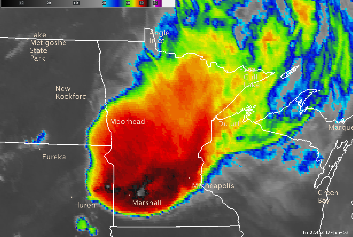
During the early afternoon of June 17th, thunderstorms came out of northwest Minnesota and tracked across western MN during the late afternoon before enventually dying over southeast Nebraska early on the morning of the 18th. The storms produced a few large hail reports in central MN before transitioning to producing strong winds for southwest MN. The largest hail report was golf ball sized (1.75 in.) from near Grove City (Meeker county) and Cold Spring (Stearns county). The strongest measured wind gust came from Fairmont at 68 mph. These storms produced heavy rain as well, with mainy locations within the main precipitation swath recieving between 2 and 4 inches of rain.
Click on the images below to view radar and IR satellite loops from this storm
.png) |
 |
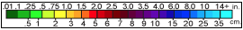
The map below shows radar rainfall estimates from these storms, notice the path these storms took across North Dakota, then due south across western MN into eastern Nebraska. The area below within the black outline shows where rainfall from this system fell.
.png)
The reason the storms followed the path they did is they followed a westerly jet stream over North Dakota, but an upper ridge over MN resulted in weak stearing winds over MN once they reached the state. At that point, the storms started to move toward the greatest instability. The image below shows what the instability looked like at 2 pm as the storms were moving into central MN. Notice the greatest instability was down toward Sioux Falls, SD, which is where these storms would eventually track toward.
.PNG)
The map below shows preliminary damage reports recieved June 17th and 18th along with warnings issued by all NWS offices.
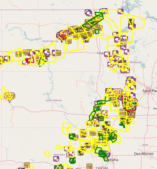
Here is a list of preliminary severe weather reports received within our area of responsibility:

