Overview
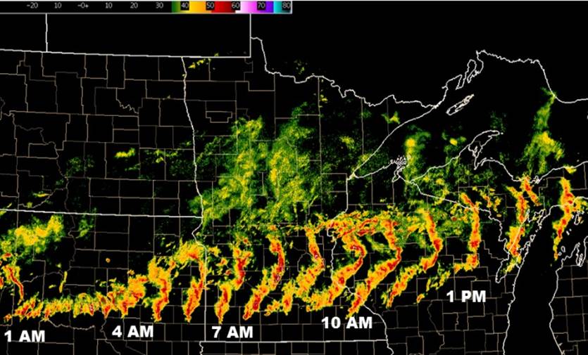
During the morning hours of June 11, 2017, a line of severe thunderstorms trekked eastward out of South Dakota, across Southern and Central Minnesota, and through Northern Wisconsin into the Upper Peninsula of Michigan. The system produced widespread wind gusts, large hail, and a tornado. Radar output encompassing the period from initial storm development around 1 AM CDT through 3 PM CDT is shown below.
Tornado:
|
|
||||||||||
|
||||||||||
|
Tornado - Kandiyohi, MN
Track Map 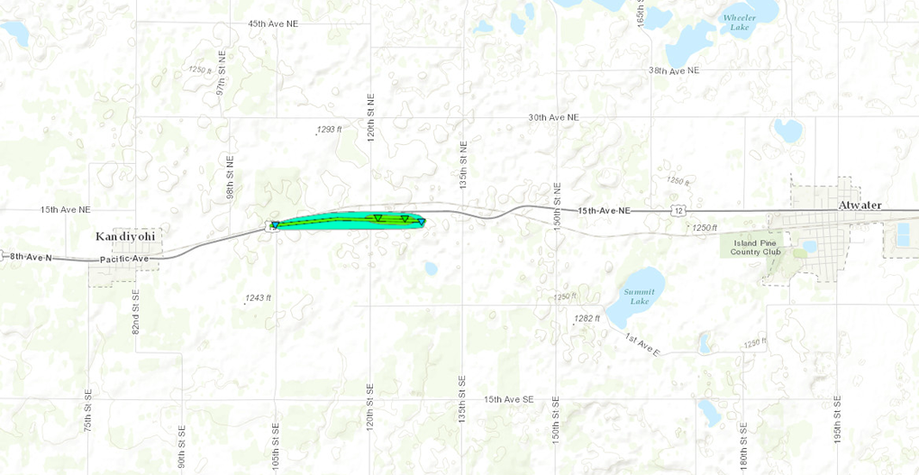 
|
||||||||||||||||
The Enhanced Fujita (EF) Scale classifies tornadoes into the following categories:
| EF0 Weak 65-85 mph |
EF1 Moderate 86-110 mph |
EF2 Significant 111-135 mph |
EF3 Severe 136-165 mph |
EF4 Extreme 166-200 mph |
EF5 Catastrophic 200+ mph |
 |
|||||
Photos:
 |
 |
 |
| Hail in Coon Rapids, MN | Wind Damage near Lake Nokomis, MN | Wind Damage in Minneapolis, MN |
Radar:
Header
|
Radar Loop from 6:05AM to 12:54 PM on June 11, 2017 |
Storm Reports
Click link to see storm reports for June 11, 2017: http://www.spc.noaa.gov/exper/archive/event.php?date=20170611
 |
Media use of NWS Web News Stories is encouraged! Please acknowledge the NWS as the source of any news information accessed from this site. |
|

