Overview
|
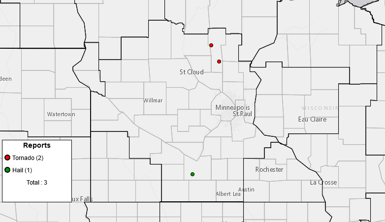
Scattered thunderstorms moved across central Minnesota on the evening of August 26th and two of those storms produced brief tornadoes in Mille Lacs county. An EF0 occurred south of Onamia, while the second touched down southeast of Milaca and was rated an EF1. These were the first tornadoes to occur in Mille Lacs county since July 30, 2011. |
|
|
Tornado - 4 ESE Milaca, MN
Track Map 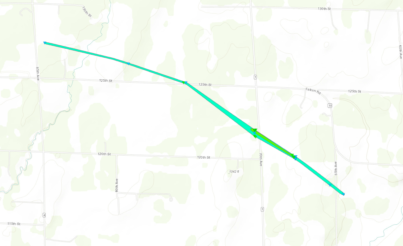 
Downloadable KMZ File |
||||||||||||||||
|
Tornado - 7 ESE Hillman, MN
Track Map 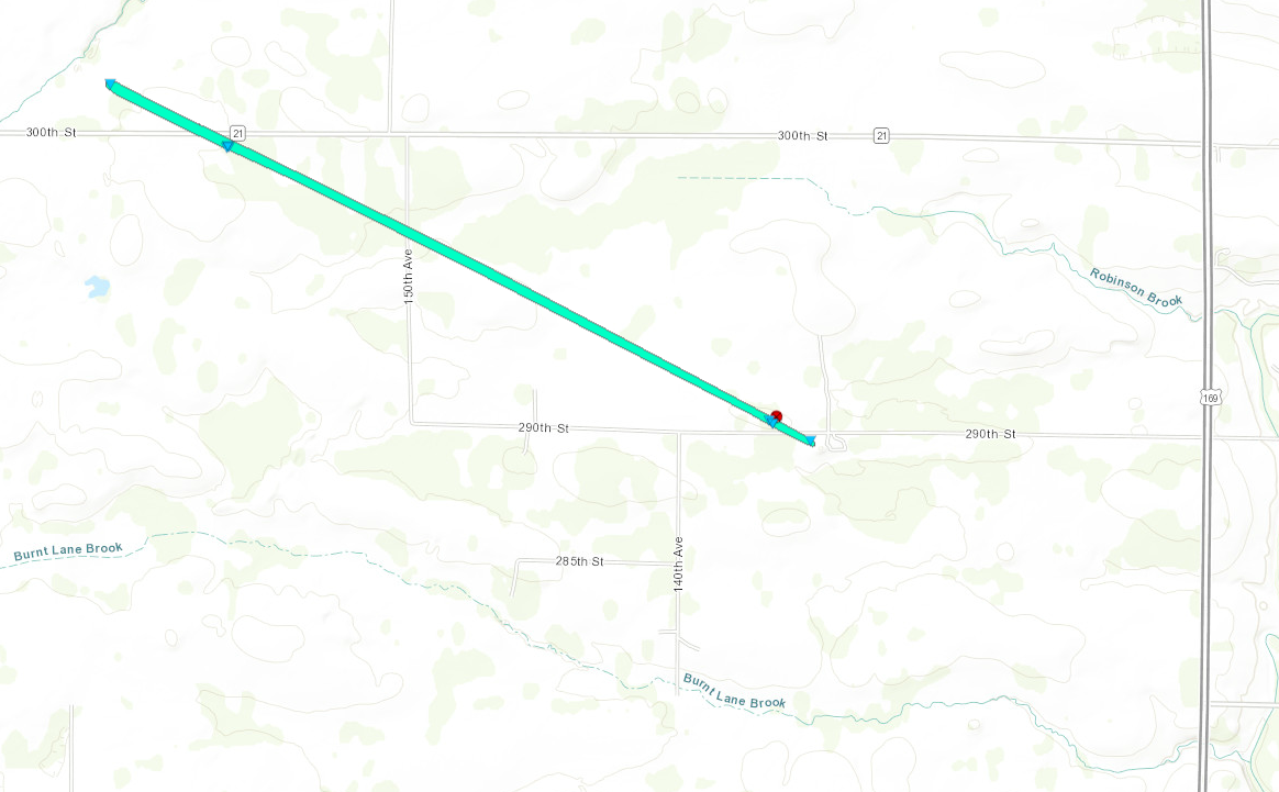
Downloadable KMZ File |
||||||||||||||||
The Enhanced Fujita (EF) Scale classifies tornadoes into the following categories:
| EF0 Weak 65-85 mph |
EF1 Moderate 86-110 mph |
EF2 Significant 111-135 mph |
EF3 Severe 136-165 mph |
EF4 Extreme 166-200 mph |
EF5 Catastrophic 200+ mph |
 |
|||||
 |
Media use of NWS Web News Stories is encouraged! Please acknowledge the NWS as the source of any news information accessed from this site. |
|