Overview
|
Severe thunderstorms developed across Western Minnesota Friday afternoon, August 14th. These storms produced several tornadoes across the region, as well as numerous reports of wind damage. Survey results are preliminary and not an exhaustive list of all tornadoes that were reported. Thank you to all weather spotters, public, media partners, and law enforcement that relayed reports and helped build a Weather Ready Nation. Preliminary results indicated that over 20 tornadoes occurred in Minnesota with 16 in the NWS Twin Cities forecast area. 3 of the 16 tornadoes were of EF-1 strength. |
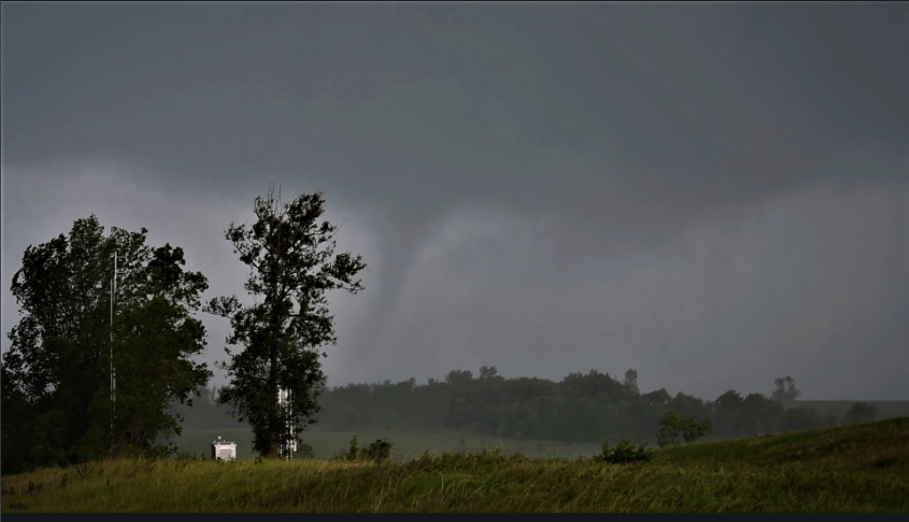
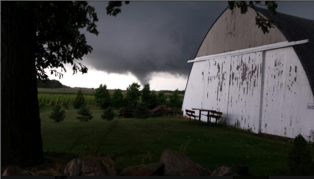
 Biscay Tornado - Photo Courtesy of Sahoosan Meyers Clark |
Tornadoes:
|
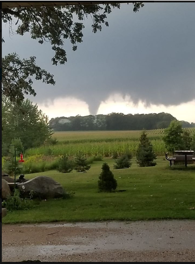
Tornado - Farwell
Track Map 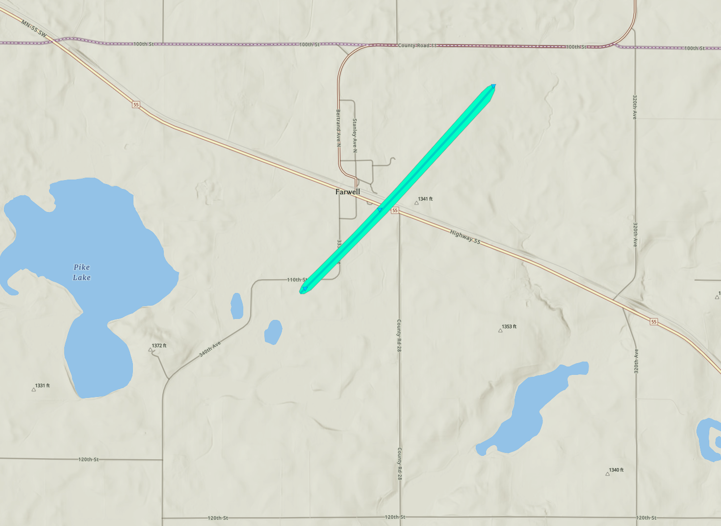 
Downloadable KMZ File |
||||||||||||||||
|
Tornado - Osakis
Track Map .PNG/Osakis(1)__446x320.PNG)
Downloadable KMZ File |
||||||||||||||||
|
Tornado - Lincoln
Track Map 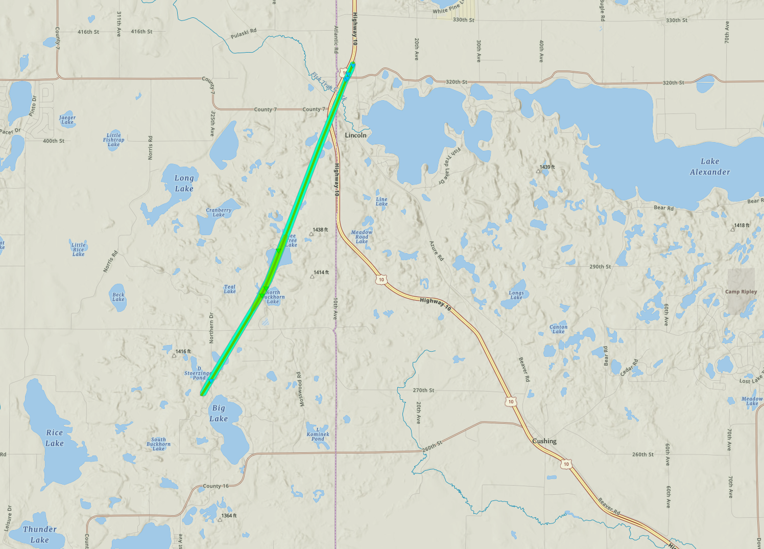
Downloadable KMZ File |
||||||||||||||||
|
Tornado - West Union
Track Map 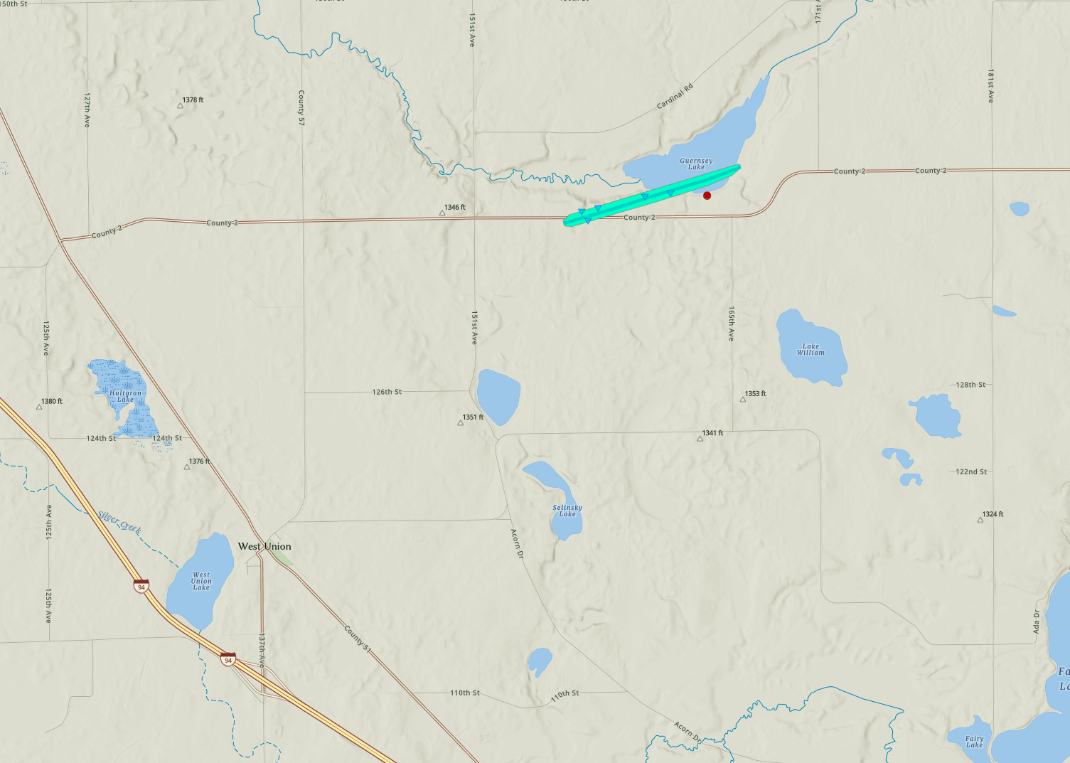
Downloadable KMZ File |
||||||||||||||||
|
Tornado - Spicer/Green Lake
Track Map 
Downloadable KMZ File |
||||||||||||||||
|
Tornado - Ripley Township
Track Map
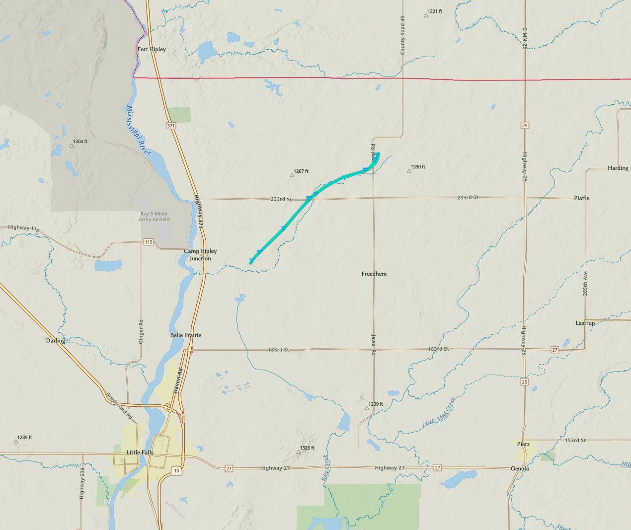
Downloadable KMZ File |
||||||||||||||||
|
Tornado - Brownton
Track Map 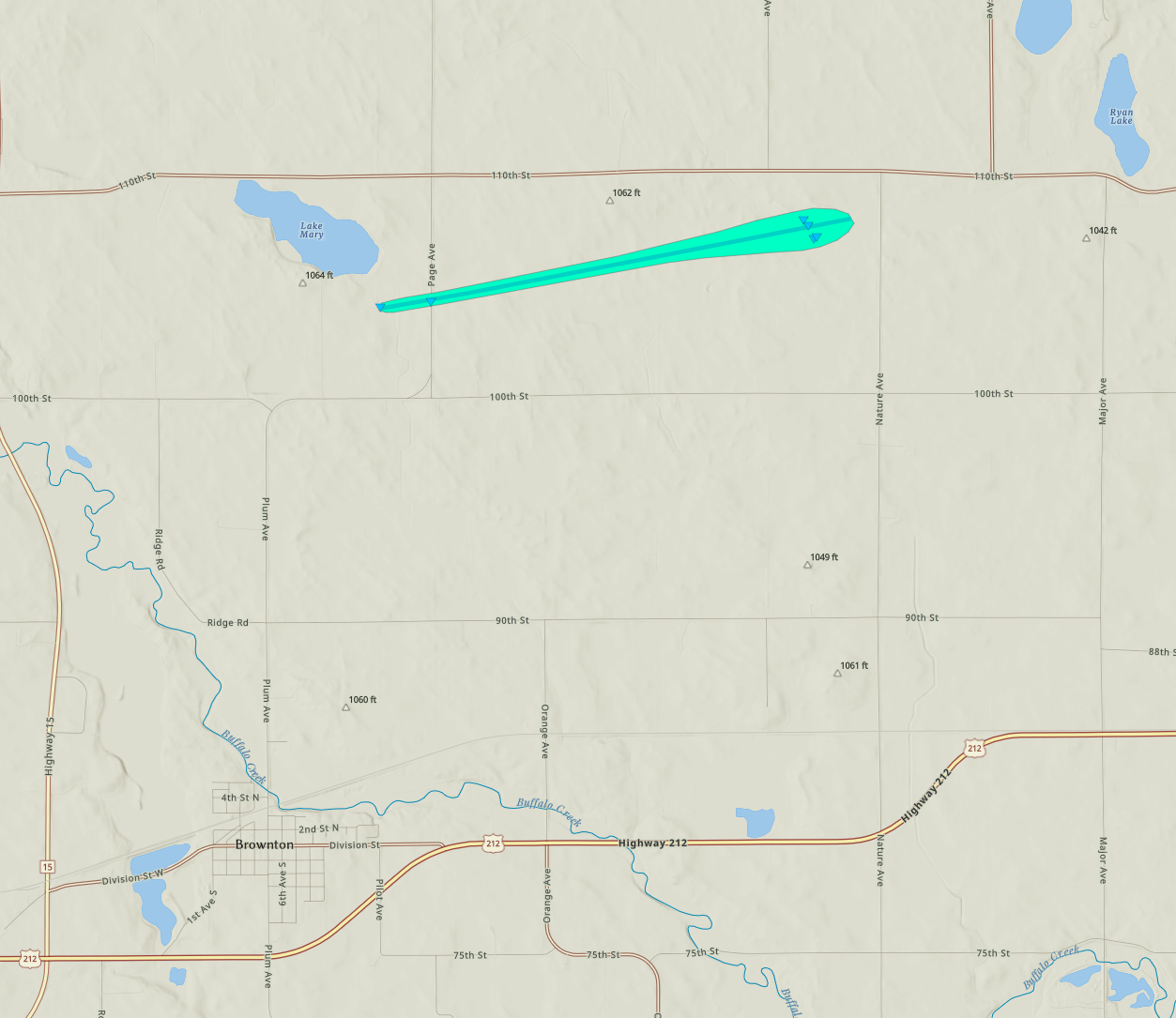
Downloadable KMZ File |
||||||||||||||||
|
Tornado - Kandiyohi/Meeker County Line
Track Map 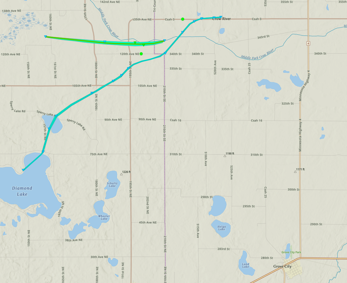
Downloadable KMZ File |
||||||||||||||||
|
Tornado - Bowlus
Track Map 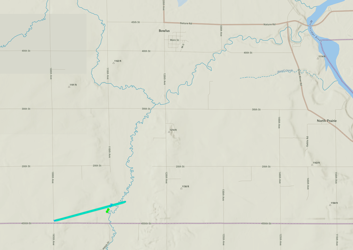
Downloadable KMZ File |
||||||||||||||||
|
Tornado - Irving Township
Track Map 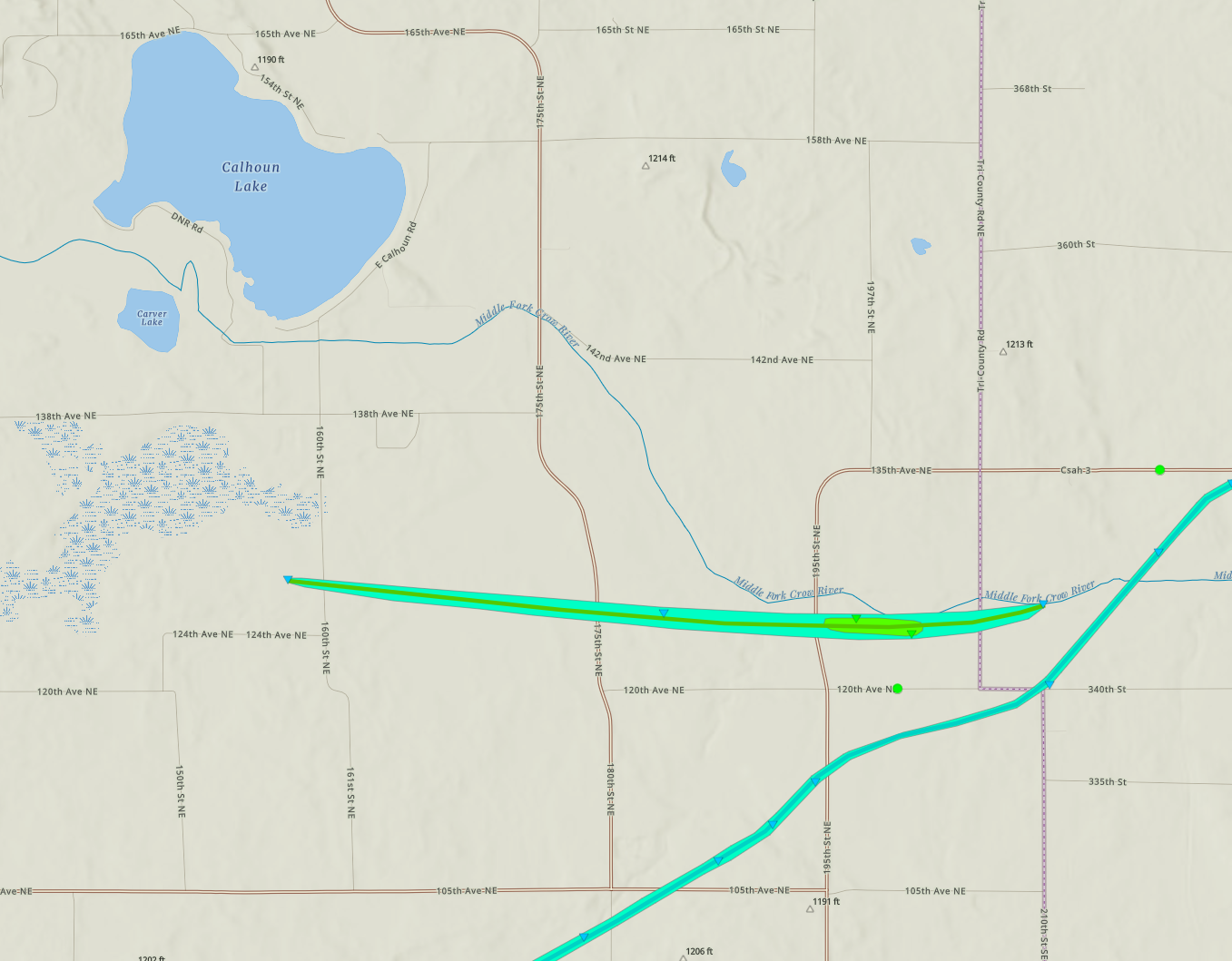
Downloadable KMZ File |
||||||||||||||||
|
Tornado - Biscay/Glencoe
Track Map 
Downloadable KMZ File |
||||||||||||||||
|
Tornado - Hillman
Track Map 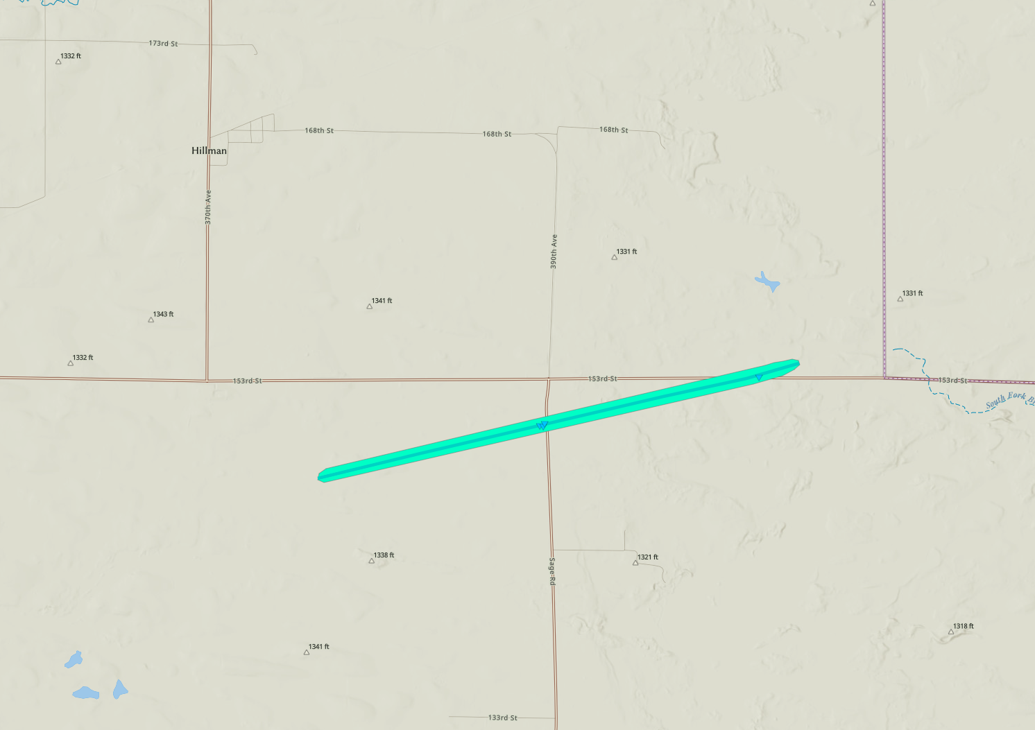
Downloadable KMZ File |
||||||||||||||||
|
Tornado - Lake Minnie Belle
Track Map 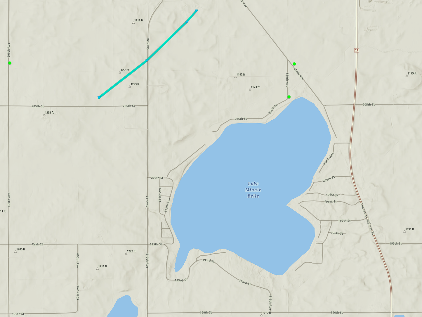
Downloadable KMZ File |
||||||||||||||||
|
Tornado - Waconia

Downloadable KMZ File |
||||||||||||||||
|
Tornado - Greenfield
Track Map 
Downloadable KMZ File |
||||||||||||||||
|
Tornado - Crystal
Track Map 
Downloadable KMZ File |
||||||||||||||||
The Enhanced Fujita (EF) Scale classifies tornadoes into the following categories:
| EF0 Weak 65-85 mph |
EF1 Moderate 86-110 mph |
EF2 Significant 111-135 mph |
EF3 Severe 136-165 mph |
EF4 Extreme 166-200 mph |
EF5 Catastrophic 200+ mph |
 |
|||||
Photos
 |
 |
 |
 |
|
Brownton Tornado (Photo Brett LaBare) |
Farwell Tornado (Photo Weather Unrated) |
Glencoe Tornado (Photo Sahoosan M Clark) |
Irving Township Tornado Irving Township Near 160th Street, North of 124th Ave - Looking East (Photo - Tyler Olson) |
 |
|||
|
Kandiyohi/Meeker Tornado Meeker County Road 25, Looking West Along Meeker County Road 3 (Photo - Tyler Olson) |
Radar
 |
 |
 |
 |
|
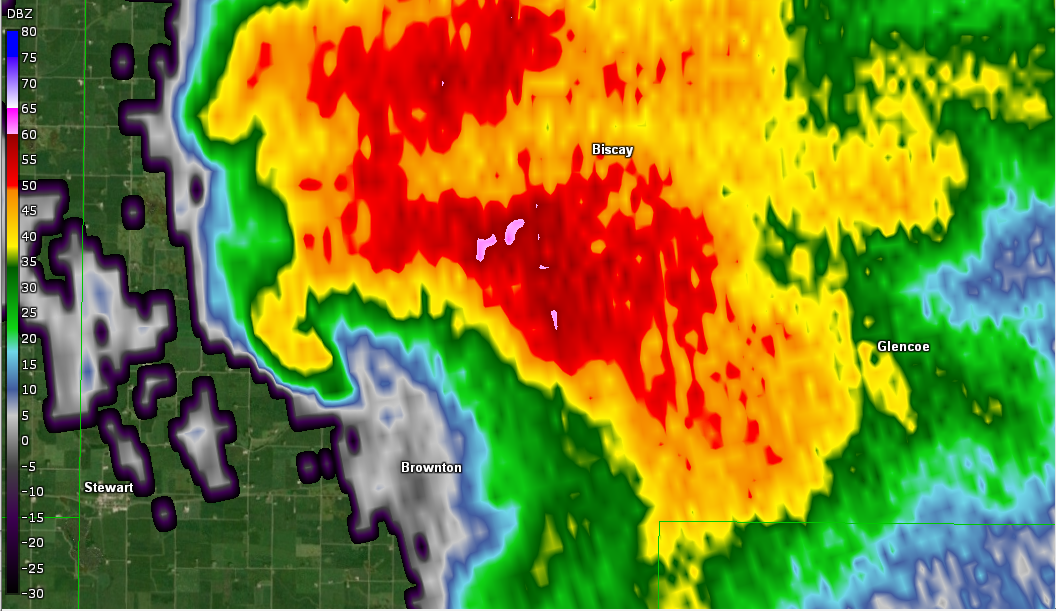
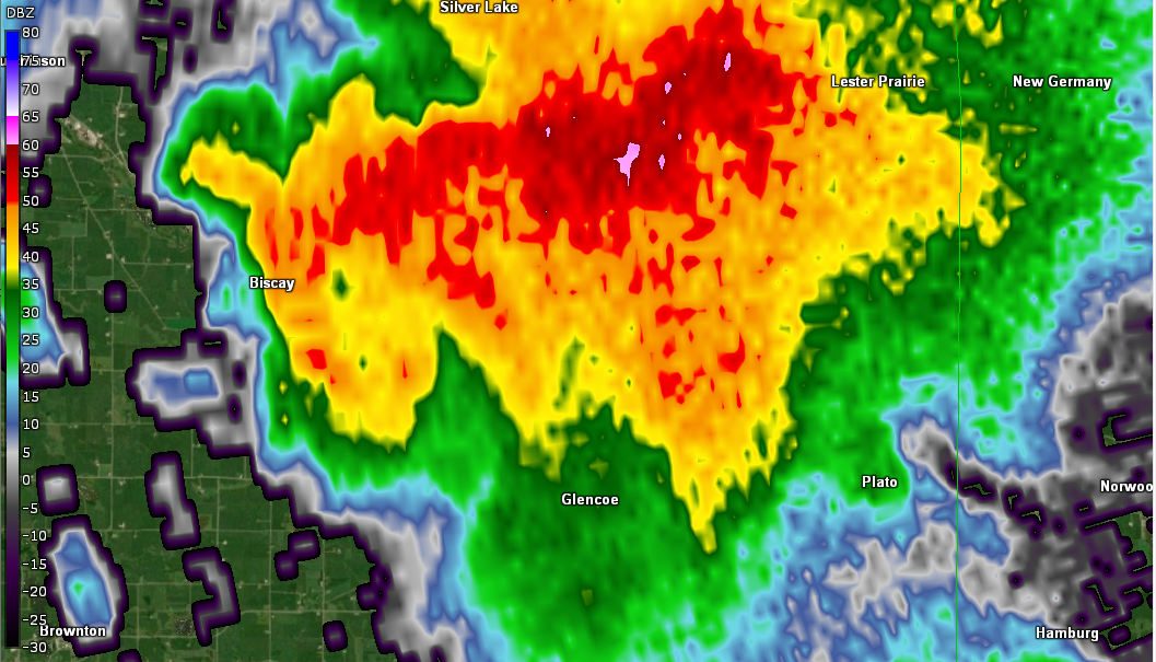
Brownton-Tornado (Hook-Echo Reflectivity) |
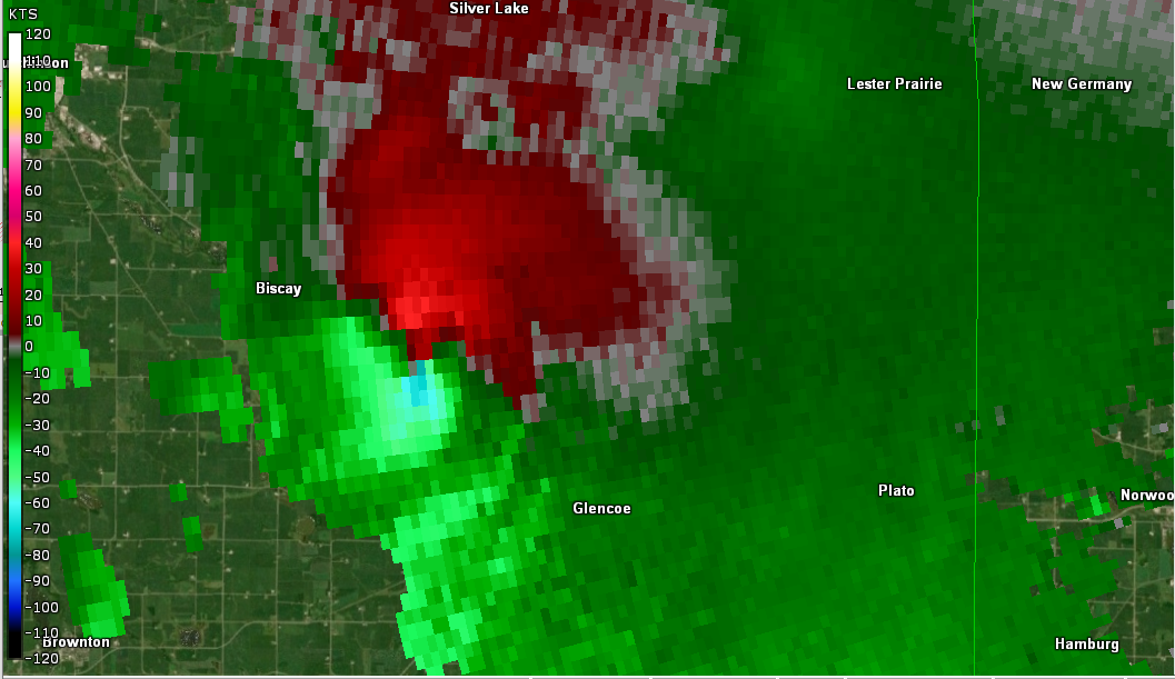
Brownton - Tornado (Storm Relative Motion - SRM) |
Biscay/Glencoe - Tornado (Hook Echo Reflectivity) |
Biscay/Glencoe - Tornado (Storm Relative Motion - SRM) |
Environment
During the afternoon, the environment became very conducive for severe thunderstorms. The afternoon sounding at the Chanhassen NWS office indicated a very favorable environment for severe storms. A surface boundary provided the focus for several of the tornadoes that occurred across central and southern Minnesota.
 |
 |
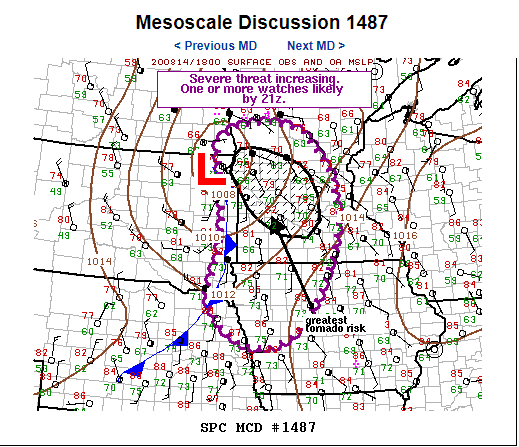 |
| Figure 1: Afternoon Sounding | Figure 2: Afternoon Surface Analysis | Figure 3: Mesoscale Discussion SPC 2 PM |
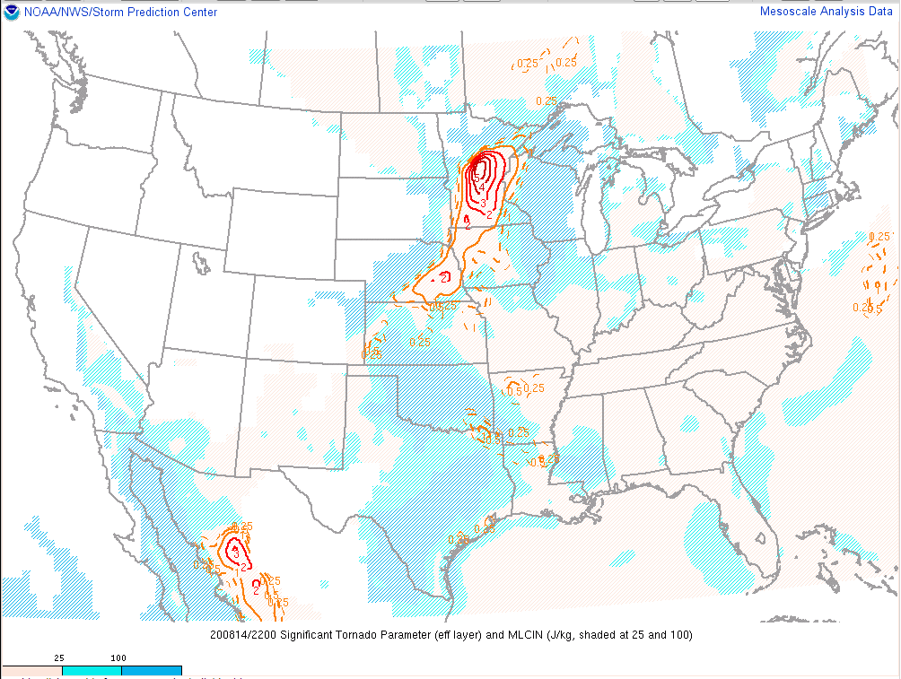
Additional severe weather parameters. (From SPC)
 |
 |
 |
| Figure 4: Late Afternoon MLCAPE & No CIN | Figure 5: 500 MB Short Wave 40-50 Knots | Figure 6: Effective Bulk Shear 40-50 Knots |
Additional severe weather parameters. (From SPC)
 |
 |
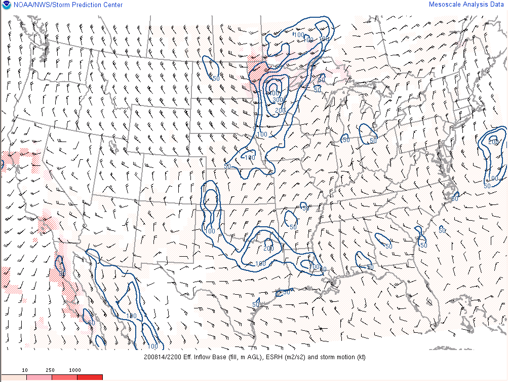 |
| Figure 7: SCP or Supercell Composite Parameter | Figure 8: STP or Significant Tornado Parameter | Figure 9: Effective SRH (Storm Relative Helicity) |
 |
Media use of NWS Web News Stories is encouraged! Please acknowledge the NWS as the source of any news information accessed from this site. |
|

