Overview
|
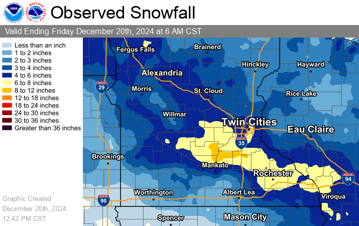
A storm system moved in from the northwest and spread a band of 4 to 7 inches across central Minnesota into western Wisconsin. The heaviest snow fell on Thursday morning, December 19th, which prompted several school closings and caused travel impacts through the evening. A few of the highest amounts are listed below. Here's a link to the Full List of Reports. 8.9 inches near Faribault MN in Rice County. |
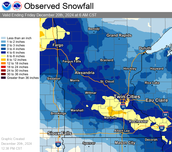 Interpolated snowfall map based on reports from observers across the region. |
Weather Data
 |
 |
 |
 |
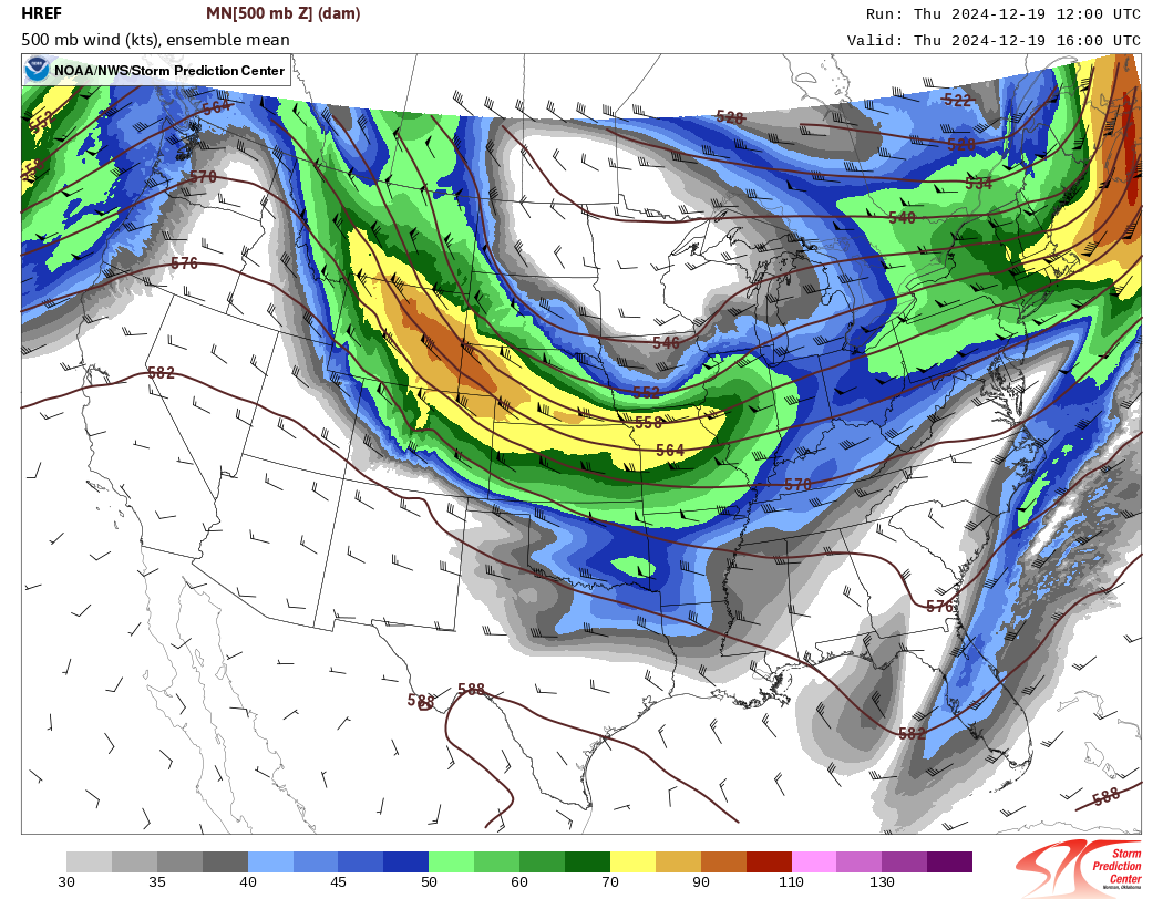
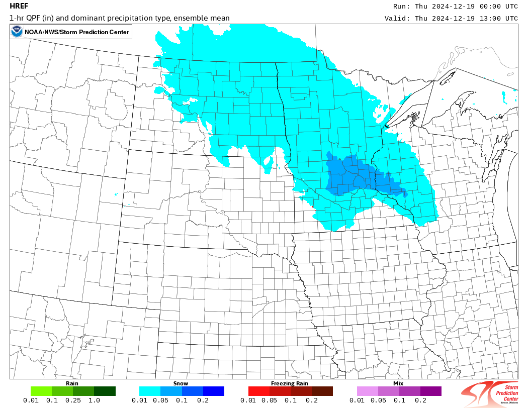
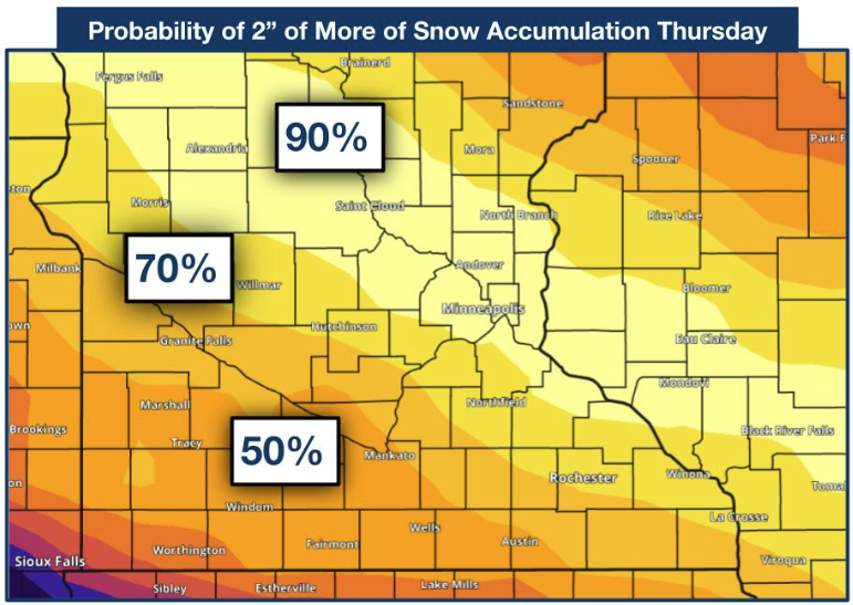
| At 500mb, a northern stream shortwave trough moved across the High Plains toward the Great Lakes. A Jet Streak (color fill) on the southern side, together with the curvature of the flow, created rising motion over Minnesota and Wisconsin. HREF 500mb Height / Wind. | Temperatures were cold enough for the precipitation to fall as snow (blue shading). HREF mean Ptype. | Two days before the event, the heaviest snow was expected along I-94. This is shown by the higher probabilities (yellow) of seeing at least two inches of snow. | As the event drew near, the forecast shifted to the south, and the heaviest snow ended up south of I-94. |
Photos & Video
 |
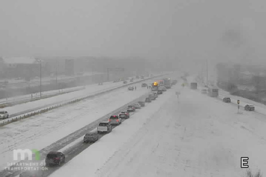 |
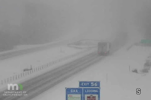
| The MNDOT image above shows heavy snow falling along I-35 near Faribault MN. | The MNDOT image above shows heavy snow near Shakopee MN along Hwy 169. |
 |
Media use of NWS Web News Stories is encouraged! Please acknowledge the NWS as the source of any news information accessed from this site. |
|

