Overview
|
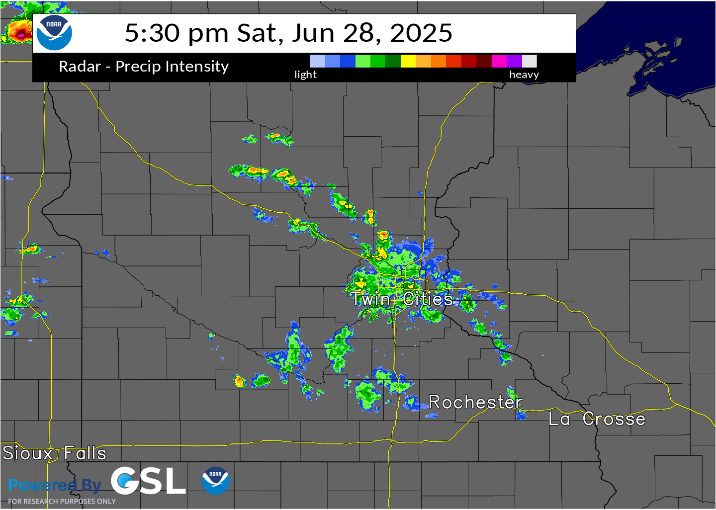
During the late afternoon of June 28, 2025, several thunderstorms developed across the Dakotas and western Minnesota. These storms produced a few tornadoes, heavy rain, and some wind damage. Areas in far western Yellow Medicine and Lac Qui Parle counties had flooded and washed out roads. As the storms approached central and eastern Minnesota, they formed into a line. This line of storms had several circulations along the leading edge, and produced several tornadoes in Carver County, other tornadoes in western Minnesota, as well as sporadic wind damage across much of the western Twin Cities metro area.
8 tornadoes have been confirmed across the NWS Twin Cities County Warning Area; one in western Lac Qui Parle County that produced no damage, one in northwestern Yellow Medicine County (damage unknown so far), one in western Swift County that damaged powerlines & a turkey barn south of Danvers, & five in Carver County that produced damage to trees, powerlines, & various minor damage to farm outbuildings. More tracks from these tornadoes will be added to the map below as survey data from a variety of sources is compiled & analyzed. |
|
Tornadoes
Select a tornado from the table to zoom into the track and view more information. The default table view is limited to 8 tracks, but can be scrolled by a mouse wheel or dynamically expanded. Additionally, the table can fill the entire window by clicking the small circular expanding arrow icon at the very top right of the table and returned to its original size by clicking the button again. The side information panel that opens over the map can be closed using the "X" on the upper right corner of the pop-up. Zoom into the map and click damage points to see detailed information and pictures from the surveys.
|
NOTE: times shown below are local to your device's time zone. |

The Enhanced Fujita (EF) Scale classifies tornadoes into the following categories:
| EF0 Weak 65-85 mph |
EF1 Moderate 86-110 mph |
EF2 Significant 111-135 mph |
EF3 Severe 136-165 mph |
EF4 Extreme 166-200 mph |
EF5 Catastrophic 200+ mph |
 |
|||||
| Tornadoes that fail to impact any ratable damage indicators on the EF-Scale are rated EF-Unknown (EF-U) | |||||
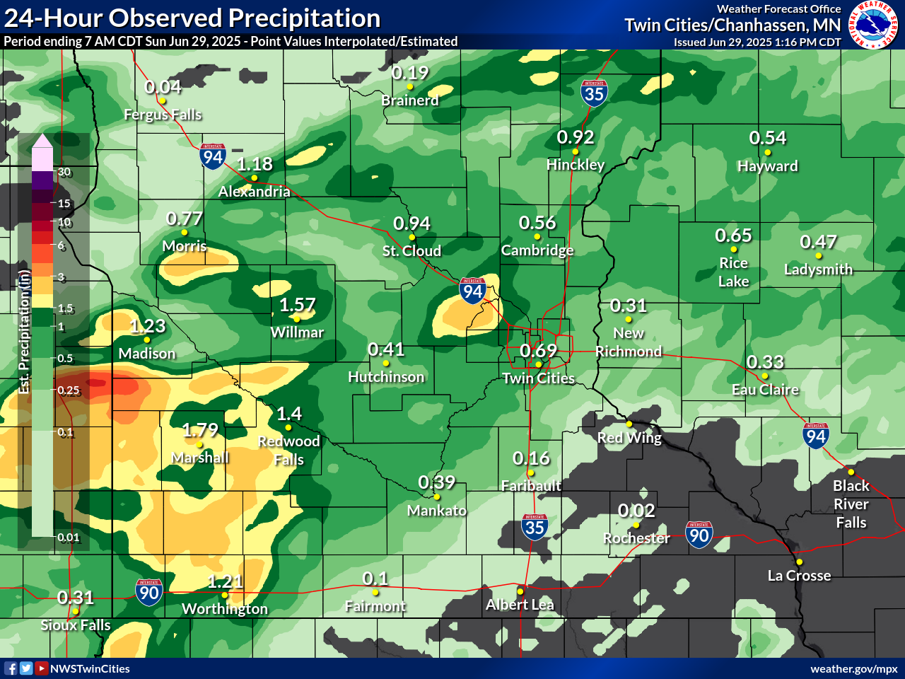
Rain Reports
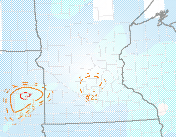
Here is a map of the 24 hour rainfall reports. There were a few public reports of 5 to 6 inches across far western Yellow Medicine County.
Storm Reports
Here is a link to severe weather reports. We'll continue to update those over as we receive more information.
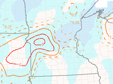
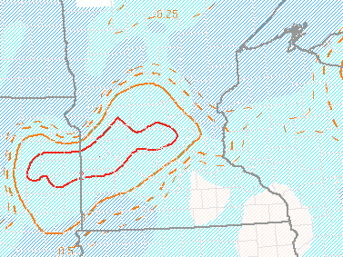
Environment and Radar Data
The fixed layer Significant Tornado Parameter showed a decreasing tornado threat Saturday evening, but there was still a small signal as the storms approached the west metro.
 |
 |
 |
| Figure 1: Significant Tornado Parameter (effective layer) and SBCIN (J/kg, shaded at 25 and 100) valid at 0100Z | Figure 2: Significant Tornado Parameter (fixed layer) and SBCIN (J/kg, shaded at 25 and 100) valid at 0300Z | Figure 3: Significant Tornado Parameter (fixed layer) and SBCIN (J/kg, shaded at 25 and 100) valid at 0500Z |
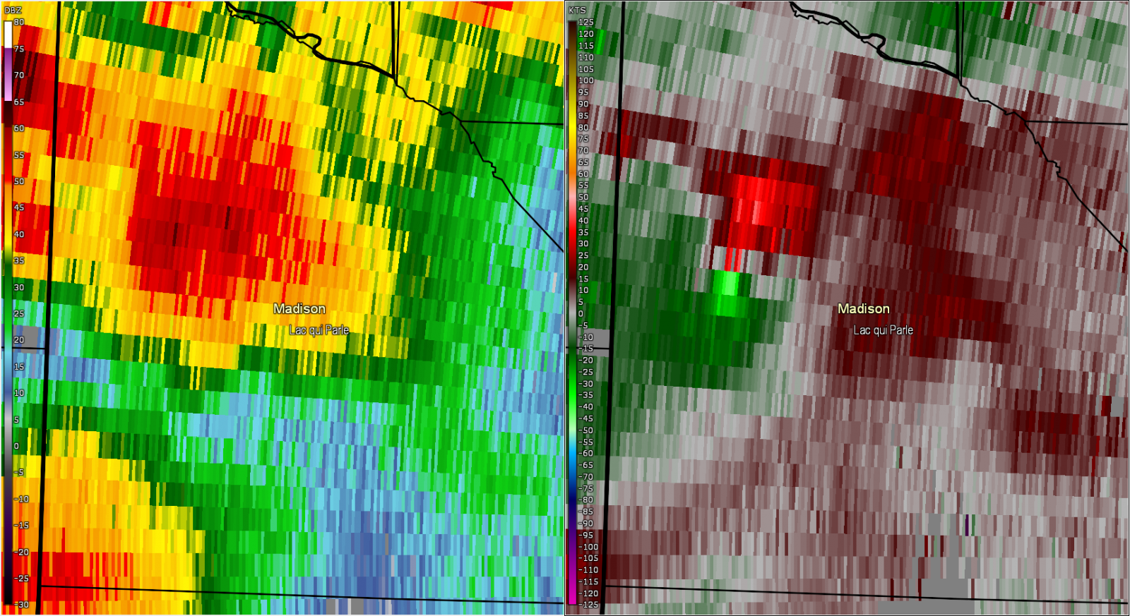
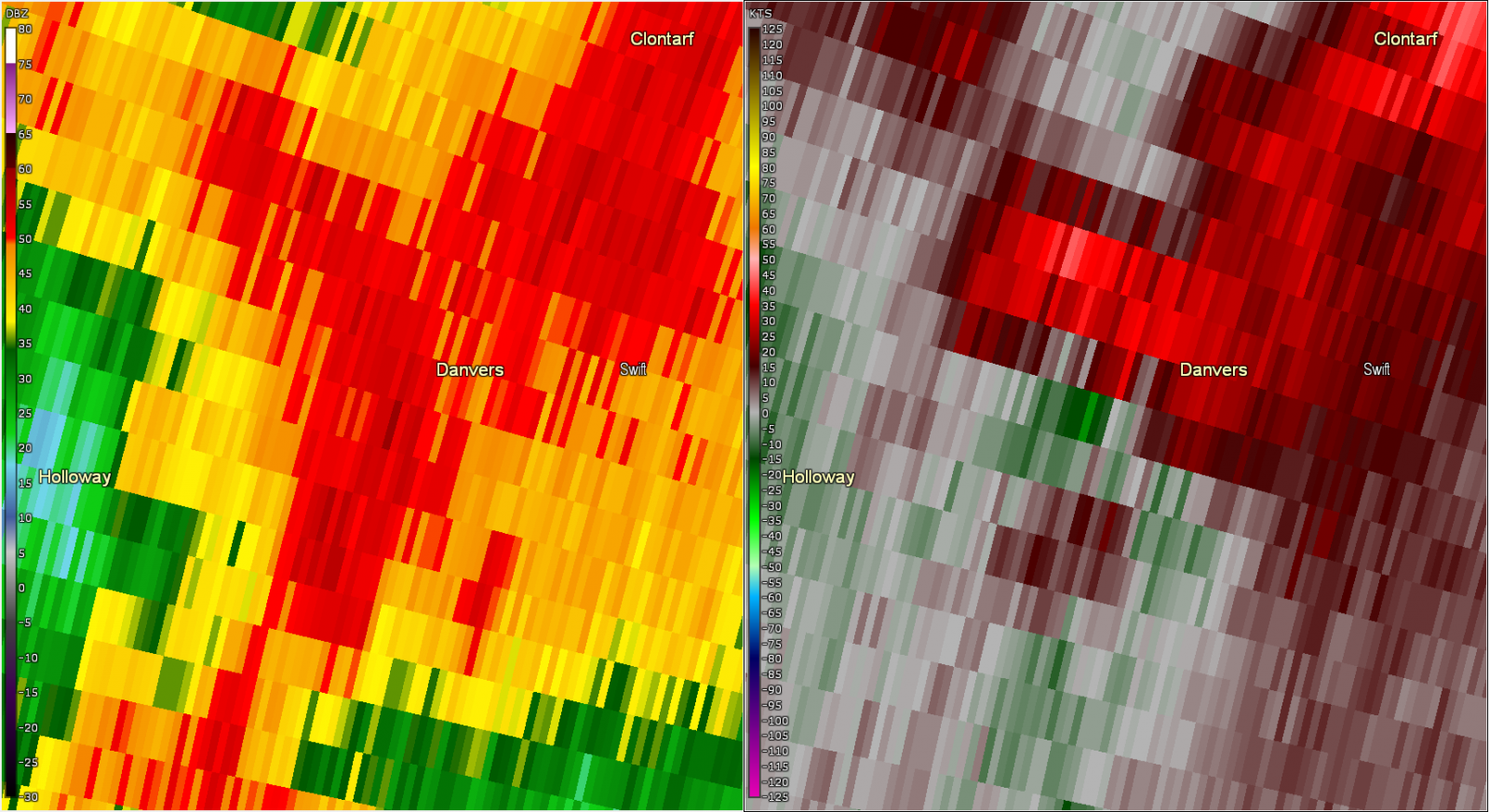
Radar imagery from when the tornadoes touched down in western Minnesota.
 |
 |
 |
| Figure 4: Radar reflectivity (left) and storm relative velocity (right) for the storm northwest of Madison MN, valid at 7:25 PM CDT. | Figure 5: Radar reflectivity (left) and storm relative velocity (right) for the storm near Danvers MN, valid at 7:51 PM CDT. | Figure 6: Radar reflectivity (left) and storm relative velocity (right) for the storm near Danvers MN, valid at 8:51 PM CDT. |
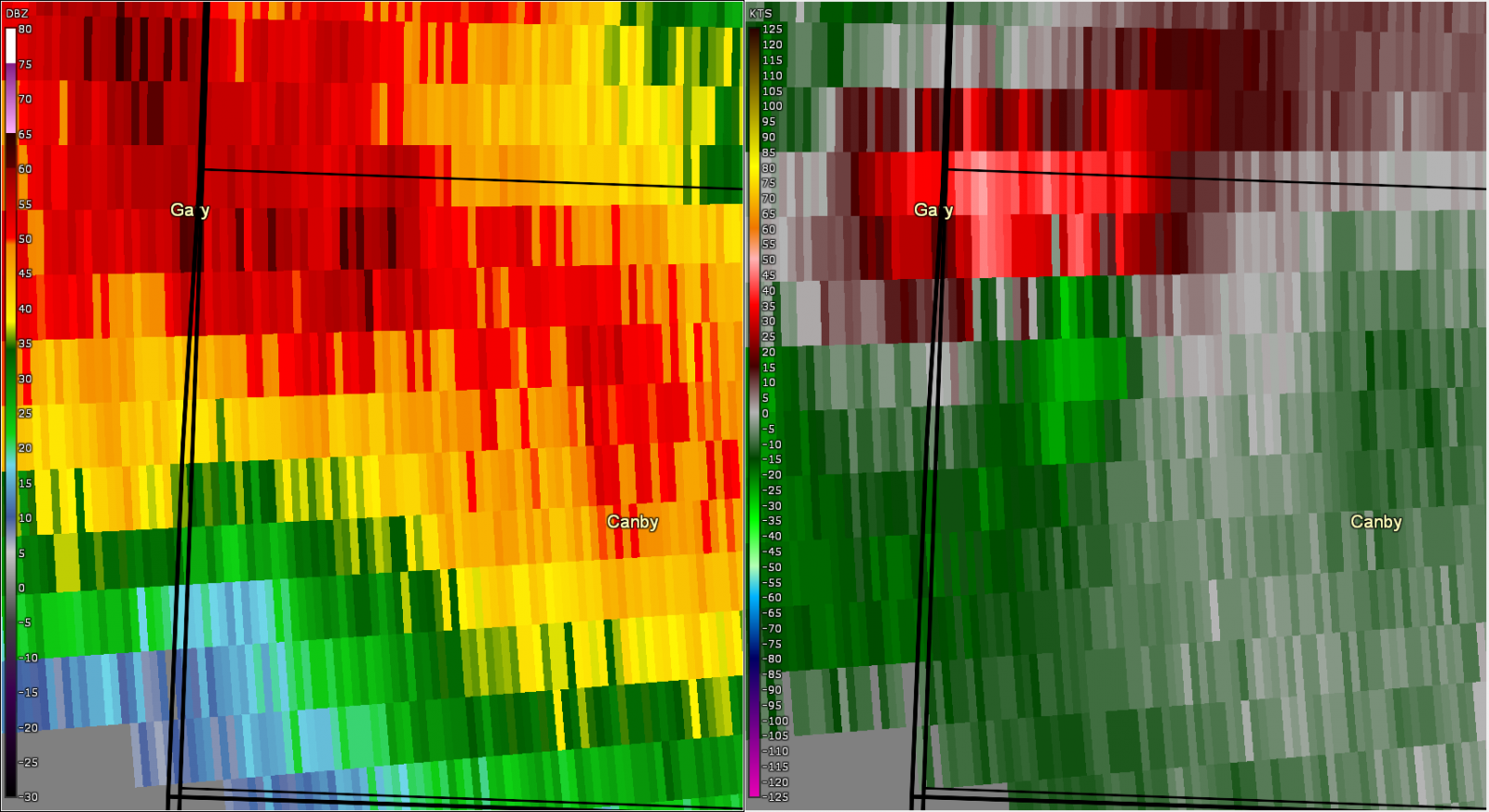
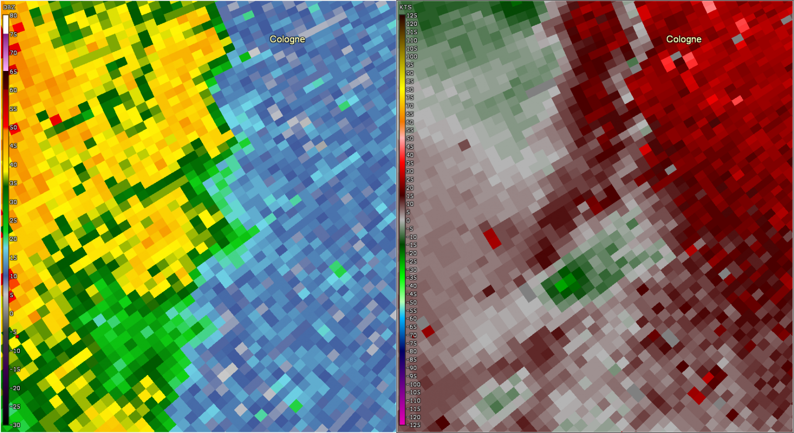
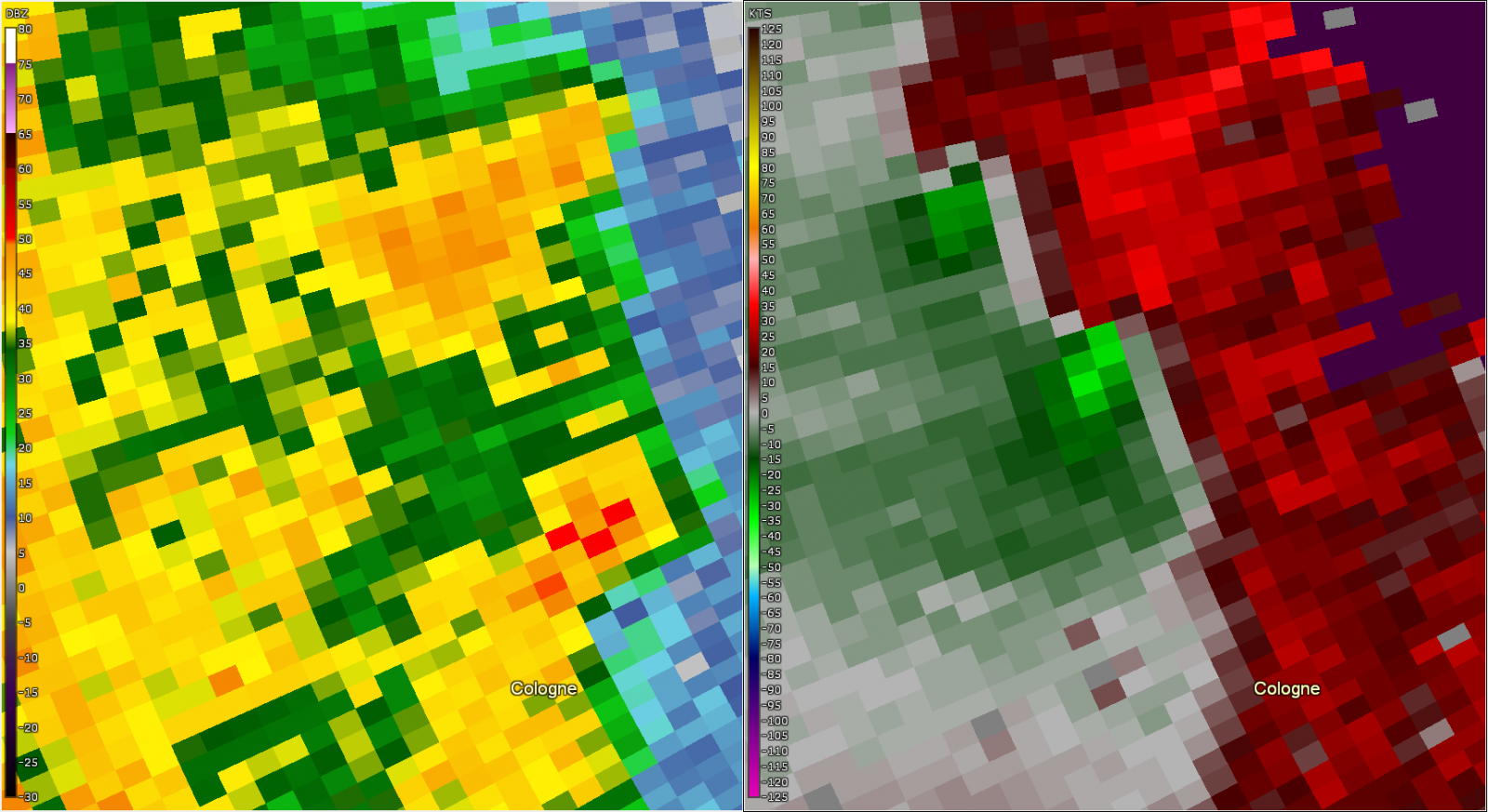
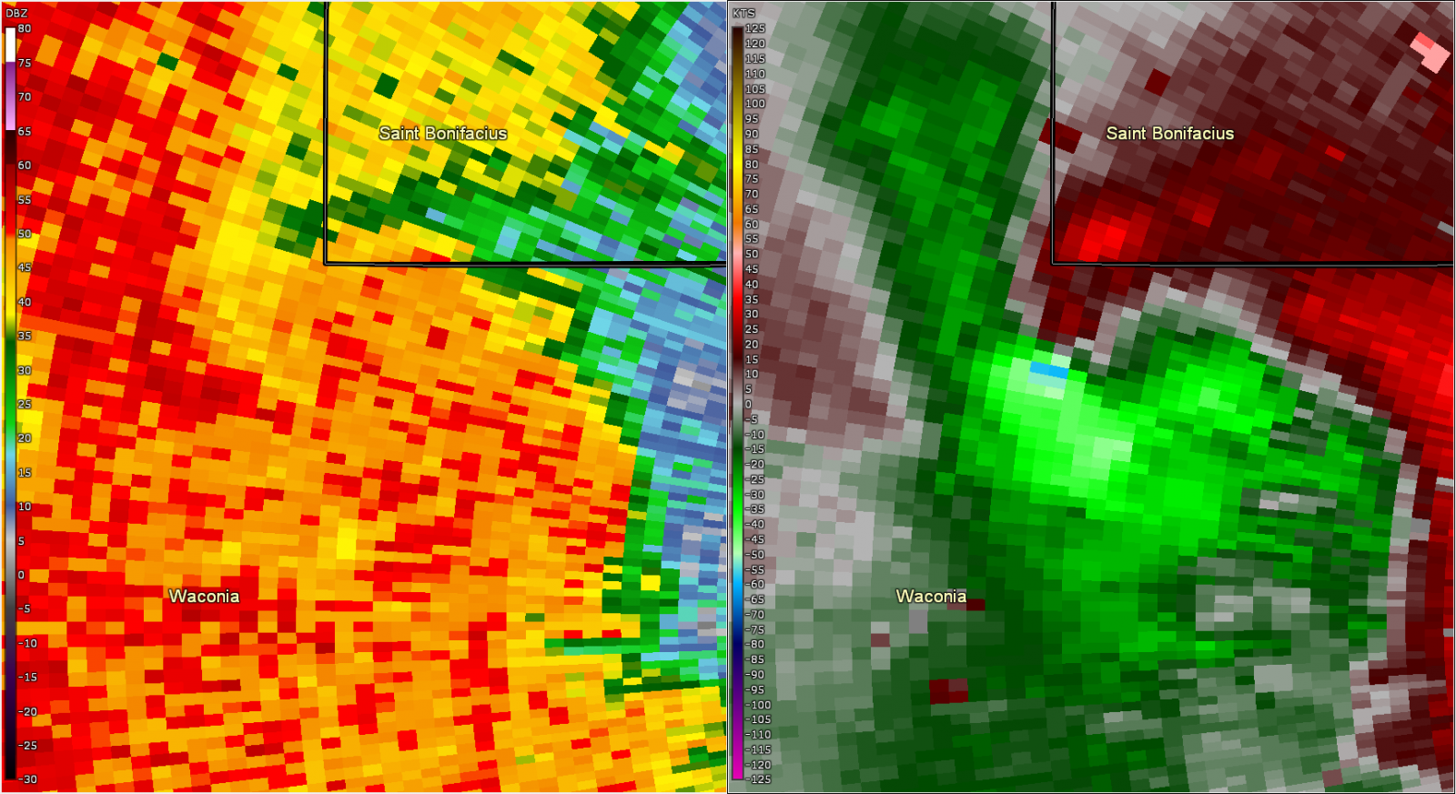
Radar imagery from when the tornadoes touched down in Carver County, Minnesota..
 |
 |
 |
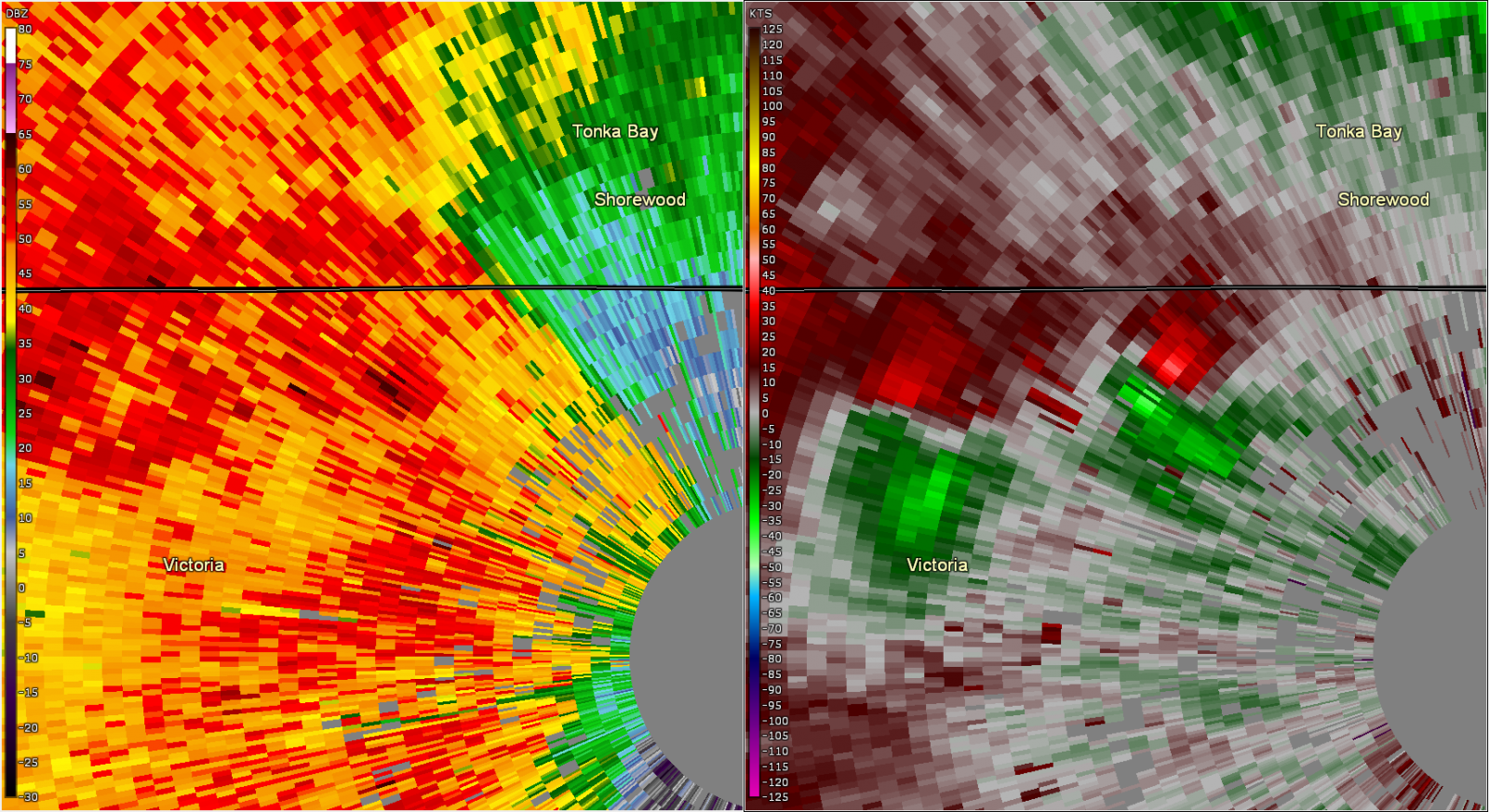 |
| Figure 7: Radar reflectivity (left) and storm relative velocity (right) for the storm southwest of Cologne MN, valid at 12:10 AM CDT. | Figure 8: Radar reflectivity (left) and storm relative velocity (right) for two tornadoes north of Cologne MN, valid at 12:12 AM CDT. | Figure 9: Radar reflectivity (left) and storm relative velocity (right) for the storm on north side of Lake Waconia, valid at 12:15 AM CDT. | Figure 9: Radar reflectivity (left) and storm relative velocity (right) for the storm near Lake Zumbra, valid at 12:29 AM CDT. |
 |
Media use of NWS Web News Stories is encouraged! Please acknowledge the NWS as the source of any news information accessed from this site. |
|