Overview
|
Several storms that developed across west central Wisconsin during the late afternoon, and early evening of July 4th, 2019, produced an EF0 tornado south of Bruce, Wisconsin. Numerous trees were blown down or uprooted. Some of the trees fell on lake cabins. The radar loop shows Radar Reflectivity (left) and Storm Relative Velocity (right) in 2 minute increments from 522 PM to 6:11 PM. The red area indicates outbound velocity, and green indicates inbound velocity (circulation, but at 12,000 feet above the surface) At times you can also see circulations in the velocity, which indicate rotating updrafts.
|
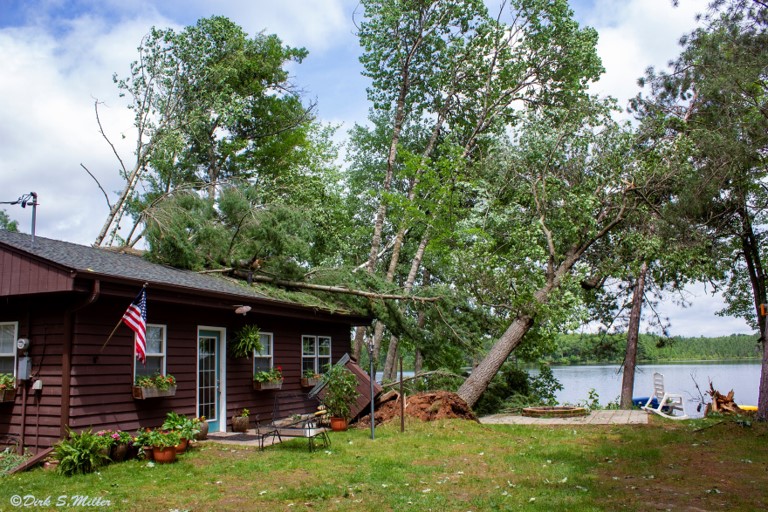
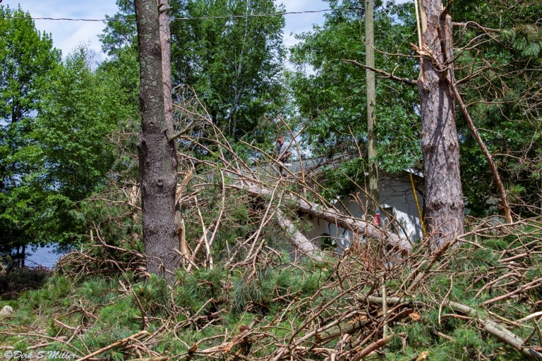
Photos
Here are a few images of tornadic damage.
 |
 |
 |
|
| Roof Damage | EF-0 Damage Near Lake | Tree Damage In Rusk County |
Tornado Track:
|
Tornado - Fireside, Pulaski & Boot Lake
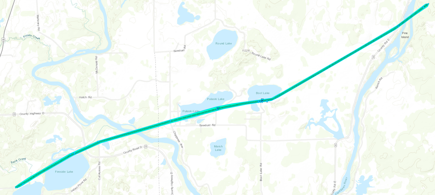 
Track Map
|
||||||||||||||||
The Enhanced Fujita (EF) Scale classifies tornadoes into the following categories:
| EF0 Weak 65-85 mph |
EF1 Moderate 86-110 mph |
EF2 Significant 111-135 mph |
EF3 Severe 136-165 mph |
EF4 Extreme 166-200 mph |
EF5 Catastrophic 200+ mph |
 |
|||||
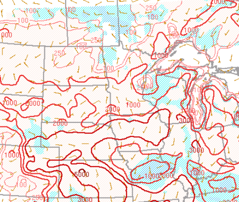
Environment:
The following Severe Weather Parameter showed a very weak environment for tornado development. This tornado likely formed by localized affects of storm convergence along a boundary in west central Wisconsin. There was a better indication of severe weather potential once the storm already produced the EF0 tornado south of Bruce, Wisconsin.
SBCAPE: (Surface-Based Convective Available Potential Energy) is a measure of instability in the troposphere.
This storm had roughly 1000-1500 J/Kg around tornado touchdown.
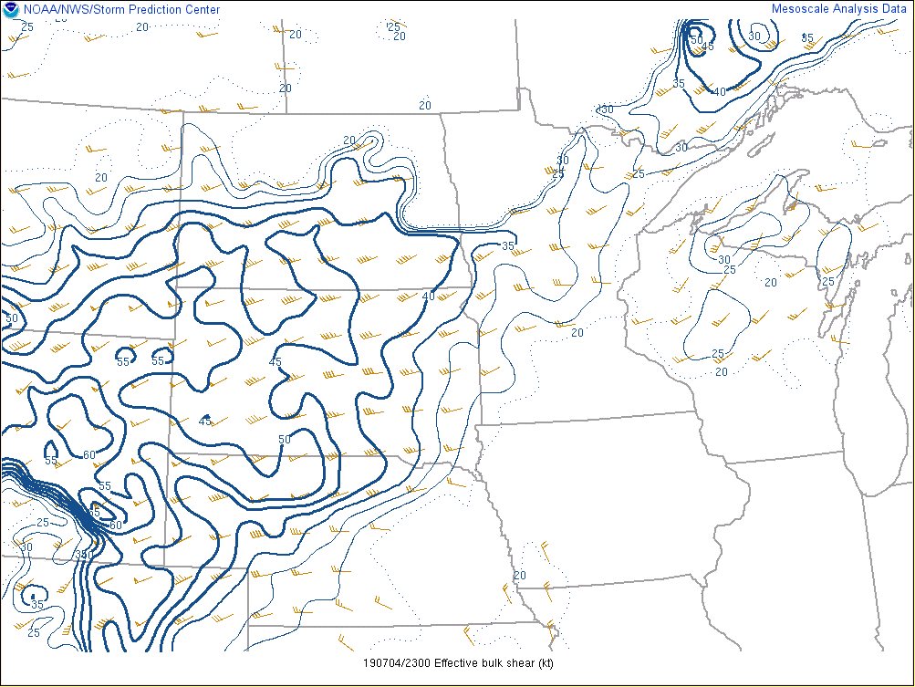
Effective Bulk Shear: The magnitude of the vector wind difference from the effective inflow base upward to 50% of the equilibrium level height for the most unstable parcel in the lowest 300 mb. This parameter is similar to the 0-6 km bulk wind difference, though it accounts for storm depth (effective inflow base to EL) and is designed to identify both surface-based and "elevated" supercell environments.
This storm had over 25 knots of Effective Bulk Shear around tornado touchdown. 40 knots of shear is about the threshold for supercells. Lower values tend to result in multi-cells and unorganized storms.
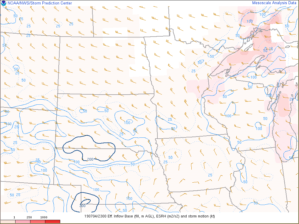
Effective Storm-Relative Helicity (ESRH): The measure of how much potential cyclonic updraft rotation is available for a right-moving supercell in the current thermodynamic environment. In more general terms, this variable gives a value of the amount of vertical turning of the winds near the surface. Higher values of ESRH suggest an increased threat of tornadoes with supercells.
This storm had over 100 m2/s2 (relatively favorable for tornadoes) of ESRH around tornado touchdown.
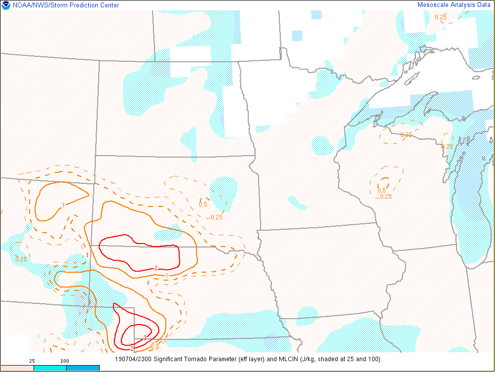
Significant Tornado Parameter: A multiple ingredient, composite index that includes effective bulk wind difference, effective storm-relative helicity, 100-mb mean parcel CAPE, 100-mb mean parcel CIN, and 100-mb mean parcel LCL height.
This storm was within an environment of about 0.25 STP. Values below 1 tend to be associated with non-tornadic supercells.
 |
 |
 |
 |
| Surface Based CAPE - 6 PM CDT | Effective Bulk Shear - 6 PM CDT | Effective Storm-Relative Helicity - 6 PM CDT | Significant Tornado Parameter - 6 PM CDT |

