Overview
|
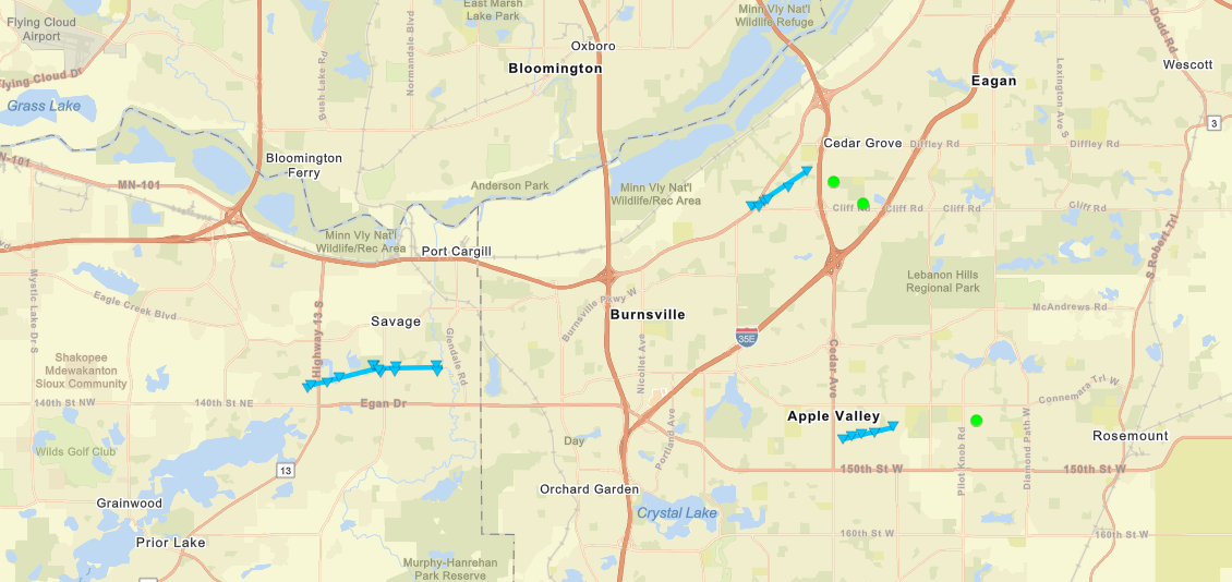
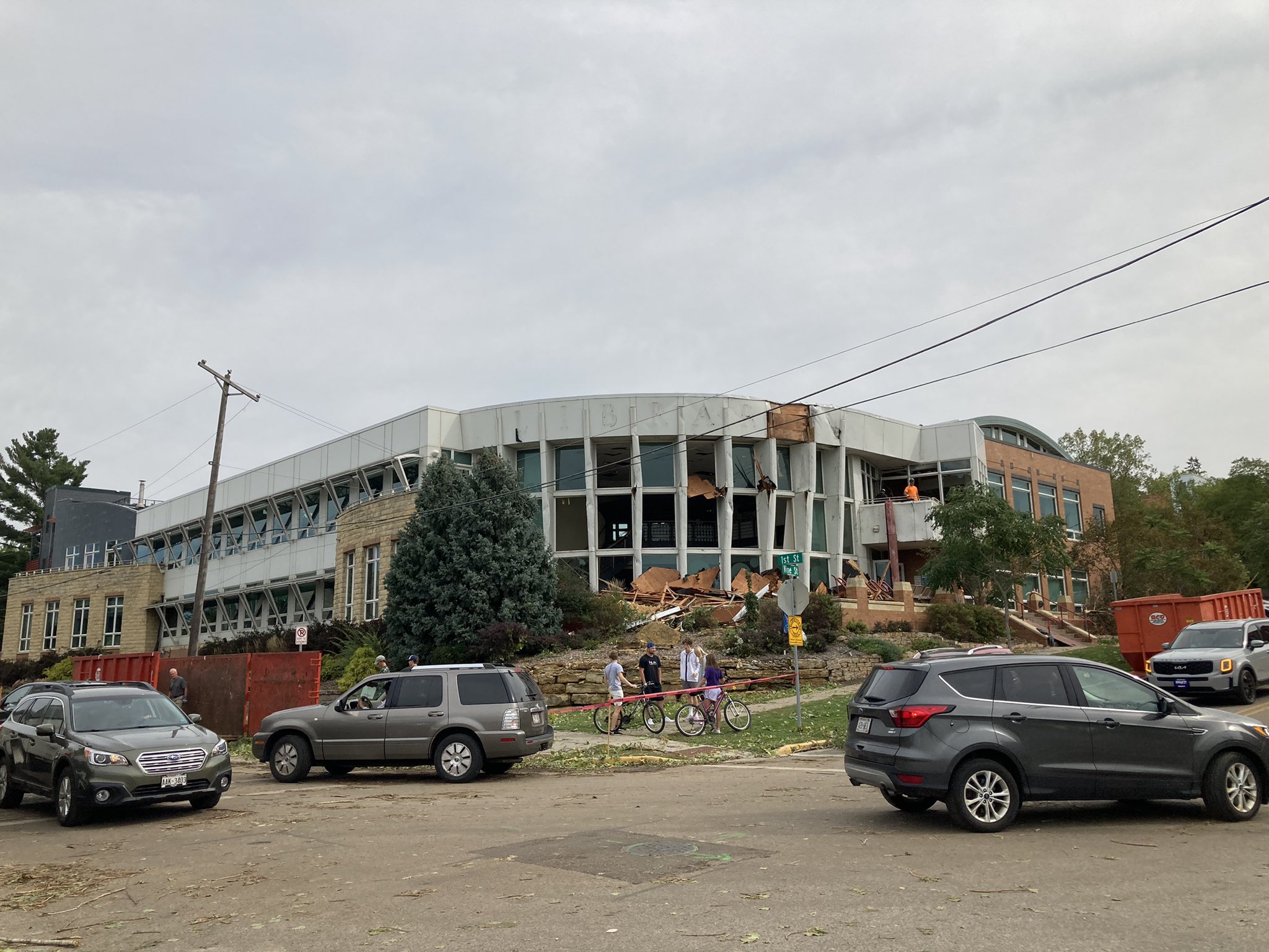
A line of severe thunderstorms moved across southern Minnesota during the early morning hours of September 17th. The bulk of the storm reports and damage occurred between 2-4 AM CDT. A damage survey conducted on Friday found 4 EF-0 QLCS tornadoes occurred (3 within the southern Twin Cities metro). Received reports of numerous areas with straight-line wind damage [downed tree branches, uprooted trees, and structural damage (significant damage did occur to Hudson, WI's library)]. |
Tornadoes:
|
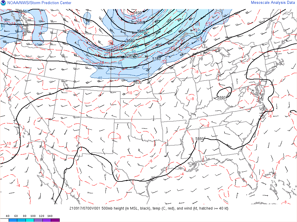
Tornadoes - Southern Metro
|
||||||||||||||||
The Enhanced Fujita (EF) Scale classifies tornadoes into the following categories:
| EF0 Weak 65-85 mph |
EF1 Moderate 86-110 mph |
EF2 Significant 111-135 mph |
EF3 Severe 136-165 mph |
EF4 Extreme 166-200 mph |
EF5 Catastrophic 200+ mph |
 |
|||||
Photos
 |
 |
 |
 |
|
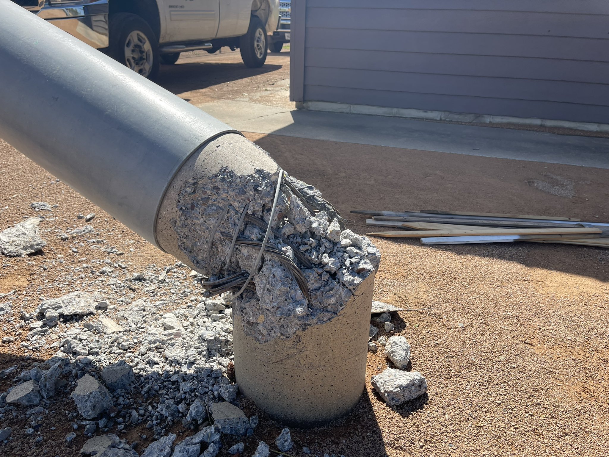
Savage Bent Light Pole (Photo FOX 9) |
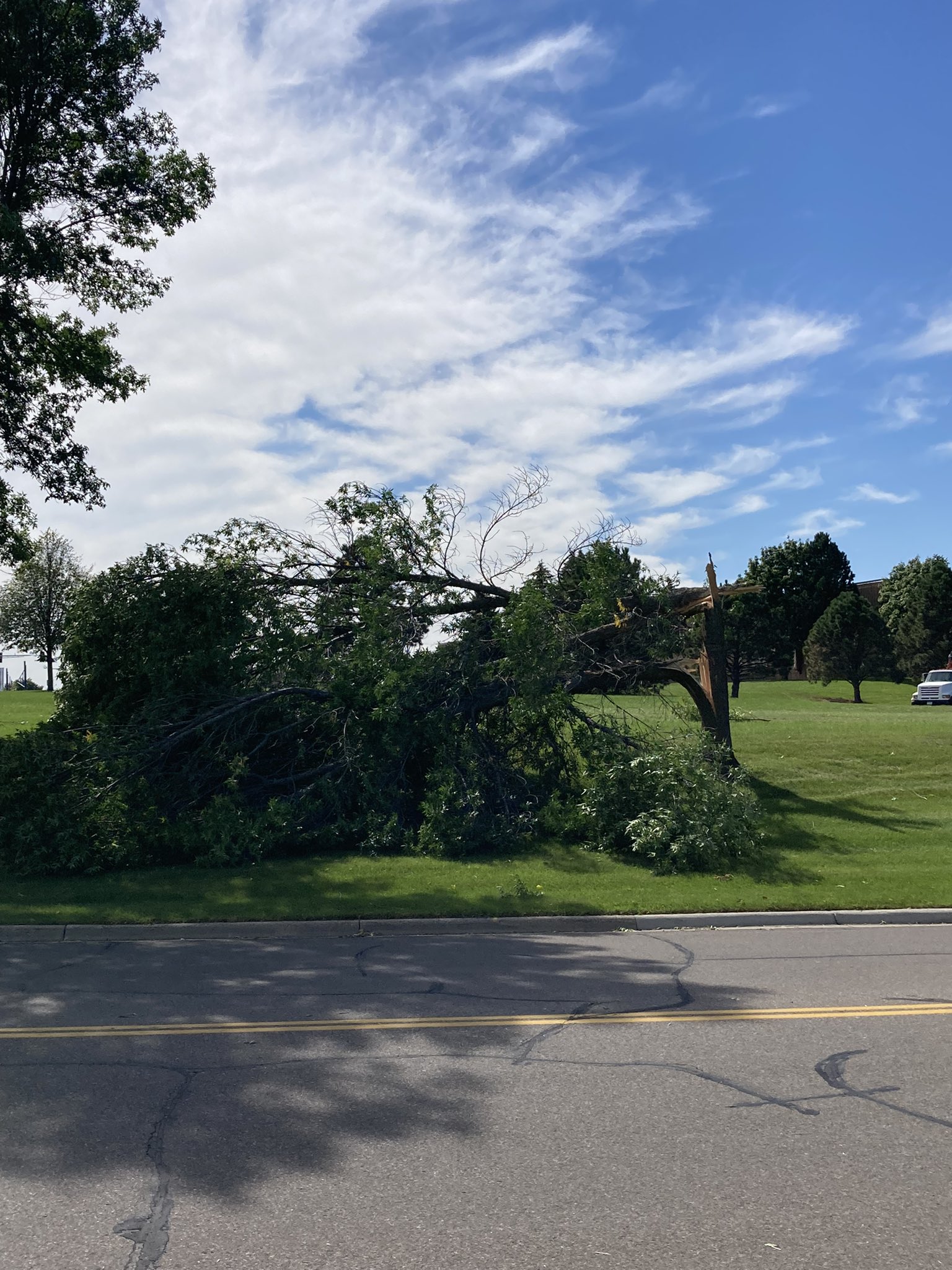
Savage Tree Damage (Photo FOX 9) |
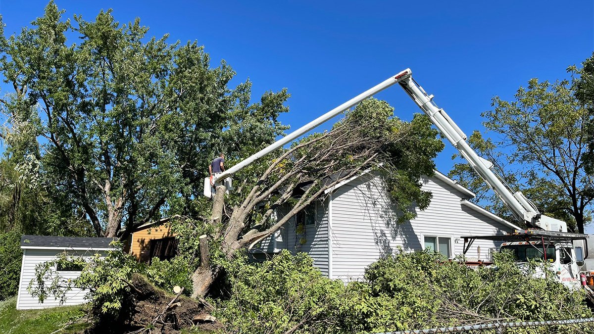
Burnsville Tree Damage (Photo Brandon Spratt) |
Damage to Hudson Library Hudson, WI (Photo KARE 11) |
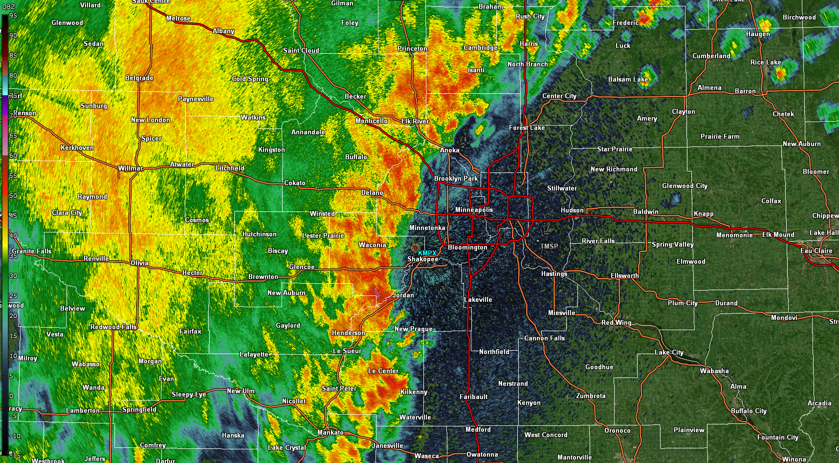
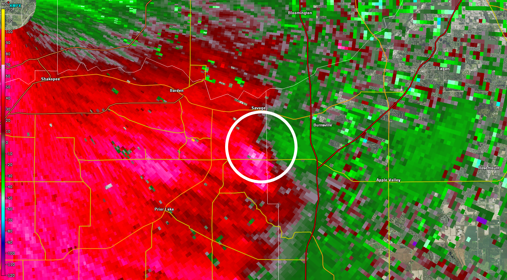
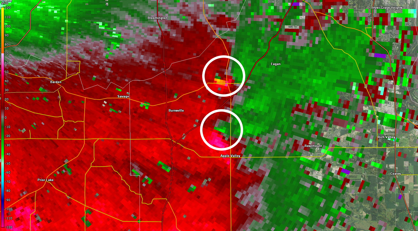
Radar
 |
 |
 |
|
Line of storms at 2:46 AM (Radar Reflectivity) |
Savage tornado at 3:02 AM (Storm Relative Motion - SRM) |
Burnsville & Apple Valley tornadoes at 3:08 AM (Storm Relative Motion - SRM) |
Environment
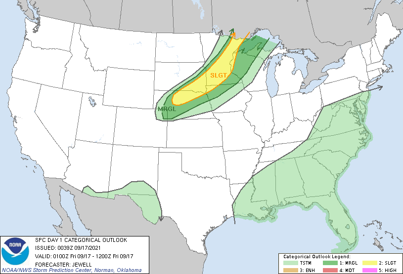
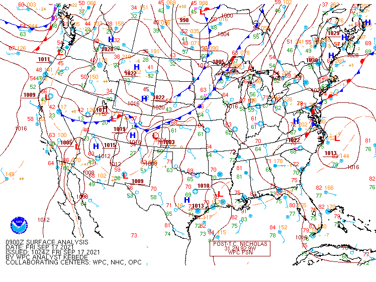
During early Friday morning, a line of thunderstorms ahead of a cold front moved east across southern Minnesota. Environmental parameters indicated that the remnant atmosphere from the previous evening still was slightly favorable for severe storms.
 |
 |
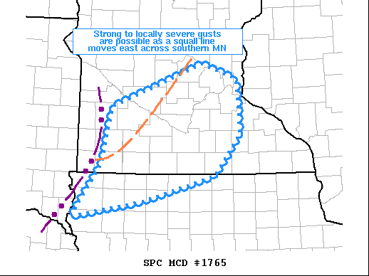 |
| Figure 1: 8 PM SPC Day 1 Outlook | Figure 2: 3 AM Surface Analysis | Figure 3: 1 AM Mesoscale Discussion SPC |
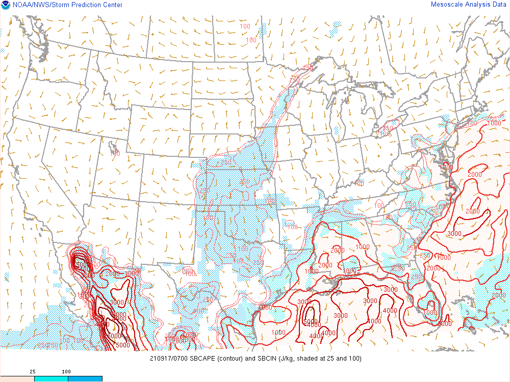
Additional severe weather parameters. (From SPC)
 |
 |
 |
| Figure 4: 2 AM SBCAPE & CIN | Figure 5: 2 AM 500 MB Short Wave | Figure 6: 2 AM Effective Bulk Shear |
Additional severe weather parameters. (From SPC)
 |
|
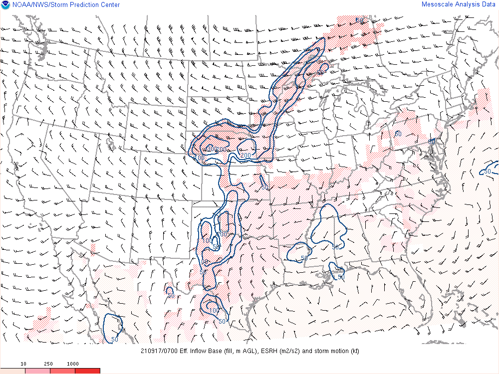
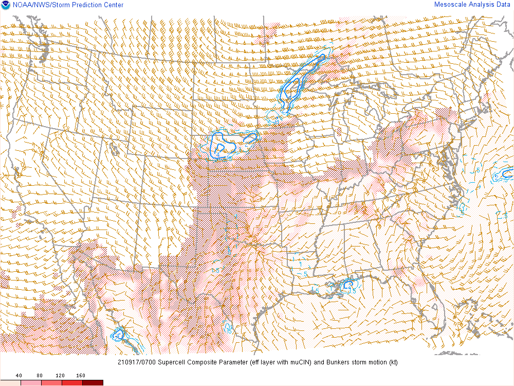
| Figure 7: 2 AM Supercell Composite Parameter | Figure 9: 2 AM Effective Storm Relative Helicity |
 |
Media use of NWS Web News Stories is encouraged! Please acknowledge the NWS as the source of any news information accessed from this site. |
|