|
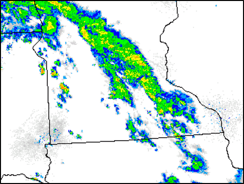
Storms developed Thursday afternoon in west central Minnesota. These storms became supercells as they drifted southeast, which means they had a rotating updraft. There were several reports of large hail, damaging wind, and a few tornadoes in southwest Minnesota. The radar loop shows radar reflectivity (left) and velocity (right) in fifteen minute increments from 300 PM up through 830 PM CDT. The pink reflectivity values indicate very large hail. At times you can also see circulations in the velocity, which indicate rotating updrafts. Preliminary results from damage surveys identified three tornadoes. An EF-1 tornado occurred in Redwood county between Redwood Falls and Wabasso. An EF-0 tornado occurred in Brown County two miles south of Leavenworth. An EF-0 tornado occurred in far northern Watonwan County about a half mile southeast of Godahl. There were also several reports of wind damage and large hail. |
Photos & Video
Header
 |
 |
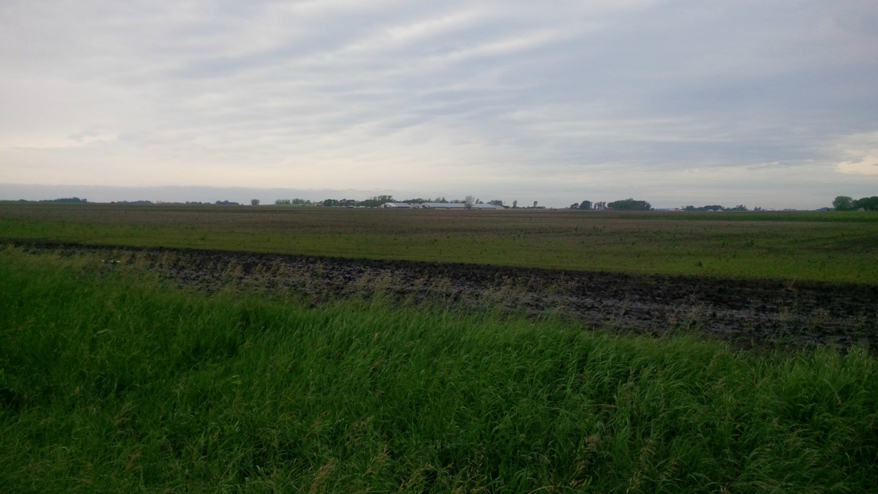 |
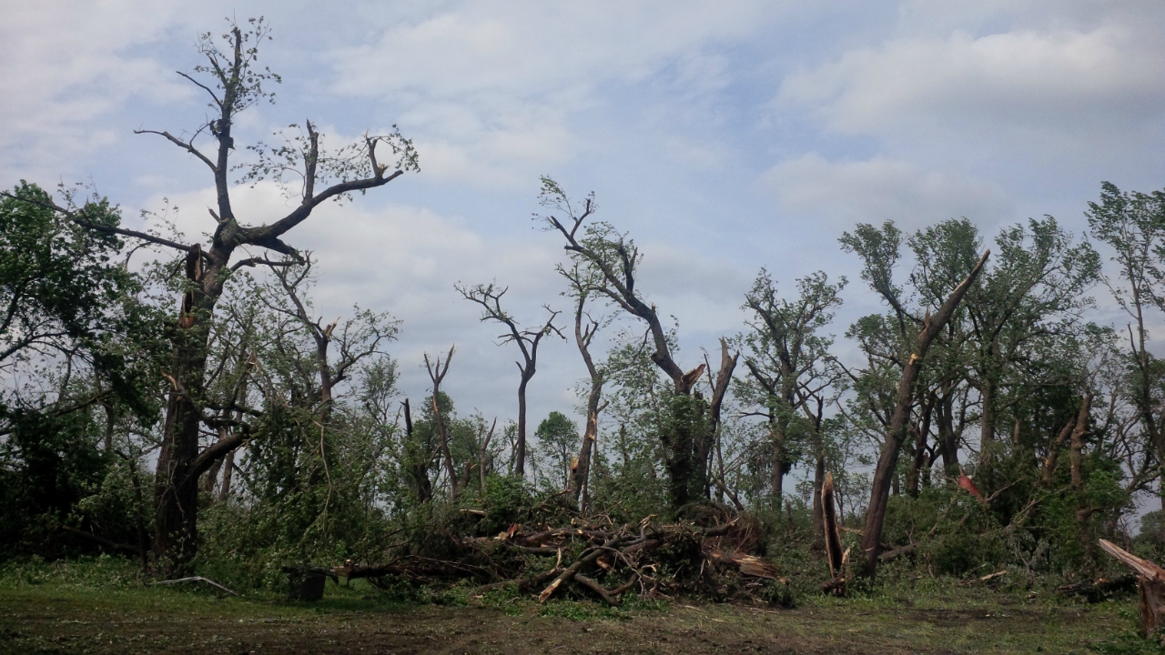
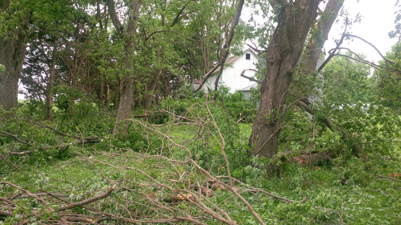
| EF-1 tree damage in Redwood County. | EF-0 damage in Brown County. | Wind damage to a turkey barn in Watonwan County. |
Radar
Header
| Coming soon | Coming Soon | Coming soon | Coming soon |
Storm Reports
..TIME...   ...EVENT...      ...CITY LOCATION...     ...LAT.LON...
..DATE...   ....MAG....      ..COUNTY LOCATION..ST.. ...SOURCE....
            ..REMARKS..

0745 PM     HAIL             TRUMAN                  43.83N 94.43W
06/20/2019  E1.00 INCH       MARTIN             MN   TRAINED SPOTTER


0712 PM     TSTM WND GST     4 E ST. JAMES           43.99N 94.55W
06/20/2019  M78 MPH          WATONWAN           MN   AWOS


0709 PM     HAIL             ST. JAMES               43.98N 94.63W
06/20/2019  E1.75 INCH       WATONWAN           MN   TRAINED SPOTTER


0701 PM     FLOOD            MORGAN                  44.41N 94.93W
06/20/2019                   REDWOOD            MN   PUBLIC

            PUBLIC TWEETED PICTURE OF FLOODED ROADWAY
            THROUGH NEIGHBORHOOD IN MORGAN.

0642 PM     TORNADO          GODAHL                  44.11N 94.64W
06/20/2019                   BROWN              MN   LAW ENFORCEMENT

            WATONWAN COUNTY DEPUTY REPORTS TORNADO ON
            THE GROUND IN GODAHL, OR 4 NW LASALLE.

0530 PM     TORNADO          6 NNW CLEMENTS          44.45N 95.11W
06/20/2019                   REDWOOD            MN   PUBLIC

            TREE AND SOME STRUCTURAL DAMAGE. PICTURE OF
            TORNADO RECEIVED.

0505 PM     FUNNEL CLOUD     1 SSW BELVIEW           44.59N 95.34W
06/20/2019                   REDWOOD            MN   FIRE DEPT/RESCUE

            FIREFIGHTER SAW A FUNNEL CLOUD MOVING OVER
            THEIR HOME.

0446 PM     HAIL             ECHO                    44.62N 95.42W
06/20/2019  M1.25 INCH       YELLOW MEDICINE    MN   PUBLIC

            PHOTO SENT VIA TWITTER.

0440 PM     HAIL             ECHO                    44.61N 95.42W
06/20/2019  M1.00 INCH       YELLOW MEDICINE    MN   AMATEUR RADIO


0353 PM     HAIL             HAZEL RUN               44.75N 95.71W
06/20/2019  M1.75 INCH       YELLOW MEDICINE    MN   PUBLIC
Additional reports will be added as they become available. For the full list of storm reports from that day, visit the SPC Reports Page.
Environment
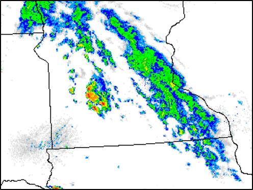
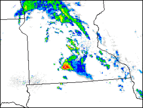
Composite reflectivity showing the storms in southwest Minnesota. The storm developed in the late afternoon and quickly diminished after sunset.
 |
 |
 |
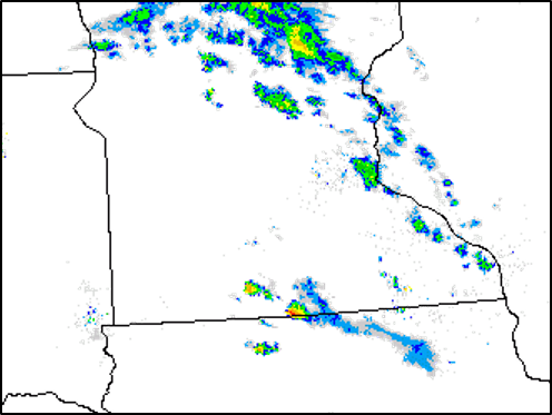 |
| Radar reflectivity - 3 PM CDT | Radar reflectivity - 5 PM CDT | Radar reflectivity - 7 PM CDT | Radar reflectivity - 9 PM CDT |
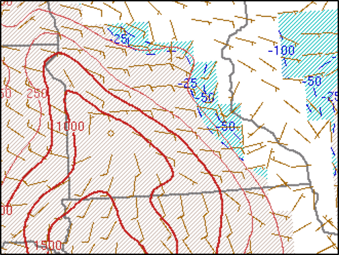
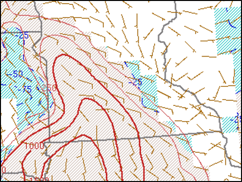
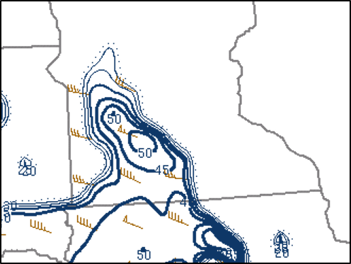
Mixed Layer CAPE showing the instability ahead of the storms. The storms moved southeast right along the CAPE gradient.
 |
 |
 |
 |
| MLCAPE - 3 PM CDT | MLCAPE - 5 PM CDT | MLCAPE - 7 PM CDT | MLCAPE - 9 PM CDT |
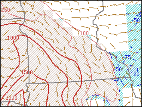
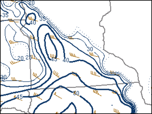
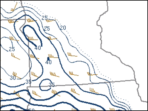
Effective Shear was just enough deep layer shear for supercells.
 |
 |
 |
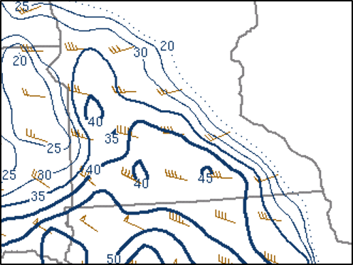 |
| Effective Shear - 3 PM CDT | Effective Shear - 5 PM CDT | Effective Shear - 7 PM CDT | Effective Shear - 9 PM CDT |
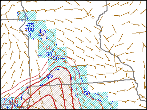
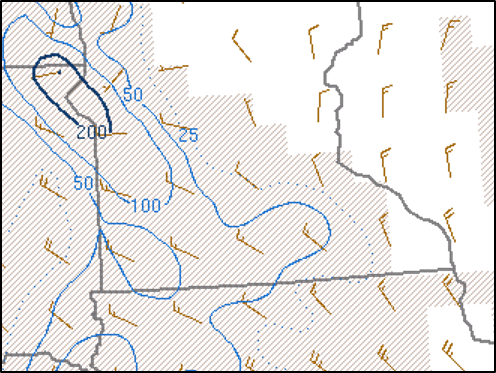
Effective Storm-Relative Helicity showed the potential for tornadoes, but the storm motion was underdone so the actual values where higher than the ones on this map.
 |
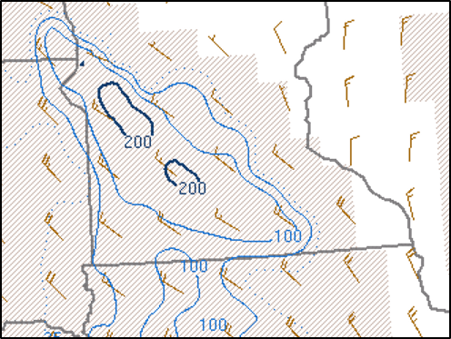 |
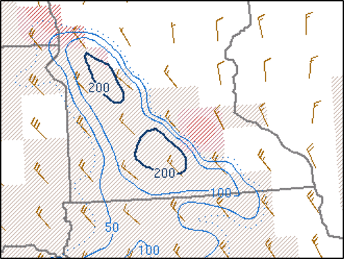 |
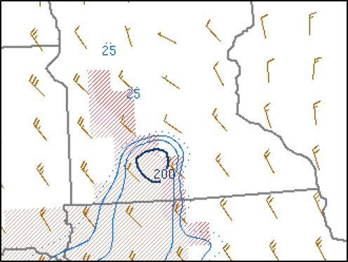 |
| Effective Storm Relative Helicity - 3 PM CDT | Effective Storm Relative Helicity - 5 PM CDT | Effective Storm Relative Helicity - 7 PM CDT | Effective Storm Relative Helicity - 9 PM CDT |
 |
Media use of NWS Web News Stories is encouraged! Please acknowledge the NWS as the source of any news information accessed from this site. |
|

