
Extreme heat will continue across the Pacific Northwest into midweek before finally waning. Hot temperatures, low relative humidity, gusty winds, and isolated dry thunderstorms will bring critical fire weather into Tuesday. A refreshingly cool air mass has settled into much of the eastern two-thirds of the Rockies through the week. Read More >
Twin Cities, MN
Weather Forecast Office
| Add a Weather Element to the Map | |||
|---|---|---|---|
Radar Storm Reports Watches Local Warnings States |
SPC Convective Outlooks Day 1 Categorical Day 1 Tornado Day 1 Wind Day 1 Hail |
Day 2 Categorical Day 2 Probability Day 3 Categorical Day 3 Probability |
Precipitation Forecasts Day 1 QPF Day 2 QPF Day 3 QPF |
SPC Outlooks

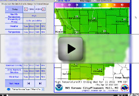
Video Weather Briefing
Current Radar

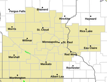
Watches, Warnings & Advisories
US Dept of Commerce
National Oceanic and Atmospheric Administration
National Weather Service
Twin Cities, MN
1733 Lake Drive West
Chanhassen, MN 55317-8581
952-361-6670
Comments? Questions? Please Contact Us.


